Redington Road – flooded and closed. February 2019.
Most of the time driving across the sandy bed of the San Pedro River on Redington road is a complete non-event, easy to miss, and the occasional road closures in the area are a bit of a mystery until you see San Pedro River flowing and the road underwater… Another beautiful result of our wet winter!
I had hoped to see a ribbon of water trickling towards the San Pedro at the mouth of Edgar Canyon – but, driving across, nothing… A bit up-canyon where the gas line road cuts down into the canyon – still dry… Finally, 20 or 30 minutes up-canyon, water appears – not rushing or filling the canyon wall to wall, but a steady clear flow slightly sunken into the gravel.
Farther up canyon I loop up above the canyon to see the line of Sycamores, look for flowers and then wander into long shadows before returning down canyon and making the long drive home.
Water in Edgar Canyon. February 2019.Looking down Edgar Canyon as it heads towards the San Pedro with Bassett Peak in the background. February 2019.A narrow section of side canyon. February 2019.Crow Poison. February 2019.Red Maid. February 2019.Shadows. February 2019.
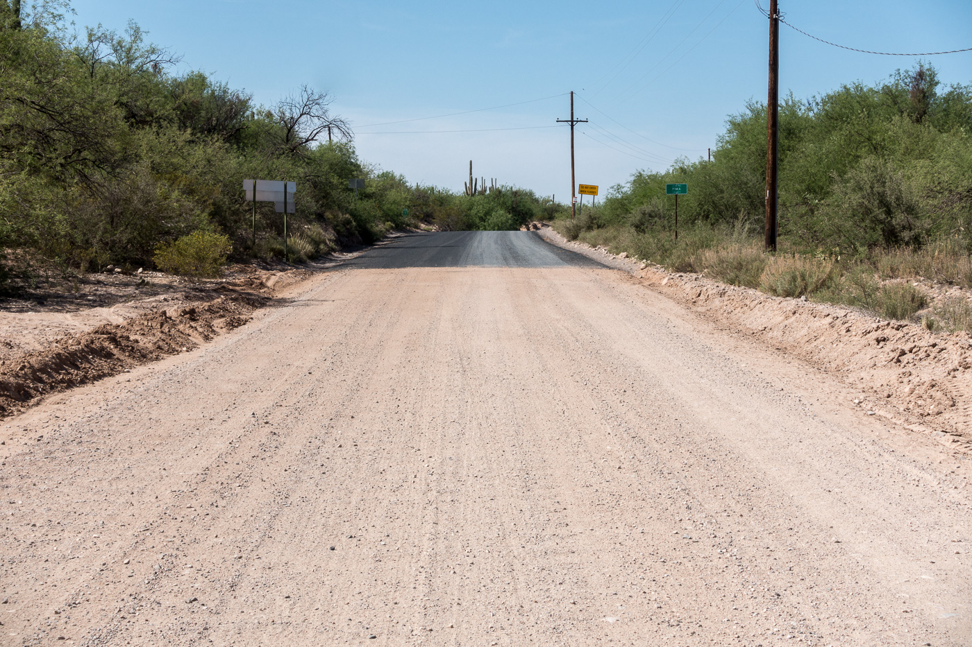
Thru San Manuel, a sharp left then the familiar right turn at the San Pedro – but today the last turn takes me into unfamiliar territory – a strange, freshly paved, night black road parallel to the river – it takes me a minute to reconcile this new thing with my memory of Redington Road.
It makes me sad and uncomfortable to see more pavement encircling the Santa Catalina Mountains – there is nothing encouraging about its current end at the Pinal County line. Maybe the pavement really isn’t that important one way or another – inconsequential compared to the destruction that the SunZia power transmission lines will likely bring to this part of the San Pedro River Valley in the coming years.
The mountain no longer seems like a thing that can stop a city in its tracks; it seems more like a cornered beast. When I hike the Catalinas now and stare down at the valleys, I feel I am on an island, one that is being constantly eroded by the fierce waves of energy sweeping across the desert floor. When I leave the city for the mountain, I walk past bulldozers on my way to the trailhead.
Looking back on the pavement starting at the Pinal County line. April 2017.
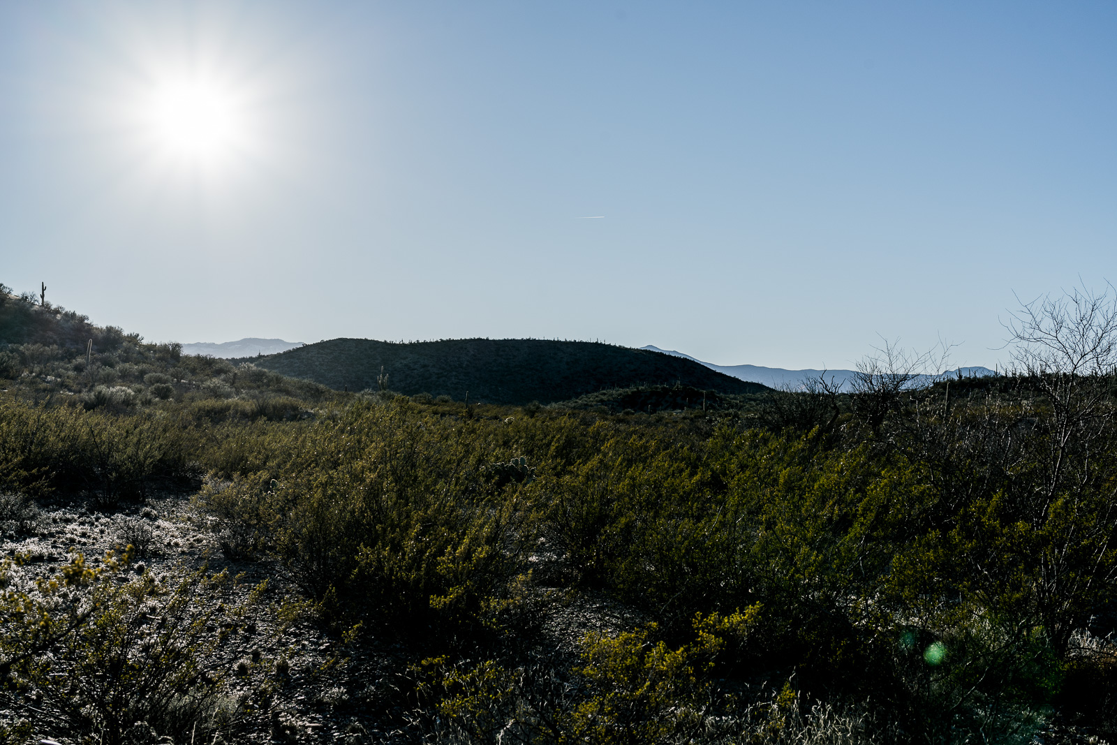
Looking back at the Point 3224 in the Black Hills from an old road to the east. January 2017.
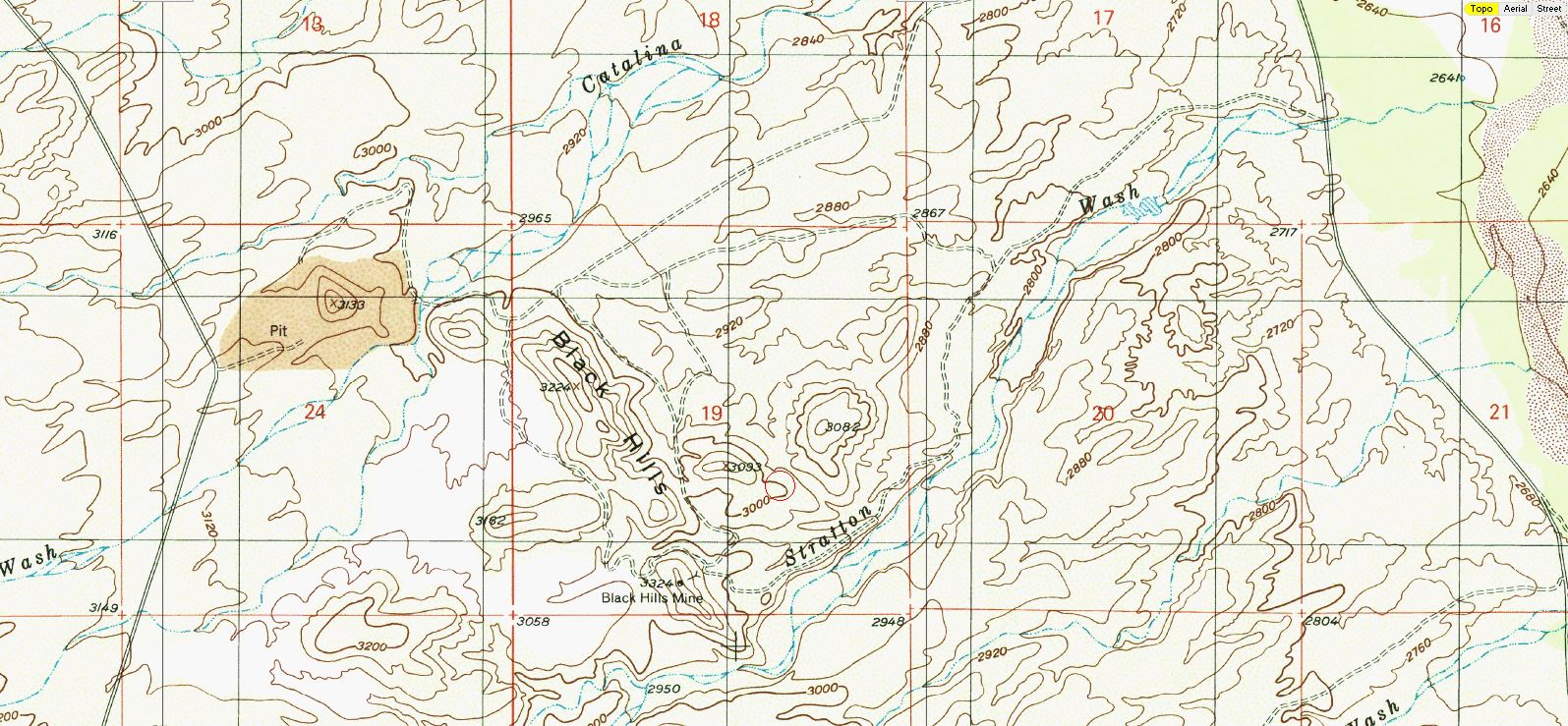
East of Black Hills Mine Road, west of the San Pedro River, north of Stratton Wash and south of Catalina Wash the Black Hills rise out of the desert on Arizona State Trust Land. A packet of information online via the Arizona Geological Survey details the mining history back into the 1940s.
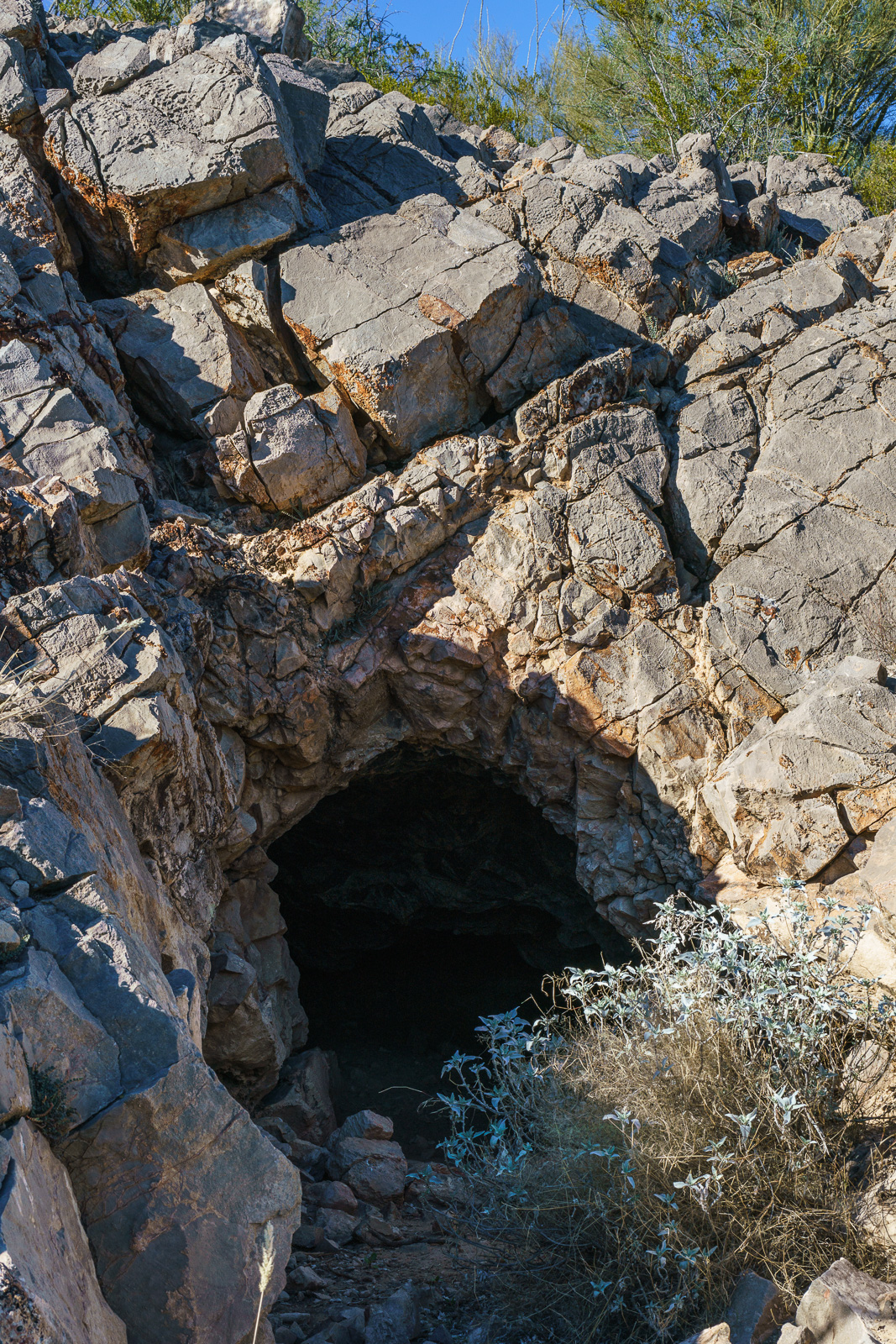
An entrance in the Black Hills. January 2017.
1947 – “Mr. Reuss and his partner acquired the Black Hills property several years ago. They built a road to it, constructed a camp, and equipped it with a small compressor and accessory tools. The partners then spent nearly two years developing the area. The chief work is a crosscut tunnel about 200 feet in length. Development abandoned when the partners ran out of funds to carry on.”
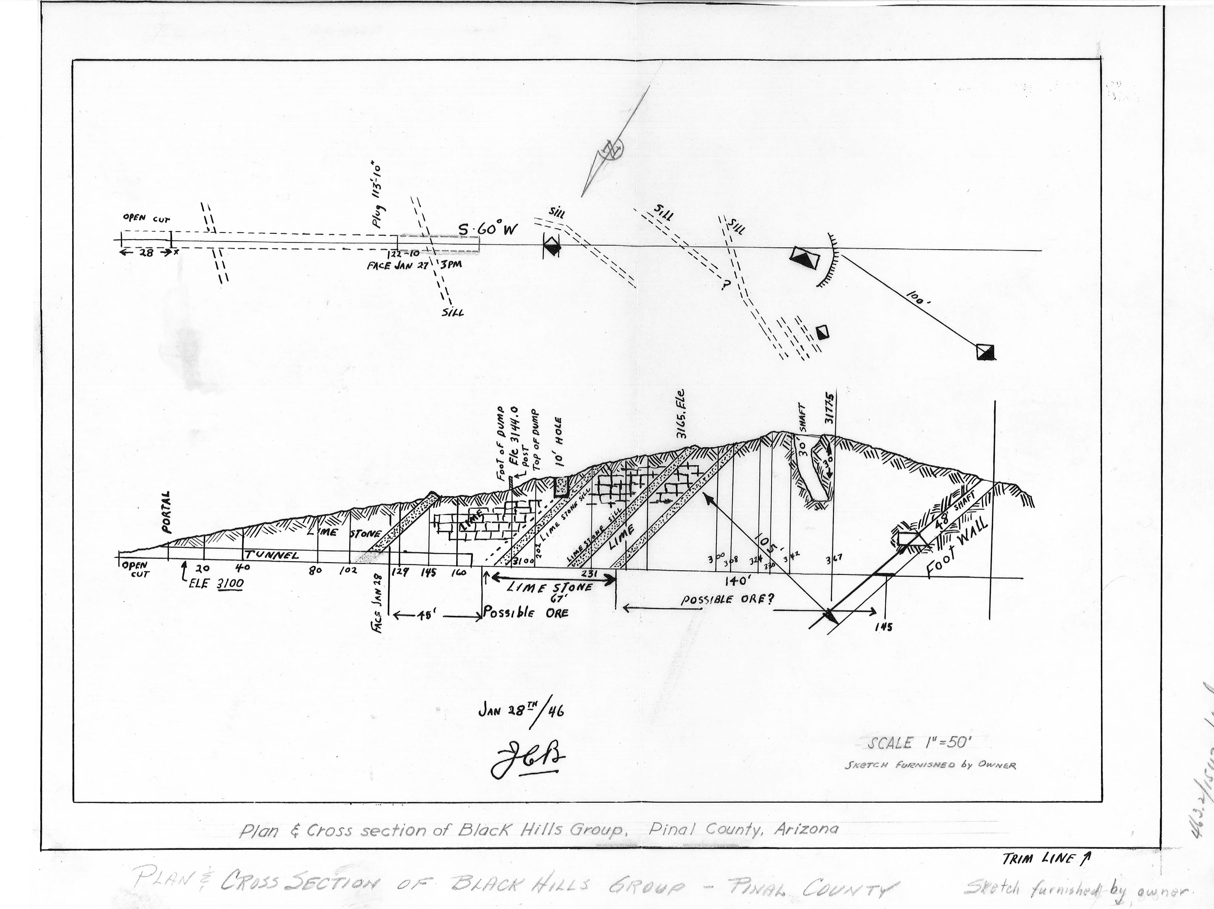
Plan and Cross Section of the Black Hills Group from a packet of information about the mine from the Arizona Department of Mines and Mineral Resources Mining Collection. January 2017.
1955 – “Proposed Plans Operators wish to sell the limestone or lime to the San Manuel Copper Corp. by selling the limestone as mined, or by installing a lime kiln to treat the limestone.”
Perhaps fill over the 30′ shaft in the Black Hills Mine Group? January 2017.
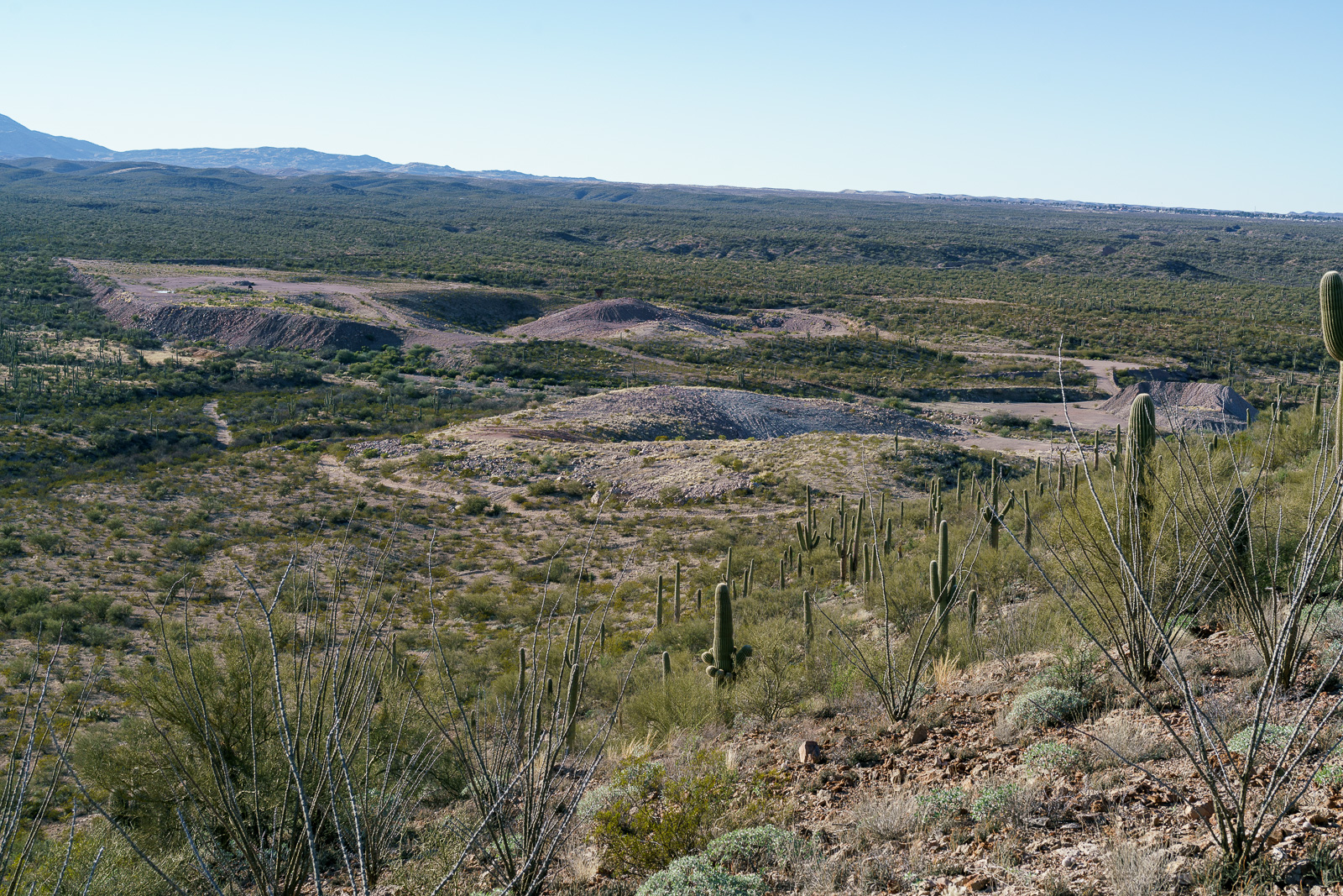
1983 – “The Magma Copper Co. owns the original Black Hills Mine, Pinal County and its associated patented claims covering most of the west half of Section 19, T10S RI8E. The company also owns all of the adjacent Section 24, T10S RI7E; in the NE 1/4 of this section lies the current Black Hills limestone quarry where, according to company officials, enough limestone has been mined and stockpiled to last some 10 years.”
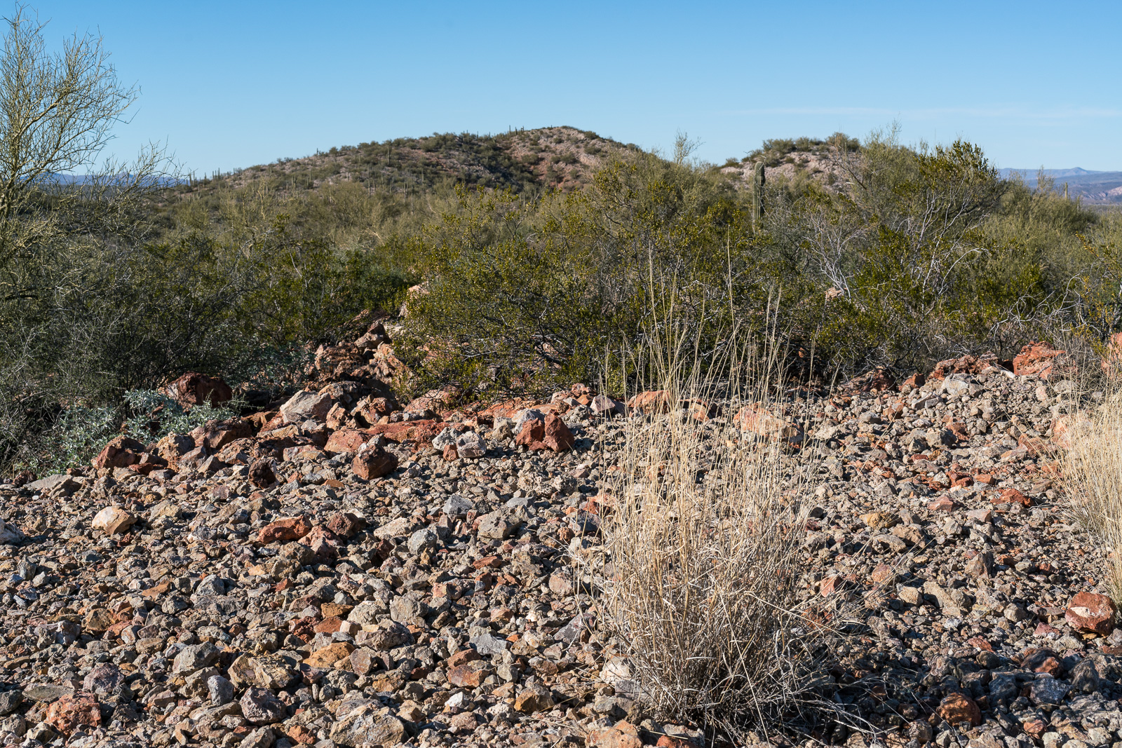
Looking down on the Limestone Quarry between the old Black Hills Mine and Black Hills Mine Road. January 2017.
For this hike I parked in a pull out on the west side of Redington Road just south of Stratton Wash and walked up the wash to the Black Hills. Stratton Wash and the Black Hills are on Arizona State Trust Land, a permit is required. The area around the quarry between the Black Hills and Black Hills Mine Road is private property – the mix of land ownership in this area makes it valuable to have a map showing property boundaries if you are exploring.
Much of San Pedro River east of the Santa Catalina Mountains (north of Redington Road meeting the river, south of San Manuel/Magma Copper) is surrounded by private land – however Stratton Wash east of Redington Road down to (and across) the San Pedro River is on Arizona State Trust Land – walking down to the (usually dry) river is an interesting way to start the day before walking up canyon to the Black Hills.
A rattlesnake watches after warning us away – on a small ridge above the San Pedro. August 2016.
A hint of trail leads us away from a road thru Pima County’s A-7 Ranch and out onto a ridge above the San Pedro River. The fields below and occasional engine noise make it clear that this isn’t pure wilderness – but we are alone with the creosote and cactus.
The sparse population and relatively long drive into the valley mean that there are many (maybe a limitless number?) of small, subtle, seldom visited places to enjoy – better perhaps that the drive into the valley today still reminds me of this passage in the conclusion of Bernard W. Muffley’s excellent 1938 thesis The History of the Lower San Pedro Valley in Arizona (pp. 71-72):
Possibly one reason why the lower San Pedro Valley was never a cohesive unit lies in the fact that there were no good roads. The Leach Route of 1857-58 had been only a clearing in the mesquite wide enough to permit the passage of a wagon. This road had never been extensively used. The later roads were developed from trails made by the early settlers. By 1930, the quality of the highways in the lower San Pedro Valley was much below the general state average. Even then, if a traveler wanted to go from Reddington to Mammoth by automobile the best route was by Tucson, a distance of 130 miles to cover what might easily be a level highway of less than thirty miles.
Barrel Collective. August 2016.Walking Stick. August 2016.
The story of the farms was the saddest part of the history of the lower San Pedro Valley. Once a hardy, ambitious, energetic class wrested many fertile acres from the mesquite and rocks. By 1904 the river had carved away the choice pieces of land. The more energetic of the settlers had moved on to places of greater promise. Ditches from the river were difficult to keep in place, and many an acre of land was allowed to grow into a mesquite thicket. Farmers found it easier to keep a few head of range cattle and forget about tilling the soil. One by one, as the large barns or fine homes collapsed or were destroyed, mud shacks or sheet iron sheds took their places. Along the San Pedro where once, more than fifty fine farms were to be seen, by 1930 only a few remained, and they were fast deteriorating. Only in Aravaipa Canyon did the farms retain a semblance of their old beauty.
The Santa Catalina Mountains from a ranch road on the A-7. August 2016.
Near the San Pedro River, between Redington and Cascabel Road, at the edge of Redfield Canyon, across from the Carlink Ranch, in the ‘town’ of Redington, with the top of a windmill visible over the trees and protected by a cholla stands a lonely phone. There are roads, homes and ranches along the San Pedro River so I suppose the phone makes a certain kind of sense – but mostly it just seems strange.
Crossing the San Pedro River on the way from Redington Road to the town of Redington and the Carlink Ranch – cows in the distance. July 2016.
The Redfields settled in the San Pedro River Valley in the 1870s when Apache Raids were a concern and soldiers traveled from Fort Lowell over Redington Pass to protect residents. In 1879 the Redfields petitioned for a post office to be established, but the site could not be named after a living person so the name ‘Redington’ was used instead of Redfield. In the late 1880s Henry Redfield sold his ranch and moved to Benson – the ranch was eventually acquired by the Bayless family who had established the Carlink Ranch 1884. The Carlink Ranch is still operating today, run by descendants of William Bayless. The Post Office operated until 1940 and at one time the town had both a school and a general store.