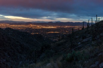
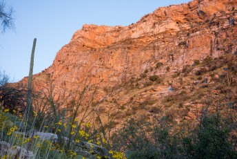
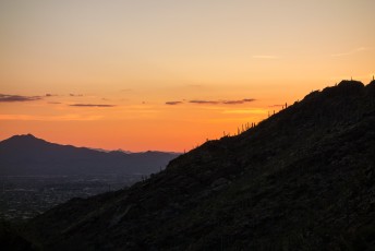
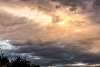
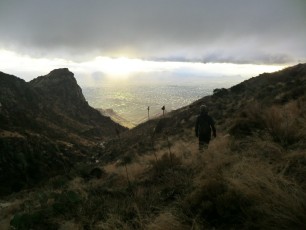
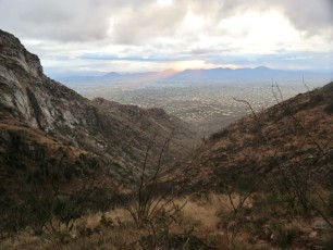
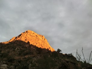
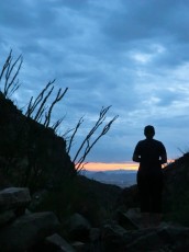
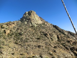
 Pontatoc Ridge in the Sunset from the Pontatoc Canyon Trail. March 2015.
Overview
The Pontatoc Ridge Trail and Pontatoc Canyon Trail share the same start, parting ways at signed junction on a steep hillside – you might, if you have not read about these trails, think that the Pontatoc Canyon Trail is the easier choice (a pleasant ramble by the canyon perhaps?) – and after the climb to the junction that might sound appealing…
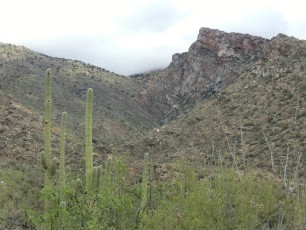
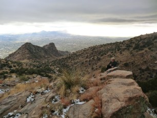
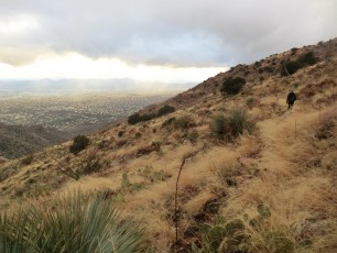
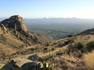
But in truth the Pontatoc Canyon Trail is the longer, more difficult and more rugged trail! For the most part the trail runs above the west side of the canyon, eventually yielding great views of Pontatoc Ridge, and occasionally dropping into the bottom of the canyon.
The Pontatoc Canyon Trail was impacted by the Finger Rock Fire in 2015 and the upper section of the trail – still shown here in the map/gps data – should probably be considered an off-trail adventure, be sure to see the notes about the hike below for more information about this.
Hike Stats
- Out and Back
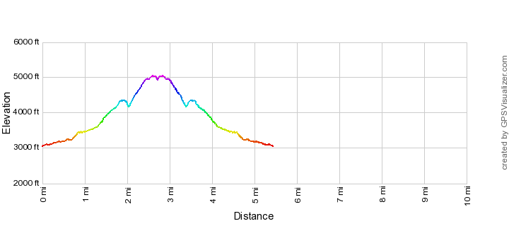
- 5.5 miles
- 2,800' Elevation Gain
- 2,800' Elevation Loss
- Highest Elevation: 5,050'
- Lowest Elevation: 3,050'
Location
- North side of Tucson, Pusch Ridge Wilderness, Santa Catalina Mountains.
- Start/End: Richard McKee Finger Rock Trailhead (City's Edge Hikes)
Details
- Fee: No
- Dogs: No (Bighorn Sheep Restrictions)
- Bikes: No (Pusch Ridge Wilderness)
- [bighorn-management-area-restrictions/]
- [pusch-ridge-wilderness-restrictions/]
- [pima-county-trailhead-permit/]
Drive
- 8.4 miles from Speedway and Campbell
- 20 Minutes from Speedway and Campbell
- Vehicle Access: Paved Roads/Passenger Car
Pontatoc Canyon Trail Elevation Profile
Driving Directions
Suggested driving directions from the Speedway and Campbell intersection in Tucson to the Richard McKee Finger Rock Trailhead:
- North on Campbell (6.4 miles)
- Right onto Skyline (0.4 miles)
- Left to continue on Skyline (0.7 miles)
- Left on North Alvernon Way (0.9 miles)
- The trailhead is on the left/west side of the road.
Google Maps Directions from the Speedway and Campbell intersection in Tucson to Richard McKee Finger Rock Trailhead.
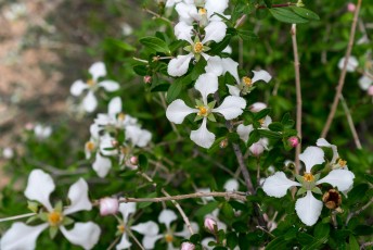
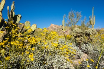
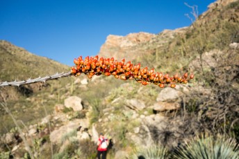
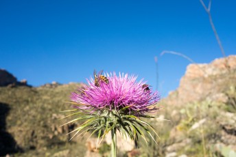
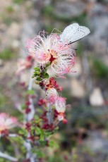
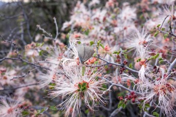
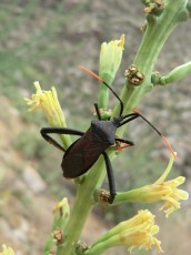
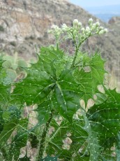
[ImageTwoPictureSideBySide imagepathone=”/santa-catalina-mountains/pontatoc-canyon-trail/1503-Brittlebush” captionone=”Brittlebush in Pontatoc Canyon. March 2015.” imagepathtwo=”/santa-catalina-mountains/pontatoc-canyon-trail/1503-Thistle-with-Bees” captiontwo=”Thistle and Bees along the Pontatoc Canyon Trail. March 2015.” /]
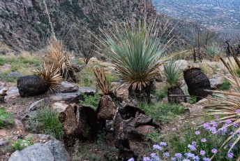
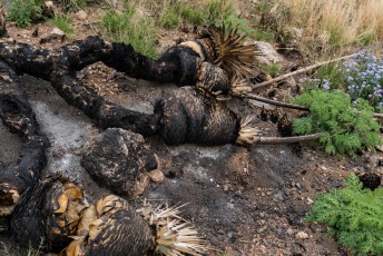
[ImageTwoPictureSideBySide imagepathone=”/santa-catalina-mountains/pontatoc-canyon-trail/1603-Fire-and-Flowers” captionone=”Fire and flowers along the upper section of the Pontatoc Canyon Trail. March 2016.” imagepathtwo=”/santa-catalina-mountains/pontatoc-canyon-trail/1603-Burn-on-the-Pontatoc-Canyon-Trail” captiontwo=”Burnt and fallen – a victim of the Finger Rock Fire. March 2016.” /]
Trail Notes
[CueListWarning/]
- 0.0 miles, 3040′: Start at the Richard McKee Finger Rock Trailhead (parking for the Pontatoc Ridge Trail, Pontatoc Canyon Trail and Finger Rock Trail) [Waypoint thfr].
- Cross the road and walk north towards the mountains, several signs mark the beginning of the trail just after the entrance to a gated community.
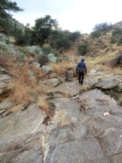
- The trail climbs a short hill to a signed junction [Waypoint pc-fr] – turn right (left for the Finger Rock Trail) – the trail wanders thru the desert towards Pontatoc Ridge crossing several washes.
- 0.7 miles, 3250′: Cross Pontatoc Canyon [Waypoint PT01] (there are a number of wash crossing before crossing Pontatoc Canyon) – the trail begins to climb steeply.
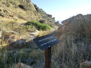
- 0.8 miles, 3430′: Well before reaching the top of the ridge you will come to a signed junction [Waypoint pr-pc] – a left will keep you on the Pontatoc Canyon Trail (take a right for the Pontatoc Ridge Trail)
- 1.3 miles, 3650′: Cross Pontatoc Canyon for the second time – after crossing the trail climbs steeply up the hillsides north of the canyon [Waypoint PC02]
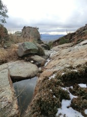
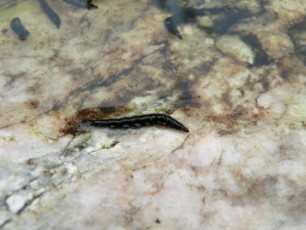
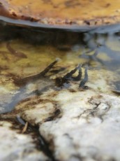
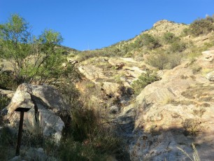
- 2.0 miles, 4250′: After a short/steep downhill section the trail reaches the third Pontatoc Canyon crossing [Waypoint PC03] – a great place for a break with beautiful rock walls, great views and, sometimes, pools and flowing water. From here you can cross the canyon and continue along the trail or scramble directly up canyon (be careful if you scramble up canyon, the scramble is not overly difficult but it can be very very slippery!).
- 2.1 miles, 4300′: The trail crosses Pontatoc Canyon for a fourth and final time [Waypoint PC04] and begins to climb up the hillside to the north. Traveling beyond this point on the trail should be considered an off-trail adventure. For many years the trail past this crossing was faint/overgrown and hard to follow in places – but after the Finger Rock Fire in August 2015 many sections of the trail have disappeared back into the landscape. Short sections of overgrown trail can certainly still be found – but finding/linking these sections without help from the occasional cairns would be very difficult…
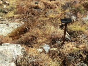
- 2.7 miles, 5000′: An sign in the bottom of Pontatoc Canyon marks the official end of the trail [Waypoint PC05].
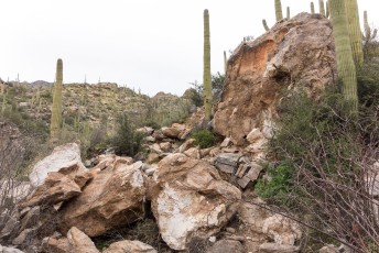
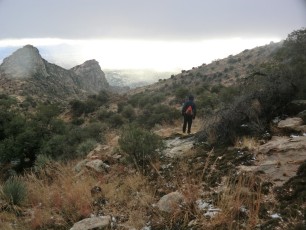
 Looking down Pontatoc Canyon from the Pontatoc Canyon Trail. May 2012.
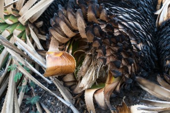
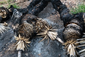
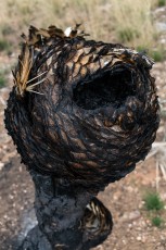
 The strange alien shape of a Yucca burned in the Finger Rock Fire. March 2016.
Resources
- Trail Talk – Summit Hut Blog – Pontatoc Trails
- HikeArizona.com
- Mountain Project
- [GuideYellowBook/]
- Posts on HikeLemmon.com:
- Strange Vandalism – 5/4/2018, 3/4/2018, 5/24/2015
- Fire, Fire, Fire, Horses, Tram – 4/22/2017
- Pontatoc Canyon – 3/27/2017
- Pontatoc Canyon Trail – 2/5/2017 and 2/9/2017
- End of the Day Sun in Pontatoc Canyon – 3/13/2016
- Burned and Disappearing, Upper Pontatoc Canyon Trail – 3/5/2016
- Pontatoc Canyon – 5/24/2015
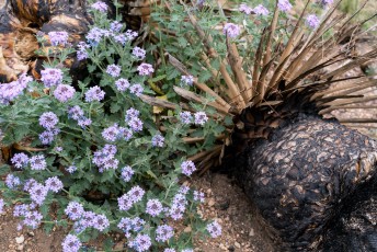
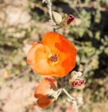
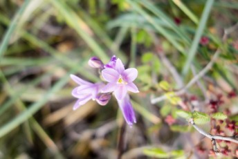
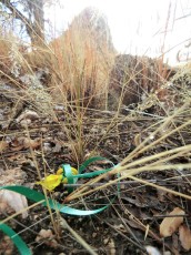
- Pontatoc Canyon Flowers – 3/21/2015
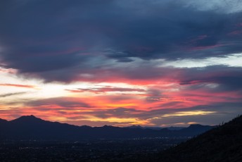
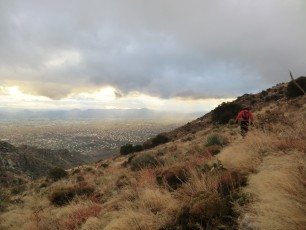
- Pontatoc Canyon Sunset – 2/21/2015
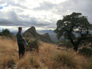
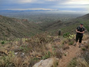
[ImageTwoPictureSideBySide imagepathtwo=”/santa-catalina-mountains/pontatoc-canyon-trail/1205-Looking-up-canyon-from-the-end-of-the-Pontatoc-Canyon-Trail” captiontwo=”The official end of the Pontatoc Canyon Trail – now a bit of an obscure landmark with the last section of the Pontatoc Canyon Trail an off-trail adventure. November 2012.” imagepathone=”/santa-catalina-mountains/pontatoc-canyon-trail/1211-Alison-on-the-Pontatoc-Canyon-Trail” captionone=”The Pontatoc Canyon Trail climbing a grassy hillside – this photo is from before the Finger Rock Fire burned this section of the trail. December 2011.”/]
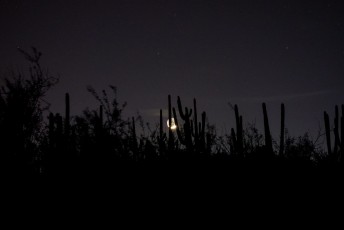
 Moon thru the Saguaros near the start of the trail. March 2015.
Pictures
2016 March Pontatoc Canyon Trail


2015 March Pontatoc Canyon Trail


2015 February Pontatoc Canyon

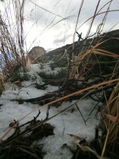
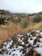
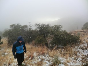
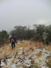
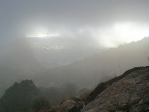
2012 December First Snow in the Santa Catalina Mountains
2012 July Pontatoc Canyon

2012 May Pontatoc Canyon
Update Notes
- 2017/8/14 – Added HikeLemmon posts to Resources
- 2016/3/16 – Added information about and pictures from the trail after the Finger Rock Fire, added new picture set, small edits to the main description and trail description
- 2015/3/28 – Added pictures, updated GPX (minor track changes, waypoint updates, updated elevations)
- 2014/7/27 – Format update
- 2014/4/1 – Updated GPX and Hiking Notes (new waypoints)
- 2014/3/8 – Update to WordPress, added elevation profile
- 2014/1/26 – Added small ‘driving’ map, increased the size of the Gmap4 Topo Map.
- 2014/1/19 – Updated Overview/Typos, added cautions and restrictions.
- 2014/1/18 – Updated format (driving directions, last update in overview), added dates to picture captions.
- 2013/11/25 – Updated format.