
Overview
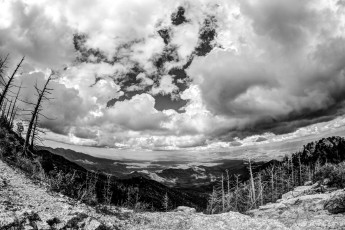
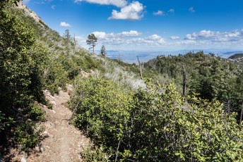
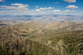
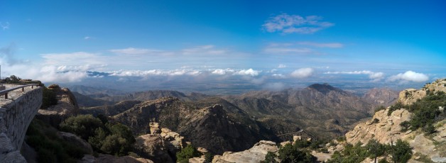
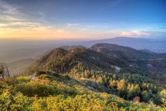
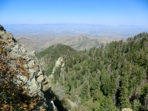
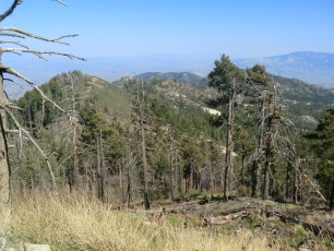
This lovely trail connects the hills and ridges between San Pedro Vista and Mount Bigelow with views into the San Pedro River Valley and across the Santa Catalina Mountains down into Tucson – well worth hiking! And perhaps worth visiting multiple times because – for more experienced hikers, who are comfortable off-trail – this trail offers access to Peak 7954 above Barnum Rock, Leopold Point and Kellogg Mountain.
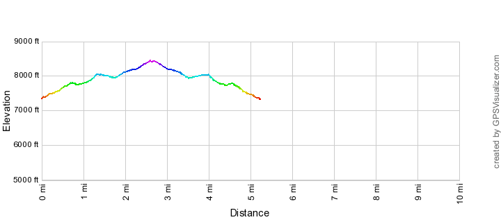
Hike Stats
- Out and Back
- 5.3 miles
- 1,600' Elevation Gain
- 1,600' Elevation Loss
- Highest Elevation: 8,450'
- Lowest Elevation: 7,350'
Location
- This hike is located in the Santa Catalina Mountains near Tucson, Arizona.
- Start/End: San Pedro Vista (Upper Highway Hikes)
Details
- Fee: No
- Dogs: Yes
- Bikes: Yes
Drive
- 31.3 miles from Speedway and Campbell
- 1 Hour from Speedway and Campbell
- Vehicle Access: Paved Roads/Passenger Car (Mountain Road - be careful of weather conditions!)
Incinerator Ridge Trail and Kellogg Trail Elevation Profile
Driving Directions
Suggested driving directions from the Speedway and Campbell intersection in Tucson to the San Pedro Vista:
- Drive East on Speedway (5.0 miles)
- Left on Wilmot and continue on Tanque Verde (4.3 miles)
- Left on Catalina Highway (21.9 miles)
- Signs will help you find this vista on the up-mountain side of the Highway.
Google Maps Directions from the Speedway and Campbell intersection in Tucson to San Pedro Vista.

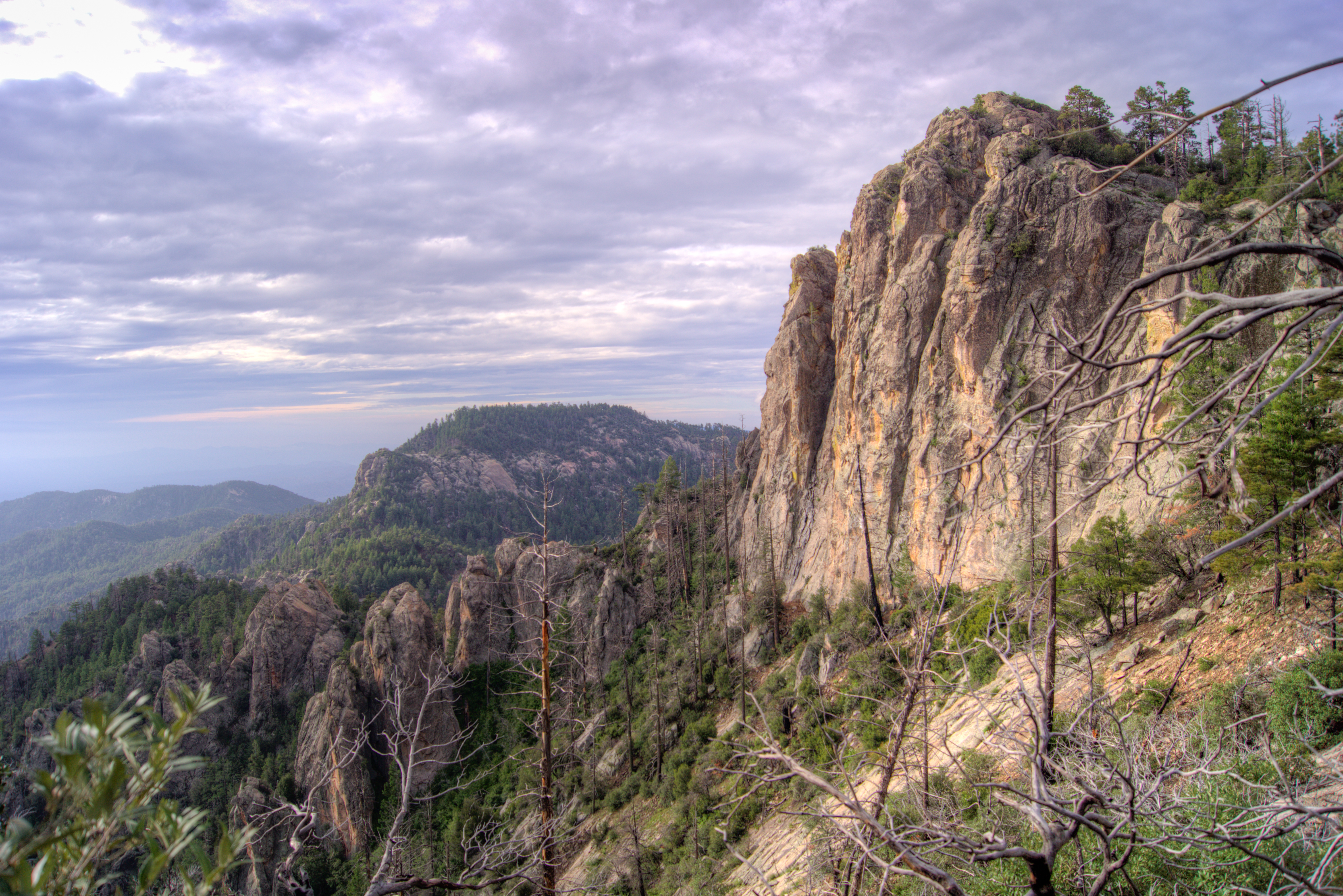
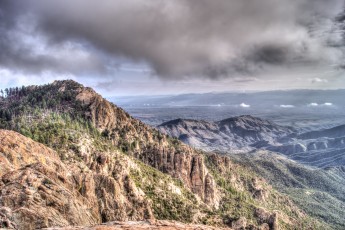
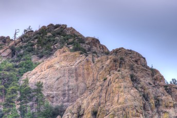
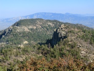
Right: Cliffs below Point 7954. July 2013.
Trail Notes
In 2012 the Incinerator Ridge Trail was extended down to the San Pedro Vista. This short – but brilliant – extension links the Bellota Trail, Molino Basin Trail, Bug Spring Trail and Green Mountain Trail with the Incinerator Ridge Trail and Kellogg Trail, Crystal Spring Trail and Control Road! This impressive trail system offers an alternative to traveling up and down the mountain thru the Pusch Ridge Wilderness – this is a useful detail for mountain bikers who are not allowed to ride thru the wilderness area – the trails from the Bug Spring Trail to the Oracle Ridge Trailhead form the The Arizona Trail Pusch Ridge Wilderness Bypass .
In addition to helping form an impressive network of trails up and down the mountain the extension also makes a rather lovely day hike possible – San Pedro Vista to Mount Bigelow!
[CueListWarning]
- Park at the San Pedro Vista – on the north side of the parking area a trail marker marks the start of the trail.
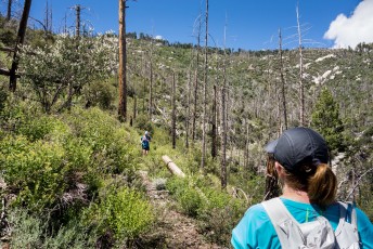
- The trail takes you along a ridge near the highway and then up thru the cliffs in the Barnum Rock area. This hike has a number of opportunities for off-trail hikes/scrambles to nearby destinations – the first good opportunity is Peak 7954 above Barnum Rock, watch the map and look for the best place to head up to this scenic spot if you are interested and comfortable traveling off trail. (I have seen Peak 7954 referred to as Barnum Rock but the elevation and coordinates in GNIS entry for Barnum Rock seem to indicate that the name Barnum Rock is officially applied to the iconic rock formation, not the peak above… Either way a lovely spot!).
- Pass an unofficial trail to the left that leads down to the Ridgeline Parking Pullout
- Pass an unofficial trail to the right that leads to the Ridgeline Climbing Area
- At a small saddle an unofficial trail to the right can take you to Leopold Point – another great off-trail destination! (The Leopold Point GNIS entry lists ‘Incinerator Peak’ as a variant name with the citation noting ‘USFS signs’ as the source – also confusing the naming in this area is the older name Peck Basin Overlook – which I believe is also a variant name…)
- Continue past the signed junction with the Knagge Trail at a well-used campsite.
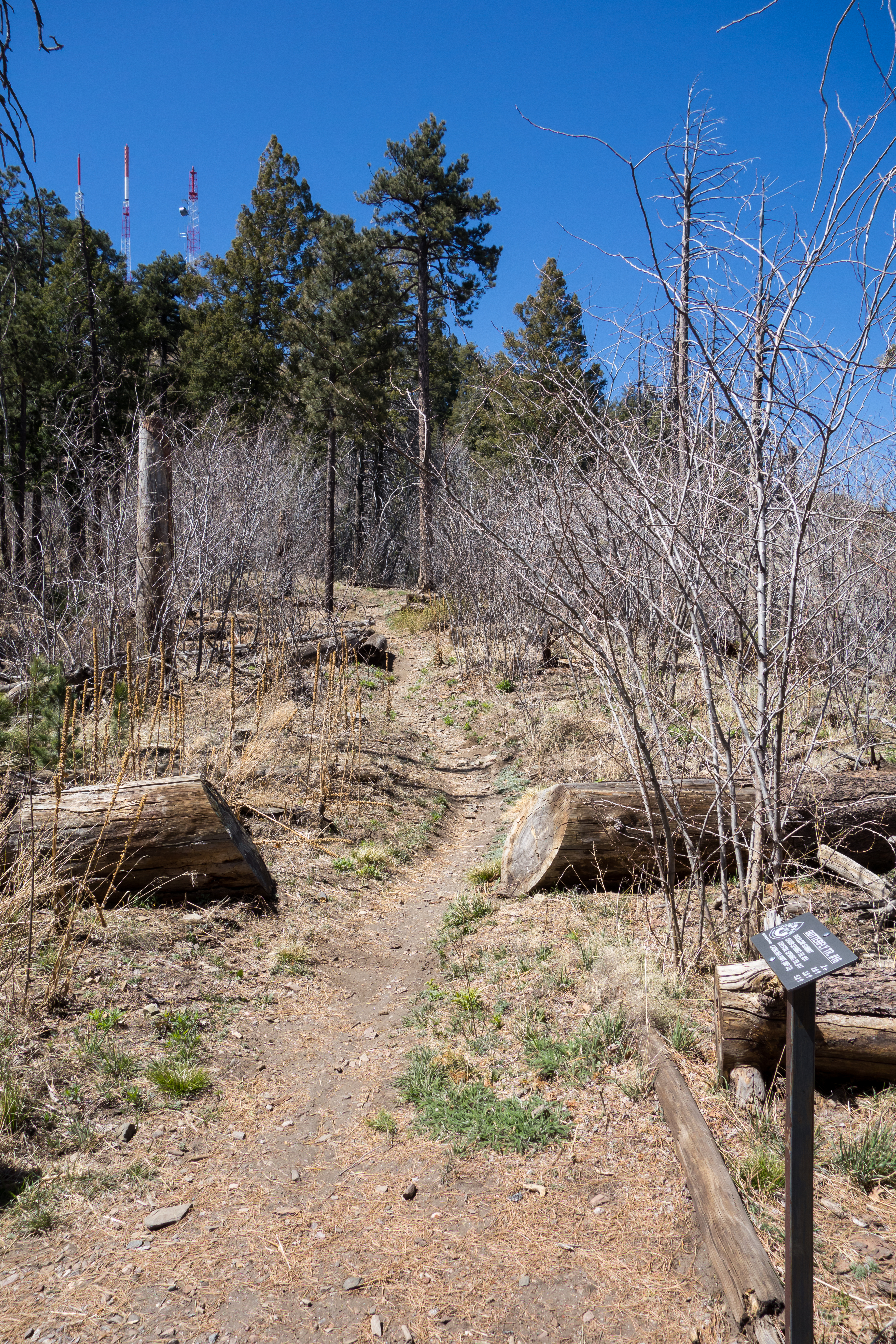
- Several signs mark your arrival at the Kellogg Trailhead. The Incinerator Ridge Trail ends here – to continue towards Mount Bigelow cross the road and go thru a parking space onto the Kellogg Trail.
- At a saddle the Kellogg Trail ends at a junction with the Bigelow Trail (to the left for the Bigelow Trailhead), the Butterfly Trail towards the Incinerator Ridge Trail and Kellogg Trail (to the right) and the Butterfly Trail towards Mount Bigelow and the Mount Bigelow Butterfly Trailhead (straight ahead). This is a good starting spot to travel off-trail up to Kellogg Mountain.
- For Mount Bigelow continue straight along the Butterfly Trail to a junction with a dirt road – a right on the road will take you up and around towards several nice views and the Mount Bigelow Butterfly Trailhead
Mount Bigelow is named for John Bigelow, Jr. who served with the 10th Cavalry Regiment in the Arizona territory in the late 1800s.
Leopold Point is name for Aldo Leopold – an ecologist who is perhaps best known as the author of A Sand County Almanac.
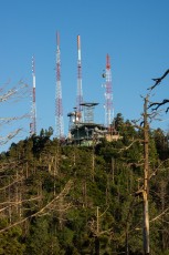
The Kellogg Trailhead is at the end of Incinerator Ridge Road which was built in 1948. At the edge of the parking area you can still see several walls that remain from the incinerator (and source of the name for Incinerator Ridge) – it was used for several years before it was removed. Look to the Mountains, An in-depth look into the lives and times of the people who shaped the history of the Catalina Mountains includes several pictures of the incinerator.
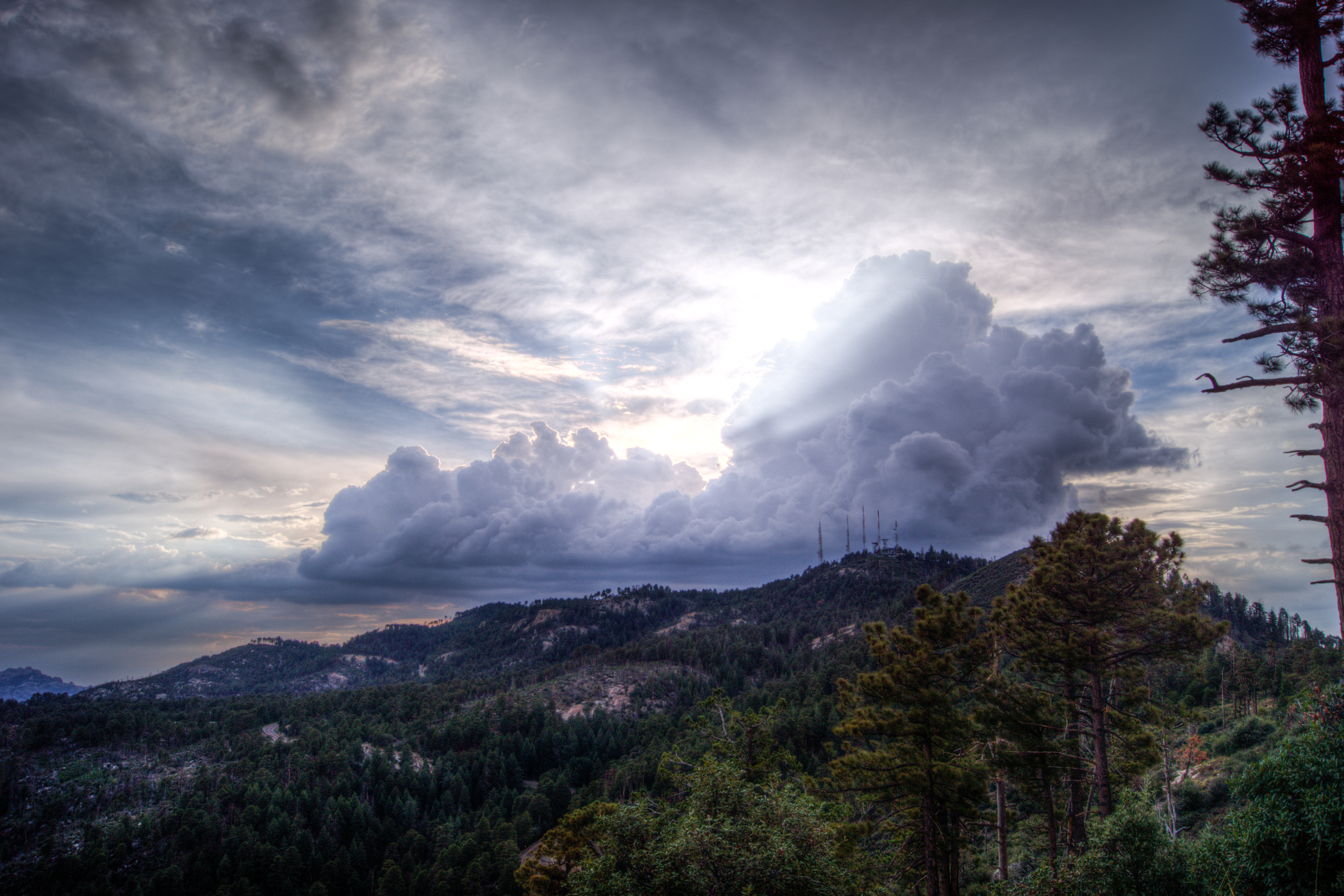
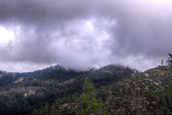
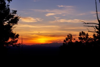
Right: Clouds behind Mount Bigelow. July 2013.
Maps
- (Printed Map) Recreation Map – Santa Catalina Mountains, Green Trails – The Incinerator Ridge Trail extension is NOT currently shown (July 2013) but there is good coverage of the other trails and very likely enough coverage of the terrain (the Mount Bigelow USGS Quad covers this area).

Resources
- Summit Hut Trail Talk Blog – Incinerator Ridge Trail, Kellogg Trail, Mount Bigelow
- HikeArizona – Incinerator Ridge to Leopold Point
- Tucson Hikes – Incinerator Ridge Trail
- Tucson Hikes – Incinerator Ridge Photos
- New trail segment in Catalinas serves up a visual feast for hikers – November 23, 2012
- National Environmental Policy Act Information for the 2012 Extension
- Posts on HikeLemmon.com:
- Views from Barnum Rock and Leopold Point, News – 5/19/2016
- Storm, Sky Island Traverse, AZTR 300/750 – 5/4/2016
- Knagge Trail to the Cabin, Snow – 1/31/2015
- Incinerator Ridge to Mount Bigelow – 9/21/2014
- Oracle Ridge Trailhead to San Pedro Vista – 8/24/2014
- Start of the Monsoon Season? – 2014/7/3
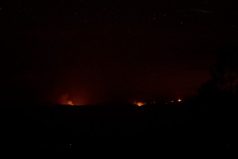
- Oak Fire from the Kellogg Trail – 2014/6/29
Pictures
2014 September Ridgeline Parking to Mount Bigelow

2014 July Incinerator Ridge


2014 August Oracle Ridge to San Pedro – Crystal Spring, Butterfly, Kellogg


2013 July Kellogg Mountain and Barnum Rock


2013 July Incinerator Ridge, Kellogg Mountain Trail, Mount Bigelow


2012 May Kellogg Mountain and Mount Bigelow
Update Notes
- 2017/12/23 – Update Incinerator Ridge Parking Area to Kellogg Trailhead to reflect current signage
- 2017/8/15 – HikeLemmon posts added to resources
- 2017/8/12 – Description updated, Pusch Ridge Wilderness Bypass linked, links added to the hike description, small hike updates, Img Srcset update.
- 2014/9/23 – New Flickr Album added
- 2014/6/28 – Added several new pictures, updated format, fixed broken link to the Ridgeline Parking Pullout
- 2014/3/4 – WordPress update
- 2014/2/27 – Adding driving directions section, added elevation profile, updated format, added picture dates.