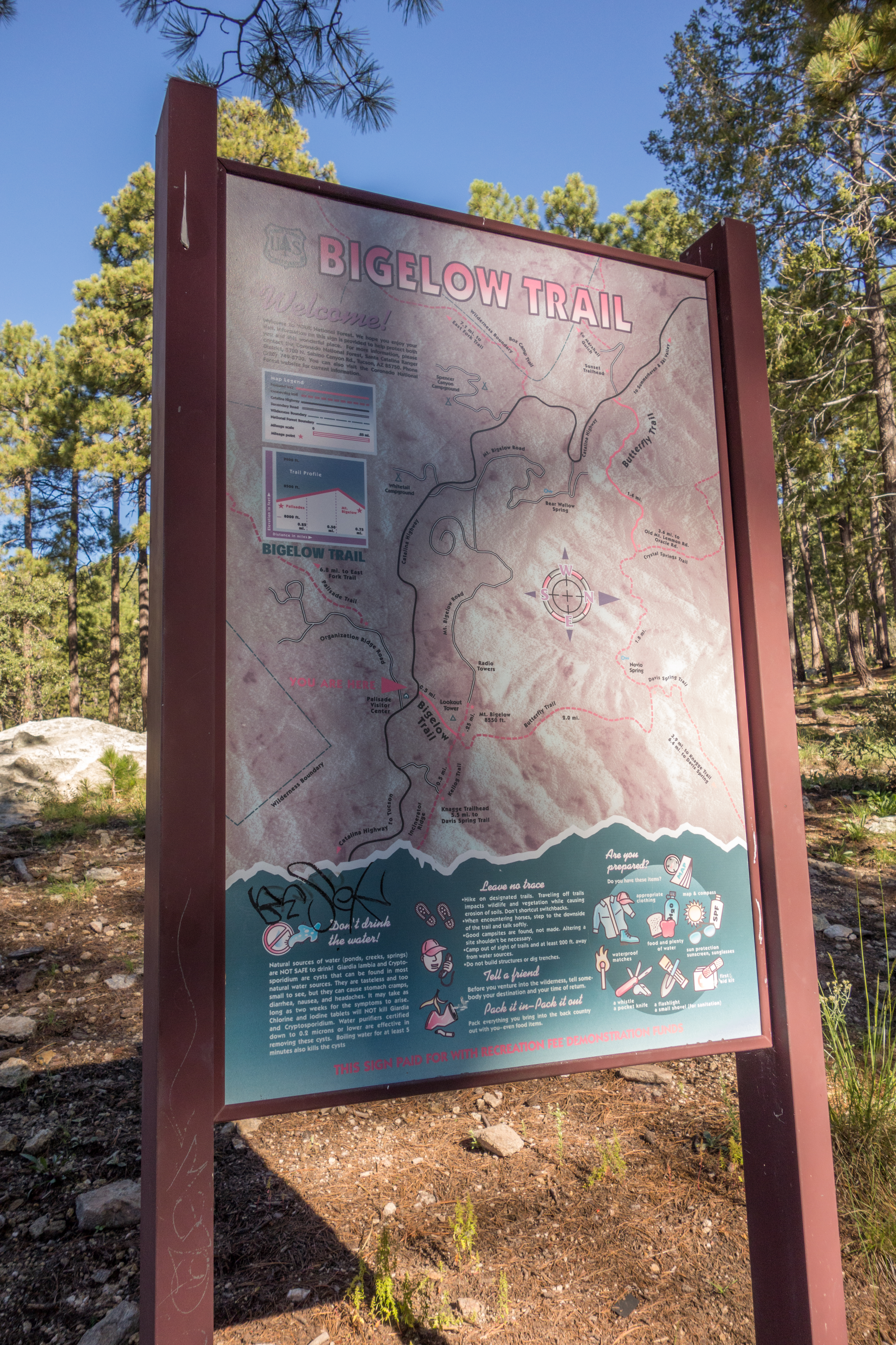
Trail Map Sign at the Bigelow Trailhead. September 2014
Overview
Location
- Upper Highway Hikes - Santa Catalina Mountains - Southern Arizona
- Google Map Coordinates: 32.40963027 -110.71327329
- At This Trailhead: Bigelow Trail which connects to the Butterfly Trail and Incinerator Ridge Trail and Kellogg Trail
- Nearby Trailheads and Parking: Down-mountain Kellogg Trailhead, up-mountain San Pedro Vista
Driving Time and Distance from Tucson
- 1 Hour and 5 Minutes from Speedway and Campbell
- 33.4 miles from Speedway and Campbell
- Miles up Highway: 19.5 miles
- Side of the Highway: up-mountain
- Vehicle Access: Paved Roads/Passenger Car (Mountain Road - be careful of weather conditions!)
Fees and Services
- Fee: No
- Restrooms: Yes
- Water: Yes
Driving Directions
Suggested driving directions from the Speedway and Campbell intersection in Tucson to the Bigelow Trailhead:
- Drive East on Speedway (5.0 miles)
- Left on Wilmot and continue on Tanque Verde (4.3 miles)
- Left on Catalina Highway (24 miles)
- Signs will help you locate the trailhead on the up-mountain side of the highway.
Google Maps Directions from the Speedway and Campbell intersection in Tucson to Bigelow Trailhead.
Resources
- Posts on HikeLemmon.com:
- Government Shutdown, Day 24 – 1/14/2019
- Fees, Redesign, Shuttle, Discharge – 1/2/2018
- Crystal Spring and Butterfly Trails – 5/8/2017
- After the Burn – 12/11/2016
- Almost Super Moon from Kellogg Mountain – 11/13/2016
- City Lights, West of Mount Bigelow – 8/10/2015
- Bigelow Trail and Butterfly Trail, Playing in the Snow – 12/28/2014
- Bigelow Trail, Butterfly to Mount Bigelow, Bigelow Road and the Highway – 9/12/2014
All Trailheads - Map
Update Notes
- 2019/1/29 – Resources section added, tags update
- 2017/7/28 – Img Srcset update, Added All Trailheads Map