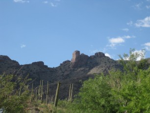
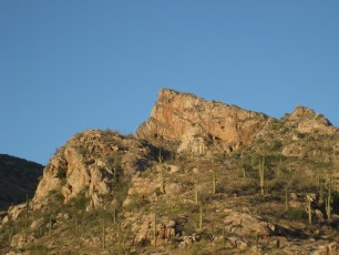
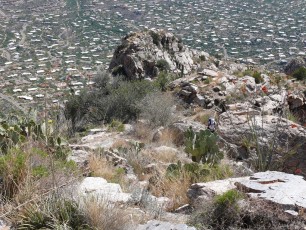
 Pontatoc Ridge rising above the the east side of Pontatoc Canyon. November 2012.
Overview
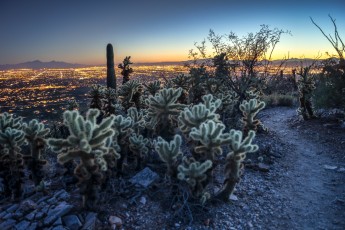
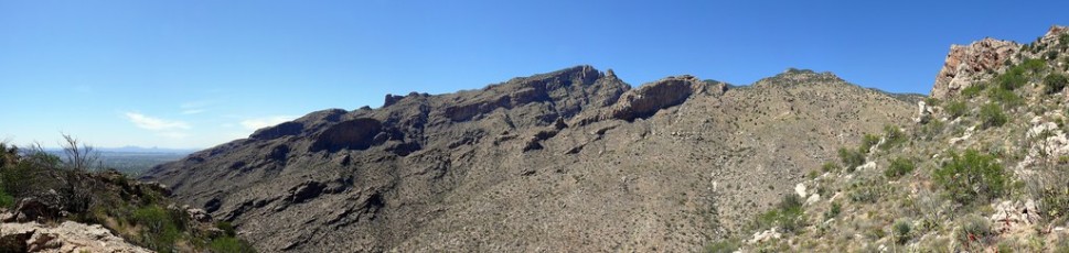
Close to Tucson the Pontatoc Ridge Trail #411 climbs quickly/aggressively up Pontatoc Ridge with great views of Tucson, the dramatic cliffs and formations that make up Finger Rock and Prominent Point and the Pontatoc Cliffs!
Hike Stats
- Out and Back
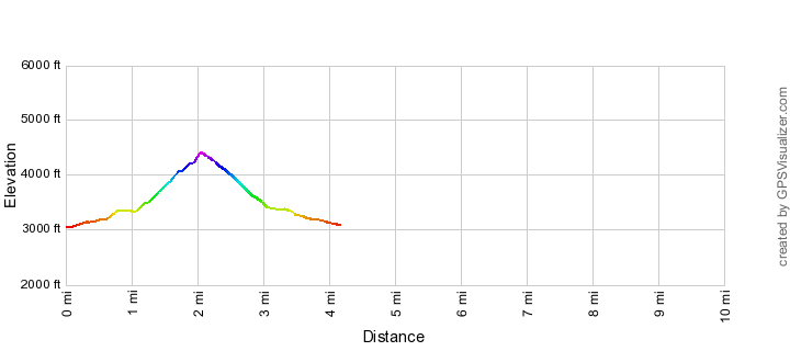
- 4.3 miles
- 1,500' Elevation Gain
- 1,500' Elevation Loss
- Highest Elevation: 4,400'
- Lowest Elevation: 3,050'
Location
- North side of Tucson, Pusch Ridge Wilderness, Santa Catalina Mountains.
- Start/End: Richard McKee Finger Rock Trailhead (City's Edge Hikes)
Details
- Fee: No
- Dogs: No (Bighorn Sheep Restrictions)
- Bikes: No (Pusch Ridge Wilderness)
- [bighorn-management-area-restrictions/]
- [pusch-ridge-wilderness-restrictions/]
- [pima-county-trailhead-permit/]
Drive
- 8.4 miles from Speedway and Campbell
- 20 Minutes from Speedway and Campbell
- Vehicle Access: Paved Roads/Passenger Car
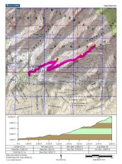
Pontatoc Ridge Trail Elevation Profile
Driving Directions
Suggested driving directions from the Speedway and Campbell intersection in Tucson to the Richard McKee Finger Rock Trailhead:
- North on Campbell (6.4 miles)
- Right onto Skyline (0.4 miles)
- Left to continue on Skyline (0.7 miles)
- Left on North Alvernon Way (0.9 miles)
- The trailhead is on the left/west side of the road.
Google Maps Directions from the Speedway and Campbell intersection in Tucson to Richard McKee Finger Rock Trailhead.
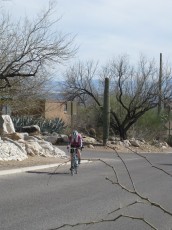
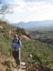
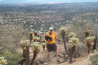
 Running on the Pontatoc Ridge Trail. August 2013.
Trail Notes
[CueListWarning]
- 0.0 miles, 3040′: start at the Richard McKee Finger Rock Trailhead (parking for the Pontatoc Ridge Trail, Pontatoc Canyon Trail and Finger Rock Trail) [Waypoint thfr].
- Cross the road and walk north, several signs mark the beginning of the trail just after the entrance to a gated community.
- The trail climbs a short hill to a signed junction [Waypoint pc-fr] – take a right (left for the Finger Rock Trail) – the trail wanders thru the desert towards Pontatoc Ridge crossing several washes.
- 0.7 miles, 3250′: Cross Pontatoc Canyon [Waypoint PT01] (there are a number of wash crossing before crossing Pontatoc Canyon) – the trail begins to climb steeply.
- 0.8 miles, 3450′: Signed junction [Waypoint pr-pc] – take a right (left for the Pontatoc Canyon Trail) – in a few more minutes there is a nice rocky area just off the trail is a good spot for a break with nice views over Tucson [Waypoint PR02].
- The trail continues to climb – at 1.4 miles, 3550′ [Waypoint PR03] walk up a section of rocky slab – there are often several cairns to help you find the trail.
- 1.9 miles, 4100′: Saddle – great views! [Waypoint PR04]
- 2.0 miles, 4200′: A few minutes after the saddle stay to the left as a very well-worn route splits off to the right – the route to the right is an unofficial route up to the top of the ridge. [Waypoint pr-pd]
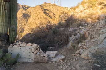
- A sign marks the end of the official trail [Waypoint prend] – there is an obvious unofficial trail beyond the sign that will take you towards an old mining area (use caution/good judgment traveling off trail and around old mine works).
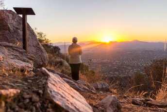
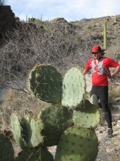
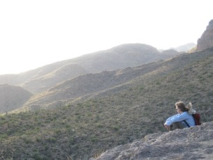
 At the sign marking the end of the official trail. January 2014.
Although the cliffs were mined they are not the site of the ‘Pontatoc Mine’ that was worked in the early 20th century, the location of Pontatoc Mine is apparently somewhere inside the housing developments south of the ridge. The ridge/cliff area was prospected during and shortly after the Pontatoc Mine was producing, but what was found “apparently didn’t amount to much” – see The Pontatoc mine in a north Tucson neighborhood and Mineral investigation of the Pusch Ridge Wilderness, Pima County, Arizona for more information. The older name for this trail is the ‘Old Spanish Mine Trail’.
Portions of the trails in the Pontatoc and Finger Rock Canyons may be part of the network of trails built by Francis Knagge and his family to give their cattle access to more land for grazing – one of their camps was near the end of North Alvernon Way.
 Snow and Frost on the Prickly Pears on a cold winter day. February 2013.
Resources
- AZDean – Tucson Hikes – Pontatoc Ridge Trail
- Trail Talk – Summit Hut Blog – Pontatoc Trails
- HikeArizona.com
- Coronado National Forest
- Tucson Hikes – Pontatoc Ridge Trail
- Mountain Project
- [GuideTucsonHikingGuide/]
- [GuideYellowBook/]
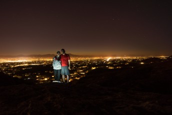
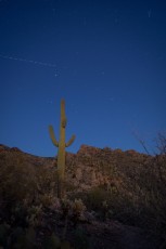
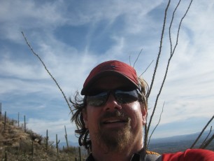
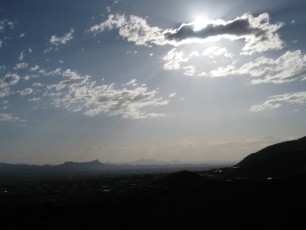
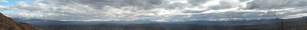
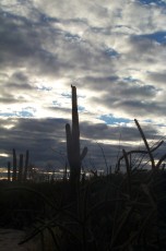
 Night on the Pontatoc Ridge Trail. January 2014.
Pictures
2014 January Pontatoc Ridge to the End of Trail Sign

2013 October Pontatoc Ridge
2011 March Pontatoc Bike/Run/Hike

2010 June Pontatoc Ridge
2007 May Pontatoc Ridge Trail
2004 Jan Pontatoc Ridge
Update Notes
- 2017/8/14 – Add HikeLemmon posts to Resources
- 2014/11/9 – Updated link to the Pontatoc Mine article (not sure of best link now for this)…
- 2014/10/28 – Added note about Francis Knagge, corrected several typos, improved GPX file, added PDF Map and Description
- 2014/7/27 – Format update
- 2014/3/31 – Improved GPX file, hiking notes changed to match
- 2014/3/8 – Move to WordPress, added elevation profile
- 2014/1/26 – Added small ‘driving’ map, increased the size of the Gmap4 Topo Map.
- 2014/1/19 – Updated Overview/Typos, added cautions and restrictions.
- 2014/1/18 – Updated format (driving directions, last update in overview), added dates to picture captions, added additional pictures, changed picture links.
- 2013/11/25 – more format work, added recent photo sets from Alison and I and resource link to AZDean – Tucson Hikes
- 2013/10/15 – updated Overview format, added elevation and mileage notes