Houses and private property push up to the southern edge of the Santa Catalina Mountains near the Pontatoc Ridge Trail and Tucson is nearly always in view – but the area, views and wildlife are beautiful and there is still plenty of wildness to be found!
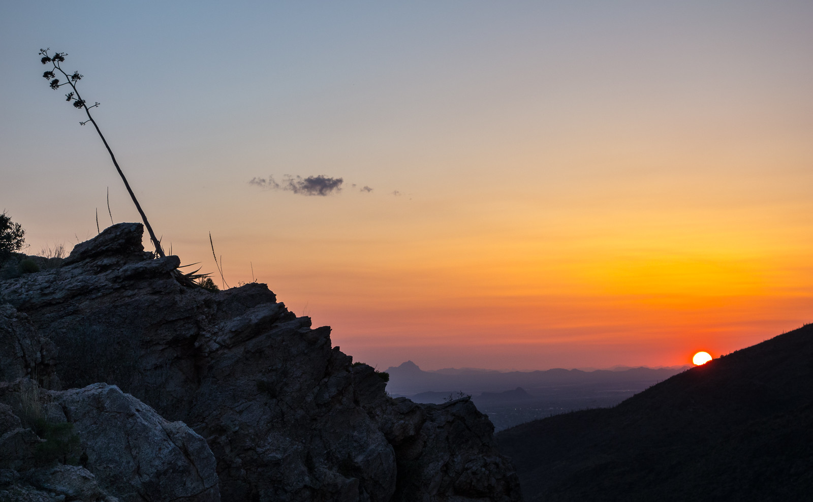
A hillside across from Pontatoc Ridge. September 2016.A desert tortoise in the brush at the end of the Pontatoc Ridge Trail. September 2016.Pontatoc Canyon in shadow at sunset from the end of the Pontatoc Ridge Trail. September 2016.Saguaro and moon. September 2016.
Saguaro just off the General Hitchcock Highway. May 2016.
The drive up to San Pedro Vista was slightly slower than normal – both because I couldn’t resist stopping and photographing Saguaros near the highway and because a film crew was set up at Windy Point filling part of the parking lot with trailers and vehicles and occasionally stopping traffic. I didn’t see what they were filming – but the motorcycles in a pop-up tent and drone hovering off the side of the highway on my way down did make me a bit curious…
From Barnum Rock: Green Mountain – center, Guthrie Mountain – left, San Pedro Vista – lower left, Mica Mountain in the Rincon Mountains – right. May 2016.
From San Pedro Vista I intended to take the Incinerator Ridge Trail and Kellogg Trail up to Mount Bigelow – my idea was a good workout with great views – but the views quickly won out over the workout – I sat on the top of Barnum Rock and watched the sun and clouds create shapes of light and shadow on Green and Guthrie Mountains and then admired Kellogg Mountain, Mount Bigelow and the San Pedro Valley from Leopold Point.
Kellogg Mountain and Mount Bigelow from Leopold Point near the Incinerator Ridge Trail. May 2016.
Rider Carol Fontana and her horse Tiki passed thru the Santa Catalina Mountains in May as part of their thru-ride of the Arizona Trail – see more about their journey on SaddleUpAz. The ride is to support and raise awareness of the Prescott Area Shelter Services whose mission is “serve homeless women, families, and veterans by providing temporary shelter, resources, individualized case management, and a pathway to permanent housing.”
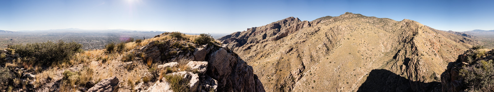
Looking across Pontatoc Canyon, over Finger Rock Canyon and up to Prominent Point, Finger Rock and the Finger Rock Guard. March 2016.Cholla flower in the sun. April 2016.Loosing the light while descending the Pontatoc Ridge Trail – Tucson city lights in background. April 2016.
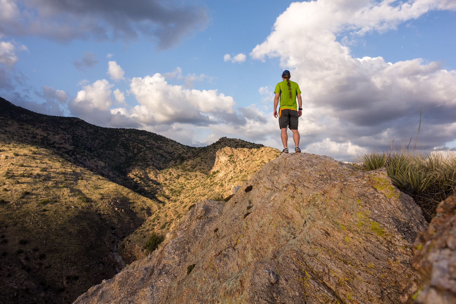
The view from the top of the Pontatoc Cliffs! November 2014.
Holiday hike to both the end of the trail sign on the Pontatoc Ridge Trail and to the top of Pontatoc Ridge – great to be outside! 5.4 miles, 2300′ of elevation gain and loss.