Overview
There are a number of amazing trails on the top of the mountain, but most of them plunge quickly down the mountain and become quite a workout – thrilling, but there are days when something a bit more mellow is called for. The Meadow Trail #5A leaves from the Mount Lemmon Recreation Area and wanders out into an area of big trees, small meadows and great views before ending at a junction with the Mount Lemmon Trail.
Hike Stats
- Loop
- 1.8 miles
- 400' Elevation Gain
- 400' Elevation Loss
- Highest Elevation: 9,090'
- Lowest Elevation: 8,760'
Location
- This hike is in the Santa Catalina Mountains near Tucson, Arizona.
- Start/End: Mount Lemmon Recreation Area (Top of the Mountain Hikes)
Details
- Fee: Yes ([LemmonFeeCostAndLink/])
- Dogs: Yes
- Bikes: Yes
Drive
- 41.6 miles from Speedway and Campbell
- 1 Hour and 25 Minutes from Speedway and Campbell
- Vehicle Access: Paved Roads/Passenger Car (Mountain Road - be careful of weather conditions!). Closed to motor vehicles in winter (December 15 to March 1 - dates subject to change depending on weather/conditions).
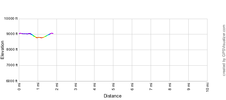
Meadow Trail Elevation Profile
Driving Directions
Suggested driving directions from the Speedway and Campbell intersection in Tucson to the Mount Lemmon Recreation Area:
- Drive East on Speedway (5.0 miles)
- Left on Wilmot and continue on Tanque Verde (4.3 miles)
- Left on Catalina Highway (29.1 miles)
- Turn right on Ski Run Road (2.7 miles). Note that 1.4 miles up Ski Run Road at Ski Valley and the Iron Door Restaurant there is a gate that is closed seasonally that blocks the last 1.7 miles of the road (Lemmon Rock Road) - when the gate is closed foot traffic up the road is still allowed but consider using the Aspen Draw Trail to access this area (it won't save you time compared to walking the road but has good parking in Summerhaven and is very beautiful!)
- Continue 0.2 miles past the Summit Trailhead (a gravel parking area on the down-mountain side of the road) to the Mount Lemmon Recreation Area. The trailhead is near a fenced in power station - there is a (normally) closed gate into the Mount Lemon Observatory Area just after the turn for the trailhead - if you drive into the fenced in Mount Lemon Observatory Area you have gone too far...
Google Maps Directions from the Speedway and Campbell intersection in Tucson to Mount Lemmon Recreation Area.

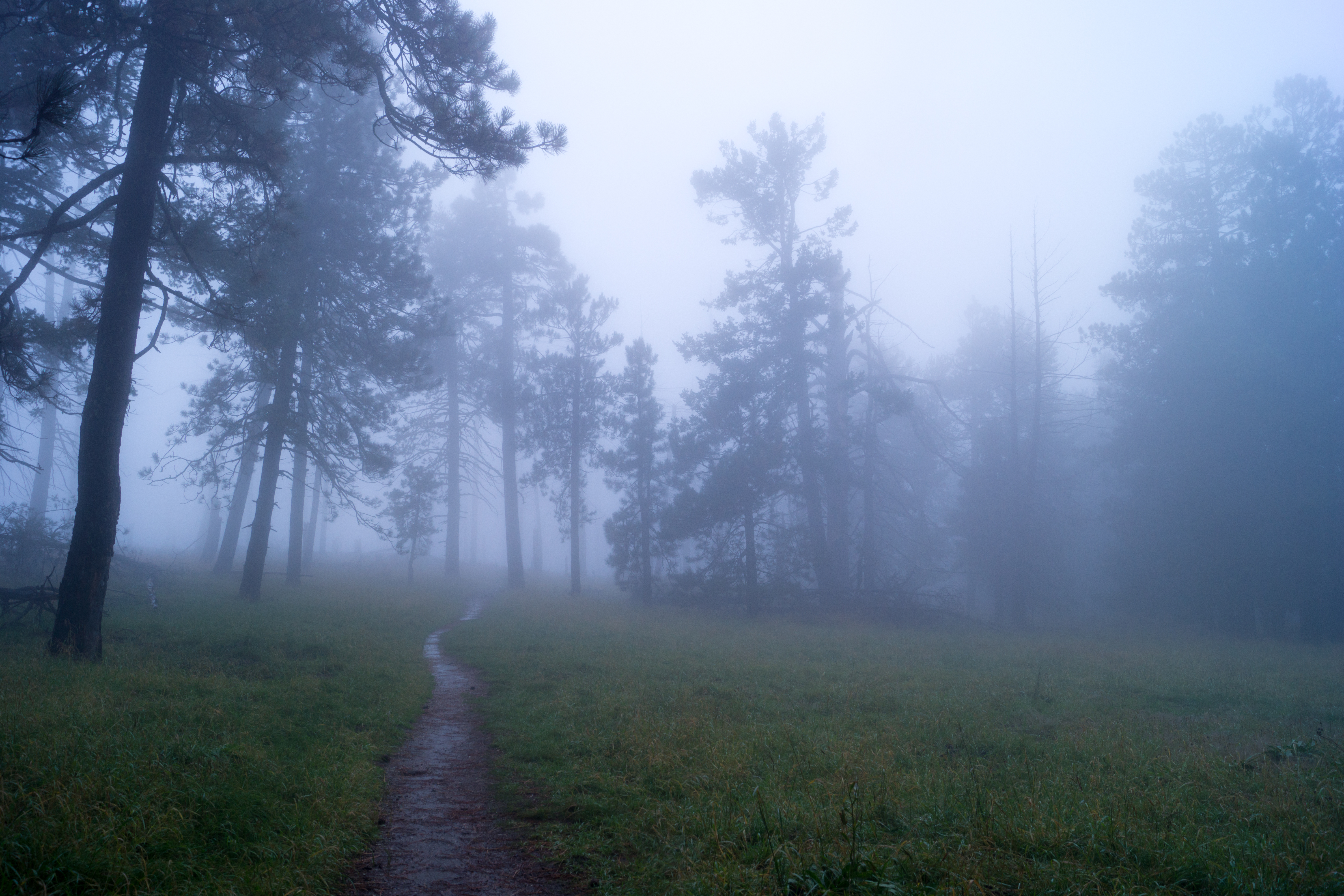
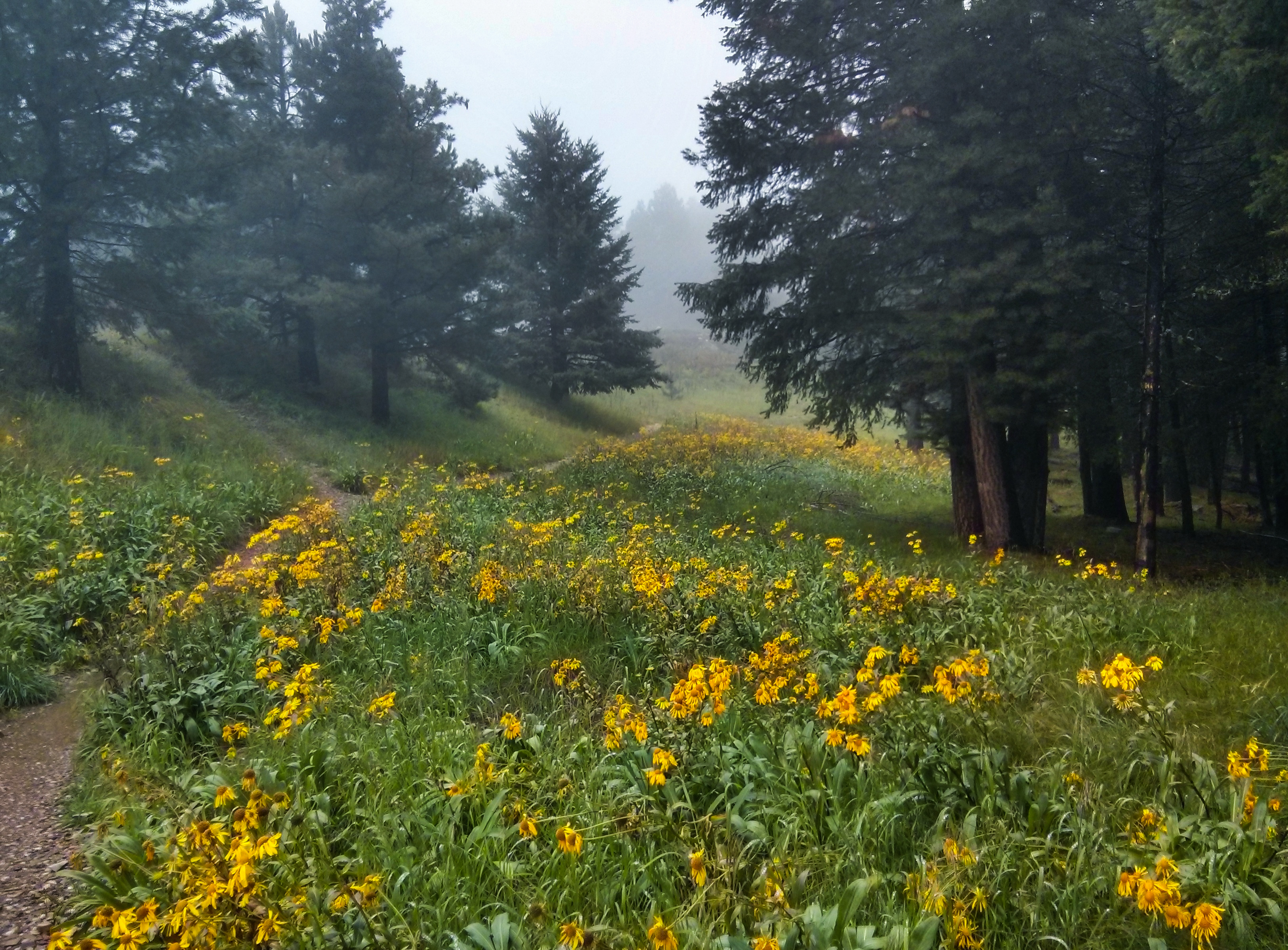
Right: The Meadow Trail - covered in beautiful clouds. October 2014.
Trail Notes
[CueListWarning/]
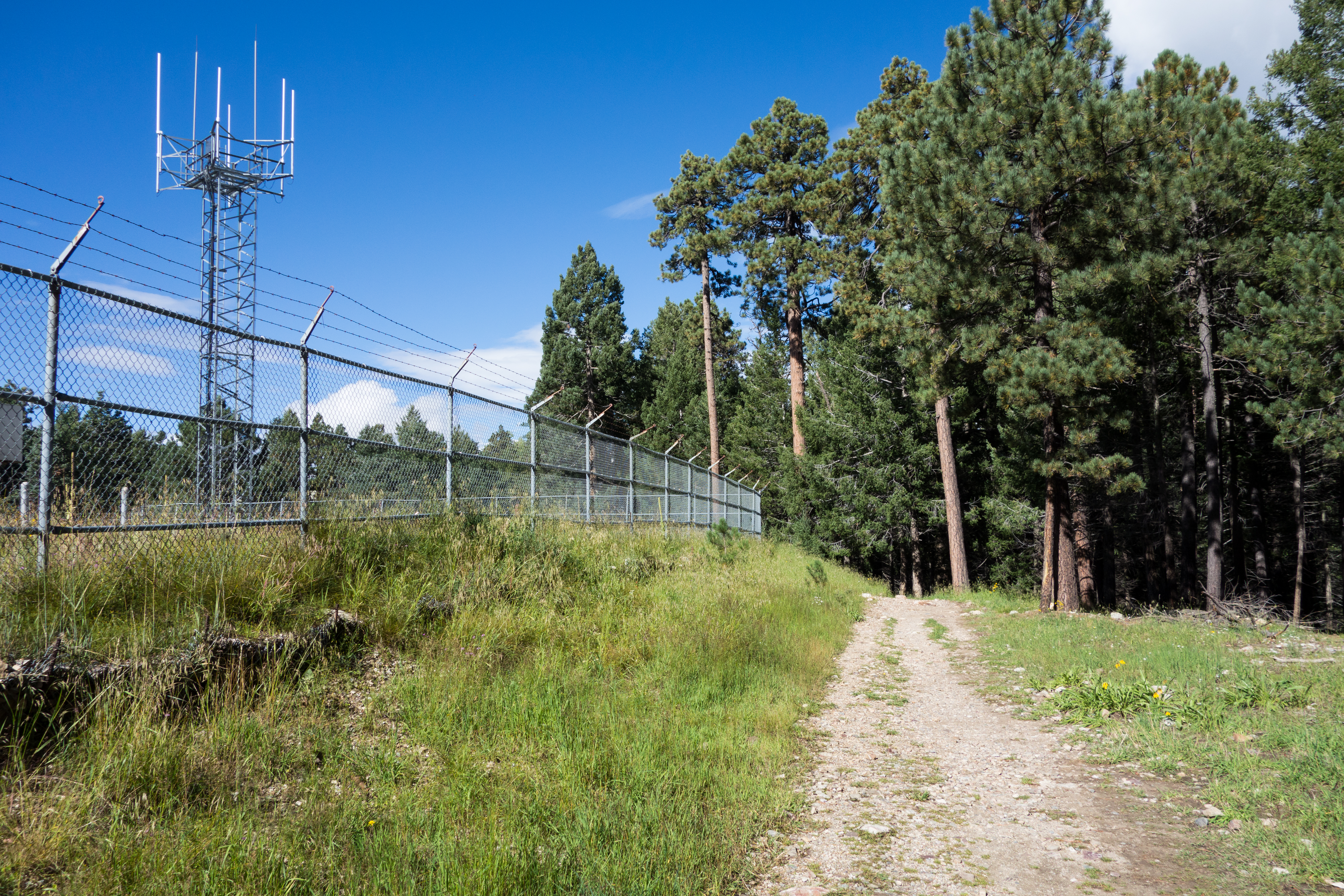
- 0.0 miles, 9100′: Start from the Mount Lemmon Recreation Area [Waypoint mlra] on the Mount Lemmon Trail. The trail starts near several trail signs and runs along the power substation fence. (If the parking is full at the Mount Lemmon Recreation Area or you want to avoid the fee at this location park instead at the Summit Trailhead [Waypoint ths].)
- After passing the power substation the trail quickly reaches a junction [Waypoint L01] with a path (to your right) out to the paved road and another path (to your left) to a building – continue straight to the signed junction of the Meadow Trail and the Mount Lemmon Trail [Waypoint l-me] – continue to the right on the Meadow Trail.
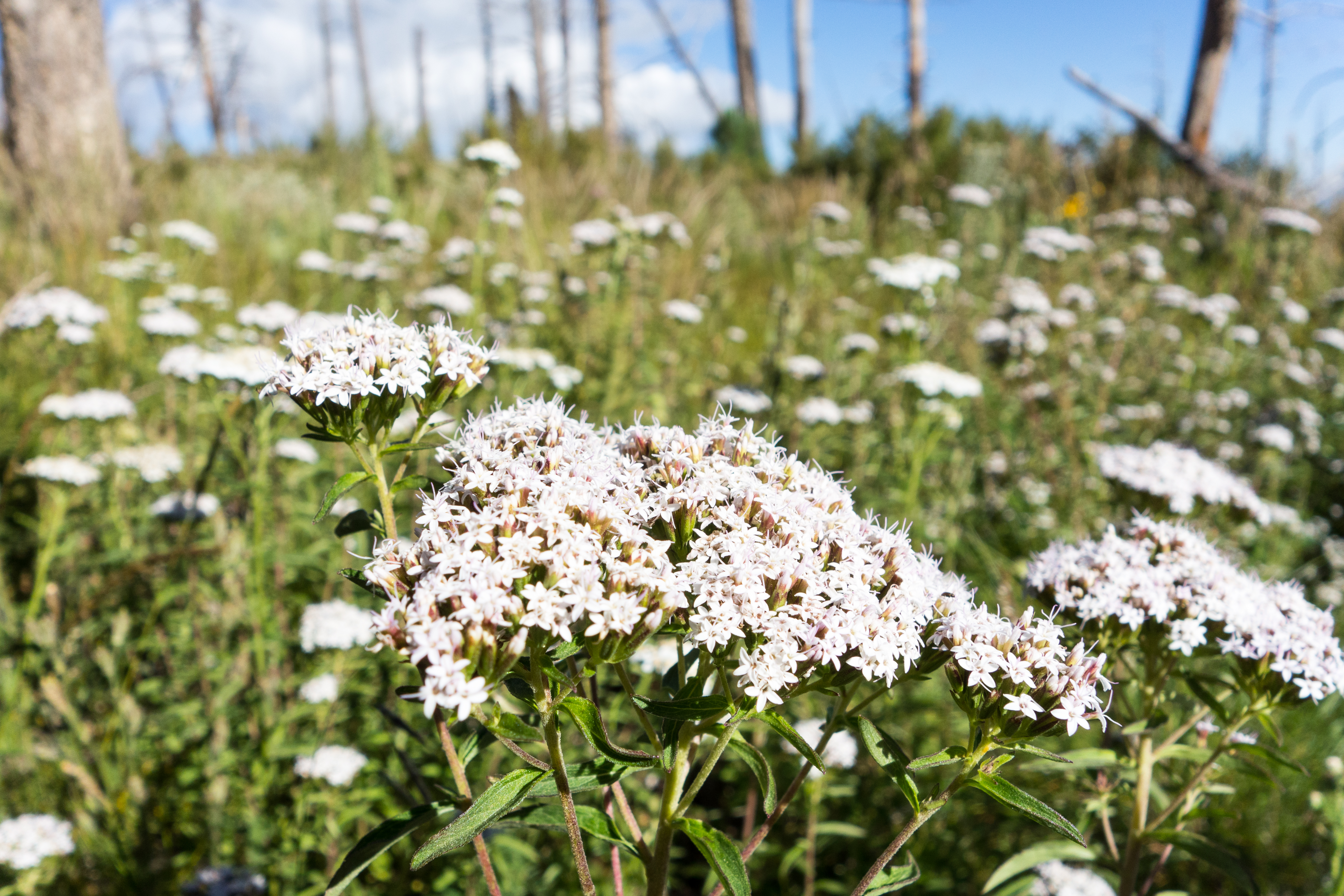
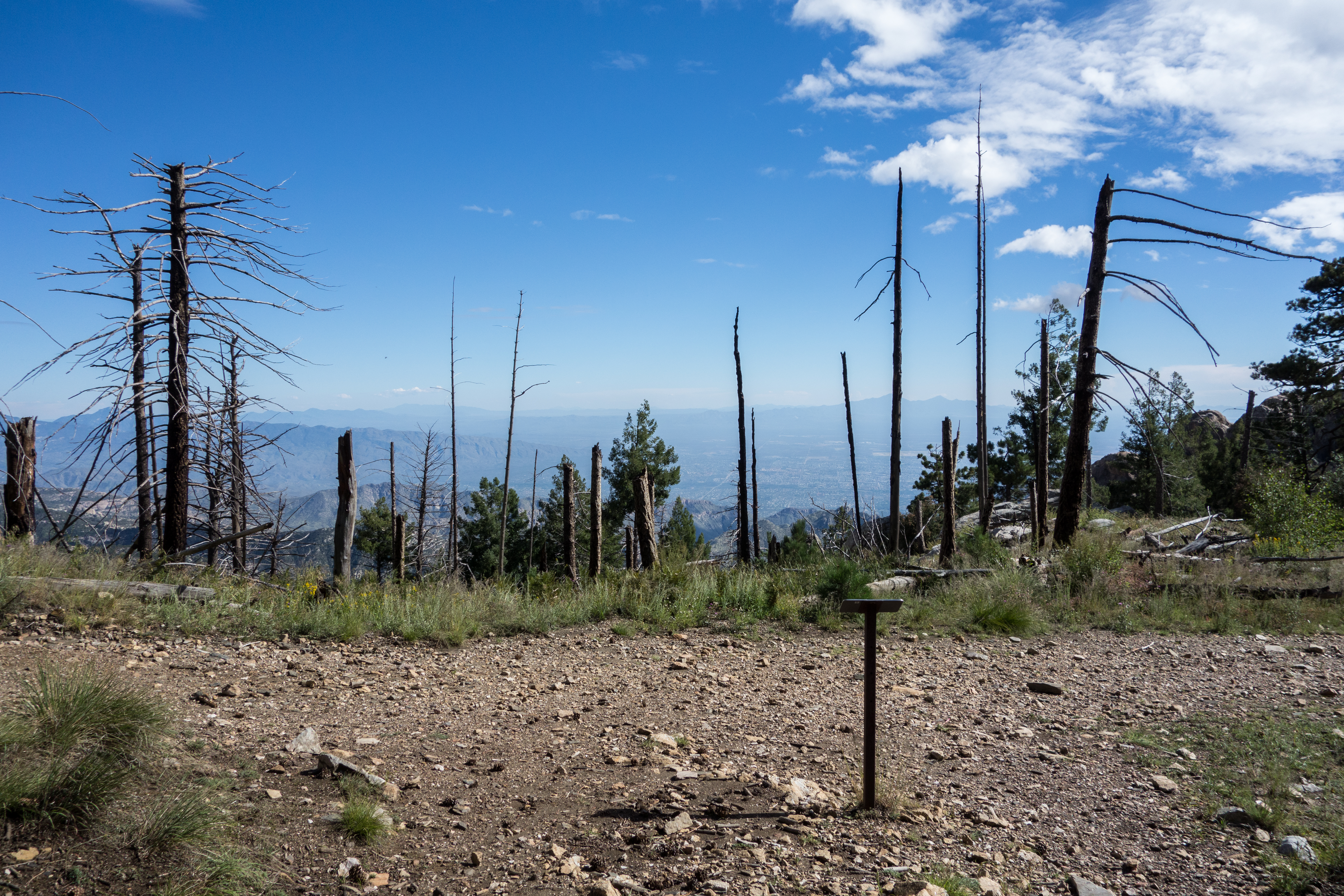
- The meadow trail travels near the south edge of the Mount Lemmon Observatory (you will see the fences and buildings) and then enters an area with trees and grassy meadows, this is a great place to stop and enjoy – but it can be busy on a nice day. The trail is well worn – there are several side trails (into the meadows and out to views) that can be nice distractions but are unlikely to be confused with the main path if you are paying attention.
- After the meadow area the trail descends to its end at a junction with the Mount Lemmon Trail.
- 0.95 miles, 8850′: Signed junction of the Meadow Trail and the Mount Lemmon Trail [Waypoint l-mw] – you can return back to the Mount Lemmon Recreation Area on the Meadow Trail – but taking a left and continuing east along the Mount Lemmon Trail makes a nice loop.
- 1.3 miles, 8900′: At a signed junction the Lemmon Rock Trail leaves to the right (going to the Fire Lookout is a nice side-trip if you have the time – the out-and-back to the Lookout adds about .3 miles round-trip) – continue on the Mount Lemmon Trail. [Waypoint l-lr]
- 1.7, 9100′: Signed junction of the Meadow Trail and the Mount Lemmon Trail [Waypoint l-me].
- 1.8, 9100′: Mount Lemmon Recreation Area [Waypoint ths].
For a short time the Meadow trail is next to large a large fence topped with barbed wire which is part of the fencing surrounding the Mount Lemmon Observatory. The Mount Lemmon Observatory was not the first organization to occupy the top of the mountain – it was originally cleared for the Mount Lemmon Air Force Station. Construction of the Mount Lemmon Air Force Station began in 1955 and for years it housed various radar installations. The site was vacated by the Air Force by 1970 and in the 1970s the site was leased to the University of Arizona for the Mount Lemmon Observatory.
Right: The signed western junction of the Meadow Trail and the Mount Lemmon Trail. September 2014.
Resources
- Posts on HikeLemmon.com:
- Samaniego Peak – 6/2/2013 and 5/2/2018
- Meadow, Mt Lemmon, Wilderness of Rock and Mint Spring Trail – 8/21/2017
- Bears, Steward, Grants, 2006 – 9/10/2016
- Heat, Deaths, Fire, Joining – 7/1/2017
- Storm, Sky Island Traverse, AZTR 300/750 – 5/4/2016
- Storm: Point 5506, San Pedro Vista, Meadow Trail Loop – 10/9/2014
- Construction, Fire and Flowers
Update Notes
- 2017/8/18 – Img Srcset Update
- 2017/8/15 – HikeLemmon posts added to Resources
- 2017/8/8 – Update description and gpx to reflect the Summit Trailheads and Mount Lemmon Recreation Area split, fix broken picture
- 2014/10/11 – Initial page