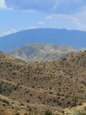
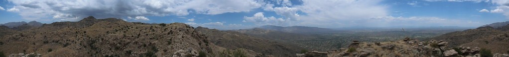
 Point 4981 in the distance. June 2012.
Overview
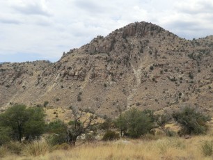
This trail was a surprise to me! I had never read about it, heard about it, or seen it mentioned – I followed it because I thought it was going to take me to the top of Gibbon Mountain – so I was completely surprised and delighted that it took me to a completely new destination.
It is possible Point 4981 (or the trail) has a name that I am not aware of – or possible that this trail has another final destination… It would be interesting to know more about this trail/area, if you have information please email me!
Hike Stats
- Out and Back
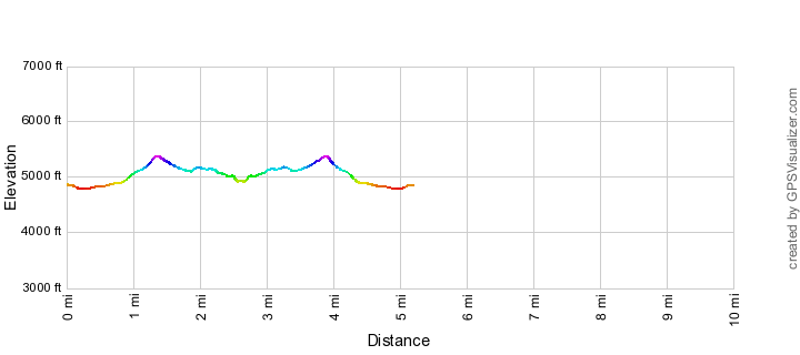
- 5.2 miles
- 1,500' Elevation Gain
- 1,500' Elevation Loss
- Highest Elevation: 5,400'
- Lowest Elevation: 4,800'
Location
- This hike is located in the Santa Catalina Mountains north of Tucson, Arizona. Much of this hike is in the Pusch Ridge Wilderness
- Start/End: Gordon Hirabayashi Recreation Site (Lower Highway Hikes)
Details
- Fee: No
- Dogs: Yes
- Bikes: No (Pusch Ridge Wilderness)
- [OffTrailWarning/]
Drive
- 21.3 miles from Speedway and Campbell
- 45 Minutes from Speedway and Campbell
- Vehicle Access: Most of the drive is Paved Roads/Passenger Car (Mountain Road - be careful of weather conditions!) - the drive to the end of the road parking area is on a dirt road that is generally in good condition and passenger car friendly.
Point 4981 Above Hairpin Turn Elevation Profile
Driving Directions
Suggested driving directions from the Speedway and Campbell intersection in Tucson to the Gordon Hirabayashi Recreation Site:
- Drive East on Speedway (5.0 miles)
- Left on Wilmot and continue on Tanque Verde (4.3 miles)
- Left on Catalina Highway (11.8 miles)
- Signs mark the turn into the Gordon Hirabayashi Recreation Site on the down-mountain side of the Highway.
- If the gate is closed: park in the paved upper parking or one of the dirt pullouts and walk to the parking area at the end of the dirt road (this will add to the total mileage of your hike). If the gate is open: drive the 0.3 miles to the parking area at the end of the dirt road. Restrooms are located just before the parking circle at the end of the road (the restrooms may be closed seasonally) – no water is available.
Google Maps Directions from the Speedway and Campbell intersection in Tucson to Gordon Hirabayashi Recreation Site.
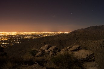
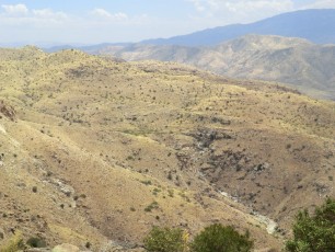
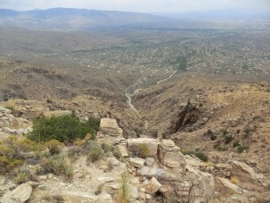
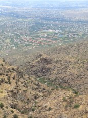
 Looking down into the Hairpin Turn Area from Point 4981. June 2012.
Trail Notes
[CueListWarning]
- 0.0 miles, 4850′: Park at the lower parking area in the Gordon Hirabayashi Recreation Site. [Waypoint THGHC]
- Take the Molino Basin Trail west (towards Sycamore Reservoir)
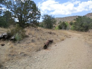
- 0.5 miles, 4800′: Look for several old pipes on the left side of the trail, just after the pipes there is a small, but obvious, drainage coming in from the left – the trail to Point 4981 is just beyond the drainage (this picture shows the pipes and (just barely) the drainage coming in). The trail is well worn at this point. [Waypoint J MB P4981]
- You are no longer on an official trail – while sections of the trail are reasonable possible to follow many sections are vague/non-existent – this is best considered an off-trail hike, certainly don’t attempt this unless you are comfortable navigating off-trail! There are decent stretches of good trail – if you are not seeing any sign of a trail it may be worth your time to backtrack/look for the trail – it is sometimes faster than traveling cross country.
- 1.3 miles, 5400′: After climbing the trail tops out on a ridge with views of Tucson – a lovely spot! This spot is the junction for one possible route to Gibbon Mountain. [Waypoint J Gib]
- Continue along/near the ridge out to Point 4981. The last down and up to Point 4981 are steeper/looser than previous sections of the trail – use caution and take your time finding the best path.
- 2.6 miles, 4981′: Point 4981! Enjoy the views! [Waypoint P4981]
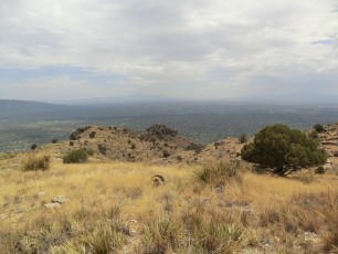
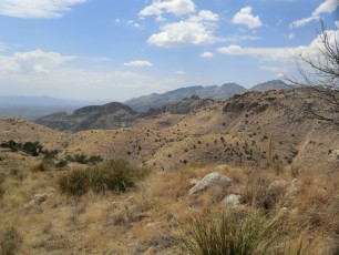
 Trail to Point 4981. December 2013.
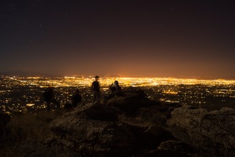
 Tucson lights - enjoying warm May temps on Point 4981. May 2013.
Maps
- [MapGreenTrailsCatalina]
- It may be useful to have the more detailed USGS 7.5′ maps for this hike – the [Usgs75AguaCaliente/] covers all of this hike but the hike is on the western edge of the map so it is nice to also the adjoining [Usgs75SabinoCanyon].
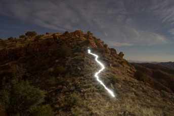
 Headlamp trail along the final descent before climbing up to Point 4981. May 2013.
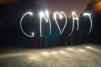
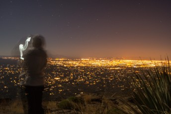
 Camera incantations on Point 4981. May 2013.
Pictures
2013 May Night Hike to Point 4981

2012 June Prison Camp to Point 4981 above Hairpin Turn
Update Notes
- 2014/3/24 – Format Update
- 2014/3/24 – Added better gpx file, updated format, fixed links, added pictures