Soldier Trail – 2/17/2019

Water at a rocky canyon crossing lower on the Soldier Trail. February 2019.

A Principled Stand, The Story of Hirabayashi v. United States by Gordon K. Hirabayashi with James A. Hirabayashi and Lane Ryo Hirabayashi, page 155:

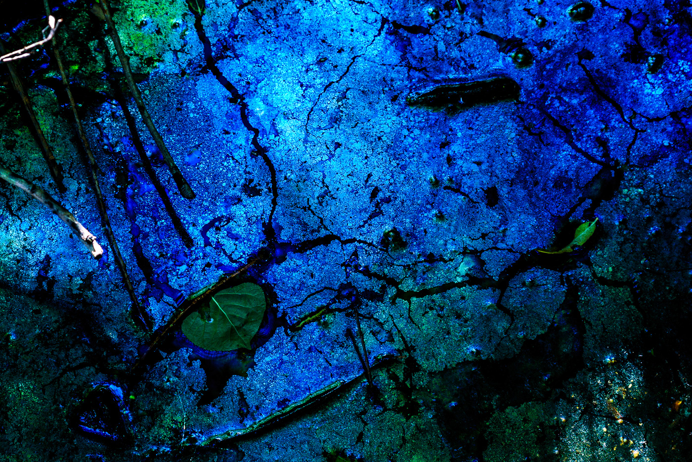
Periods of meditation are Quaker in style and spirit. Under the open sky and hills, we feel very close to the nature of things. Life becomes meaningful in a vivid way.

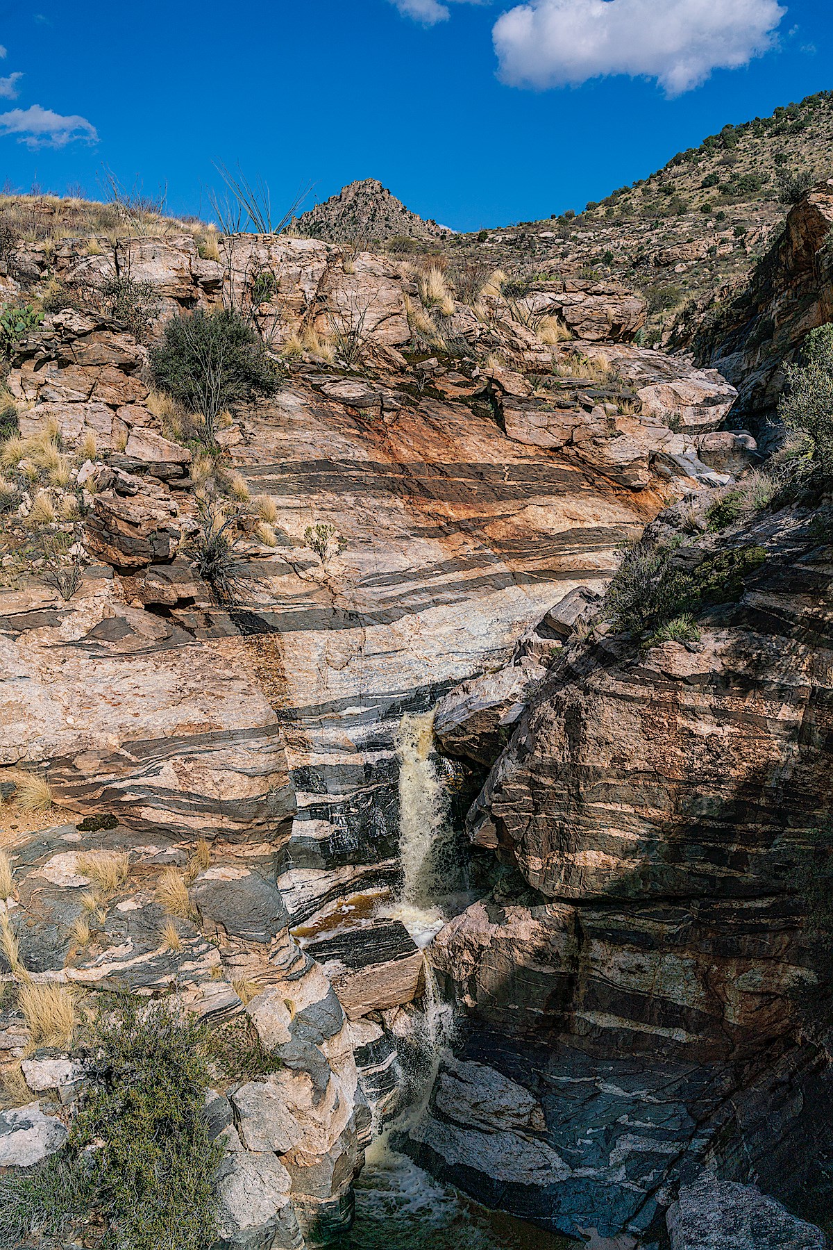
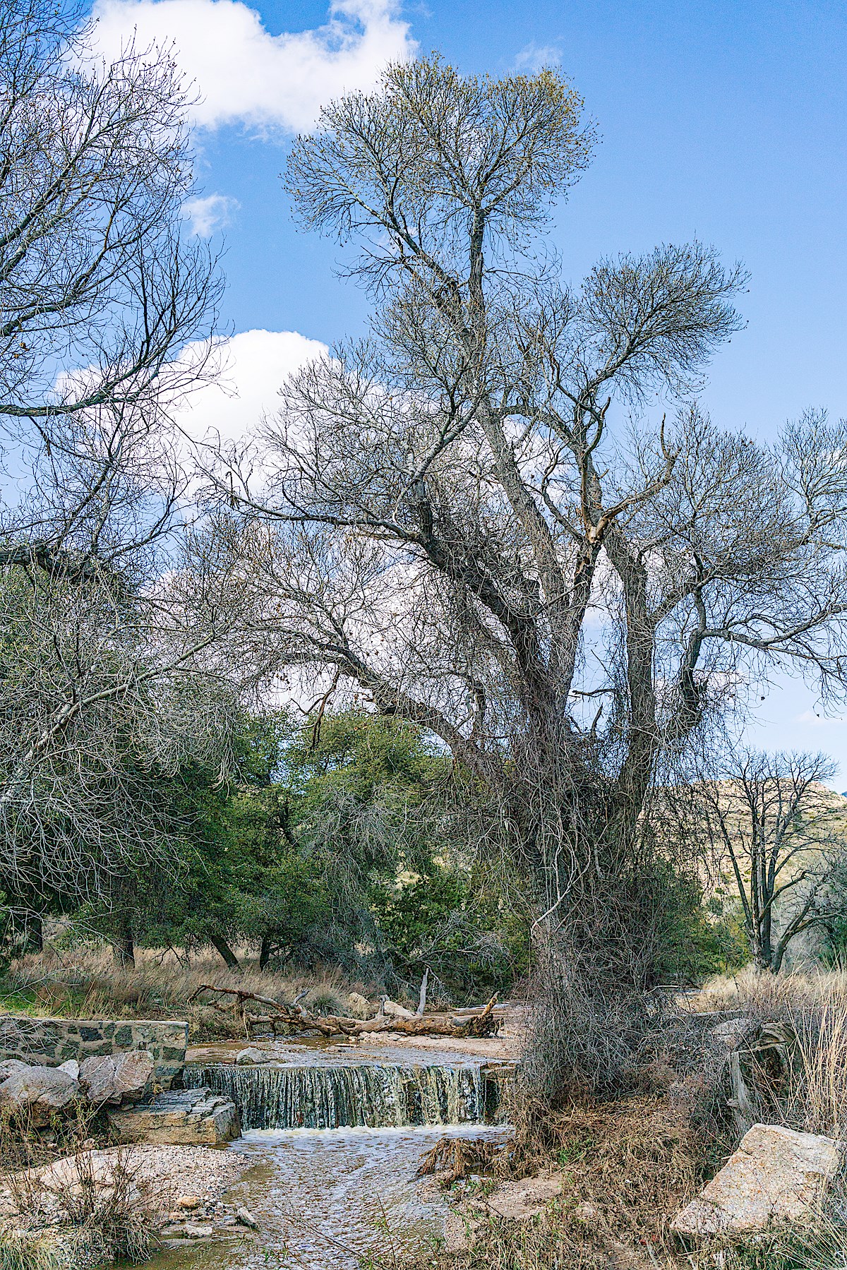
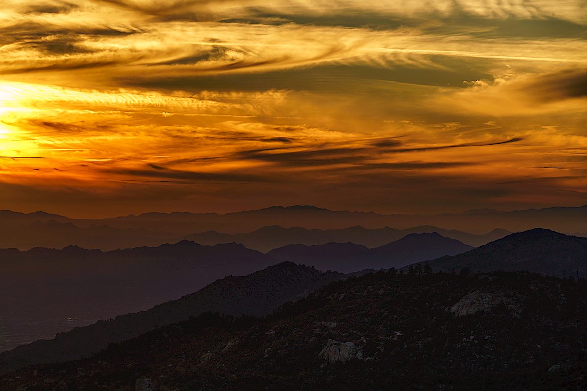
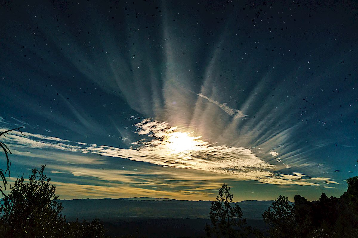
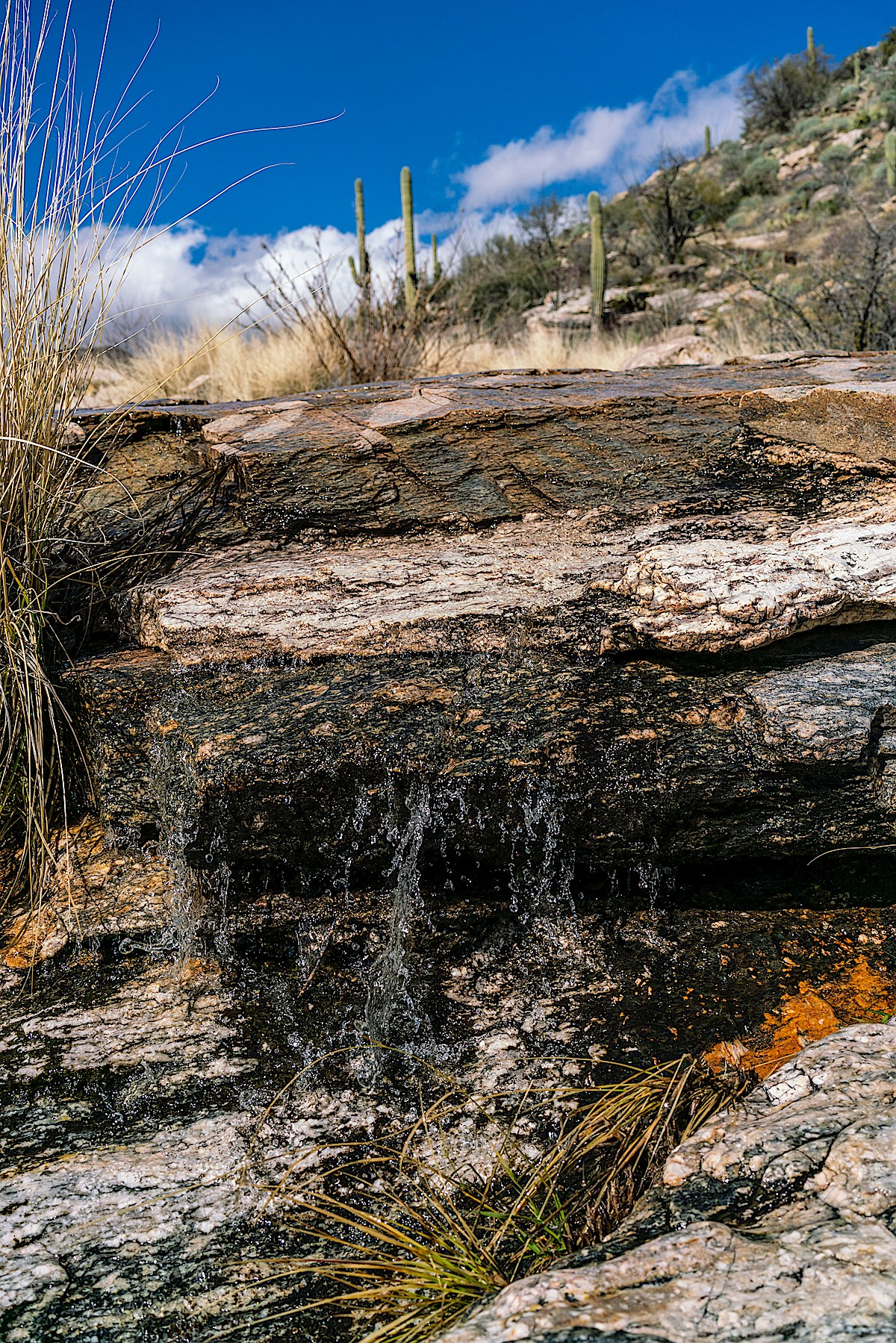
More images from 2018/2019’s wet winter – this time from Soldier Trail – the highlight of this hike was seeing the rushing falls in Soldier Canyon and, more of a surprise, seeing the water pouring over the rock structure near the junction of the Soldier and Molino Basin Trails.

Soldier Trail takes its general route from an old powerline and road to the prison camp that provided labor for the construction of the General Hitchcock Highway. Highway construction began in 1933 with the prisoners originally in temporary housing at the base of the mountain – in 1939 the camp moved up to the Vail’s Corral area where the remains of the prison can still be seen.

During WWII the Catalina Federal Honor Camp housed draft resistors and conscientious objectors – including Jehovah’s Witnesses, Mennonites and Hopi – in addition to prisoners convicted of federal crimes such as immigration-law violations, tax evasion and bank robbery. The first version of the General Hitchcock Highway was completed in 1951. Before being torn down in the early 70s the prison site served as a juvenile prison, was turned over to the State of Arizona and housed Forest Service crews.

In 1999 the prison site was renamed the Gordon Hirabayashi Recreation Site. Gordon Hirabayashi was one of the approximately 45 Japanese American draft resisters who were sent to the camp during WWII. Committed to non-violent resistance to the unconstitutional racially motivated curfew on, and removal of, Japanese Americans during WWII he served 90 days at the Catalina Federal Honor Camp after his initial conviction was unanimously upheld by the Supreme court in 1943. It would be over 40 years before a 1987 Ninth Circuit Court of Appeals ruling finally overturned his wrongful conviction.

If you want to read more there are a number of interesting articles online – a few are listed above – but I also highly recommend A Principled Stand, The Story of Hirabayashi v. United States by Gordon K. Hirabayashi with James A. Hirabayashi and Lane Ryo Hirabayashi. Published in 2013 the book is a collection of Gordon Hirabayashi’s writings and letters – published and unpublished – that have been selected and edited by James A. Hirabayashi, Gordon’s bother, and Lane Ryo Hirabayashi, Gordon’s Nephew.

Of particular interest to readers of this site may be the chapter on the Catalina Federal Honor Camp – a few quotes:

Page 150:

There are approximately two hundred inmates, and most are engaged in constructing a road to the mountain resort at the top of the hill. I joined the road crew that worked crushing and shoveling rocks into a dump truck, which was quite monotonous and a non-incentive activity, I assure you.

Consequently, by November 1943, at my request, I was transferred to the baking department. There I became “adept” at mixing, rolling, and baking bread, learning the techniques for various rolls, pies, cakes, etc. I hope to learn something by the time I leave.

Page 152:

There were a lot of Mexican border jumpers … , quite a few selective service cases, many Jehovah’s Witnesses, several pacifists of the FOR type. The latter group was the most aesthetic in appreciation, and I joined them once in climbing a little hill back of the camp to gaze at the beautiful, indescribable Arizona sunsets. The Native Indians were of two types. One type, which included many traditional Hopis, was objecting to being drafted into a white man’s war.

Page 154:

A group of us retreat to our favorite meditation spot for a refreshing, stimulating period of quiet. My thoughts: There is no excuse for tolerating injustice or violation of the brotherhood of man merely because we are incarcerated.

One part of the Hirabayashi family’s history that has been stuck in my mind is the story of the White River Garden. A Principled Stand, page 16:

In 1919, four families of the Pontiac collective, including two Hirabayashi families—my father’s family and the Toshiharu Hirabayashi family—moved to Thomas, Washington, a rural community twenty miles south of Seattle. These families formed a Christian cooperative, White River Garden, and purchased forty acres of land. Then the difficult development process began: clearing the land of stumps, digging ditches for better drainage, fertilizing the soil, cultivating, and building their homes.

At the time Washington’s Alien Land Law prevented non-citizens from owning land – so the White River Garden purchase was made in the name of the oldest child born in the United States – Aiko Katsuno, 10 years old at the time. Government officials felt this arrangement was an illegal subversion of the law and after a victory in the Washington Supreme Court Washington State took the land back from the White River Garden Corporation. The families were forced to lease the land in order to stay and work the property they had developed.

It wasn’t until the early 1950s that the Supreme Court ruled that forbidding aliens from owning land was a violation of the 14th Amendment’s equal protection clause. The White River Valley Museum has several photographs from White River Garden including a photograph of the White River Garden families and friends including a young Gordon Hirabayashi!

Poppy just off Soldier Trail. February 2019.
Falls in Soldier Canyon. February 2019.
Water flowing near the Soldier Trail and Molino Basin Trail junction. February 2019.
Grassy hillsides on Soldier Trail. February 2019.

Romo Peak and the Sutherland Wash Rock Art District – 2/23/2019

View from Romo Peak. February 2019.

In 1949 Ray Romo was walking near the top of a hill above the Sutherland Wash Rock Art District when he found a ceramic jar covered by an inverted bowl – the ceramics and contents as described in Archaeology in the Mountain Shadows – Exploring the Romero Ruin – by Deborah L. Swartz and William H. Doelle:

Both vessels were decorated with red-on-brown designs, which dated between A.D. 1100 and 1150. The jar contained around 100,000 stone and shell beads, and about 30 copper bells.

Most of the beads were made from red and black stone, but a small number were made of turquoise or marine shell. A majority of them exhibited signs of wear from having been strung. However, no thread was found to show whether they were strung when placed into the vessel. This find is called the “Romo Cache” after Mr. Romo.

The estimate in Archaeology in the Mountain Shadows is that it would take a single person 2.8 years of constant work to produce the 100,000 beads and if strung together it they would stretch 300 feet – an astonishing quantity, while I have not seen a concrete theory offered for the reason the cache was created it seems hard to believe that it didn’t have quite a bit of meaning to the person/people who left the objects.

Copper bells, made in Mexico, have been found in sites across the Southwest but are not common and finding 30 bells in one locations seems to be very rare. From Archaeology in the Mountain Shadows:

Copper bells were made using a process called the “lost wax” method. A small pebble was embedded into a ball of clay, the clay was dipped into wax to form an even coat, and then the waxed ball was surrounded with more clay. Molten copper was poured into the space held by the wax, which melted out. After the copper cooled, the clay was removed from the exterior and chipped off of the pebble inside the copper bell.

The hike to Romo Peak was steep and rugged, we never found any hint of a trail, and to our eyes the summit was remarkably like many other hilltops in the area. We spent some time at the top, enjoying the quickly melting snow, the great views, and wondering at the human activity in the area nearly 1,000 years ago that resulted in the Sutherland Wash Rock Art District and the Romo Cache.

Water in Sutherland Wash near the Golder Ranch South Parking Area. February 2019.
Rushing water in Sutherland Wash. February 2019.
Sutherland Wash Rock Art District Petroglyph. February 2019.
Corn perhaps? February 2019.
Sutherland Wash Rock Art District Petroglyph. February 2019.
A quiet moment at the Golder Ranch South Parking Area. February 2019.

Flooded Redington Road and Lower Edgar Canyon – 2/24/2019

Redington Road - flooded and closed. February 2019.
Redington Road – flooded and closed. February 2019.

Most of the time driving across the sandy bed of the San Pedro River on Redington road is a complete non-event, easy to miss, and the occasional road closures in the area are a bit of a mystery until you see San Pedro River flowing and the road underwater… Another beautiful result of our wet winter!

I had hoped to see a ribbon of water trickling towards the San Pedro at the mouth of Edgar Canyon – but, driving across, nothing… A bit up-canyon where the gas line road cuts down into the canyon – still dry… Finally, 20 or 30 minutes up-canyon, water appears – not rushing or filling the canyon wall to wall, but a steady clear flow slightly sunken into the gravel.

Farther up canyon I loop up above the canyon to see the line of Sycamores, look for flowers and then wander into long shadows before returning down canyon and making the long drive home.

Water in Edgar Canyon. February 2019.
Looking down Edgar Canyon as it heads towards the San Pedro with Bassett Peak in the background. February 2019.
A narrow section of side canyon. February 2019.
Crow Poison. February 2019.
Red Maid. February 2019.
Shadows. February 2019.

Fees, Redesign, Shuttle, Discharge – 1/2/2018

Sunset from Barnum Rock. January 2018.

Coronado National Forest Fee Proposal – Coronado National Forest: News articles about and the press release for the Fee (Increase) Proposal were from a post here in November – the link leads to the official page for the project and is a good starting spot if you are interested in submitting a comment about the proposal (comments due by May 1, 2018). I think that the list of ‘New Fee Sites’ is worth reading thru and considering – included from the Santa Catalina Mountains are the Bigelow Trailhead, Butterfly Trailhead and Windy Point Vista Day Use Area.

Improvements at Marshall Gulch Picnic Area and Trailhead – Coronado National Forest: If this topic, or the illustration below, seem familiar it is because the first comments on this plan were taken in 2010… The long running process to redesign the Marshall Gulch Trailhead appears to be in the final stages and on 10/27/2017 the Draft Environmental Assessment was published. If this plan goes forward it will not increase the number of parking spaces available but will attempt to restore the convergence of Marshall Gulch and Sabino Creek and make the area easier to navigate on busy days. An interesting note on visitation from the EA:

On average, the site receives over 65,000 cars each summer (May through September), which includes those just driving through and others who stop to use the facilities (Forest Service, unpublished data, 2010). Assuming that there are an average of 2.5 visitors per car, estimated use is 162,500 visitors. This does not include walkin use from Summerhaven and walk-in use during the winter when the gate is closed.

Conceptual Design Document for the proposed Marshall Gulch changes - the current 'main' trailhead parking and bathroom are below the area shown here and are eliminated to restore the area where Marshall Gulch and Sabino Canyon meet. January 2018.
Conceptual Design Document for the proposed Marshall Gulch changes – the current ‘main’ trailhead parking and bathroom are below the area shown in this illustration and are eliminated to restore the area where Marshall Gulch and Sabino Creek meet. January 2018.

The Coronado National Forest is now taking applications to operate the Sabino Canyon Shuttle System. The Sabino Canyon Shuttle Prospectus page has the relevant documents – the documents contain quite a few details about the shuttle system including limits on and requirements for the number of trips the shuttle makes, required operating hours and details about the costs/revenue involved – among the details was this statement about visitation to Sabino Canyon:

Visitation by private vehicle totals approximately 520,000 people annually; it is estimated that the Sabino Canyon Recreation Area receives more than one million visitors per year (Feasibility Study, 2010). Actual visitation to the Sabino Canyon Recreation Area is difficult to quantify, as the public may visit at any time of day and may to arrive on foot, on horseback, or by bicycle, as well as by private vehicle.

Potential shuttle service operators tour Sabino Canyon – KVOA.com, Forest, Arizona Tour Company Says Feds Arbitrarily Disqualified Its Canyon Trams – Courthouse News Service.

Gates are closed on a number of roads for the winter – foot traffic is still allowed. Seasonal road closures on Mt. Lemmon – Coronado National Forest, Seasonal road closures on Mt. Lemmon – Tucson News Now

A bear – reported to be “very old, malnourished and ill” – was euthanized in northeast Tucson in December – ‘Malnourished and ill’ bear euthanized on northeast side – Tucson News Now, AZ Game and Fish report bear sightings in Bear Canyon, Tanque Verde Area – Tucson News Now, Bear Euthanized Near Sabino Canyon – Arizona Public Media, Bear spotted several times in foothills this week – KGUN9

Meet the Black Friday resisters – KGUN9: This article made me laugh a little – I assumed it would be about a serious protest but instead was about people getting outside and avoiding the Black Friday deal-shopping crowds! Of course, I highly recommend joining the movement…

The history behind the name of Arizona’s Mount Lemmon – The Arizona Republic: An article about Sara Lemmon and the name Mount Lemmon.

Sunburst Petroglyph Vandalized in the Tohono O’odham Haki:dag – Intercontinental Cry: In early 2016 a sunburst petroglyph in Catalina State Park was vandalized – this article details some of the efforts to preserve the petroglyph.

Popular Sabino Creek is bone-dry after months with no rain – Arizona Daily Star: Sabino Canyon is on a dry streak as we head into 2018, no surprise given the weather… The USGS makes data from Sabino Canyon available online and there is discharge data available back to late 1987. The graph below show data from 1988 to the end of 2017, this presentation is far from perfect – high spikes are cut off, some very low numbers are essentially hidden and this is just the raw data with no filtering for data quality – but it is still interesting to quickly scan thru:

Sabino Creek Discharge 1988 to 2017 - the data contains . January 2018.

Endangered Gila Topminnow Returns to Santa Cruz – Arizona Public Media: One explanation offered for the prescence of the Topminnow in the Santa Cruz is that “they may have reached the Santa Cruz from Sabino Canyon via the Rillito River”.

One way to celebrate the New Year: Take a hike – Arizona Daily Star: Again this year the Arizona State Parks promoted getting outside and taking a hike on New Years by offering guided hikes in parks around the state.

Suntran Sabino Canyon Sun Shuttle – Sun Tran: For the brief period of 12/26 to 1/1 there was shuttle service from Udall Park to Sabino Canyon – even with overflow parking available it can occasionally still be a challenge to find parking in Sabino Canyon and this service is a nice detail.

ASTEROID LATEST: NASA monitoring ‘unseen’ asteroid 2017 YZ4 set to skim Earth – Express.co.uk: An asteroid first observed from the Mount Lemmon Survey Observatory in the Santa Catalina Mountains!

Contador and Polartec-Kometa tackle Mt. Lemmon – Cyclingnews.com: A short article about the Polartec-Kometa Continental team and Alberto Contador riding up the Santa Catalina Mountains.

Weather! Even by Tucson standards this winter has been quite warm – we did get one winter storm that generated snow on the mountain…

Hikes and Events:

Rescues/Accidents/Incidents including information from SARCI’s SARNews:

  • 12/11/2017 La Milagrosa Trail: Not a rescue but an interesting report because it was a false alert due to an accidental emergency beacon activation – no details were given about how the beacon might have been activated.
  • 12/18/2017 Romero Canyon Trail: Two hikers were unable to find the trail after entering Romero Canyon – they found the trail before help arrived.
  • 12/23/2017 Seven Falls Area: An ankle injury leads to a carry and ‘reindeer’ ride out.
Wolf moon from San Pedro Vista. January 2018.

Sabino Canyon – 5/22/2017

Lower Sabino Canyon below the dam. May 2017.
The dryness and early summer heat are having their way with Sabino Canyon – just below the dam the water’s movement is nearly imperceptible and in the still pools strange patterns and stresses emerge – it feels like the canyon and I are both longing for the refreshing July rains…
The Gauge at the Sabino Canyon Dam - July is usually reliable for weather and rain, but every year is different... July 2017.
The Gauge at the Sabino Canyon Dam – July is usually reliable for weather and rain, but every year is different… July 2017.
Lower Sabino Canyon below the dam. May 2017.