The Black Hills, West of the San Pedro River – 1/28/2017

January 2017.
Looking back at the Point 3224 in the Black Hills from an old road to the east. January 2017.

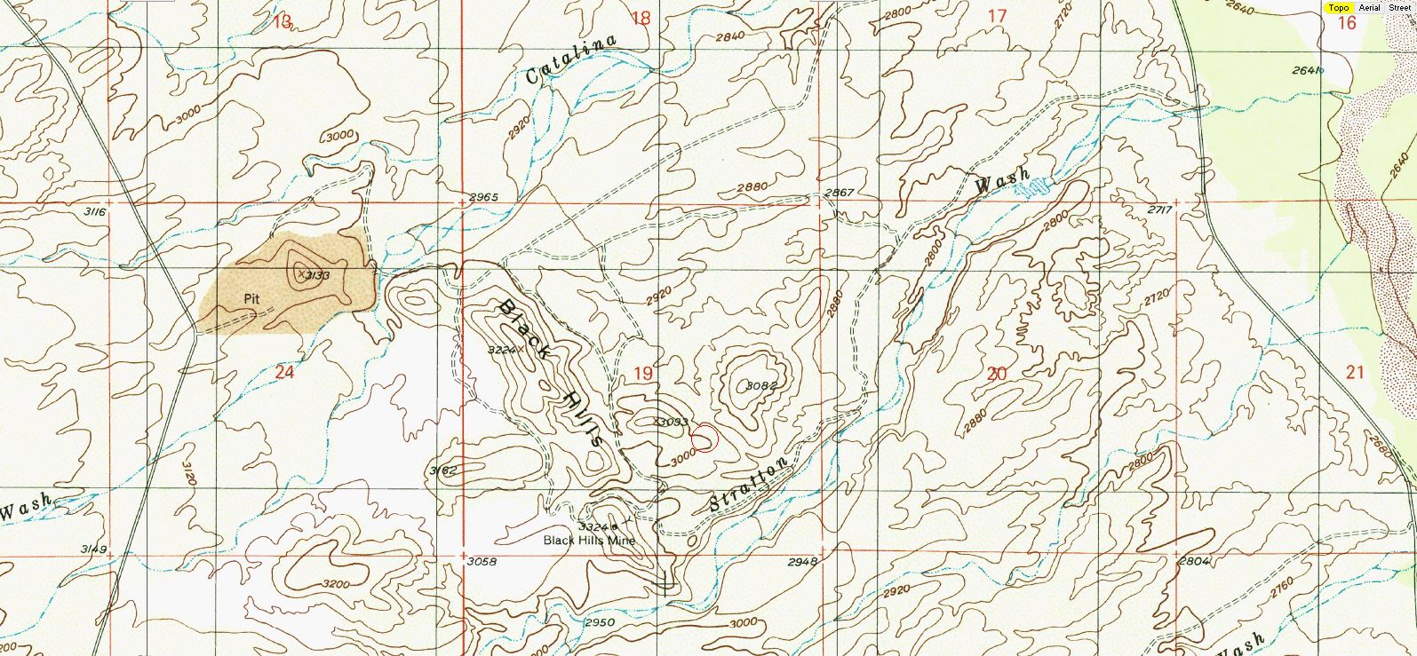
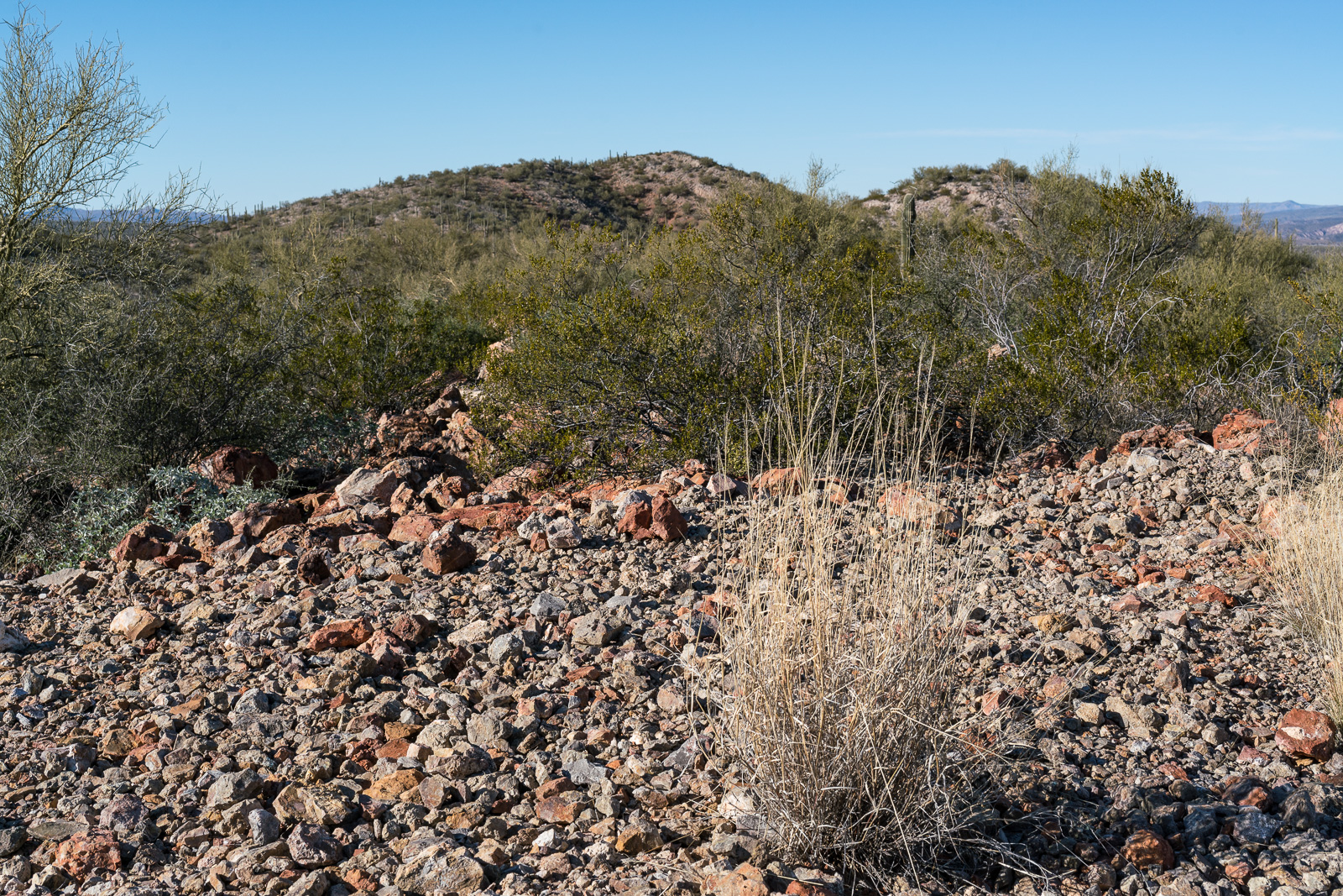
East of Black Hills Mine Road, west of the San Pedro River, north of Stratton Wash and south of Catalina Wash the Black Hills rise out of the desert on Arizona State Trust Land. A packet of information online via the Arizona Geological Survey details the mining history back into the 1940s.

January 2017.
An entrance in the Black Hills. January 2017.

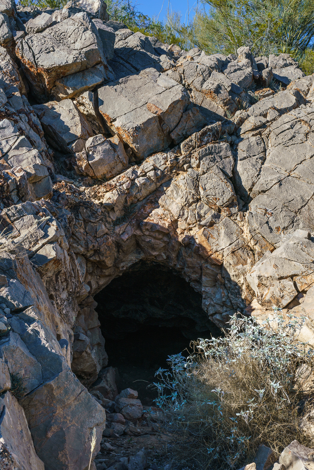
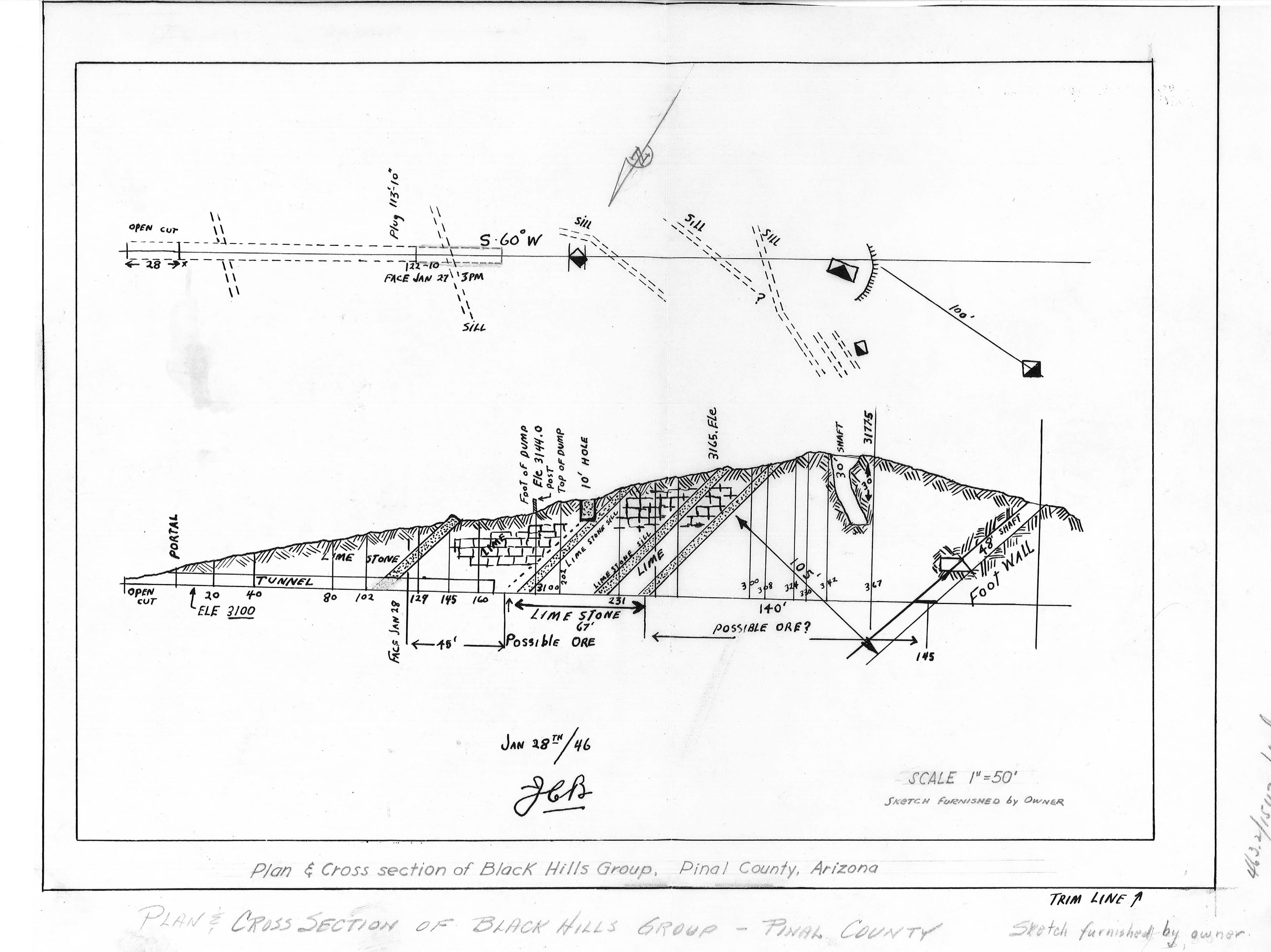
1947 – “Mr. Reuss and his partner acquired the Black Hills property several years ago. They built a road to it, constructed a camp, and equipped it with a small compressor and accessory tools. The partners then spent nearly two years developing the area. The chief work is a crosscut tunnel about 200 feet in length. Development abandoned when the partners ran out of funds to carry on.”

January 2017.
Plan and Cross Section of the Black Hills Group from a packet of information about the mine from the Arizona Department of Mines and Mineral Resources Mining Collection. January 2017.

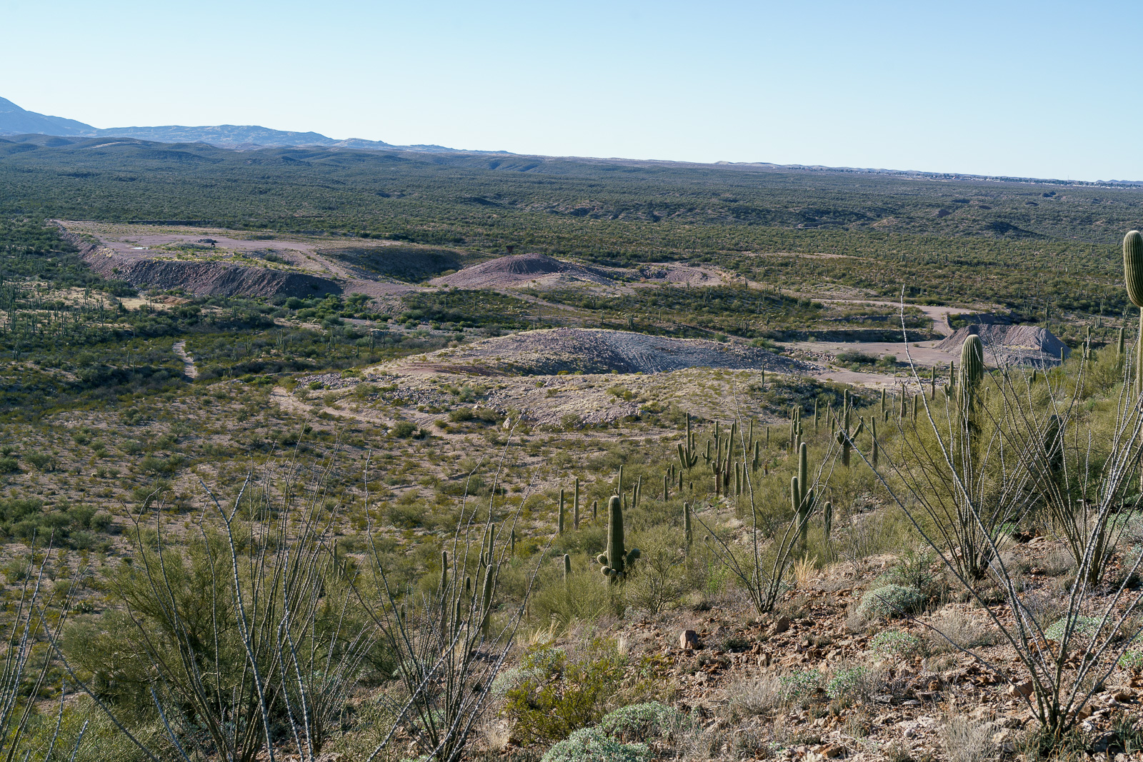
1955 – “Proposed Plans Operators wish to sell the limestone or lime to the San Manuel Copper Corp. by selling the limestone as mined, or by installing a lime kiln to treat the limestone.”

January 2017.
Perhaps fill over the 30′ shaft in the Black Hills Mine Group? January 2017.

1983 – “The Magma Copper Co. owns the original Black Hills Mine, Pinal County and its associated patented claims covering most of the west half of Section 19, T10S RI8E. The company also owns all of the adjacent Section 24, T10S RI7E; in the NE 1/4 of this section lies the current Black Hills limestone quarry where, according to company officials, enough limestone has been mined and stockpiled to last some 10 years.”

January 2017.
Looking down on the Limestone Quarry between the old Black Hills Mine and Black Hills Mine Road. January 2017.

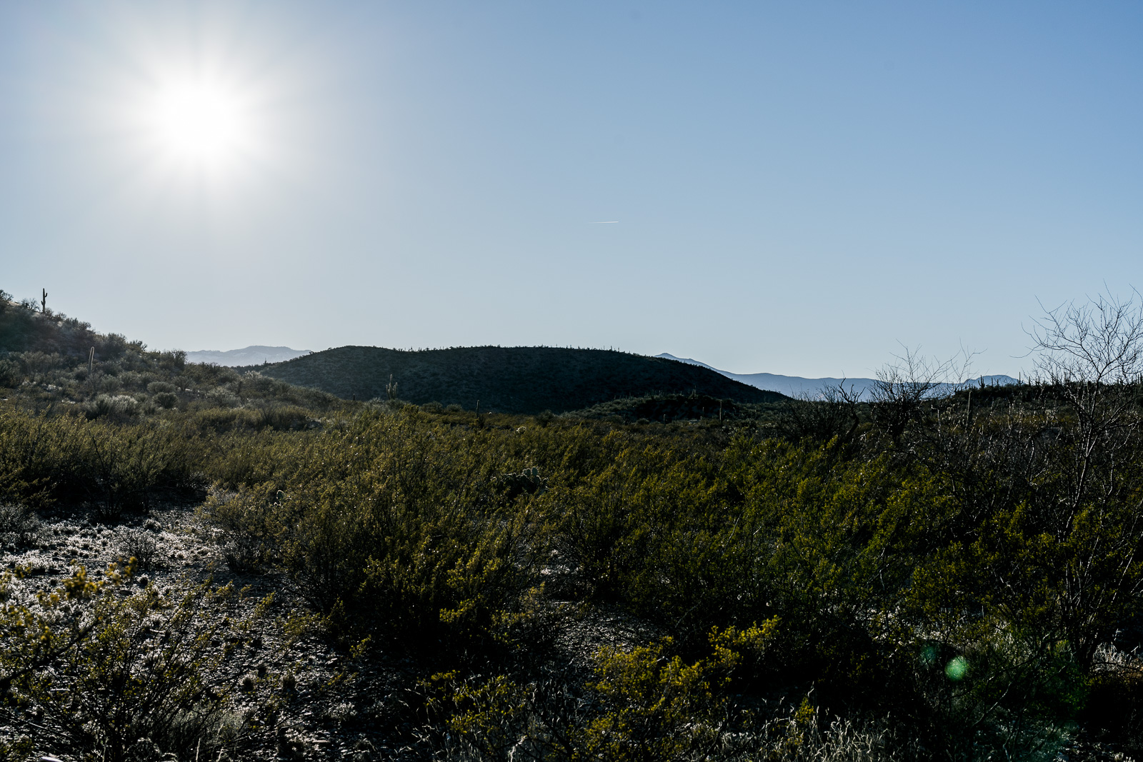
For this hike I parked in a pull out on the west side of Redington Road just south of Stratton Wash and walked up the wash to the Black Hills. Stratton Wash and the Black Hills are on Arizona State Trust Land, a permit is required. The area around the quarry between the Black Hills and Black Hills Mine Road is private property – the mix of land ownership in this area makes it valuable to have a map showing property boundaries if you are exploring.

Much of San Pedro River east of the Santa Catalina Mountains (north of Redington Road meeting the river, south of San Manuel/Magma Copper) is surrounded by private land – however Stratton Wash east of Redington Road down to (and across) the San Pedro River is on Arizona State Trust Land – walking down to the (usually dry) river is an interesting way to start the day before walking up canyon to the Black Hills.

January 2017.
The Black Hills. January 2017.

Headless Windmill in Geesaman Wash – 8/5/2016

Headless Windmill in Geesaman Wash at 'Deep Well'. August 2016.
Headless Windmill in Geesaman Wash at ‘Deep Well’. August 2016.

As a result of the mining and ranching history on the east side of the Santa Catalina Mountains there are a seemingly infinite number of dirt roads criss-crossing the landscape. One of these roads splits off from the Black Hills Mine road and works along the ridge between the Geesaman and Stratton Washes. Below the road, in Geesaman Wash, at a site labeled ‘Deep Well’ a headless windmill stands near a large, impressively full, water tank – the solar panels that replaced the windmill sit below the old tower.

Finley Geesaman, 1830-1917, staked a number of claims in the Old Hat Mining district and this wash and a mine group higher on the mountain bear his name. A short obituary appeared in the Arizona Daily Star on December 18, 1917:

Finley Geesaman.

Up to 9 o’clock last night, pioneers of Tucson visited the Reilly Undertaking parolrs [sic] to take a last look at the long familiar features of Finley Gessaman [sic], who died Saturday night at a local hospital after a brief illness, at the age of 87. The remains will be shipped this morning to his boyhood home, Quincy, Ill., to rest beside the graves of his father and mother. Mr. Gessaman is survived by a number of nephews and nieces, beneficiaries under his will of an estate estimated at about $60,000. His holdings include a number of claims in the Catalina mountains. Once the owner of the old Condon mines, he sold them to the Copper Queen Consolidated Mining company.

There are two photos of F. Geesaman in the Geesaman Family Newsletter #11 (Volume III, July, 1977, No. 3) – a portrait and a photo of Geesaman in the door of a cabin in the Santa Catalina Mountains. These photos accompany a letter written by Geo. P. Myers to Miss Amanda F. Geesaman of Rouzerville, Pa. after Geesaman’s death.

A horseshoe in the Deep Well area of Geesaman Wash. August 2016.
A flower surviving in the middle of Black Hills Mine Road. August 2016.
Marked on the map as 'Drill Hole' this small site sits on the slope of Alder Canyon below Black Hills Mine Road. August 2016.
Marked on the map as ‘Drill Hole’ this small site sits on the slope of Alder Canyon below Black Hills Mine Road. August 2016.