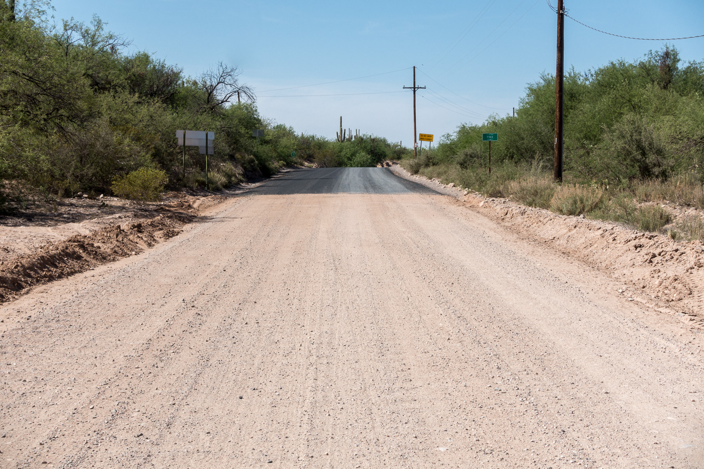
Thru San Manuel, a sharp left then the familiar right turn at the San Pedro – but today the last turn takes me into unfamiliar territory – a strange, freshly paved, night black road parallel to the river – it takes me a minute to reconcile this new thing with my memory of Redington Road.
It makes me sad and uncomfortable to see more pavement encircling the Santa Catalina Mountains – there is nothing encouraging about its current end at the Pinal County line. Maybe the pavement really isn’t that important one way or another – inconsequential compared to the destruction that the SunZia power transmission lines will likely bring to this part of the San Pedro River Valley in the coming years.
The mountain no longer seems like a thing that can stop a city in its tracks; it seems more like a cornered beast. When I hike the Catalinas now and stare down at the valleys, I feel I am on an island, one that is being constantly eroded by the fierce waves of energy sweeping across the desert floor. When I leave the city for the mountain, I walk past bulldozers on my way to the trailhead.
Looking back on the pavement starting at the Pinal County line. April 2017.
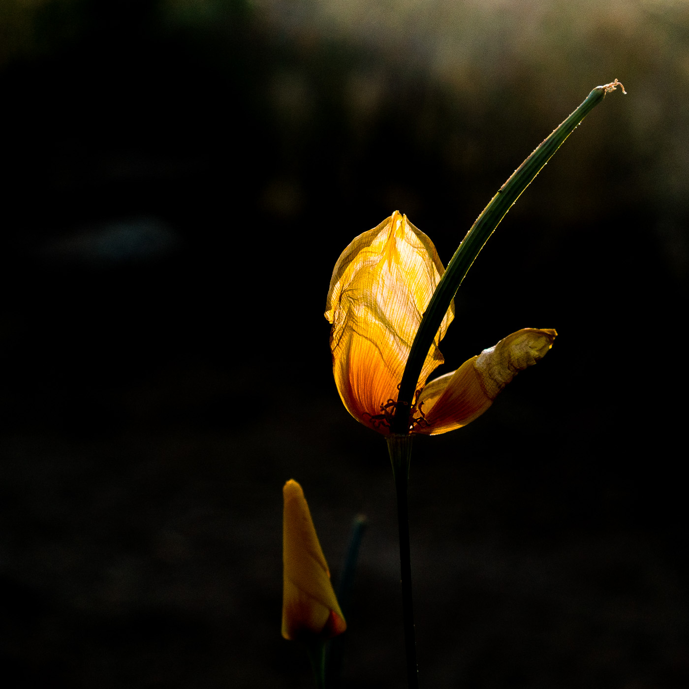
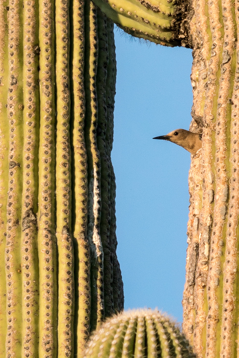
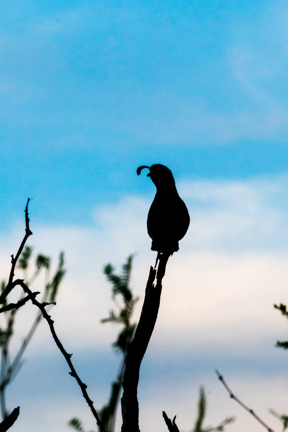
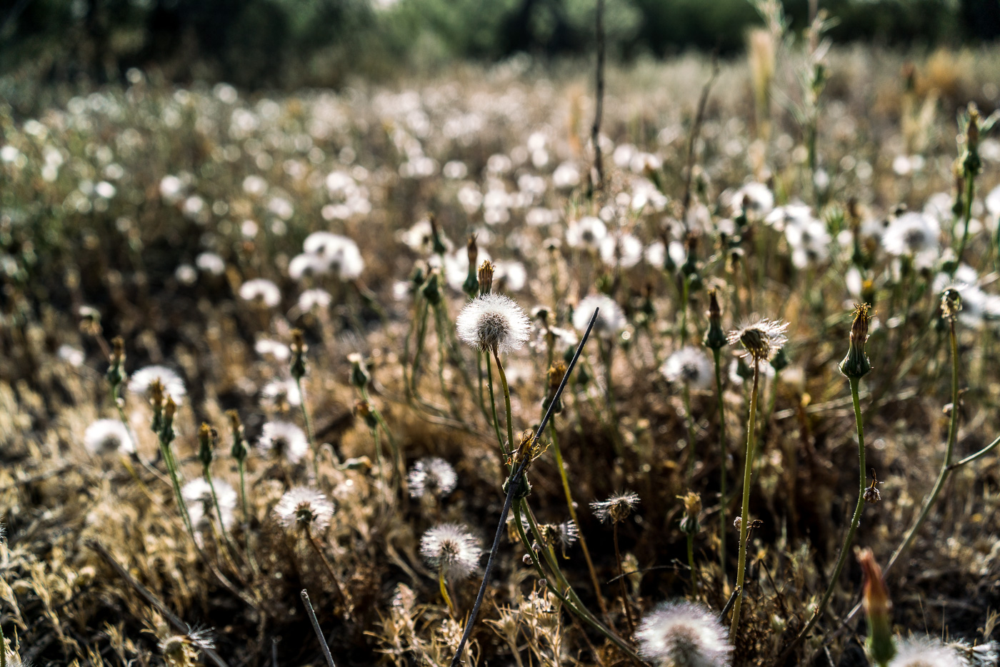
End of the season for this poppy in Catalina State Park. April 2017.Leaving the nest – the sounds of hungry young birds was a constant while we sat and watched the parent come and go. April 2017.A Gambel’s Quail perched and calling near the trail. April 2017.A field of puff balls in the sun. April 2017.
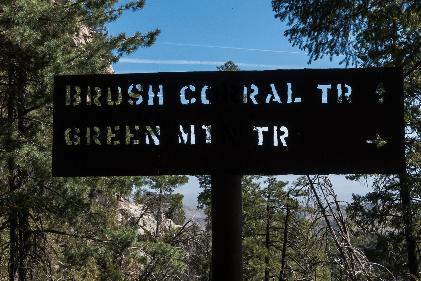
At the junction of the Brush Corral and Green Mountain Trails. April 2017.
In the early 20th century the Brush Corral area on the east side of the Santa Catalina Mountains featured a Ranger Station with a 3 room adobe building and a telephone connection up to Mount Lemmon. Today the area is just another indistinct flat along Buehman Canyon… Forest Road 4407 (Brush Corral Road) still allows high-clearance access into the area from Redington Road near the San Pedro River – but I would guess that the area saw more visitors in the the 1910s/1920s than it sees today.
I am not sure when the Forest Service began using Brush Corral on the east side of the Santa Catalina Mountains. It is absent from the 1904 Tucson topographic map and with a number of ranches and other Ranger Stations noted its omission seems notable. Jim Westfall – hired by the Forest Service in 1906 – and his wife Leeta were early residents, spending winters at Brush Corral after working on the mountain during the spring, summer and fall. Newspaper articles from 1911 and 1912 mention Brush Corral because it was on the route of a phone line being built from Tucson to Soldier Camp, down to Brush Corral and south to the Spud Rock Ranger Station in the Rincons. In a 1964 Arizona Daily Star article by Pete Cowgill Gilbert Sykes, a Forest Service employee after WWI, says “Brush Corral was used more as a camp with a guard stationed there two or three months of the year. The guard would work on grazing permits, timber sales and, of course, watch out for fires. But it was not a permanent ranger station like the one located, but not now used either, at Oracle”. The same article mentions that the cabin – possibly built about 1913 – was sold around 1925 and the timber removed.
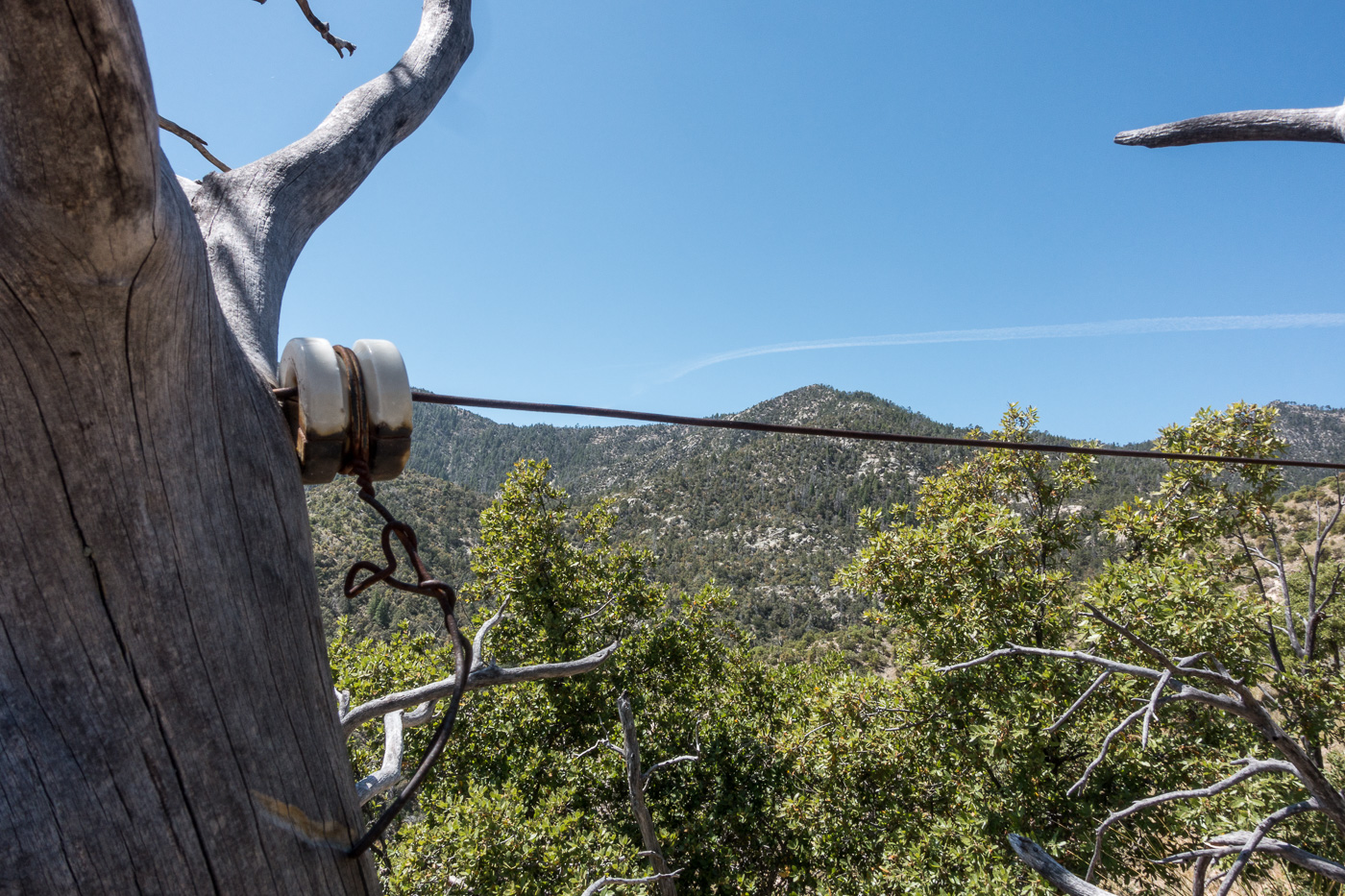
Remains of the phoneline from the 1910s that came up from Tucson and over to the Brush Corral Ranger Station. April 2017.
Our ride dropped us at the Upper Green Mountain Trailhead, our destination was a vehicle we had dropped on FR4407 the previous day – it had been hours of driving to drop a vehicle, but it made our hike much simpler – no need to worry about the time needed to climb back up the mountain, carry overnight gear or make an uncomfortably hot walk out on Redington Road.
The Brush Corral Trail was described in the first three editions of the [GuideYellowBook/] as “fair to very poor” and, after extensive work by the Southern Arizona Hiking Club in the late 1980s, was upgraded to “fair to good” in the 1990s. But those descriptions are pre-2002-Bulllock Fire… There are two notable posts online about this trail from after the Bullock Fire – Scott Morris’s ‘Brush Corral Epic’ from 2004 and Sirena Dufault’s ‘Brush Corral Trail’ from 2010. We knew from those posts, and a hike I made in 2013, that it would probably be difficult, or impossible, to find all of the trail – our planning left a comfortable amount of time for traveling at an off-trail-didn’t-pick-the-best-way-thru-the-manzanita-are-we-on-the-right-ridge kind of pace…
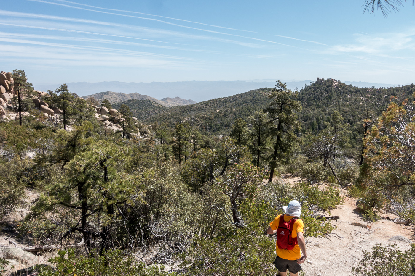
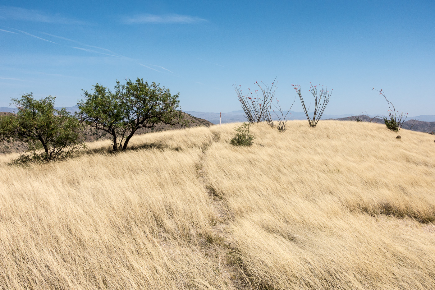
Running an upper section of the trail – the Brush Corral Trail is easy to follow and in decent shape down the junction with the Brush Corral Shortcut Trail. April 2017.
We quickly reached the Brush Corral Trail’s junction with the Green Mountain Trail and started the descent to the junction with the Brush Corral Shortcut Trail – this section of trail is still in decent condition and is easy to follow. Below the junction with the Brush Corral Shortcut Trail the trail immediately becomes overgrown and interrupted by fallen trees, but it was still easy to follow until – at an old metal trail marker – the trail emerged from the trees and became an off-trail ‘route’.
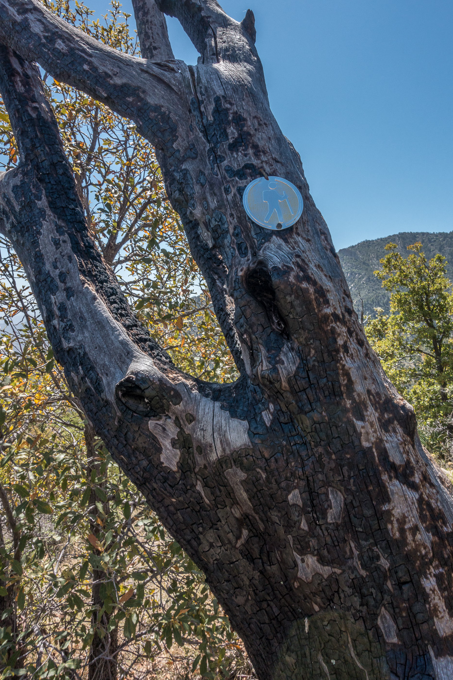
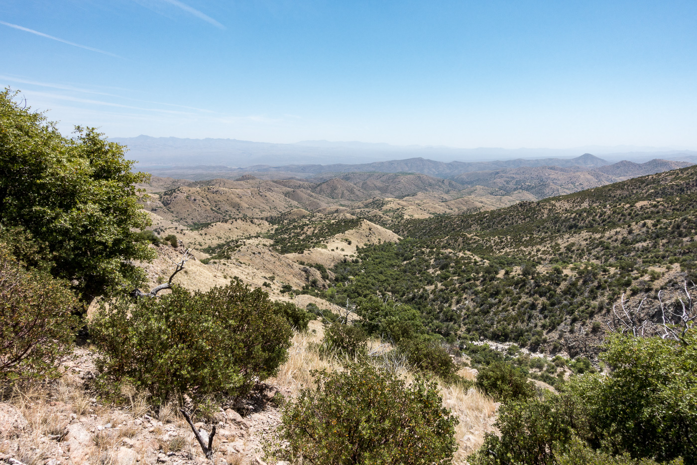
A metal trail marker – it was encouraging to see this, but beyond this point the ‘trail’ was distinctly harder to find. April 2017.Looking down on the ridges that the Brush Corral Route follows. April 2017.
We found stretches of the old trail, and cairns sometimes helped us stay on course – but in sections we just wandered across the ridges, perhaps we could have found more of the old trail but the terrain was not particularly difficult off-trail walking and rather than hunt for the old track it seemed more interesting to just keep moving forward.
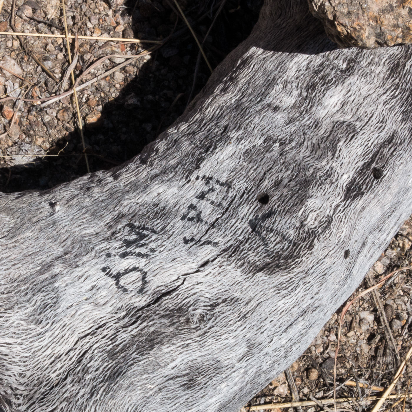
A rather alarming note – ‘Jim – 1PM’ – next to a small cairn – if anyone knows the story on this I would love to hear it… April 2017.
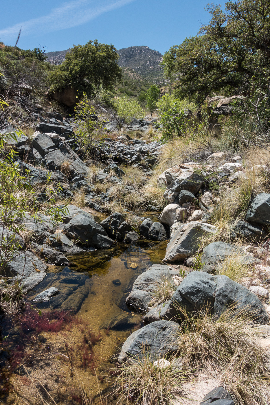
The biggest surprise of the hike may have been finding water when we crossed a small canyon – we had planned on the route being dry and it was nice surprise to find water to soak my shirt and hat with – we were thousands of feet lower than when we started and it was getting hot, the edge of the season for this part of the mountain I think.
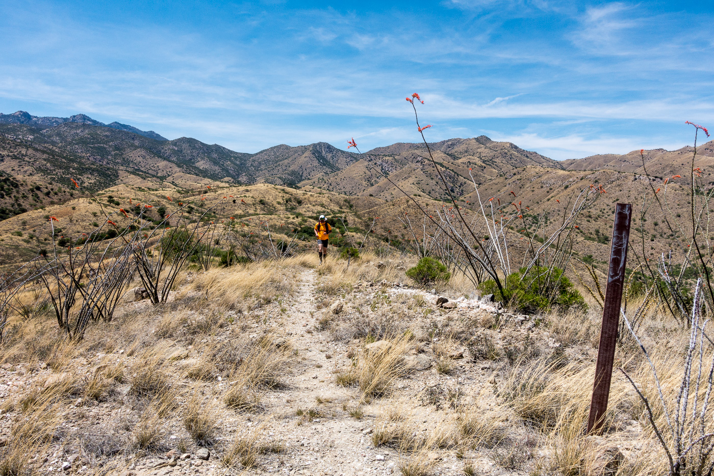
Water in a canyon along the Brush Corral Trail. April 2017.An obvious section of trail across a grassy ridge – brown carsonite posts like the one at the top of this hill mark the lower part of the trail. April 2017.
From the crossing we quickly found the brown trail markers mentioned in other reports and the trail became relatively easy to follow thru the grass and across the ridges. We took advantage of the good trail and ran the final mile+ down to the Brush Corral site before making the hike up the road back to our ride home.
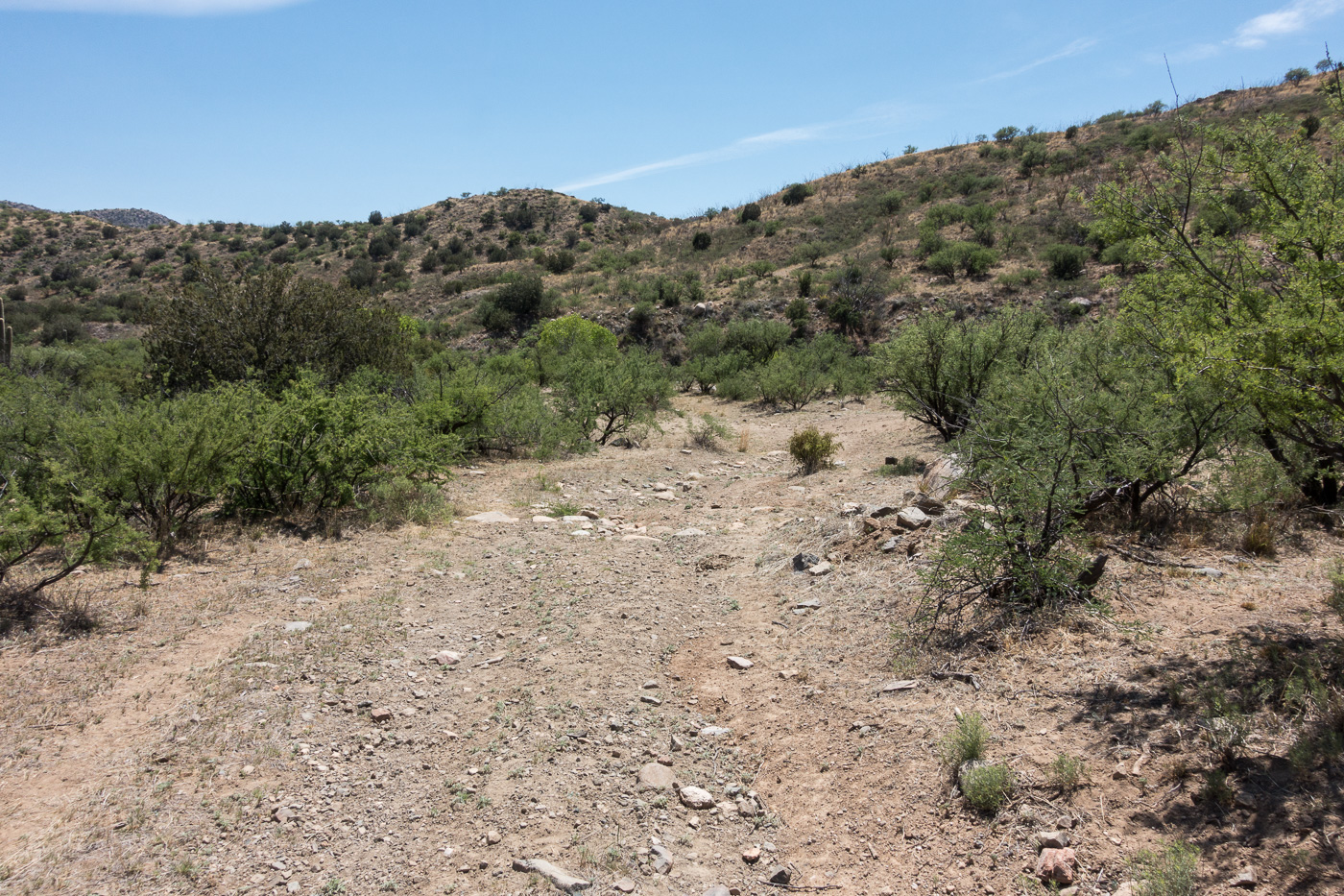
Richard running the bottom section of the trail – Mount Bigelow in the background – the trail close to the trailhead is in decent shape – brown carsonite posts mark the way. April 2017.FR4407 coming to an end at the Brush Corral area. April 2017.
Newspaper articles that reference the Brush Corral Trail that I used for this post:
Arizona Daily Star, 8/24/1911, p. 5, Forestry Will Have Its Own Telephones
Arizona Daily Star, 10/10/1912, p. 8, Brevities
Arizona Daily Star, 11/6/1912, p. 8, Telephones Arrive For Mt. Lemmon Line
Arizona Daily Star, 12/6/1912, p. 8, Government Installs New Telephones
Arizona Daily Star, 3/22/1964, p 55, Pete Cowgill, Hike Up To Brush Corrall Is For Experienced Hikers
Arizona Daily Star, 11/8/1984, p. 51, Pete Cowgill, Old Ranger Station is Just a Memory
Arizona Daily Star, 11/17, 1989, p. 41, Pete Cowgill, Hiking club dug in for Brush Corral Trail
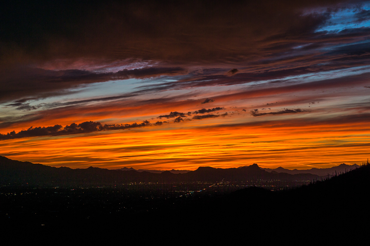
Sunset from the Pontatoc Canyon Trail. March 2017.
The Molino Fire started on April 4th in the Molino Basin area – the fire was quickly contained and limited to 50 acres. The Forest Service has suggested that the fire was caused by recreational shooting and is seeking information on a ‘person of interest’ – “a tall, white man of husky build wearing a light-colored hat, gray shirt, shorts, and tennis shoes. Witnesses saw him move toward a forest green, mid-1990s Ford Explorer parked in the area.” If you have any information please report it to the Coronado National Forest Supervisor’s Office at (520) 388-8300.
Hikers: Commercial horseback rides are damaging popular Oro Valley trail – Arizona Daily Star: Last month I mentioned a letter in the Arizona Daily Star that was critical of the condition of the Linda Vista Trails since the Tucson El Conquistador Golf & Tennis Resort began offering guided horseback rides on the trails about 6 months ago. There is now a petition that has been given to the Forest Service asking that the renewal of their permit for commercial use of the trails be denied. The Forest Service commented that “an evaluation of the condition of the trail will be completed before a decision is made on renewal of the use permit in May” and a representative from the El Conquistador said that “said the guides leading the rides “want to make sure (the trail) looks good for anybody who visits the area. From a cleanup standpoint, they do quite a lot of cleanup.”
Community members continue to push for improvements to the Sabino Canyon Tram including electric vehicles, credit card payments and an alternative to the current loud narration – an article by Tim Stellar for the Arizona Daily Star contains a number of interesting details including information from an interview with Sabino Canyon Tours owner Donn Ricketts, well worth reading – Pressure increases to get new Sabino tram operator | Latest Tim Steller columns | tucson.com – Arizona Daily Star, Letter: Sabino Canyon needs a new tram – Arizona Daily Star
Rescues/Accidents/Incidents including information from the SARCI Newsletter:
3/4/2017 Pima Canyon Trail: Exhausted hiker helped out
3/6/2017 Pima Canyon Trail: Ankle injury results in a carry out
3/10/2017 Bug Spring Trail: Head Injury
3/10/2017 Seven Falls Trail: Exhausted hiker – walked and then ridden out by horse
3/11/2017 Romero Canyon Trail: 4 hikers assisted out
3/11/2017 Aspen Trail: Lost hikers found and assisted out
3/11/2017 Sycamore Canyon: A group of 8 descending the canyon – they separated into several groups – 1 hiker was unable to follow the Sycamore Reservoir Trail and turned up Bear Canyon (found and helped) – three exhausted hikers were given water/food and gear to spend the night and then short-hauled out the next day.
3/12/2017 Seven Falls: Injury results in a short-haul out
3/13/2017 Bear Canyon: Ankle injury is assisted out on foot and horseback
3/13/2017 Pima Canyon Trail: Ill and unresponsive hiker flown out
3/14/2017 Butterfly Trail: A head injury in the Novio Spring area eventually results in a hiker being flown out
3/16/2017 Bellota Trail near La Milagrosa Canyon: Chest pains reported by a hiker via Personal Locator – hiker flown out
3/18/2017 Palisades Canyon: Rockfall injury during a canyoneering descent – two party members flown out, two assisted out on foot
3/19/2017 Willow Canyon: Hikers became lost in the Rose Canyon Lake area and are assisted out after ending up in the Seven Cataracts drainage
3/20/2017 Window Peak: Hikers become lost when they take the trail up to Window Peak rather than heading down – hoisted out the next morning
3/21/2017 Bear Canyon Trail: An exhausted hiker with medical complications and ankle injury are assisted out
3/25/2017 Seven Falls Trail: A fall on the trail results in a hiker being unresponsive for several minutes – carried and flown out
3/29/2017 Romero Pools: A fall results in a head injury – injured hiker was flown out
Sunset from the Pontatoc Canyon Trail. March 2017.
Beautiful green below West Spring near the large tank on the Bellota Trail. March 2017.
Pieces of the Bellota Trail are easy to see from the Molino Basin Parking Area or the Italian Spring Trailhead, but at over 20 miles for a full out and back it’s a long day to see the whole thing – so it was lucky to find a friend interested in doing a car swap/key exchange allowing me to make the rather beautiful trip out of the Santa Catalina Mountains over to Redington Road with a casual start, relaxed pace and plenty of time to enjoy the journey!
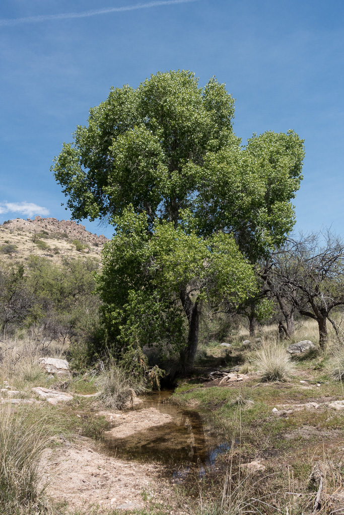
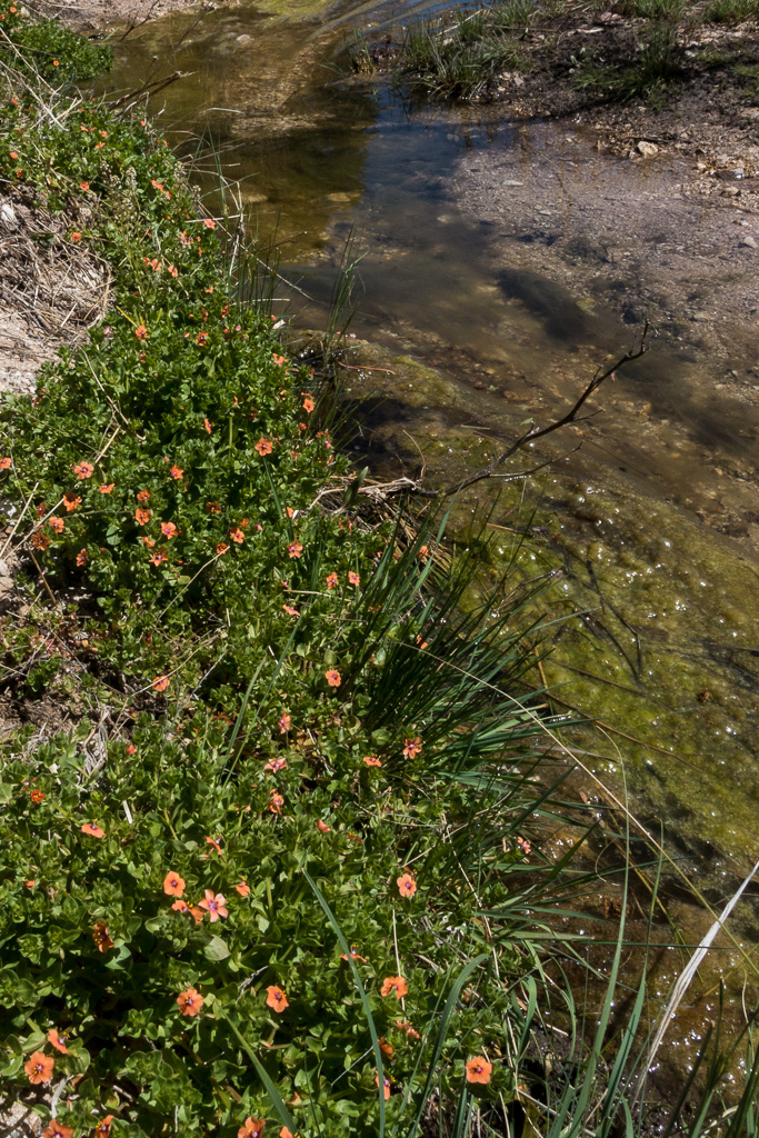
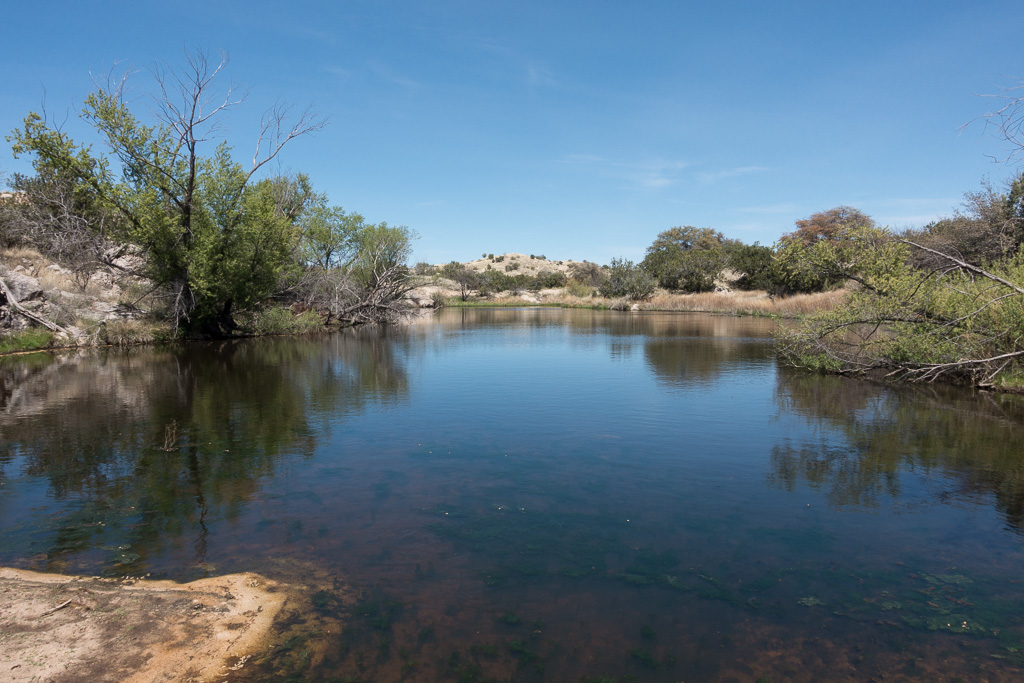
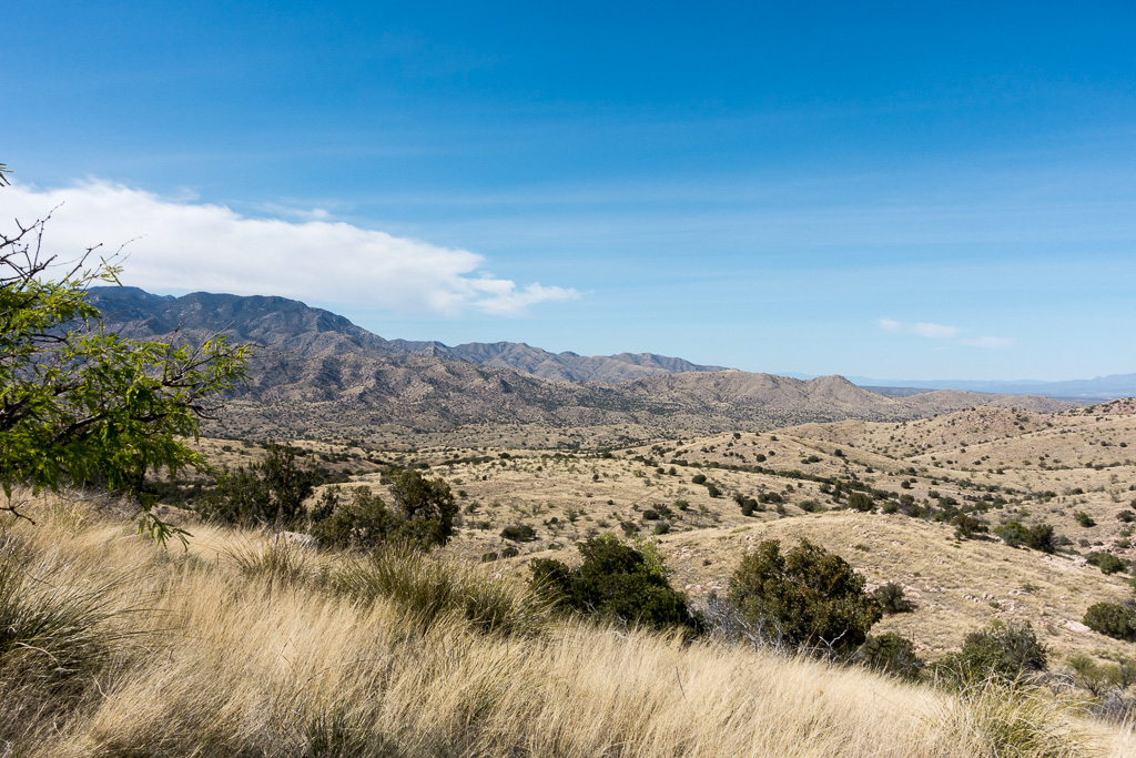
Scarlet Pimpernel high in Agua Caliente Canyon at the Bellota Trail crossing (after the trail leaves FR36A). March 2017.The Lake – this pool of water is just off the Arizona Trail (Bellota Trail) near The Lake Trailhead on FR36. March 2017.Looking towards the Evans Mountain from Point 4622, just off the Bellota Trail. March 2017.