The cameras at the top of the mountain showed a nice layer of snow but at 6 AM ‘Closed’ signs blocked the drive up the mountain – instead I drove Redington Road hoping the snow might have made it far enough down the mountain to photograph from one of the view points near the Italian Spring Trailhead, low clouds and a high snow line meant that the lovely sunrise scene didn’t include any snow – but closer to town it was easy to see the first good snow of the winter blanketing the top of the mountain!
Sunset from Redington Road. November 2016.First snow of the winter! November 2016.No snow lower on the mountain – but a nice blanket higher on the Mountain. November 2016.
Sunset from Catalina State Park. October 2016.Night creatures… A Katydid along the Sutherland Trail. October 2016.Scorpion on the Sutherland Trail. October 2016.
We hike up the Bigelow Trail to the junction with the Butterfly Trail and then wander up to the top of Kellogg Mountain. Tall trees on the eastern slope, missed by the fires that scorched much of the mountain over a decade ago, block our view – from a rocky perch farther down the ridge we can clearly see Bassett Peak and the spot where the moon will rise – just a few minutes of waiting in the cold wind and then…
Almost supermoon – moonrise. November 2016.Moon over the Galiuro Mountains. November 2016.
On the 13th the moonrise was about 10 minutes before the sunset and we thought with some luck we might get the almost-supermoon rising against beautiful sunset color – it didn’t quite work out exactly as planned, the light on the eastern mountains faded faster than expected – but still beautiful, and the clouds around the setting sun were spectacular!
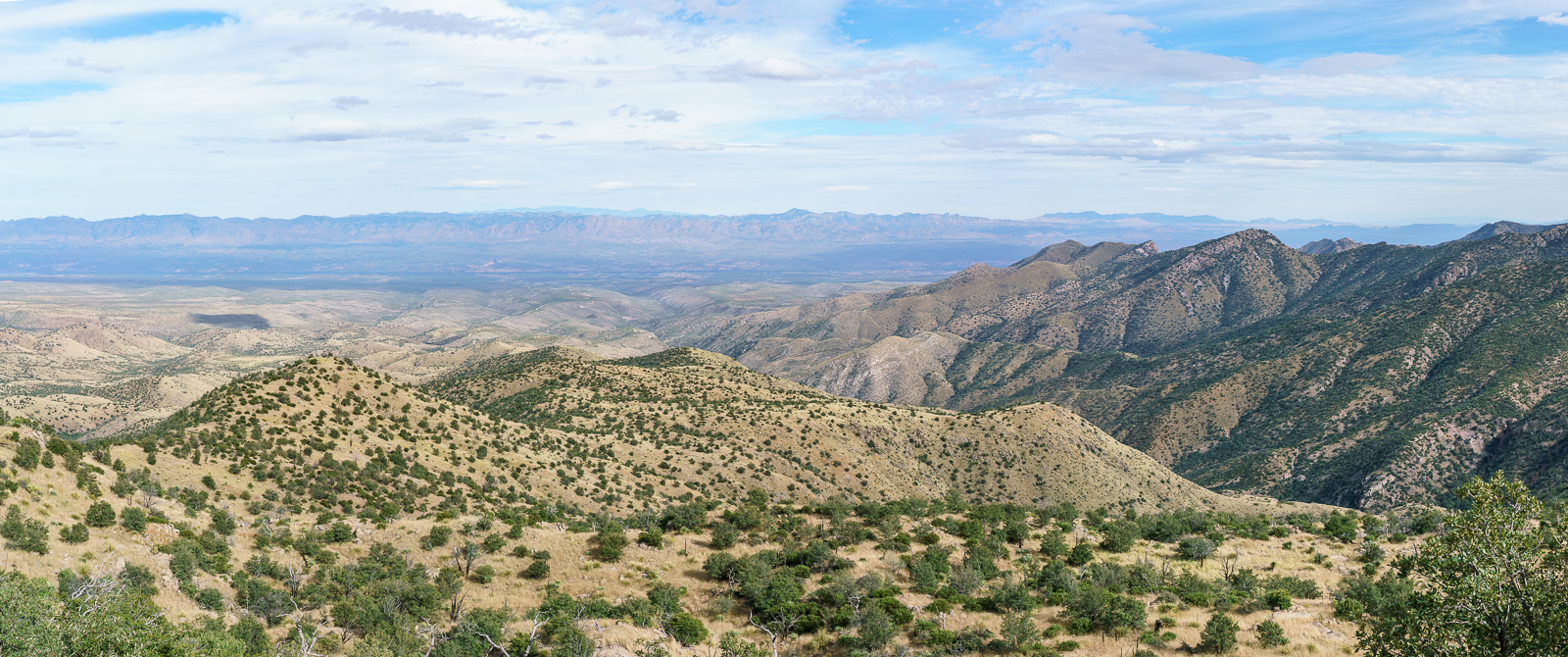
Below Marble Peak, at a sharp turn, the Control Road crosses a cattle guard and a fence runs up the ridge towards the top of Lombar Hill. A road on the north side of the fence seems like it might take you to the top, but instead it ends at a fire ring and a trail that quickly disappears into thick vegetation. On the south side of the fence a small, occasionally overgrown, path parallels the fence – it only takes a few minutes on this path to get to the top – a nice break from the long drive up the mountain!
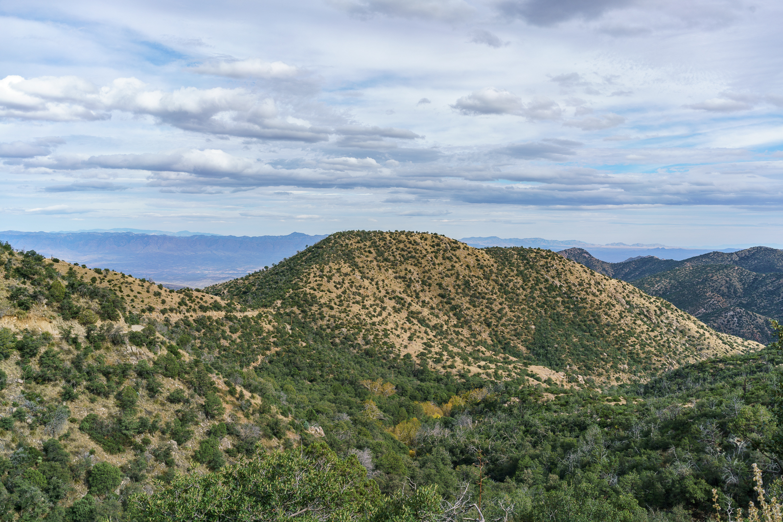
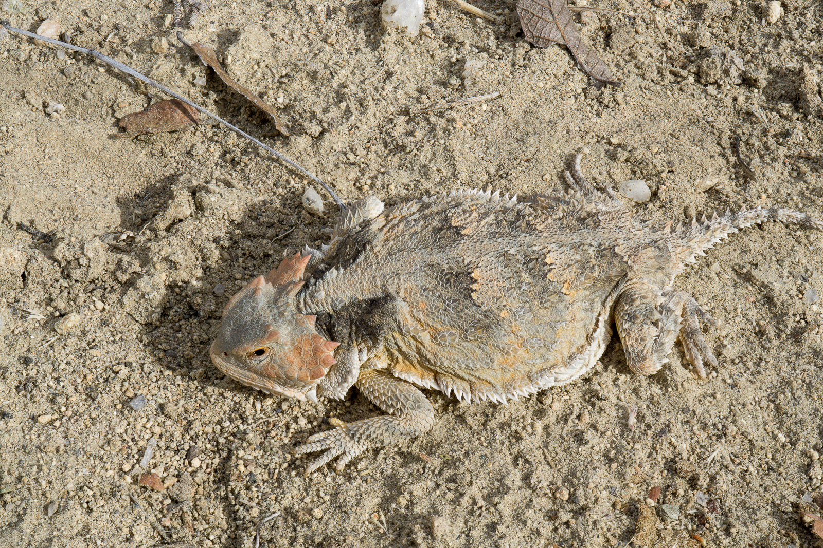
Looking down the mountain into the San Pedro River Valley from Lombar Hill – Alder Canyon and the ridge between Alder and Edgar Canyons are on the right – if you zoom in you can see Black Hills Mine Road and the road to Ventana Windmill descending into Alder Canyon. October 2016.Horned Lizard on Lombar Hill. October 2016.
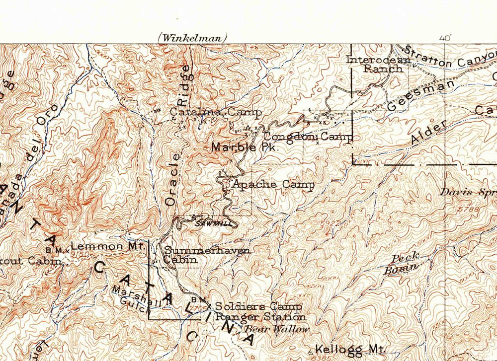
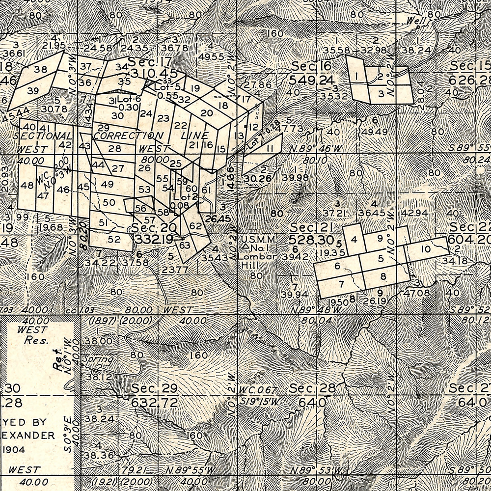
I am not sure about the who/what/why of the name Lombar Hill (please contact me if you can fill me in on the history of this name!) – the name does not appear on the USGS 1904 Tucson Map, perhaps because it is a smaller feature, but does appear on a survey from the 1920s…
The 1904 Tucson Topo Map (available as a free download from the USGS) – Lombar Hill is near the center of the map but is not labeled. October 2016.Lombar Hill shown on a Survey from the 1920s, unlike the 1904 Topo Lombar Hill is labeled. The survey document is available from the General Land Office (Township 11S Range 16E). October 2016.
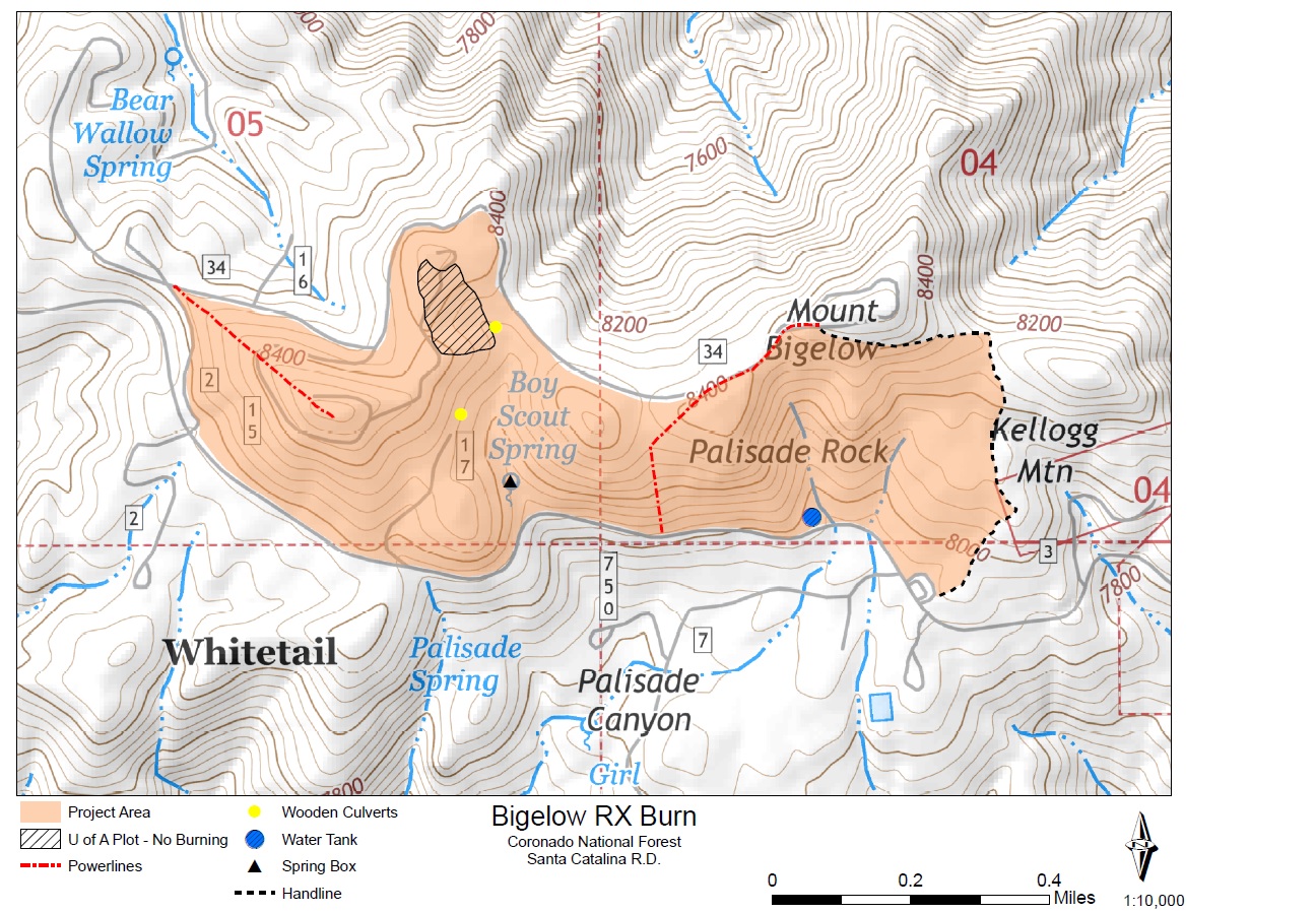
Bigelow Prescribed Fire on Mt. Lemmon, Coronado National Forest: On Monday, November 4th, “if conditions such as temperature, wind speed and direction, relative humidity and fuel moistures are favorable” fire managers will burn a 200-acre area around Mount Bigelow. The fire could cause road and trail closures in the area – the Kellogg Trail, Butterfly Trail and dirt roads in the vicinity seem the most likely to be impacted. From the Forest Service News Release “Prescribed fires are among the most effective tools available to resource managers to restore fire-adapted ecosystems. They mimic natural fires by reducing forest fuels, recycling nutrients and increasing habitat diversity.”
Forest Service Bigelow Prescribed Burn Map. October 2016.
Hilton Tucson El Conquistador opens 18-horse stable – AZBIGMEDIA: The Hilton Tucson El Conquistador, located north of the Linda Vista Trailhead, has opened stables and is offering “trail rides, riding lessons and family friendly adventures for locals and visitors looking to explore the spectacular Sonoran Desert.”
Fuelwood Permits (for personal use only) are available for Mt. Lemmon at the Ranger District Office, 5700 N. Sabino Canyon Road from 11/1 to 12/16 for the 11/1 to 4/16 cutting season. Permits are $20, 1 per household, and “will authorize collection on Mt. Lemmon and in the Oracle area of dry, dead-and-down and dead standing wood (no live branches) less than eight inches in diameter at breast height. Cutting area maps and program regulations will be provided with permits upon request. Permit holders may collect and remove only dry wood from the collection areas.”
Rescues/Accidents/Incidents including information from the SARCI Newsletter:
Wilderness of Rocks 10/1/2016: A hiker is stranded off trail by darkness in the area of the Lemmon Rock Trail/Wilderness of Rocks junction.
Windy Point 10/6/2016: A woman injured in the area is carried out.
Sutherland Trail 10/8/2016: A hiker is carried out after becoming exhausted on a social trail off the Sutherland Trail.
Sabino Canyon 10/13/2016: Three lost hikers in Sabino Canyon below the guaging station, and above the Box Spring Trail, requested helped and were helped upstream.
Butterfly Trail 10/17/2016: A biker on the Butterfly Trail was lost in the Novio Spring area and lifted out by helicopter.
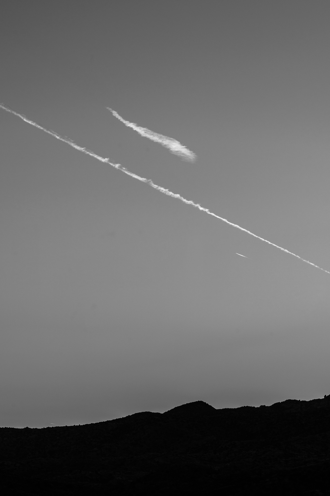
Cloud streaks over the edge of the Rincon Mountains from Redington Road, near sunrise. October 2016.