Below Marble Peak, at a sharp turn, the Control Road crosses a cattle guard and a fence runs up the ridge towards the top of Lombar Hill. A road on the north side of the fence seems like it might take you to the top, but instead it ends at a fire ring and a trail that quickly disappears into thick vegetation. On the south side of the fence a small, occasionally overgrown, path parallels the fence – it only takes a few minutes on this path to get to the top – a nice break from the long drive up the mountain!
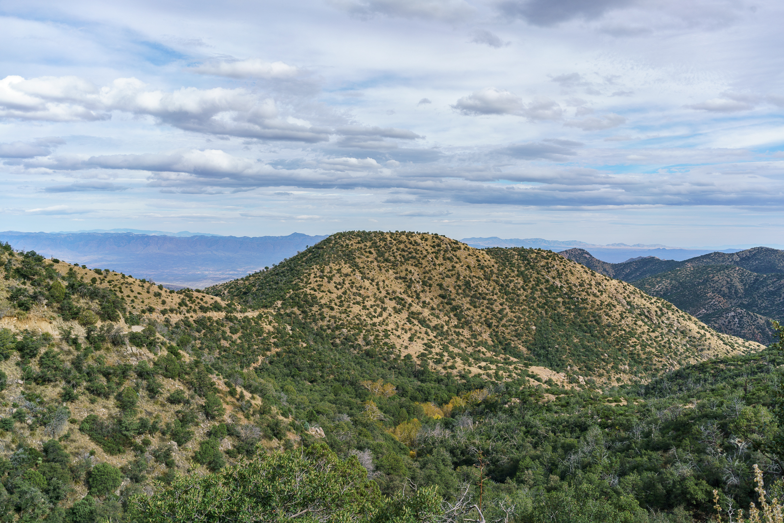
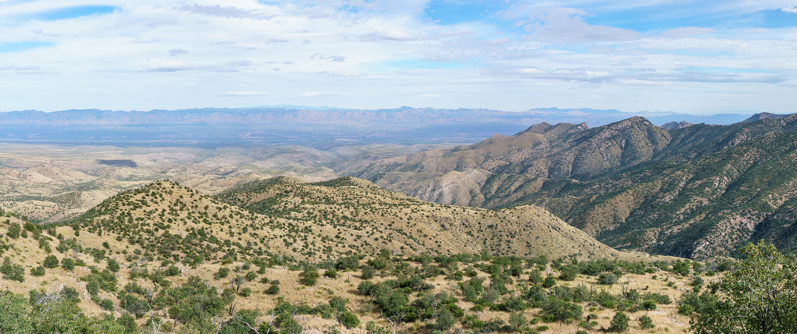
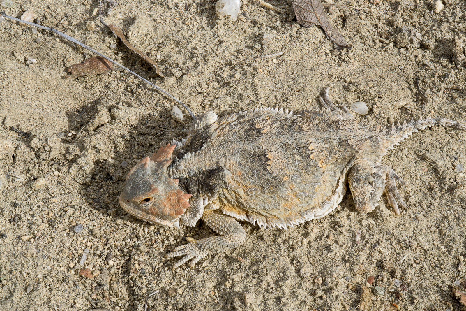
Looking down the mountain into the San Pedro River Valley from Lombar Hill – Alder Canyon and the ridge between Alder and Edgar Canyons are on the right – if you zoom in you can see Black Hills Mine Road and the road to Ventana Windmill descending into Alder Canyon. October 2016.Horned Lizard on Lombar Hill. October 2016.
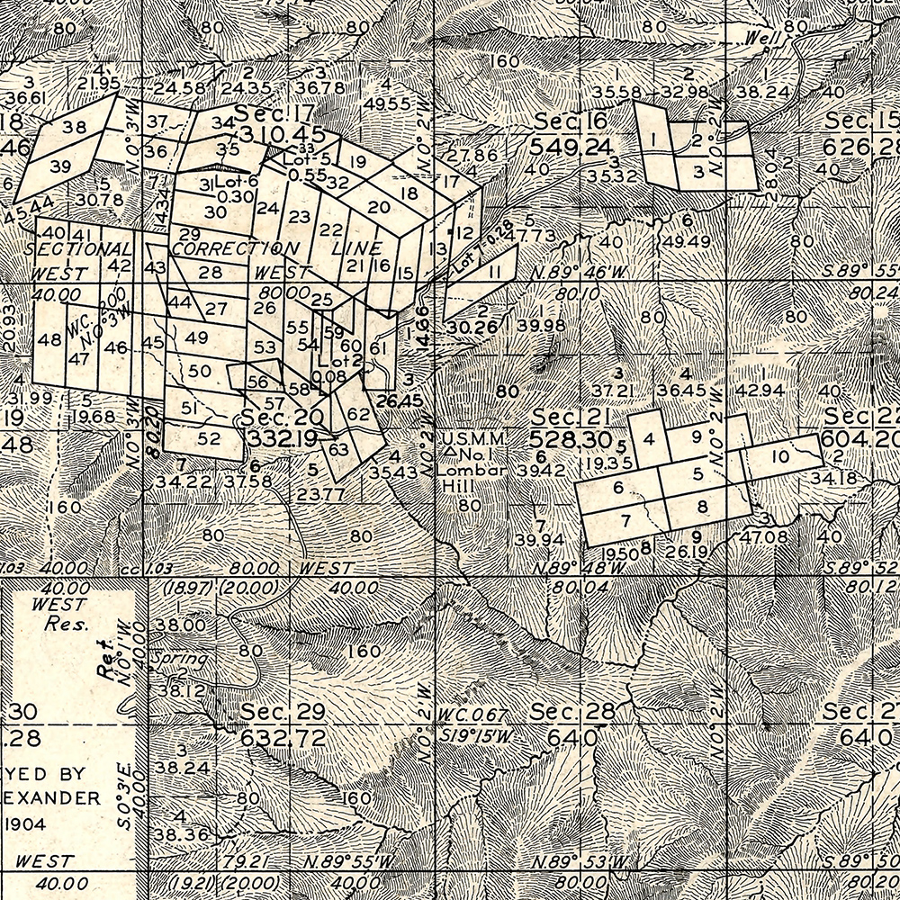
I am not sure about the who/what/why of the name Lombar Hill (please contact me if you can fill me in on the history of this name!) – the name does not appear on the USGS 1904 Tucson Map, perhaps because it is a smaller feature, but does appear on a survey from the 1920s…
The 1904 Tucson Topo Map (available as a free download from the USGS) – Lombar Hill is near the center of the map but is not labeled. October 2016.Lombar Hill shown on a Survey from the 1920s, unlike the 1904 Topo Lombar Hill is labeled. The survey document is available from the General Land Office (Township 11S Range 16E). October 2016.
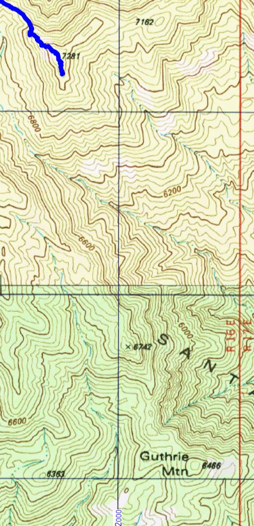
The Guthrie Mountain Trail ends near Point 7281 – the highest peak in the area – but if you look at the USGS 7.5′ maps you might notice that Point 7281 is not labeled ‘Guthrie Mountain’.
The end of the Guthrie Mountain Trail shown on the USGS 7.5′ topo map – note that this point is not labeled ‘Guthrie Mountain’.
However if you look around on the USGS 7.5′ maps for the Santa Catalina Mountains you will eventually find a point well to the south of the ending of the Guthrie Mountain Trail labeled ‘Guthrie Mountain’.
The two Guthrie Mountains – Point 7281 where the Guthrie Mountain Trail ends and Point 6466 where Guthrie Mountain is labeled on the USGS Maps.
From the 3rd edition of the [GuideYellowBook/], p. 75:
Guthrie Mountain was named for an early forest supervisor in the southwest and is located on the U.S.G.S. quadrangle map as a 6464-foot-high point on the ridge just east of Molino Canyon. It is the opinion of the authors that this is an error and that Guthrie Mountain is the prominent 7300-foot-high point just north of Burro Canyon and about a mile southeast of Bear Saddle.
While I think that the ending point of the Guthrie Mountain Trail makes the most sense as ‘Guthrie Mountain’ the Guthrie Mountain label on the USGS maps provides an excellent excuse to visit another point on the map…
We approached the USGS Guthrie Mountain from the Molino Basin Parking Area, starting on the Bellota Trail but quickly turning onto the route up Molino Canyon. We hiked several miles up the beautifully rugged canyon bottom to a point west of the USGS Guthrie Mountain and, after some debate about what would be the best way up onto the ridge, we began our ascent. What started as a smart/clean way to the ridge quickly devolved into a slow crawl (occasionally literally) thru the Manzanita – thankfully the ridge was fairly close soon we had our first good look at the USGS Guthrie Mountain.
USGS Guthrie Mountain. March 2016.
A small trail along the ridge took us quickly to the top – the peak is fairly open on top and there are great views! Not, I think, the ‘real’ Guthrie Mountain – but certainly a beautiful destination.
Piety Hill from the USGS Guthrie Mountain. March 2016.Looking up towards the ‘real’ Guthrie Mountain from the USGS Guthrie Mountain – Point 7135, Point 6742 and the ‘real’ Guthrie Mountain are the highpoints. March 2016.Looking across Point 6069 down into Tucson from the USGS Guthrie Mountain – part of Airmen Peak is visible on right edge of the picture. March 2016.