
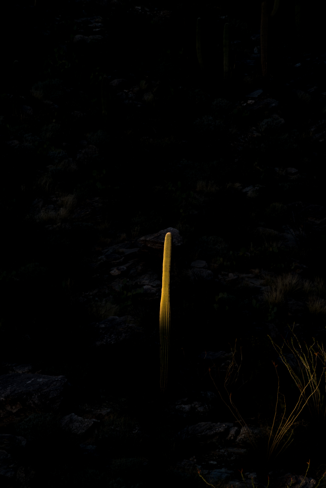
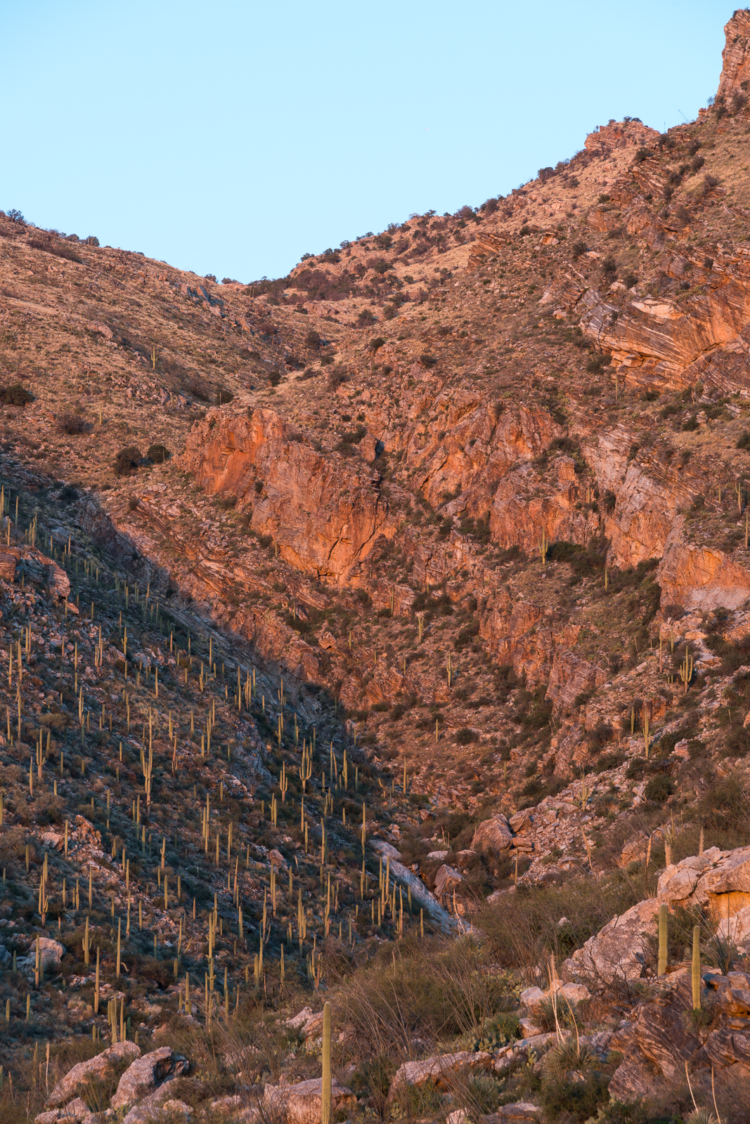
Views from a loop up the ridge between La Milagrosa and Agua Caliente Canyon and down the La Milagrosa Trail.


Views from a loop up the ridge between La Milagrosa and Agua Caliente Canyon and down the La Milagrosa Trail.

The upper section of the Pontatoc Canyon Trail – above the last crossing of Pontatoc Canyon at ~2.1 miles – has been faint/overgrown in some places for years – but the Finger Rock Fire has made it even more obscure.
Not long after the last canyon crossing you enter the burn – not everything is scorched, but the fire was not subtle.
Burned Yuccas lay among flowers and stand in strange and unexpected shapes. Short stretches of the trail are still identifiable – but it would have been difficult to link those sections together without help from occasional cairns. At least for now it seems the upper section of the trail has almost been erased – perhaps in another few seasons the sturdy ‘End of Trail’ sign, still standing in the canyon bottom, will be a puzzling and obscure landmark…


The latest Santa Catalina Bighorn Sheep Reintroduction Project update was recently released:
Look beyond poppies for additional worthy wildflowers – Arizona Daily Star, Best places to see Arizona’s wildflowers – Arizona Republic: Wildflowers!!! Notes on some of the flowers that are blooming and a mention for Catalina State Park as a great place to see wildflowers.
Hiker injured, rescued from Seven Falls on horseback – Tucson News Now: A leg injury left a hiker unable to walk in the Seven Falls Area – the hiker was taken out on horse by the Southern Arizona Mounted Search and Rescue.
PCSD rescues hiker off of Windy Point – KVOA.com: A hiker fell and suffered a broken leg in “a remote rocky area” near Windy Point – the hiker was flown out by the Sheriff’s Department’s helicopter “SHERIFF 1” – video from the helicopter of the nighttime pick up.
Seven Falls: A magnet for waterfall watchers – Arizona Daily Star: Some details on the popular hike to Seven Falls with a few pictures.
Rescues/Accidents/Incidents including information from the SARCI Newsletter:

We started at the Lower Green Mountain Trailhead in Bear Canyon – dirty snow was piled near the start of the Bug Spring Trail and there was occasional snow on/near the trail for the first few miles – but it disappeared too quickly, as we ran thru the Gordon Hirabayashi Recreation Site and on to the Soldier Trail the temperature seemed oppressively hot for February – we were grateful for the wind and occasional shade as we made our way down to the Soldier Trail Trailhead.

Lower Green Mountain Trailhead to Soldier Trail Trailhead (Bug Spring Trail, Molino Basin Trail and Soldier Trail) – 8.1 miles, + 740’/-3,200′ of elevation gain/loss.

Balloons floating up into the sky can seem beautiful and symbolic – but after picking up balloons from an astounding number of places in the mountains – including many off-trail destinations with no sign of people/trash for miles – I cringe when I see a piece of floating trash ascending into the sky… For more sad pictures of balloons and a bit more information see Balloons in the Backcountry.
In January a boulder with a petroglyph was pushed over and some surrounding vegetation was damaged in Catalina State Park – if you have any information please contact the Coronado National Forest Supervisor’s Office at (520) 388-8300. It is sad anyone would vandalize a site like this – January was not a great month in regards to vandalism with an incident also reported in Saguaro National Park. Vandalism at Catalina State Park – Coronado National Forest, Catalina State Park vandalism under investigation – Arizona Daily Star, Native American petroglyph vandalized at Catalina State Park – TucsonSentinel.com, Vandals strike Catalina State Park – Tucson News Now.
The comment period for the Catalina-Rincon FireScape Project is open and the Forest Service is holding several open houses about this project:
The press release from the Forest Service provides this quick summary of the project – “The CRFS is a landscape-scale restoration project that focuses on promoting resilient ecosystems; protecting life, property, and natural resources; and encouraging natural wildland fire to function as a healthy process in the ecosystem” – and the Scoping Notice provides background including:
The fire history recorded by tree rings indicates that, since the beginning of the early 20th century, the frequency of natural fire has decreased dramatically. Tree-ring research has shown that for many centuries, the Santa Catalina and Rincon mountains shared broadly similar fire regimes and ecosystem properties. However, since the early 20th century, natural fire regimes have been significantly altered because of grazing (which removes the fine fuels that carry surface fire) and continued fire suppression.
The latest Santa Catalina Bighorn Sheep Reintroduction Project update was recently released:
Coronado National Forest waives fees in honor of Presidents Day – Coronado National Forest: Coronado National Forest will waive fees at most of its day-use recreation sites Monday, February 15, in honor of Presidents Day – Fees are waived generally for day-use areas, such as picnic grounds, developed trailheads and destination visitor centers!
Recreation projects completed on Mt. Lemmon – Coronado National Forest: A recent press release from the Coronado National forest notes several recently complete projects include 22 new interpretive signs along/near the highway and new restrooms at the Cypress Picnic Area and Showers Point Campground.
Rescues/Accidents/Incidents including information from the SARCI Newsletter: