Agua Caliente Canyon Trail – 2/10/2019

General Hitchcock Highway, Weathertop and The Ruins from the Agua Caliente Canyon Trail. February 2019.

Agua Caliente Canyon Trail – headed out to do the full La Milagrosa and Agua Caliente Canyon Trail Loop, but didn’t make it… Too many flowers and too much water!

Tuber Anemone. February 2019.
Blue Dick's off the Agua Caliente Canyon Trail. February 2019.
Blue Dick’s off the Agua Caliente Canyon Trail. February 2019.
A gall on a Cat's Claw Acacia. February 2019.
A gall on a Cat’s Claw Acacia. February 2019.
Flowing water in Agua Caliente Canyon. February 2019.
Sunset on the Agua Caliente Canyon Trail - below the junction of La Milagrosa and Agua Caliente Canyons. February 2019.
Sunset on the Agua Caliente Canyon Trail – below the junction of La Milagrosa and Agua Caliente Canyons. February 2019.

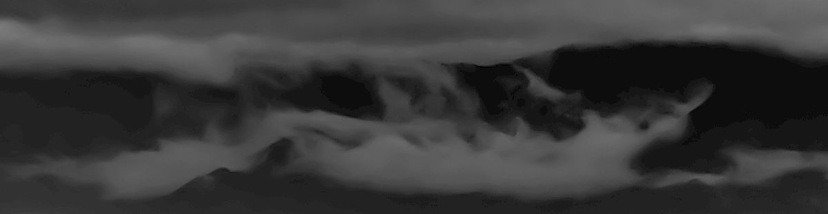
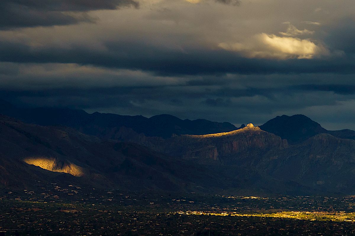
Winter Storm – 2/14, 2/15, 2/18/2018

Light on the south side of the Santa Catalina Mountains from Saguaro National Park East. February 2018.

After a largely dry and storm free winter it was a privilege to spend a week under grey skies! Rain, flowing washes, road cuts turned into waterfalls, canyons filled with water – a real joy, and as I write this it looks like we might get another short storm in February!

Clouds over Pusch Ridge from Honey Bee Canyon Park. February 2018.


Weathertop in low clouds, from the General Hitchcock Highway. February 2018.
A creature emerging from the clouds! February 2018.
Thimble Peak in the light from Saguaro National Park East. February 2018.

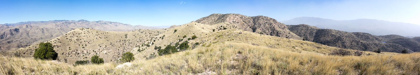
La Milagrosa Canyon Views, 3/6/3016

Looking down La Milagrosa Canyon from the hillside just above the falls and pools. March 2016.

Views from a loop up the ridge between La Milagrosa and Agua Caliente Canyon and down the La Milagrosa Trail.

Weathertop - above the La Milagrosa Trail before the descent to the first canyon crossing. March 2016.
Weathertop – above the La Milagrosa Trail before the descent to the first canyon crossing. March 2016.
Looking across the La Milagrosa Trail to a ridge below Agua Caliente Hill - from above the La Milagrosa Trail. March 2016.
Looking across the La Milagrosa Trail to a ridge below Agua Caliente Hill – from above the La Milagrosa Trail. March 2016.

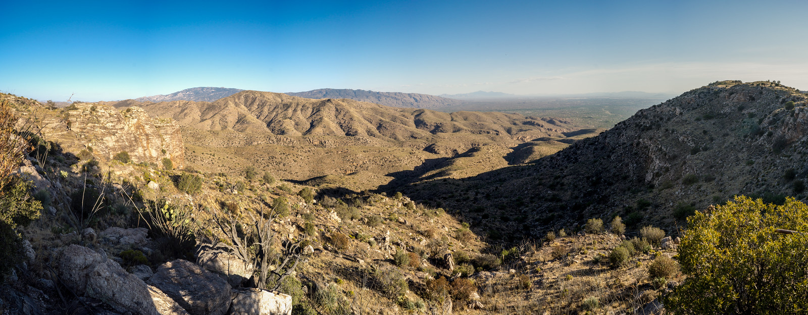
Agua Caliente Hill Trail and Ridge Loop – 2/12/2015

1502 Cat Track Tank
Cat Track Tank with water from the recent winter storms. February 2015.

Its sunny and windy, no sign of the rain that filled Cat Track Tank and many of the smaller drainages – I follow the Agua Caliente Hill Trail past the junction with FR4445, under False Hope Hill, across the grassy hillsides and up to the top.

At the top – a quick note in the summit register, a few moments pondering the short/sad/beautiful note above mine and a brief but careful consultation of the map and GPS before leaving the trail and plunging down the ridge to the west towards towards Cat Track Tank.

1502 Weathertop to Tuffet Tank
Off-trail on the ridge west of Agua Caliente Hill (center) with a view stretching from Weathertop (left) to Tuffet Tank (right). February 2015.

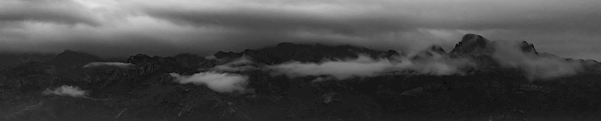
Capturing the view from Weathertop to Tuffet Tank takes multiple photos – stitched together they document the view, but fall far short of capturing the joy of being out on the ridge. The map shows a trail from the ridge to Cat Track Tank, I find it and try to follow the fading track.

1502 Grass and Tree
Grass and tree on the ridge – the windy day reduced visibility and looking towards the Tucson Mountains the sky was white with dust. February 2015.

As the trail descends off ridge it disappears and the Cat’s Claw closes in – eventually I abandon trying to find the trail and cut down to the Agua Caliente Hill Trail to finish the day.

9.2 miles, +/- 3000′ of elevation gain and loss.

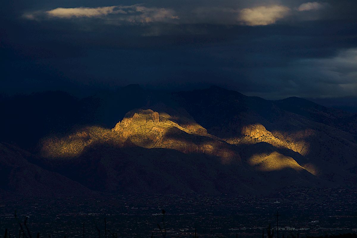
Point 4831 (Weathertop) and Point 4773 (The Ruins) – 2014/6/22

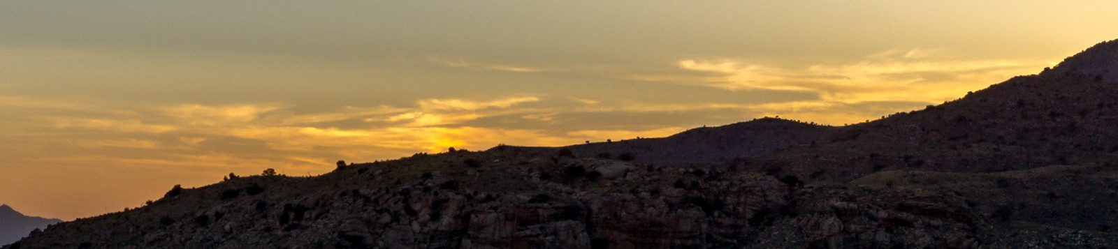
Southeast, and above, the Molino Canyon Overlook there is an impressive ridge – I have been up to the ridge a number of times to climb at The Ruins, but had never spent any time hiking or exploring in the area… Arriving at the Molino Canyon Overlook at 5pm meant we had just over 2.5 hours to get to Point 4831 and see the sunset on this long summer day – plenty of time for several breaks in the shade along the steep climber’s trail to the ridge.

1406 The Ruins to Point 4831
A view from the ridge – climbing area ‘The Ruins’ on the left, Agua Caliente Hill center, Point 4831 on the right (above the Weathertop climbing area). June 2014.

Ridge – Point 4773 (above the Ruins) – and then on to Point 4831. The trail is – mostly – easy to follow, only occasionally disappearing. The top seems so close! False peak… We continue along the path, under Point 4831 to a great rocky ledge with an old fire ring – a nice spot to sit and enjoy the sunset.

1406 Faint Clouds in the Sunset
Sunset from a rocky ledge below Point 4831. June 2014.

We watch the cars and city light as it gets dark – 

1406 Fading Light from near Point 4831
Watching the fading light – car lights on the highway and the Tucson City Lights in the background. June 2014.

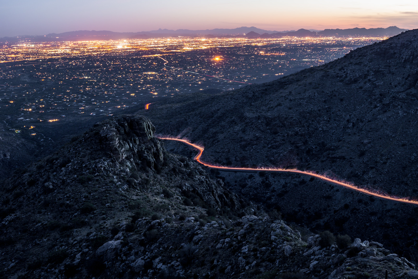
and eventually turn on our headlamps and head down… 3.5 miles, 1000′ of elevation gain/loss – there is a well used climber’s trail from the Molino Canyon Overlook up to the ridge but note that it is not an official trail.