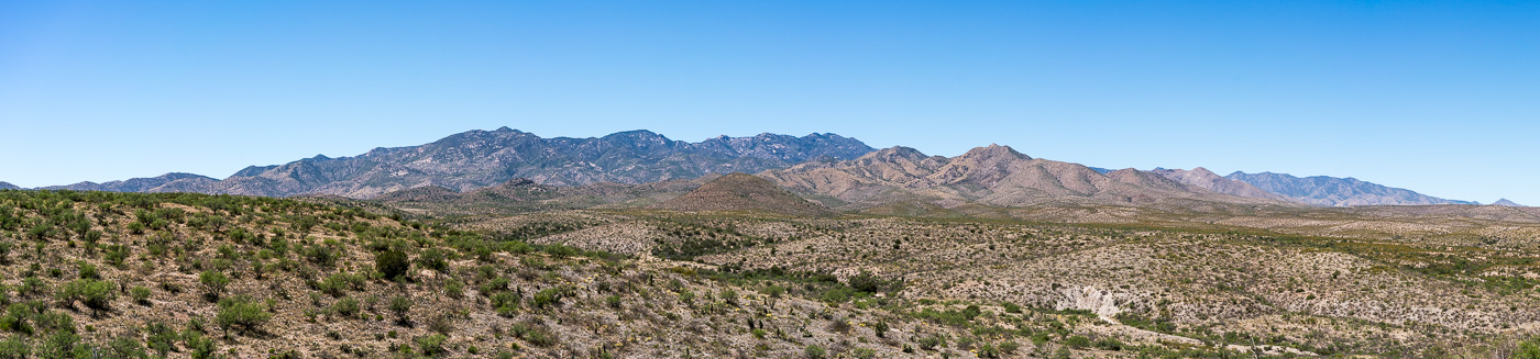
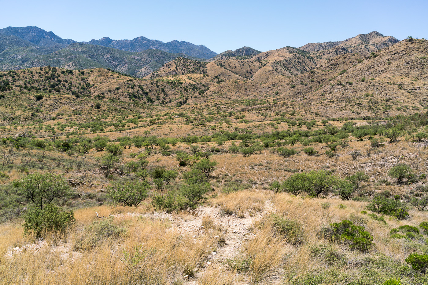
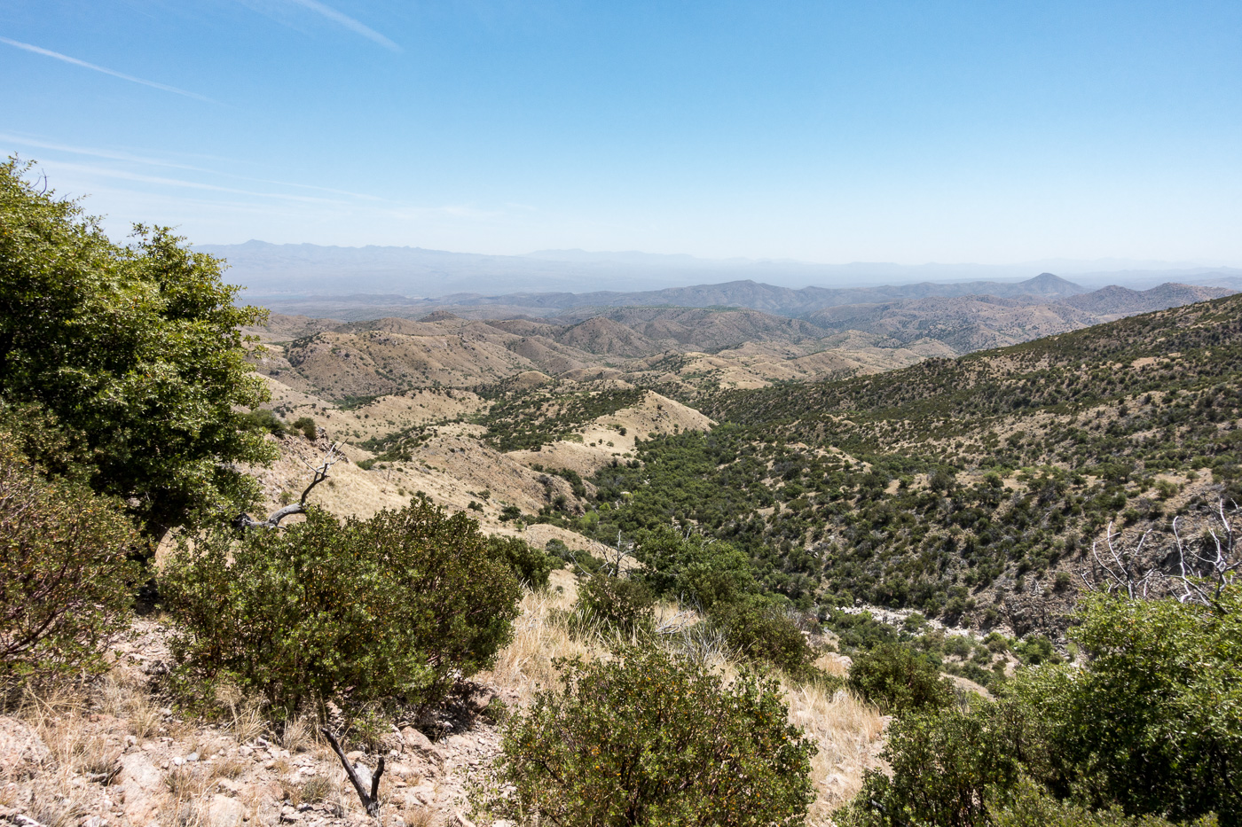
A view of the Santa Catalina Mountains from FR4407 Brush Corral Road. April 2017.
Back to the Brush Corral area! Unlike my last trip into the area the goal wasn’t a long hike on the Brush Corral Trail – but instead just a chance to explore a little.
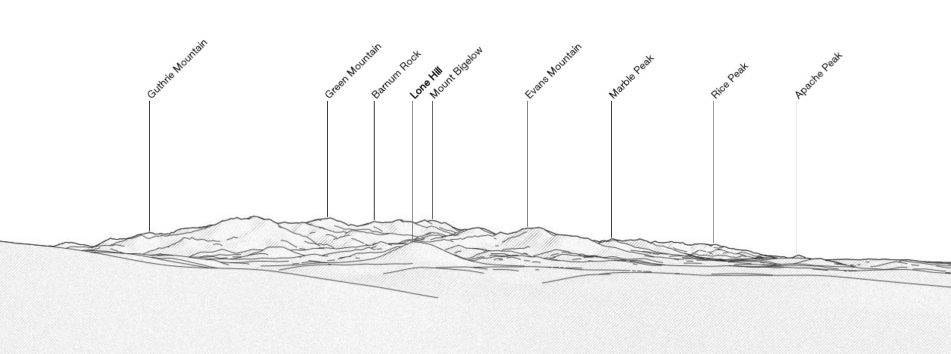
There are some great views from Brush Corral Road (FR4407) – the edge to edge view (above) of the Santa Catalina Mountains is amazing – familiar peaks are labeled below in a reference image from PeakFinder.org (note that this is showing the USGS Guthrie Mountain rather than the peak at the end of the Brush Corral - Cedar Spring, Georges Spring, Pearsons Spring - 4/30/2017).
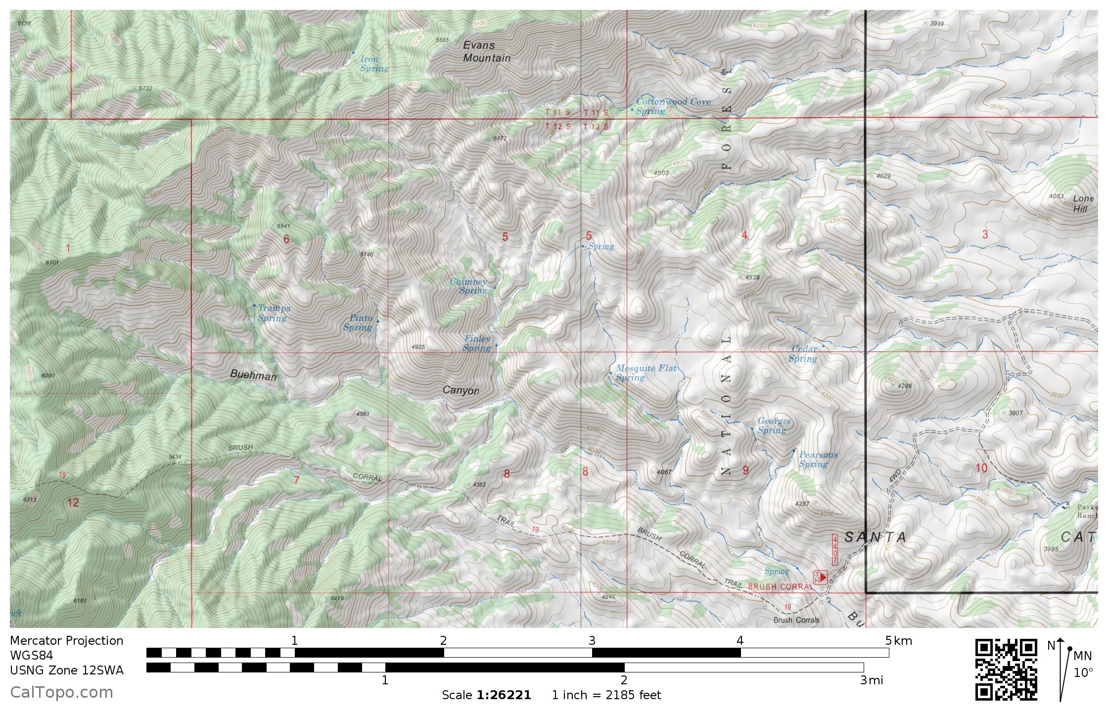
Hopeful curiosity and extreme skepticism and his a fair description of how I feel about blue marks on the maps of Southern Arizona. The area south of Evans Mountain down to Buehman Canyon has 11 springs marked on the map – an interesting concentration, I wonder how many of them still flow…
The area between Evans Mountain and Buehman Canyon has 11 marked springs. May 2017.
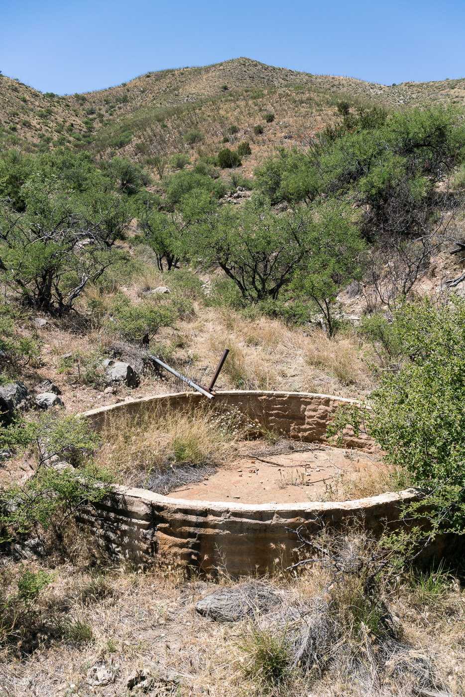
From a ridge-top camp west of Brush Corral Road I drop down into a a dry wash, crawl under barbed wire fence at the forest boundary and quickly find a dry tank where Cedar Springs is marked on the map. Pipes run up canyon from the tank, but there is no sign of water where they seem to end.
Cedar Spring Tank – dry… April 2017.Mesquite Flat, North of the Brush Corral Trailhead. April 2017.
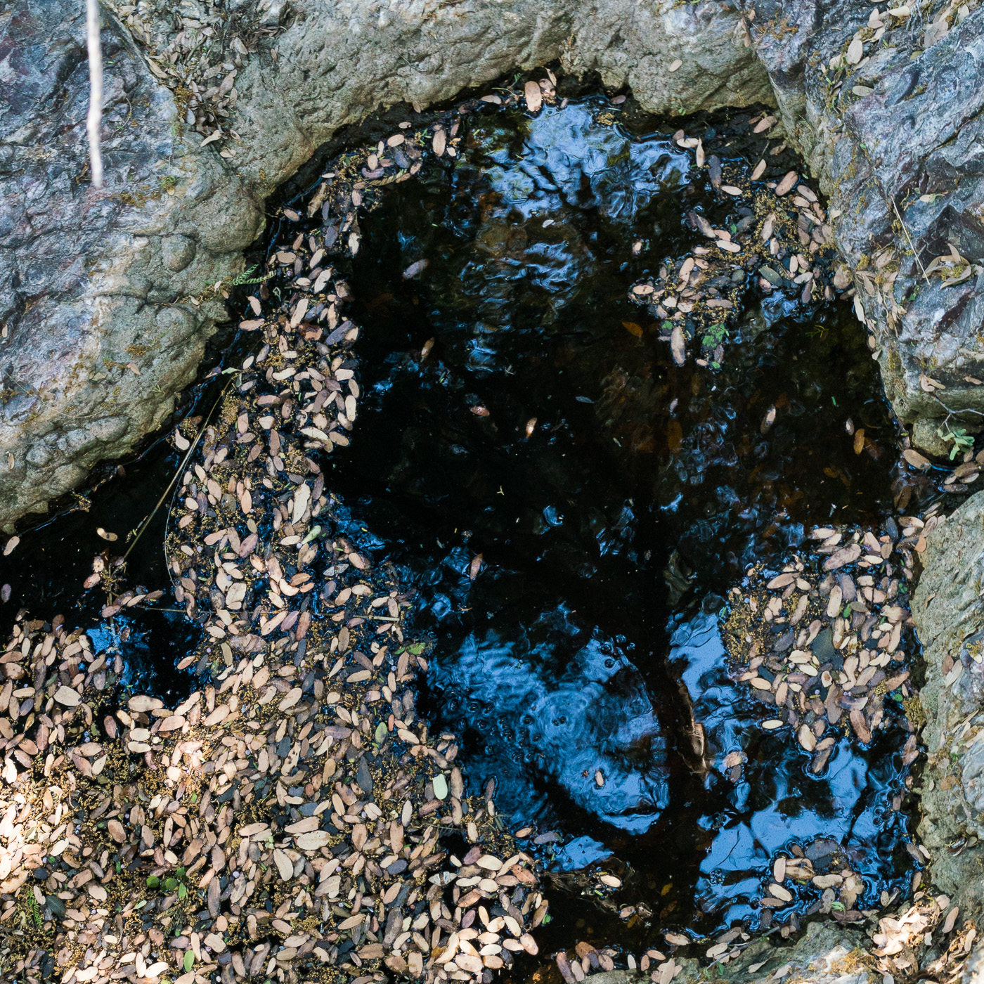
Around Mesquite Flat and over to the Georges Spring area – after finding Cedar Spring dry the number of pools of water in the area surprised me!
A beautiful pool in the Georges Spring area. April 2017.
From Georges Spring it was a short walk to Pearsons Spring – in its small side canyon the only sign of water was a single, small depression with damp sand at the bottom. Returning to the canyon just west of the Brush Corral Trailhead I don’t have to walk very far before both cows and small pools of water appeared in the canyon bottom. It looks like there was quite a bit more water in the canyon earlier in the year. The canyon merges seamlessly into Buehman Canyon a short distance above the Brush Corral Trailhead – from there it doesn’t take long to loop back to the start of my hike.
Water and cow manure in the canyon just west of the Brush Corral Trailhead. April 2017.
Thru San Manuel, a sharp left then the familiar right turn at the San Pedro – but today the last turn takes me into unfamiliar territory – a strange, freshly paved, night black road parallel to the river – it takes me a minute to reconcile this new thing with my memory of Redington Road.
It makes me sad and uncomfortable to see more pavement encircling the Santa Catalina Mountains – there is nothing encouraging about its current end at the Pinal County line. Maybe the pavement really isn’t that important one way or another – inconsequential compared to the destruction that the SunZia power transmission lines will likely bring to this part of the San Pedro River Valley in the coming years.
The mountain no longer seems like a thing that can stop a city in its tracks; it seems more like a cornered beast. When I hike the Catalinas now and stare down at the valleys, I feel I am on an island, one that is being constantly eroded by the fierce waves of energy sweeping across the desert floor. When I leave the city for the mountain, I walk past bulldozers on my way to the trailhead.
Looking back on the pavement starting at the Pinal County line. April 2017.
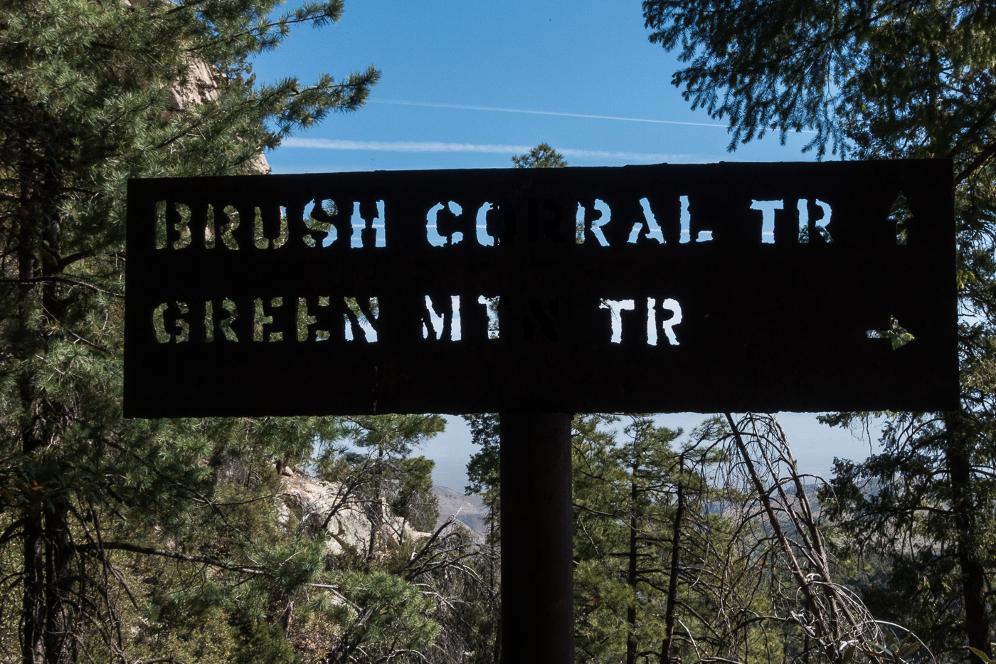
At the junction of the Brush Corral and Green Mountain Trails. April 2017.
In the early 20th century the Brush Corral area on the east side of the Santa Catalina Mountains featured a Ranger Station with a 3 room adobe building and a telephone connection up to Mount Lemmon. Today the area is just another indistinct flat along Buehman Canyon… Forest Road 4407 (Brush Corral Road) still allows high-clearance access into the area from Redington Road near the San Pedro River – but I would guess that the area saw more visitors in the the 1910s/1920s than it sees today.
I am not sure when the Forest Service began using Brush Corral on the east side of the Santa Catalina Mountains. It is absent from the 1904 Tucson topographic map and with a number of ranches and other Ranger Stations noted its omission seems notable. Jim Westfall – hired by the Forest Service in 1906 – and his wife Leeta were early residents, spending winters at Brush Corral after working on the mountain during the spring, summer and fall. Newspaper articles from 1911 and 1912 mention Brush Corral because it was on the route of a phone line being built from Tucson to Soldier Camp, down to Brush Corral and south to the Spud Rock Ranger Station in the Rincons. In a 1964 Arizona Daily Star article by Pete Cowgill Gilbert Sykes, a Forest Service employee after WWI, says “Brush Corral was used more as a camp with a guard stationed there two or three months of the year. The guard would work on grazing permits, timber sales and, of course, watch out for fires. But it was not a permanent ranger station like the one located, but not now used either, at Oracle”. The same article mentions that the cabin – possibly built about 1913 – was sold around 1925 and the timber removed.
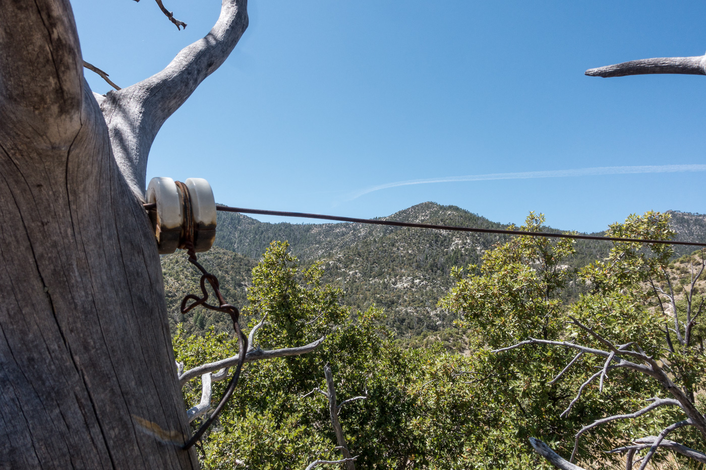
Remains of the phoneline from the 1910s that came up from Tucson and over to the Brush Corral Ranger Station. April 2017.
Our ride dropped us at the Upper Green Mountain Trailhead, our destination was a vehicle we had dropped on FR4407 the previous day – it had been hours of driving to drop a vehicle, but it made our hike much simpler – no need to worry about the time needed to climb back up the mountain, carry overnight gear or make an uncomfortably hot walk out on Redington Road.
The Brush Corral Trail was described in the first three editions of the [GuideYellowBook/] as “fair to very poor” and, after extensive work by the Southern Arizona Hiking Club in the late 1980s, was upgraded to “fair to good” in the 1990s. But those descriptions are pre-2002-Bulllock Fire… There are two notable posts online about this trail from after the Bullock Fire – Scott Morris’s ‘Brush Corral Epic’ from 2004 and Sirena Dufault’s ‘Brush Corral Trail’ from 2010. We knew from those posts, and a hike I made in 2013, that it would probably be difficult, or impossible, to find all of the trail – our planning left a comfortable amount of time for traveling at an off-trail-didn’t-pick-the-best-way-thru-the-manzanita-are-we-on-the-right-ridge kind of pace…
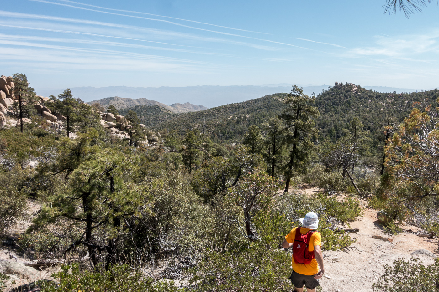
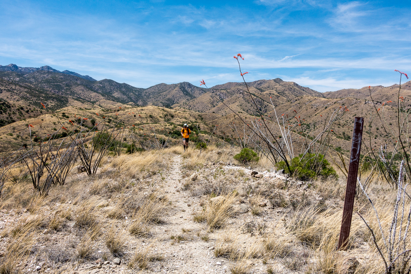
Running an upper section of the trail – the Brush Corral Trail is easy to follow and in decent shape down the junction with the Brush Corral Shortcut Trail. April 2017.
We quickly reached the Brush Corral Trail’s junction with the Green Mountain Trail and started the descent to the junction with the Brush Corral Shortcut Trail – this section of trail is still in decent condition and is easy to follow. Below the junction with the Brush Corral Shortcut Trail the trail immediately becomes overgrown and interrupted by fallen trees, but it was still easy to follow until – at an old metal trail marker – the trail emerged from the trees and became an off-trail ‘route’.
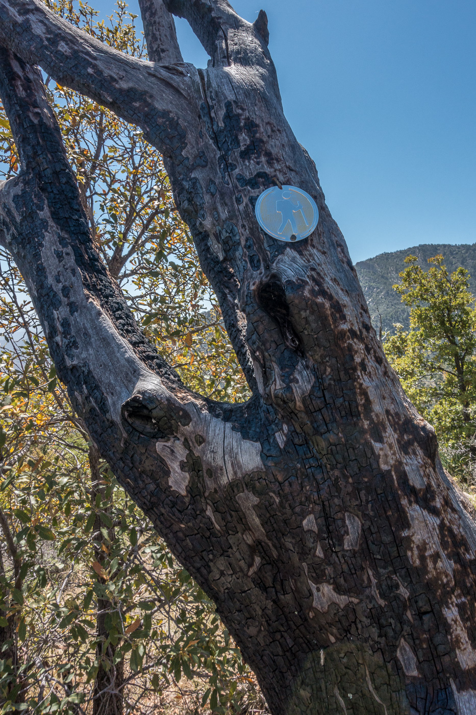
A metal trail marker – it was encouraging to see this, but beyond this point the ‘trail’ was distinctly harder to find. April 2017.Looking down on the ridges that the Brush Corral Route follows. April 2017.
We found stretches of the old trail, and cairns sometimes helped us stay on course – but in sections we just wandered across the ridges, perhaps we could have found more of the old trail but the terrain was not particularly difficult off-trail walking and rather than hunt for the old track it seemed more interesting to just keep moving forward.
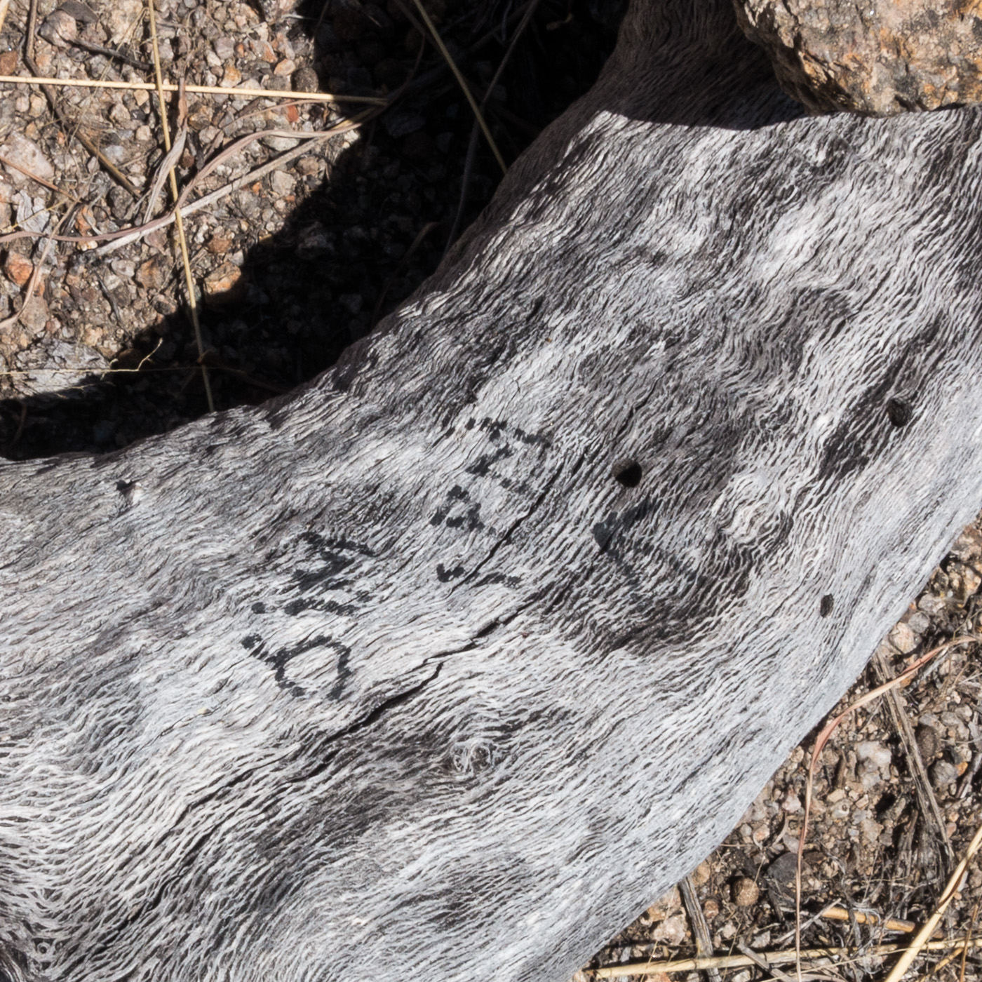
A rather alarming note – ‘Jim – 1PM’ – next to a small cairn – if anyone knows the story on this I would love to hear it… April 2017.
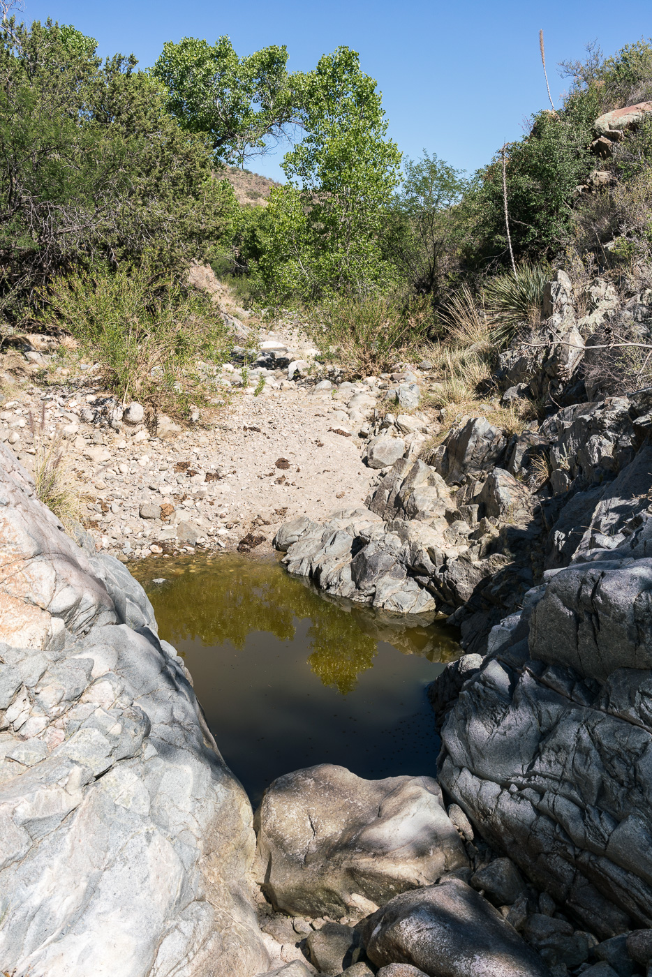
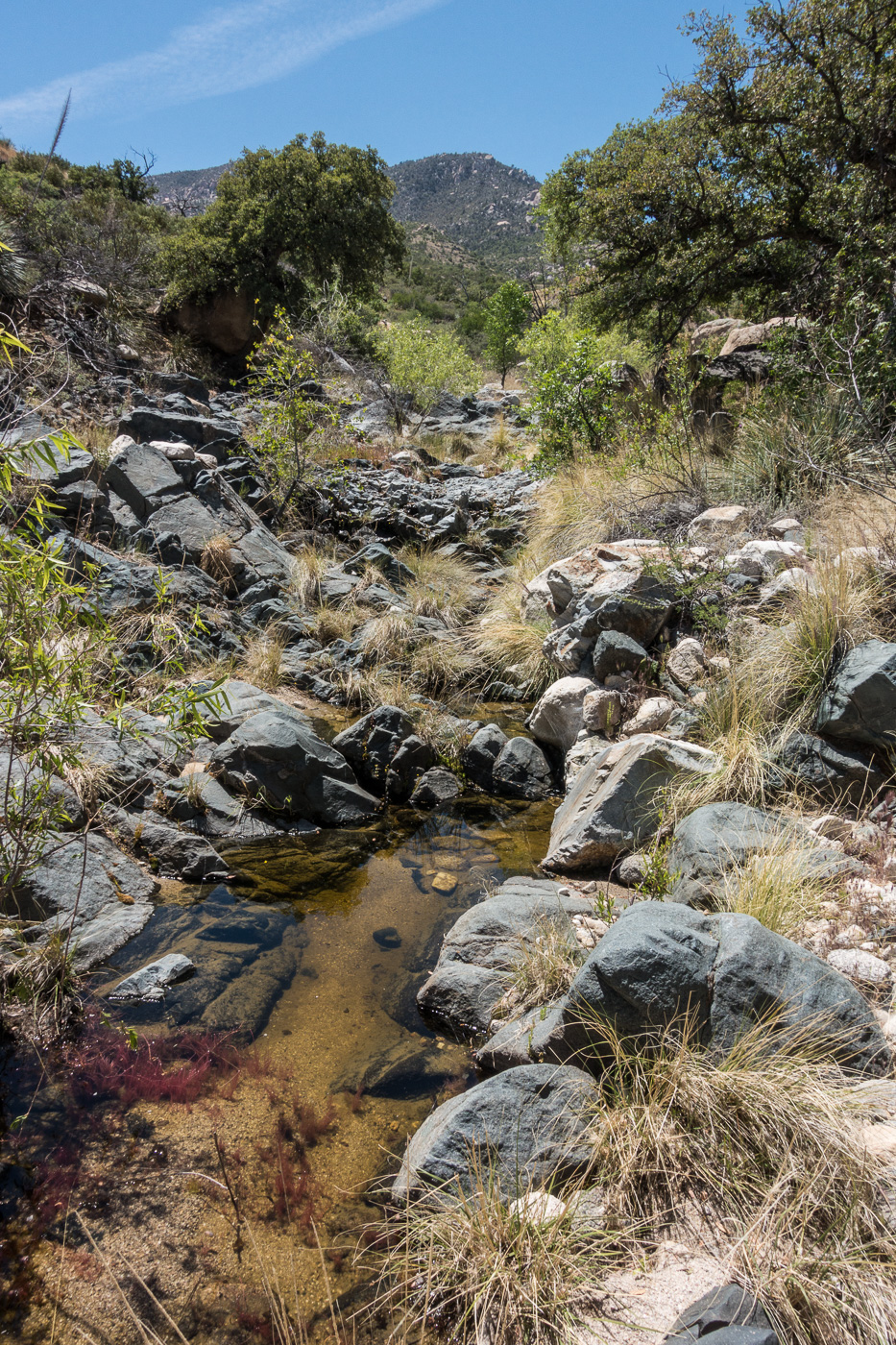
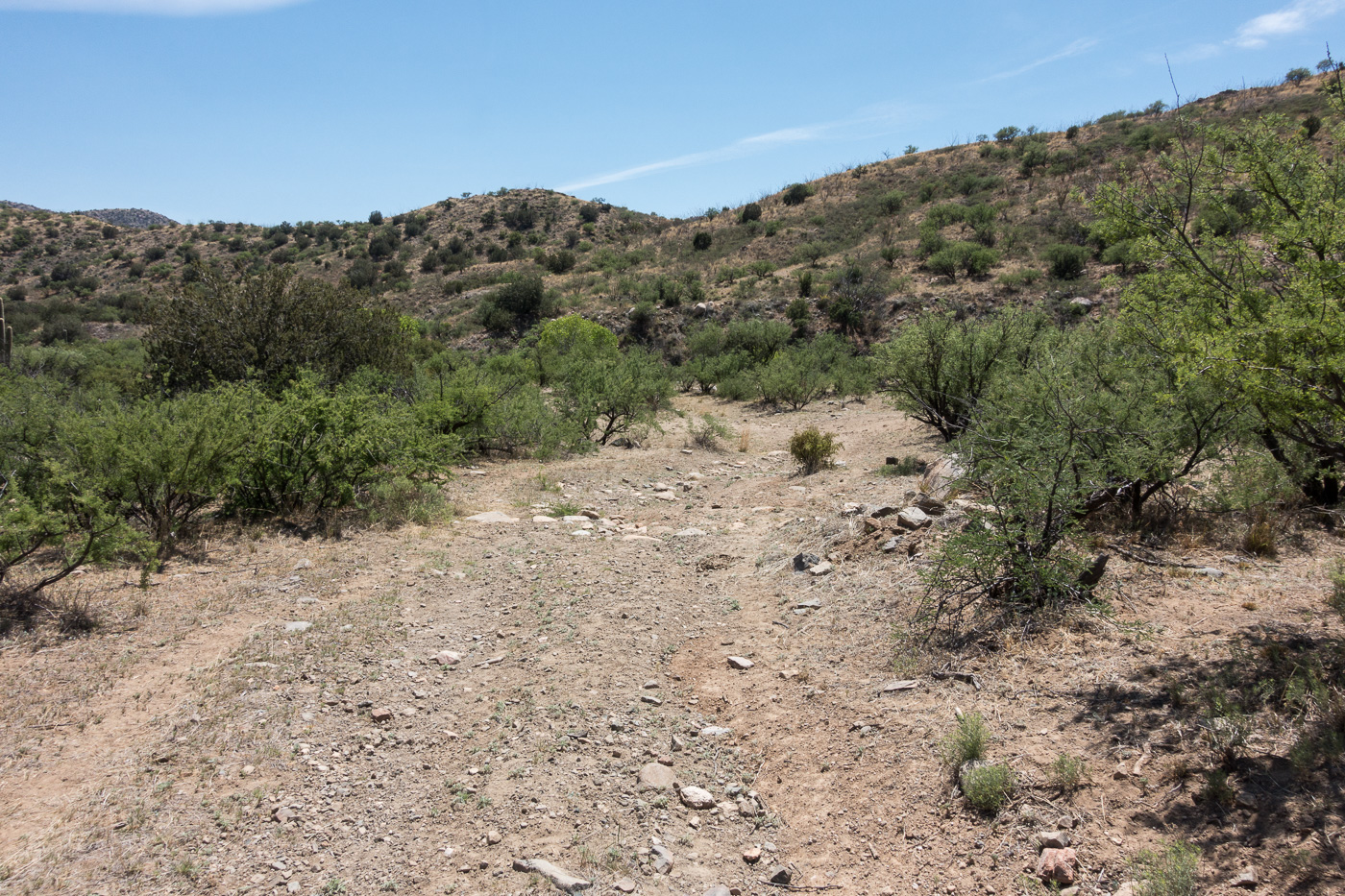
The biggest surprise of the hike may have been finding water when we crossed a small canyon – we had planned on the route being dry and it was nice surprise to find water to soak my shirt and hat with – we were thousands of feet lower than when we started and it was getting hot, the edge of the season for this part of the mountain I think.
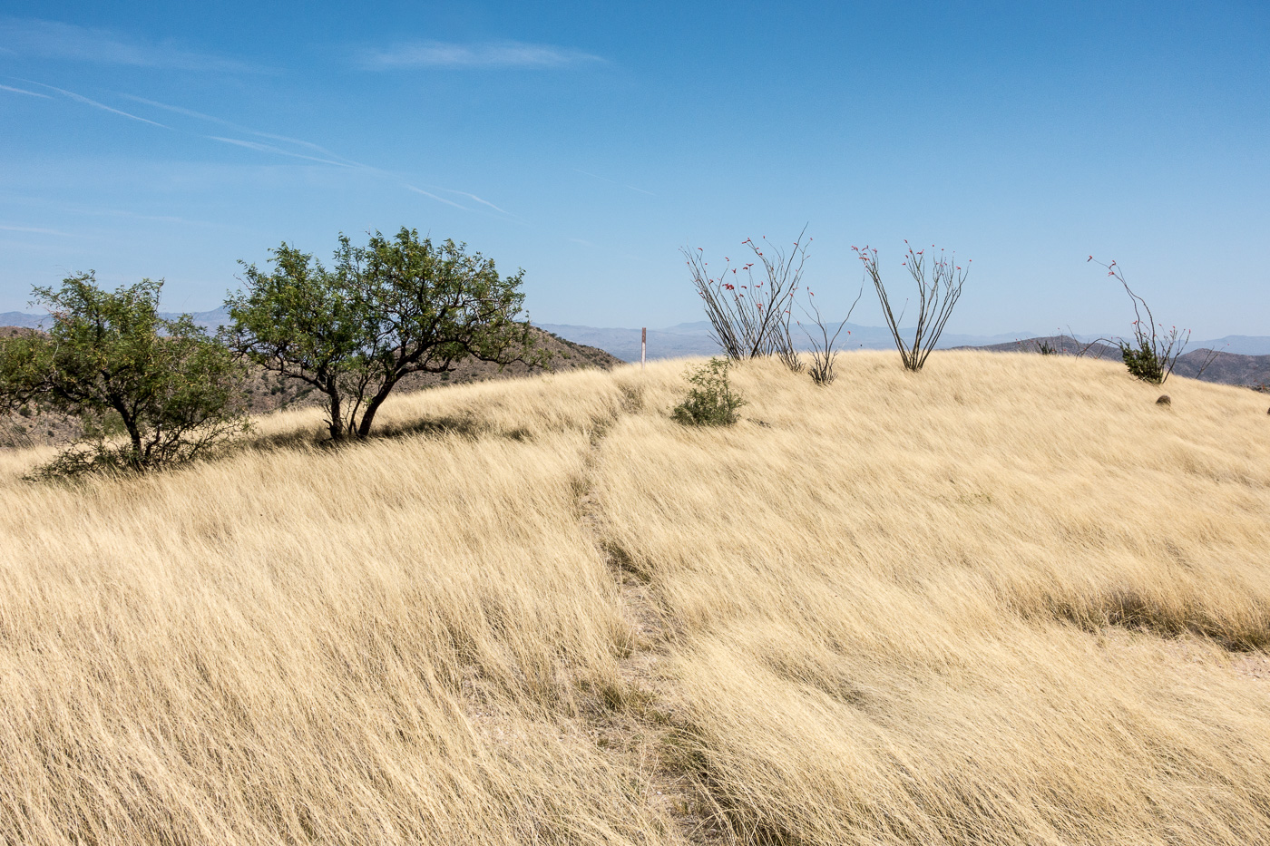
Water in a canyon along the Brush Corral Trail. April 2017.An obvious section of trail across a grassy ridge – brown carsonite posts like the one at the top of this hill mark the lower part of the trail. April 2017.
From the crossing we quickly found the brown trail markers mentioned in other reports and the trail became relatively easy to follow thru the grass and across the ridges. We took advantage of the good trail and ran the final mile+ down to the Brush Corral site before making the hike up the road back to our ride home.
Richard running the bottom section of the trail – Mount Bigelow in the background – the trail close to the trailhead is in decent shape – brown carsonite posts mark the way. April 2017.FR4407 coming to an end at the Brush Corral area. April 2017.
Newspaper articles that reference the Brush Corral Trail that I used for this post:
Arizona Daily Star, 8/24/1911, p. 5, Forestry Will Have Its Own Telephones
Arizona Daily Star, 10/10/1912, p. 8, Brevities
Arizona Daily Star, 11/6/1912, p. 8, Telephones Arrive For Mt. Lemmon Line
Arizona Daily Star, 12/6/1912, p. 8, Government Installs New Telephones
Arizona Daily Star, 3/22/1964, p 55, Pete Cowgill, Hike Up To Brush Corrall Is For Experienced Hikers
Arizona Daily Star, 11/8/1984, p. 51, Pete Cowgill, Old Ranger Station is Just a Memory
Arizona Daily Star, 11/17, 1989, p. 41, Pete Cowgill, Hiking club dug in for Brush Corral Trail
The rain is making streaks across my photos – I am half way up a small side canyon finishing a too-short loop in Buehman Canyon. Often I would welcome the weather – but today, parked on a dirt road I barely know and in a section of canyon I have never visited before, an early exit due to the weather seems like a smart decision and, reluctantly, I continue upwards.
Beautiful light on the Evans Mountain area from FR4407 – Brush Corral Road. February 2017.
Rather than the the traditional entrance to Buehman Canyon I started on Brush Corral Road – FR4407 – near Pink Tank. From here there are beautiful views of the Evans Mountain area – it is an easy walk to the edge of Buehman Canyon and stunning views of the canyon below.
Looking down into Buehman Canyon. February 2017.
The descent down a small drainage into the canyon is steep and unremarkable – but the bottom of the canyon is amazing! Interesting rock walls, carved water ways, flowing water, gorgeous colors – the first drops of rain signal an end too my visit much too quickly…
Buehman Canyon. February 2017.
Pima County owns and protects much of the bottom of the canyon east of the forest boundary – the land was donated to The Nature Conservancy in 1996 and in 2011 was transferred to Pima County (who owns the nearby A7 and Six Bar ranches). In the last few miles down to the San Pedro River the canyon becomes a mix of Arizona State Trust Land and private land.
Buehman Canyon is named for Henry Buehman. Henry Buehman was born in Bremen, Germany, in 1851 and before setting off for the US in 1868 he spent 3 years as a photographer’s apprentice. After a short stay in New York Buehman traveled to California where he worked as a photographer for 4 years before selling his business in Visalia to fund mining ventures in Califonia, Utah and Nevada.
After becoming an American citizen Buehman crossed into in Arizona at Stone’s Ferry and equipped himself for a trip into Mexico in Prescott – but in Tucson he ended his journey and soon began working as a photoghaper and dentist.
Buehman made potraits, photographed events and traveled Southern Arizona creating photographs. His studio and photographic business were successful and he purchased 150 acres west of Redington and established a ranch. He lost the ranch after droughts in 1895 and 1896.
In addition to photography Buehman held a number of offices in Pima County and Tucson beginning in 1882 when he was elected as Public Administrator of Pima County and culminating with two consecutive terms as Mayor from 1895 to 1899.
Henry Buehman died in 1912 – but Buehman Studio continued to be run by Henry’s son Albert and grandson Remick. The studio closed in 1950 and in 1967 the Arizona Historical Society purchased the collection. The photos are available for the public to view thru the Arizona Historical Society and are featured in The Buehman Studio, Tucson in Focus.
An overcast weekday in Oracle State Park. March 2017. March 2017.
The picture is unremarkable – rolling hills stretching towards the east side of the Santa Catalina Mountains on an overcast day – the remarkable thing is not the picture, but when and where it was taken… On a Friday in Oracle State Park!
Oracle State Park was, sadly, closed in 2009 due to budget cuts. It was re-opened in 2012 on weekends and this March finally re-opened full-time to the public.
I am very glad that the park is now open on weekdays – the north and east side of the Santa Catalina Mountians can be surprisingly different from the more often visited south and west sides and Oracle State Park’s compact network of trails is one of the easiest ways to visit this landscape!