A view into the Santa Catalina Mountains from the Palisade Trail. September 2018.
Simple – down the Palisade Trail, along the East Fork Trail to water, back up the Palisade Trail – I can’t remember ever recommending this route to someone and probably never will – once you’ve made it down the Palisade Trail to the East Fork Junction there are so many nearly-impossible-to-resist connections into other parts of the mountain! But simplicity has its place and the Palisade Trail is a great place to spend time – besides, no two trips along the trail are ever the same.
Tank at Mud Spring – dry, water still runs across the trail making the namesake Mud, but the tank is dry. September 2018.
This is the first time I can remember finding the cement tank at Mud Spring completely empty – the spring is still running, the familiar patch of mud along the trail – but the tank is dry, I assume something is cracked and broken.
Late summer growth over the Palisade Trail. September 2018.A summer storm moving across the Santa Catalina Mountains. September 2018.
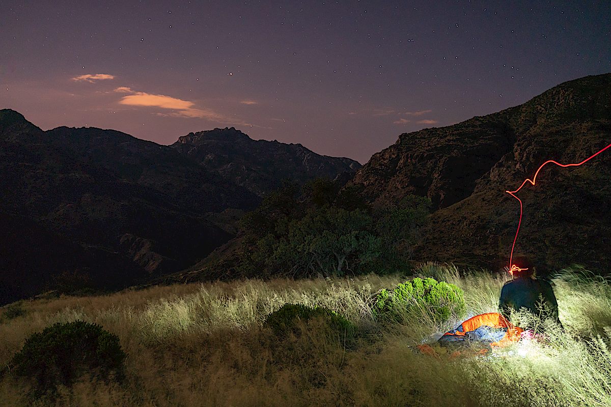
A summer storms rolls across the trail – enough rain to give me a brief excuse to get out the rain gear and take a break under an Oak Tree before continuing along the impressively grassy and overgrown trail. I knew I would have to walk west on the East Fork Trail to find water – but I have to walk a little farther than expected, eventually finding a large pool to filter and refill from. Back up the trail to one of the grassy ridges above Sabino Canyon – a few more mosquitoes than expected but a lovely night – and then back up to the Palisade Trailhead the next day…
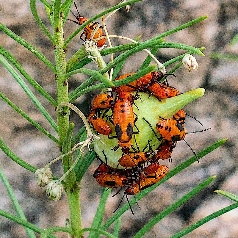
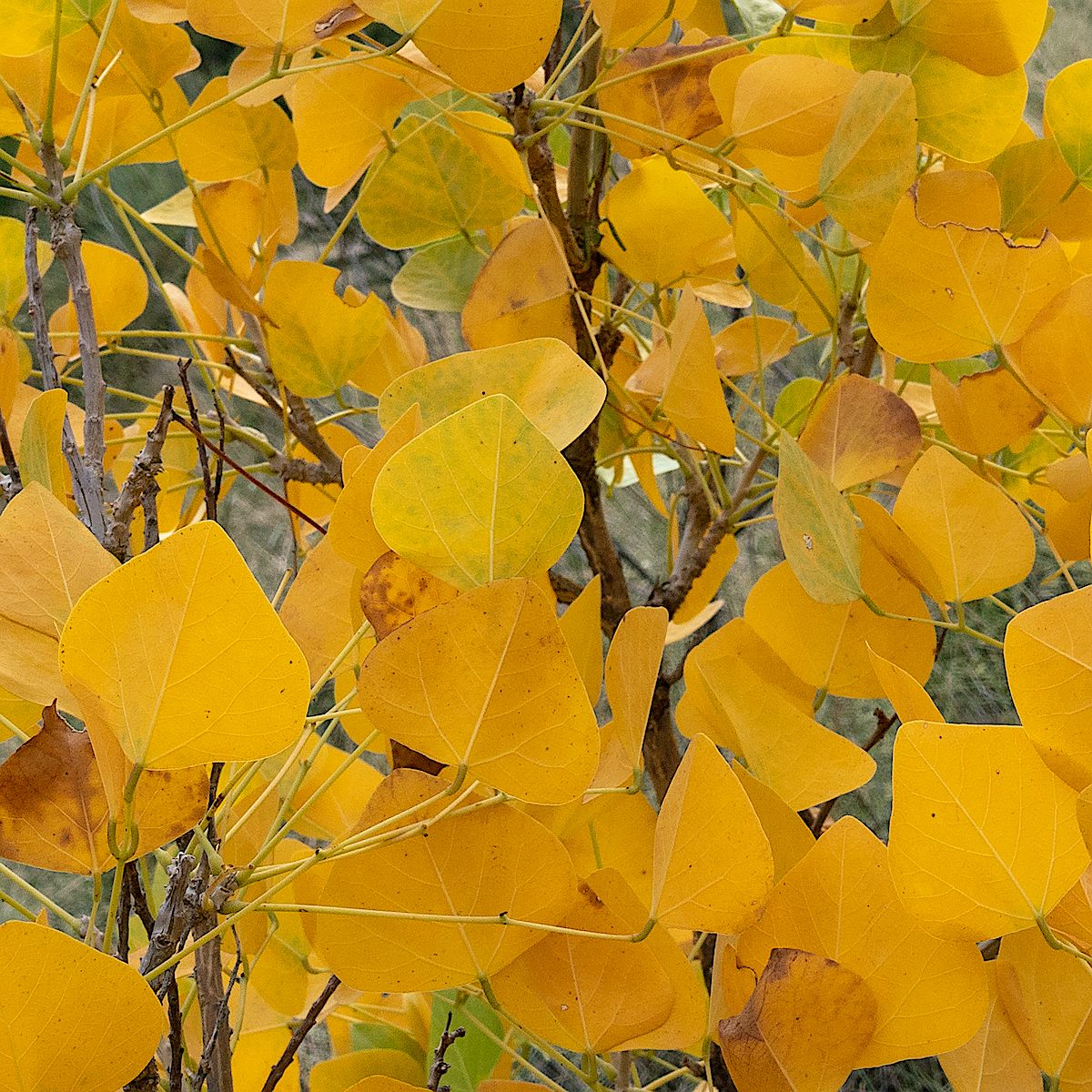
Camped near the Palisade Trail above Sabino Canyon. September 2018.Milkweed bugs along the Palisade Trail. September 2018.Fall Color – a Coral Bean lower on the Palisade Trail. September 2018.
Table Mountain from N. Oracle Road (77) near N 1st Avenue in Oro Valley. January 2019.
Pictures from Oro Valley – from Oracle Road near First Ave, the Oro Valley Public Library and Naranja Park – I would rather be hiking in the mountains than shooting from town, but different days present different opportunities and Oro Valley has some amazing views of the Santa Catalina Mountains!
Clouds around Cathedral Rock from the Oro Valley Public Library. January 2019.Pusch Peak from Naranja Park in Oro Valley. January 2019.Cathedral Rock Sunset from Naranja Park in Oro Valley. January 2019.The Cleaver in Shadow and The Thumb peaking over Pusch Ridge in the Sunset Light – from Naranja Park in Oro Valley. January 2019.
Cotton Wood Tank with Table Mountain in the background. December 2018.
A 2017 post shows Cotton Wood Tank sadly covered in graffiti (picture below) – thankfully between then and now the graffiti has been painted over (picture above). I was slightly surprised, since this hasn’t felt like a very wet year, to see that the tank is to-the-rim full at the moment, even higher than last year.
Graffiti covering Cottonwood Tank. December 2017.
Our destination for the day was the bottom of Catchment Canyon – I thought we would have time to explore up canyon but it took longer than I guessed to reach the canyon so we touched the bottom, took some pictures and, with the Bighorn Sheep Management Area closing in two days, said goodbye-until-next-year…
Looking up at Table Mountain from the shadowed bottom of Catchment Canyon. December 2018.Buster Mountain and Alamo Canyon – Sunset. December 2018.
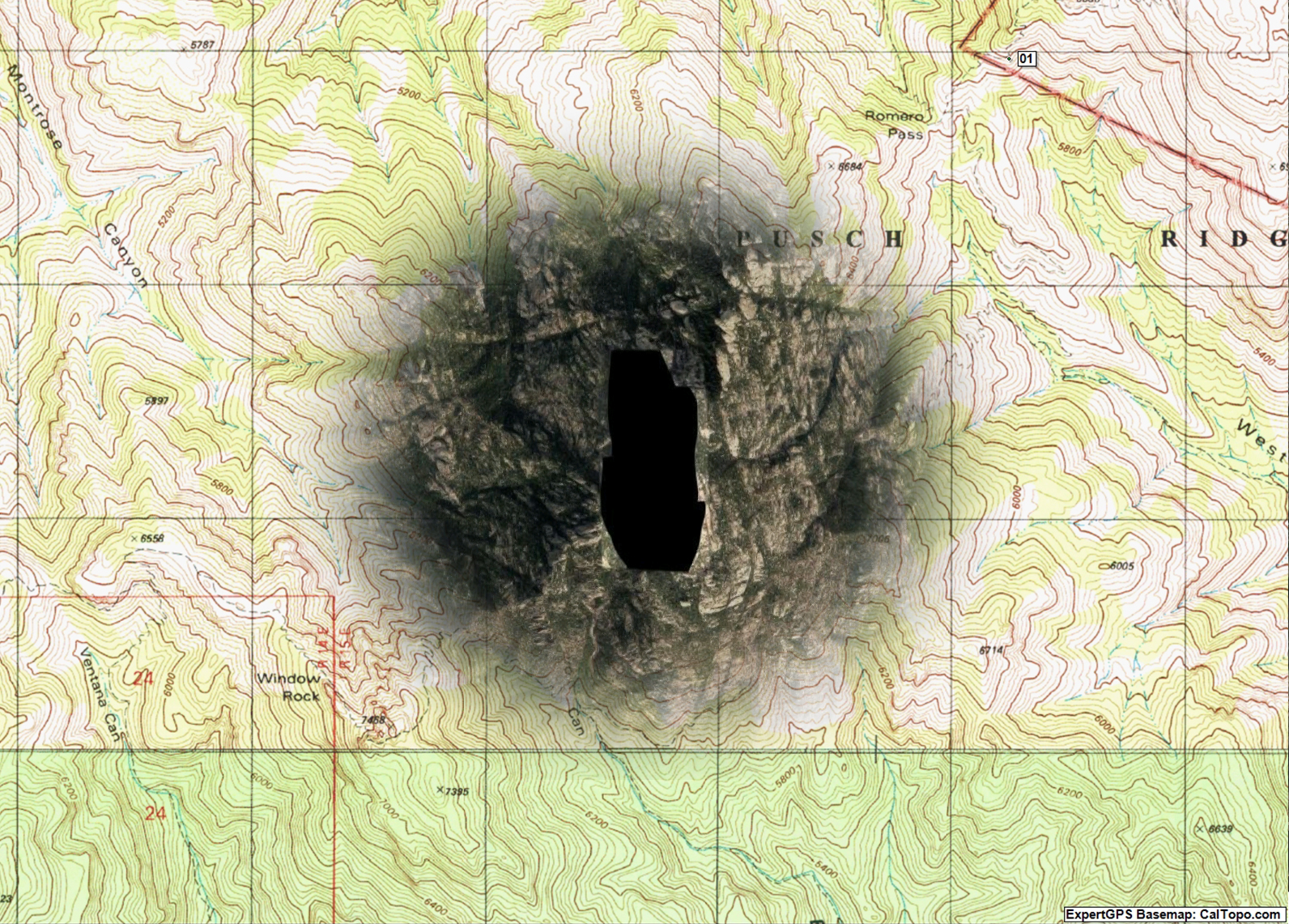
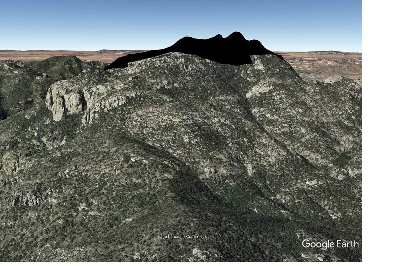
The Google Maps black blob covering the Cathedral Rock Area – surrounding topo map for reference. January 2019.
A message from the amazing Arizona based photographer Erini Pajak (Instagram) let me know that according to Google a strange black blob had appeared in the Santa Catalina Mountains. I was, of course, 99.999999% sure that this was something mundane like an unfortunate Google maps omission for a government agency or map data oddity/error and not a reflection of the real world. Thinking otherwise is probably the territory of theories like ‘blacked out because of an alien landing’ or ‘blacked out because new high resolution imagery clearly shows the Iron Door of mine-with-the-Iron-Door fame and Google is in the process of claiming mineral rights’ – but Google’s power and reach these days is such that sometimes it seems their information creates and influences reality rather than just reflecting it… So it was with 0.000001% relief that my recent photographs of Cathedral Rock didn’t show a black blob covering the peak!
Cathedral Rock and Window Peak on New Year’s Day. January 2019.The Google black blob covering the Cathedral Rock area in Google Earth. January 2019.
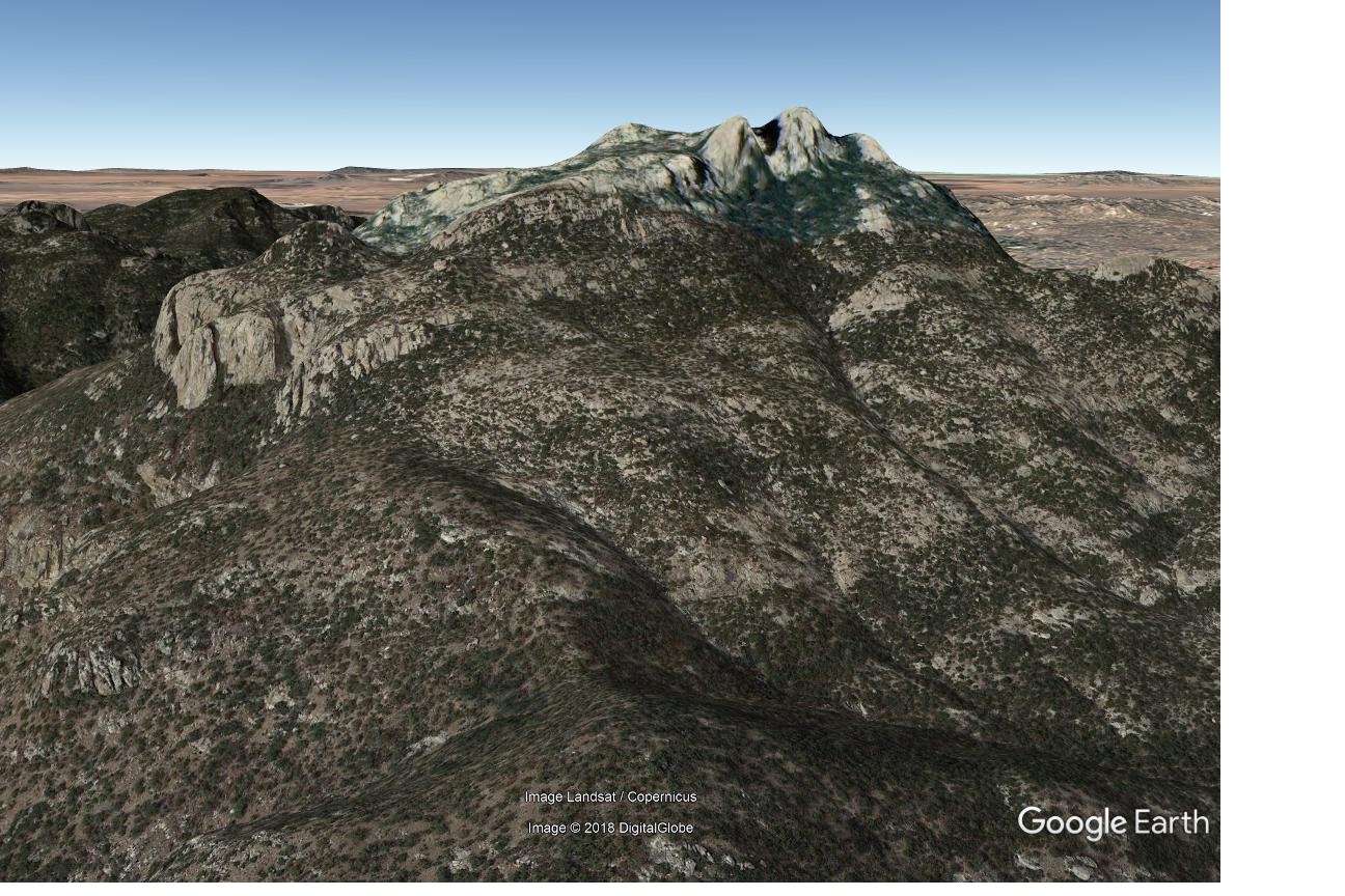
The images above show the black blob as seen on my screens in early January – I still see the blob on Google Maps, but changing the imagery date in the desktop version of Google Earth immediately shows the expected imagery (shown below). I can’t find any hint of the black blob in Microsoft’s Bing Maps, Gaia GPS and Backcountry Navigator Pro so it appears that the Cathedral Rock area is safe…
Google Earth – Cathedral Rock area with complete imagery. January 2019.
I suspect that any map large and detailed enough to be interesting – printed or digital – has errors, or at the very least representations that are historically accurate but not currently relevant…
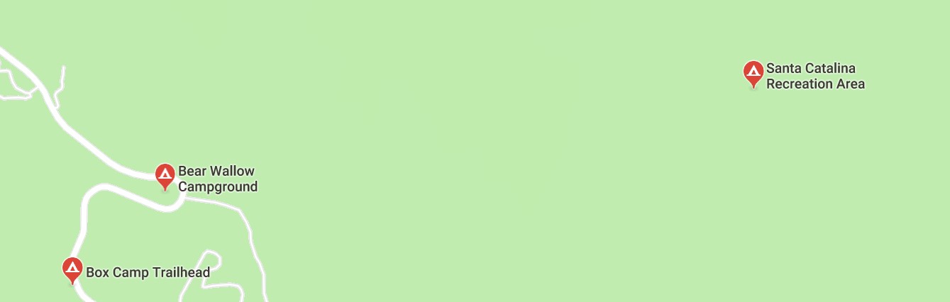
Witness the Ghost Campgrounds of the Santa Catalina Mountains – current results that come up if you zoom in and search for ‘campgrounds’ in Google Maps…
Google Maps – a search for Campgrounds reveals some questionable results… January 2019.
From left to right:
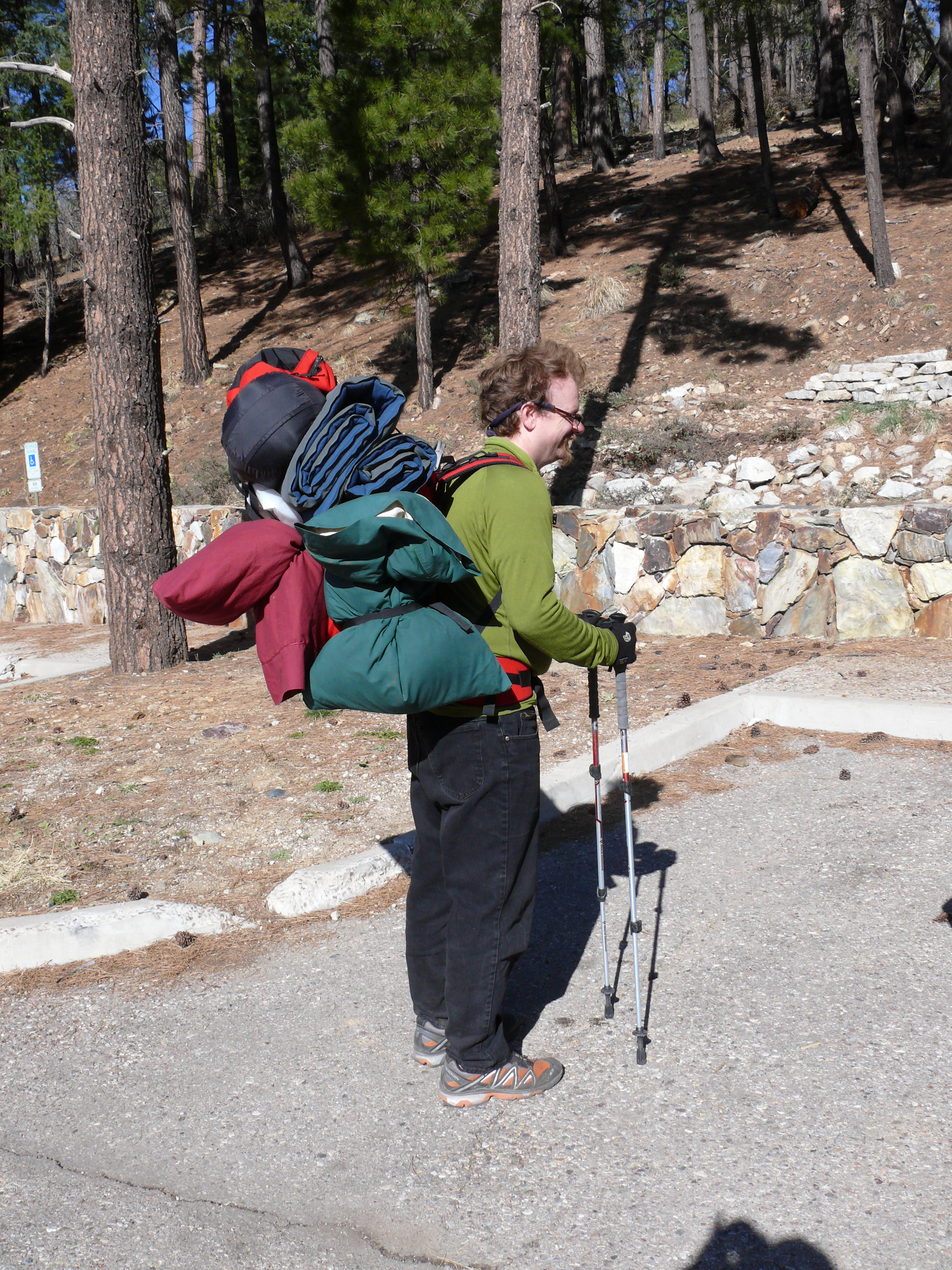
Box Camp Trailhead: a great place to start a hike and a decent place to backpack from – but there is no campground or camping in the trailhead proper…
The Box Camp Trailhead – no campground to be seen… September 2014.The closest you are going to get to camping at the Box Camp Trailhead is loading up your gear and hiking in! March 2008.
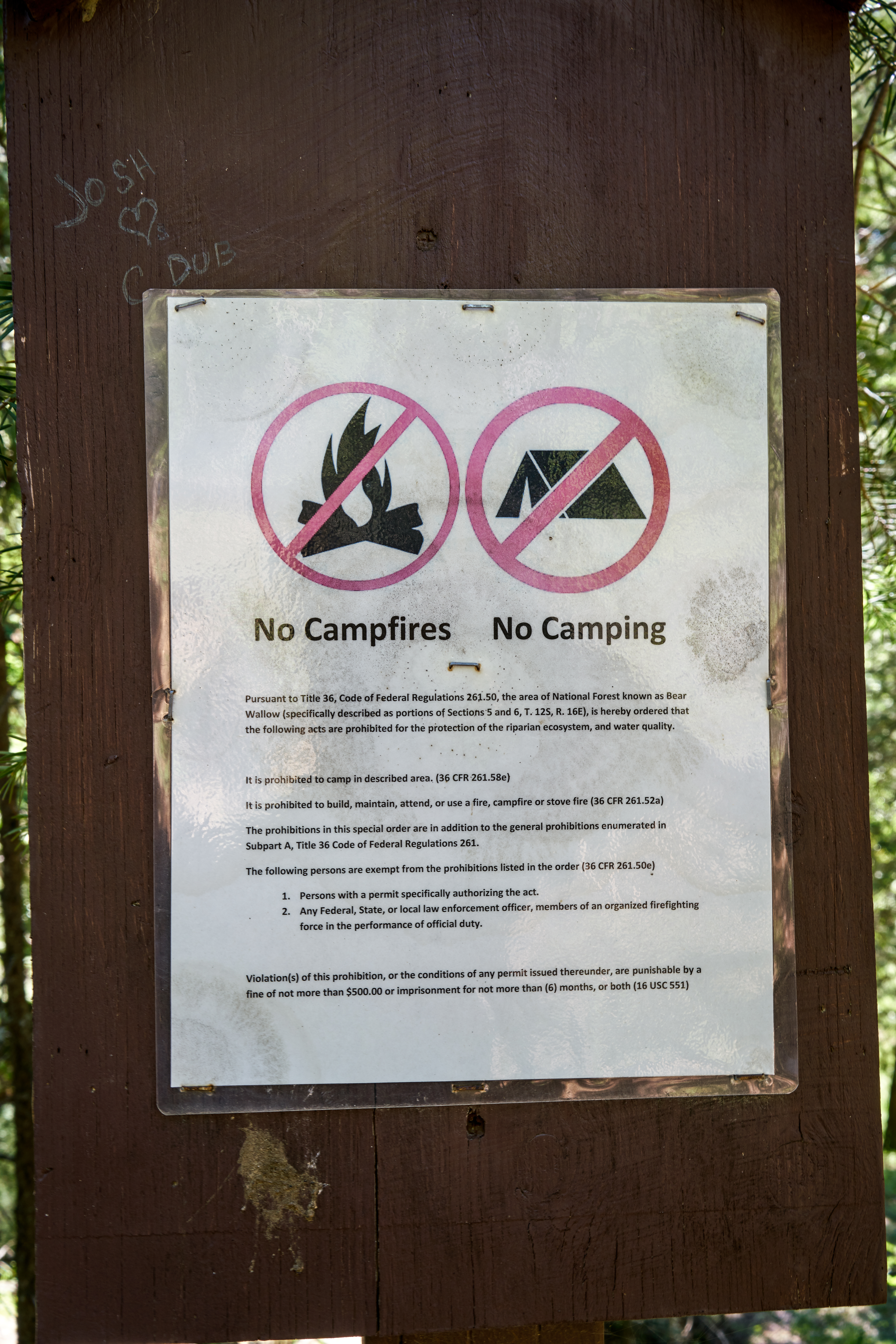
Bear Wallow Campground: A beautiful area for a hike, probably the best single spot for Fall color in the Santa Catalina Mountains and the first official campground on the mountain (established in 1921!) – but it has been closed to camping for decades…
No camping sign in Bear Wallow. August 2017.An empty sign holder still standing in the Bear Wallow area – leftover from earlier days… October 2018.A picture from as close as I could find to Google’s Bear Wallow Campground marker – perhaps inviting but no campground in sight and in fact Camping is not permitted in this area. August 2017.
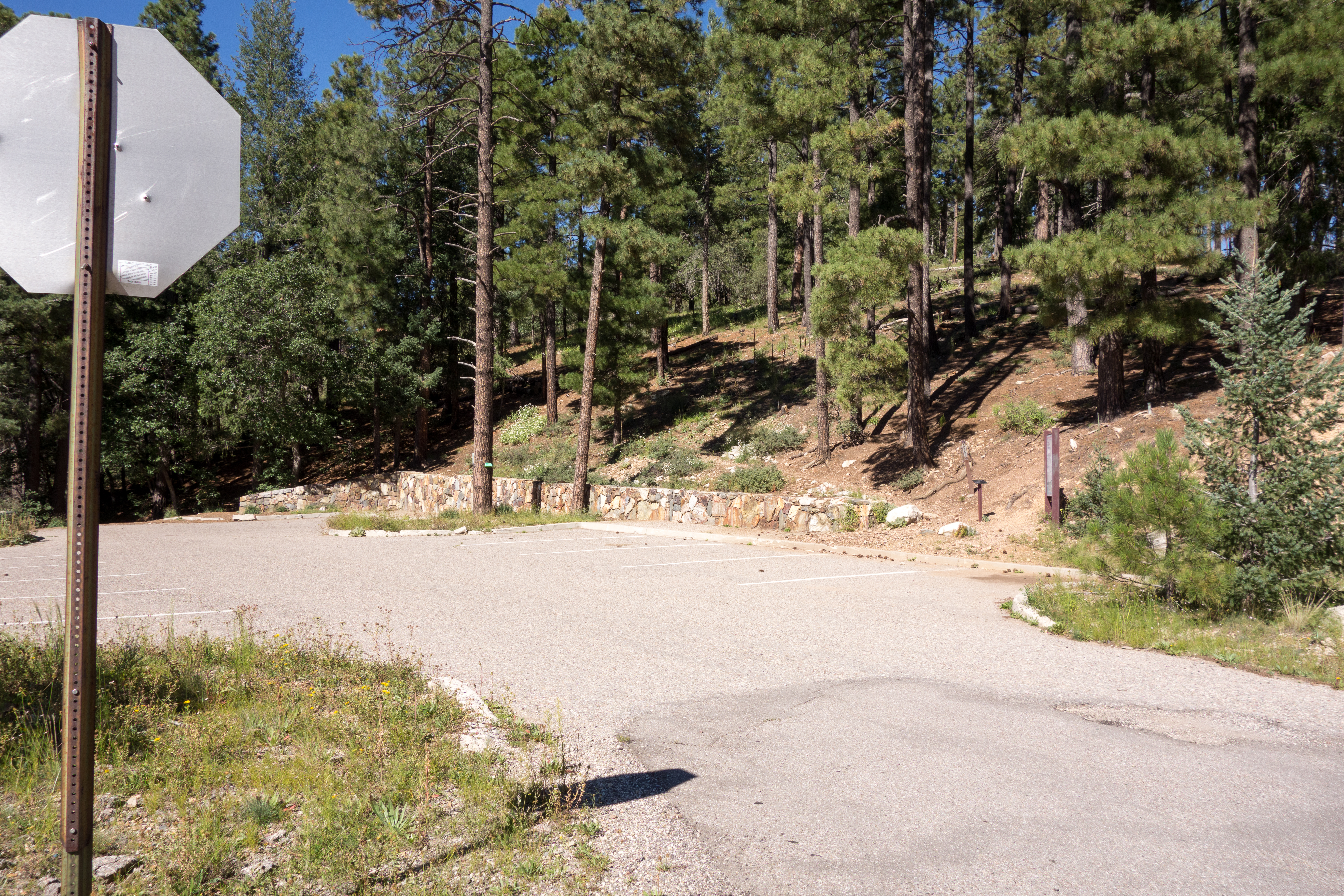
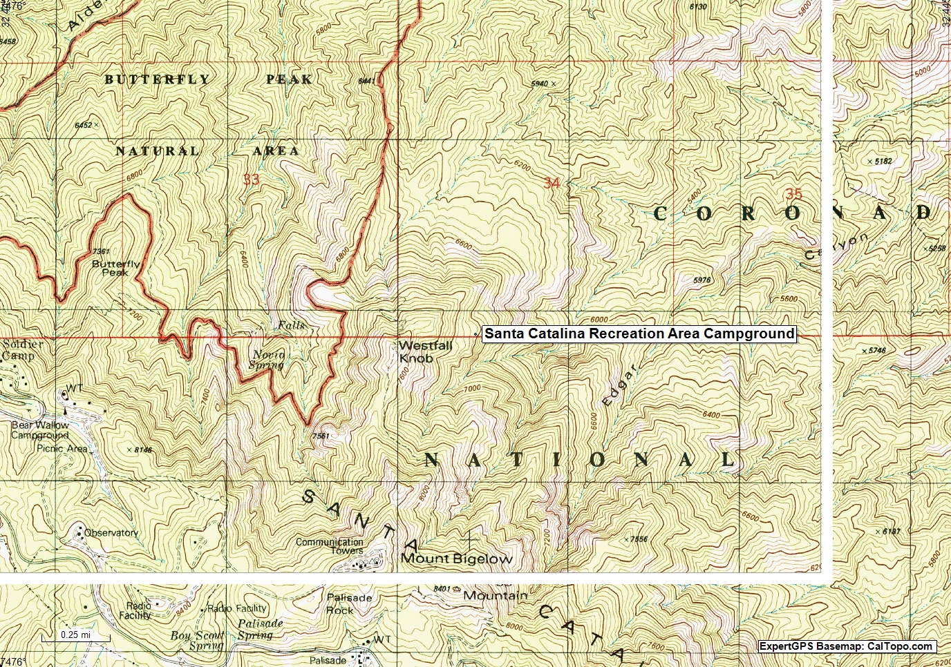
Santa Catalina Recreation Area: Well, I guess unlike the previous two examples you could legally camp at, or in many places near this marker – but that is true of most of the Santa Catalina Mountains that (like this spot) are away from roads and ‘civilization’ – there is no road or trail to this area and if there is an opposite of ‘Campground’ this might be it…
Google’s Santa Catalina Recreation Area Campground Marker on a USGS topo map. January 2019.
In the case of Google Maps the map interface features a ‘Suggest an Edit’ button that allows you to submit potential corrections – I have submitted corrections to the campgrounds above perhaps by the time you look they will be corrected…
I’m sure, especially as you really dig into the details, that there are more interesting mapping oddities, mysteries and errors in the Santa Catalina Mountains – leave a comment if you want to share one!
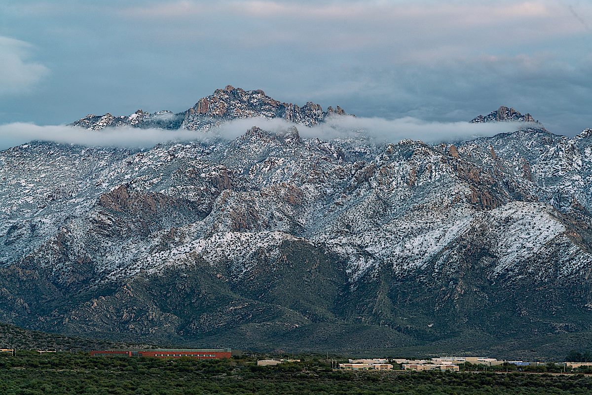
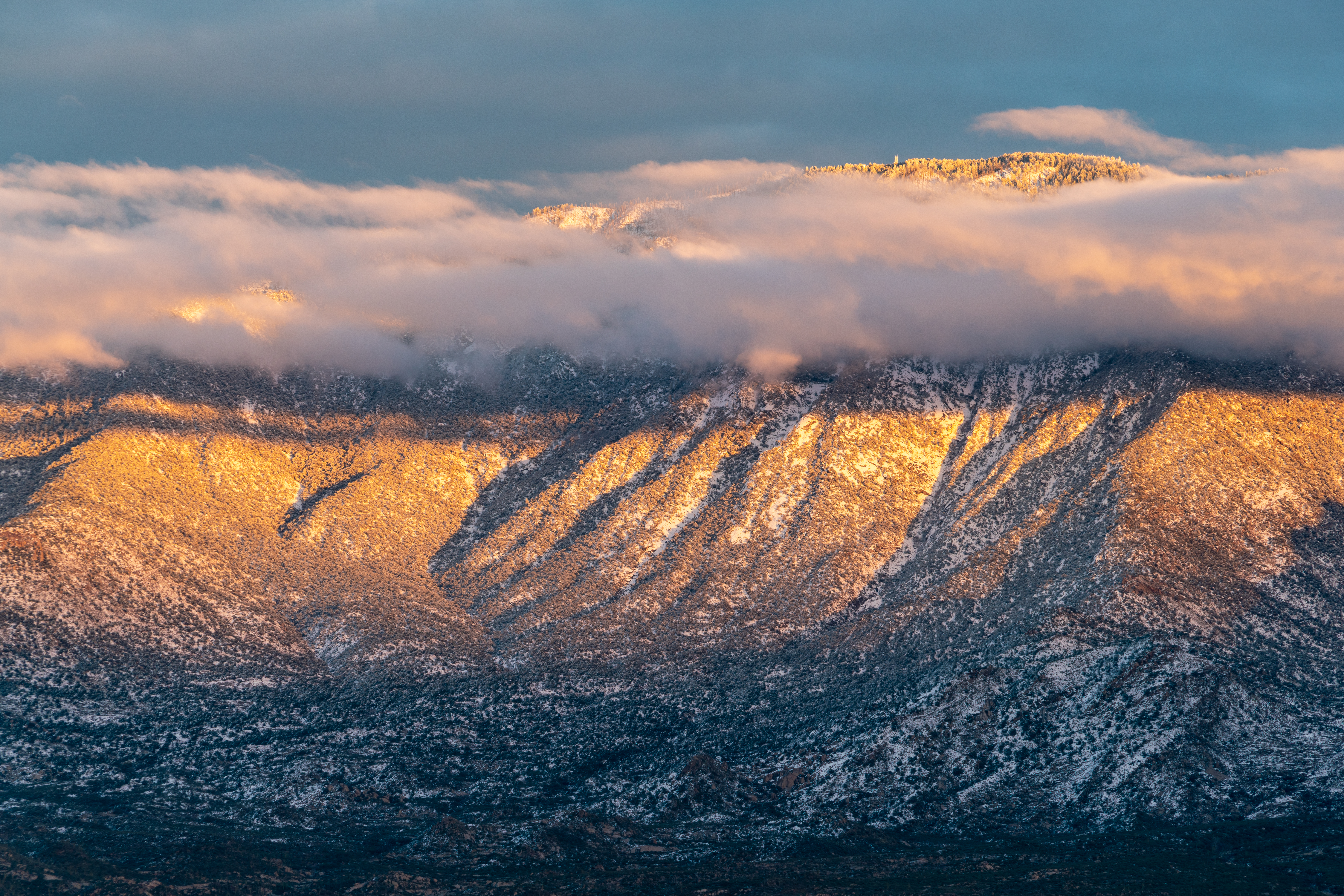
Snow on the Cholla and clouds over the Santa Catalina Mountains from the Golder Ranch North Parking Area. January 2019.
Snow in the desert! It didn’t last long, by mid-morning it was melting fast, and at the end of the day the snow line across the west side of the Santa Catalina Mountains was well above the desert floor.
2015 is the last time I took pictures of good ‘desert snow’ – in 2015 the snow line appears to have been a bit lower, Pima Canyon Trail in the Snow, 1/1/2015 has some pictures.
Beautiful to see and what a way to start the New Year!
Looking towards a snowy Charlouea Gap from the Golder Ranch Area. January 2019.Cardinal and Snowy Cholla. January 2019.Clouds swirling over Samaniego Peak. January 2019.Cathedral Rock and Window Peak above the clouds. January 2019.Sunset on Mount Lemmon. January 2019.West side of the Santa Catalina Mountains from Honey Bee Canyon Park. January 2019.