Palisade Trail, Late Summer Night – 9/16 and 9/17/2018

A view into the Santa Catalina Mountains from the Palisade Trail. September 2018.

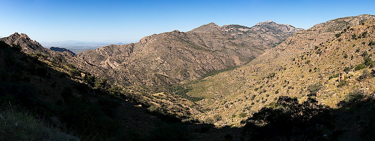
Simple – down the Palisade Trail, along the East Fork Trail to water, back up the Palisade Trail – I can’t remember ever recommending this route to someone and probably never will – once you’ve made it down the Palisade Trail to the East Fork Junction there are so many nearly-impossible-to-resist connections into other parts of the mountain! But simplicity has its place and the Palisade Trail is a great place to spend time – besides, no two trips along the trail are ever the same.

Tank at Mud Spring - dry, water still runs across the trail making the namesake Mud, but the tank is dry. September 2018.
Tank at Mud Spring – dry, water still runs across the trail making the namesake Mud, but the tank is dry. September 2018.

This is the first time I can remember finding the cement tank at Mud Spring completely empty – the spring is still running, the familiar patch of mud along the trail – but the tank is dry, I assume something is cracked and broken.

Late summer growth over the Palisade Trail. September 2018.
A summer storm moving across the Santa Catalina Mountains. September 2018.

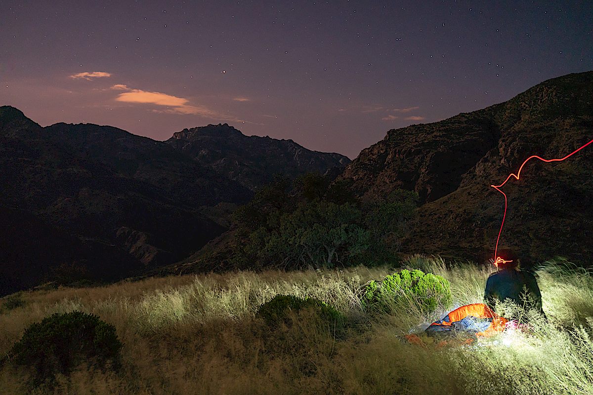
A summer storms rolls across the trail – enough rain to give me a brief excuse to get out the rain gear and take a break under an Oak Tree before continuing along the impressively grassy and overgrown trail. I knew I would have to walk west on the East Fork Trail to find water – but I have to walk a little farther than expected, eventually finding a large pool to filter and refill from.  Back up the trail to one of the grassy ridges above Sabino Canyon – a few more mosquitoes than expected but a lovely night – and then back up to the Palisade Trailhead the next day…

Camped near the Palisade Trail above Sabino Canyon. September 2018.
Milkweed bugs along the Palisade Trail. September 2018.
Fall Color - a Coral Bean lower on the Palisade Trail. September 2018.
Fall Color – a Coral Bean lower on the Palisade Trail. September 2018.

Bigelow Trailhead to the Gordon Hirabayashi Recreation Site – 1/17/2015

We started at the Bigelow Trailhead, walked past the gate that closes Organization Ridge Road to public motorized traffic in the winter and continued on to the Palisade Trailhead. The road was icy and there was just enough snow at the trailhead to give a pleasant hint of winter, but not enough to require anything other than a little caution.

1501 Snow at the Palisade Trailhead
Palisade Trailhead with snow – Organization Ridge Road is closed seasonally to motorized vehicles so we parked at the Bigelow Trailhead and walked the road. January 2015.

We could hear Palisade Canyon flowing below – it looked like quite a bit of water from the trail – walked snowy sections of Palisade Trail where the shade preserved the remains of the last storm, paused for birds and enjoyed the polished stone in Pine Canyon before reaching Mud Spring.

1501 Cairn and brown ferns near Mud Spring
A cairn marking the Mud Spring Tank is surrounded by dead ferns. January 2015.

The waterfall in Pine Canyon was roaring away – quite a sight – and we paused just before the trail begins to plunge downwards to enjoy the view – Thimble Peak to Brinkley Point!

1501 A View from the Palisade Trail
A impressive view of the mountains – from near the Palisade Trail looking into Tucson – landmarks include Thimble Peak (near the left), Cathedral Rock and Brinkley Point (on the right). January 2015.

Down to the junction with the East Fork Trail and then up – past the Bear Canyon Trail and onto the Bear Canyon Trail, across Sycamore Canyon, past Sycamore Reservoir where Sycamore Canyon and Bear Canyon were pouring an impressive amount of water over the dam, up to Shreve Saddle and then down the Molino Basin Trail to the car we had left at the Gordon Hirabayashi Recreation Site earlier in the day.

1501 Water rushing over the Sycamore Reservoir Dam
Water from Sycamore Canyon and Bear Canyon rush over the Sycamore Reservoir Dam. January 2015.

Descending the Palisade Trail is a great way to see everything from pine forest to cactus and take in quite a few impressive views. Currently miles 4-6 of the Palisade Trail are distinctly more overgrown and less used than the upper sections of the trail – with some attention and effort you should be able to find the trail, but be prepared to use your map and navigate if needed.

12.8 miles, +1,400’/-4,350′ of elevation gain/loss.