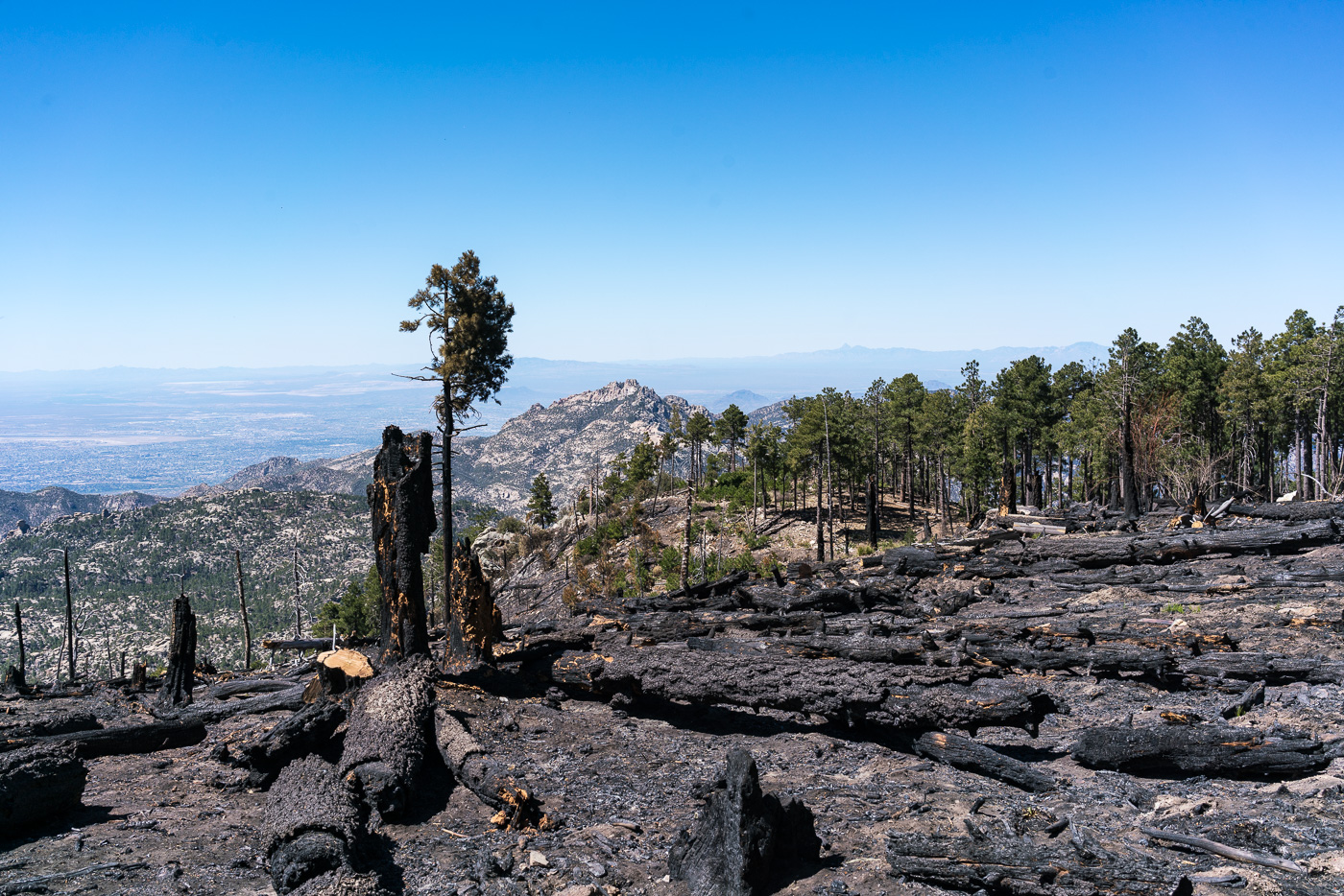
Fire damage along the Mount Lemmon Trail – probably from the Shovel Fire. May 2017.
With two trips last month on the Red Ridge Trail/Catalina Camp/Oracle Ridge Trails (probably the best sub-10 mile trail loop on the mountain) it seemed like it was time for the longer Canada del Oro/Red Ridge Trail loop, probably the best 10+ mile trail loop on the mountain!
We left a car at the Red Ridge Trailhead and drove to the Summit Trailhead – Lemmon, Sutherland, Samaniego Ridge, CDO Shortcut Trails – 3.7 miles and 2,700′ of elevation loss take us to the start of the Canada del Oro Trail.
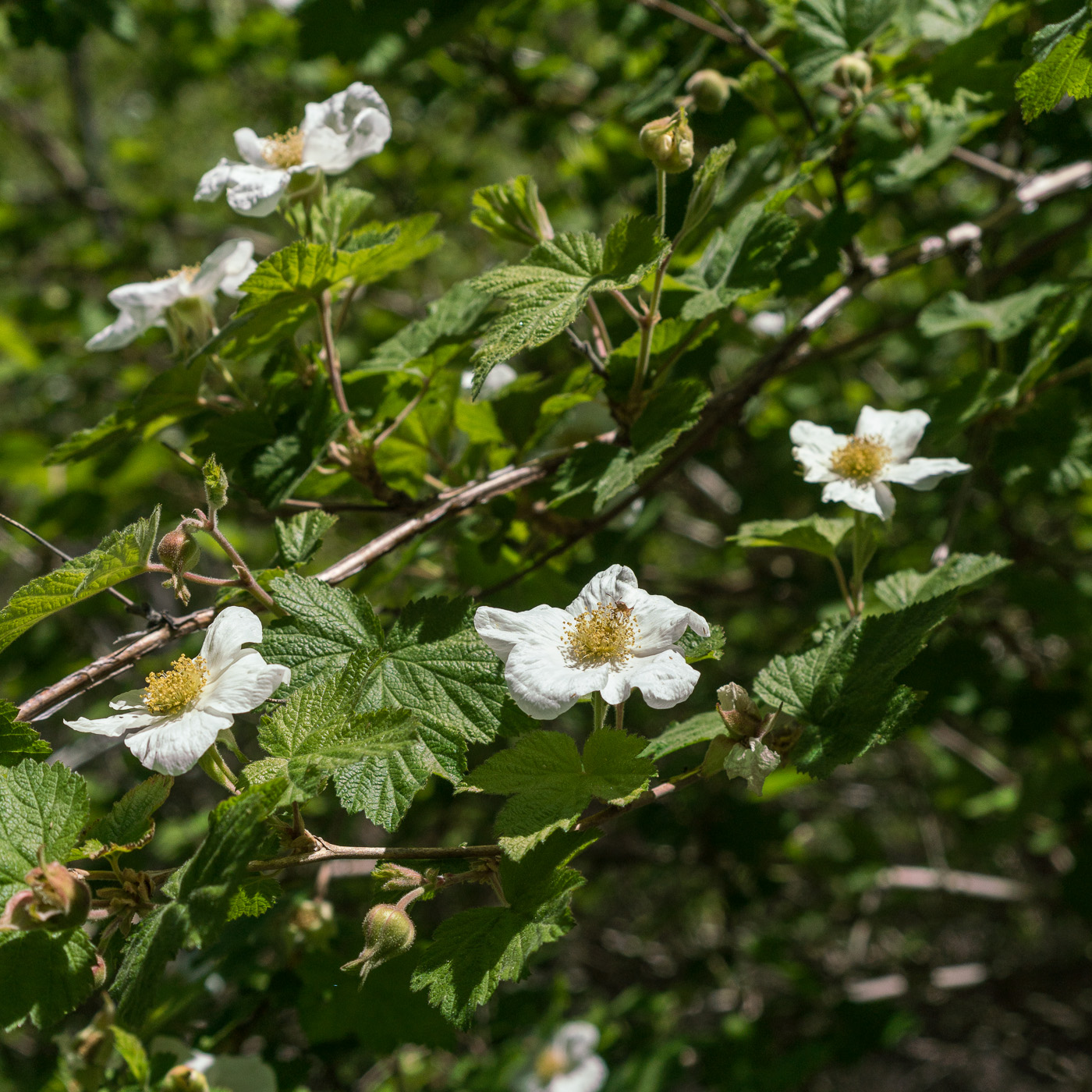
Raspberry flowers along the Canada del Oro. May 2017.
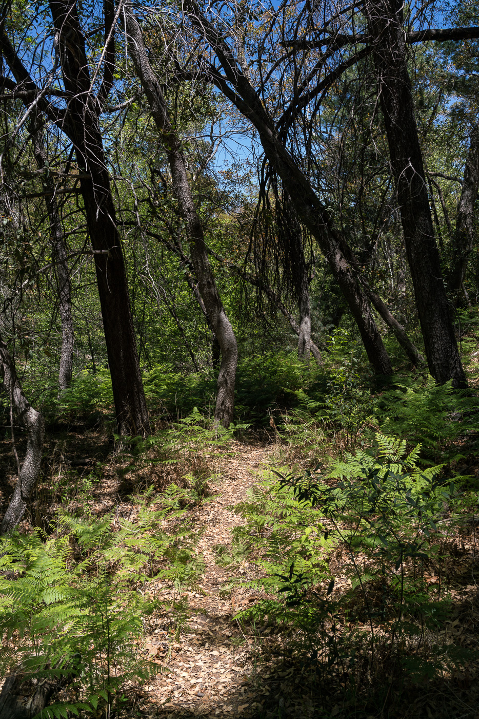
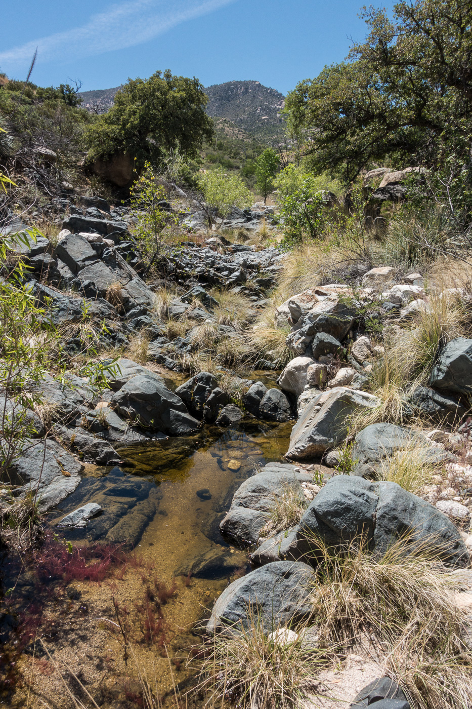
As the Canada del Oro Trail descends the views of towns and distant mountains disappear – the upper part of the canyon is surrounded by the Santa Catalina’s northern ridges – Samaniego, Reef of Rock and Oracle Ridge. The feeling of remoteness in the upper section of the canyon is great, but the real magic here is the water – the upper Canada del Oro seems to have remarkably good (perhaps even year-round?) flow – spending miles rambling in a wooded canyon beside a flowing stream is a unique experience in the Santa Catalina Mountains!
The CDO Trail. May 2017.
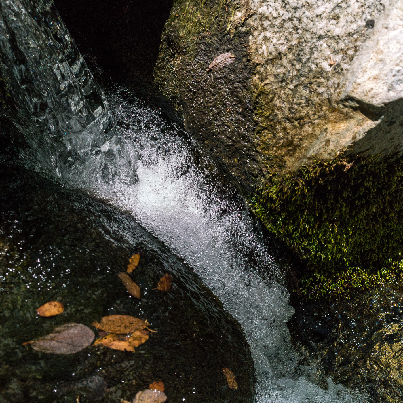
Seeing water in the CDO might be a surprise if you are used to the dry sandy wash that leaves the mountains and heads southwest thru Saddlebrooke, Catalina, Oro Valley and Tucson to the Rillito River. In Canyon of Gold, Tales of Santa Catalina Pioneers Barbara Marriott asserts that the (at least seasonal) water in the CDO and grass along waterway during the 1800s was part of the reason why ranches were located near the CDO and that in the first quarter of the 1900s the CDO became much drier.
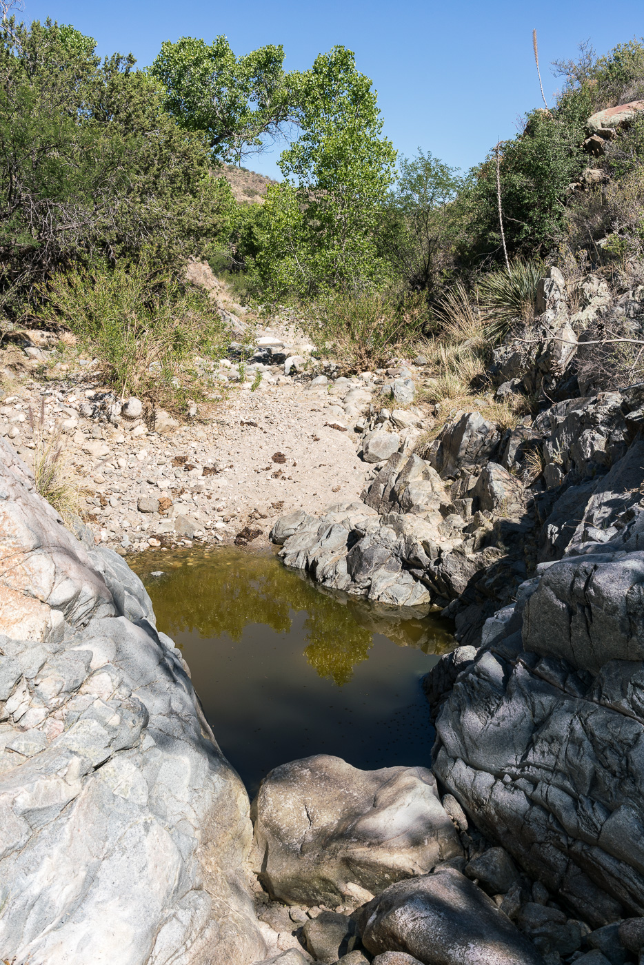
Flowing water in the Canada del Oro. May 2017.
The 2003 Aspen Fire reduced the CDO trail to an off-trail bushwhack. For years I would occasionally hear or read about epic hikes thru the area – you can get a hint of the dense obstacles that hikers found in some of Sirena’s pictures from 2011. But over the years both Forest Service crews and volunteers have worked on the trail and it has once again been tamed – not a wide perfectly groomed path by any means, but very reasonable – maybe even ‘easy’ – to find and follow!
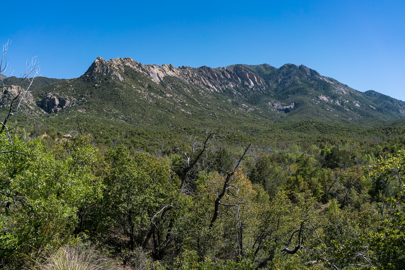
The Reef of Rock from the Red Ridge Trail – the large formations on the right side are referred to as the ‘Sea Gods’. May 2017.
From the CDO we take the Red Ridge Trail – it follows the East Fork of the CDO to the base of Red Ridge where we rest before climbing thousands of feet up back to the Red Ridge Trailhead.
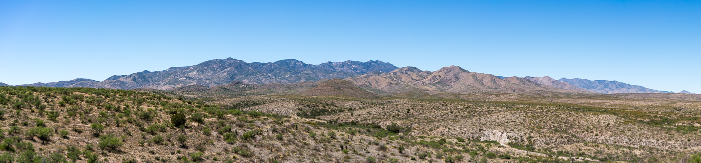
A view of the Santa Catalina Mountains from FR4407 Brush Corral Road. April 2017.
Back to the Brush Corral area! Unlike my last trip into the area the goal wasn’t a long hike on the Brush Corral Trail – but instead just a chance to explore a little.
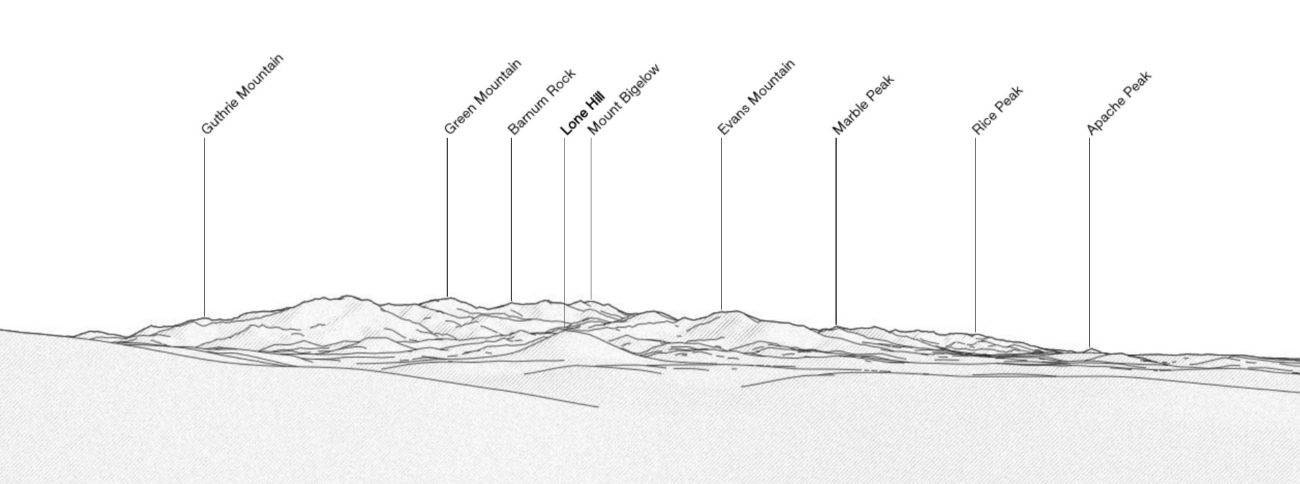
There are some great views from Brush Corral Road (FR4407) – the edge to edge view (above) of the Santa Catalina Mountains is amazing – familiar peaks are labeled below in a reference image from PeakFinder.org (note that this is showing the USGS Guthrie Mountain rather than the peak at the end of the Brush Corral - Cedar Spring, Georges Spring, Pearsons Spring - 4/30/2017).
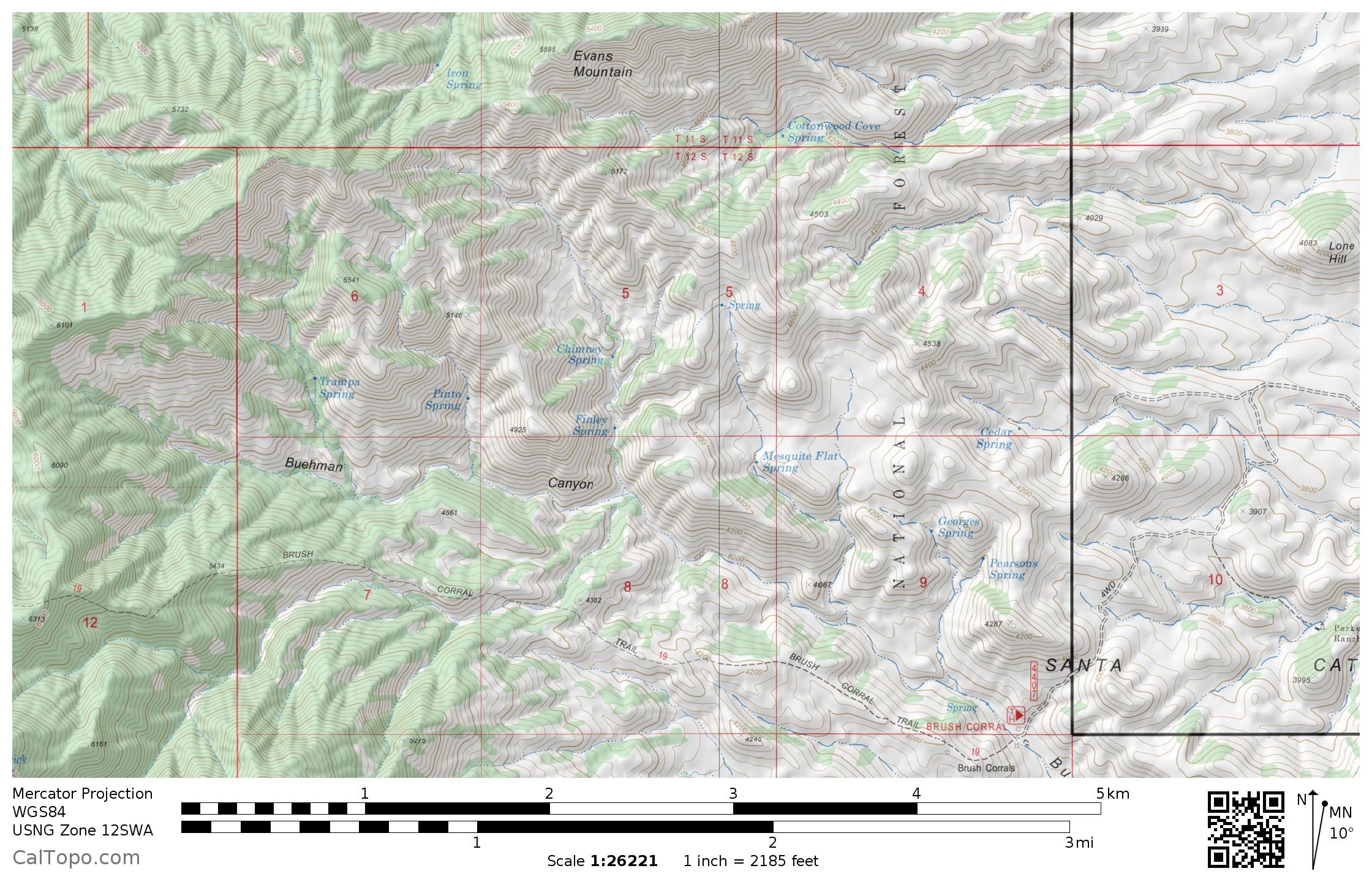
Hopeful curiosity and extreme skepticism and his a fair description of how I feel about blue marks on the maps of Southern Arizona. The area south of Evans Mountain down to Buehman Canyon has 11 springs marked on the map – an interesting concentration, I wonder how many of them still flow…
The area between Evans Mountain and Buehman Canyon has 11 marked springs. May 2017.
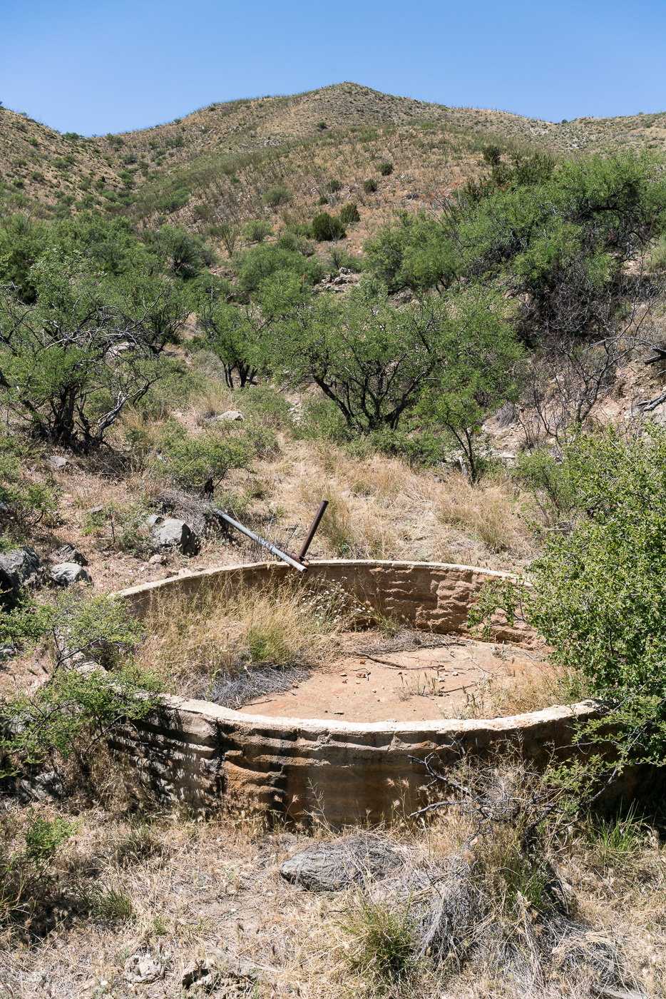
From a ridge-top camp west of Brush Corral Road I drop down into a a dry wash, crawl under barbed wire fence at the forest boundary and quickly find a dry tank where Cedar Springs is marked on the map. Pipes run up canyon from the tank, but there is no sign of water where they seem to end.
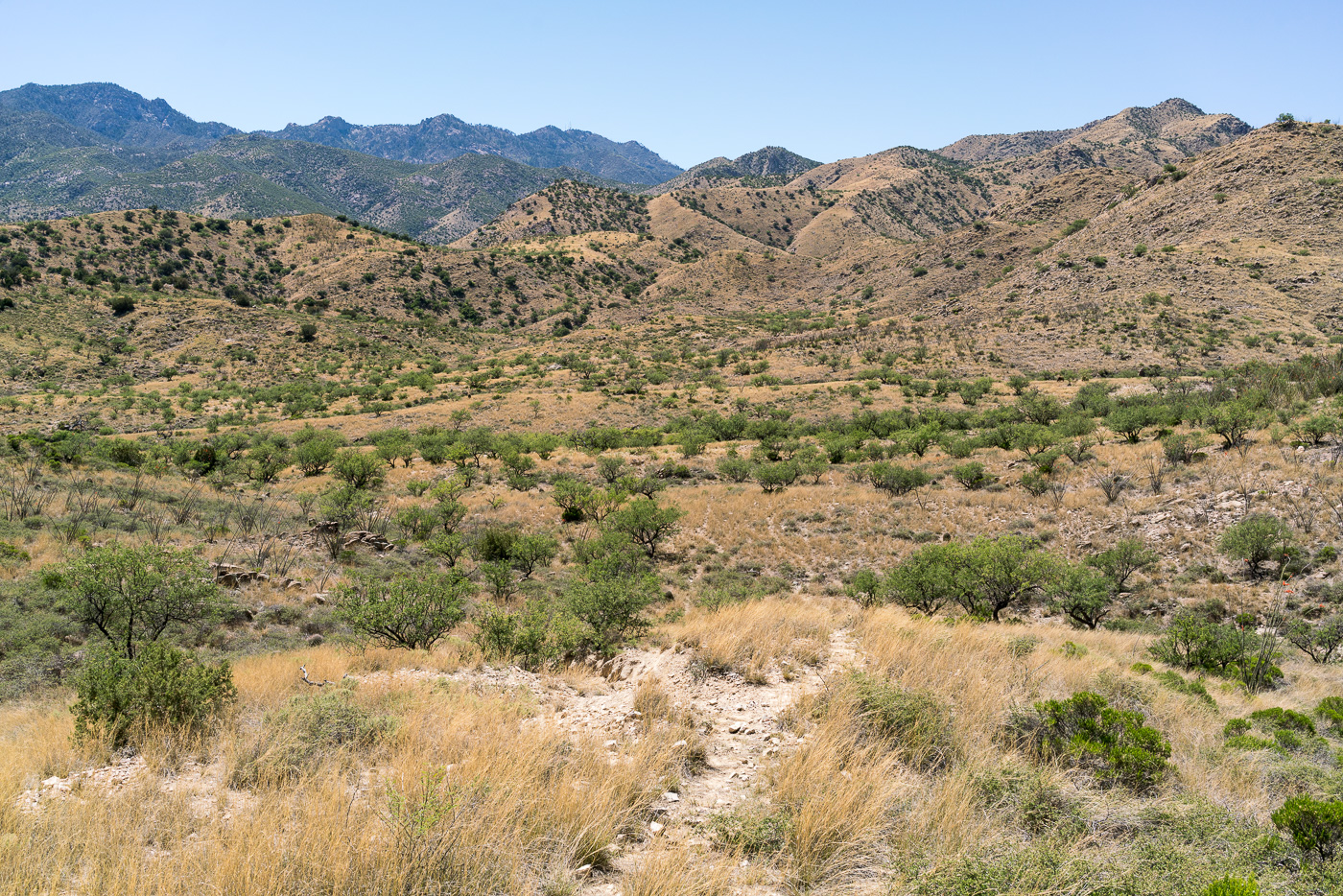
Cedar Spring Tank – dry… April 2017.Mesquite Flat, North of the Brush Corral Trailhead. April 2017.
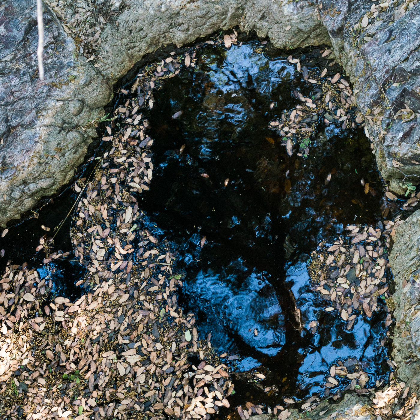
Around Mesquite Flat and over to the Georges Spring area – after finding Cedar Spring dry the number of pools of water in the area surprised me!
A beautiful pool in the Georges Spring area. April 2017.
From Georges Spring it was a short walk to Pearsons Spring – in its small side canyon the only sign of water was a single, small depression with damp sand at the bottom. Returning to the canyon just west of the Brush Corral Trailhead I don’t have to walk very far before both cows and small pools of water appeared in the canyon bottom. It looks like there was quite a bit more water in the canyon earlier in the year. The canyon merges seamlessly into Buehman Canyon a short distance above the Brush Corral Trailhead – from there it doesn’t take long to loop back to the start of my hike.
Water and cow manure in the canyon just west of the Brush Corral Trailhead. April 2017.
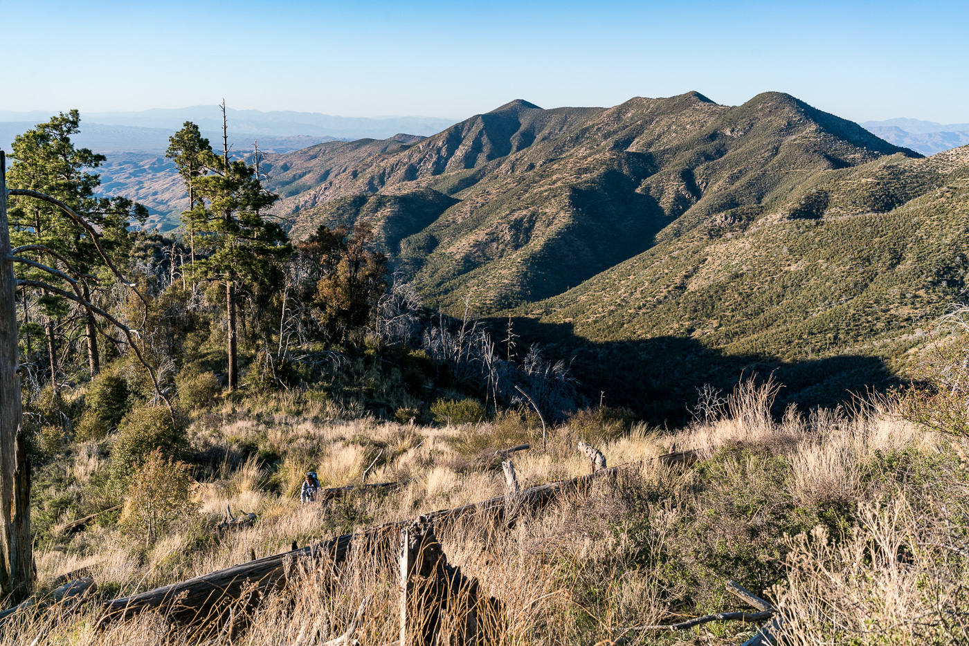
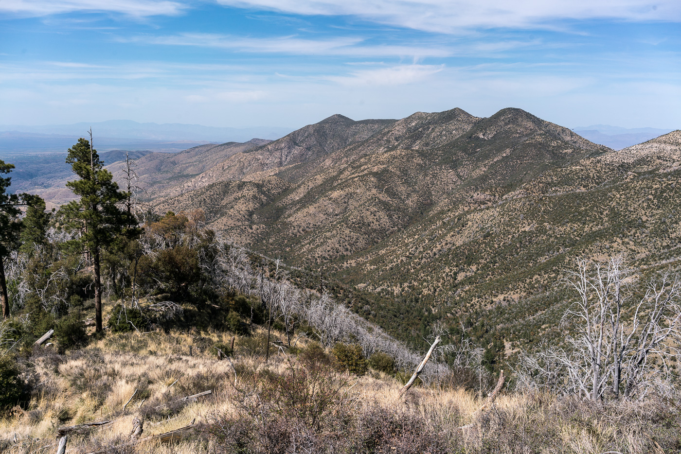
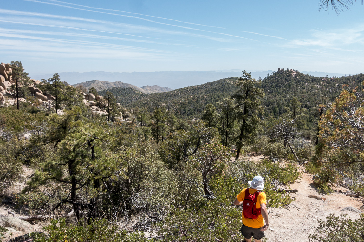
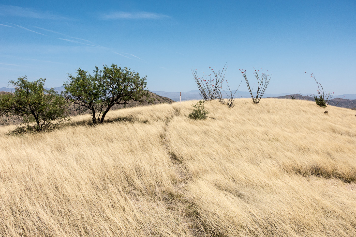
Oracle Ridge and Rice Peak from the Red Ridge Trail – the Catalina Camp Trail can be seen descending from Oracle Ridge towards its junction with the Red Ridge Trail. April 2017.
The Red Ridge Trail, Catalina Camp and Oracle Ridge Trail loop is one of my favorite hikes – and one of my favorites to recommend. I was lucky this month to be able to do the loop twice – once in each direction – and lucky to do it with many different friends who, I think, enjoyed seeing this area of the mountains.
1924, June 29, p. 13 – from the Arizona Daily Star:
The forest service is at present working on the construction of two very interesting trails … Red Ridge trail begins near the main ridge of the Catalinas that the highway crosses, and goes, as the name implies, over the ridges toward Oracle.
I wonder what the trail would have been like then – the stunning views of the Reef of Rock would be the same and with fewer visitors to the mountain in those days the trail was probably, like today, not heavily used. In the 1920s the top of the trail must have been covered in trees and it may have been impressively quiet – today the top of the ridge is largely open, cleared by the 2003 Aspen Fire, and noise from the General Hitchcock Highway is notable (the General Hitchcock Highway, not yet built in the 1920s, is larger, busier and faster than the ‘highway’ referred to in the quote above).
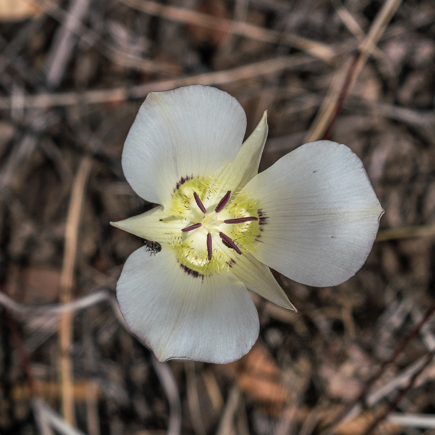
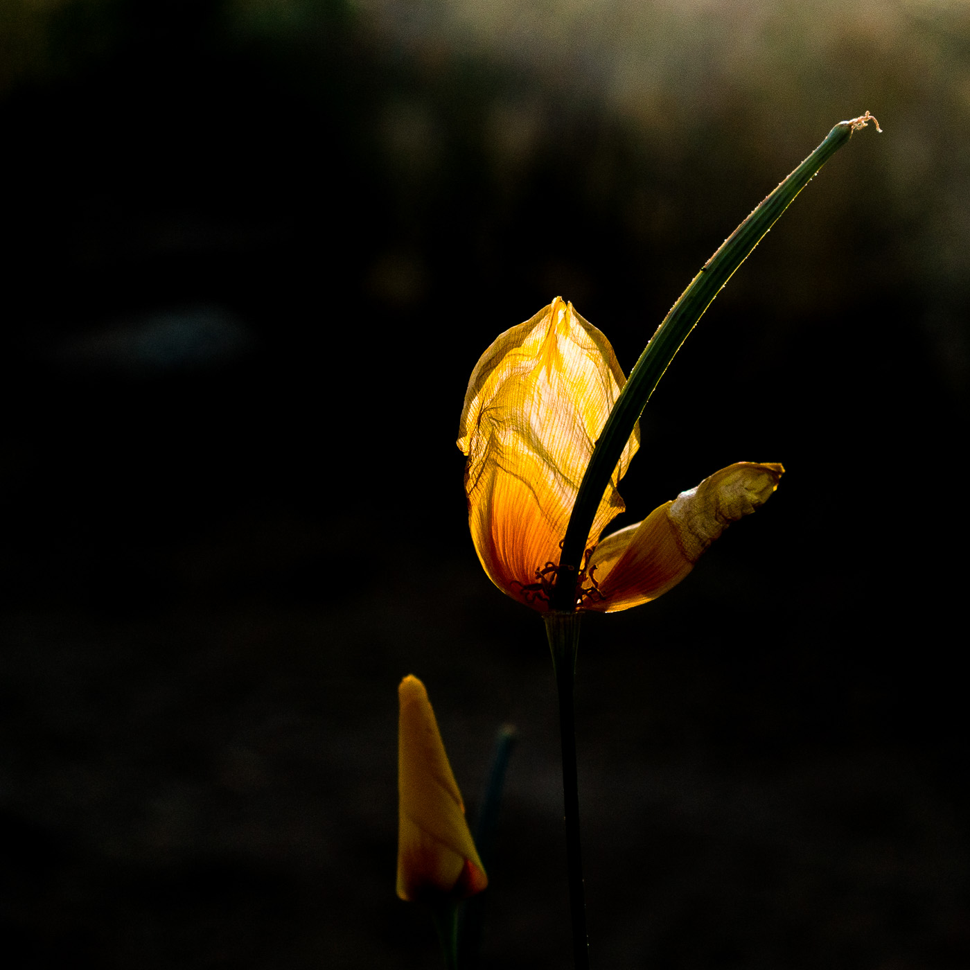
A Mariposa Lilly along the Red Ridge Trail – I wonder if they would have bloomed here when the trail was first constructed? April 2017.
A steep descent – past the edge of the Aspen Fire and into the oaks – takes you to the East Fork of the Canada del Oro. Water flows in this drainage most of the year, always a great spot to stop and enjoy.
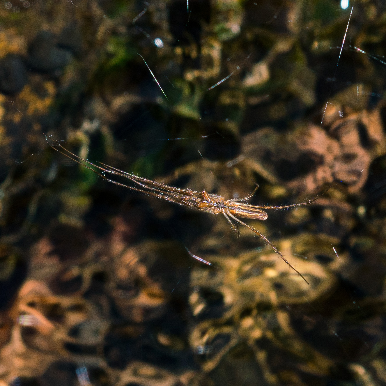
A spider hunting over the water in the East Fork of the Canada del Oro. April 2017.
The Red Ridge Trail crosses the East Fork of the CDO and quickly reaches a junction with the Catalina Camp Trail. The Red Ridge Trail continues west, chasing the East Fork down to the Canada del Oro – but this loop turns east onto the Catalina Camp Trail. The Catalina Camp Trail used to be the route of the Arizona Trail as it climbed out of the CDO and up to Oracle Ridge – today the AZT takes a kinder and more practical route straight onto the Oracle Ridge Trail from Summerhaven.
The reason I love this loop is the variety. Red Ridge is a wild place, violently burned in the Aspen Fire, with just a hint of the remoteness that some of the more distant sky islands offer. The Catalina Camp Trail is something altogether different – a few minutes from the junction buildings come into view – the address above one of the doors reads ‘One Park Place’.
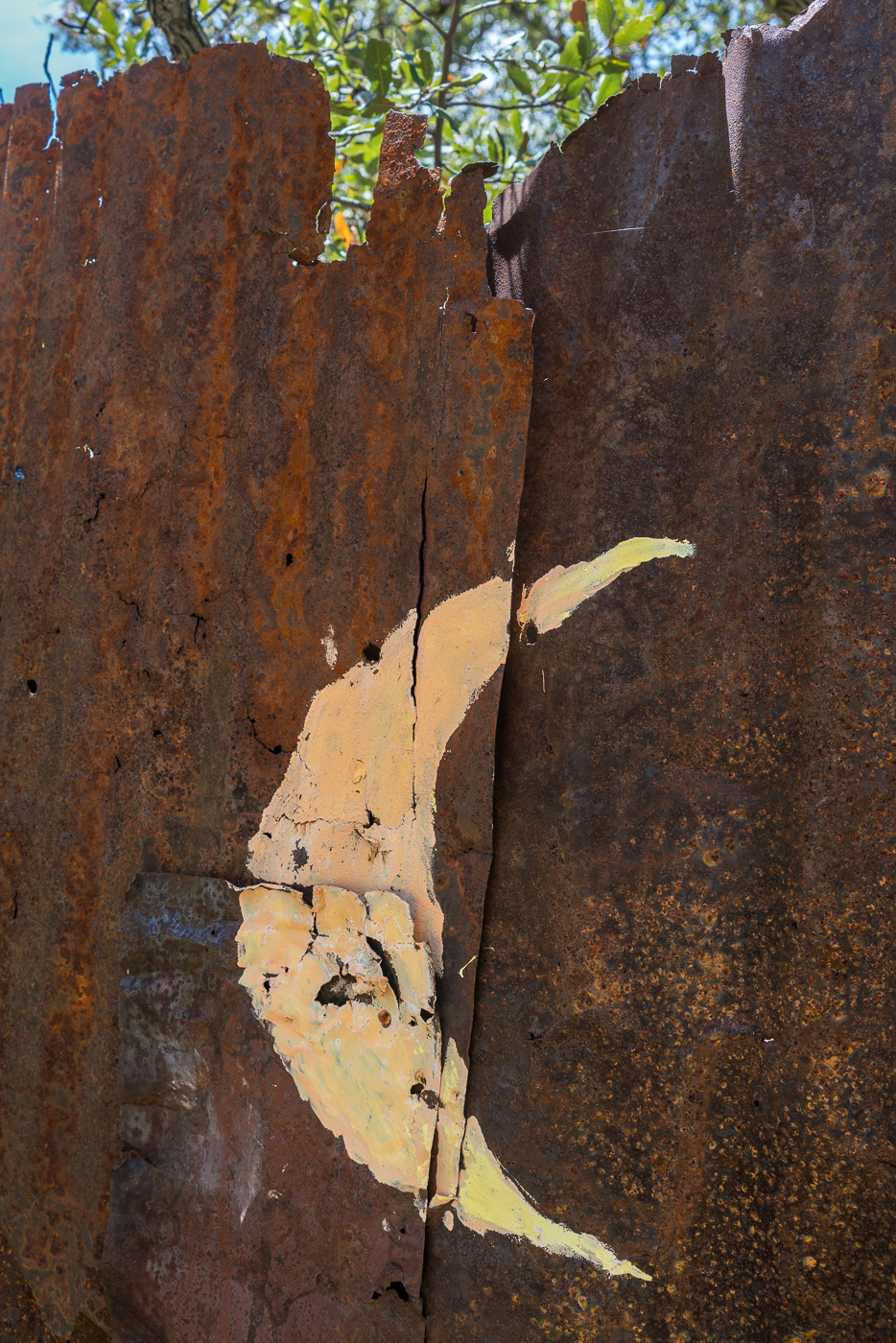
A moon on the old outhouse near 1 Park Place. April 2017.
These buildings seem out of place, but they are part of the long history of mining in the Santa Catalina Mountains that predates the construction of the Red Ridge Trail by many years – if you know where to look you can see old equipment rusting back into the earth, disappearing remains of old mining operations.
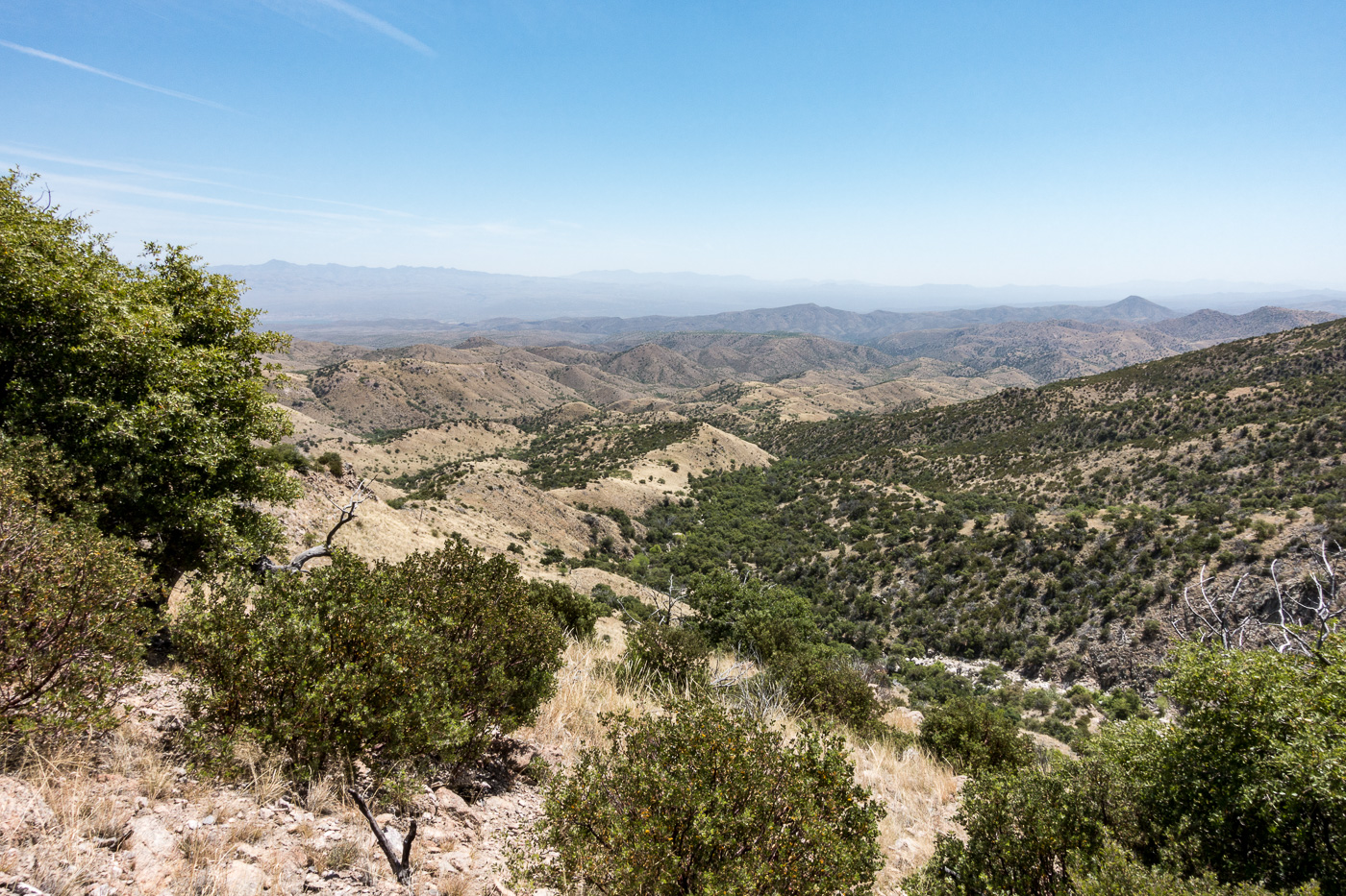
At Dan Saddle the Catalina Camp and Oracle Ridge Trails meet and this loop joins the current route of the Arizona Trail. The Oracle Ridge Trail between Dan Saddle and the Oracle Ridge Trailhead routes you on and off an old road with views of Marble Peak (a long-time mining area). This area has none of the wildness of Red Ridge – but what it adds to this loop is views of east side of the Santa Catalina Mountains and the San Pedro River Valley – a surprisingly remote area when you consider how close it seems on a map. If you travel out to the east side of the Santa Catalina Mountains it is rare to see other hikers these days – with good reason I suppose, it is an hour (or more) drive from Tucson to reach the start of the long 4wd roads that access the few existing trailheads. The area probably saw more use before the 2003 Bullock fire when the Davis Spring and Brush Corral Trails could still be followed down into the area – now those trails are just off-trail routes…
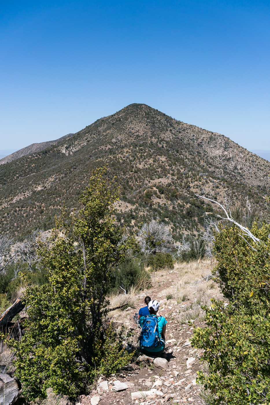
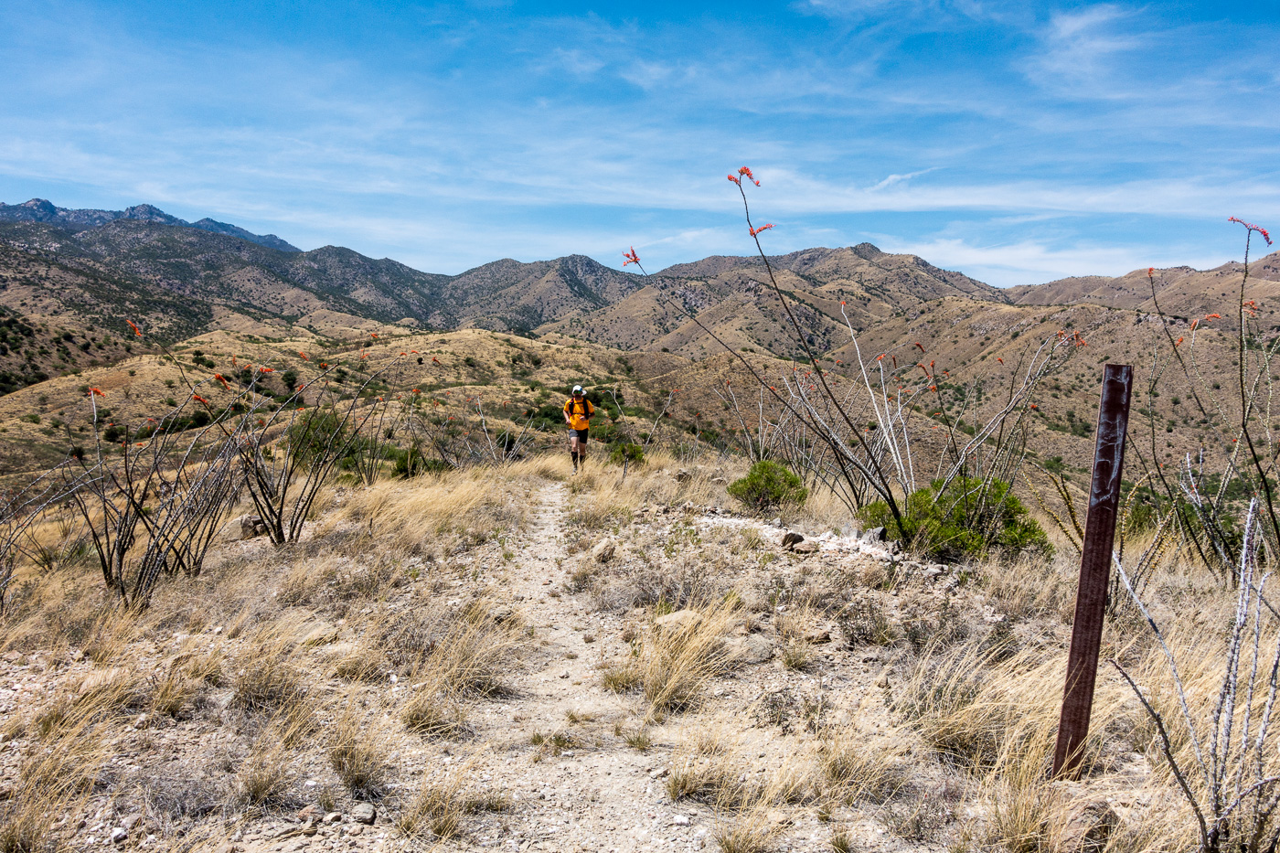
Dana and Traci taking a break and enjoying the view on the Oracle Ridge Trail. April 2017.
The Oracle Ridge Trailhead and Red Ridge Trailhead are close enough together that you can walk between them to start, or complete, the loop. Perhaps under-emphasized in the description above is that in addition to being about 9 miles long the loop has around 2800′ of elevation loss and gain, definitely worth considering before committing to this loop!
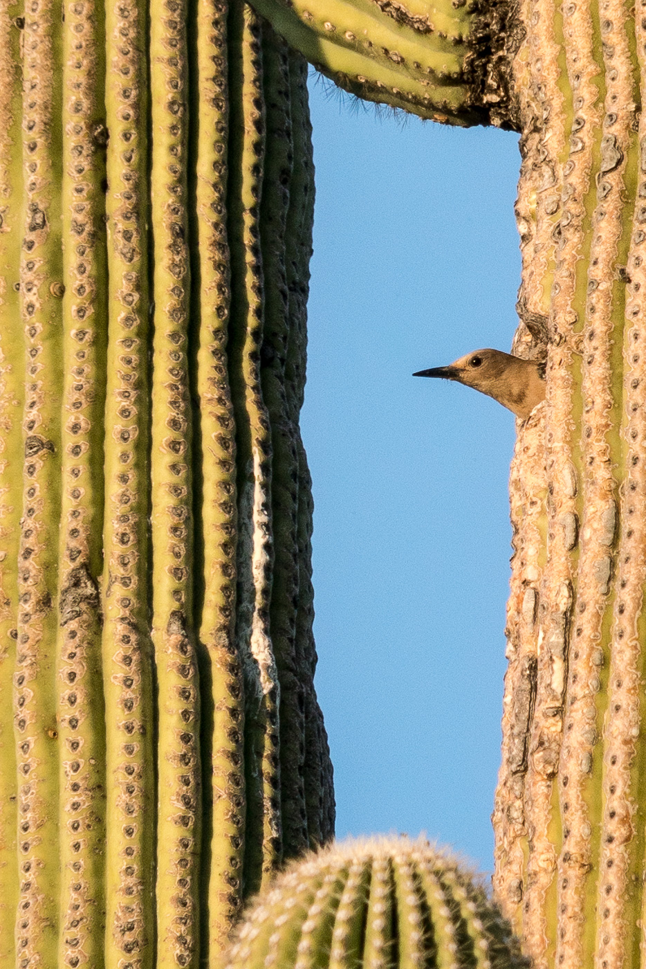
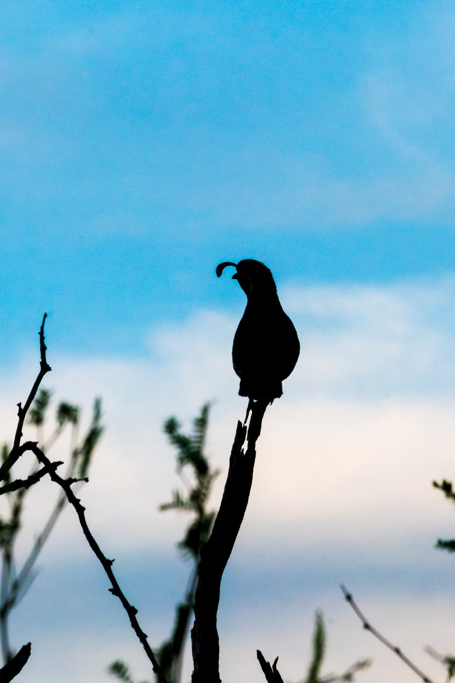
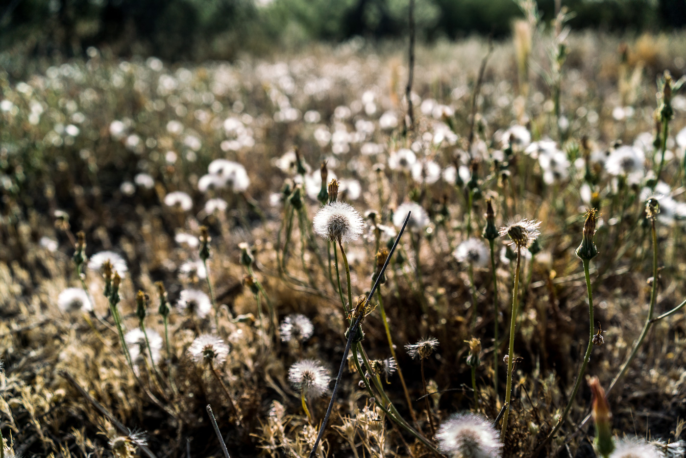
End of the season for this poppy in Catalina State Park. April 2017.Leaving the nest – the sounds of hungry young birds was a constant while we sat and watched the parent come and go. April 2017.A Gambel’s Quail perched and calling near the trail. April 2017.A field of puff balls in the sun. April 2017.
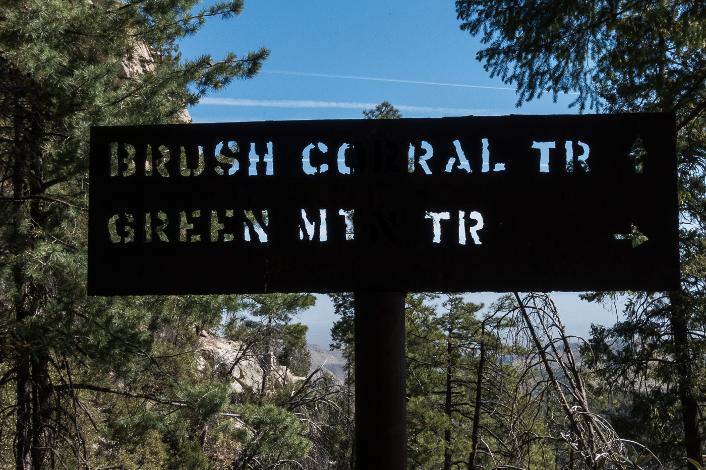
At the junction of the Brush Corral and Green Mountain Trails. April 2017.
In the early 20th century the Brush Corral area on the east side of the Santa Catalina Mountains featured a Ranger Station with a 3 room adobe building and a telephone connection up to Mount Lemmon. Today the area is just another indistinct flat along Buehman Canyon… Forest Road 4407 (Brush Corral Road) still allows high-clearance access into the area from Redington Road near the San Pedro River – but I would guess that the area saw more visitors in the the 1910s/1920s than it sees today.
I am not sure when the Forest Service began using Brush Corral on the east side of the Santa Catalina Mountains. It is absent from the 1904 Tucson topographic map and with a number of ranches and other Ranger Stations noted its omission seems notable. Jim Westfall – hired by the Forest Service in 1906 – and his wife Leeta were early residents, spending winters at Brush Corral after working on the mountain during the spring, summer and fall. Newspaper articles from 1911 and 1912 mention Brush Corral because it was on the route of a phone line being built from Tucson to Soldier Camp, down to Brush Corral and south to the Spud Rock Ranger Station in the Rincons. In a 1964 Arizona Daily Star article by Pete Cowgill Gilbert Sykes, a Forest Service employee after WWI, says “Brush Corral was used more as a camp with a guard stationed there two or three months of the year. The guard would work on grazing permits, timber sales and, of course, watch out for fires. But it was not a permanent ranger station like the one located, but not now used either, at Oracle”. The same article mentions that the cabin – possibly built about 1913 – was sold around 1925 and the timber removed.
Remains of the phoneline from the 1910s that came up from Tucson and over to the Brush Corral Ranger Station. April 2017.
Our ride dropped us at the Upper Green Mountain Trailhead, our destination was a vehicle we had dropped on FR4407 the previous day – it had been hours of driving to drop a vehicle, but it made our hike much simpler – no need to worry about the time needed to climb back up the mountain, carry overnight gear or make an uncomfortably hot walk out on Redington Road.
The Brush Corral Trail was described in the first three editions of the The Santa Catalina Mountains, A Guide to the Trails and Routes as “fair to very poor” and, after extensive work by the Southern Arizona Hiking Club in the late 1980s, was upgraded to “fair to good” in the 1990s. But those descriptions are pre-2002-Bulllock Fire… There are two notable posts online about this trail from after the Bullock Fire – Scott Morris’s ‘Brush Corral Epic’ from 2004 and Sirena Dufault’s ‘Brush Corral Trail’ from 2010. We knew from those posts, and a hike I made in 2013, that it would probably be difficult, or impossible, to find all of the trail – our planning left a comfortable amount of time for traveling at an off-trail-didn’t-pick-the-best-way-thru-the-manzanita-are-we-on-the-right-ridge kind of pace…
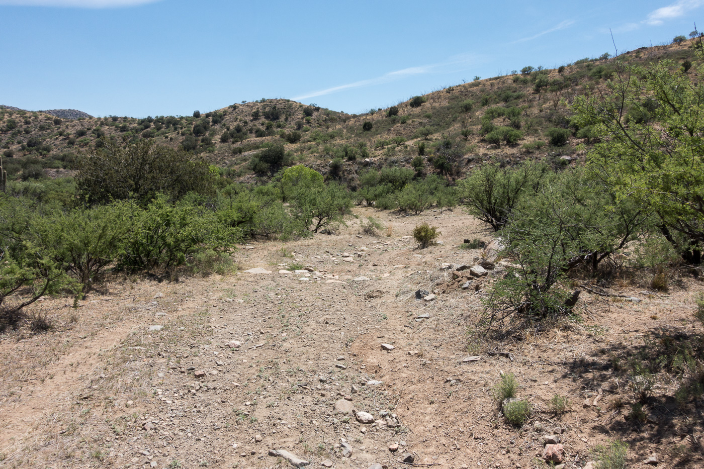
Running an upper section of the trail – the Brush Corral Trail is easy to follow and in decent shape down the junction with the Brush Corral Shortcut Trail. April 2017.
We quickly reached the Brush Corral Trail’s junction with the Green Mountain Trail and started the descent to the junction with the Brush Corral Shortcut Trail – this section of trail is still in decent condition and is easy to follow. Below the junction with the Brush Corral Shortcut Trail the trail immediately becomes overgrown and interrupted by fallen trees, but it was still easy to follow until – at an old metal trail marker – the trail emerged from the trees and became an off-trail ‘route’.
A metal trail marker – it was encouraging to see this, but beyond this point the ‘trail’ was distinctly harder to find. April 2017.Looking down on the ridges that the Brush Corral Route follows. April 2017.
We found stretches of the old trail, and cairns sometimes helped us stay on course – but in sections we just wandered across the ridges, perhaps we could have found more of the old trail but the terrain was not particularly difficult off-trail walking and rather than hunt for the old track it seemed more interesting to just keep moving forward.
A rather alarming note – ‘Jim – 1PM’ – next to a small cairn – if anyone knows the story on this I would love to hear it… April 2017.
The biggest surprise of the hike may have been finding water when we crossed a small canyon – we had planned on the route being dry and it was nice surprise to find water to soak my shirt and hat with – we were thousands of feet lower than when we started and it was getting hot, the edge of the season for this part of the mountain I think.
Water in a canyon along the Brush Corral Trail. April 2017.An obvious section of trail across a grassy ridge – brown carsonite posts like the one at the top of this hill mark the lower part of the trail. April 2017.
From the crossing we quickly found the brown trail markers mentioned in other reports and the trail became relatively easy to follow thru the grass and across the ridges. We took advantage of the good trail and ran the final mile+ down to the Brush Corral site before making the hike up the road back to our ride home.
Richard running the bottom section of the trail – Mount Bigelow in the background – the trail close to the trailhead is in decent shape – brown carsonite posts mark the way. April 2017.FR4407 coming to an end at the Brush Corral area. April 2017.
Newspaper articles that reference the Brush Corral Trail that I used for this post:
Arizona Daily Star, 8/24/1911, p. 5, Forestry Will Have Its Own Telephones
Arizona Daily Star, 10/10/1912, p. 8, Brevities
Arizona Daily Star, 11/6/1912, p. 8, Telephones Arrive For Mt. Lemmon Line
Arizona Daily Star, 12/6/1912, p. 8, Government Installs New Telephones
Arizona Daily Star, 3/22/1964, p 55, Pete Cowgill, Hike Up To Brush Corrall Is For Experienced Hikers
Arizona Daily Star, 11/8/1984, p. 51, Pete Cowgill, Old Ranger Station is Just a Memory
Arizona Daily Star, 11/17, 1989, p. 41, Pete Cowgill, Hiking club dug in for Brush Corral Trail