Snippets from lower Edgar Canyon – I wish I knew more, maybe one day I will…
Arizona Daily Star, May 14, 1965, Section A, Page 11:
O. R. (Ope) Parker, one of a noted Southern Arizona trio of brothers, died yesterday. He was 75 years old. … Mr. Parker was a native of Abilene, Tex., and became the owner of the Bar-6 ranch here. He came to Tucson in 1919.
Sycamores and Saguaros in Edgar Canyon. January 2018.
Arizona Daily Star, January 11, 2015, Obituaries, C5:
Shortly after his arrival home, his father laughing and crying, told him there was just so much land, and too many cows, and “one of us has to leave, and I’m staying”. From this point on, Joe was branched out on his own. He first leased land along the present Tangerine Road from George Pusch, then went on to buy a square mile of flood plain on Brawley Wash, “Santa Patricia”. Next he purchased Cactus Hill west of Winkleman, followed by Ope Parker’s 6-ranch west of Redington.
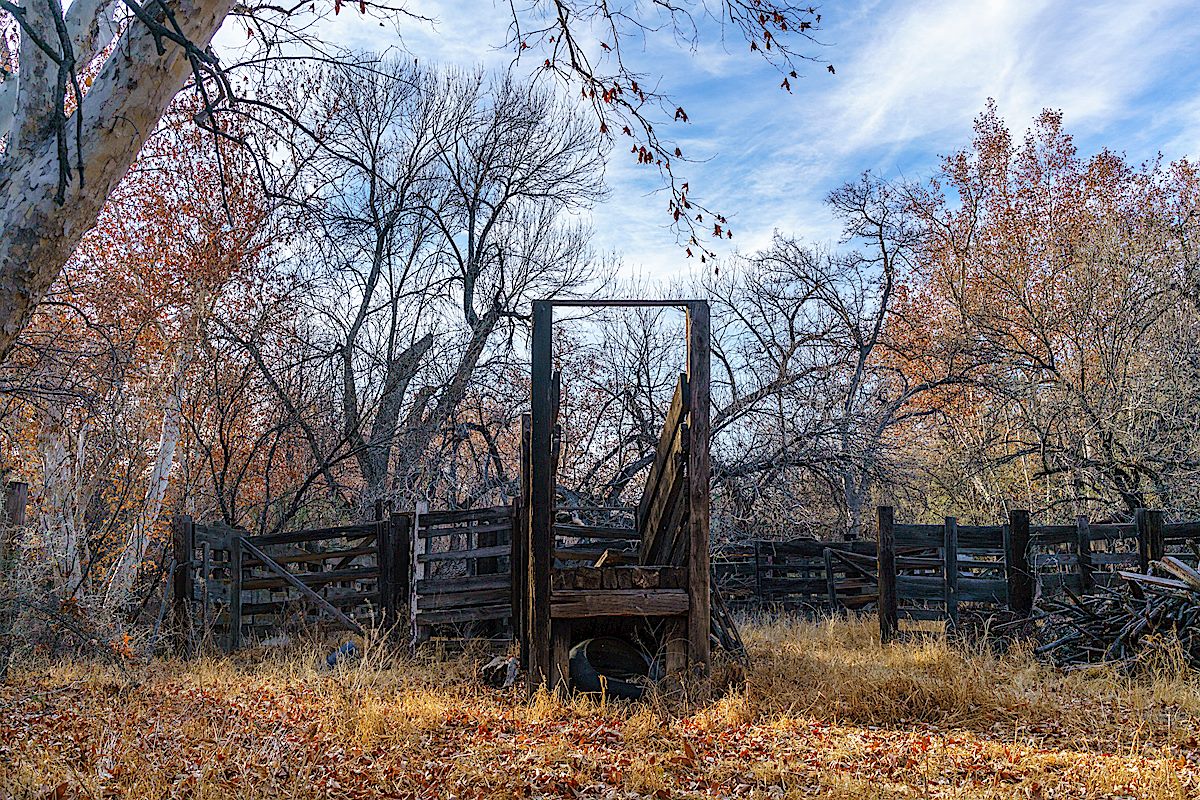
Old cattle chute and fall leaves in Edgar Canyon. January 2018.
Pima County has bought its sixth ranch using voter-approved open-space bonds: the Six-Bar Ranch in the San Pedro River Valley northeast of Tucson, for $11.6 million.
Joe Goff, who has owned the 3,300-acre spread for 50 years, agreed to sell to the county after a private party approached him with an offer that could have led to the construction of 36-acre ranchettes, said the leader of a land trust that helped negotiate the county purchase.
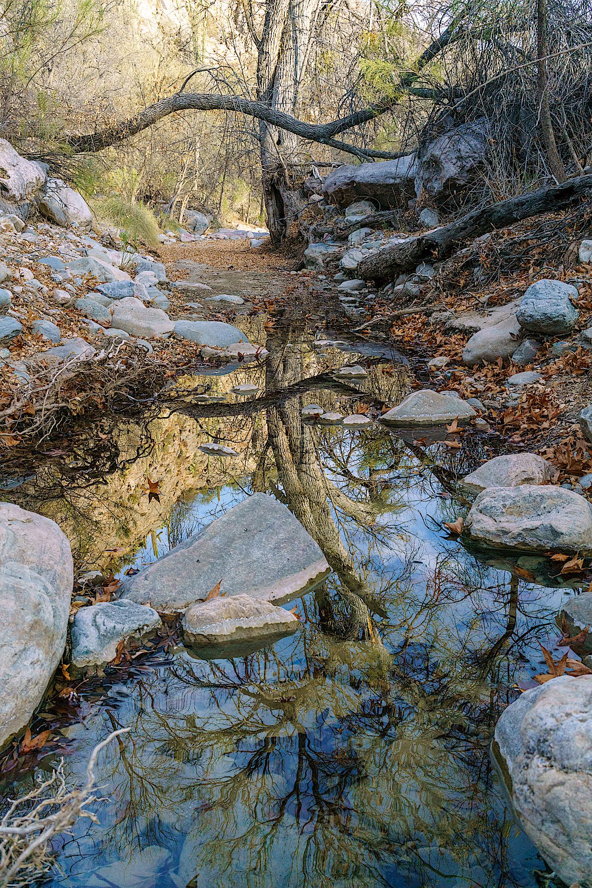
A reflection at the end of the surface water below the spring in Edgar Canyon. January 2018.
The rocks look like maps – they remind me of the shape of the San Pedro River and of the brutal line that the SunZia project may cut thru this landscape. On four different days I explored the canyons under, and terrain around, the proposed SunZia route – from the north edge of Buehman Canyon, across the hills to Edgar Canyon and up to the Brush Corral Road.
In Buehman Canyon – looking up at the sky – the lines of the SunZia project may one day interrupt this view. February 2018.
Recent rains must have filled Buehman Canyon with water – there is wall to wall slippery mud and debris pressed against the tree trunks. I suppose the power lines hanging overhead won’t change the canyon much, but there is an infinite difference between nothing and something.
Sitting on the south side of the Buehman Canyon the first stars of the evening appear over the SunZia route – towers on the canyon sides may eventually carry the transmission lines across Buehman Canyon – man-made shapes added to the dark silhouette of land below the stars.
First stars appearing – looking south across Buehman Canyon on the Proposed SunZia Route. February 2018.
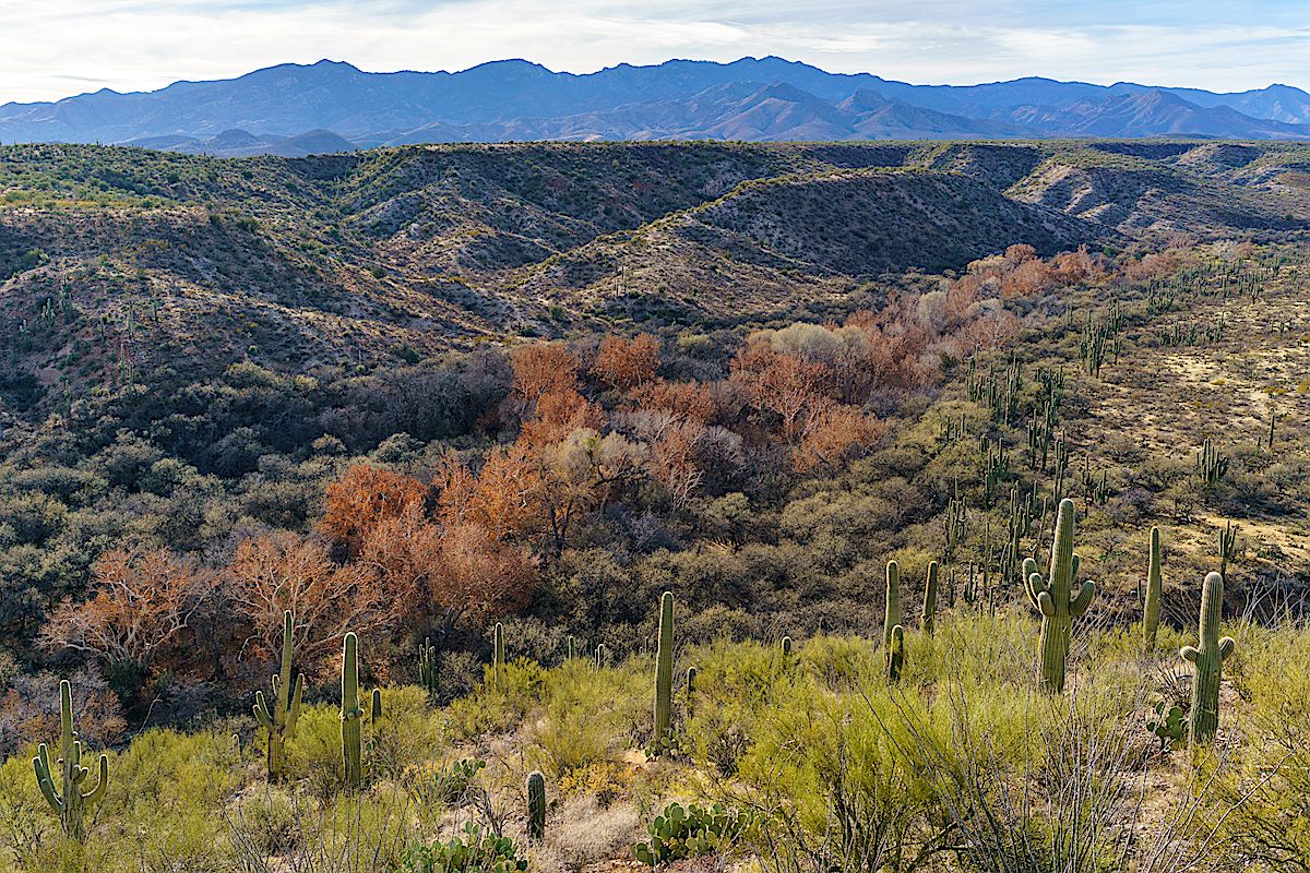
Early in the morning the milky way is low in the sky and frost covers my gear, a cold start quickly changes to a warm day hiking north thru the desert. The SunZia route crosses the Brush Corral Road and continues across hills and small washes towards Edgar Canyon, both the Santa Catalinas and Galiuros are visible. A long set of access roads will be cut into these hills to construct and maintain the lines.
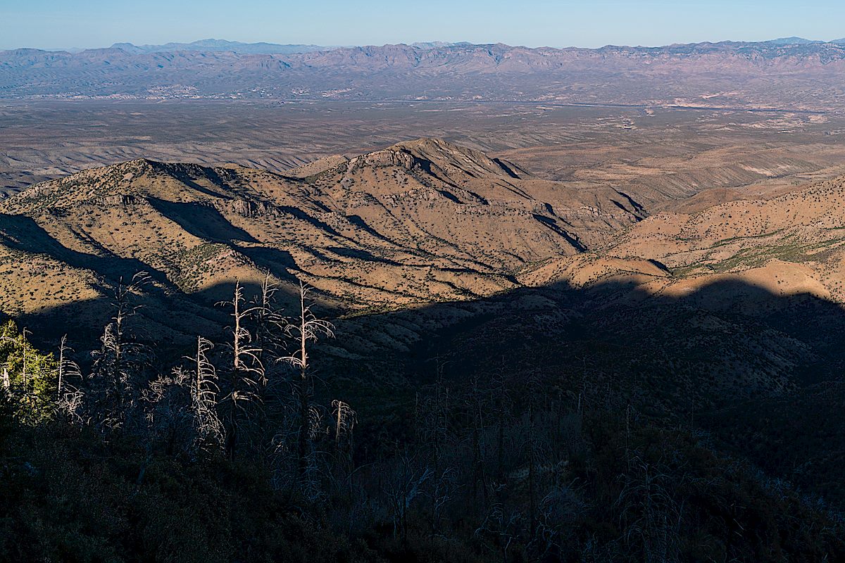
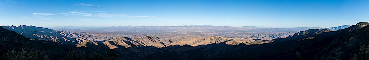
A panoramic view from the SunZia route with both the Santa Catalina Mountains (left) and Galiuros (right) in the distance. February 2018.Empty desert – walking north along the proposed SunZia route to the sourth side of Edgar Canyon. February 2018.Looking north across Edgar Canyon on the proposed SunZia route. February 2018.Sky above Edgar Canyon along the proposed SunZia transmission line route. January 2018.
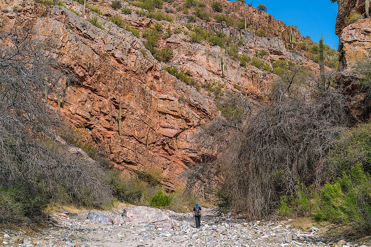
The lower section of Edgar Canyon is a surprise, more to explore, and more reason to come back, than I had guessed – like Buehman Canyon there aren’t towers or new access roads in the canyon bottom – ‘just’ a line imprisoning the sky. From the edge of Edgar Canyon the line follows hills and washes to the Davis Mesa Road.
An abandoned tank south of the Brush Corral Road near the proposed SunZia route. January 2018.Sunzia Route Crossing the Davis Mesa Road with the Galiuros in the background. January 2018.
It is sad to think about the changes coming to this landscape – I read Chris Townsend’s Thoughts on the Conservation and Restoration of Nature in Scotland while working on images for this post and found it encouraging and relevant – I am not familiar with the places and organizations in his post, but I suspect the subject will be immediately familiar regardless of your location:
Whilst the Gleann nam Fiadh track is depressing there is much that is positive in the conservation and restoration of nature in the Scottish hills and elsewhere in Britain. Not enough certainly but looking at what is being done can counter the feelings of despair when more damage occurs. It can also encourage a desire to help protect what is left and restore what we can. Public pressure is what counts here. I doubt many politicians would do much without it (there are a few who would, perhaps). It’s easy to think that one person can’t do anything and that signing petitions, sharing and commenting on posts on social media, and writing to representatives achieves nothing. However any effect from these actions is cumulative. If enough people take part then sometimes a momentum can build towards something happening. The alternative is to give up.
The proposed SunZia route from Buehman to Edgar Canyon – 12 towers (yellow dots), miles or new roads plowing thru the desert (red lines), 4 days of exploring the area (blue lines). March 2018.
The Cascabel Working Group’s SunZia Page has some current status information from the project and a link to a history of the group’s work “Helping the SunZia transmission line project to understand that the environmentally unique San Pedro River Valley is NOT a viable location for a major powerline corridor.”
Looking down into Edgar Canyon and over to the Davis Spring Trailhead. February 2018.
Point 7556 is a short distance from the Knagge Trail – no trail, but easy enough to get to. I can’t remember having walked out to it before, no idea why not, but I guess with so many places to explore…
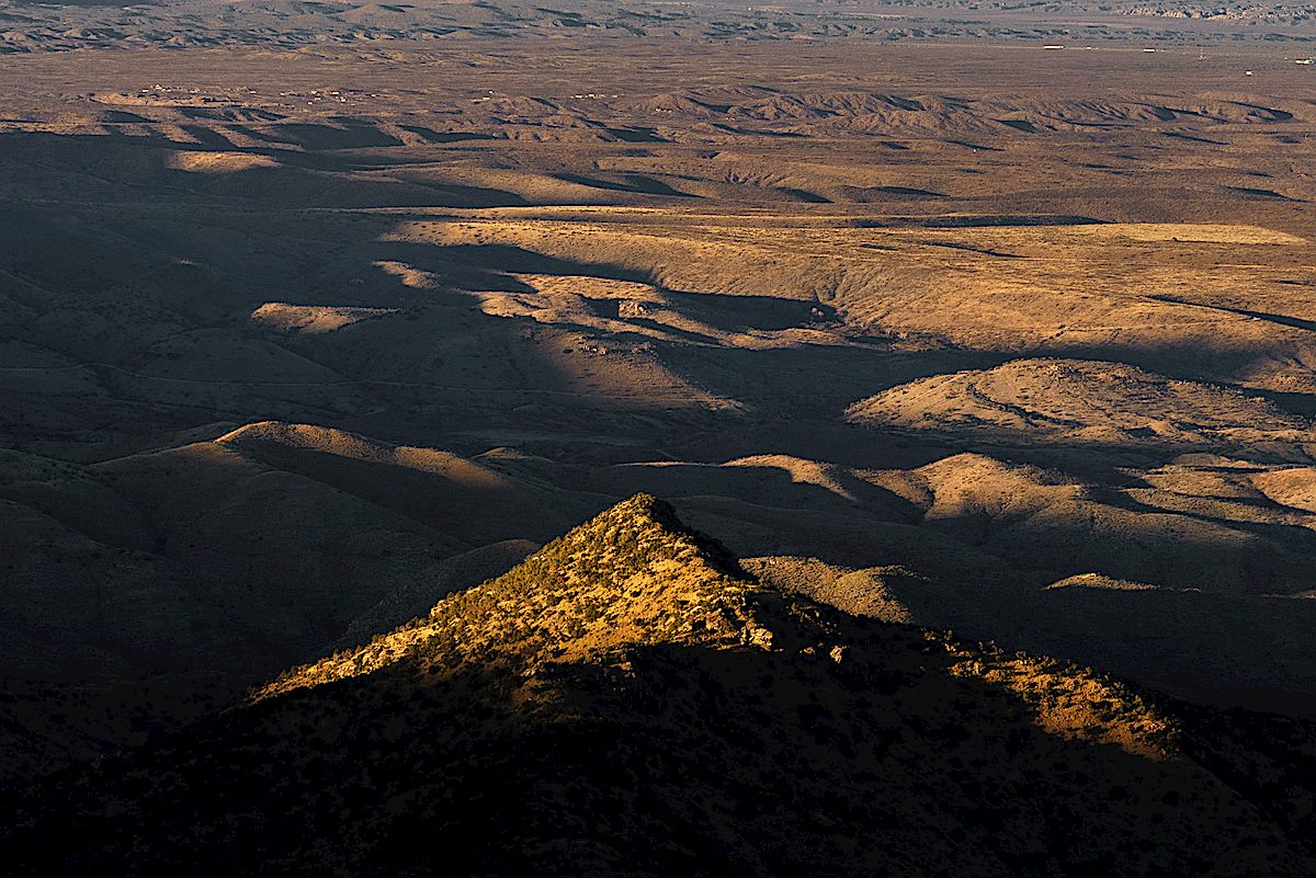
In a way it might be better that I overlooked it until now. Years ago the views would have been just as spectacular – a sweeping view down into the San Pedro River Valley and across to distant mountain ranges, east side canyons and rolling hills folding the landscape – but looking down now, after having spent more time in recent years exploring the east side of the Santa Catalina Mountains, is more interesting, and more personal, than it used to be.
A small peak in the sunset light from Point 7556. February 2018.A huge view down into and across the San Pedro River Valley from Point 7556 off the Knagge Trail. February 2018.Guthrie Mountain from Point 7556. February 2018.
Looking down into the clouds from the top of the Knagge Trail. February 2018.
Clouds cover the mountain, small waterfalls decorate highway road cuts and on the trail every small drainage is flowing – the variety on the mountain is infinite, what an interesting day to be on the Knagge ‘Trail’!
The Knagge Trail is still drawn onto maps of Santa Catalina Mountains, but like the Davis Spring and Brush Corral Trails, it disappears long before reaching it’s eastern terminus. You can, of course, still make your way down to the junction of the Knagge Trail and the Davis Spring Trail in Edgar Canyon, and even find occasional convincing pieces of old trails, but at this point it is an off-trail adventure.
In addition to their homestead and the pack train, The Knagges worked a mining claim in the Catalinas. It was located on the east side of Kellogg Mountain. From around 1916 into the 1930’s, the family spent time at the claim during the summer under very rustic conditions. A simple cabin provided shelter and a spring supplied them with fresh water. On occasion, a mountain lion stalked the camp, lured by their horses and burros.
Mine below the cabin – first time I have seen water flowing here! February 2018.A distant waterfall thru the clouds. February 2018.