Brush Corral – Cedar Spring, Georges Spring, Pearsons Spring – 4/30/2017

A view of the Santa Catalina Mountains from FR4407 Brush Corral Road. April 2017.

Back to the Brush Corral area! Unlike my last trip into the area the goal wasn’t a long hike on the Brush Corral Trail – but instead just a chance to explore a little.

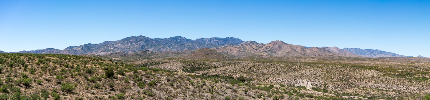
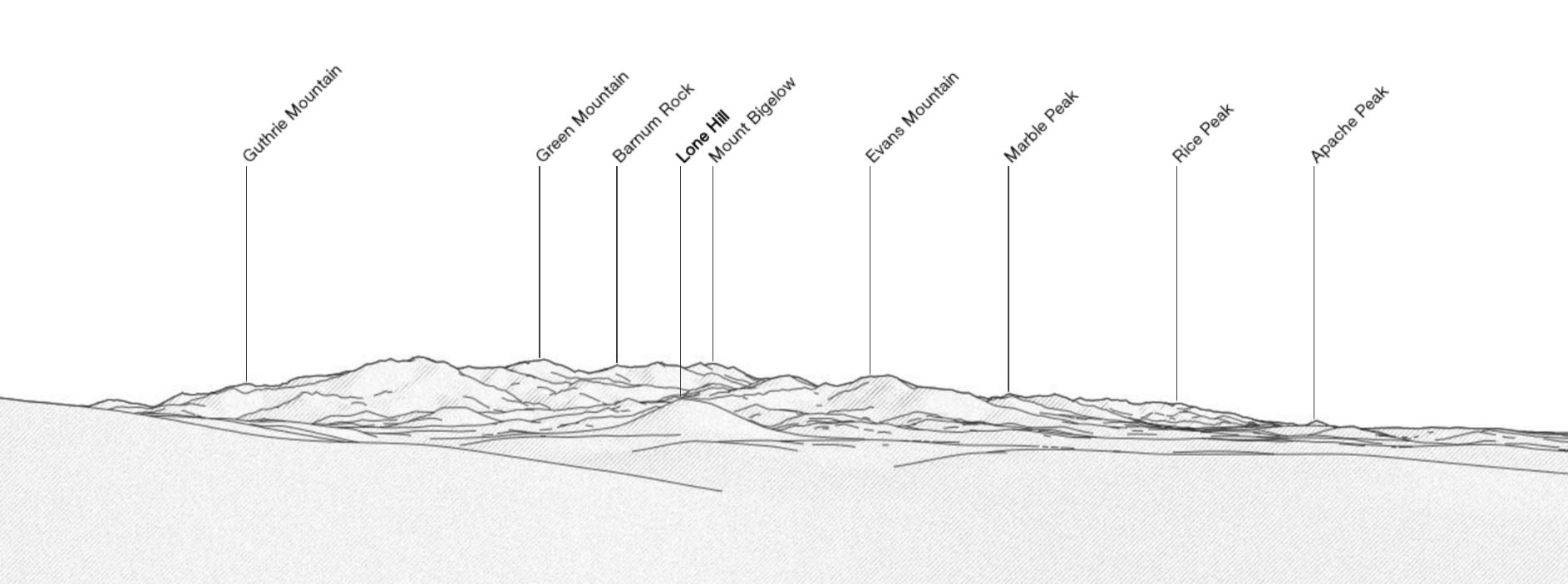
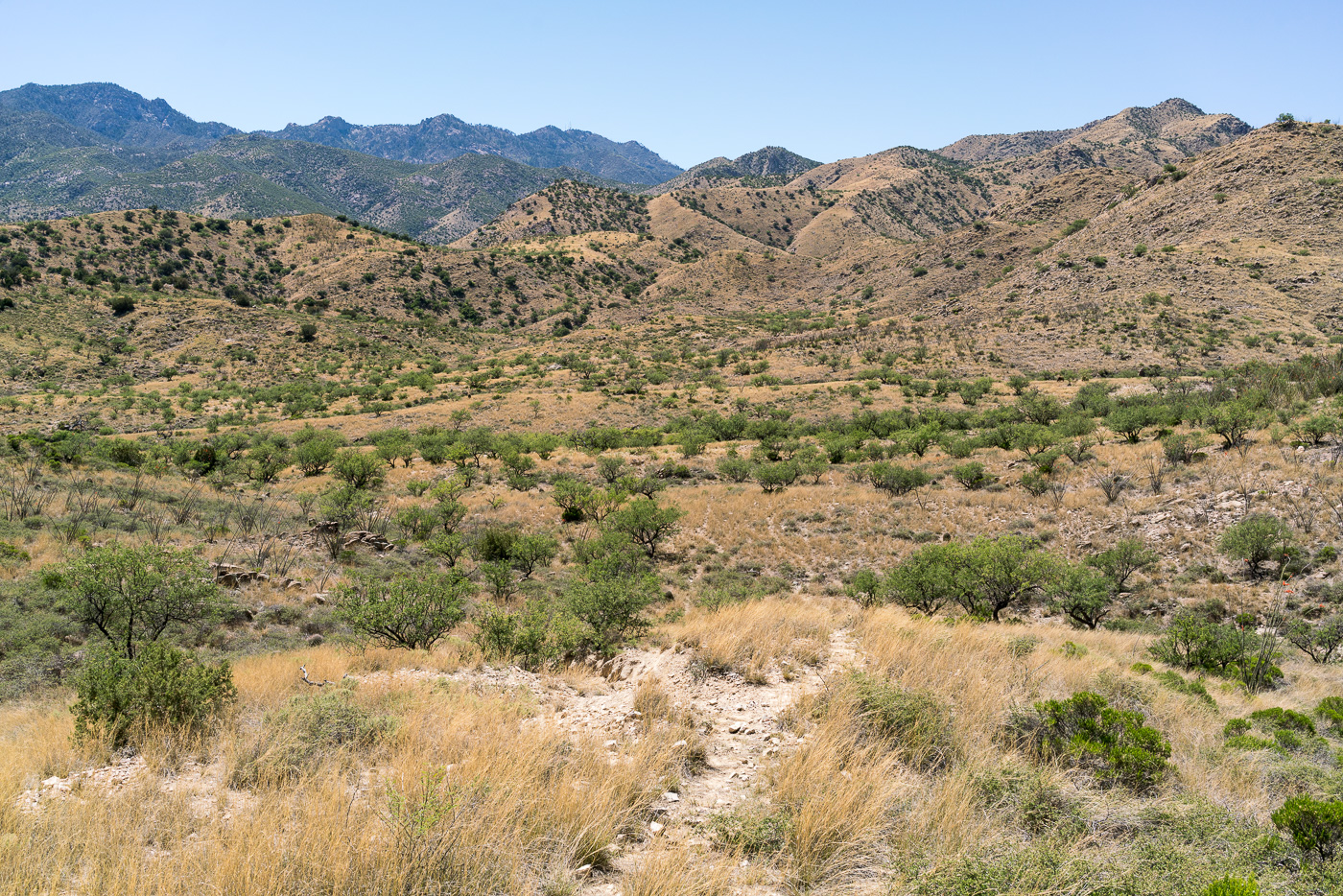
There are some great views from Brush Corral Road (FR4407) – the edge to edge view (above) of the Santa Catalina Mountains is amazing – familiar peaks are labeled below in a reference image from PeakFinder.org (note that this is showing the USGS Guthrie Mountain rather than the peak at the end of the Brush Corral - Cedar Spring, Georges Spring, Pearsons Spring - 4/30/2017).

A view from the PeakFinder web application - www.peakfinder.org - showing the peaks in the panorama above. May 2017.
A view from the PeakFinder web applicationshowing the peaks in the panorama above. May 2017.

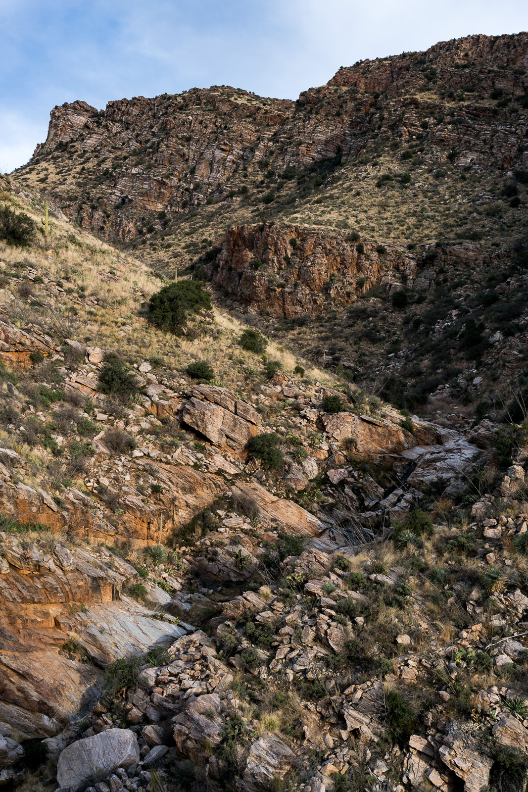
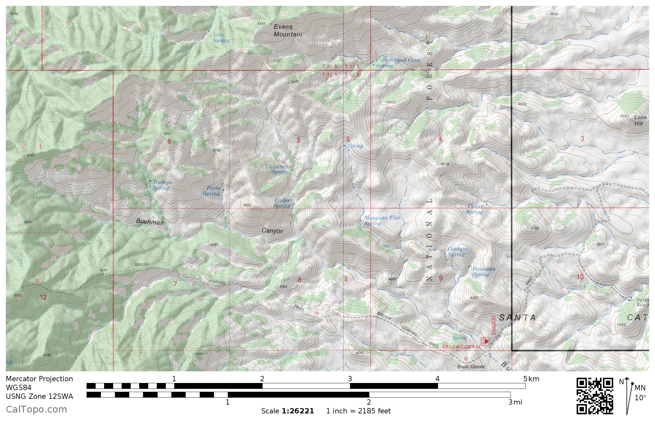
Hopeful curiosity and extreme skepticism and his a fair description of how I feel about blue marks on the maps of Southern Arizona. The area south of Evans Mountain down to Buehman Canyon has 11 springs marked on the map – an interesting concentration, I wonder how many of them still flow…

The area between Evans Mountain and Buehman Canyon has 11 marked springs. May 2017.

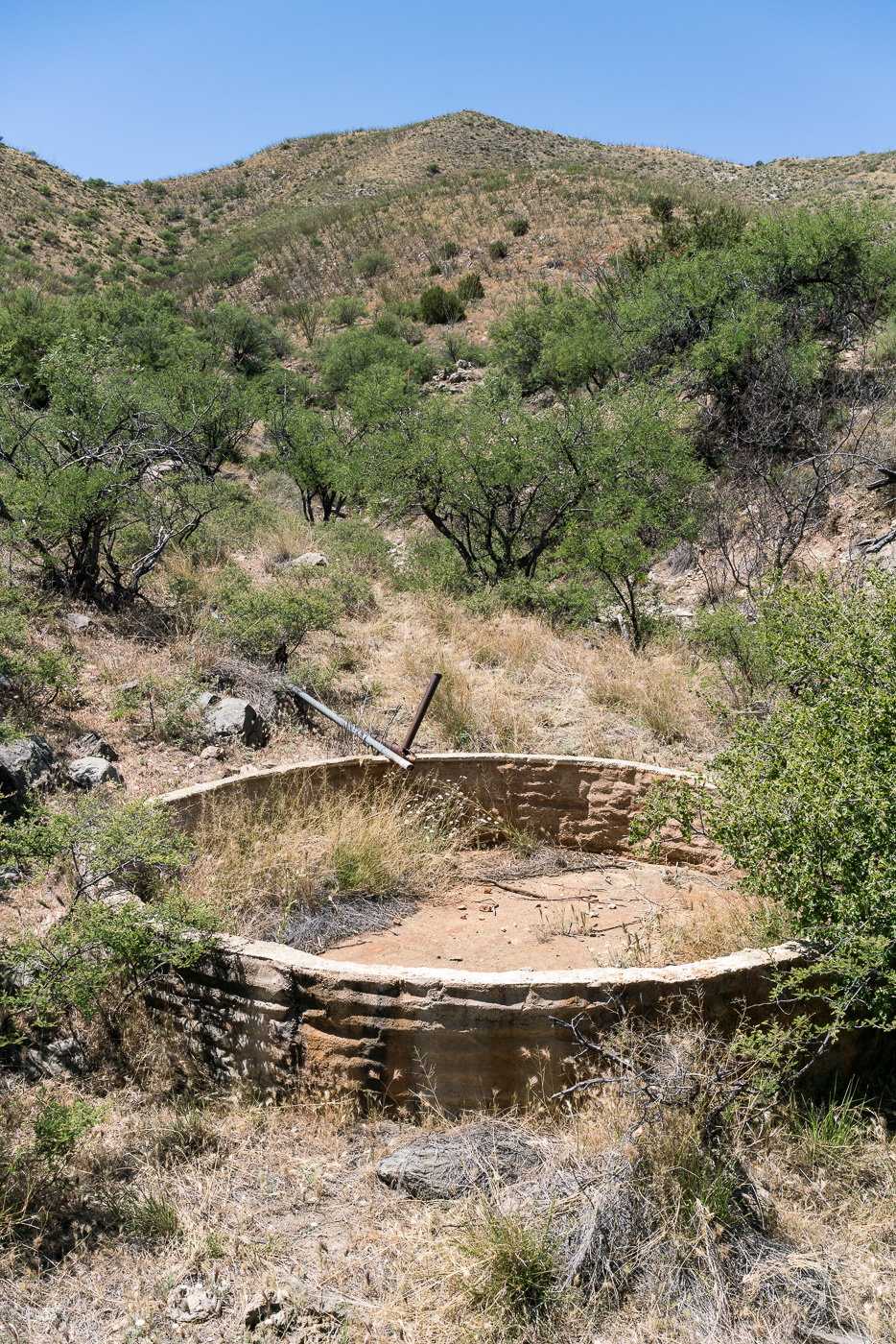
From a ridge-top camp west of Brush Corral Road I drop down into a a dry wash, crawl under barbed wire fence at the forest boundary and quickly find a dry tank where Cedar Springs is marked on the map. Pipes run up canyon from the tank, but there is no sign of water where they seem to end.

Cedar Spring Tank - dry... April 2017.
Cedar Spring Tank – dry… April 2017.
Mesquite Flat, North of the Brush Corral Trailhead. April 2017.

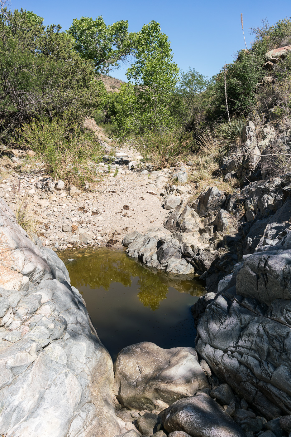
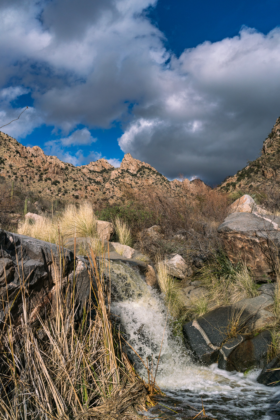
Around Mesquite Flat and over to the Georges Spring area – after finding Cedar Spring dry the number of pools of water in the area surprised me!

A beautiful pool in the Georges Spring area. April 2017.

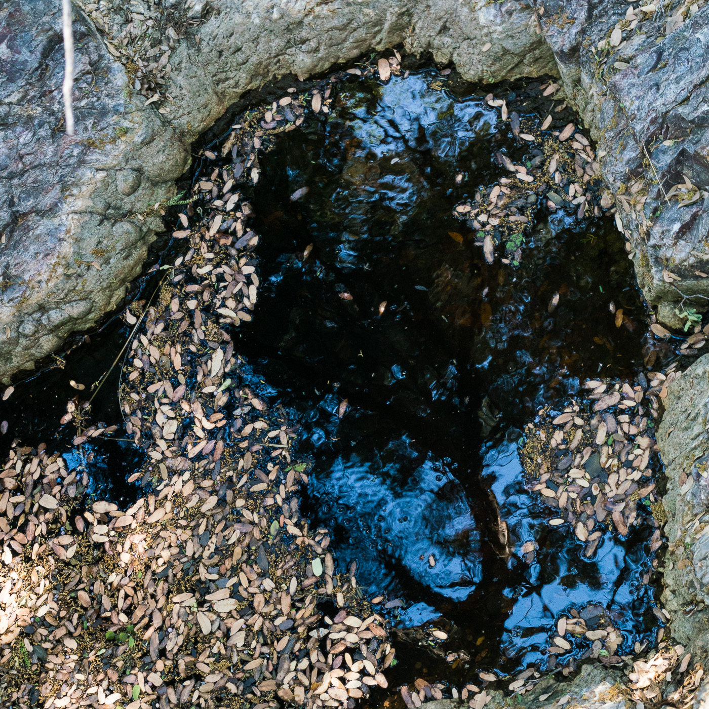
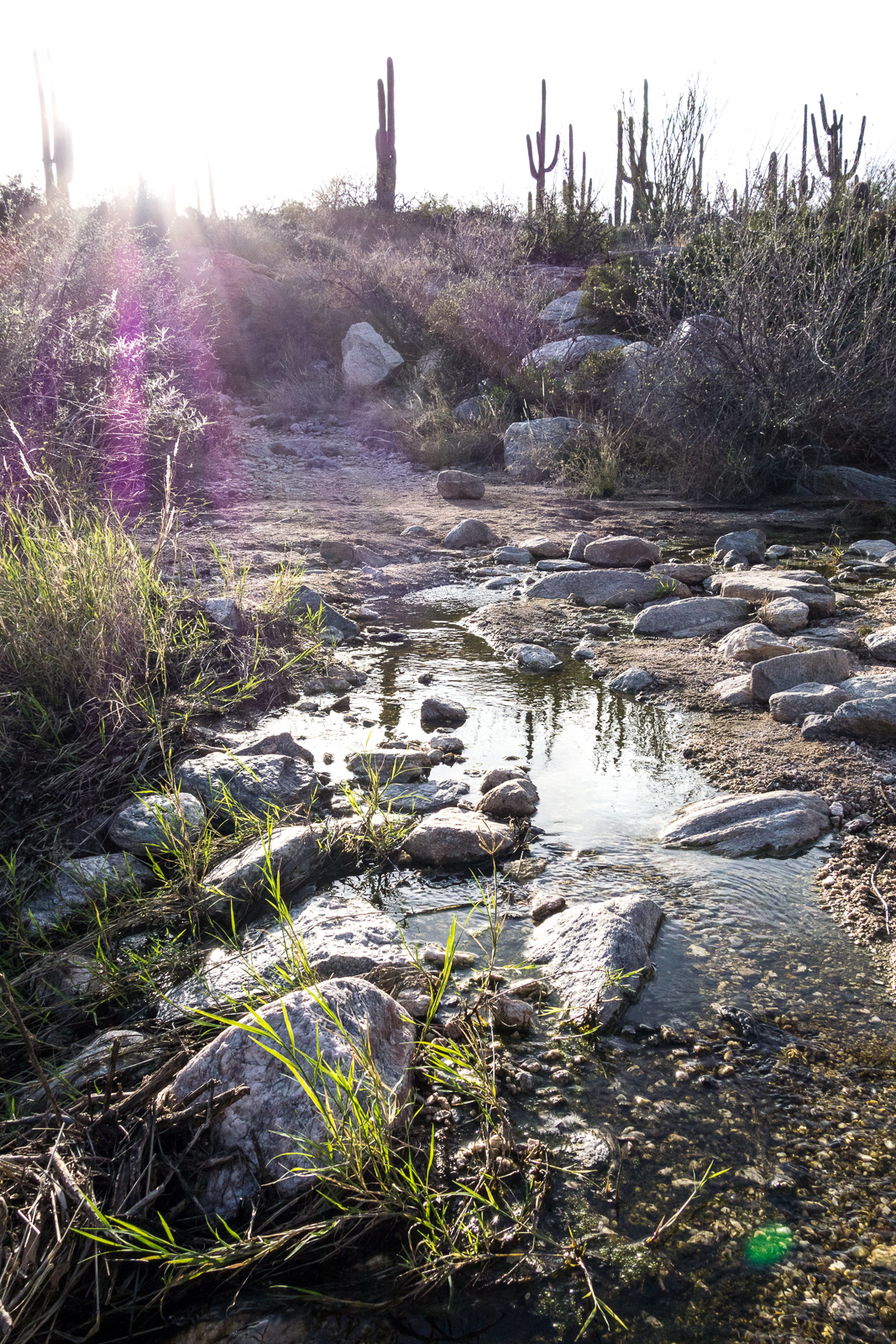
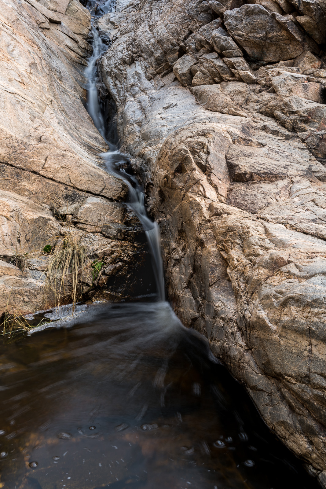
From Georges Spring it was a short walk to Pearsons Spring – in its small side canyon the only sign of water was a single, small depression with damp sand at the bottom. Returning to the canyon just west of the Brush Corral Trailhead I don’t have to walk very far before both cows and small pools of water appeared in the canyon bottom. It looks like there was quite a bit more water in the canyon earlier in the year. The canyon merges seamlessly into Buehman Canyon a short distance above the Brush Corral Trailhead – from there it doesn’t take long to loop back to the start of my hike.

Water in the canyon just west of the Brush Corral Trailhead. April 2017.
Water and cow manure in the canyon just west of the Brush Corral Trailhead. April 2017.

Pontatoc Canyon Trail – 2/5/2017 and 2/9/2017

February 2017.
Shallow water near the start of the Pontatoc Trail – this area is more often seen completely dry… February 2017.

It is always a treat to start the Pontatoc Trail and see water flowing in the first wash – as you might expect farther up the Pontatoc Canyon Trail there was water at each crossing of Pontatoc Canyon. New-to-me on this hike was watching the moonrise over Pontatoc Ridge – I wonder if, or how many times, it has risen behind me on other hikes, but tired and staring down at the rocky trail in front of me I missed it…

February 2017.
Looking into Pontatoc Canyon from the Pontatoc Canyon Trail – in the lower right section of the picture you can see a section of the trail (sometimes bypassed by a scramble up the canyon!) February 2017.
February 2017.
A small spill in Pontatoc Canyon. February 2017.
February 2017.
Sunset on the Pontatoc Canyon Trail. February 2017.
February 2017.
Saguaros – end of the day looking down towards Tucson from the Pontatoc Canyon Trail. February 2017.
February 2017.
Moon over Pontatoc Ridge. February 2017.

Ventana Canyon Trail – 2/6/2017

February 2017.
Rushing water in the Maiden Pools area. February 2017.
February 2017.
Maiden Pools. February 2017.

With water flowing all over the range we hiked to Maiden Pools to see the water – rushing, as expected – but the sunset and night in the canyon were the highlights of the hike…

February 2017.
Fading sunset before the steep descent back down to the canyon. February 2017.
February 2017.
Saguaro and Stars – looking up from the Ventana Canyon Trail. February 2017.

Sutherland Wash Rock Art District – 1/29/2017

January 2017.
Rushing water in Sutherland Wash. January 2017.

Moving away from the static of the rushing water in Sutherland Wash we can hear the slow, constant, distant, repeating gunshots – not close by, not a concern… not even inappropriate – but certainly an unwelcome intrusion as we try to carefully and respectfully contemplate the petroglyphs in the Sutherland Wash Rock Art District.

January 2017.
Petroglyphs with Romo Hill and Samaniego Peak in the distance. January 2017.

After visiting this area last year I spent some time reading about and looking for information – some of which is included in the post – this year my mind wanders to two books – John P. Wilson’s Islands in the Desert (an amazing history of the mountains of Southern Arizona) and Cormac McCarthy’s Blood Meridian (a fictional journey thru the borderlands of the mid 1800s based on the Glanton Gang). In both books the landscape is a stunningly beautiful – maybe even magical in Blood Meridian, but in both books there is also terrible and stunning violence – sacred and the profane, petroglyphs and gunfire…

January 2017.
Saguaro and Saguaro. January 2017.
January 2017.
Sun thru the grass on the hike back. January 2017.

Pima Canyon Trail to the First Dam – 1/23/2017

January 2017.
Flowing water in Pima Canyon covering the first canyon crossing on the Pima Canyon Trail. January 2017.

January 2017 can’t quite rival January 2015 for weather in Pima Canyon – in 2015 snow fell low into Pima Canyon collecting on the tops of the Saguaros and making sections of the trail a snowy tunnel – but the weather this year has put a wonderful amount of water in motion and it was spectacular to see water covering and flowing down canyon from the first canyon crossing on the Pima Canyon Trail.

January 2017.
Looking up at the Cleaver from the Pima Canyon Trail. January 2017.
January 2017.
Rushing water in the first dam area of Pima Canyon. January 2017.
January 2017.
A tree standing above the water and against the sky in Pima Canyon. January 2017.