Sutherland Wash Rock Art District – 1/30/2016

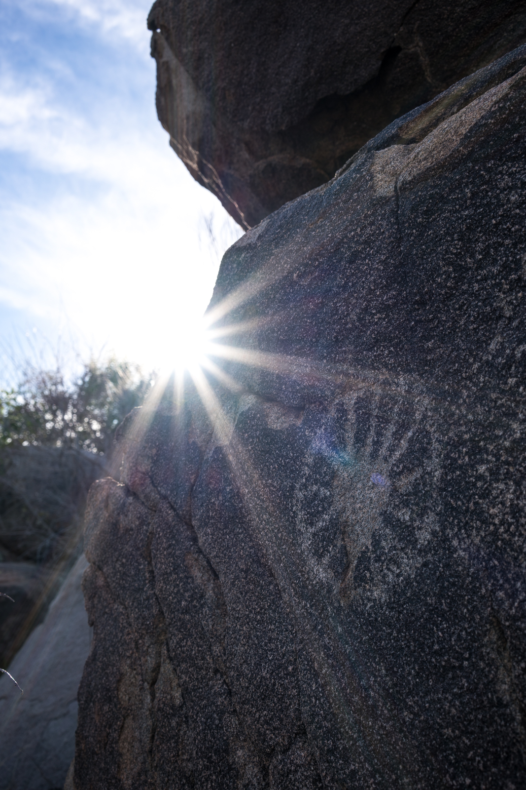
The Sutherland Wash Rock Art District was added to the National Register of Historic Places in 1993. Located in and around Sutherland Wash the area holds an incredible number of Hohokam petroglyphs. Ceramics and artifacts found in the area indicate that it was inhabited by the Hohokam between 1000 A.D and 1300 A.D. The water in the area would certainly have been an attraction and researchers have identified probable prehistoric trails both to the top of the Santa Catalina Mountains and to nearby locations such as Romo Peak pass thru this area. (The Romo Cache was found on Romo Peak and contains 100,000 beads and a number of copper bells) .

Flower petroglyph. January 2016.

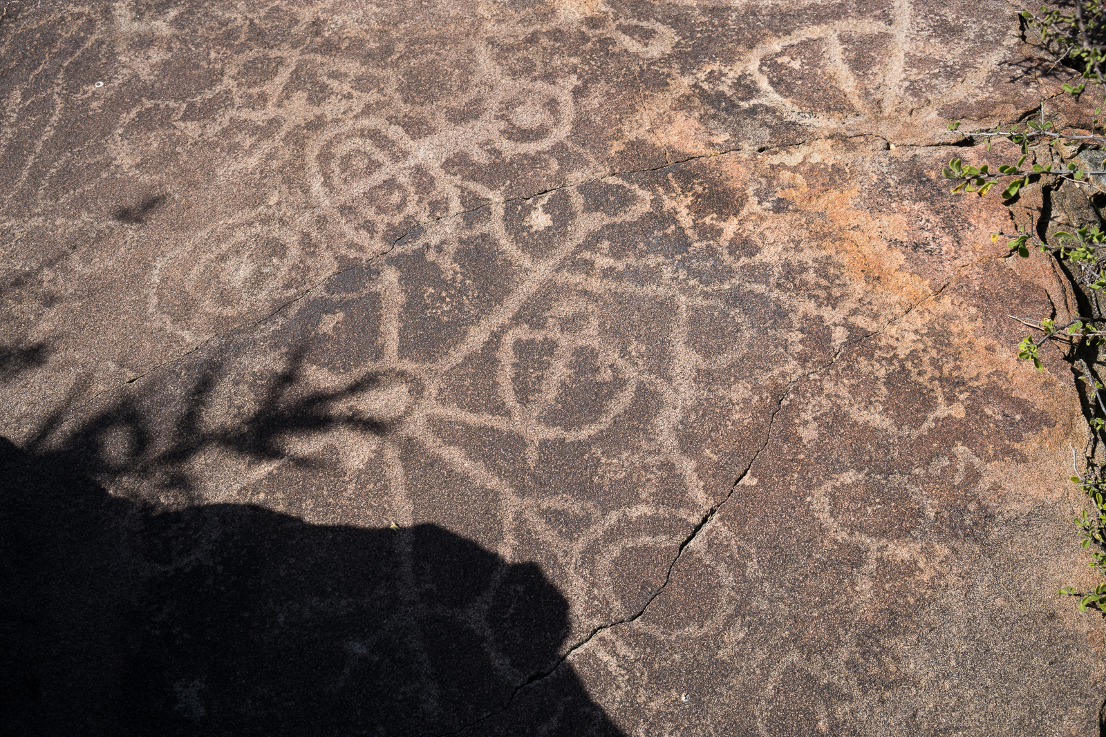
In Flower World Imagery in Petroglyphs: Hints of Hohokam Cosmology on the Landscape by Janine Hernbrode and Peter Boyle the petroglyph above is identified as a flower – from a BorderLore post:

There are more than 600 petroglyph panels in the district, including many representations of flowers, butterflies and birds. Such imagery is characteristic of a spiritual landscape known as the Flower World. In this Uto-Aztecan belief system of ancient Mesoamerican origin, believers evoked a flowery, colorful, glittering paradise through prayers, songs, and other actions. The likelihood of this connection is strengthened by the discovery of Mesoamerican copper bells at Honey Bee Village (a nearby Hohokam settlement) and in a cache of Hohokam artifacts found near the rock art district.

A panel of petroglyphs in the Sutherland Rock Art District. January 2016.
Female anthropomorph and flowers. Januaru 2016.
Female anthropomorph and flowers. January 2016.

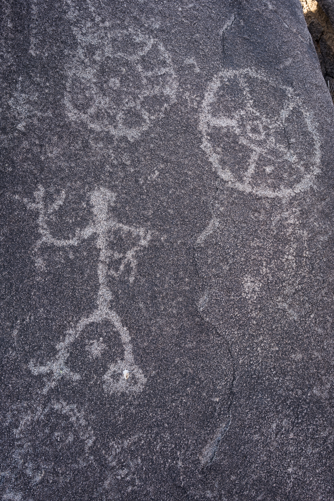
Gender in Hohokam Imagery and Landscape: Sutherland Wash Rock Art District, Coronado National Forest, Arizona by Janine Hernbrode and Peter Boyle examines gender in the Sutherland Wash Rock Art District – out of the 419 anthropomorphs at the site 64 male and 65 female figures were identified – the image above clearly matches the female characteristics described in the paper.

Zoomorph. January 2016.

Even more common than the anthropomorphic petroglyphs at the site are representations of animals – it is difficult to tell what animal is represented above, but interesting to dream about what people were seeing in this area 1,000 years ago…

Rock Art, Ranch, and Residence: Cultural Resources in the Town of Oro Valley and Its Planning Area – 1/20/2016

Snow and clouds on the top of the mountain. January 2016.
Snow and clouds – looking up at Mount Lemmon from Honeybee Canyon Park. January 2016.

Having taken several trips to Honeybee Canyon Park in the past few months I was looking for a little more information about the area and came across Rock Art, Ranch, and Residence: Cultural Resources in the Town of Oro Valley and Its Planning Area. This document was developed by William Self Associates for Oro Valley and completed in 2010.

The document covers the history of the Oro Valley area from the Paleoindian Period (10,000+ years ago) into the 20th century – some of the included information: Hohokam ruins such as Honey Bee Village and Sleeping Snake Village, early land claims in the area, notable 20th century architecture including the Countess of Suffolk’s Forest Lodge and information about later development in the area. While most of the information is fairly brief the broad overview was very interesting to read.

One of the details that I enjoyed was seeing the General Land Office maps of the Oro Valley Area. The General Land Office was created in 1812 and oversaw the survey, platting and sale of public land – including land in present day Oro Valley. The Oro Valley records are from the beginning of the 20th century when the area began to see a steady stream of homesteaders entering the area –  Rock Art, Ranch, and Residence asserts that:

The relatively late beginning for the settlement along the Canada del Oro can be attributed in large part to a continuing perception of the area as dangerous: it was still considered a place too far from Tuscon and too close to the usual range of the Apaches. (p. 60)

The Bureau of Land Management makes many General Land Office Records, dating back to 1810, available online. The map below, from 1902, shows Pusch and Zellweger’s Steam Pump Ranch (which you can still visit today)  – labeled Pusch Ranch – and another ranch – ‘Mexican Ranch’ – that was probably owned by the Marin family and later patented by Francisco Marin. The roads on the map are a reasonable match for modern roads – the early version of Oracle Road is especially easy to recognize!

Township 12 South, Range 14 East, 1902 - General Land Office.
Township 12 South, Range 14 East, 1902 – General Land Office.


Romero Ruins, In The Mountain Shadows – 1/1/2016

The Romero Ruin is a 15 acre site that was one of several large Hohokam villages in the Tucson Basin – it is located in what is now Catalina State Park. The settlement was continuously inhabited from A.D. 500 to 1450 and as many as 125 to 200 people may have lived at the settlement at its peak around A.D. 900. Around 1875 several buildings were built on the site as part of the Romero Ranch.

The Romero Ruin Interpretive Trail allows visitors to Catalina State Park to access the site. The 3/4 mile trail, constructed in the early 1990s, starts across the road from the Romero Ruins Ramada – approximately 0.8 miles down the road from the Ranger Station and Gift Shop. After crossing Sutherland Wash the trail climbs onto a hill where it winds in a loop thru the Romero Ruin. A number of informative signs along the loop provide interesting information about the site.

While the signs along the trail provide quite a bit of information there is additional information in Archaeology Southwest Magazine, Volume 27 Number 1, Winter 2013 which is an updated and expanded version of a 1996 booklet titled Archaeology in the Mountain Shadows: Exploring the Romero Ruin. These publications are short – 20 pages for the revised version – and provide concise, interesting and accessible information.

Reconstructed Romero Ranch Wall in the Romero Ruin. January 2016.

Built on top of the Hohokam settlement walls from the buildings of the Romero Ranch are still visible. Francisco and Victoriana Romero lived here briefly sometime around 1875. 

Hohokam Ballcourt along the Romero Ruin Interpretive Trail. January 2016.
Small Hohokam Ballcourt along the Romero Ruin Interpretive Trail. January 2016.

The Ballcourt along the trail is the smaller of the two identified in the ruins. Hohokam Ballcourts have also been excavated in other locations around the Tucson Basin at Sleeping Snake, Hodges, Water World and Dakota Wash. Ballcourts are thought to have been an important link between settlements – people traveled for ball games and ceremonies and the visits probably provided opportunities for trading and finding marriage partners.

View from near a trash mound in the Romero Ruin. January 2016.

Many of the features of the ruin have, to my eye, disappeared back into the desert – without the interpretive signs and information in In the Mountain Shadows I would have had no idea about the history of this area…

Top: Archaeology Southwest Magazine, Volume 27 Number 1, Winter 2013. Bottom: Archaeology in the Mountain Shadows: Exploring the Romero Ruin, 1996.

Oracle State Park, Aermotor, J. Knox Corbett Lumber and Hardware Company – 12/5/2015

Aermotor Windmill Vane - on the Arizona Trail in Oracle State Park. December 2015.
Aermotor Windmill Vane – on the Arizona Trail in Oracle State Park. December 2015.
Markings - J. Knox Corbett Lumber and Hardware Company (or variation). December 2015.
Markings – J. Knox Corbett Lumber and Hardware Company (or variation). December 2015.

An obvious destination in Oracle State Park is the Windmill on the Arizona Trail – on this trip to the windmill I paid a bit more attention to the windmill itself and was able to learn more about it:

Aermotor: Aermotor has been making windmills since 1888 and is still in business today! From the beginning their windmills featured a steel wind wheel – apparently a key feature because it was more efficient than the wooden wind wheels commonly in use at the time. Some articles about Aermotor’s history: Aermotor Windmill Company HistoryGasEngine Magazine – History Of The Aermotor Windmill Corporation, Watrnews.com – The Aermotor Company – Windmills Made in the U.S.A. 

– J. Knox Corbett Hardware and Lumber Company, Tucson: While I can not read all of the smaller writing on the windmill there is enough to connect it to the  J. Knox Corbett Lumber and Hardware Company. 

William Corbett came to Arizona in 1877 – after working at Lord & Williams, as an Assistant Postmaster and as a paymaster in the army he returned to Tucson in 1890 and bought a hardware store on the corner of Congress and Main – it became the W.J. Corbett Hardware Company. William Corbett ran the company until his death in 1919.

J. Knox Corbett came to Tucson several years after his brother and worked selling news papers for the Arizona Daily Star, as a postal clerk, owned a stage and freight line, owned the Tres Alamos Ranch on the San Pedro River and was the Postmaster of Tucson. Knox established J. Knox Corbett Lumber in the early 1890s. After his bother’s death in 1919 J. Knox took over the W.J. Corbett Hardware Company and it became the W.J. Corbett Lumber and Hardware Co. After suffering a stroke 1922 Knox retired from the business and it was taken over by Hiram Stevens Corbett.

Hiram “Hi” Stevens Corbett – son of J. Knox Corbett and Lizzie Hughes (eldest child of Sam Hughes and Atancia Santa Cruz) – became president of the J. Knox Corbett Lumber and Hardware Company in 1923. Today “Hi” Corbett’s name is familiar to many in Tucson because in 1950 Hi Corbett Field was named in his honor for his work in bringing baseball to Tucson. 

The J. Knox Corbett Lumber and Hardware Company – which eventually included a store on Speedway – closed in 1965.

The  J. Knox Corbett House is now part of the The Tucson Museum of Art’s Historic Block. The Arizona Memory Project contains a contribution from the Tucson Museum of Art Research Library, Tucson Museum of Art Historic Block Homes – A Window on Bygone Days, that includes a great resource in learning about the Corbett family:  A History of the J. Knox Corbett House and the J. Knox Corbett Family by Bettina Lyons (March 1981).