Night, stars, saguaros, night creatures and small pools in Bear Canyon – I’ve seen all of these before, many times, and look forward to seeing them many many many more times…

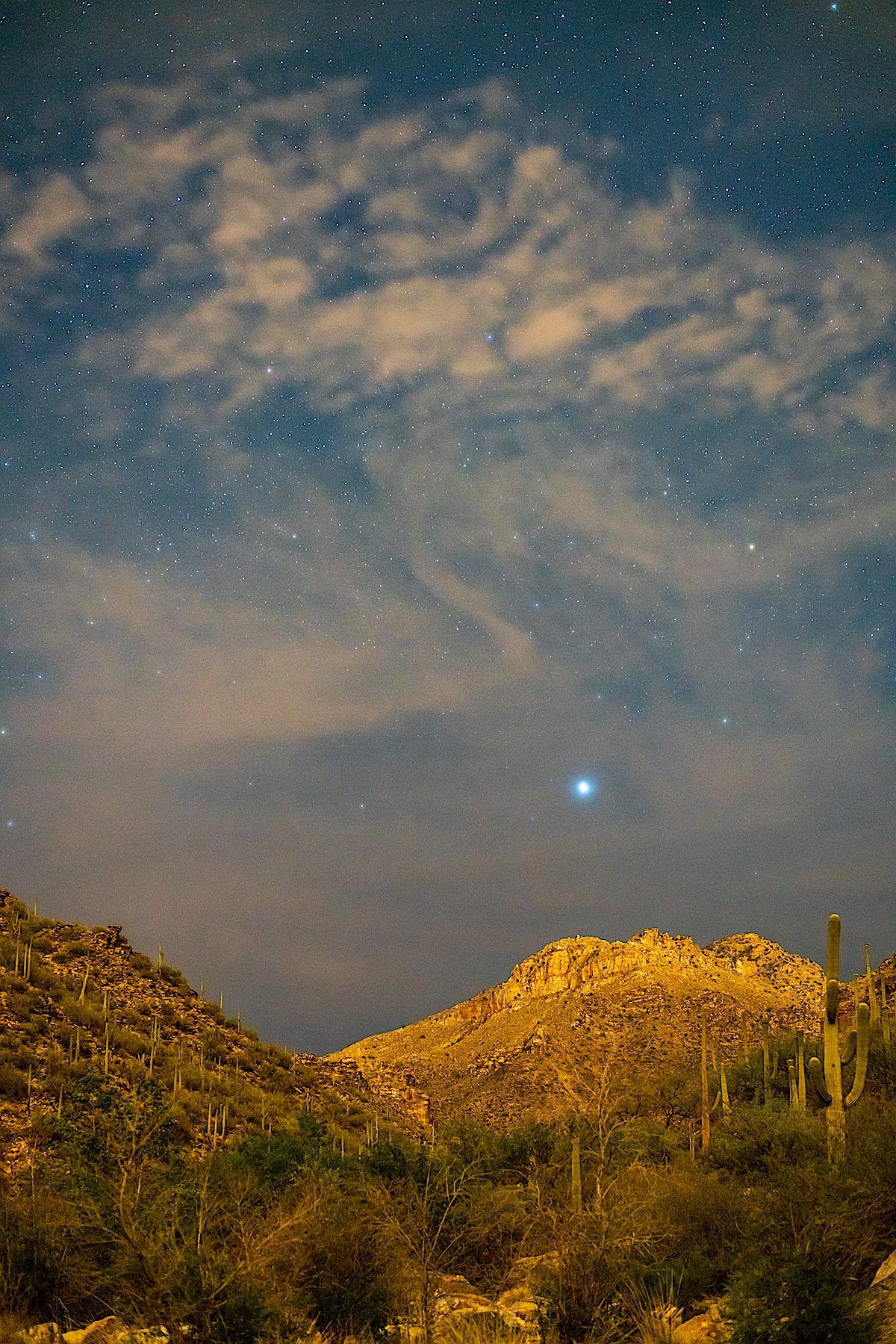
Night, stars, saguaros, night creatures and small pools in Bear Canyon – I’ve seen all of these before, many times, and look forward to seeing them many many many more times…
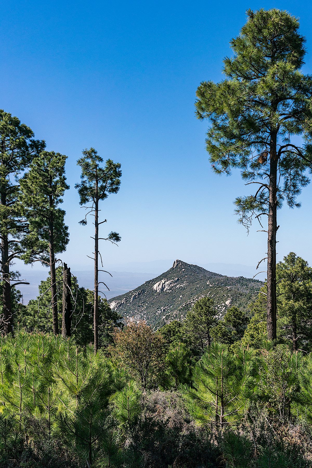
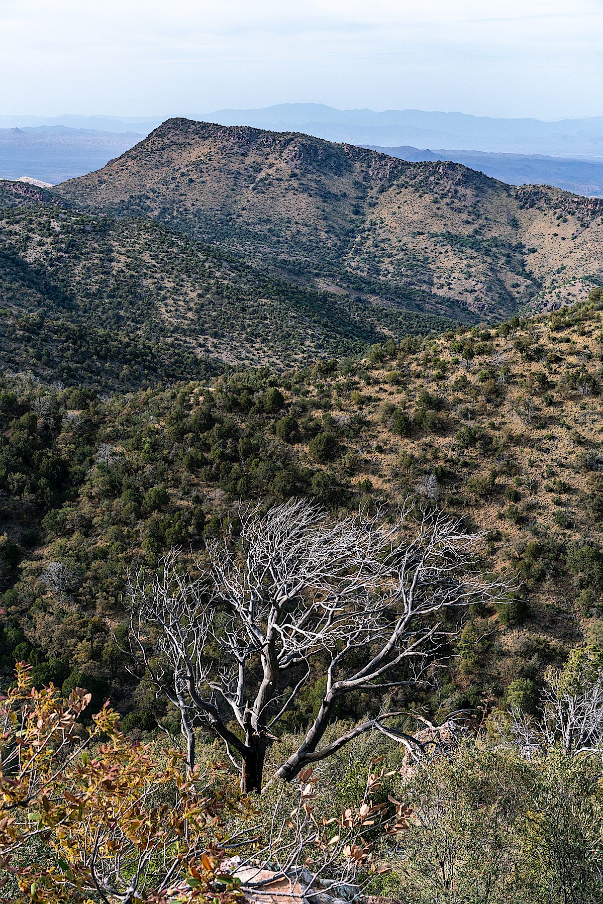
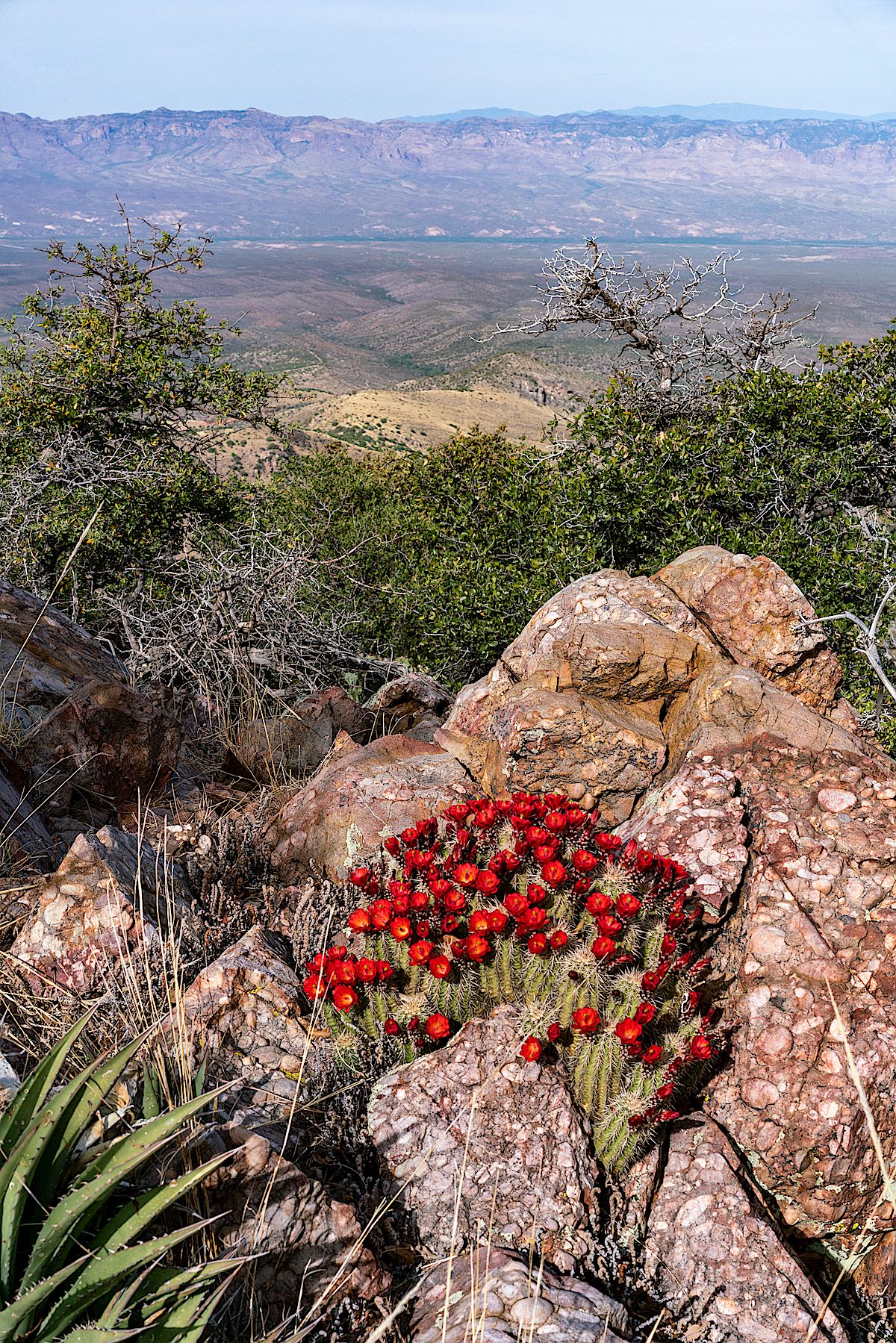
I have been into and by the CDO a number of times over the past few years, but 2013 was the last time I turned down the Samaniego Ridge Trail towards Samaniego Peak – too long! Samaniego Ridge burned in the 2003 Aspen Fire and while it has received attention since then these days it is overgrown and crisscrossed by downed tree – but with some care you can still follow the trail.

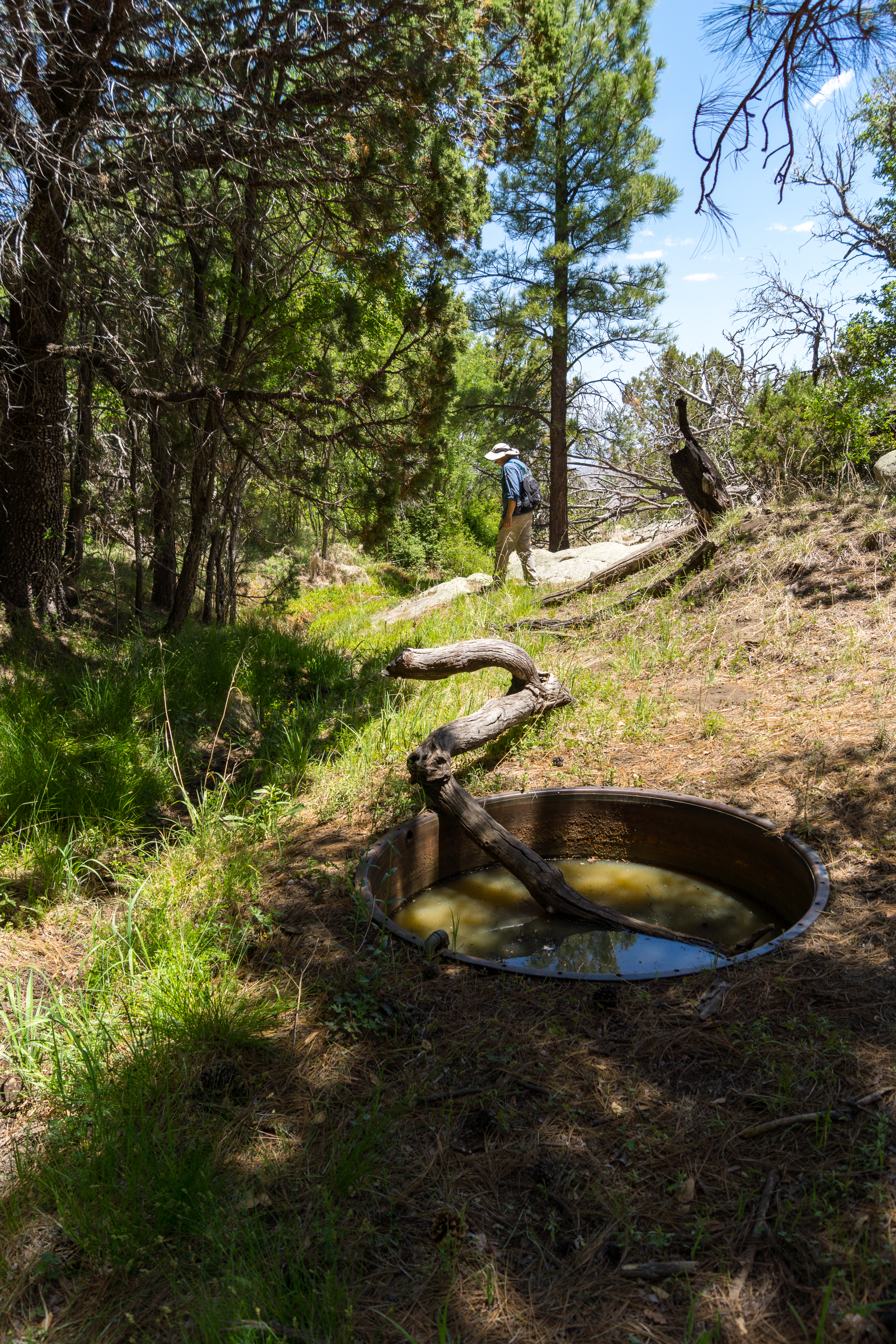
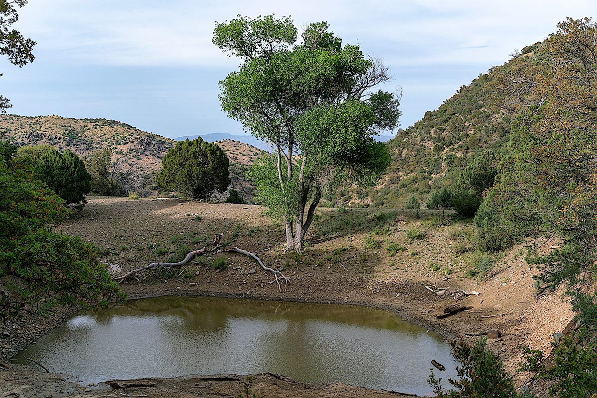
Walnut Spring largely looks the same as it did five years ago – a little less water in the tank and the trees are a bit bigger, but the same log into the tank, still water in the nearby drainage and green grass, and still a great place for a break before heading up to the peak.
In 2013 part of our ‘hike’ to the top was partly spent more-or-less crawling thru the dense post-fire growth – this trip I found a better route and even though the ‘better route’ is overgrown and loose it made getting to the top quite a bit more fun. It is not completely clear comparing my pictures from 2018 and 2013 but my best guess is that the growth on the hill is taller and drier this year.
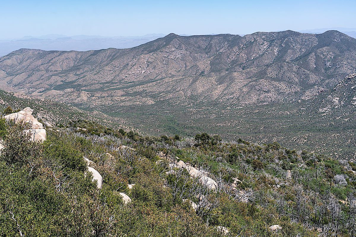
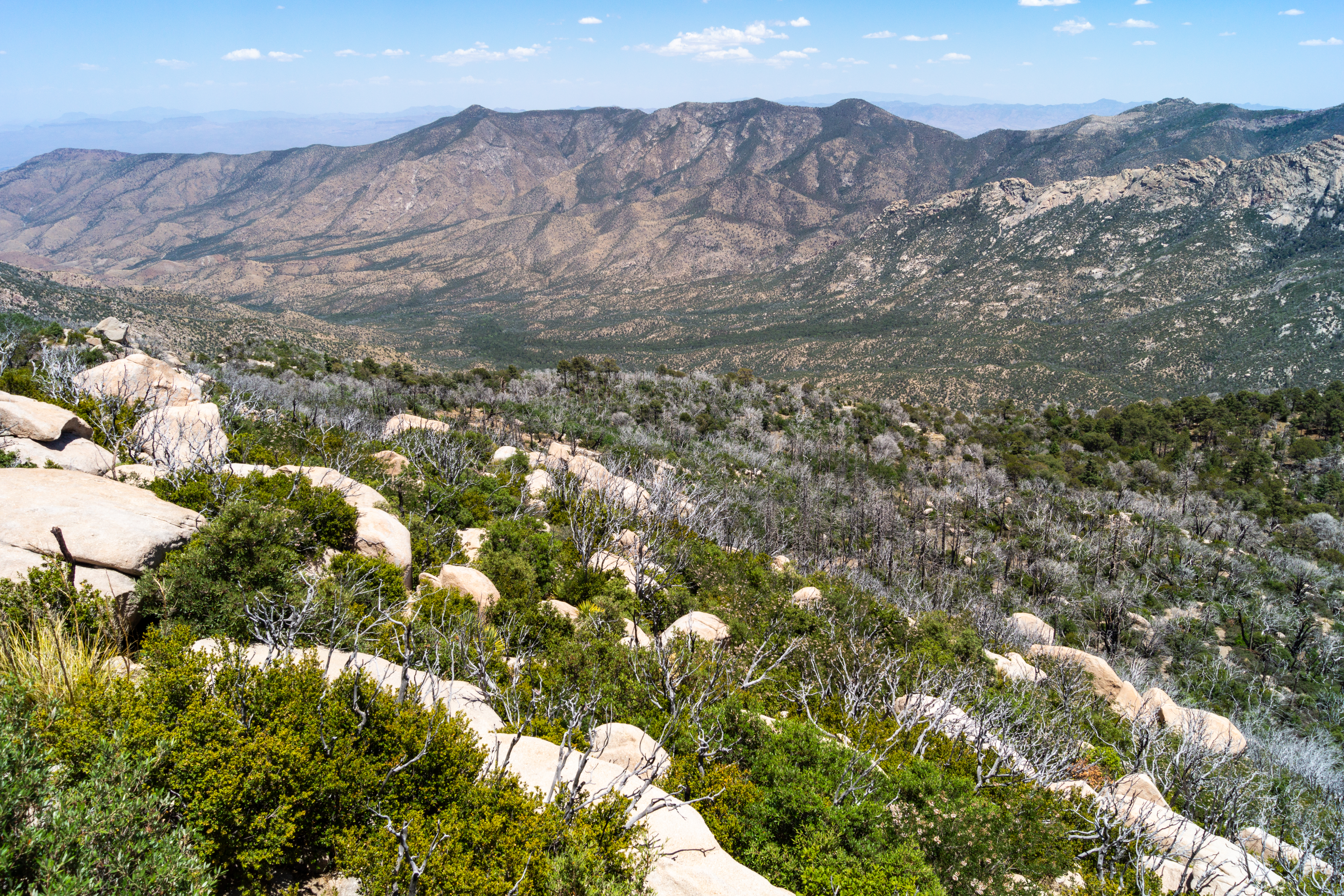

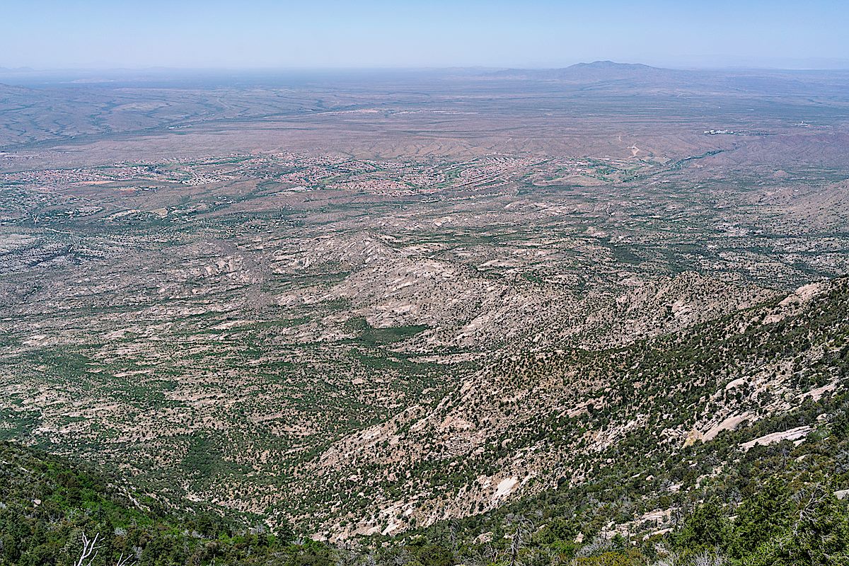
The peak and nearby ridge have fantastic views – along the ridge towards Mule Ears, down into the CDO, over to Oracle Ridge, back up to the top of the mountains and down into Catalina State Park and areas north. After finding some friends in the register it was time to make the long climb back up the mountain!
Samaniego Ridge and Peak take their name from Mariano G. Samaniego. Mariano Samaniego was born in Sonora, Mexico, in 1844. After his father’s death in 1850 Mariano’s mother Ysabel moved the family to La Mesilla, New Mexico. Mariano became a US citizen via the Gadsden Purchase in 1853. He graduated from St. Louis University in 1862 and worked briefly for the Texas Rangers as an interpreter for the Confederacy before returning to Mesilla. In 1864 he established a freighting company – a business he would continue into his time in Tucson. In 1867 he married Dona Delores Aguirre, the daughter of his business partner Don Pedro Aguirre. In 1869 the Samaniego family arrived in Tucson and in 1883 established the 1,000 acre Canada del Oro Ranch. The ranch had cattle, goats and farm land irrigated by water from the CDO. Apache attacks were a threat at this time and Samaniego was wounded several times in conflicts with the Apache. During the 1892 drought cattle were moved north to the Rancho de San Francisco in the Red Rock area after well-diggers hired Samaniego, neighbor Pedro Charouleau and brother-in-law Yjinio Aguirre were able to establish a well. After Samaniego’s death in 1907 the ranch was sold to his nephews Don Hinginio and Don Epifanio Aguirre – the ranch was sold again in 1927 and part of the land went to George Wilson for his Linda Vista Ranch.
Samaniego was the first Pima County Assessor, served on the Tucson City Council, Board of Supervisors, Territorial Legislature, University of Arizona Board of Regents and was the president of the Arizona Pioneers Historical Society. From Mexicanos: A History of Mexicans in the United States by Manuel G. Gonzales, p. 96:
Throughout his career, Samaniego sought to protect the rights of fellow Mexicanos, a concern that dominated his public career after the 1880s, when the strength of nativist sentiments began to alarm the Mexicano community. … Waging a tireless campaign to combat negative Mexican stereotypes, he defended the rights of his people to retain their own culture, doing everything possible to promote traditional customs and practices, including Mexican patriotic holidays and fiestas. He also sought to ameliorate the deteriorating economic conditions in the fledgling Mexicano barrios by promoting the organization of mutual-aid associations.

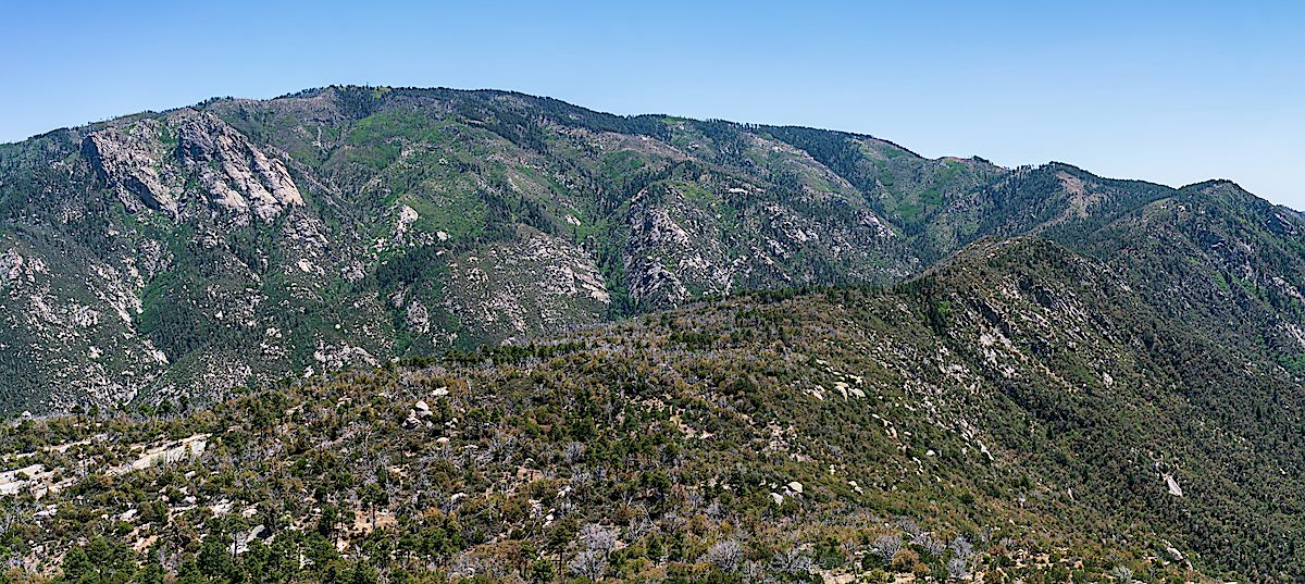
Summer temps are making top of the mountain loops very appealing lately – one of my favorite variations: Aspen Draw (best trail on the top of the mountain for getting a taste of how the area looked before the Aspen Fire), a short trip thru Summerhaven, onto the Mint Spring Trail (admire the small stands of Aspen, take in views cleared by the Aspen Fire and enjoy a stop at the spring – the Mint Spring Trail has been in rough condition in previous years but is looking quite good right now!) and up the Aspen Trail (wander up thru the pines and admire the great views from the final climb to the top – on this trip I took note of the view over Summerhaven, along Alder Canyon and Black Hills Mine Road to the San Pedro River with the Galiuro Mountains and Mount Graham in the background!).

Aficionados of upper mountain loops will probably be well aware of the situation that using the Aspen Draw Trail as your ‘down’ trail presents -> connecting to the Mint Spring Trail or any of the trails that leave from the Marshall Gulch Trailhead will force you to pass the Sawmill Run Restaurant, Stompin Grounds Coffee and Kettle Korn, The Mt. Lemmon General Store & Gift shop and the Mt Lemmon Cookie Cabin… Perilous temptation if you goal is a hardcore fitness outing – wondrous distraction on a leisurely day!


On the one hand the flowers last year were much more impressive – on the other hand even a ‘less impressive’ year still has an incredible number of flowers to see! Photos from a hike up the Pima Canyon Trail to the dam where the only water remaining is in small pools hiding near the cattails…


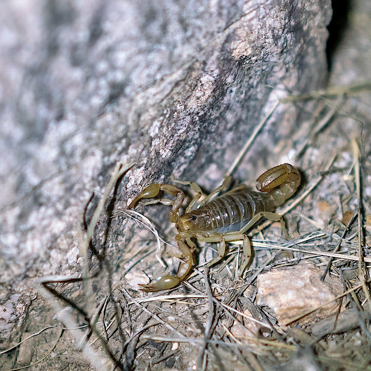
A few minutes from FR639 on the Oracle Ridge Trail I heard my first rattle of the season. With a long stretch of 100 degree days in the forecast it felt like a warning of summer’s arrival – a strange Arizona variation on Groundhog Day with the messenger hidden in the deep dry grass.
Unlike most of the trails in the Santa Catalina Mountains the Oracle Ridge Trail uses a number of Forest Service roads. North east of Rice Peak the trail uses part of a network of roads that ascend from the Control Road in the Peppersauce Wash/Nugget Canyon area and allow 4WD access to the peak.
With enough vehicle traffic these roads would be a dusty misery on foot – but it is easy enough to find days when the roads are quiet and you can use them to make a variety of longer or shorter loops thru the mountains – like many hikers I generally choose trails over roads, but there are so many beautiful details hiding in the mountains, no reason to avoid a quiet road when you have the chance…