Overview
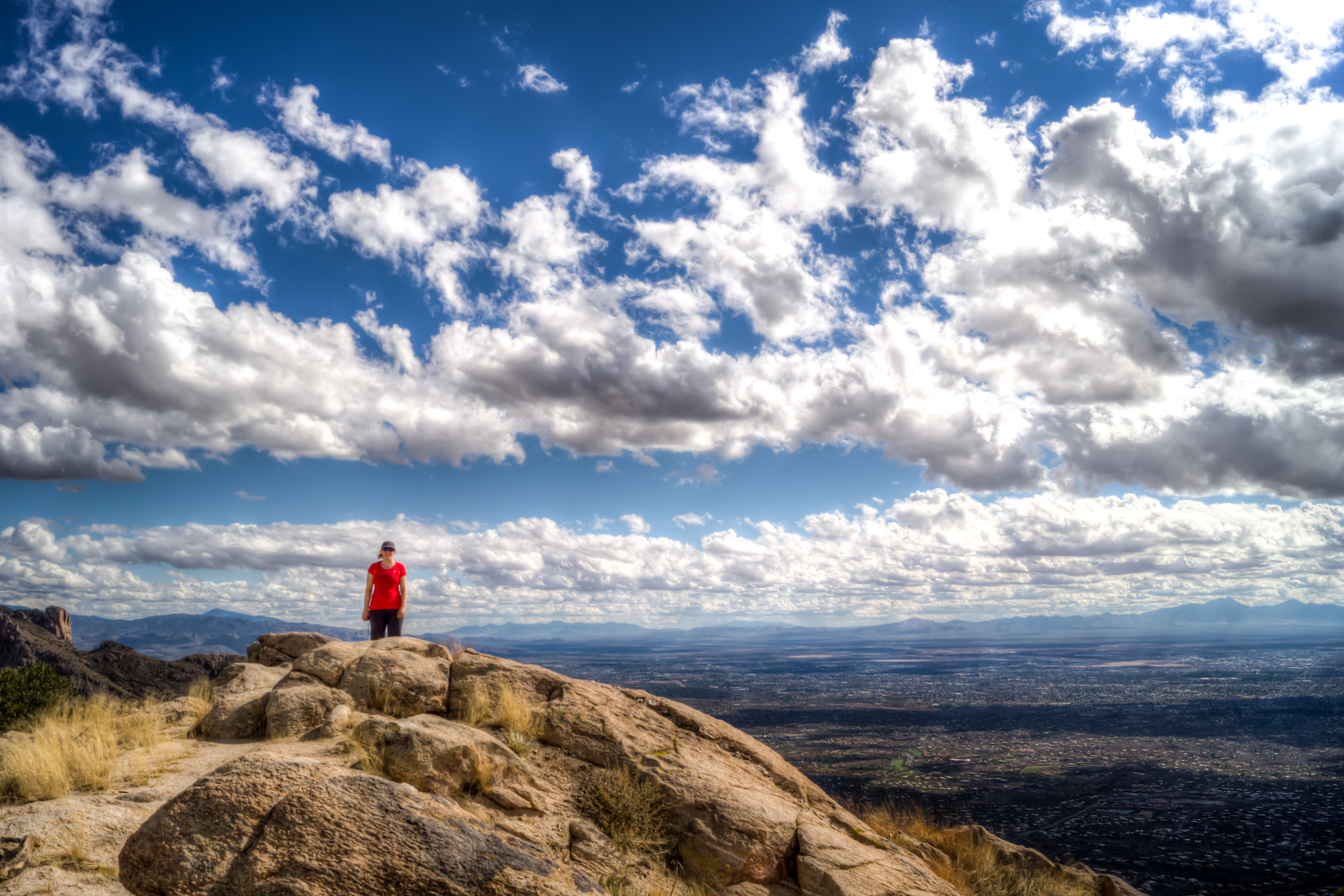
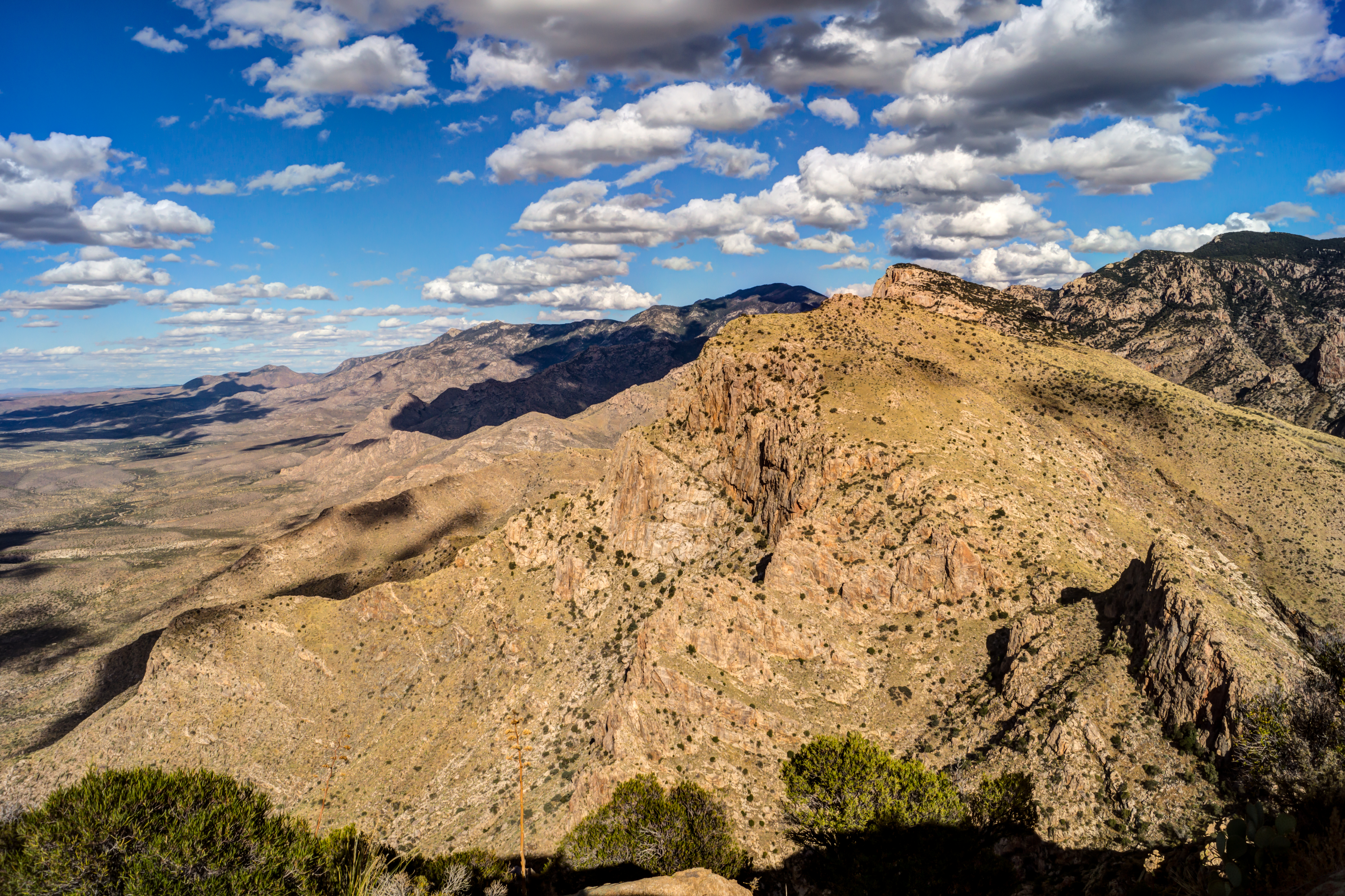
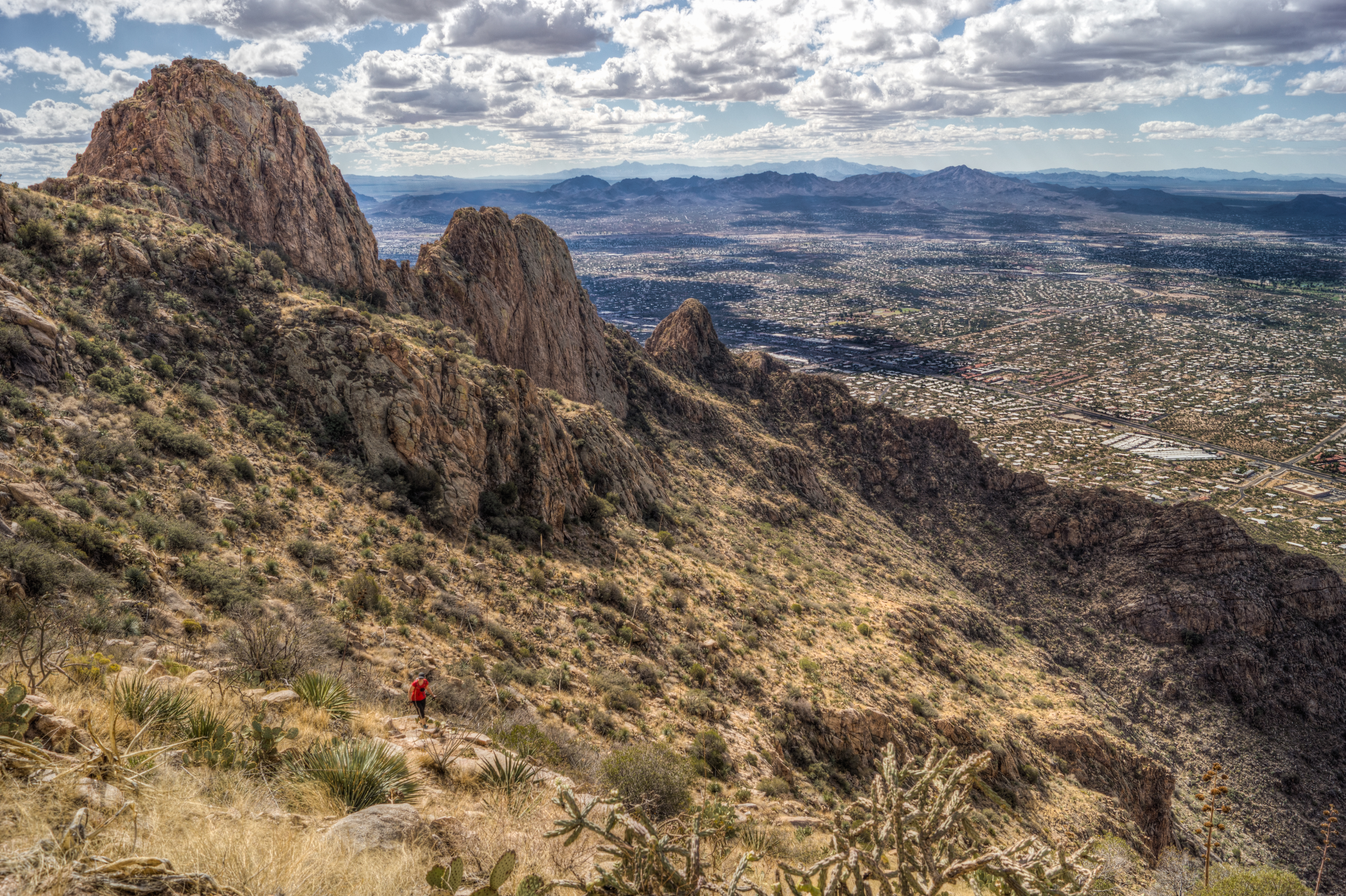
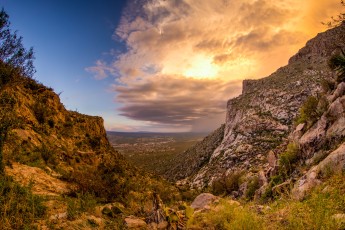
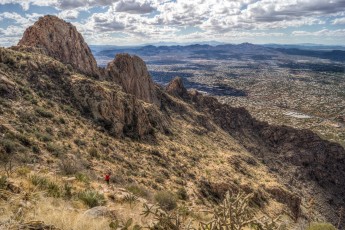
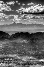
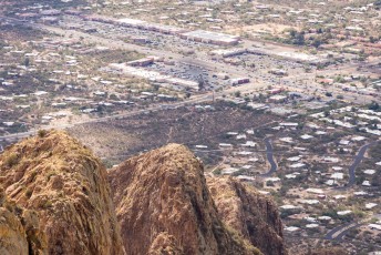
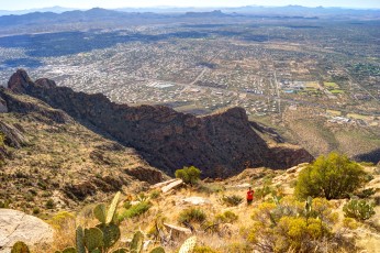
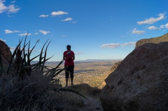
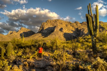
Pusch Peak rises steeply from the desert floor marking the southwest corner of the Santa Catalina Mountains. It’s distinct shape is visible from quite a few locations in and around Tucson and the views from the top are superb – made all the better by the effort it takes to get to the top… There is not an official trail to the top of Pusch Peak but this route is very popular and well used.
Hike Stats
- Out and Back
- 4.1 miles
- 2,500' Elevation Gain
- 2,500' Elevation Loss
- Highest Elevation: 5,360'
- Lowest Elevation: 2,700'
Location
- This hike is located in the Santa Catalina Mountains north of Tucson, Arizona. This hike is in the Pusch Ridge Wilderness.
- Start/End: Linda Vista Trailhead (City's Edge Hikes)
Details
- Fee: No
- Dogs: No (Bighorn Sheep Restrictions)
- Bikes: No (Pusch Ridge Wilderness)
- Off-trail hiking in the Santa Catalina Mountains can be hazardous and challenging - make sure you understand the skills you need to stay safe, be cautious and know your limits!
- Pusch Ridge Wilderness: Motorized and mechanized vehicles and equipment, including mountain bikes, are not permitted in Wilderness.
- Bighorn Sheep Restrictions: January 1 to April 30: Travel more than 400′ off of designated Forest Service Trails is prohibited. All year: Dogs are prohibited (except for seeing-eye dogs and handi-dogs), the maximum day use group size is 15 and the maximum overnight group size is 6.
- The trailhead is officially open from dawn to dusk - overnight parking is not permitted.
Drive
- 11.9 miles from Speedway and Campbell
- 25 Minutes from Speedway and Campbell
- Vehicle Access: Paved Roads/Passenger Car
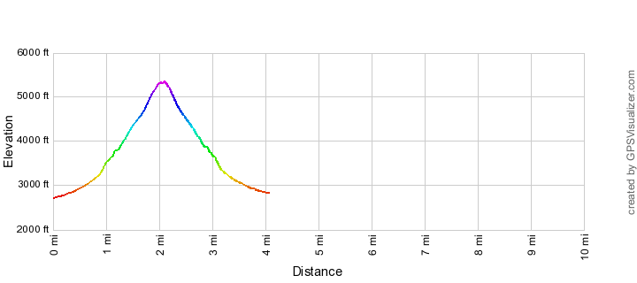
Pusch Peak Northwest Side Route Elevation Profile
Driving Directions
Suggested driving directions from the Speedway and Campbell intersection in Tucson to the Linda Vista Trailhead:
- Drive West on Speedway (2.0 miles)
- Turn right onto N Main Avenue and continue on N Oracle Road (10.1 miles)
- Turn right onto Linda Vista Boulevard, the trailhead is on the right (0.2 miles)
Google Maps Directions from the Speedway and Campbell intersection in Tucson to Linda Vista Trailhead.
Trail Notes
The mileages and elevations below are approximate (don't expect the values below to match your GPS exactly).
- 0.0 miles, 2700′: Park at the Linda Vista Trailhead [Waypoint LV TH] and take the Linda Vista Trail from the south side of the parking lot.
- The Linda Vista trail system looks like a rectangle with a diagonal thru the middle – the trail you want is the diagonal (the other trails will also get you to the correct junction but will take longer).
- Where the diagonal meets the outer rectangle turn left
- 0.7 miles, 3100′: The junction of the Linda Vista Trail system and the route to Pusch Peak is marked by a sign that reads “NOT A FOREST SERVICE SYSTEM TRAIL BEYOND THIS POINT” (there used to be a distinctive old metal sign with no markings at this junction, it was replaced sometime in 2014) [Waypoint PPNW01].
- Take a right at the sign.
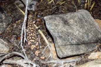
- From here the main trail is unrelentingly steep, often a bit loose and sometimes requires some easy scrambling. Be careful of side trails – this is a rough and rugged trail and there are plenty of opportunities to loose the trail if you are not paying attention.
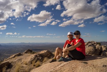
- Enjoy the top! 2.0 miles, 5350′ – [Waypoint PP].
Pusch Peak is named for George Pusch who purchased the Steam Pump ranch on the west side of the Santa Catalina Mountains in 1874 – see the Pusch Ridge Wilderness for more details.
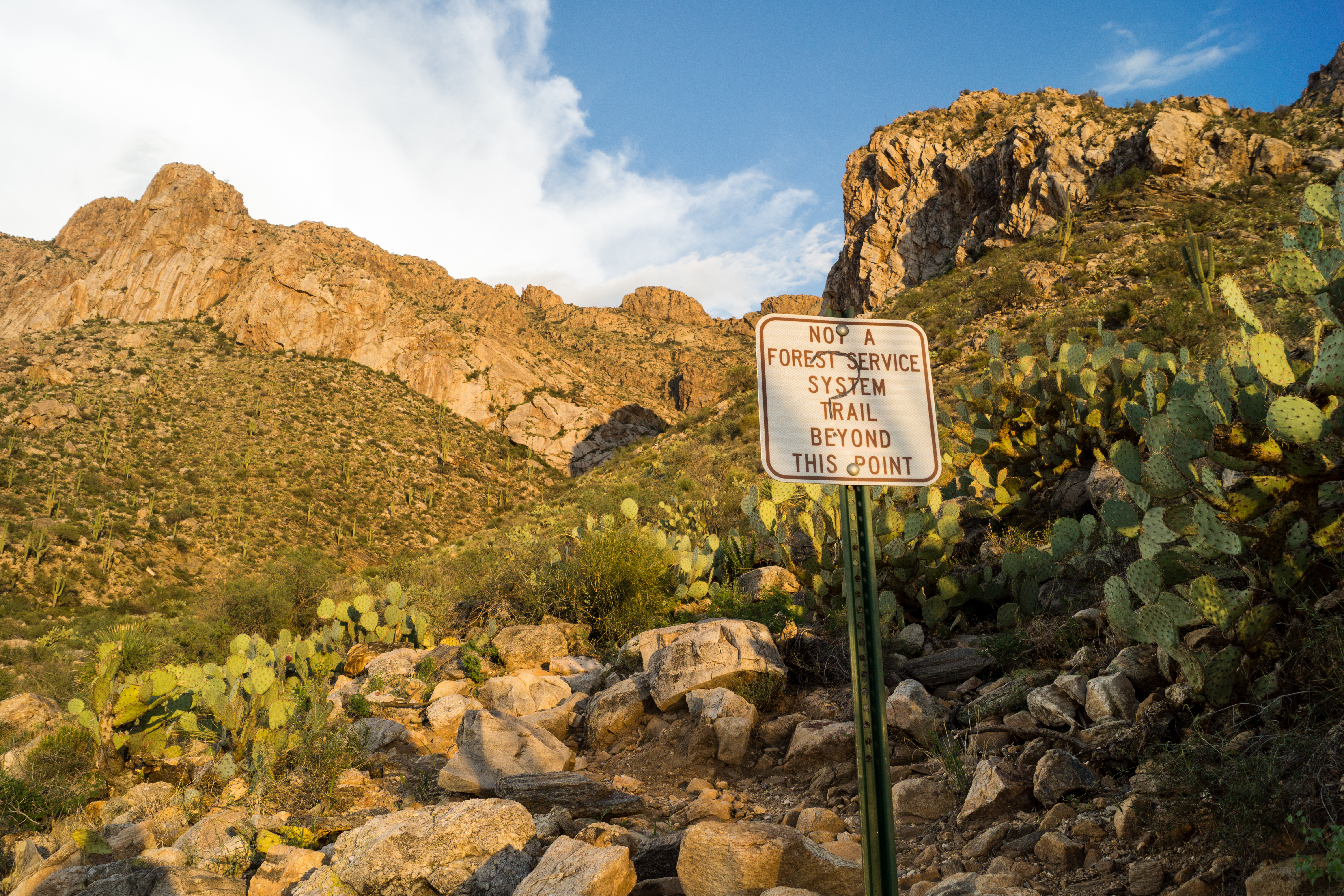
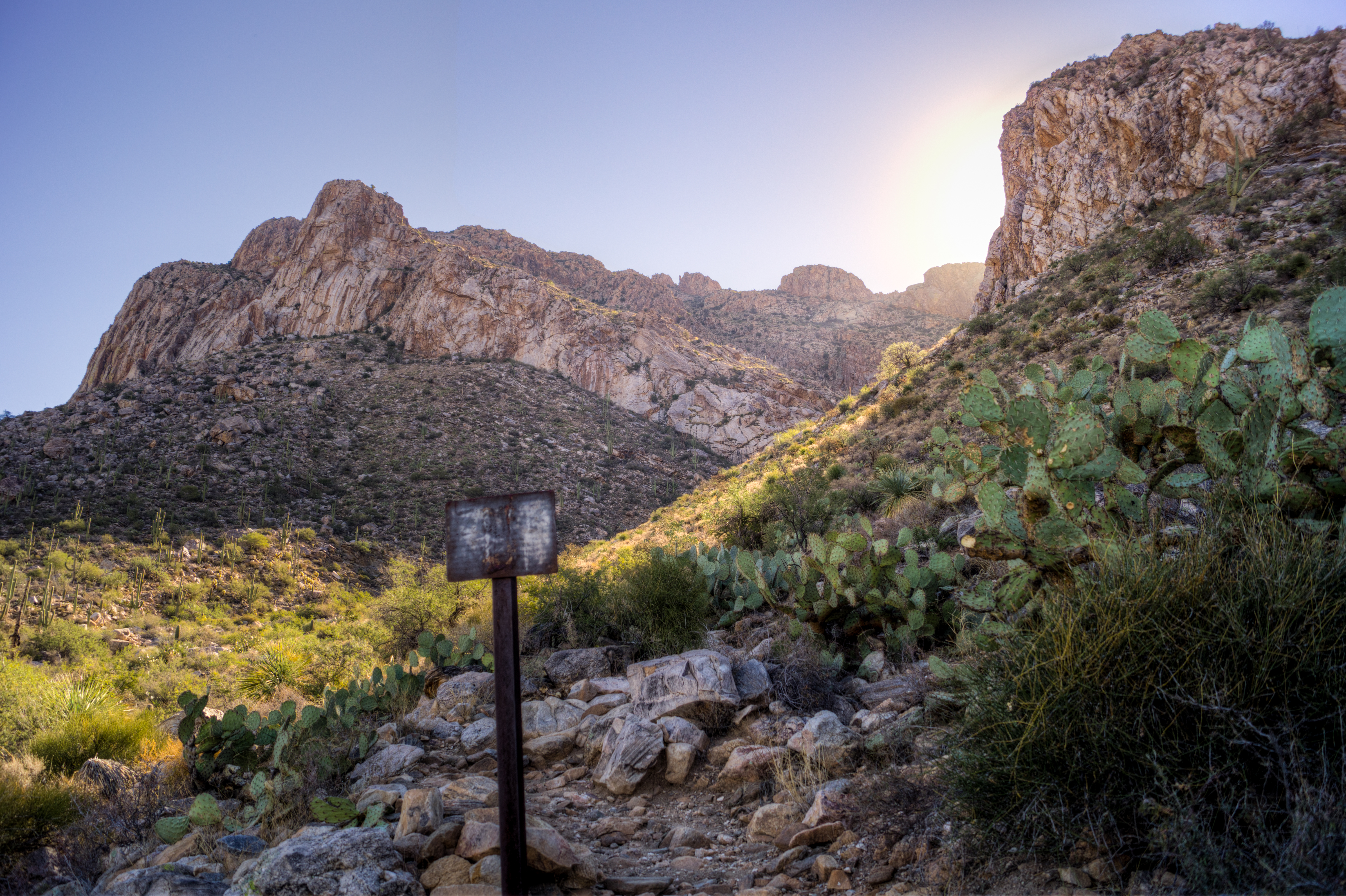
Right: The sign that used to mark the junction of the Linda Vista Trails and the route to Pusch Peak. November 2013.
Maps
- (Printed Map) Green Trails - Recreation Map - Santa Catalina Mountains. – Shows the Linda Vista Trailhead (and draws some of the nearby trails) and Pusch Peak but does not show this route.
- (Printed Map) Southern Arizona Hiking Club Maps – Does not show the Linda Vista Trailhead.
Resources
- HikeArizona – Pusch Peak, AZ
- Steve’s RV Travelogue – Pusch Peak, a Sky Island
- Sirena’s Wanderings – Early morning Pusch Peak, September 14, 2010
- Trail Talk – Summit Hut Blog – Pusch Peak, by Dave Baker, Thursday, November 12th 2009
- SANDIWAY FONG – Pusch Peak (from Linda Vista) – 2006
- summitpost.org
- MountainProject
- The Santa Catalina Mountains, A Guide to the Trails and Routes
Pictures
2014 August Pusch Peak Trail to the first Viewpoint

2013 November Pusch Peak


Update Notes
- 2017/8/10 – Img Srcset update, small update and hiking direction updates
- 2014/8/19 – Add pictures – esp. picture to show the current sign at the junction with the Linda Vista Trail
- 2014/7/27 – Split this page from the original Pusch Peak page that had both routes