Box Camp Trail, Hutch’s Pool, out to Prison Camp – 9/23 and 9/24/2018

A view from a ridgetop section of the Box Camp Trail. September 2018.

Pictures from last Fall – watery Hutch’s Pools, a bright moonrise from the West Fork and a beautiful night – but what really sticks in my mind is the lower half of the Box Camp Trail. The rough trail hides other footsteps – hard to guess the last time someone has been here – an hour? a week? Nice to be alone and wonder!

Water at a canyon crossing on the Box Camp Trail. September 2018.
Grinding holes along the West Fork Trail. September 2018.
Hutch's Pool off the West Fork Trail. September 2018.
Hutch’s Pool off the West Fork Trail. September 2018.
Moonrise on the West Fork Trail. September 2018.
Camped above the junction of the Bear Canyon, East Fork and Sycamore Reservoir Trails. September 2018.
Looking across the Santa Catalina Mountains towards Romero Pass. September 2018.
Sacred Datura in the Sycamore Reservoir Area. September 2018.

Prison Camp, Thimble Peak, Bear Canyon – 11/28/2015

The route out to Thimble Peak from Bear Canyon. November 2015.

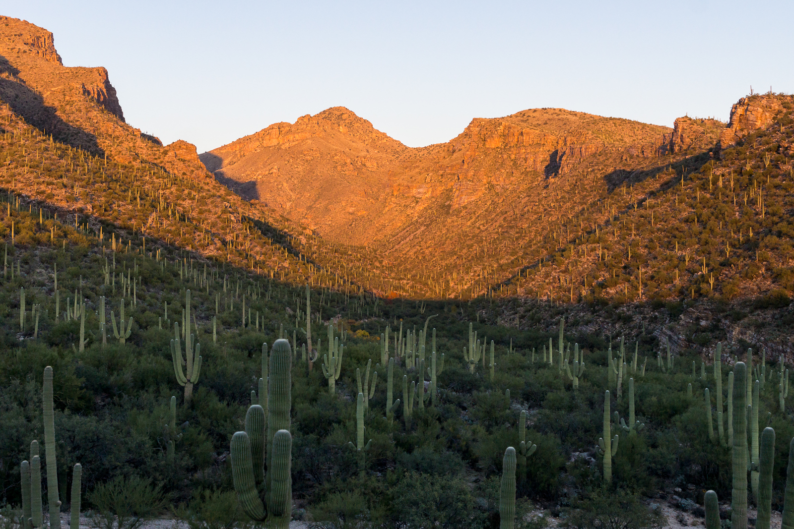
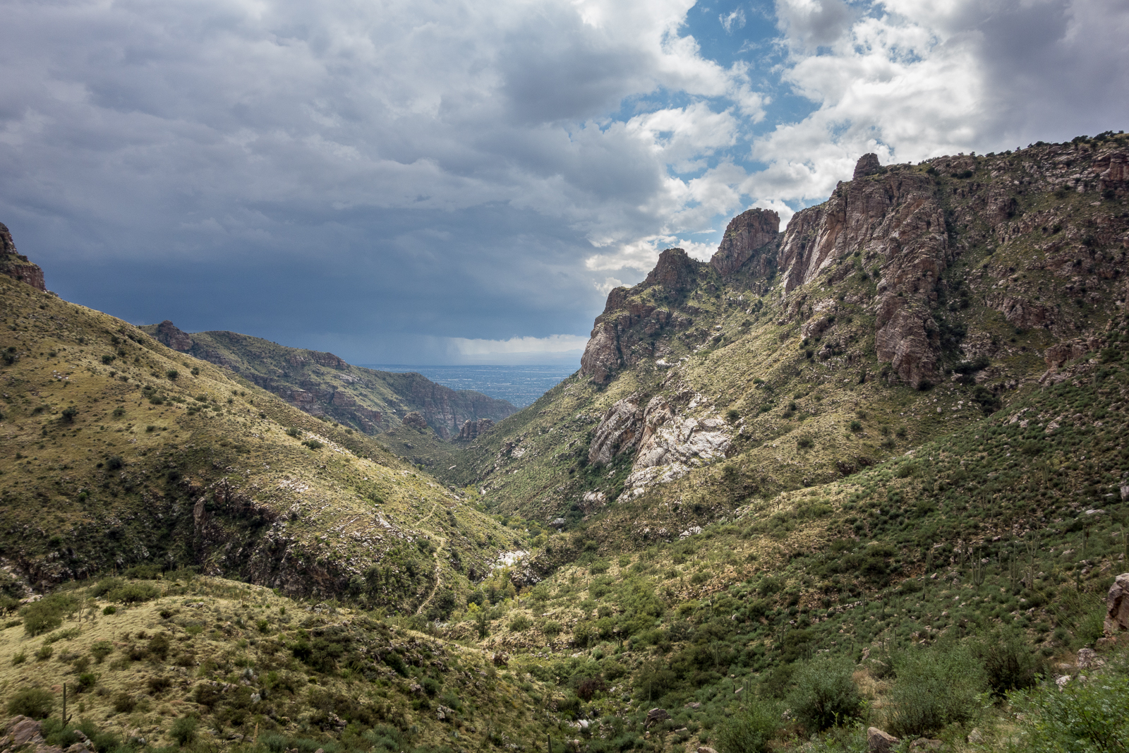
A sea of grass out to the Thimble, a ribbon of color down Sabino Canyon, looking up Bear Canyon to and past the Sycamore Reservoir Dam, back lit Saguaros and sunset light in Bear Canyon – every trip into the mountains is another chance to see something new – even the most familiar places are constantly changing, different light, season, weather, colors, wildlife, plants, friends… – and this was a particularly amazing day.

Looking down Sabino Canyon, a ribbon of color in the desert - from just below the base of Thimble Peak. November 2015.
Looking down Sabino Canyon, a ribbon of color in the desert – from just below the base of Thimble Peak. November 2015.
Saguaros in the sunlight - from the Bear Canyon Trail, above Seven Falls. November 2015.
Saguaros in the sunlight – from the Bear Canyon Trail, above Seven Falls. November 2015.
Bear Canyon - Sunset light and clear blue winter sky - a sea of Saguaros - from the road. November 2015.
Bear Canyon – Sunset light and clear blue winter sky – a sea of Saguaros – from the road. November 2015.

Prison Camp to Sabino Canyon – 10/6/2015

A wall near the top of the Sycamore Reservoir dam. October 2015.
Looking across the Santa Catalina Mountains - from near Shreve Saddle, looking down on Sycamore Reservoir. October 2015.
Looking across the Santa Catalina Mountains – from near Shreve Saddle, looking down on Sycamore Reservoir. October 2015.
Looking back towards the Prison Camp area from the Bear Canyon Trail - fast moving clouds covering the mountains. October 2015.
Looking back towards the Prison Camp area from the Bear Canyon Trail – fast moving clouds covering the mountains. October 2015.
Looking down Bear Canyon - rain in Tucson and a break in the clouds above. October 2015.
Looking down Bear Canyon – rain in Tucson and a break in the clouds above. October 2015.

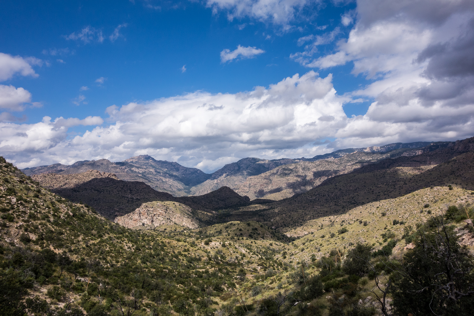
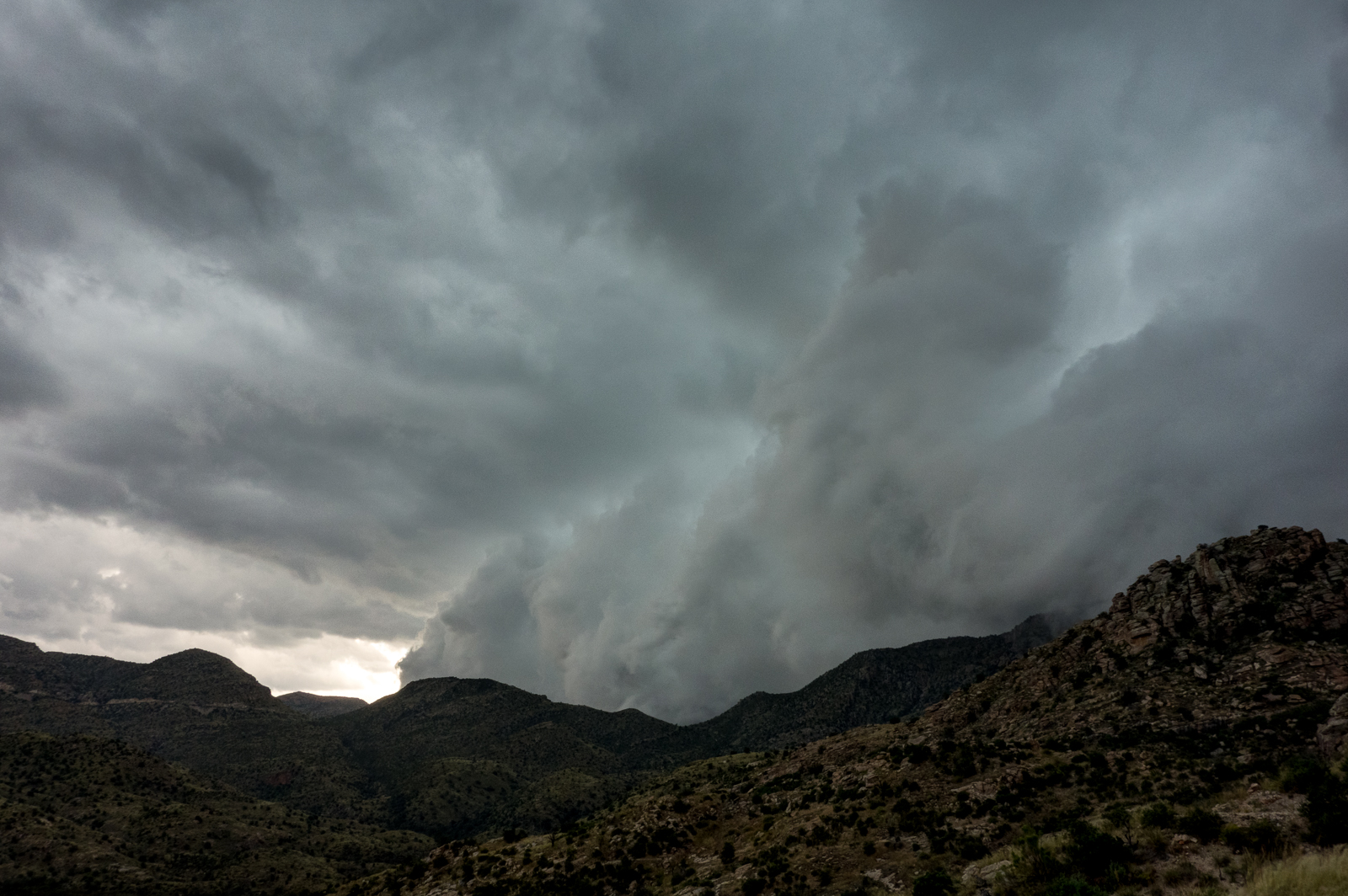
Waves of rain and hail were the highlights of the day – it was beautiful to see the mountain covered in clouds and wet with rain!

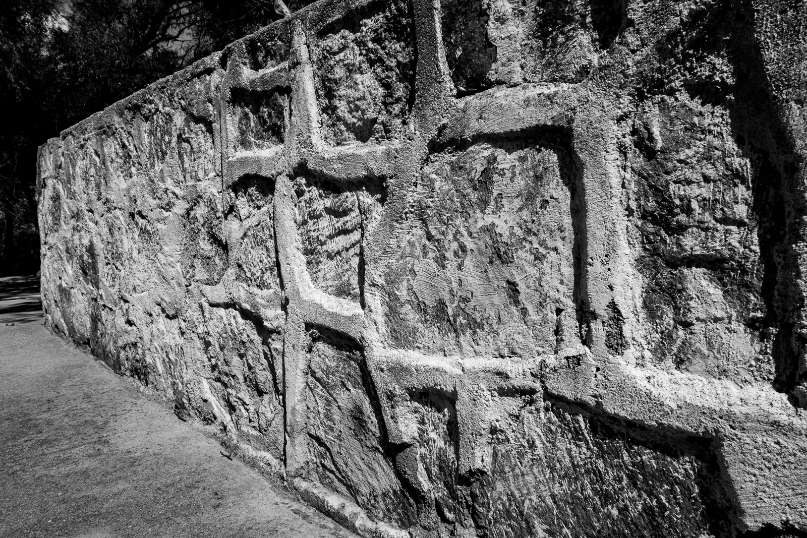
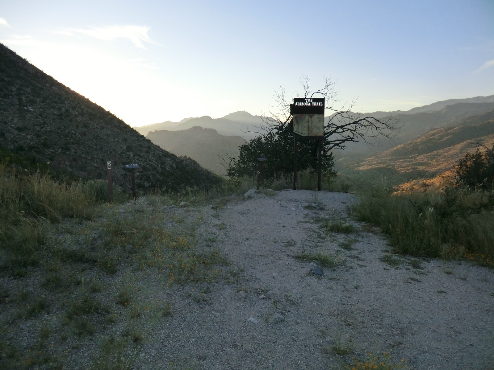
The Shreve Saddle Arizona Trail Sign

1212 Arizona Trail Sign
The Arizona Trail Sign at Shreve Saddle. December 2012.

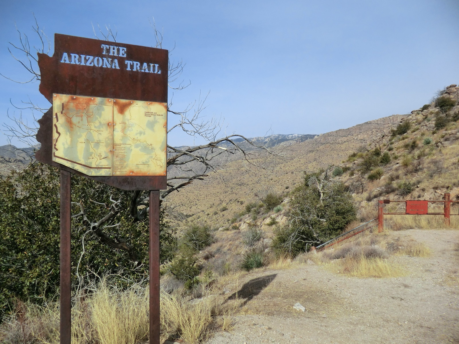
For years the sign above greeted you at Shreve Saddle on the edge of the Pusch Ridge Wilderness where the Molino Basin Trail and Sycamore Reservoir Trail meet – but it is now gone…

1505 Shreve Saddle without the Arizona Trail Sign
Shreve Saddle – Arizona Trail Sign removed. May 2015.

I liked the old sign – but the information was not up to date, ‘one less giant sign in the backcountry’ seems like a good idea and the view is nicer without the sign – probably a change for the better, but I still miss it just a little…

1209 Arizona Trail Sign
The Arizona Trail Sign at Shreve Saddle. September 2012.

Bigelow Trailhead to the Gordon Hirabayashi Recreation Site – 1/17/2015

We started at the Bigelow Trailhead, walked past the gate that closes Organization Ridge Road to public motorized traffic in the winter and continued on to the Palisade Trailhead. The road was icy and there was just enough snow at the trailhead to give a pleasant hint of winter, but not enough to require anything other than a little caution.

1501 Snow at the Palisade Trailhead
Palisade Trailhead with snow – Organization Ridge Road is closed seasonally to motorized vehicles so we parked at the Bigelow Trailhead and walked the road. January 2015.

We could hear Palisade Canyon flowing below – it looked like quite a bit of water from the trail – walked snowy sections of Palisade Trail where the shade preserved the remains of the last storm, paused for birds and enjoyed the polished stone in Pine Canyon before reaching Mud Spring.

1501 Cairn and brown ferns near Mud Spring
A cairn marking the Mud Spring Tank is surrounded by dead ferns. January 2015.

The waterfall in Pine Canyon was roaring away – quite a sight – and we paused just before the trail begins to plunge downwards to enjoy the view – Thimble Peak to Brinkley Point!

1501 A View from the Palisade Trail
A impressive view of the mountains – from near the Palisade Trail looking into Tucson – landmarks include Thimble Peak (near the left), Cathedral Rock and Brinkley Point (on the right). January 2015.

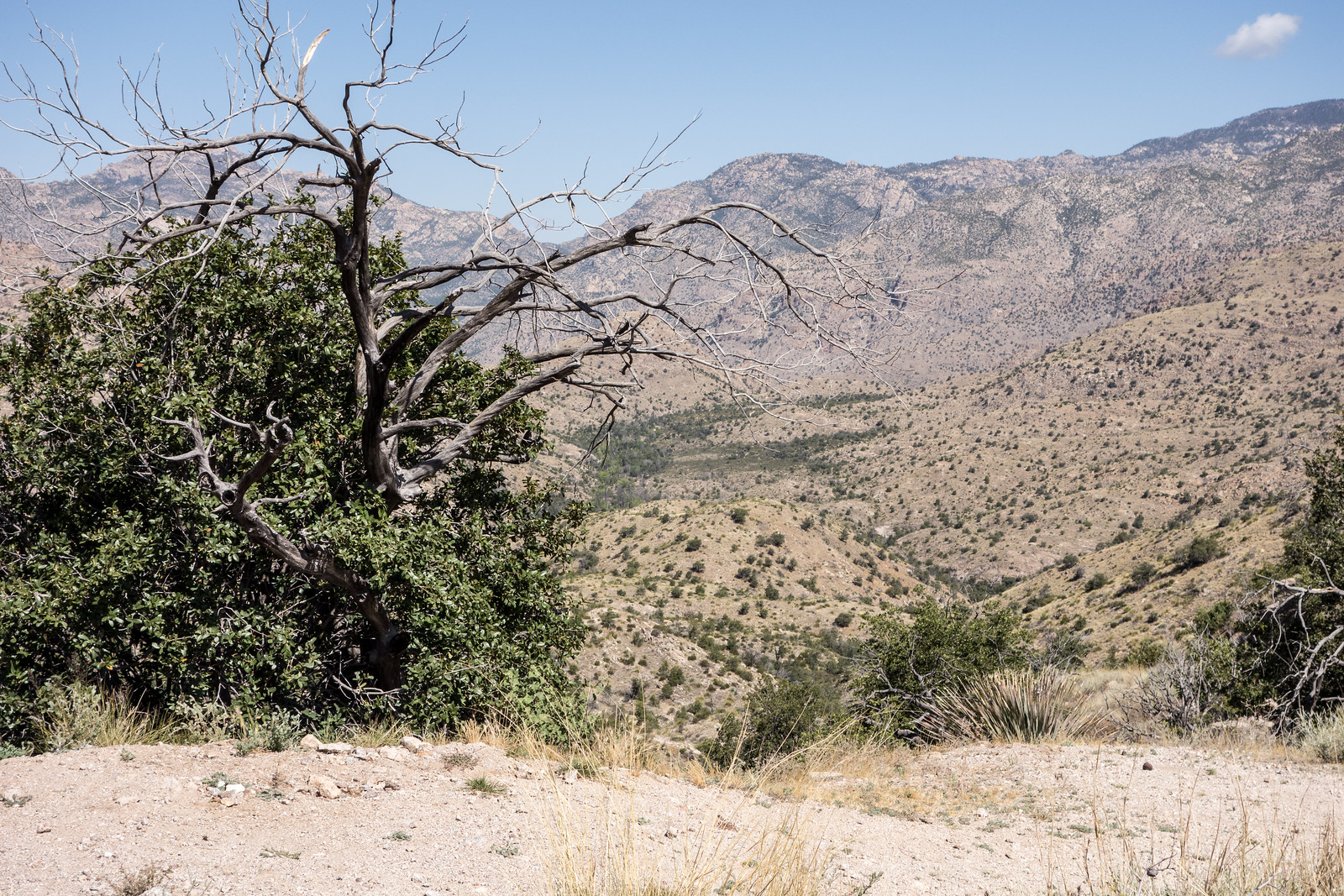
Down to the junction with the East Fork Trail and then up – past the Bear Canyon Trail and onto the Bear Canyon Trail, across Sycamore Canyon, past Sycamore Reservoir where Sycamore Canyon and Bear Canyon were pouring an impressive amount of water over the dam, up to Shreve Saddle and then down the Molino Basin Trail to the car we had left at the Gordon Hirabayashi Recreation Site earlier in the day.

1501 Water rushing over the Sycamore Reservoir Dam
Water from Sycamore Canyon and Bear Canyon rush over the Sycamore Reservoir Dam. January 2015.

Descending the Palisade Trail is a great way to see everything from pine forest to cactus and take in quite a few impressive views. Currently miles 4-6 of the Palisade Trail are distinctly more overgrown and less used than the upper sections of the trail – with some attention and effort you should be able to find the trail, but be prepared to use your map and navigate if needed.

12.8 miles, +1,400’/-4,350′ of elevation gain/loss.