A beautiful Santa Catalina sunset from the The Cordones north of Catalina. August 2016.Sunset from The Cordones north of Catalina. August 2016.
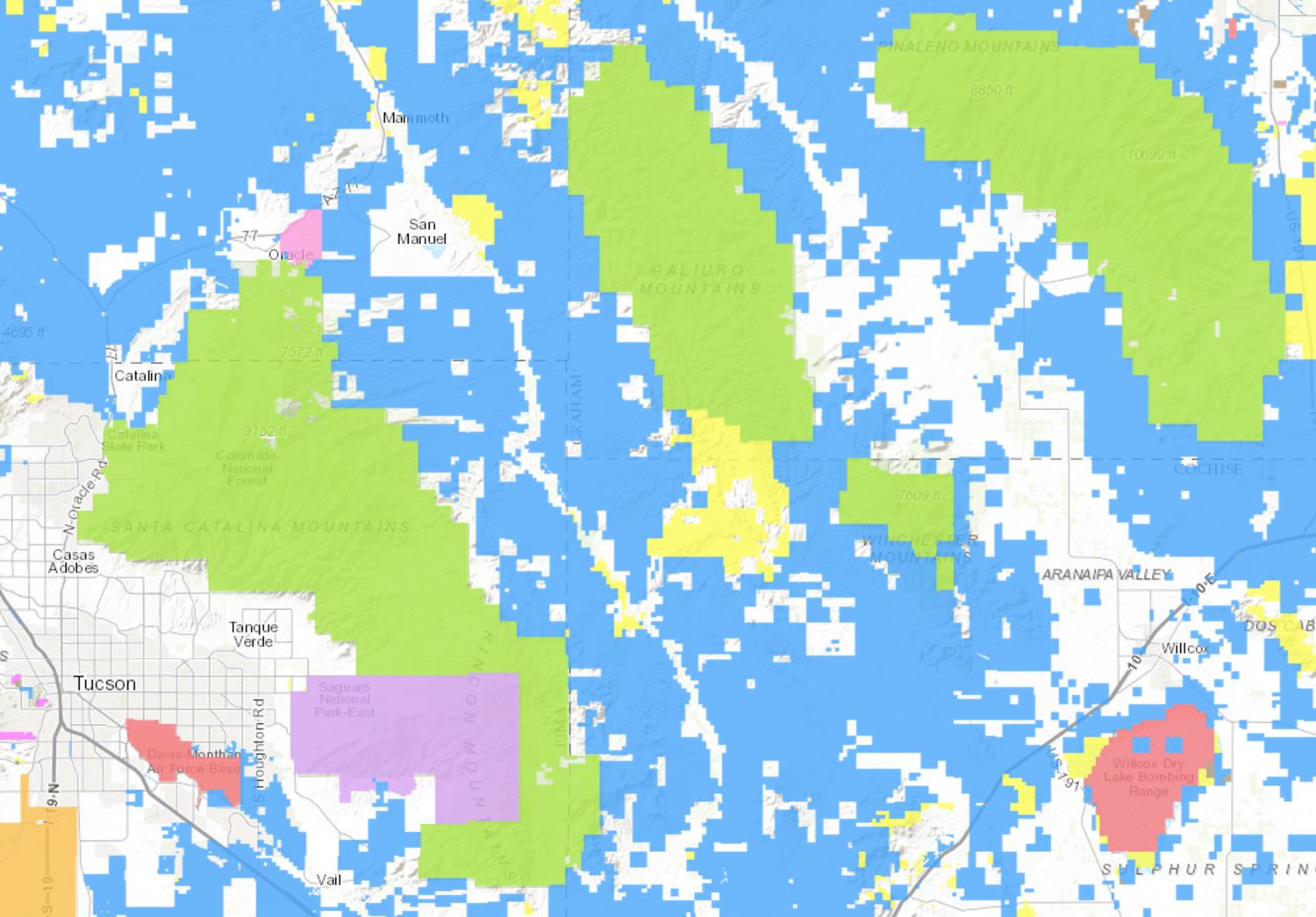
It took many years for me to realize that Arizona State Trust Land is an important portion of the lands that give Southern Arizona its character and feel – a glance at the Arizona State Trust Land Parcel Viewer shows (in blue) the large amount of Arizona State Trust Land around, at the border of and between Southern Arizona’s Sky Islands. The east side of the Santa Catalina Mountains would be a very different place without public access (for a fee) to the land that is currently owned by the State Trust.
A screen shot from the Arizona State Land Trust Parcel Viewer – the colored areas are Arizona State Trust Land. August 2016.
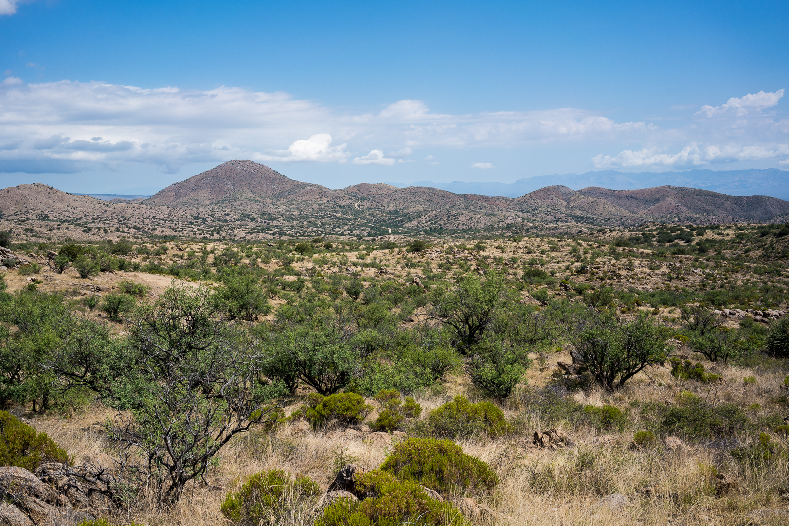
North of Catalina, just past E. Saddlebrooke Blvd, a section of State Trust land covers an area labeled ‘The Cordones’. Several roads lead out into the area and in some spots the combinations of ridges, washes and hills conspire to hide many of the nearby roads and homes – occasionally making the area feel a bit more remote than it really is. I intended to catch the sunset – but being there for a storm was just good luck…
Lightning and storm over the Santa Catalina Mountains. August 2016.Lightning over the Santa Catalina Mountains. August 2016.
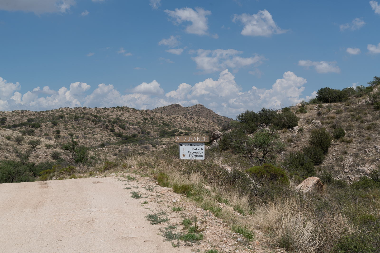
A sign on Redington Road marking the boundary of Pima County’s A-7 Ranch. July 2016.
A small sign on Redington Road announces the boundary of Pima County’s A-7 ranch – there is no welcoming trail map, list of rules, historic marker or dedications – just a simple sign, easy enough to miss, the land on either side looks the same.
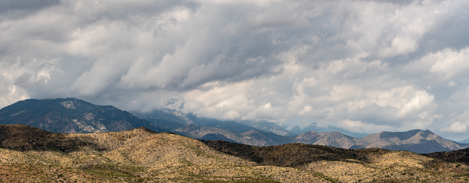
A storm over the Santa Catalina Mountains – taken from a road on the A-7 Ranch – between Redington Road and the San Pedro River. June 2016.
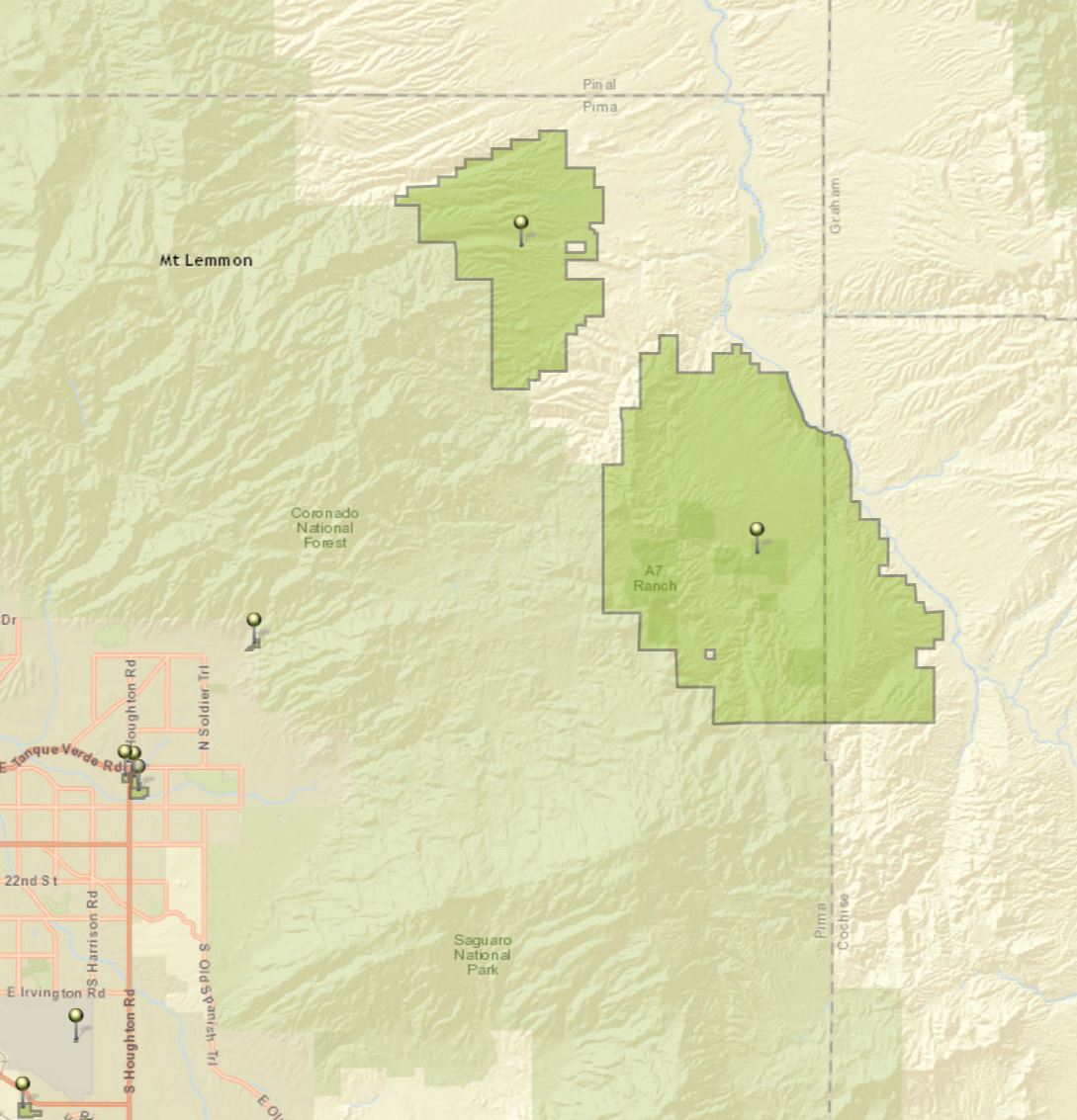
The A-7 Ranch is owned by Pima County – it was purchased with funds from a voter approved 2004 Bond program that made $174 million dollars available for open-space purchases. The A-7 stretches from Buehman Canyon in the Santa Catalina Mountains down to the North East corner of the Rincon Mountains – it is bordered on the east by the San Pedro River and helps to connect the Galiuro, Rincon and Santa Catalina Mountains.
Two of Pima County’s open space purchases – the Six Bar Ranch (upper pin) and the A-7 Ranch (lower pin). Santa Catalina Mountains (upper left), Rincon Mountains (lower center) and the edge of the Galiuro Mountains (upper right). July 2016.
Access information can be found here – don’t expect to find a network of established hiking trails… Some recent history from a Pima County Report:
The 41,000 acre A-7 Ranch lies northeast of Tucson along Redington Road, between the Catalina and Rincon Mountains and the San Pedro River. The County acquired the ranch from the City of Tucson in 2004. The City had purchased the ranch in 1999. Prior to the City’s purchase, the ranch was part of a larger ranch totaling about 96,000 acres known as the Bellota Ranch, which was owned and operated by the Riley-West Corporation for 20 years. The A-7 portion of the Bellota Ranch was sold to the City, while the Forest Service grazing permit was sold to the owners of the Tanque Verde Guest Ranch.
Redington Road heading towards Piety Hill on the A-7 Ranch. July 2016.
Looking over Peck Basin, Point 5817 and the San Pedro River Valley to the Galiuro Mountains from near the San Pedro Vista. April 2016.
The summer will bring plenty of cloudy days, but for now they remain infrequent and good clouds are more than enough of a reason to drive up the mountain – the payoffs on this trip were watching the light on the San Pedro River Valley and Galiuro Mountains from the Incinerator Ridge Trail, seeing the end of the day thru The Window from near the junction of the Mount Lemmon and Sutherland Trails and hiking in the darkness thru the clouds and big pines near the top of the mountain on the Meadow Trail.
The Window from near the Sutherland and Mount Lemmon Trail junction. April 2016.A stormy night on the Meadow Trail – Mount Lemmon. April 2016.
Any ‘big view’ from the Santa Catalina Mountains is going to include at least one – and often more – of the Madrean Sky Islands. Like the Santa Catalina Mountains these ranges soar up from the desert floor to oak and pine forests at higher elevations. Almost anyone who has spent time hiking in Southern Arizona will have driven to some, or many, of the Madrean Sky Islands – some people have also connected these ranges in long distance human powered efforts – two notable recent events:
The Sky Island Traverse is an incredibly interesting and rugged route that spirals thru a number of Sky Island ranges in Southern Arizona including the Santa Catalina Mountains – a thru-hike of the SkIT was completed by Ryan “Dirtmonger” Sylva, a rare event, and his blog includes a great post on the SKiT!
The Arizona Trail Race is an unofficial challenge that takes place every spring on the cross state Arizona Trail. Two distances are available. The Arizona Trail 300 is a 300 mile event that has been held every April since 2006. The Arizona Trail Race is the complete traversal (Mexico->Utah over 750+ miles) and was offered for the first time in 2010. Both events are run concurrently, starting on the same day.
This is not an organized or sanctioned event in any way. It’s simply a group of friends out to ride their bikes on the same route at the same time. We’ll probably compare times afterwards, but more importantly, we’ll compare experiences — the highs and lows the trail and mountains offered us.
The 18 miles or so of road climbing up to Mt. Lemmon are as challenging as I thought they would be. Pedaling up a sustained climb in the heat, on pavement, on a loaded mountain bike is a drudging affair. I decide to simply take my time and occupy myself people watching. I am passed by a few Tour de France style riders, who zip by effortlessly on their speed machines. I begin this ongoing joke in my head that Neil is up there attacking the climb, dropping all the roadies, while I am just turtle grinding in my lowest gear, waddling up the hill like that Gila Monster.
By mid-day the highway had re-opened – low on the mountain there was no sign of yesterday’s storm – but somewhere before Bear Canyon snow started covering the ground. There was more snow higher on the mountain – and an impressive display of ice on the roadcut above the pullout for the Ridgeline Climbing Area.
The past several updates have talked about the collars dropping off as the batteries run out – 3 of the collars failed to drop off, but “This does not create any added potential risk to the animals since they are mature adults”.
Since the end of 2013 there have been published updates on the project every two weeks – starting in March the plan is to go to once a month updates: “With the continued positive indicators on this project (including a successful November 2015 release and 2013 collars now dropping off as anticipated) the Catalina Bighorn Sheep Reintroduction Project is running smoothly and requiring less intensive management. Coupled with this milestone is an anticipated reduction in the frequency of the current routine bi-weekly project updates. Beginning in March we intend going to a monthly update schedule (issued on the last Friday of each month).”
Sahara Mustard threatens to bring a real “Silent Spring” to the Anza-Borrego Desert and other deserts of the Southwest. Sahara Mustard quickly multiplies to overshadow, poison, and rob water from the wildflower fields and blooming cacti that bring so many visitors from around the world to see the. Eventually, Sahara Mustard can kill even tough creosote, cholla and barrel cacti, literally taking over the desert and turning it into a mustard wasteland devoid of the biodiversity needed to sustain desert wildlife
Ice on the roadcut above the Ridgeline Parking Pullout. February 2016.