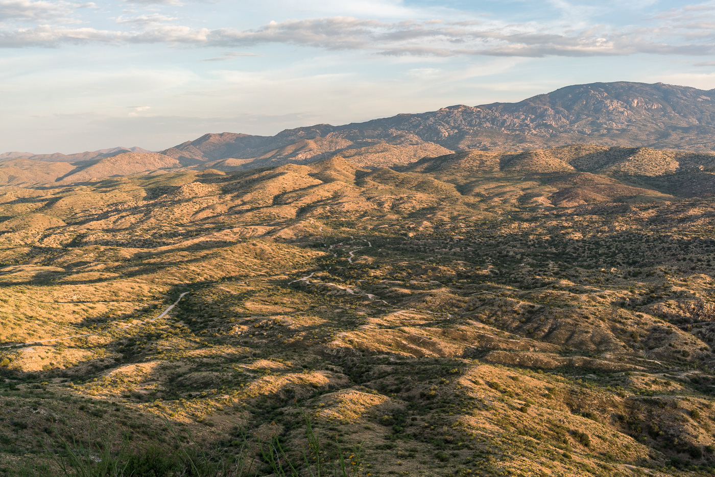
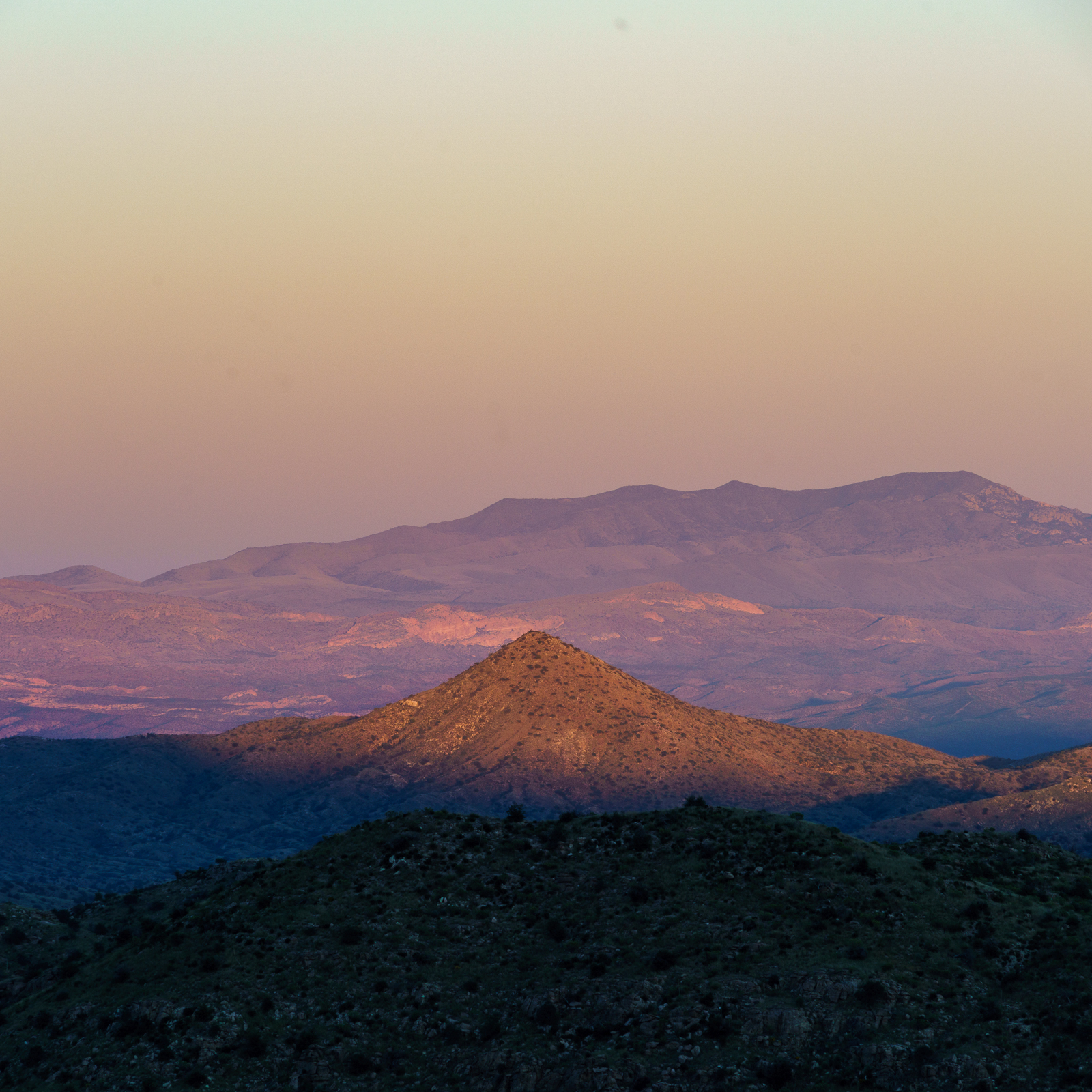
Redington Road had been closed since the start of July due to the Burro Fire – on the first day that it re-opened I drove out along the fire perimeter and hiked to the top of Piety Hill. The Burro Fire was stopped west of Piety Hill and in the sunset light it was hard tell where the Burro Fire burned – I am sure that there are areas that were heavily impacted by the fire but from Piety Hill I can still see green trees and grass below.
Piety Hill’s shadow towards the San Pedro Valley. July 2017.
Piety Hill is located on Pima County’s A7 Ranch – at 4,714′ it is not stunning high (‘Hill’ is the right name) – but it is high enough to overlook the San Pedro Valley and offer great views of the surrounding terrain! There is no official trail to the top, but the terrain, while steep, is reasonably open and it is not hard to find a way to the top.
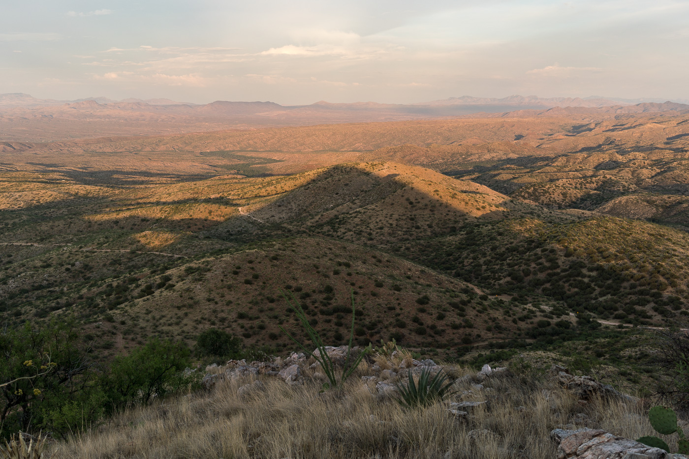
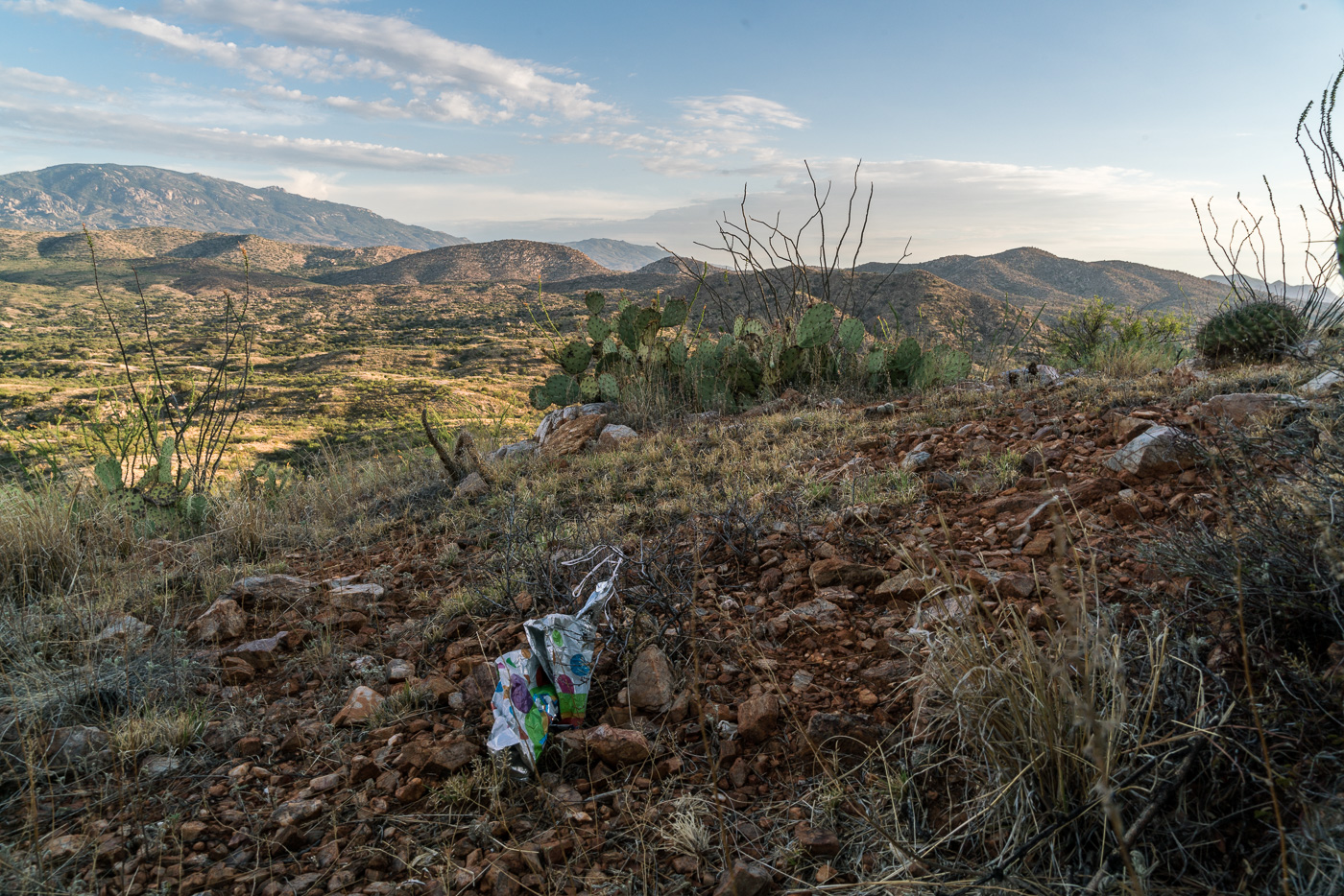
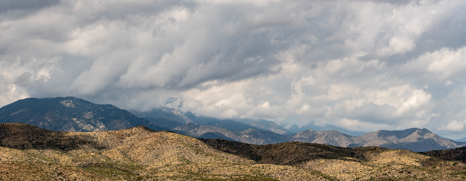
Looking up into the Santa Catalina Mountains from Piety Hill – Mount Bigelow on the left, Westfall Knob in the center. July 2017.Balloon Trash on the slopes of Piety Hill. July 2017.
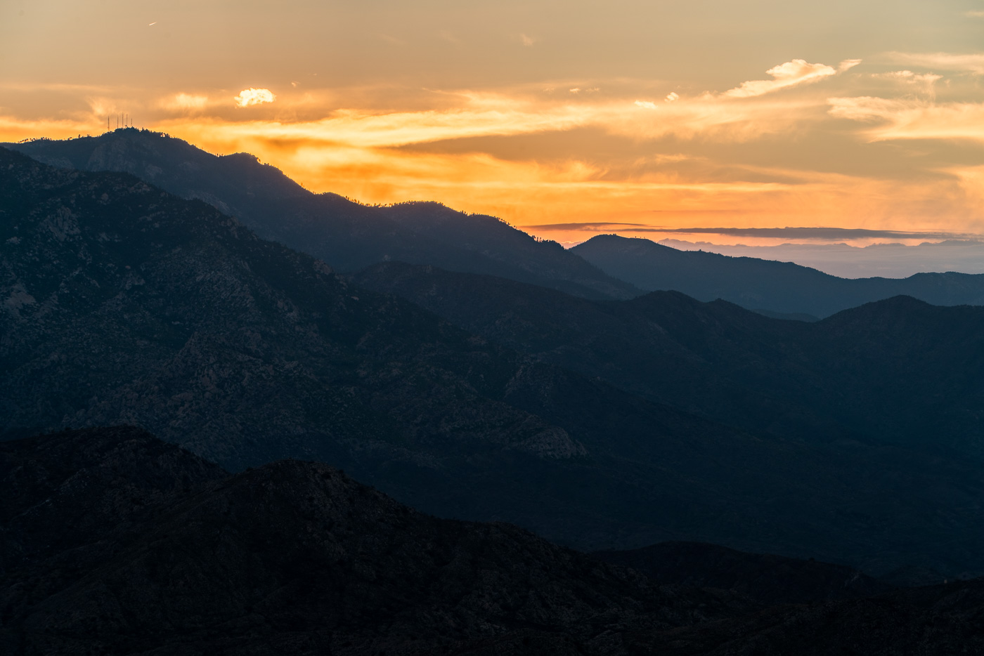
Piety Hill and the Winchester Mountains in sunset light. October 2016.
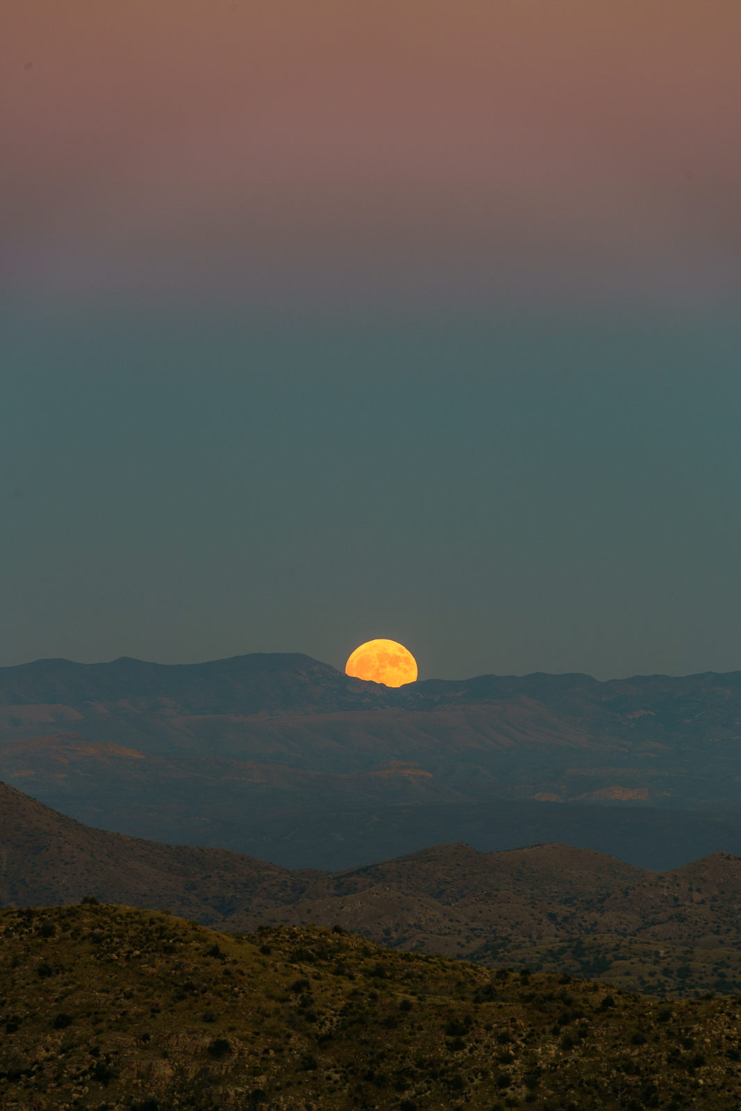
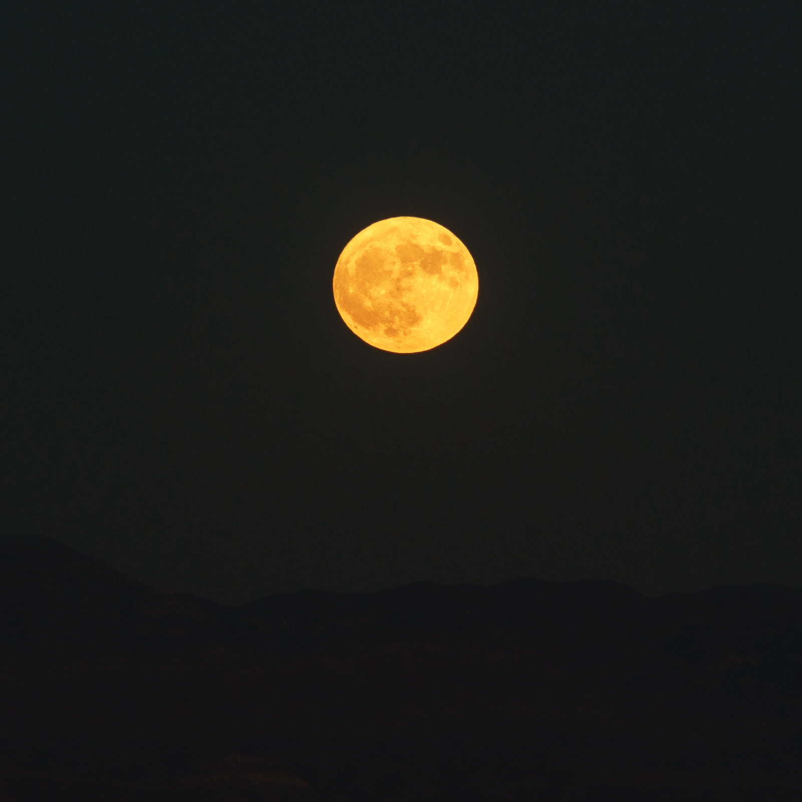
We started at the Molino Basin Parking Area and hiked the Bellota Trail – as the eastern skyline came into view we left the trail and traversed the hillside – with Piety Hill visible below and the Winchester Mountains on the horizon we sat down to watch the sunset and wait for Hunter’s Moon to rise.
The name [Hunter’s Moon] dates back to the First Nations of North America. It is so-called because it was during the month of October, when the deers had fatted themselves over the course of the summer, that hunters tracked and killed prey by autumn moonlight, stockpiling food for the coming winter.
A Hunter’s Moon rising behind the Winchester Mountains – taken near the Bellota Trail. October 2016.Watching the Hunter’s Moon from near the Bellota Trail. October 2016.
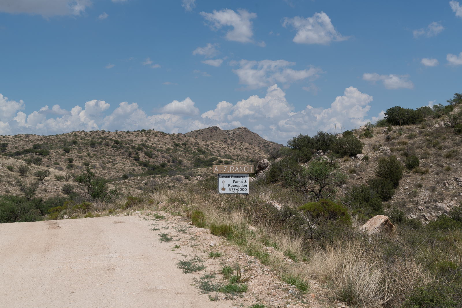
A sign on Redington Road marking the boundary of Pima County’s A-7 Ranch. July 2016.
A small sign on Redington Road announces the boundary of Pima County’s A-7 ranch – there is no welcoming trail map, list of rules, historic marker or dedications – just a simple sign, easy enough to miss, the land on either side looks the same.
A storm over the Santa Catalina Mountains – taken from a road on the A-7 Ranch – between Redington Road and the San Pedro River. June 2016.
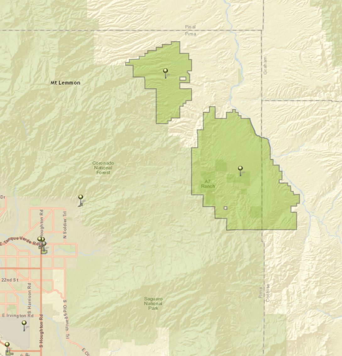
The A-7 Ranch is owned by Pima County – it was purchased with funds from a voter approved 2004 Bond program that made $174 million dollars available for open-space purchases. The A-7 stretches from Buehman Canyon in the Santa Catalina Mountains down to the North East corner of the Rincon Mountains – it is bordered on the east by the San Pedro River and helps to connect the Galiuro, Rincon and Santa Catalina Mountains.
Two of Pima County’s open space purchases – the Six Bar Ranch (upper pin) and the A-7 Ranch (lower pin). Santa Catalina Mountains (upper left), Rincon Mountains (lower center) and the edge of the Galiuro Mountains (upper right). July 2016.
Access information can be found here – don’t expect to find a network of established hiking trails… Some recent history from a Pima County Report:
The 41,000 acre A-7 Ranch lies northeast of Tucson along Redington Road, between the Catalina and Rincon Mountains and the San Pedro River. The County acquired the ranch from the City of Tucson in 2004. The City had purchased the ranch in 1999. Prior to the City’s purchase, the ranch was part of a larger ranch totaling about 96,000 acres known as the Bellota Ranch, which was owned and operated by the Riley-West Corporation for 20 years. The A-7 portion of the Bellota Ranch was sold to the City, while the Forest Service grazing permit was sold to the owners of the Tanque Verde Guest Ranch.
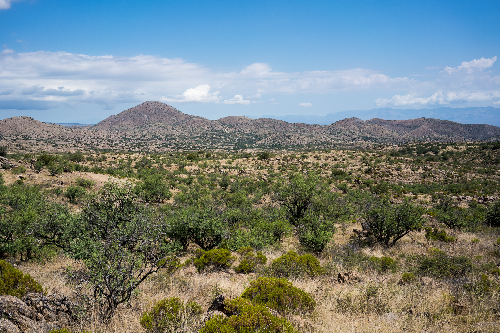
Redington Road heading towards Piety Hill on the A-7 Ranch. July 2016.
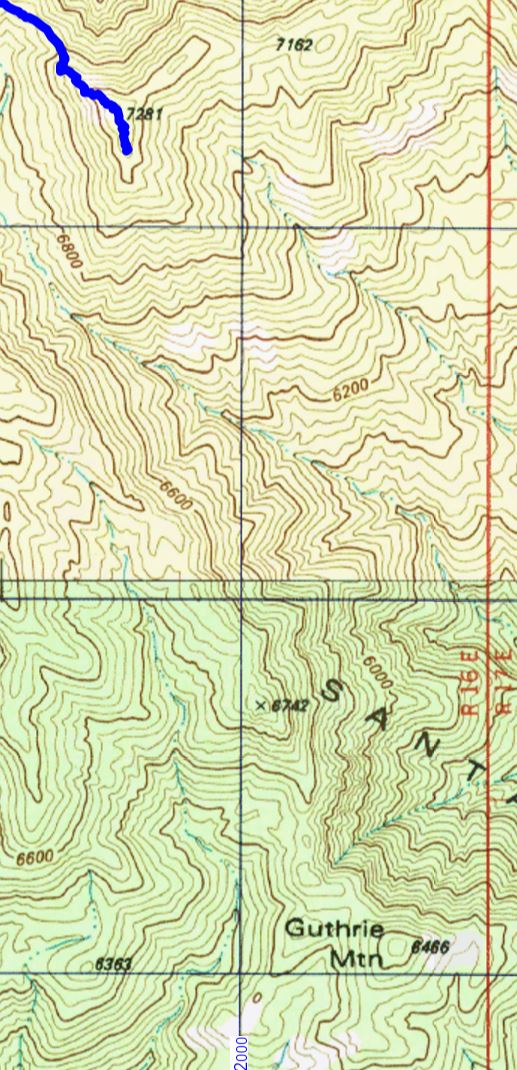
The Guthrie Mountain Trail ends near Point 7281 – the highest peak in the area – but if you look at the USGS 7.5′ maps you might notice that Point 7281 is not labeled ‘Guthrie Mountain’.
The end of the Guthrie Mountain Trail shown on the USGS 7.5′ topo map – note that this point is not labeled ‘Guthrie Mountain’.
However if you look around on the USGS 7.5′ maps for the Santa Catalina Mountains you will eventually find a point well to the south of the ending of the Guthrie Mountain Trail labeled ‘Guthrie Mountain’.
The two Guthrie Mountains – Point 7281 where the Guthrie Mountain Trail ends and Point 6466 where Guthrie Mountain is labeled on the USGS Maps.
From the 3rd edition of the [GuideYellowBook/], p. 75:
Guthrie Mountain was named for an early forest supervisor in the southwest and is located on the U.S.G.S. quadrangle map as a 6464-foot-high point on the ridge just east of Molino Canyon. It is the opinion of the authors that this is an error and that Guthrie Mountain is the prominent 7300-foot-high point just north of Burro Canyon and about a mile southeast of Bear Saddle.
While I think that the ending point of the Guthrie Mountain Trail makes the most sense as ‘Guthrie Mountain’ the Guthrie Mountain label on the USGS maps provides an excellent excuse to visit another point on the map…
We approached the USGS Guthrie Mountain from the Molino Basin Parking Area, starting on the Bellota Trail but quickly turning onto the route up Molino Canyon. We hiked several miles up the beautifully rugged canyon bottom to a point west of the USGS Guthrie Mountain and, after some debate about what would be the best way up onto the ridge, we began our ascent. What started as a smart/clean way to the ridge quickly devolved into a slow crawl (occasionally literally) thru the Manzanita – thankfully the ridge was fairly close soon we had our first good look at the USGS Guthrie Mountain.
USGS Guthrie Mountain. March 2016.
A small trail along the ridge took us quickly to the top – the peak is fairly open on top and there are great views! Not, I think, the ‘real’ Guthrie Mountain – but certainly a beautiful destination.
Piety Hill from the USGS Guthrie Mountain. March 2016.Looking up towards the ‘real’ Guthrie Mountain from the USGS Guthrie Mountain – Point 7135, Point 6742 and the ‘real’ Guthrie Mountain are the highpoints. March 2016.Looking across Point 6069 down into Tucson from the USGS Guthrie Mountain – part of Airmen Peak is visible on right edge of the picture. March 2016.