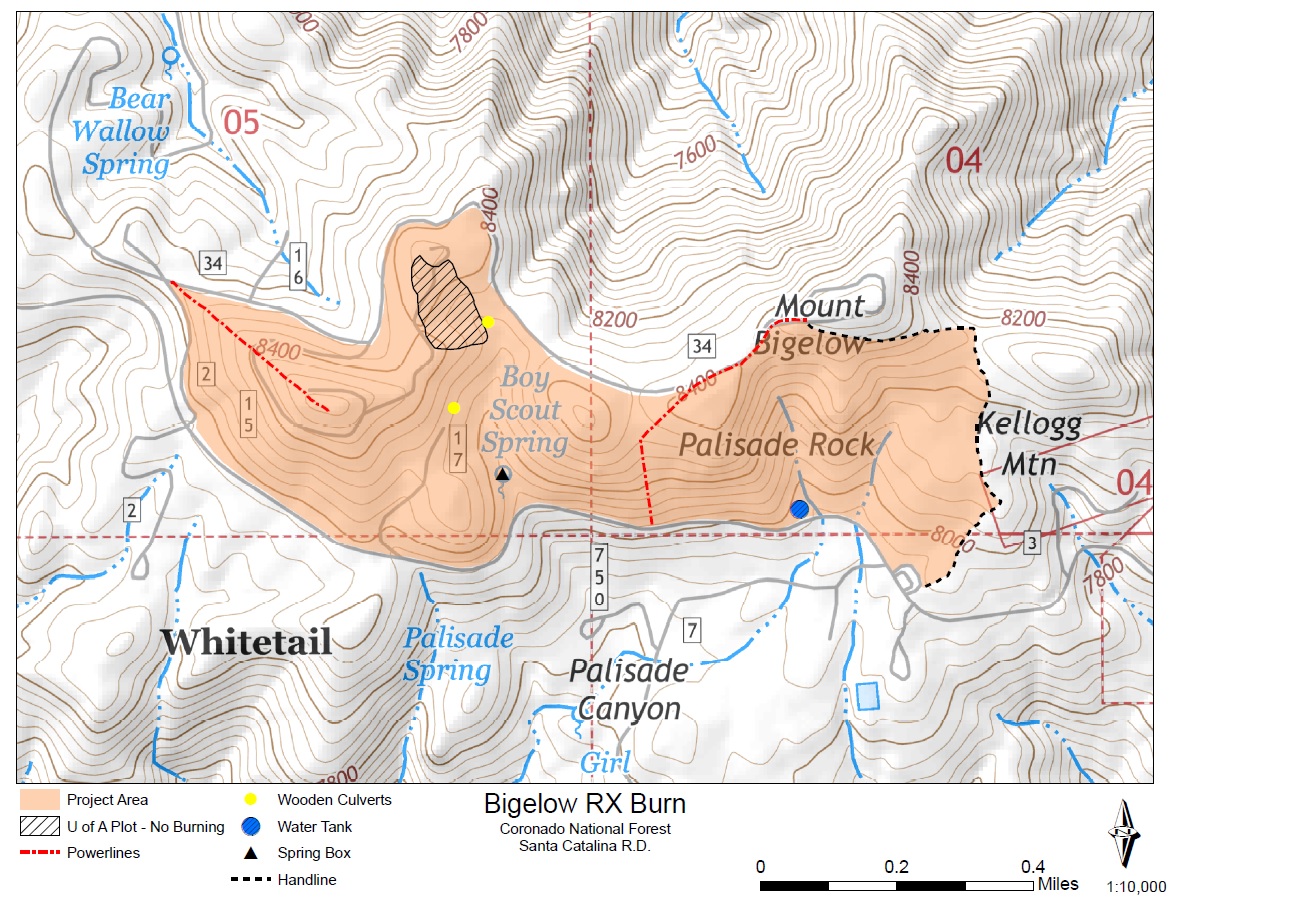
Bigelow Prescribed Fire on Mt. Lemmon, Coronado National Forest: On Monday, November 4th, “if conditions such as temperature, wind speed and direction, relative humidity and fuel moistures are favorable” fire managers will burn a 200-acre area around Mount Bigelow. The fire could cause road and trail closures in the area – the Kellogg Trail, Butterfly Trail and dirt roads in the vicinity seem the most likely to be impacted. From the Forest Service News Release “Prescribed fires are among the most effective tools available to resource managers to restore fire-adapted ecosystems. They mimic natural fires by reducing forest fuels, recycling nutrients and increasing habitat diversity.”
Forest Service Bigelow Prescribed Burn Map. October 2016.
Hilton Tucson El Conquistador opens 18-horse stable – AZBIGMEDIA: The Hilton Tucson El Conquistador, located north of the Linda Vista Trailhead, has opened stables and is offering “trail rides, riding lessons and family friendly adventures for locals and visitors looking to explore the spectacular Sonoran Desert.”
Fuelwood Permits (for personal use only) are available for Mt. Lemmon at the Ranger District Office, 5700 N. Sabino Canyon Road from 11/1 to 12/16 for the 11/1 to 4/16 cutting season. Permits are $20, 1 per household, and “will authorize collection on Mt. Lemmon and in the Oracle area of dry, dead-and-down and dead standing wood (no live branches) less than eight inches in diameter at breast height. Cutting area maps and program regulations will be provided with permits upon request. Permit holders may collect and remove only dry wood from the collection areas.”
Rescues/Accidents/Incidents including information from the SARCI Newsletter:
Wilderness of Rocks 10/1/2016: A hiker is stranded off trail by darkness in the area of the Lemmon Rock Trail/Wilderness of Rocks junction.
Windy Point 10/6/2016: A woman injured in the area is carried out.
Sutherland Trail 10/8/2016: A hiker is carried out after becoming exhausted on a social trail off the Sutherland Trail.
Sabino Canyon 10/13/2016: Three lost hikers in Sabino Canyon below the guaging station, and above the Box Spring Trail, requested helped and were helped upstream.
Butterfly Trail 10/17/2016: A biker on the Butterfly Trail was lost in the Novio Spring area and lifted out by helicopter.
Cloud streaks over the edge of the Rincon Mountains from Redington Road, near sunrise. October 2016.
White Tank off Redington Road near the Bellota Trail – the Rincons Mountains in the backgroud, storm clouds above. June 2016.
During a tragic weekend in late June record heat was the cause of three deaths in the Santa Catalina Mountains. One female hiker from out of state died on the Finger Rock Trail and two hikers from Germany died on the Ventana Canyon Trail.
Southern Arizona Rescue Association is looking for hikers who are team players to join our group! If you are interested, please plan to attend one of two Orientations and the Candidate Hike: Orientation 1 – Thursday, June 23, 7:00pm Orientation 2 – Tuesday, July 19, 7:00pm Applicant Hike and selection – Saturday, August 13
Attendance at one of the two Orientation meetings and the hike is a MANDATORY first step in joining SARA. Orientations are intended to tell you everything you need to know about the selection process and being in SARA, will last about an hour, and are held at the SARA house at 5990 N. Sabino Canyon Road. We will see you there!
A group of 4 family members out for a hike on the Butterfly Trail were reported missing – they were later found.
Mount Lemmon offers relief from the heat – KVOA.com: A short piece on trying to stay cool by escaping up to Mount Lemmon – it is, of course, always cooler at the top of the mountain… But recent temperatures have been high enough that it has been very hot even at higher elevations. If you are considering heading to the top of the mountain here is a short video about the Meadow Trail – Hittin’ the Trails 4 You: Mt. Lemmon’s Meadow Loop Trail – KVOA.com.
Campers recently spotted a black bear on Organization Ridge Road near a dumpster – a good reminder to be ‘bear aware’ when you are on the mountain. From Mark Hart of Arizona Game and Fish: “Overall it’s the heat, the bears are hungry and they are thirsty and some are moving into higher country to escape the heat.” Another sighting on Mt. Lemmon reminder to be bear aware – KVOA.com.
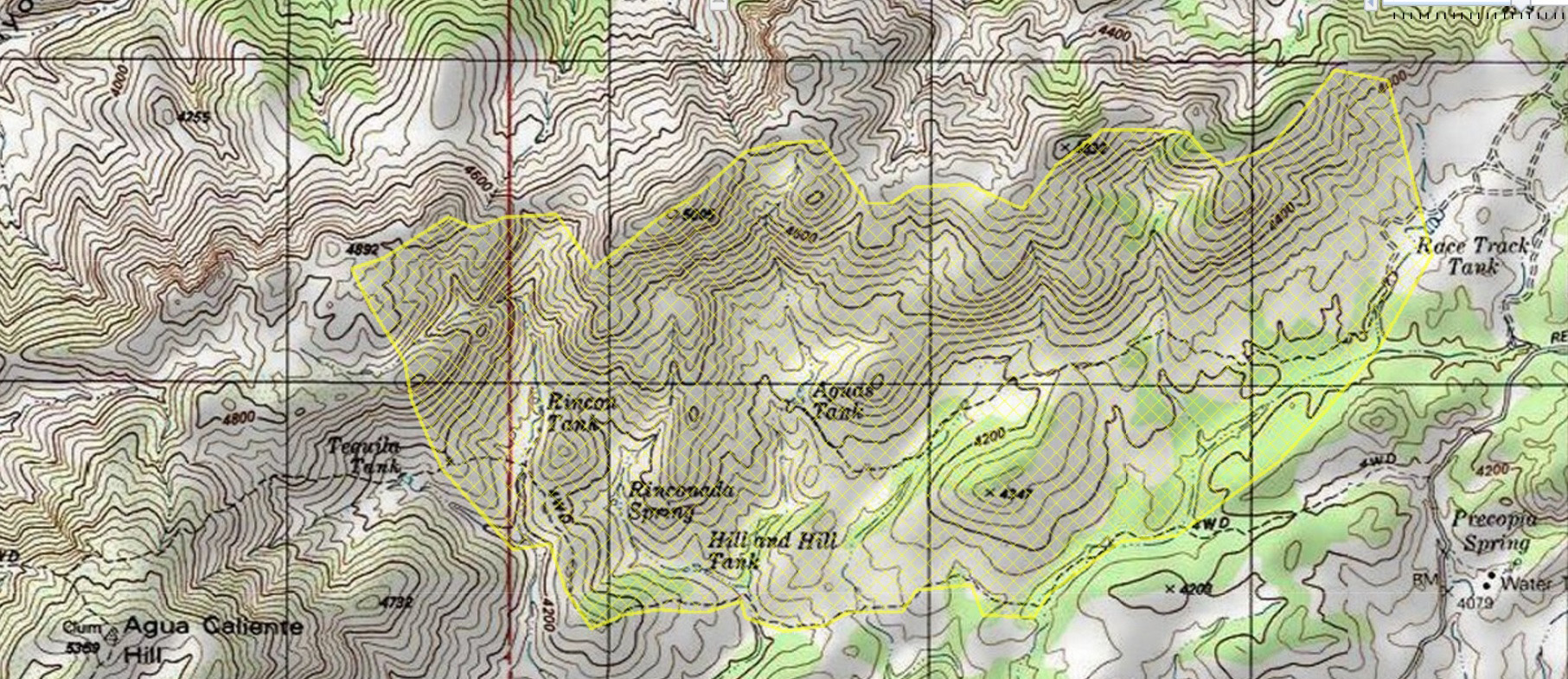
The Race Track Fire started on June 26th near Redington Road– the last update from June indicates the fire is unlikely to grow:
The Racetrack fire’s perimeter remains 80% contained today. All forward progress of the fire has been halted. Three engines and two crews remain on the fire and are mopping up hot spots, rehabilitating control lines to minimize erosion from expected monsoon rains, and patrolling for additional heat. By the end of the work period today, the incident commander anticipates increased containment.
The fire burned approximately 800 acres in an area north of Redington Road, east of Agua Caliente Hill and west of Race Track Tank.
The cause of the fire is listed as under investigation, however I don’t believe there was any weather/lightning in the Redington Road area at the time the fire started so it seems likely it will be labeled human caused.
The perimeter of the Race Track Fire – note Agua Caliente Hill in the bottom left of this map and Redington Road on the far right. June 2016.
The Santa Catalina Bighorn Sheep Reintroduction Project update for the period ending June 22 was released recently and unlike a number of recent updates there were no mortality signals from the remaining collars and the bulk of the report is filled with great pictures and reports from biologists about the Bighorn observed during the period.
Rescues/Accidents/Incidents including information from the SARCI Newsletter:
Wilderness of Rocks 5/1/2016 – Hikers coming up from Catalina State Park via Romero Canyon were stopped at the junction of the Wilderness of Rocks and Lookout Trail when one member was unable to continue. The group was given help out.
Butterfly Trail 5/23/2016 – A hiker with an ankle injury was carried out from the Butterfly Trail.
Box Camp Trail 5/26/2016 – Two members of a group hiking down the Box Camp Trail towards Molino Basin were exhausted when they reached Sabino Basin and were ferried by helicopter to Prison Camp – two other members of the group were given assistance near Shreve Saddle.
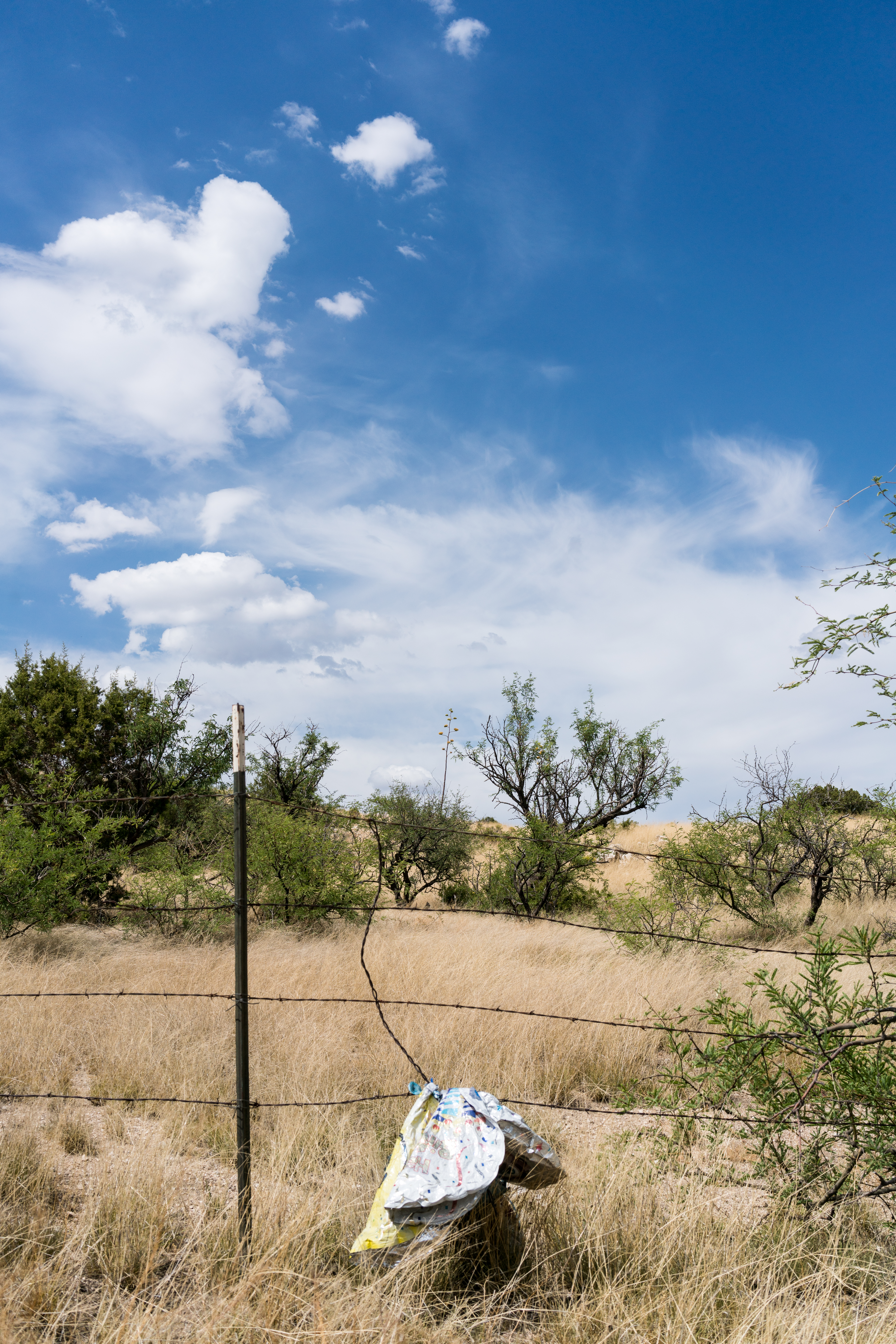
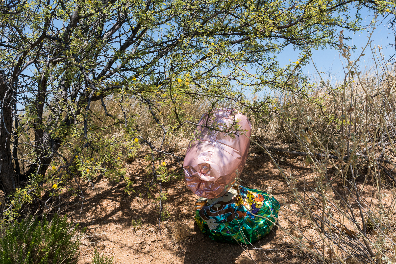
Trash – a bundle of balloons snagged on a barbed wire fence near White Tank off Redington Road – the only trash in sight… June 2016.
A hummingbird perches in the shade near the Lower Oracle Ridge Trailhead. June 2016.
In Oracle on an errand I hiked from the Lower Oracle Ridge Trailhead on the Oracle Ridge Trail – it was a hot day and I didn’t have time to go very far, but it didn’t matter – it was just great to spend a few minutes on the trail.
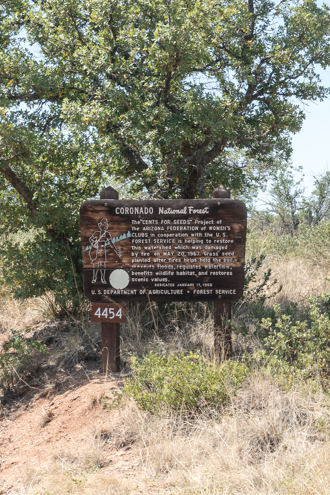
“CENTS FOR SEEDS” sign at FR4454. June 2016.
There is an interesting Coronado National Forest sign on the Cody Loop Road – the sign, on a small road in Oracle, and information, about a project from the late 1960s, seem, at best, obscure – but old newspaper articles quickly fill in the gaps – from the Tucson Daily Citizen, Friday, January 12, 1968, Page 13:
The second “cents-for-seeds” marker, sponsored by the Arizona Federation of Women’s Clubs (AFWC) and the Arizona Federation of Junior Women’s Clubs (AFJWC), will be unveiled and dedicated Wednesday at 2 p.m. The ceremony will take place near Camp Sue, Arizona Children’s Colony Lodge, Oracle. The day’s program will begin at 11 a.m. and Clyde W. Doran, forest supervisor, Coronado National Forest, will be master of ceremonies. Mrs. E. M. Bredwell, president of the AFWC, will talk on the “cents-for-seeds” project. Mrs. James R. Higgs, president of the AFJWC, will speak on the conservation activities of the AFJWC. Luncheon will be served by the Arizona-New Mexico Forest Products Industries Committee. Members of the Oracle Woman’s Club will be luncheon hostesses. The combined membership of these two statewide organizations is over 6,000. [?]11 member clubs support the “cents-for-seeds” project, which involves collecting funds for the reseeding of Arizona National Forests damaged by fires. Markers are erected to remind the traveling public of its responsibility to protect the land.
And more information about the fire from The Arizona Republic, Wednesday, January 17, 1968, Page 9:
The U.S. Forest Service will erect a large redwood sign commemorating the reseeding of the burn, which blackened more than 1,450 acres of grass and scrub oak near Oracle last May 20. The fire, which cost $80,000 to suppress, was started by children. It burned for two days and at one time threatened Oracle. No buildings were destroyed although the flames came as close as a quarter-mile to some Oracle homes.
Balloons – now trash – near the Arizona Trail outside of Oracle. June 2016.
Ewe #39552 was killed early on 4/28 by a mountain lion that was pursued and killed (this is the 7th Mountain Lion ‘lethally removed’ as part of the re-introduction effort).
Ewe #37446 died on 5/21 – disease is suspected.
36 collared sheep are known to be alive – the report states: “There could be as many as 45 uncollared sheep in this population as well, bringing the total potential population to 81 bighorn sheep.”
THE 46 SUMMITS OF THE SANTA CATALINA MOUNTAINS, TUCSON ARIZONA (PDF) – Old Adit, Andy Martin – I was recently reminded of Andy Martin’s work on a summits/high-points list for the Santa Catalina Mountains. This is a great list, especially if you love maps and the Santa Catalina Mountains, and unless you have looked thru it (or similar lists) it is likely to have at least a couple interesting summits that you have never thought about/noticed!
Forest Officials: Too Many Unattended Campfires – Arizona Public Media: Unfortunately in recent weeks “crews in the Coronado National Forest’s Santa Catalina Ranger District have spotted about 15 unattended campfires” – significant human caused fires have burned in the Santa Catalina Mountains and there is certainly a risk that unattended campfires can cause a wildfire. From the article – “You want to drown the fire out… That means pouring plenty of water on the fire, stirring the embers around in the water, and repeating as necessary.” Also related: Coronado National Forest Warning Of Memorial Day Weekend Fire Danger – KJZZ,
Sunset color above Pontatoc Ridge. May 2016.
Night in the desert under the full moon is amazing – if hiking at night in Sabino Canyon is not something you want to, or can, do consider a tour of Sabino Canyon at night on the Tram! Sabino Canyon gives moonlight tours (Arizona Daily Star)
Full Moon on Blackett’s Ridge, watching the stars above… May 2016.
“Currently we have two hives … off of the Blackett’s Ridge Trail. They’re in the wilderness and they’re a ways from the trail. So we have put up signs just advising people of the activity in the area so they know and they can make a decision: ‘Well, do I want to go this way or do I want to take one of the other trails'”
“If we get a report, we’ll go check it out and if it’s something that’s really benign like a ball of bees hanging that’s resting, we’ll put up signs so people know to stay out of the area and let them rest up and move on their way. If there’s a hive we may direct traffic around it, [or] close an area”
Rescues/Accidents/Incidents including information from the SARCI Newsletter:
Pontatoc Canyon 4/2/2016 – A hiker tried to traverse from Pontatoc Canyon to the Finger Rock Trail but called for help before completing the traverse and hiked out Pontatoc Canyon with SARA teams. Note: I believe that off-trail travel in the area between the Pontatoc and Finger Rock Canyons is prohibited in April due to Bighorn Sheep Restrictions.
Sabino Canyon Stop 9 4/4/2016 – Leg injury while hiking up from the stream.
Romero Canyon Trail 4/17/2016 – Ankle injury – able to walk out slowly.
Seven Falls 4/22/2016 – An exhausted hiker returning from Seven Falls was helped out on horse back.
Finger Rock Trail 4/23/2016 – A hiker called for help on the way down from Mount Kimball – after resting the hiker was able to continue to the trailhead.
Fire Crew Vehicles at the Box Camp Trailhead for the Montrose Fire. May 2016.
Update 5/17/2016: What looks like the end of the Montrose Fire – from InciWeb:
No smoke has not been observed over the Montrose Fire for two days. Fire managers will continue monitoring the fire area over the next several weeks. This will be the last update for the Montrose Fire unless circumstances change.
Update 5/15/2016, 4:30PM: The Montrose Fire continues to be listed as 80% contained, from a recent update:
The Montrose Fire, first discovered May 12, on the Coronado National Forest Catalina District, remains 80% contained. It is located near Box Spring 3 miles northwest of Rose Canyon Lake. One hotshot crew remains on the incident. With high winds in the Santa Catalina Mountains, their diligence is intended to prevent the fire from again becoming active. No smoke has been detected today. The crew will spend the remainder of the day and this evening monitoring the fire to ensure the perimeter is secure.
Rose Canyon Lake has been reopened for recreationists. Rose Canyon Campground is also open.
5/14/2016:
The Montrose Fire started on 5/12/2016 and, unlike the Finger Rock Fire in 2015 that was allowed to burn, there was a very prompt effort to suppress the fire – undoubtedly due to it’s proximity to homes and infrastructure on the mountain.
Currently listed as human caused and under investigation.
The fire is currently being mopped up and is listed as 13 acres/50% contained – on Friday in late afternoon we were unable to see any smoke from the fire on the Sunset Trail.
60 Personnel are listed as committed to the fire – there were Payson and Geronimo Hot Shot Crew Vehicles at the Box Camp Trailhead on Friday and helicopters dropped water from Rose Canyon Lake.