Marble Peak from the Davis Mesa Road. December 2018.
Already in Oracle on an errand I made the long drive out to the Davis Spring Trailhead stopping along the way to admire the snow covered peaks in the distance. The road to Davis Mesa seemed to be in about the same condition as previous trips – although the last few miles were muddier than expected. (A 4wd vehicle is recommended for this drive!)
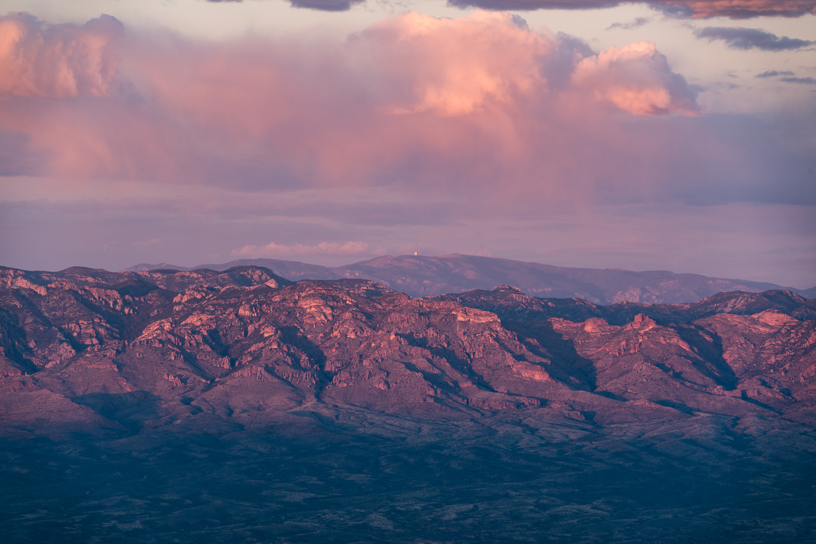
Snow on the Galiuros – Rhodes Peak – from the Davis Mesa Road. December 2018.
The long drive didn’t leave much time to hike – past the surprisingly still standing trail sign, flowing water at Davis Spring, a full tank at the corral and down into Edgar Canyon – upstream along the water, downstream in the fallen Sycamore leaves – time to go…
Looking down Edgar Canyon towards Bassett Peak in the Galiuros. December 2018.Davis Spring – water in the tank in December. December 2018.Edgar Canyon. December 2018.
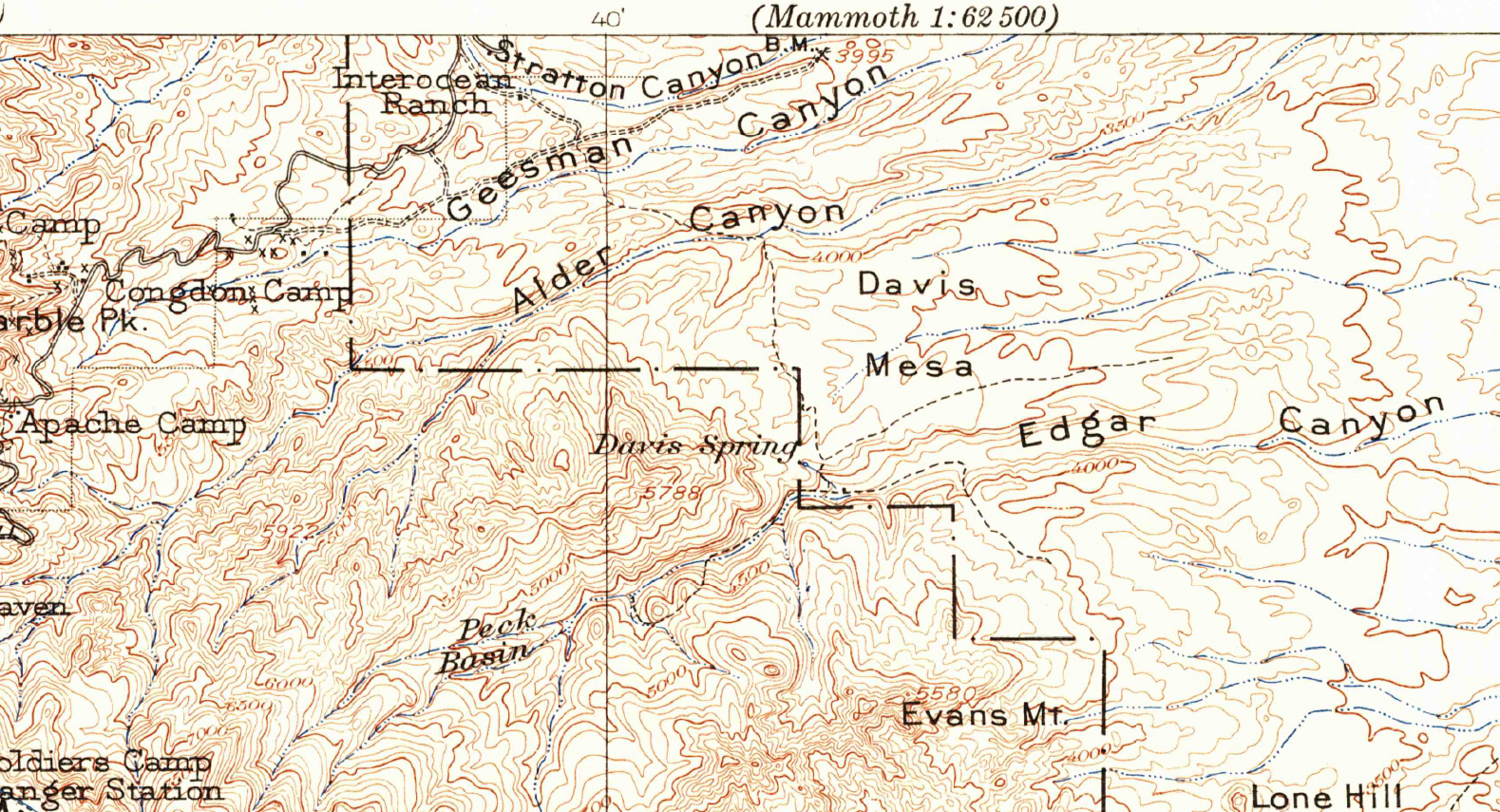
From a 1904 map of the Tucson area – the current Davis Spring Trailhead is near the center of the map above ‘Davis Spring’. Note the trail across Davis Mesa from Alder Canyon… November 2016.
The Davis Spring Trailhead is a gateway into an interesting part of the mountain – but, in addition to the mandatory hour+ drive, the primary access is a long, slow, high-clearance drive from Redington Road – far too few hikers see this area.
North of Edgar Canyon, across Davis Mesa, Black Hills Mine Road runs along the north ridge of Alder Canyon – notably easier to drive than the the Davis Spring Trailhead access road.
Encouraged by a trail shown on the 1904 USGS Tucson Quadrangle, I wondered if it might be faster to access the Davis Spring Trailhead by parking above Ventana Windmill off Black Hills mine road and hiking across Davis Mesa. I plotted a route across Davis Mesa that, in my living room, seemed like the route would be primarily fast-to-walk easy-to-find double track.
November 2016.
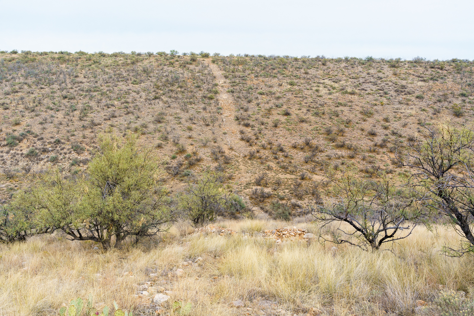
On the south side of Alder Canyon it was clear that the double track, so clear on the aerial views of the area, was not going to be quite as expected – we found hints of it but… I was glad to be hiking with Geoffrey from Trailvoyant – great company and an experienced set of eyes to look for the faint track!
Near the wash splitting Davis Mesa the double track became more distinct, but even then its rocky decent didn’t actually speed us up – on the other side an old road eventually appeared and curved towards the trailhead.
In April of this year this area was covered by a pool of water that was several feet. November 2016.
Clear water flowed from Davis Spring and water is still making its way down to the corral above Edgar Canyon. At the corral we drop into the bottom of the canyon – there is less water than there was in April, and very little flow – mostly just isolated pools.
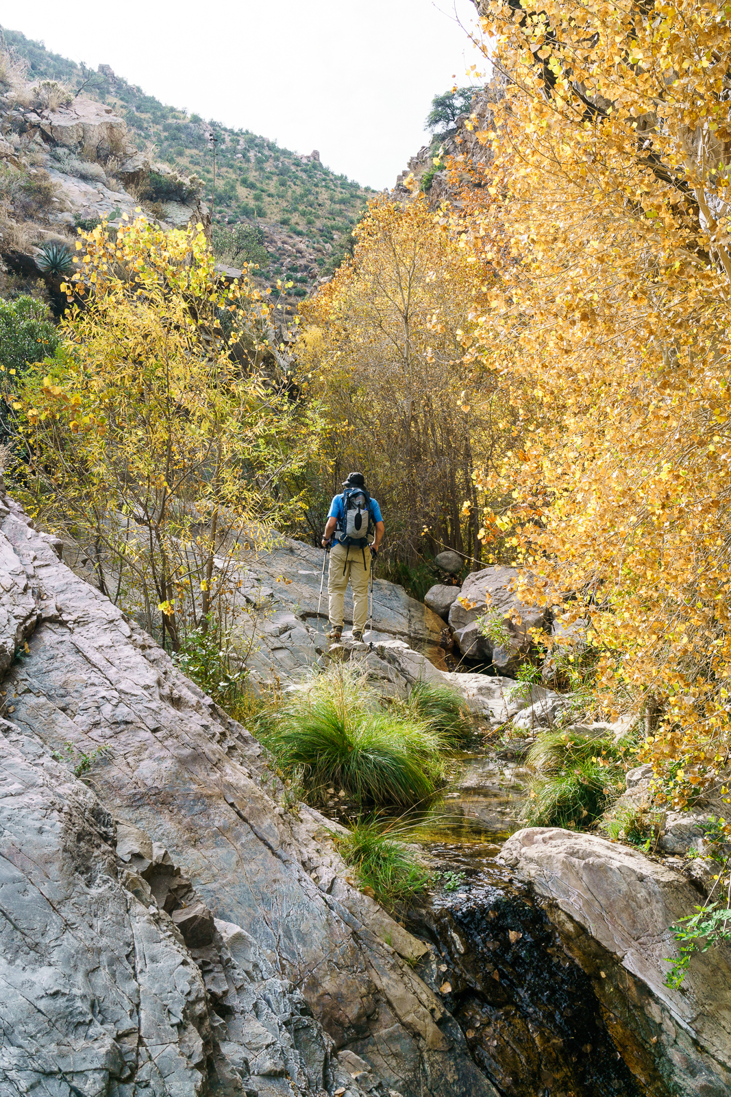
Geoffrey from Trailvoyant enjoying the Fall colors in Edgar Canyon – the Davis Spring Trail bypasses this section of Edgar Canyon on the hillside above. November 2016.
The bottom of the canyon is filled with fall colors – we leave the trail behind as it climbs the canyon side and continue up canyon to the Davis Spring and Knagge Trail junction – our turn around point for the day – on the way back we find, lose, and then find the Davis Spring Trail before crossing back over Davis Mesa and Alder Canyon as the light fades.
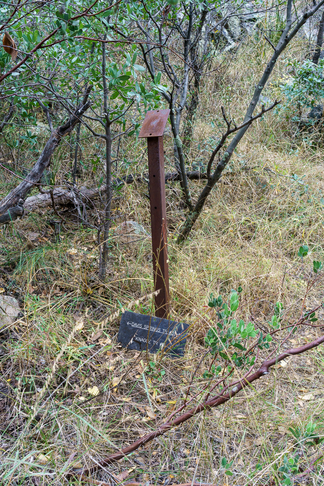
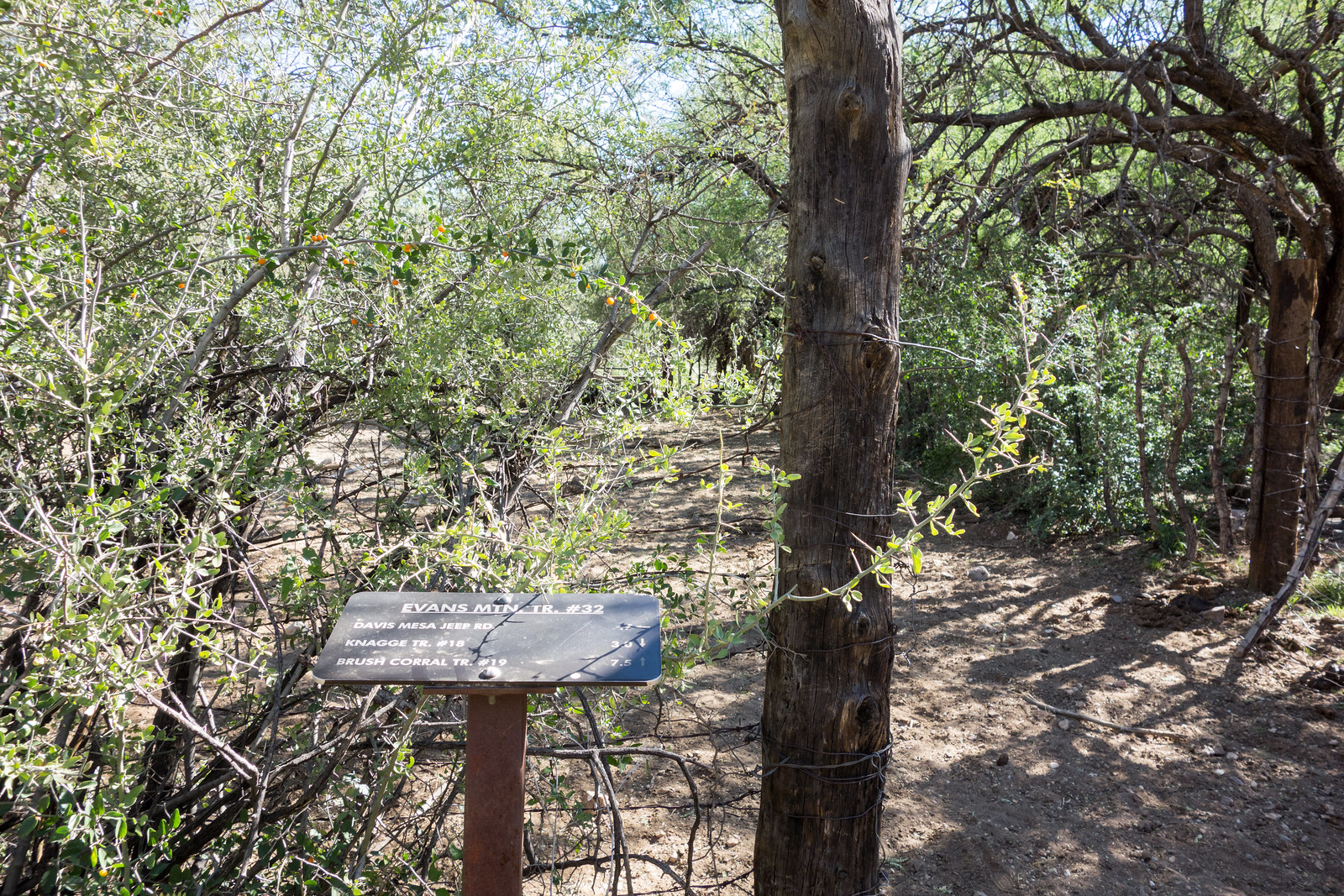
Davis Spring Trail and Knagge Trail Junction Sign. November 2016.
On the 1957 Bellota 15′ Map the trail across Davis Mesa is no longer present and our path across Davis Mesa doesn’t seem worth repeating or recommending – a fun adventure and a great day out, but not the alternate Davis Spring Trailhead access I had hoped for!
Points 5810 and 5817 on the left, Evans Mountain on the right. April 2016.
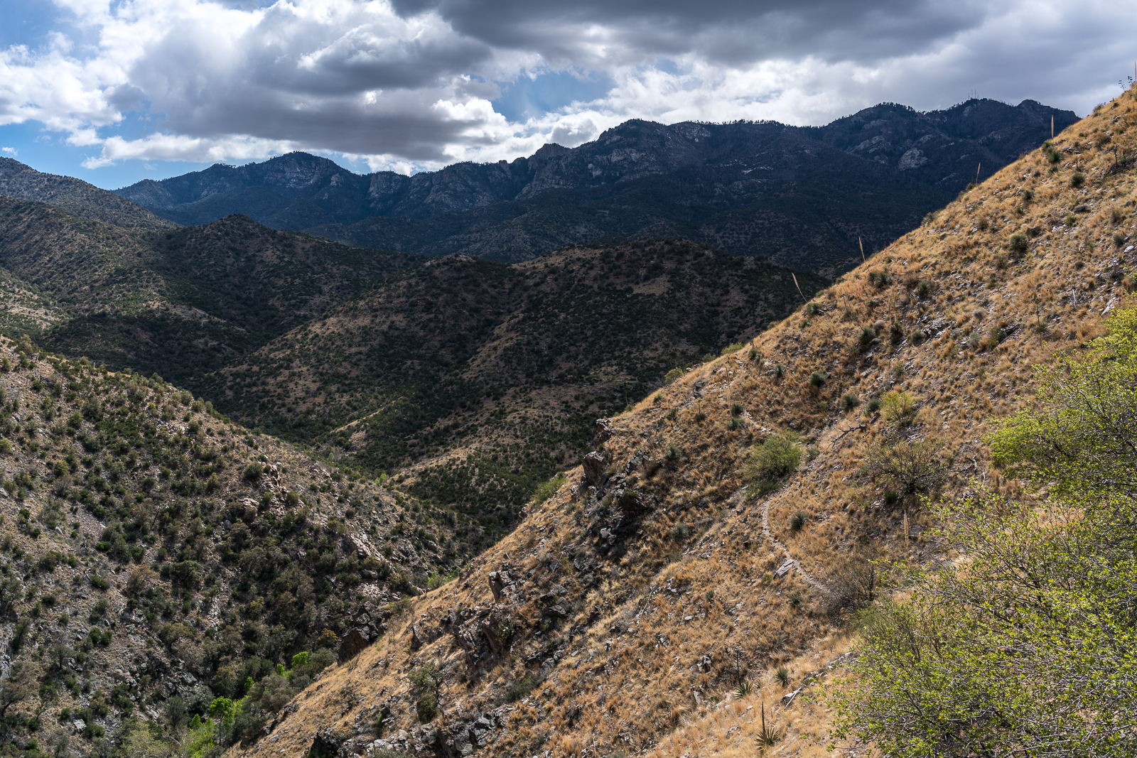
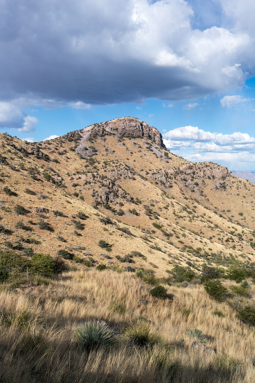
Looking down into the San Pedro Valley from high on the highway there are a huge number of ridges and peaks to draw your attention – one particularly beautiful peak is Point 5817. Point 5817 is not a massive peak or towering spire – it doesn’t even have a name – but its large cliffs stand out from the surrounding terrain.
We drive around the north end of the Santa Catalina Mountains, down the San Pedro, past the junction with Redington Road, thru the Six Bar Ranch and out to the Davis Spring Trailhead. The road seems a little rougher than it did in 2014. The trailhead is empty – probably be true most days, I don’t think this area is popular with hikers at the moment and is likely more often used by hunters.
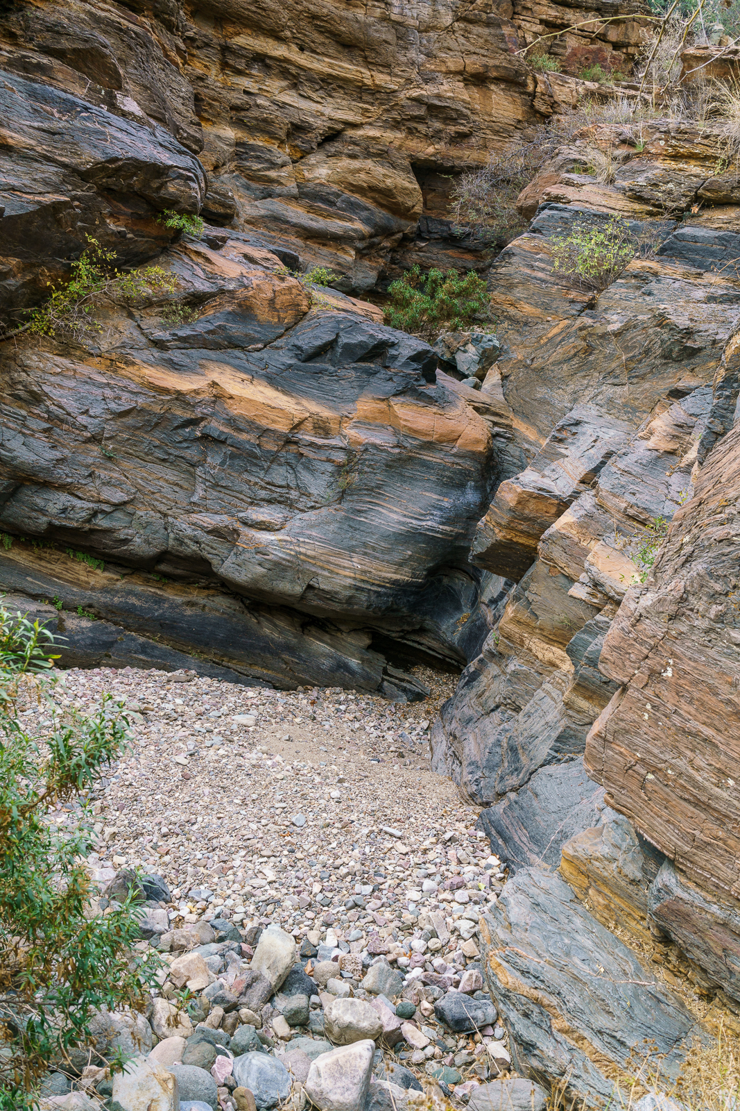
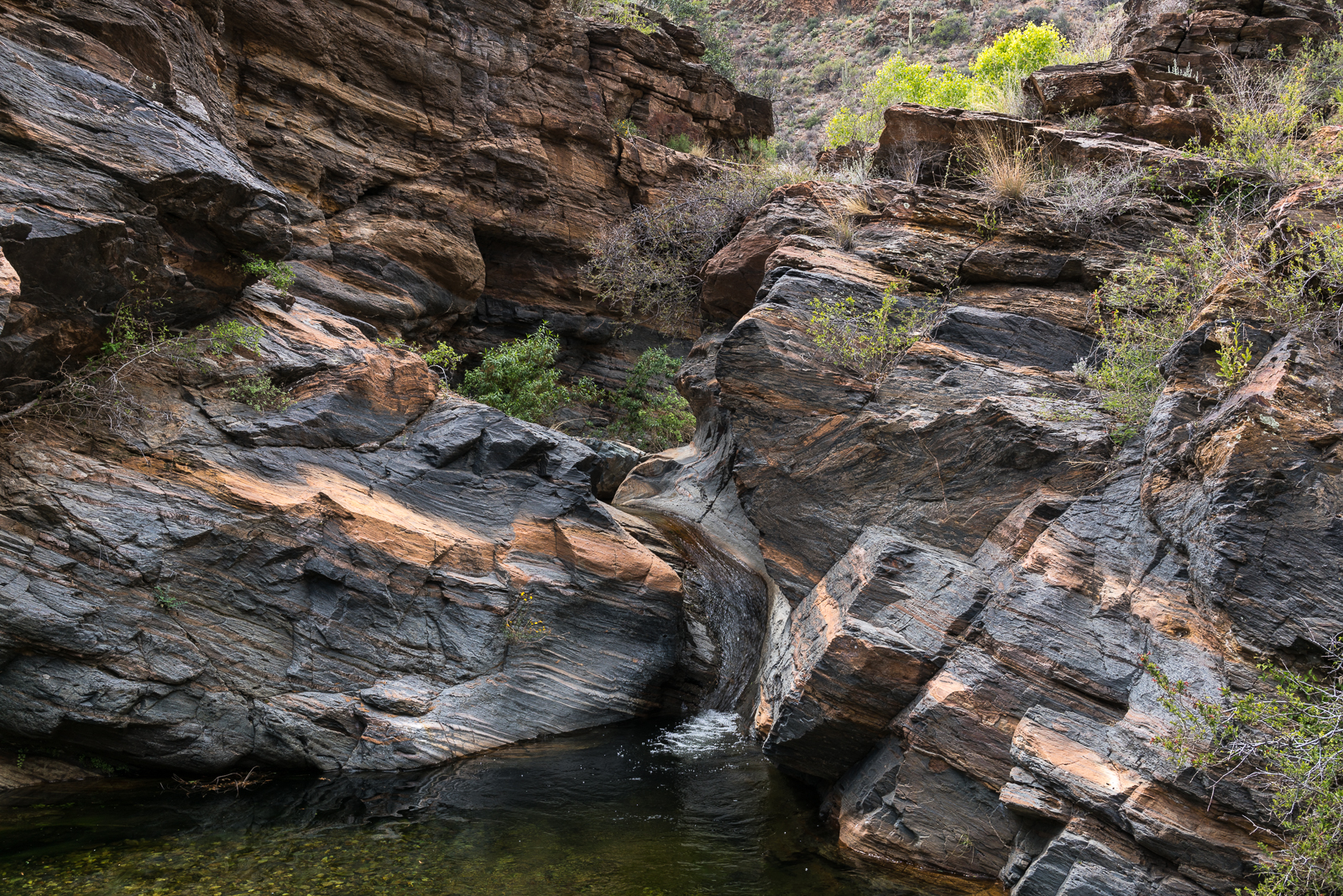
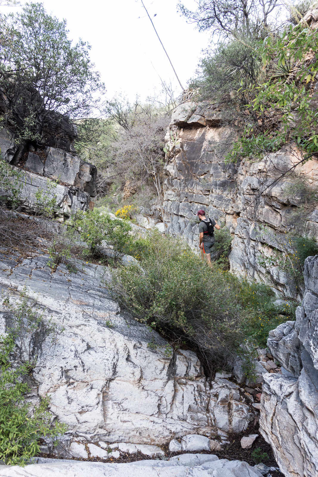
Beautiful rock in Edgar Canyon. April 2016.
One of the tanks below Davis Spring is full and pipes still take water down to the corral. At the corral we leave from the trail sign, but our first guess at the trail is a cow path to nowhere – unsure if the Davis Spring Trail really still exists in any useful form we give up and drop into Edgar Canyon – a great decision that quickly leads to unique rocks, flowing water and reasonably easy walking.
A few minutes above a section of unusual rock we are surprised to find the Davis Spring Trail – and even more surprised that we can easily follow the trail past the junction sign for the Knagge Trail and nearly to Araster Spring before it eludes us on a grassy hillside.
The Davis Spring Trail high on the hillside above Edgar Canyon. April 2016.
Araster Spring is covered with leaves, the canyon is flowing nearby – a great spot for a a short break before the climb up to the ridge to the north. The hike up to the ridge is filled with steep climbs on grassy hillsides with great views of our destination, Point 5817.
Point 5817 above Edgar Canyon – taken above Araster Spring in Peck Basin. April 2016.A mystery on the barbed wire fence – north ridge of Edgar Canyon. April 2016.
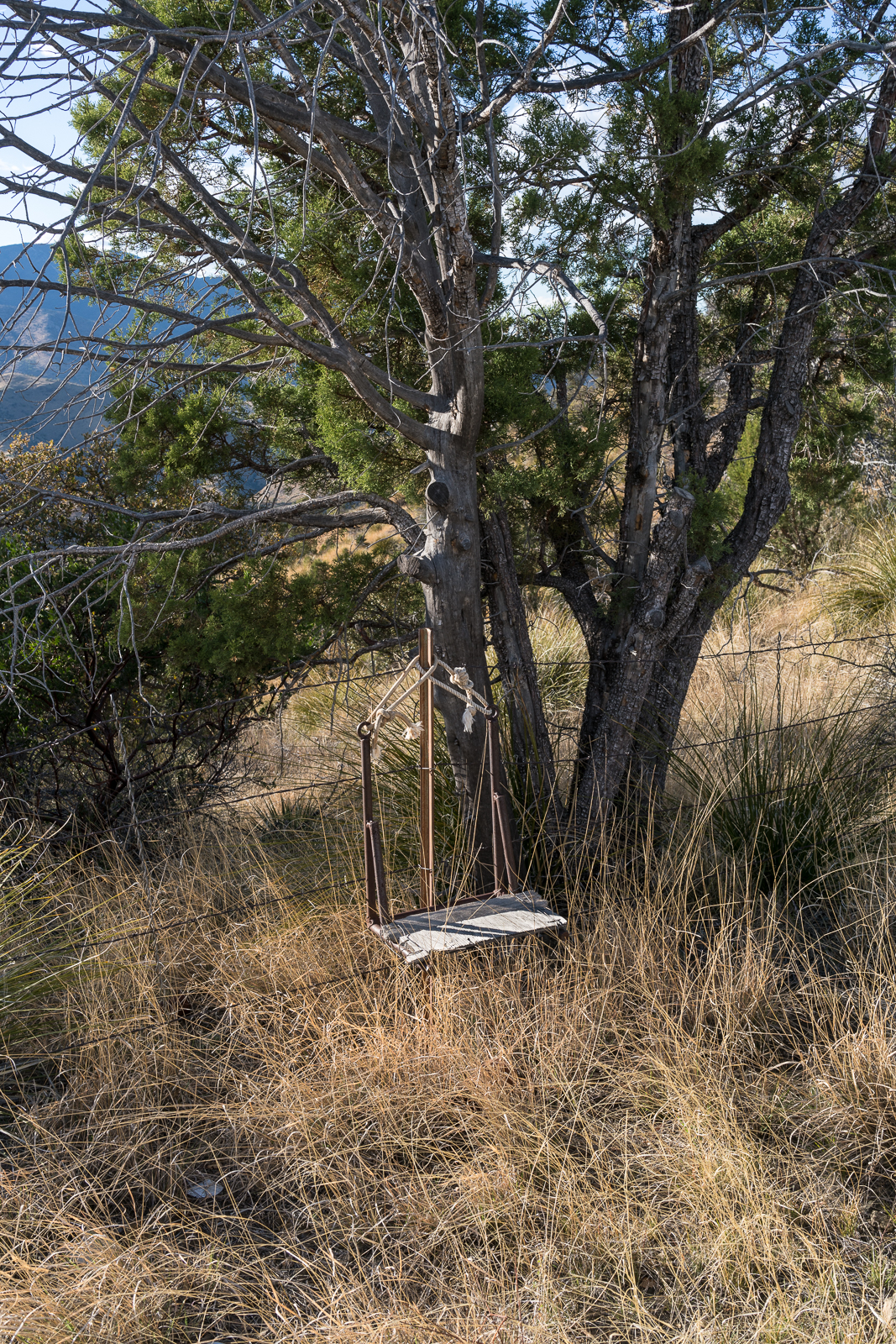
Up on the ridge a barbed wire fence becomes our path and at a small saddle what seems to be a seat hangs on the barbed wire fence surrounded by an old gate, a section of fence pulled down by a tree, a pallet that probably held fencing supplies, old rusted out cans and a shirt nearly destroyed by the elements.
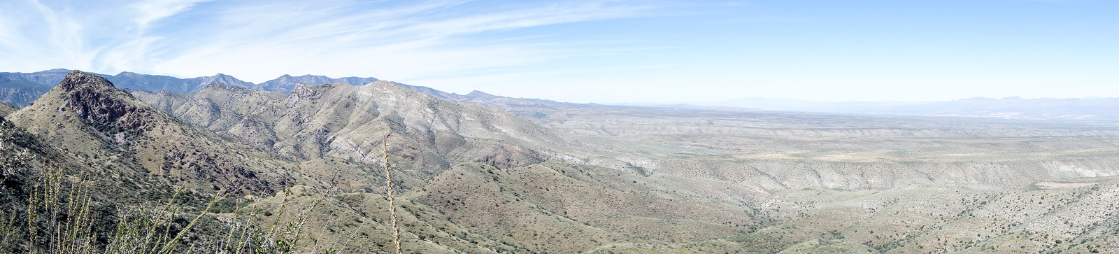
Shadows cover the landscape – from the summit of Peak 5817 the sunset lights up the Galiuros, a nice distraction before the slowest section of the hike – a loose slippery grass filled hillside back down to the trail.
Looking across Peck Basin – shadows covering the landscape at the end of the day. April 2016.The Galiuro Mountains with Mount Graham in the background – from Point 5817. April 2016.
If you are interested in visiting this area see the information at the bottom of this post on visiting Evans Mountain – there is information about the drive to the Davis Spring Trailhead from Tucson, several trip reports from the area and some information about the Six Bar Ranch.
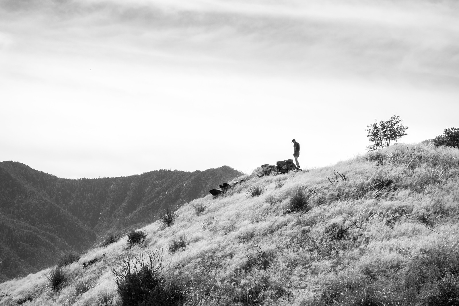
Ryan on the summit of Evans Mountains in the Santa Catalina Mountains. October 2014.
Evans Mountain is an interesting destination – some maps show a trail that takes you to the summit – but I suspect that trail is now (at best) obscure (a summit register entry from 1994 reads “Trail? What Trail?”), Evans Mountain is between the well known Davis Spring Trail and the Brush Corral Trail – both of which have long stretches that are faint or have disappeared back into the landscape and Evans Mountain is only a few miles from the Davis Spring Trailhead – which is marked on some maps but about which there is not exactly an overwhelming amount of information…
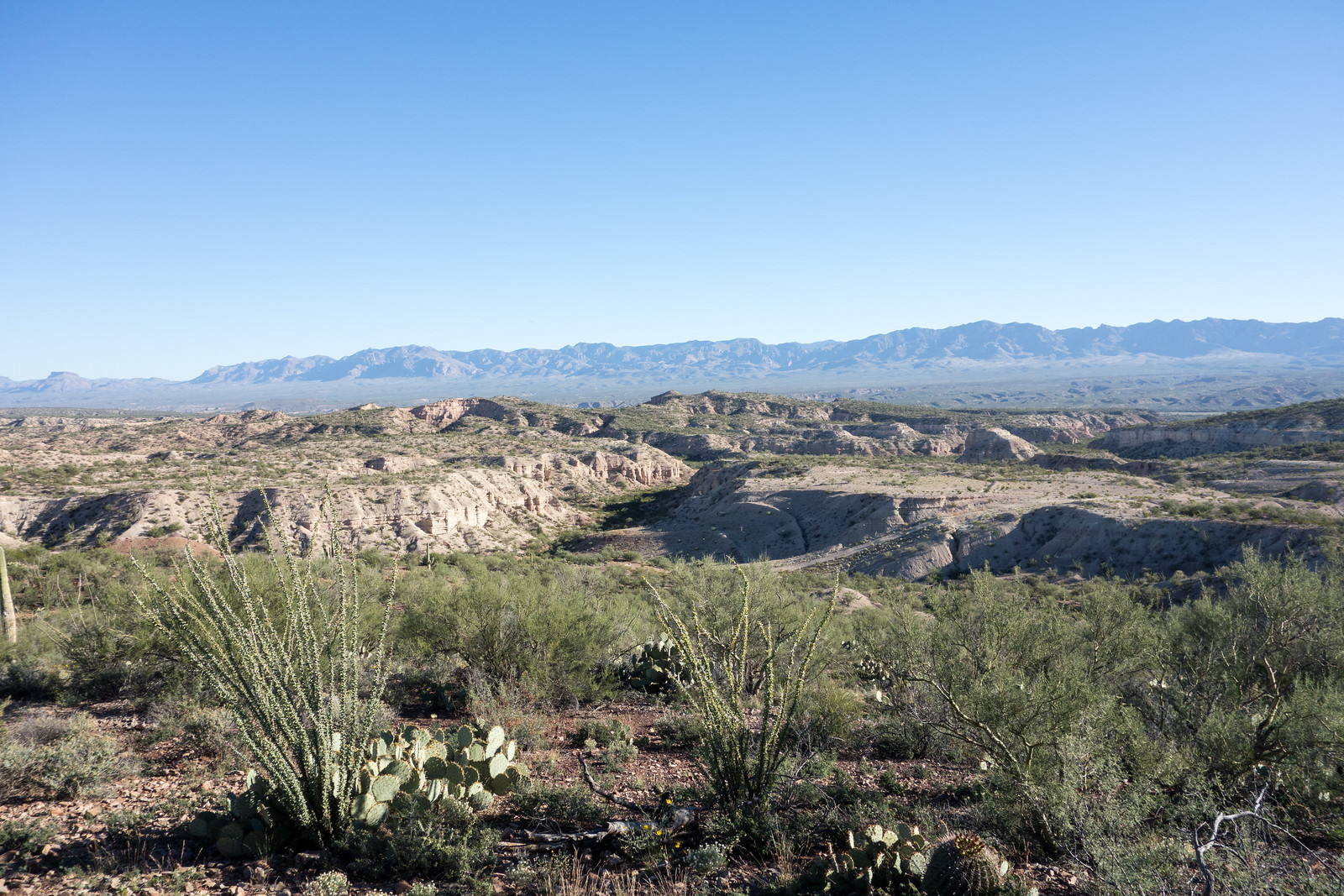
Interesting landscape – looking towards the San Pedro on the drive to the Davis Spring Trailhead. October 2014.
*** 8/12/2017 – The 2017 Burro Fire burned over Evans Mountain and down to Edgar Canyon – because many of the hillsides we hiked up to Evans Mountain were covered with brush and grass (no large trees) I don’t think the the the fire will have created any additional obstacles to getting to the top of Evans Mountain, but be aware conditions may have changed in this area! ***
We didn’t bother with an early start – navigating new-to-us dirt roads in the dark didn’t have much appeal – thru Oracle, past San Manuel and just a couple of minutes on Redington Road before turning off onto the road that we hoped would take us up to Davis Mesa and the Davis Spring Trailhead. The first miles ticked by with much better road conditions than expected, but at the junction into the 6 Bar Ranch the road immediately changed – more rocks, more ruts, more sand and much slower progress, a couple of sections demanded the switch to 4wd and our progress slowed – not unexpected, but the smooth first few miles had given us hope for a much shorter than expected drive….
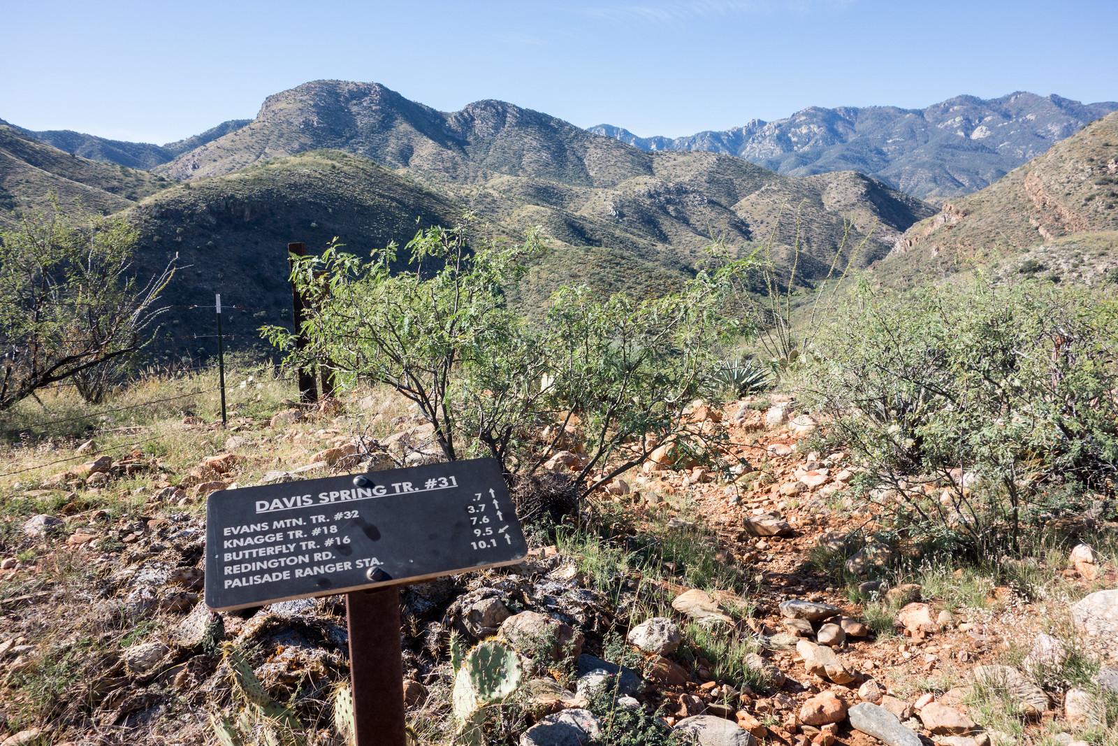
The trail sign at the Davis Spring Trailhead on Davis Mesa. October 2014.
Eventually we arrived at the Davis Spring Trailhead – the drive made made this destination feel remote and the sturdy/clean trail sign seemed almost out of place. Luckily – as promised by the sign – an obvious trail leaves from the trailhead – we hiked past a tank fed by Davis Spring and down to a corral near Edgar Canyon where we found the Evans Mountain Trail #32 trail sign.
The trail sign for the Evans Mountain Trail – near a corral on the banks of Edgar Canyon. October 2014.
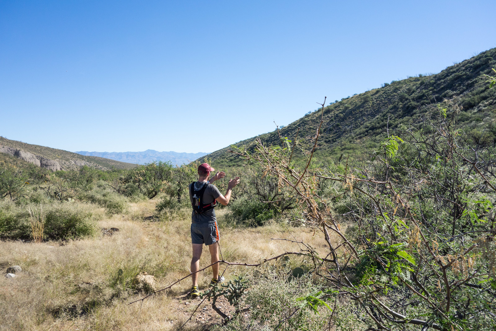
We followed the trail, and for a short time felt confident that we had found easy walking on the better-than-expected Evans Mountain Trail – but in retrospect we were probably lured too far east by well worn cow paths to correctly follow the trail’s turn south out of Edgar Canyon – eventually we began to simply pick the most likely route cross-country as worked steadily uphill towards Evans Mountain.
Near Edgar Canyon planning our route as the trail became faint. October 2014.
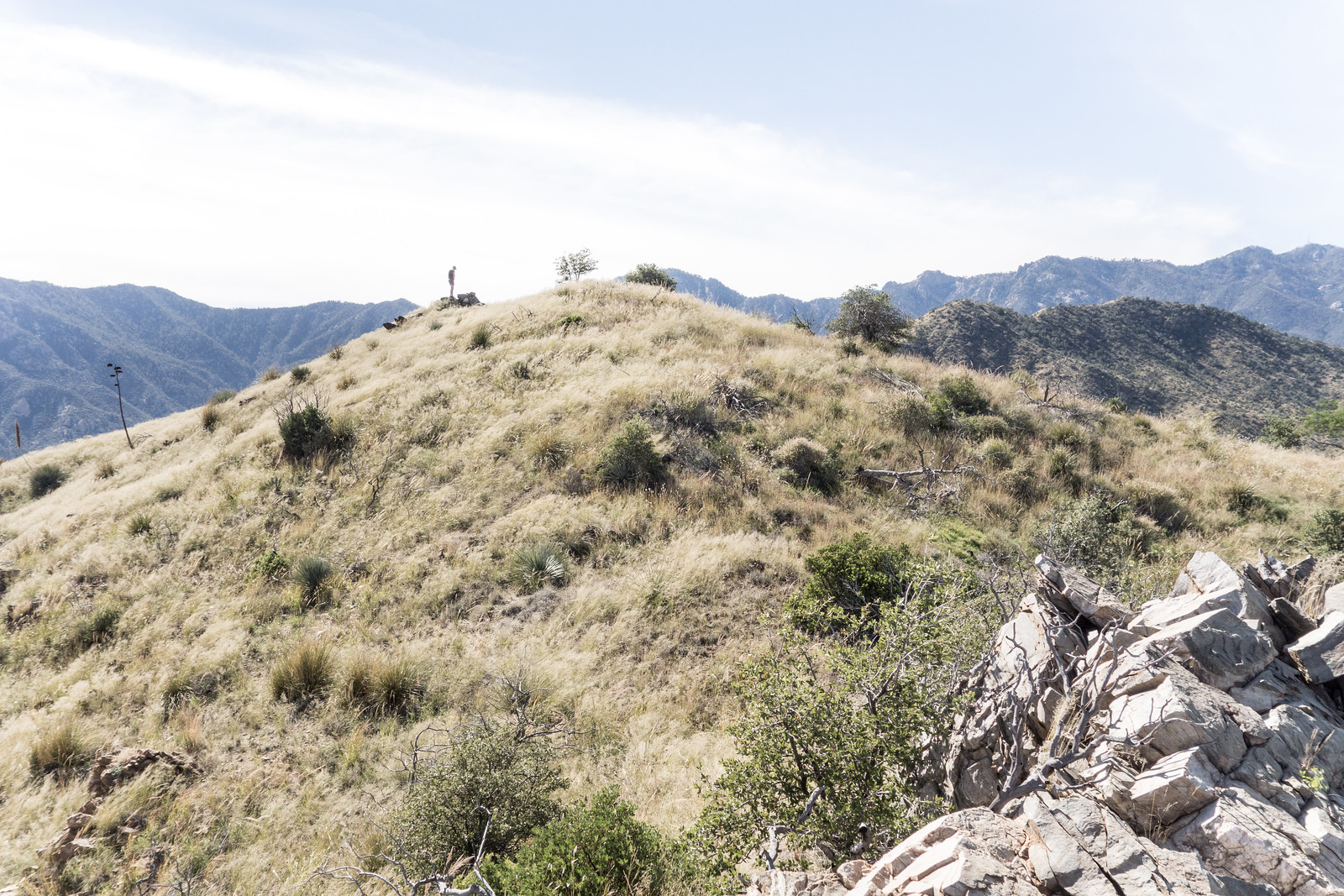
The ridgeline near Evans Mountain was a nice payoff for our climbing – great views! Soon enough we were at the top – from the register it looks like we are the only visit so far this year…
Taken from a ridge near Evans Mountain – Point 5681 on the left, cliffs to the north of Edgar Canyon and Davis Mesa center and right. If you look carefully you can see the green growth in the small drainage that contains Davis Spring near the center of the picture. October 2014.Ryan at the summit of Evans Mountain. Mount Bigelow is the last peak on the right on the far ridgeline. October 2014.
The trip back down was faster/shorter than the trip up – with no plan to even try to find the trail we simply picked a likely direct route and headed down – eventually following a lovely small canyon that had a small arch and a rather large drop near it’s junction with Edgar Canyon. Back along Edgar Canyon we took the cow paths back to the corral and climbed out of the canyon – what a great day! 8.3 miles round-trip with +/- 2700′ of elevation gain/loss.
Hiking a small canyon on the way down from Evans Mountain. October 2014.
Notes:
Based on the summit register Evans Mountains has at least one, and sometimes several, ascents each year. The summit, trailhead and access roads are easily found on (many) topographic maps of the area. The notes/resources below might provide interesting additional information if you want to visit this area (this list was last update 1/30/2019):
See the Davis Spring Trailhead page on this site for directions, maps and a gpx file to help with getting to the trailhead – a 4wd vehicle is strongly recommended and if you are not familiar with the area I also strongly recommend looking at maps/directions ahead of time, the network of unmarked dirt roads in the area can be confusing especially on your first visit to the area!
I have hiked to the Davis Spring Trailhead from the Ventana Windmill area off Black Hills Mine Road – Black Hills Mine road to the parking above the road down to the Ventana Windmill is a 2wd friendly drive which is attractive vs the 4wd road out to the Davis Spring Trailhead, but ultimately I wrote “our path across Davis Mesa doesn’t seem worth repeating or recommending – a fun adventure and a great day out, but not the alternate Davis Spring Trailhead access I had hoped for!”
During our visit there was a strong flow of water from Davis Spring into several different tanks – but from Davis Spring east sections of Edgar Canyon we saw (maybe .5 miles down canyon from the corral) were dry.
Desert Mountaineer – Evans Mountain – This is a great post about a trip to Evans Mountain and several nearby high points – many thanks to the Desert Mountaineer for responding to our question about the drive to the trailhead!!! Great information and inspiration – a fun site to visit especially if you love off-the-beaten path Arizona adventures!
[GuideYellowBook/] – As with nearly every destination in the Santa Catalina Mountains this guide is worth consulting – there are some details here that are probably useful but in this area (especially post Bullock Fire) it is hard to know how many details are ‘current’ enough to be useful.
Sirena’s Wanderings – Brush Corral Trail and Diary of Scott Morris – Brush Corral Epic – Both of these posts are about the Brush Corral Trail which is on the ‘other side’ of Evans mountain from the Davis Spring Trailhead. The Evans Mountain Trail used to connect the Davis Spring Trail to the Brush Corral Trail. These posts are only vaguely related to the Davis Spring Trailhead and Evans Mountain – they are included since it is worth knowing about this possible alternate approach to Evans Mountain.
For several years I have looked down into the Peck Basin Area and wondered what was down there… I suppose that the easiest way to get into that area is via the Davis Spring Trailhead on the north side of the Mountain – but part of my fascination with Peck Basin is a curiosity about a trail that seems to be disappearing back into the mountain: the Knagge Trail…
I was dropped off at the bottom of the Incinerator Ridge Road, walked up to the Trailhead and soon enough I was headed down the Knagge Trail, familiar territory and notably easier to follow than it was last September with the plants along the trail brown and flat.
Near the top Knagge Trail. March 2014.
The Cabin, the mine and the current end of the well established trail all come quickly – and then off onto the ridge below. Unlike my last trip I don’t use any time trying to find the original trail – instead I just work on finding the easiest way down the ridge – an occasional cairn, faint paths that look for a second like a trail, brushy puzzles, beautiful open grassy sections, views down into my destination…
Ridge below the Knagge Trail. March 2014.
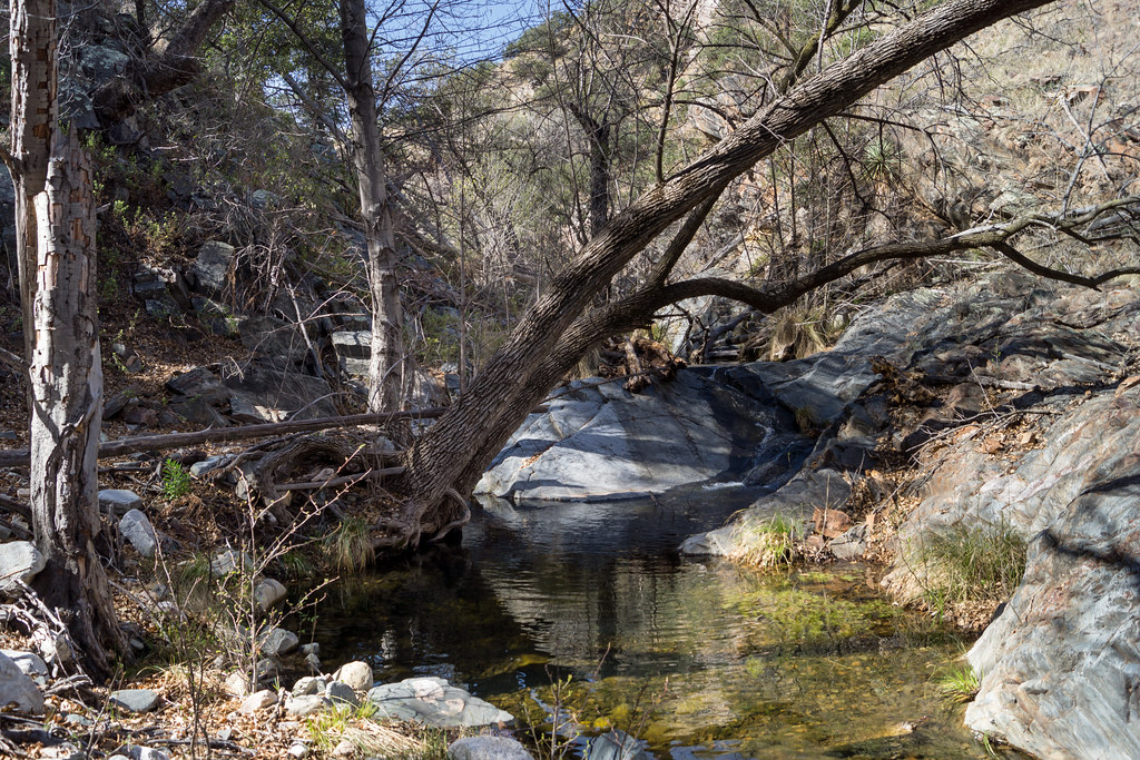
I am counting on water in the South Fork of Edgar Canyon and the canyon does not disappoint – clear rushing water!
Water in the South Fork of Edgar Canyon. March 2014.
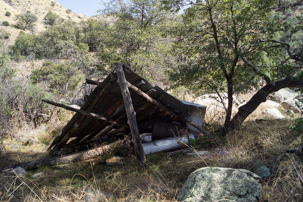
I work down canyon trying to find the easiest path – up around a box, past an old shelter, thru a fence – here I see the first signs of the cows who live in this area…
Fallen Shelter. March 2014.
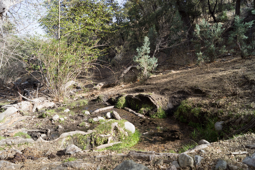
I cut out of the canyon, over the ridge and into the drainage with Araster Spring and Peck Basin (this canyon is referred to as Edgar Canyon in the Cowgill and Glendening guide but the USGS 7.5′ Map labels the canyon to the south as Edgar Canyon…). I see more cows on the ridge above and follow their tracks and dung up canyon to Araster Spring and slightly beyond. Araster Spring is beautiful but slightly trampled.
Araster Spring. March 2014.
Originally I had planned to camp here but the cows have made this area a bit less attractive than I imagined – I loop via hillside and ridge up to Point 4863 to spend the night – on the way stumbling across the Knagge and Davis Spring Trail junction sign! I find a good spot near Point 4863 – I only have to move one cow patty to setup where I want – and enjoy the view of the ridge I came from (with the blazing lights of Mount Bigelow) and the day’s journey!
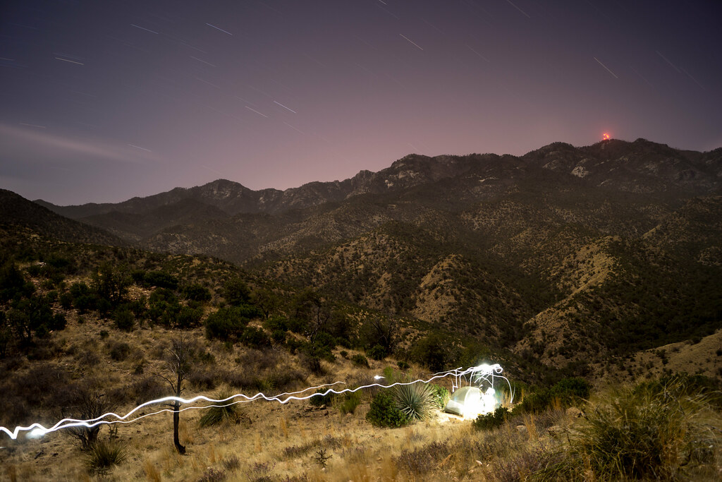
Camping above Edgar Canyon – the lights from Mount Bigelow in the background. March 2014.
I get moving a little slowly in the AM – lingering to enjoy the view –
View from Point 4863. March 2014.
And then up up up up back to the Upper Green Mountain Trailhead to meet my ride down! 13 miles and about 4000′ of elevation gain and loss.