Starting the 8 mile Peppersauce Stampede – part of the 2017 Peppersauce Roundup. September 2017.
The start line of the Peppersauce Stampede – light rain, cool temperatures and beautiful light on the Galiuro Mountains across the San Pedro River. A great morning for a run – down the Control Road, dirt roads up to the High Jinks Ranch and a loop back to Arizona Zipline Adventures via the Arizona Trail/Cody Trail.
After the run I ate breakfast and watched as more and more people arrived – it was great to see so many people out and enjoying this part of the mountain! The Oracle FordPeppersauce Roundup includes the Stampede Runs, Gravel Grinder Mountain Bike races, music, gear expo, camping, food, beer and, of course, the Zipline.
This was the 2nd year for the event and it is hard to imagine that it won’t happen again next year!
Eating breakfast at Arizona Zipline Adventures after the Peppersauce Stampede during the 2017 Peppersauce Roundup. September 2017.
Any history of mining has several inherent problems. For one thing the usual practice of relying upon relying upon contemporary or primary sources turns topsy-turvy. Such sources are often suspect, since mine owners and other interested parties deliberately sought to enhance the value of their properties, promoting them to raise capital for their development or to attract a purchaser.
[Doctor Scudder] had dreams of a chicken ranch. By looking in a Spanish dictionary, he came up with a name for the beautiful area. “Listen! Campo Bonito. Did you ever hear anything equal to that?”
Later Captain Burgess sold mining claims to the well known scout, William F. Cody, better known as Buffalo Bill. Cody’s fame was well earned, but not for his sound investiments. Perhaps Burgess knew this and took advantage of his old friend.
Camp Bonito never produced the fortune that Cody hoped for – not a unique, or even uncommon, story – this concise summary from Islands in the Desert (p.132) seems relevant:
another fact of frontier life, which was that profits were most commonly sought through buying and selling mining properties, rather than by developing them.
Freshly worked trail and a recently added sign on the Cody trail where a side trail splits off to the High Jinks Ranch. September 2016.
The High Jinks was another Cody mine that never produced the riches he had hoped for – the property, a National Historic Site, is located above Camp Bonito just off the Cody Trail, the route of the Arizona Trail – see the High Jinks Ranch for more information.
Looking back on the High Jinks area from the Cody Trail. September 2016.
Cody Trail – in the snow! January 2016.Oracle Ridge Trail at the junction with the Cody Trail. January 2016.Snow near Point 5466 off the Oracle Ridge Trail. January 2016.Sunset from just off the Oracle Ridge Trail. January 2015.
The elevation in Tucson is around 2,600′ – too low for snow to collect on the ground during the recent storms – but at 4,400′ the American Flag Trailhead outside of Oracle is high enough that there is snow at the trailhead!
At the beginning the Cody Trail alternated between well trodden snow and mud, as I climbed higher the snow became slowly deeper and once I passed the Hijinks Mine there was no trace of anyone coming this way since the storm.
Eventually I reached the junction with the Oracle Ridge Trail – covered in tire tracks – and wandered up to and around point 5466 off the Oracle Ridge Trail before finding a spot to photograph the sunset. Eventually I turned on my headlamp and headed back down the Cody Trail…
The incredible snow in the Santa Catalina Mountains has allowed Ski Valley to open for skiing and snowboarding for the first time this year! But restrictions on travel on the Mount Lemmon Highway have changed a number of times in the past few days – consider calling (520) 547-7510 for ‘nearly current’ road conditions before trying to head up the mountain – Tucson News Now reports that this afternoon there is a long line of cars waiting to go up the mountain and because of over-crowding they are only letting a car go up when one comes down….
After a leisurely start I setup at the Oracle Ridge Trailhead to wait for a friend who is coming up the mountain from the American Flag Trailhead – intermittent clouds and a nice breeze keep things cool on my first miles of the day, walking the top of the trail, waiting…
Soon enough RA appears and after a few minutes of talking, organizing gear and confirming plans I start down the Oracle Ridge Trail.
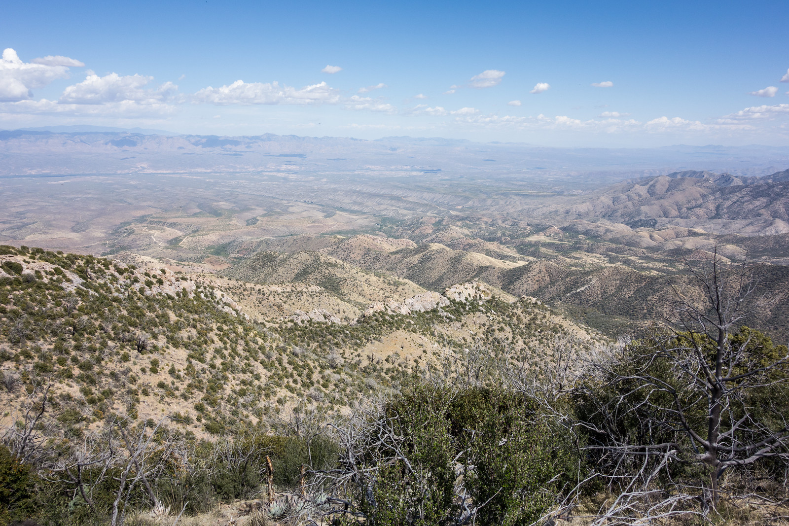
Oracle Ridge stretching out into the distance – not far from the start of the Oracle Ridge Trail. April 2015.
The trail leaves Dan Saddle and climbs (and climbs!) past good views and thru tunnels made of trees, some alive and full of leaves, some just silvery skeletons.
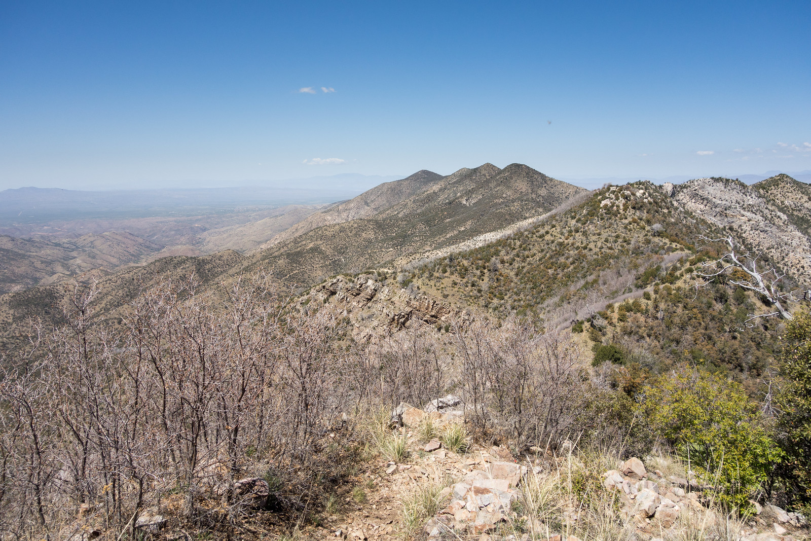
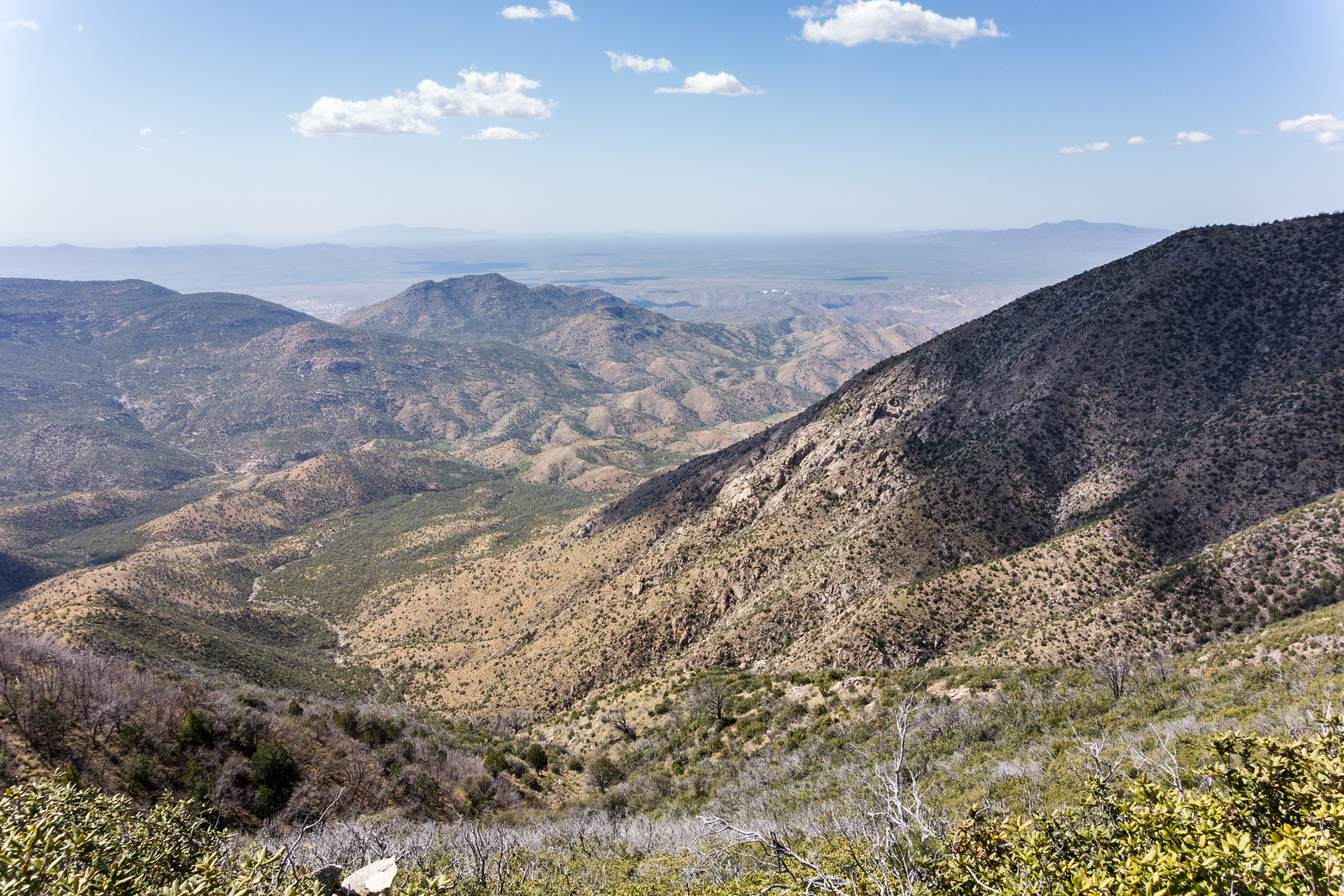
After the trail re-joins the top of the ridge I am stopped several times by views off both sides – the CDO on one the left and the San Pedro Valley to my right.
From Oracle Ridge – after the climb out of Dan Saddle where the trail rejoins the top of the ridge – the CDO and Samaniego Ridge below with the Biosphere in the distance. April 2015.The San Pedro Valley from Oracle Ridge – south of Rice Peak. April 2015.
I chat with a friendly backpacker and share some water to ease his concerns about the dry dusty miles ahead – he is the 2nd and last person I will see today – after Rice Peak the descent towards Oracle begins in earnest. Signs guide me sometimes onto single track and often back to the dirt road – not a purist’s dream perhaps, but out here – alone – it really doesn’t matter.
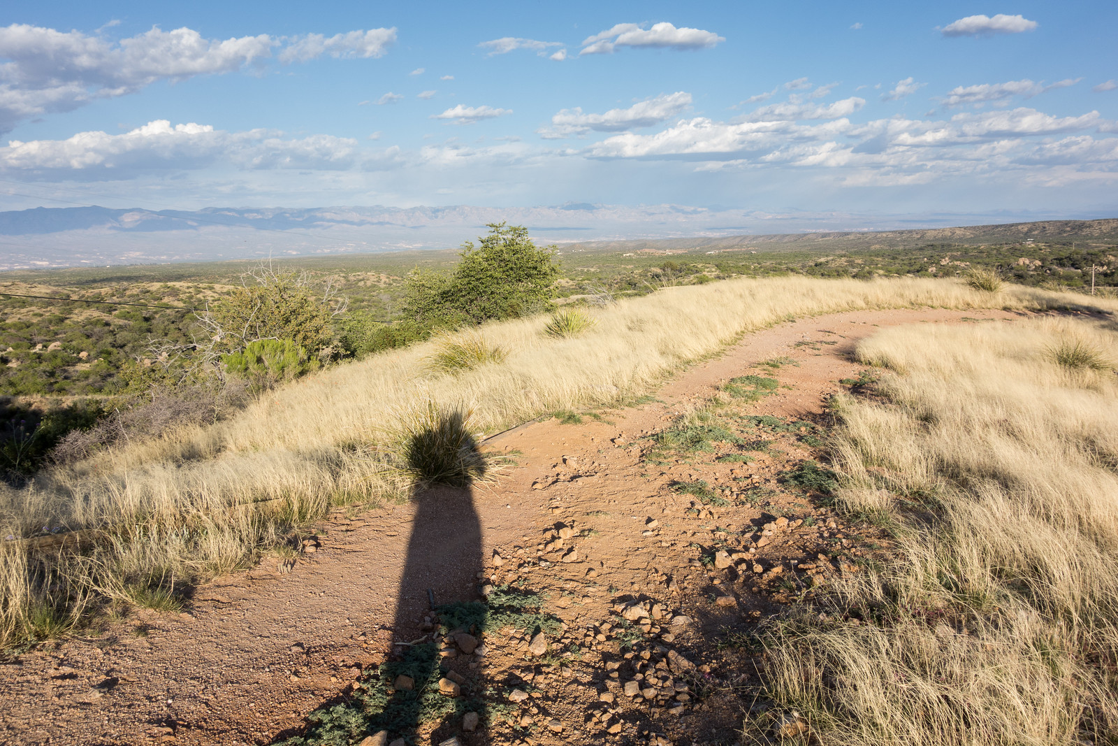
Casting a long shadow on the Cody Trail. April 2015.
The shadows get longer on the Cody Trail – power lines, buildings, roads and houses all come and go but my mind stays on the lovely winding trail – I stretch out and run for a while but I am too tired to run even the slight incline of the final hill and manage only a slow walk to end the day. 15.75 miles, +1,650/-4,800 feet of elevation gain/loss.
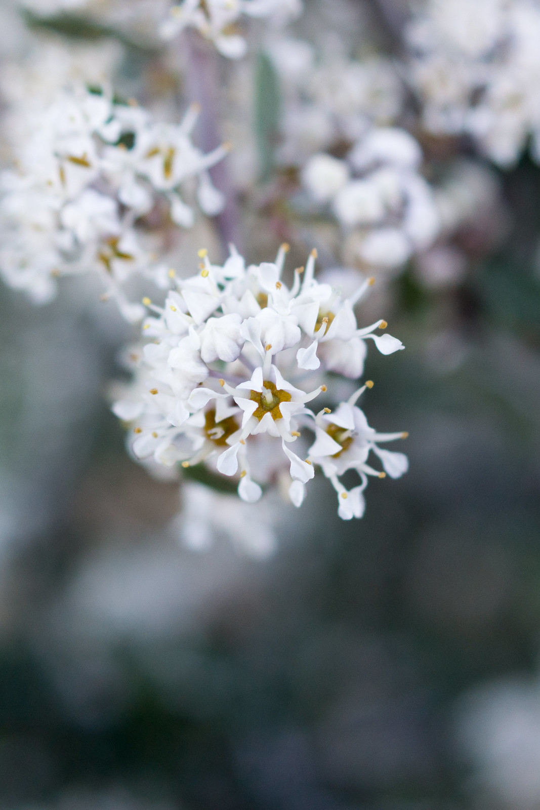
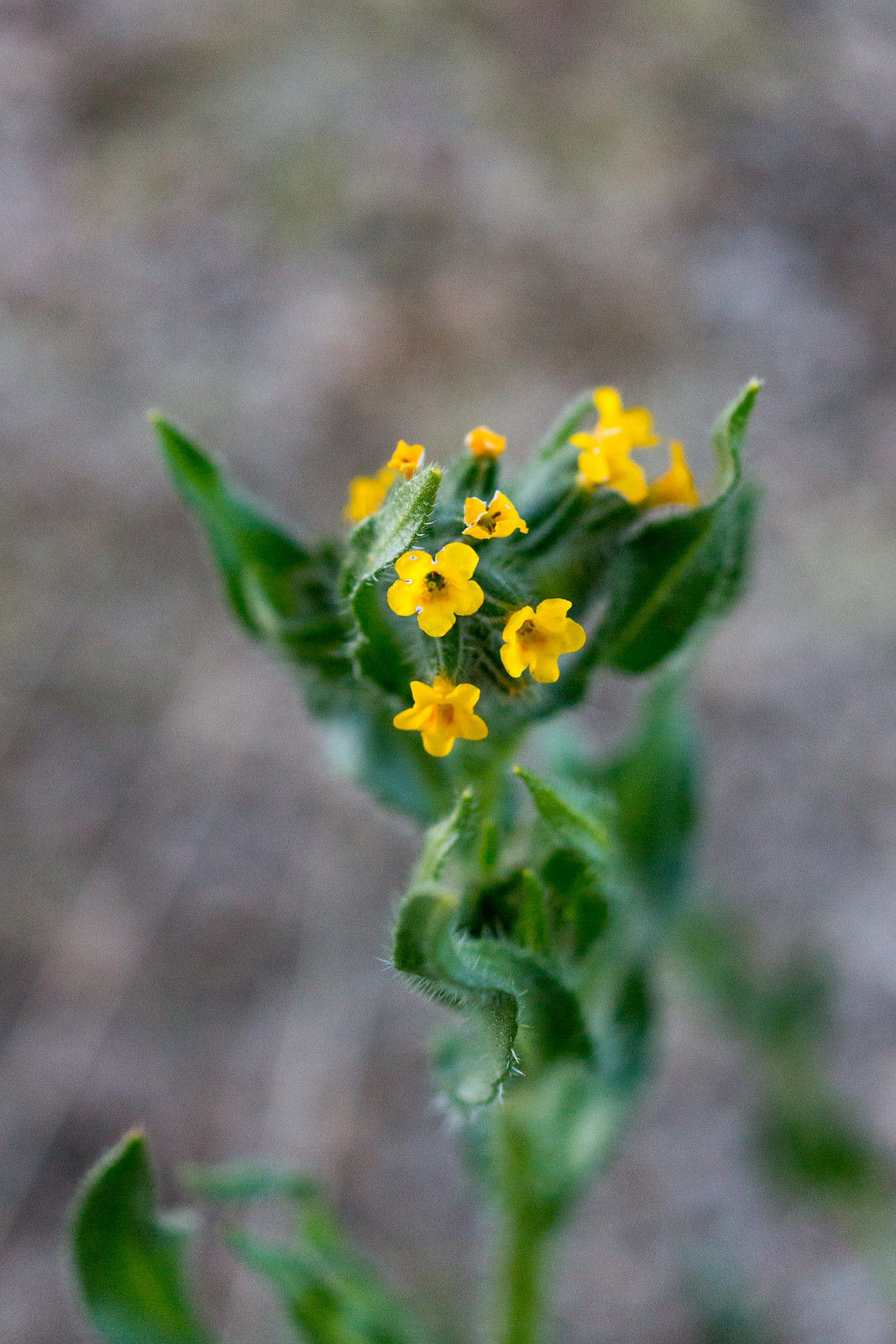
Fendler’s Buckbrush along the Cody Trail. March 2015.I believe this is Slimflower Scurfpea – Psoralidium tenuiflorum – along the Cody Trail. March 2015.Fiddleneck on the Cody Trail. March 2015.
A short hike among the beautiful flowers – Cody Trail from the American Flag Trailhead – 5 miles, +/- 900′ of elevation gain and loss.