


The Fastest Known Times – FKTs – for the Arizona Trail were last set in 2011 and, with the exception of Kathy & Ras Vaughan’s yo-yo of the Arizona Trail, the Arizona Trail page on the Fastest Known Time site has stayed quiet. But in 2016 there have been two new records!
If you thought it felt warm out on the trails in October you were not wrong – the Arizona Daily Star reports that “It was the warmest October on record for Tucson, with an average high of 92.4, an average low of 62.5 and a median of 77.4 degrees.” – the previous record was set in 1952. Yes, Tucson’s October was warm — the warmest on record – tucson.com.
The Catalina Bighorn Sheep Reintroduction Project update for Sept 29 – Oct 26, 2016 contains a number of noteworthy details:
“In February and March of this year, this ram embarked on a month-long trek through the Rincon Mountains and south towards I-10, spending time at Colossal Cave Mountain Park, and venturing even farther south to the train tracks north of Marsh Station Road before returning to the Santa Catalina Mountains. Ram #39538 was captured in the Imperial Hills in 2015.”
Positive Arizona State Park attendance and revenue were highlighted in a news release from Arizona Governor Doug Ducey:
More than 2.68 million people visited the parks, contributing $16.4 million in revenue to the State Parks system, an increase from $14.4 million in fiscal year 2015. Visitors to Arizona State Parks contribute nearly a quarter of a billion dollars to Arizona’s economy, according to a 2014 Northern Arizona University study.
The publicly available year-to-date State Park Visitation numbers show a 1.8% visitation increase thru August across all state parks with Catalina State Park reporting an 8.1% increase (numbers compiled by Northern Arizona University’s Arizona Hospitality Research & Resource Center, the year-to-date comparison is available in the August Report from the Arizona Office of Tourism Data and Trends page under State Park Visitation). Arizona State Parks Attendance And Revenue Hit All-Time High – Office of the Governor Doug Ducey, AZ report reflects good news for state’s parks – TucsonNewsNow.
The shuttle permit in Sabino Canyon is up for renewal – extensive information is available from the Forest Service. There are also comments from Donn Ricketts of Sabino Canyon Tours in KVOA.com’s article Forest Service considering options with Sabino Canyon tram and short summaries of the proposal and alternatives in Speak out: Public comment sought on Sabino Canyon shuttle service from the Arizona Daily Star. Comments must be submitted by 11/13/2016 – design features that would be implemented under the Proposed Action:
The most important news for Bighorn Sheep in the Santa Catalina Mountains this month was the release of the results from the Arizona Game and Fish population count conducted at the end of September. When the project began the population could be very closely monitored via collars put on all sheep released into the range – but the collars eventually drop off when the batteries are exhausted and sheep born in the range are not collared – at this point the collars no longer give a complete picture of the population. The estimate from the count was a population of 66 – quotes from AZGF before the count stated they would consider an addition translocation if the population was under 70 and the AZGF page for the project now states that a “fourth translocation is being planned, pending survey results of potential source populations.” Recent links:
AZGFD: Deer poached in Santa Catalina Mountains – KVOA.com: “A reward of up to $750 is being offered for information leading to an arrest of a poacher responsible for illegally killing a whitetail deer on Oct. 9 in the Santa Catalina Mountains… the deer’s remains were found on Forest Service Road 4496 near Ruin Tank, in the Charouleau Gap area.” Call 1-800-352-0700 if you have information.
University of Arizona Sky School held guided hikes on the Meadow Trail in October – the Sky School “provides immersive, inquiry-based science programs to Arizona K-12 students. Field experiences focus on core University of Arizona science areas such as sky island ecology, earth sciences, dendrochronology, hydrology, and astronomy, and meet Arizona State Science Standards.” No additional hikes are scheduled at this time but check out their Facebook Page for programs and opportunities.
Hittin’ the Trails 4 You: The Finger Rock Trail – KVOA.com: coverage of a classic hike in the Santa Catalina Mountains – the opening text below the video is pretty accurate… “If there’s a poster child for a leg-burning, lung-busting hike, it resides in the foothills of the Santa Catalina Mountains.”
Hittin’ the Trails 4 You: Molino Basin – KVOA.com: The Molino Basin Trail is an easy trail to overlook – it might not become your favorite trail but it is surprisingly nice, especially considering how close to the highway it is.
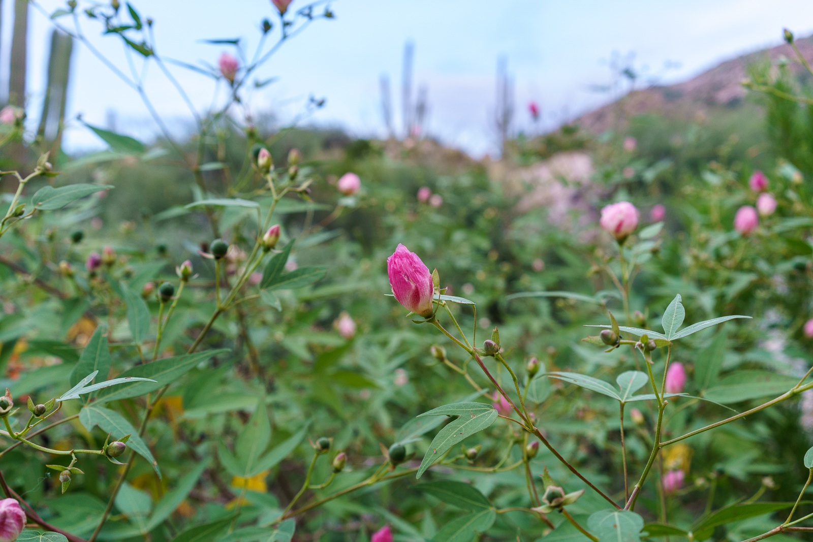
First flushes of fall color brighten Sabino Canyon – Arizona Daily Star: Even lower on the mountain Fall brings some color to the trees – especially along the canyon bottoms!
Pima Co. Sheriff’s Dept. identifies suspect in serial rape case – TucsonNewsNow: The investigation into this case started with a naked woman was found on the side of Mt. Lemmon Highway – other connected assaults did not take place on the mountain.
The TORCA 2016 PACHANGA is currently going on – based at the Gordon Hirabayashi Campground the event features a number of rides and events and is supported by both local businesses and manufacturers including Specialized, Niner, Ibis, Guerilla Gravity, Trek, Giant, Liv and Rocky Mountain. TORCA is “focused on the All-Mountain and Downhill disciplines of mountain biking with a focus on the Santa Catalina Mountains.”
N4T Investigates: Baffling Booms Update – KVOA.com: Some theories about loud booms that started in May and were heard for about a month by residents near the intersection of Linda Vista and Oracle Rd…
Rescues/Accidents/Incidents including information from the SARCI Newsletter:
Last month in Bears, Steward, Grants, 2006 – 9/10/2016 I included basic information from Arizona State Parks Approves 29 Grants to Enhance Trails throughout AZ about a number of local organizations that received grants – a quick/friendly email to the Grant Program Leader for Arizona State Parks was all that was needed to get a few more details – it is great to see these organizations applying for, and receiving, grant money to help improve outdoor recreation in Southern Arizona!
Catalina State Park
Catalina State Park is located within Coronado National Forest and is managed by Arizona State Parks in cooperation with the U.S. Forest Service.
The Bridle Trail is a heavily used trail with a trailhead and approximately 1.4 miles long beginning in Catalina State Park and extending into the Coronado National Forest. The Bridle Trail is a relatively flat, slightly curved trail. The trail surface is predominantly a compacted sand substrate, although rocky protrusions exist in a few areas. Maintenance is needed to prevent resources damage and provide for public safety.
This project will add approximately 6″ of base rock as well as 3″ decomposed granite (DG) to Bridle Trail in Catalina State Park. The trail affected is 1.4 miles long and 10 feet wide. Material haulers, compacting equipment, a water truck, and a vibratory roller designed for trail work (narrow base) will be used to spread and compact the surface. Other hand tools will be used to clear brush, prune encroaching vegetation and further manicure the trailhead.
The improvements will provide a quality and safe recreation experience.
Coronado NF—Santa Catalina Mountains
As the US Forest Service continues to experience a decline in a located funding, the dispersed recreation program on the Santa Catalina Ranger District has been unable to secure the resources needed to adequately maintain and ensure the safe conditions of its many multiple-use trail ls. The District has approximately 245 miles of multiple-use, National Forest System trails which receive 1 .5 to 2 million visitors each year, according to National Visitor Use Monitoring data. Over the past 14 years, the Santa Catalina Ranger District has experienced several above-averge flood events and two catastrophic wildfires that have exacerbated the need for trail maintenance to sustain the desired recreational opportunities for the annual visitor base.
While the popularity of recreation continues to increase exponentially, the District does not have a trail crew or the personnel required to keep these multiple-use trails maintained within the required specifications and standards, including those criteria that must be met for public safety. The District trails listed in this application have had minimal cyclic maintenance in recent years and are currently in desperate need of corridor expansion, brushing, logging and tread work to mitigate public health and safety concerns, and to provide a better recreation experience for the increasing visitor population. If awarded, these funds will benefit millions of visitors by improving their safety and enhancing their experience on the Santa Catalina Ranger District. These funds will also help to provide training opportunities for our volunteers as they work together with the conservation crews to accomplish these projects.
Oro Valley
The Honey Bee Canyon Park Trail Rehabilitation Project will include routine trail maintenance on the existing 2.03 miles of trails within the park. Honey Bee Canyon Park is a 62-acre natural passive park within the Rancho Vistoso master planned community. It features a trail system, two ramadas, and a restroom facility. The Honey Bee Canyon Park trail system connects to other Oro Valley and Pima County trails. The park is heavily used on a local and regional basis by residents and visitors. It was operated by Pima County until2012, when it was transferred to the Town of Oro Valley.
The scope of work for this project will include:
l. Trail clearing – in areas where trail is impassable/difficult (i.e. very rocky)
2. Re-delineation of trails using available rock where trail tread direction is not evident
3. Repair of trail where necessary (i.e. in areas where erosion creates big gullies in trail)
4. Replacement and/or repair of areas with steps using railroad ties or similar
5. Repair of natural trail from parking area – making switchbacks easier/safer
A materials storage/staging area will be located in an already cleared area close to the first Ramada. It is anticipated that a Bobcat might be needed, and will be provided.
The goal of this project is to enable visitors to have a better travel experience within the park by providing them with safer and better delineated trails, without losing the appreciation of the natural environment.
Climbing Association of Southern Arizona
The Santa Catalina Trails Project will provide maintenance and restoration on heavily used Santa Catalina Ranger District Forest
Service trails that are used by rock climbers, hikers, equestrians and mountain bikers.
21.5 miles of trails will be targeted, which will include the following trails: Bellota, Trail #39, Bug Springs, Incinerator Ridge, Aspen Trail, Marshal Gulch, Meadow, Trail #5, and Finger Rock.
The project will accomplish the following goals:
x Utilize the local Arizona Conservation Corps (AZCC), with crews composed of up to 50% local youth, to perform maintenance and restoration work.
x Develop and implement, in partnership with the Santa Catalina Ranger District, a training program to teach all trail users (rock climbers, hikers, equestrians, and mountain bikers) how to perform basic trail maintenance to Forest Service standards.
x Coordinate and deploy AZCC crews and volunteers sanctioned by the Santa Catalina Trails Project training program (above) to perform maintenance and restoration work as needed by the Santa Catalina Ranger District.
x Integrate targeted trail maintenance with CASA’s (Climbing Association of Southern Arizona) existing volunteer Adopt a Crag program through joint events with AZCC and other user groups such as the Arizona Trail Association.
Association of 4WD Clubs
The purpose of this grant is to create a pilot program that would enhance partnerships between public land managers, motorized recreational users and the general public. The main focus of this grant is to visit schools, dealerships, organized motorized groups and attend community events to provide Off-Highway information to the general public and listen to concerns and issues related to the Off-Highway Vehicle Program. The project will work closely with Arizona State Parks and Trails, OHV Ambassadors, and Arizona Game and Fish to provide information related to the program and develop programs that can be used in schools.
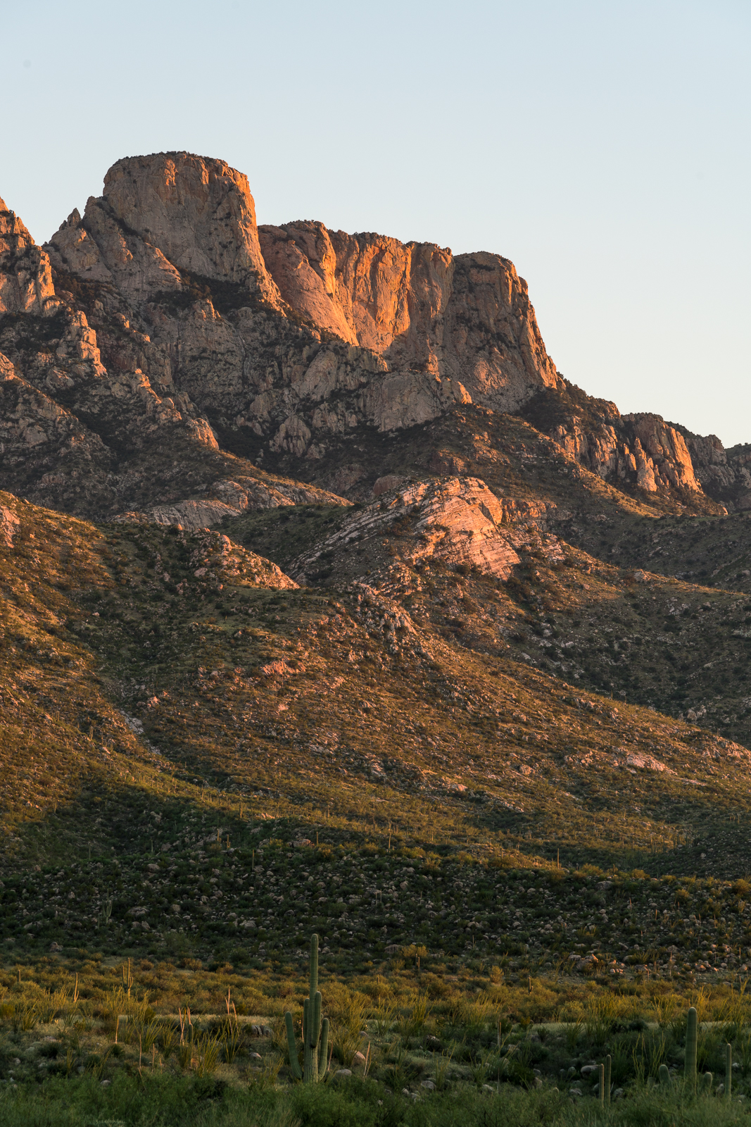


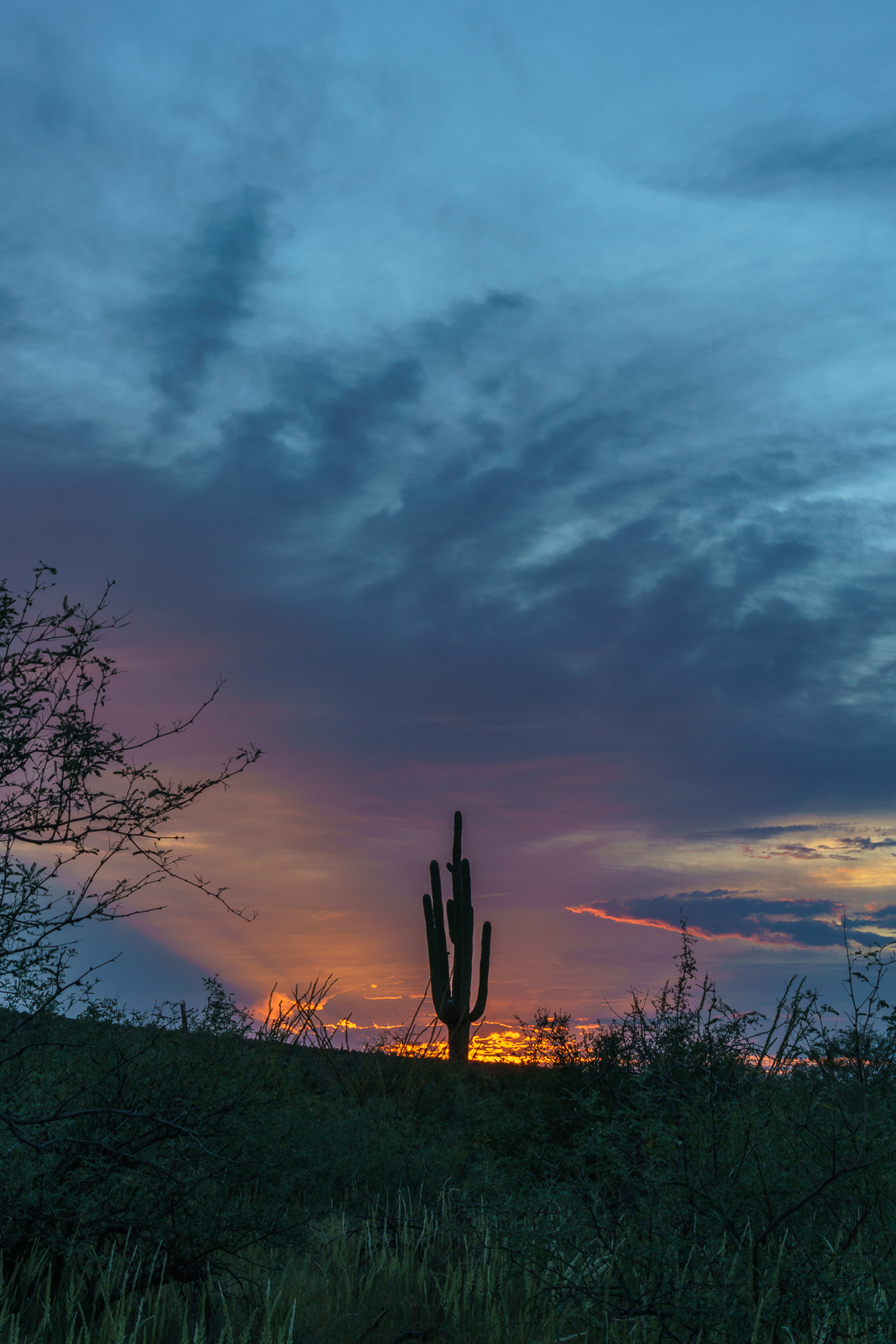
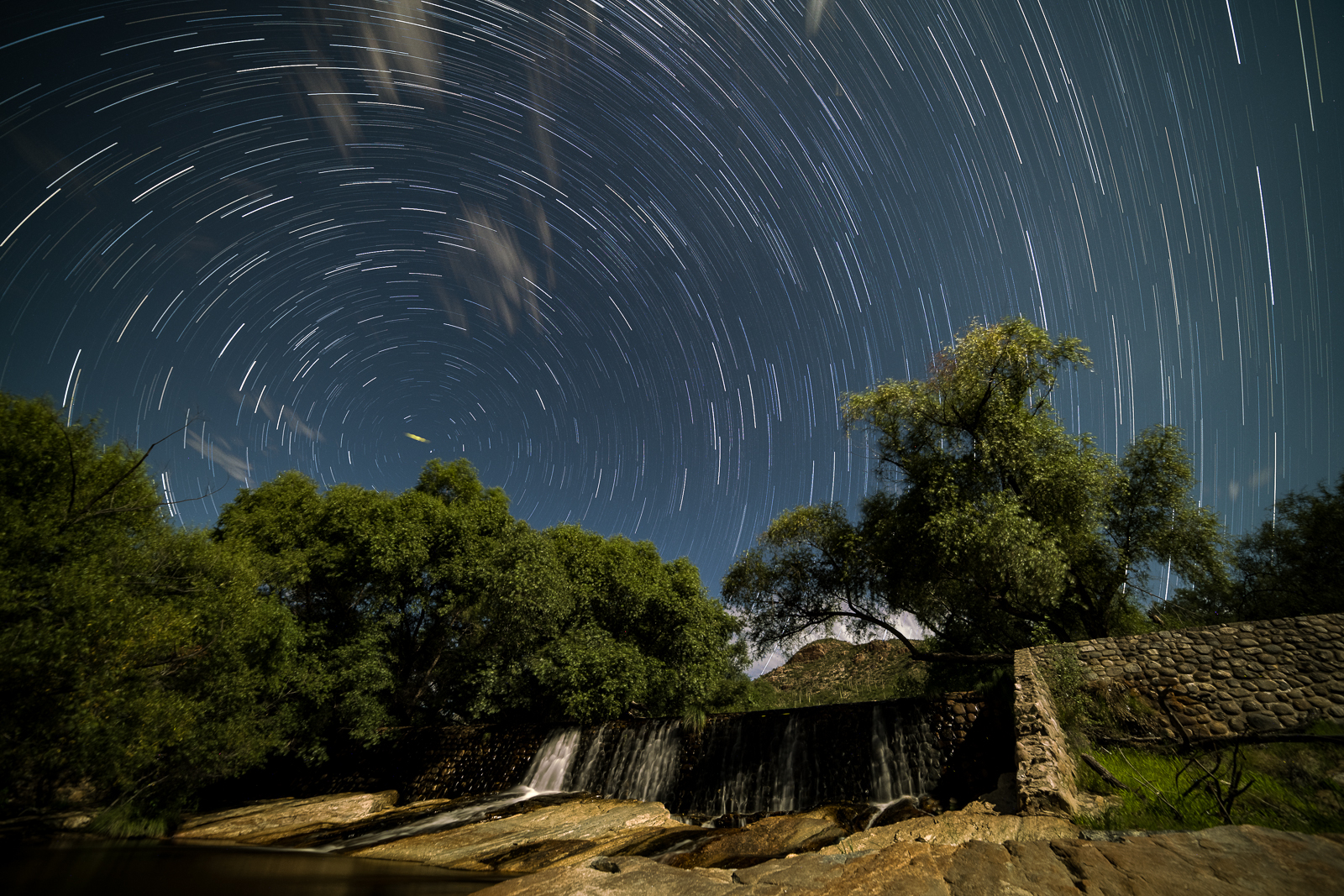
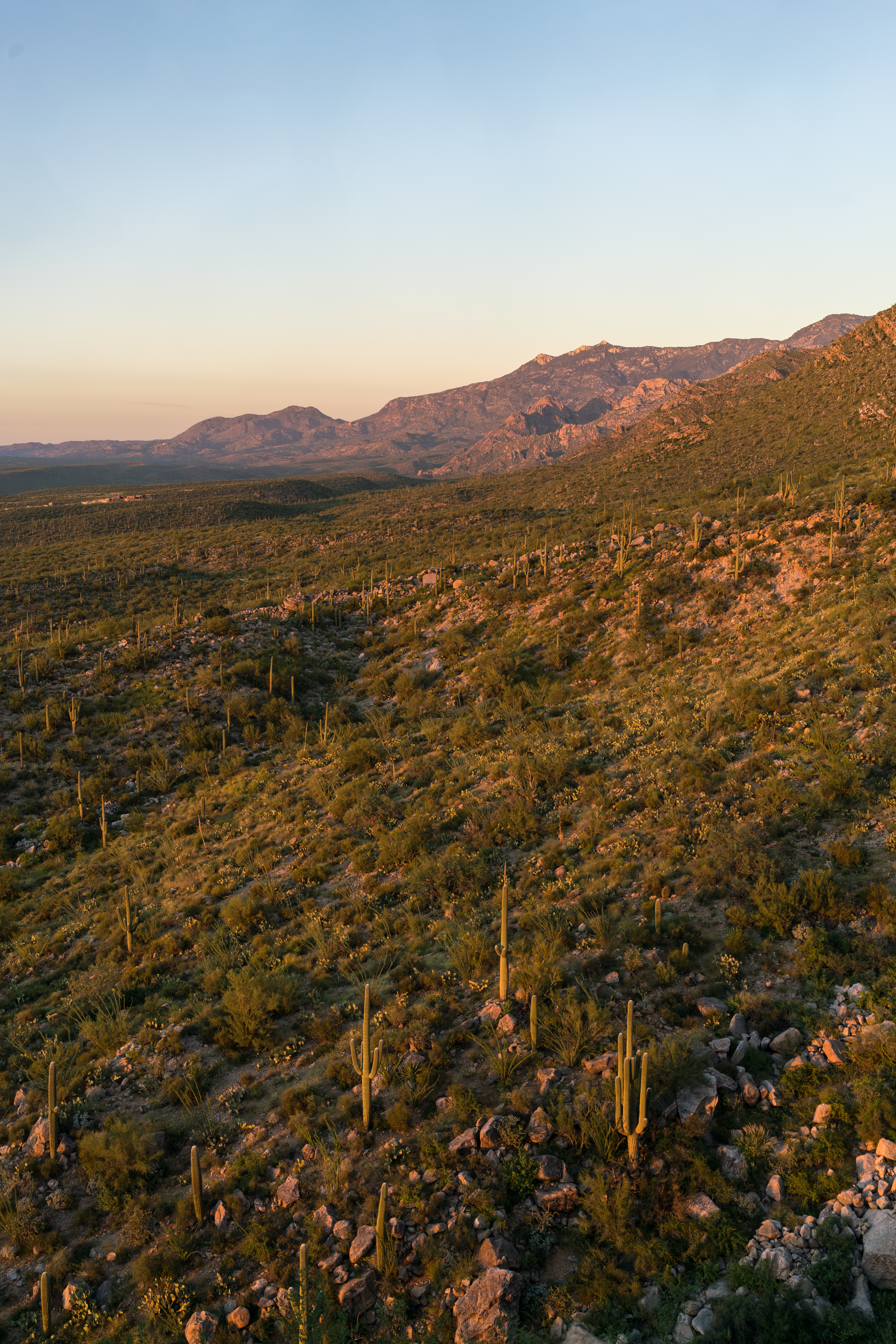
Sunsets – all taken in or near Catalina State Park, all taken on easy to find trails, all taken less than an hour from the trailhead!