Brinkley Point, perched in the middle of the Santa Catalina Mountains, is protected by an off trail approach and a modest distance and elevation profile that don’t really lend themselves to bragging. A beautiful sunset, a wait in the fading light, and then the real show begins – moonlight on the inner basins, ridges and canyons. Alone on the small point I take pictures, briefly watch headlamps on the East Fork Trail and let my mind wander. Early in the AM I wake up to take a few more pictures and find the sky covered by clouds reflecting the city lights.
box spring trail
Montrose Fire

Update 5/17/2016: What looks like the end of the Montrose Fire – from InciWeb:
No smoke has not been observed over the Montrose Fire for two days. Fire managers will continue monitoring the fire area over the next several weeks.
This will be the last update for the Montrose Fire unless circumstances change.
Update 5/15/2016, 4:30PM: The Montrose Fire continues to be listed as 80% contained, from a recent update:
The Montrose Fire, first discovered May 12, on the Coronado National Forest Catalina District, remains 80% contained. It is located near Box Spring 3 miles northwest of Rose Canyon Lake. One hotshot crew remains on the incident. With high winds in the Santa Catalina Mountains, their diligence is intended to prevent the fire from again becoming active. No smoke has been detected today. The crew will spend the remainder of the day and this evening monitoring the fire to ensure the perimeter is secure.
Rose Canyon Lake has been reopened for recreationists. Rose Canyon Campground is also open.
5/14/2016:
The Montrose Fire started on 5/12/2016 and, unlike the Finger Rock Fire in 2015 that was allowed to burn, there was a very prompt effort to suppress the fire – undoubtedly due to it’s proximity to homes and infrastructure on the mountain.
- Inciweb Page on the Montrose Fire.
- Currently listed as human caused and under investigation.
- The fire is currently being mopped up and is listed as 13 acres/50% contained – on Friday in late afternoon we were unable to see any smoke from the fire on the Sunset Trail.
- The fire is in the Sabino Canyon drainage in the Box Spring area of the Pusch Ridge Wilderness (below the gauging station and above Brinkley Point). This area burned in the Aspen Fire (2003).
- 60 Personnel are listed as committed to the fire – there were Payson and Geronimo Hot Shot Crew Vehicles at the Box Camp Trailhead on Friday and helicopters dropped water from Rose Canyon Lake.
- News coverage: Fire on Mount Lemmon burns about 12 acres – Tucson.com, GVFD helps answer call to fire in Catalina Mountains – sahuaritasun.com, UPDATE: Crews still working to contain the wildfire on Mt. Lemmon – Tucson News Now.


Box Spring Route to Sabino Canyon – 4/21/2015
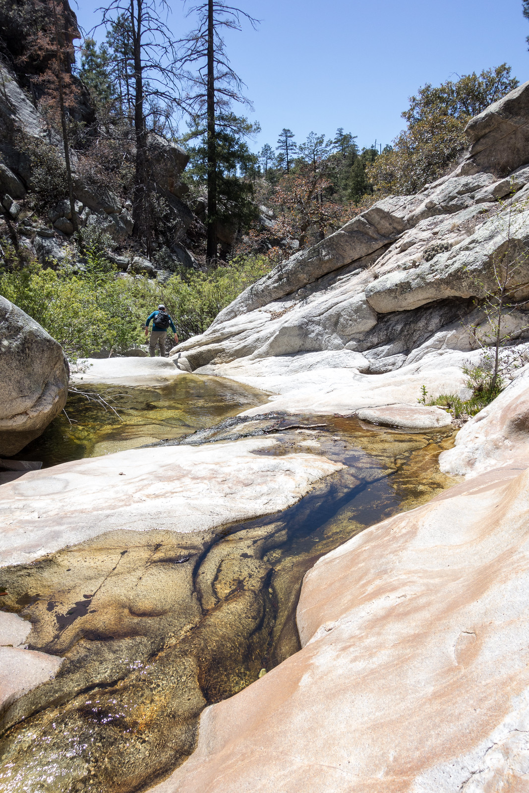
The Box Spring Trail has long been more of a route than a trail – I think it would have already disappeared back into the mountain if its ending high in Sabino Canyon wasn’t so beautiful!

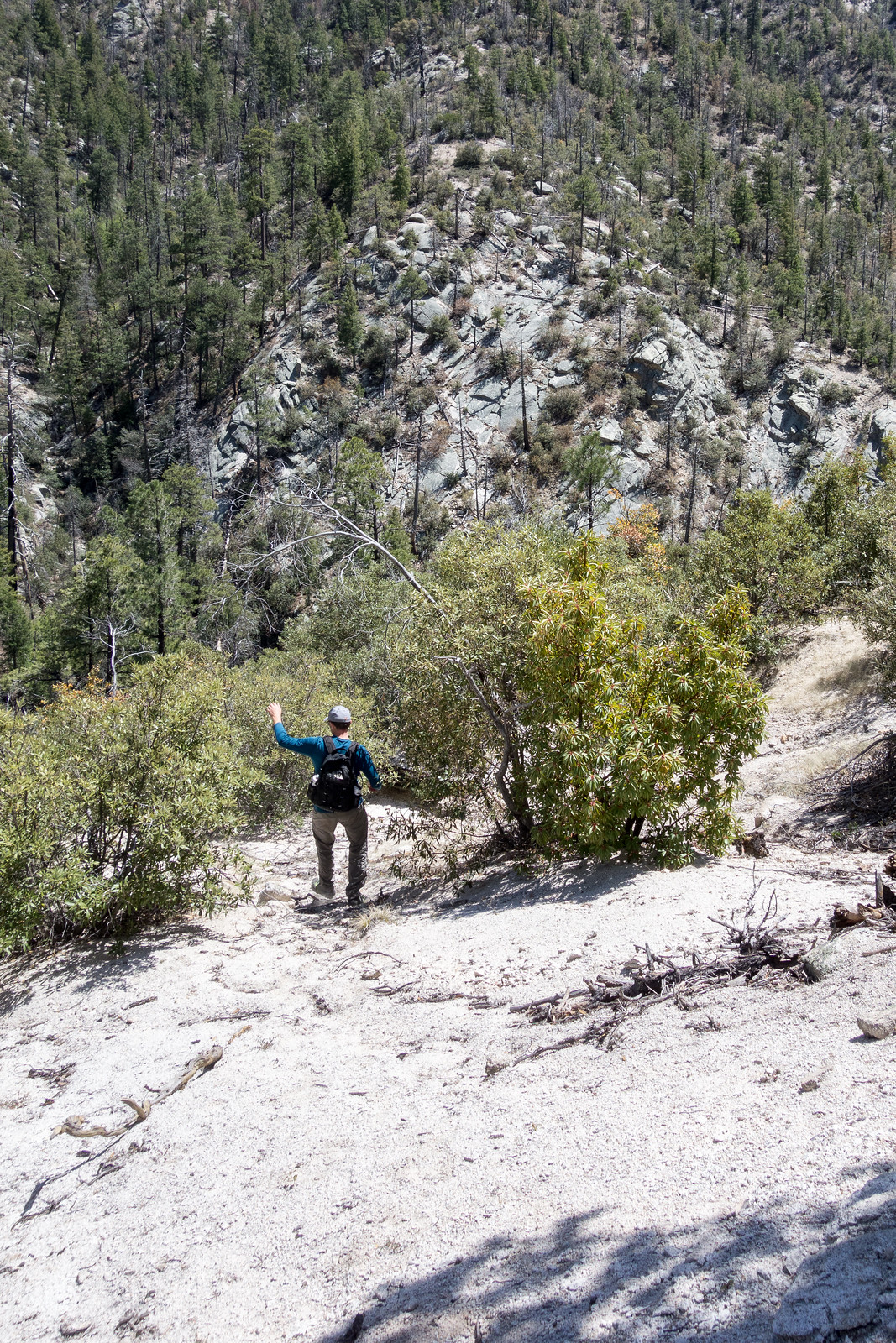
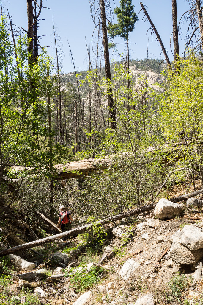
The hike down seemed slightly easier to follow than I remember – maybe with a little more loose dirt and debris in the drainage (and maybe just a little more poison ivy)? It was a surprise to meet two hikers coming up – but no surprise that anyone on this trail was fun to chat with for a few minutes!
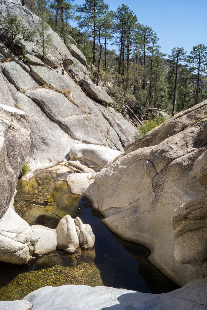
Sabino Canyon was – just like every time I have been down the Box Camp Trail – wonderful – cold flowing water, pools, beautiful rocks and green all around. After walking down to the first obstacle and taking a break we exited the canyon to the north – at first with the goal of working downstream, but eventually lured upward by the rocks to a high point…
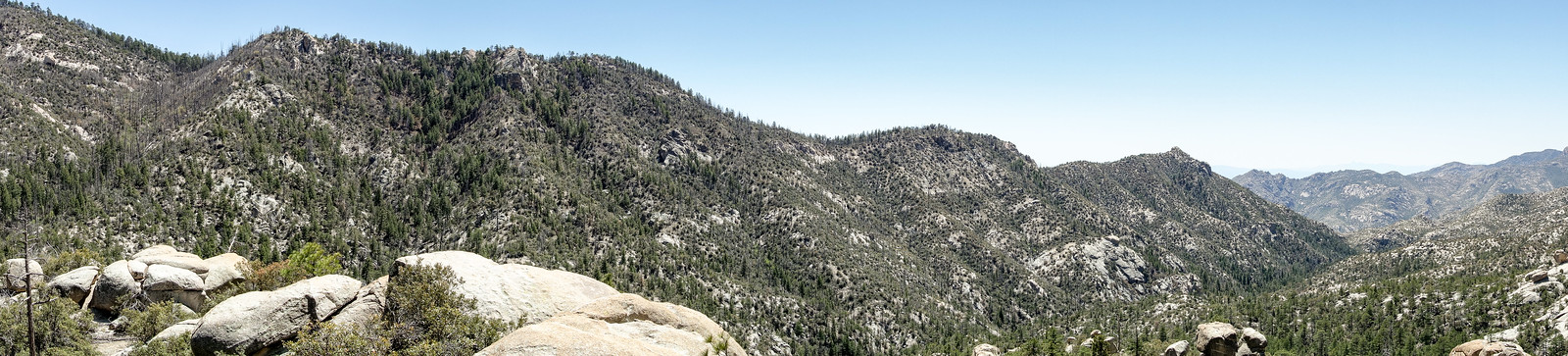
We rested, enjoyed the views and planned an exit up one of the small ridges back to the main ridge (rather than going back up the Box Spring drainage) – and then plunged down the hillsides into the canyon bottom!
We hiked a short distance down canyon before scrambling out and starting to climb. At first the route we picked seemed brilliant – steep, but fairly open and easy, unfortunately as we got closer to the top the brush became thicker and thicker… Eventually we fought thru the brush and followed game trails to finish the climb to the main ridge – from there it was an enjoyable walk back to the Box Camp Trailhead. 6.75 miles, 2300′ of elevation gain and loss.
Box Spring Trail – 2014/5/5
The Box Spring Trail appears on many maps – but it is fading back into the mountain. The sign that used to mark the junction with the Box Camp Trail is gone, the start of the trail has been obscured and the original track no longer exists.
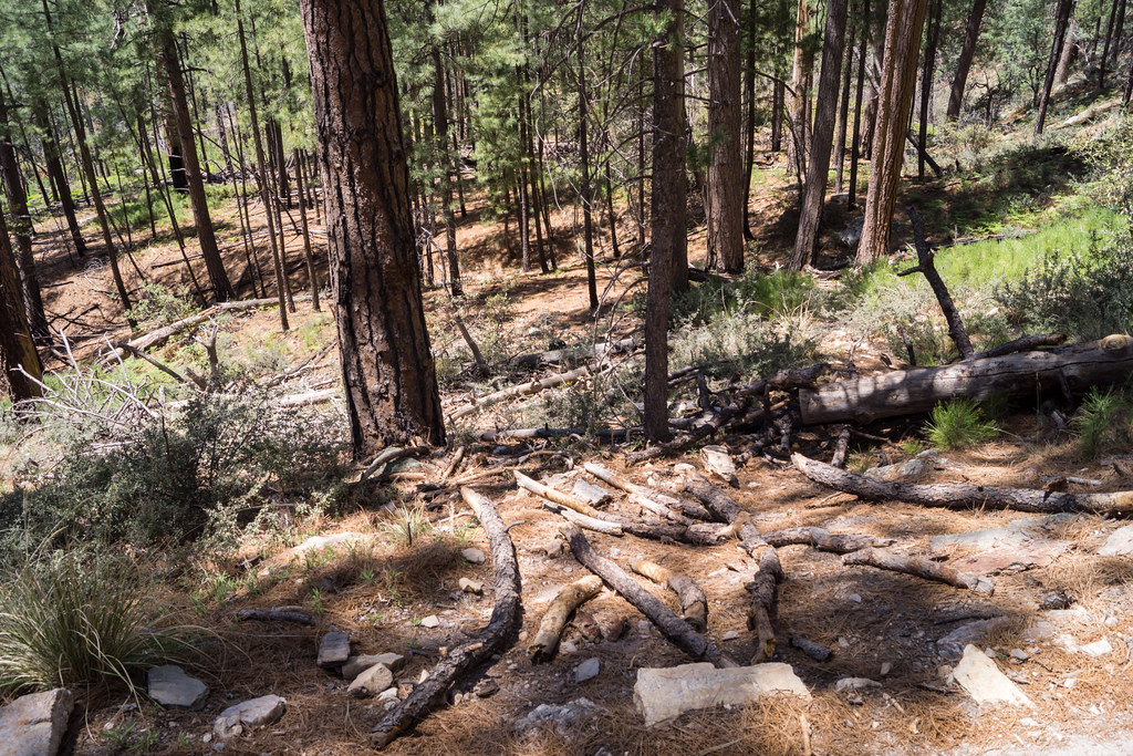
The first part of the Box Spring trail is very overgrown, but it is still somewhat reasonable up to a small (rather nice) saddle (where you leave the trail for Brinkley Point) – below the saddle you can follow a path and cairns, but the trail quickly becomes much more aggressively overgrown, the footing loose and the route obscure. Eventually the route starts to follow a rugged drainage.
Sections of the drainage are filled with debris, part very overgrown and occasionally it is filled with Poison Ivy – barely a route except for the cairns I suppose… but the reward…
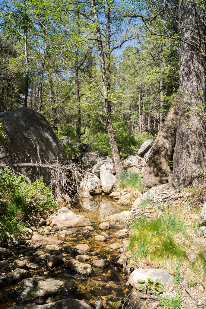
Sabino Canyon! The Arizona Daily Star reported today that Sabino Creek stops flowing 3 weeks earlier than last 2 years at Sabino Dam – but here, high in Sabino Canyon, there is clear water, pools and flow…