


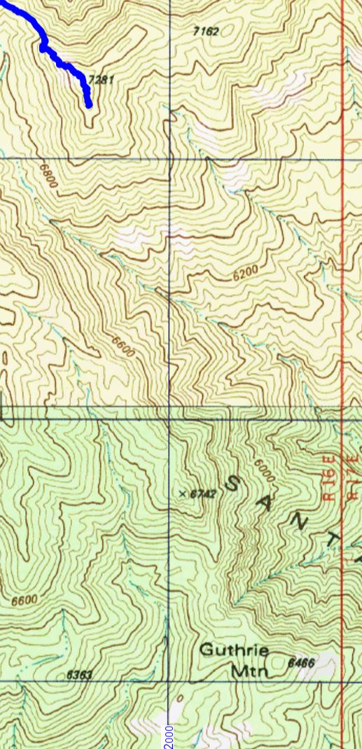
The Guthrie Mountain Trail ends near Point 7281 – the highest peak in the area – but if you look at the USGS 7.5′ maps you might notice that Point 7281 is not labeled ‘Guthrie Mountain’.

However if you look around on the USGS 7.5′ maps for the Santa Catalina Mountains you will eventually find a point well to the south of the ending of the Guthrie Mountain Trail labeled ‘Guthrie Mountain’.
From the 3rd edition of the [GuideYellowBook/], p. 75:
Guthrie Mountain was named for an early forest supervisor in the southwest and is located on the U.S.G.S. quadrangle map as a 6464-foot-high point on the ridge just east of Molino Canyon. It is the opinion of the authors that this is an error and that Guthrie Mountain is the prominent 7300-foot-high point just north of Burro Canyon and about a mile southeast of Bear Saddle.
While I think that the ending point of the Guthrie Mountain Trail makes the most sense as ‘Guthrie Mountain’ the Guthrie Mountain label on the USGS maps provides an excellent excuse to visit another point on the map…
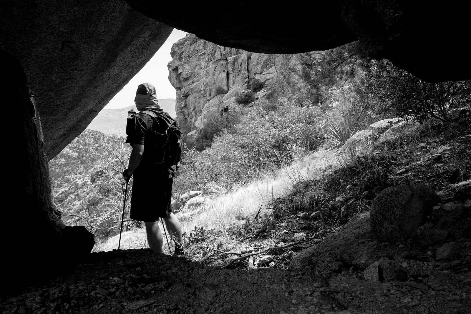
We approached the USGS Guthrie Mountain from the Molino Basin Parking Area, starting on the Bellota Trail but quickly turning onto the route up Molino Canyon. We hiked several miles up the beautifully rugged canyon bottom to a point west of the USGS Guthrie Mountain and, after some debate about what would be the best way up onto the ridge, we began our ascent. What started as a smart/clean way to the ridge quickly devolved into a slow crawl (occasionally literally) thru the Manzanita – thankfully the ridge was fairly close soon we had our first good look at the USGS Guthrie Mountain.

A small trail along the ridge took us quickly to the top – the peak is fairly open on top and there are great views! Not, I think, the ‘real’ Guthrie Mountain – but certainly a beautiful destination.


The Catalina Comet was featured on NASA’s Astronomy Picture of the Day – the picture was taken by Fritz Helmut Hemmerich who has more beautiful shots of the comet on flickr. The information with the picture notes that “Comet Catalina is now outbound from the inner Solar System and will slowly fade in coming months.” The Catalina Comet was discovered by – and named for – the Catalina Sky Survey.
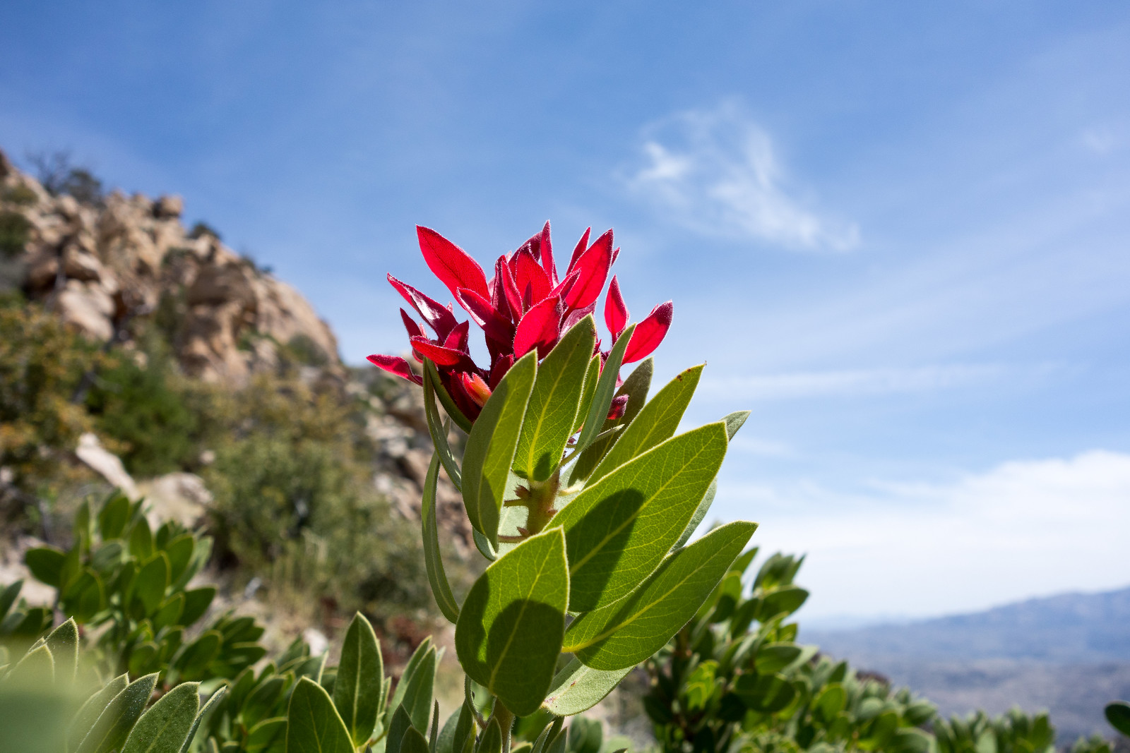
Wildflowers blooming in desert canyons — in midwinter – Arizona Daily Star: A great call out for the flowers that are appearing around the Santa Catalina Mountains! Lucky rain and weather this year…
Recent Santa Catalina Bighorn Videos – there are five new short videos of Bighorns in the Santa Catalina Mountains on YouTube and currently linked on the Friends of Santa Catalina Bighorn Sheep Facebook Page – a nice contrast to the deaths in recent months!
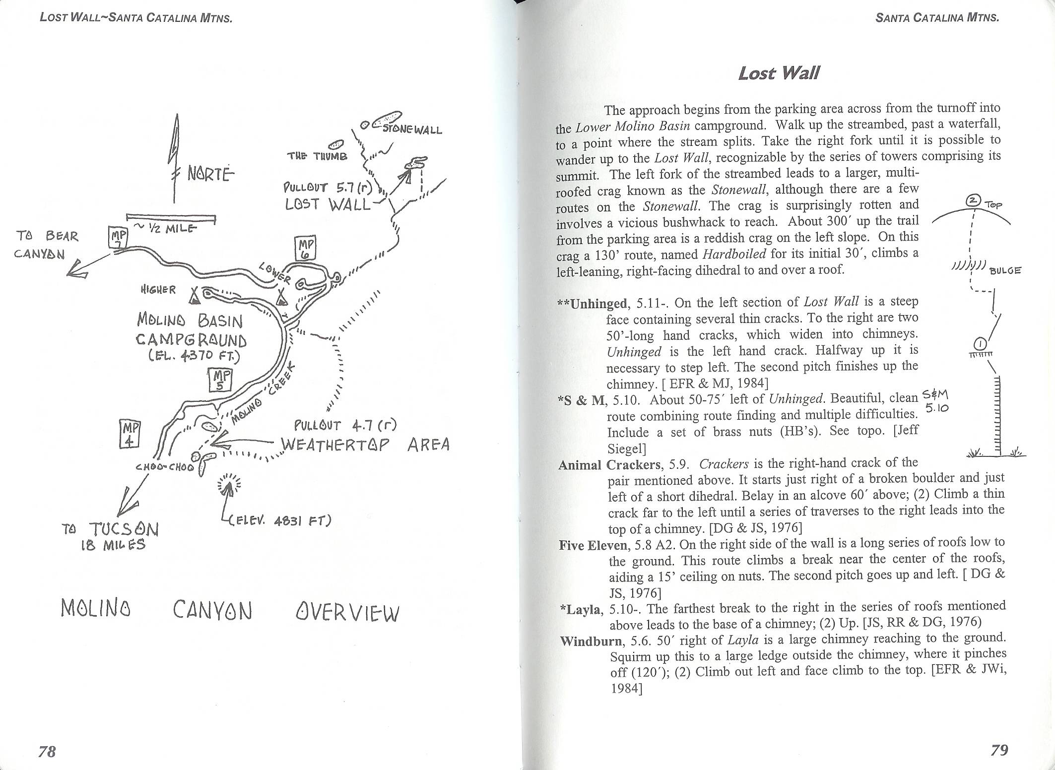
I recently found the blog Contributing to the Problem – there are several great posts linked on the Hiking in the Santa Catalina Mountains page – I particularly enjoyed Molino Thimble and Airmen Peak that includes a short description of climbing the ‘Molino Thumb’ (southwest of Airmen Peak and labeled ‘The Thumb’ in the Molino Canyon Overview of Bob Kerry’s Backcountry Rockclimbing in Southern Arizona) and references the Airmen Peak page on this site.


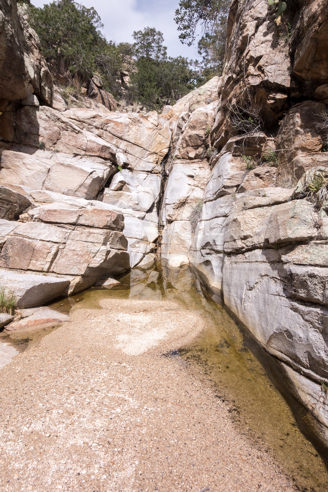
It was a busy day on the mountain so I decided on a less traveled destination – Airmen Peak. I suspected that there might be an nice path up the ridges between the Molino Basin Parking Area and the peak – I climbed past old mines to the Sun Spot Crags and then up onto the ridge – there were some nice moments on the ridge, but largely not a route I really need to repeat… Down into the West Fork of Molino (still water, and even a little flow, but stretches of dry canyon too) and then cross-country down a small drainage into Molino Canyon (water at the falls, drier than the West Fork) to finish the day. 5.6 miles, +/- 2100 feet of elecation gain and loss.