Green Mountain – 9/24/2016

September 2016.
Guthrie Mountain from Green Mountain. September 2016.
Views from Green Mountain – from San Pedro Vista the trail climbs to a saddle, from the saddle a set of loose/braided/unofficial half-paths climb first to a rocky overlook and then to the flat tree-covered summit of Green Mountain.
September 2016.
Looking down into Peck Basin from Green Mountain. September 2016.
September 2016.
Airmen Peak (front right), Agua Caliente Hill (middle right), Mica Mountain (left back), Rincon Peak (center distant). September 2016.

Window View, Flight from DFW – 11/14/2015

Flying into Tucson from Dallas/Fort Worth I had a little luck – window seat facing the mountains, decent light, good weather – and was able to take a few pictures of the Santa Catalina Mountains –

Looking down on Agua Caliente Hill on a flight coming into Tucson from DFW. November 2015.
Molino Canyon and the Highway with Airmen Peak, Guthrie Mountain, Green Mountain, Barnum Rock and Windy Point in the distance. November 2015.
Ventana, Bird, Rattlesnake, Sabino and Bear Canyons with the Summit Crags and top of the mountain in the background. November 2015.
The Cleaver, Bighorn Mountain, Table Mountain, Wolf's Teeth, Prominent Point, Finger Rock, Mount Kimball, Pontatoc Ridge. November 2015.
The Cleaver, Bighorn Mountain, Table Mountain, Wolf’s Teeth, Prominent Point, Finger Rock, Mount Kimball, Pontatoc Ridge. November 2015.
Pusch Peak rising from the southwest corner of the Santa Catalina Mountains. November 2015.

Molino Basin to Agua Caliente Hill – 10/31/2015

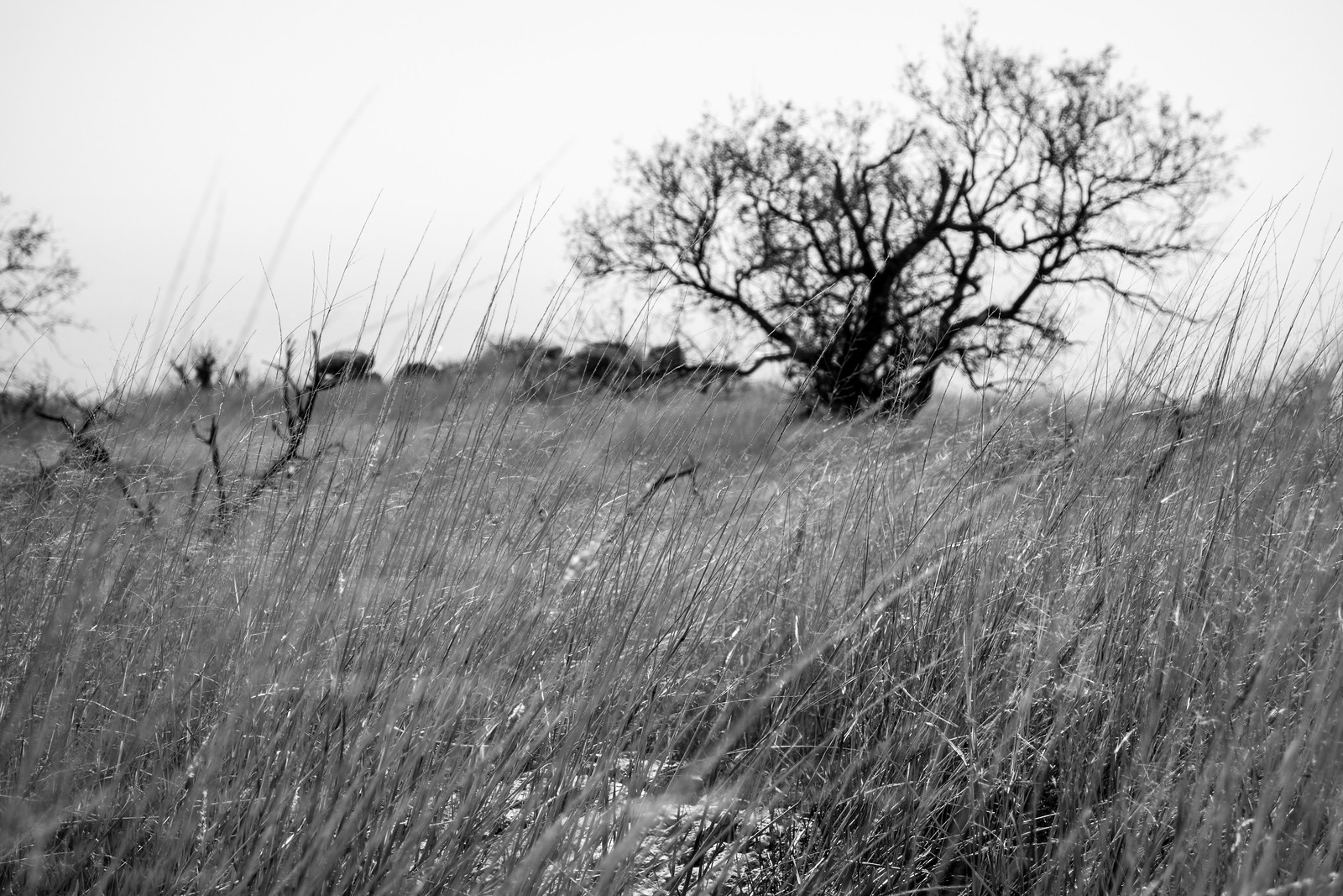
Grass, grass and more grass – the Bellota Trail is covered in grass – hiding the trail and occasionally making the footing…interesting… Water is flowing at West Spring Tank and we almost get our feet wet at the junction with the La Milagrosa Trail.

Desert Tortoise using FR4445 above Agua Caliente Canyon. October 2015.

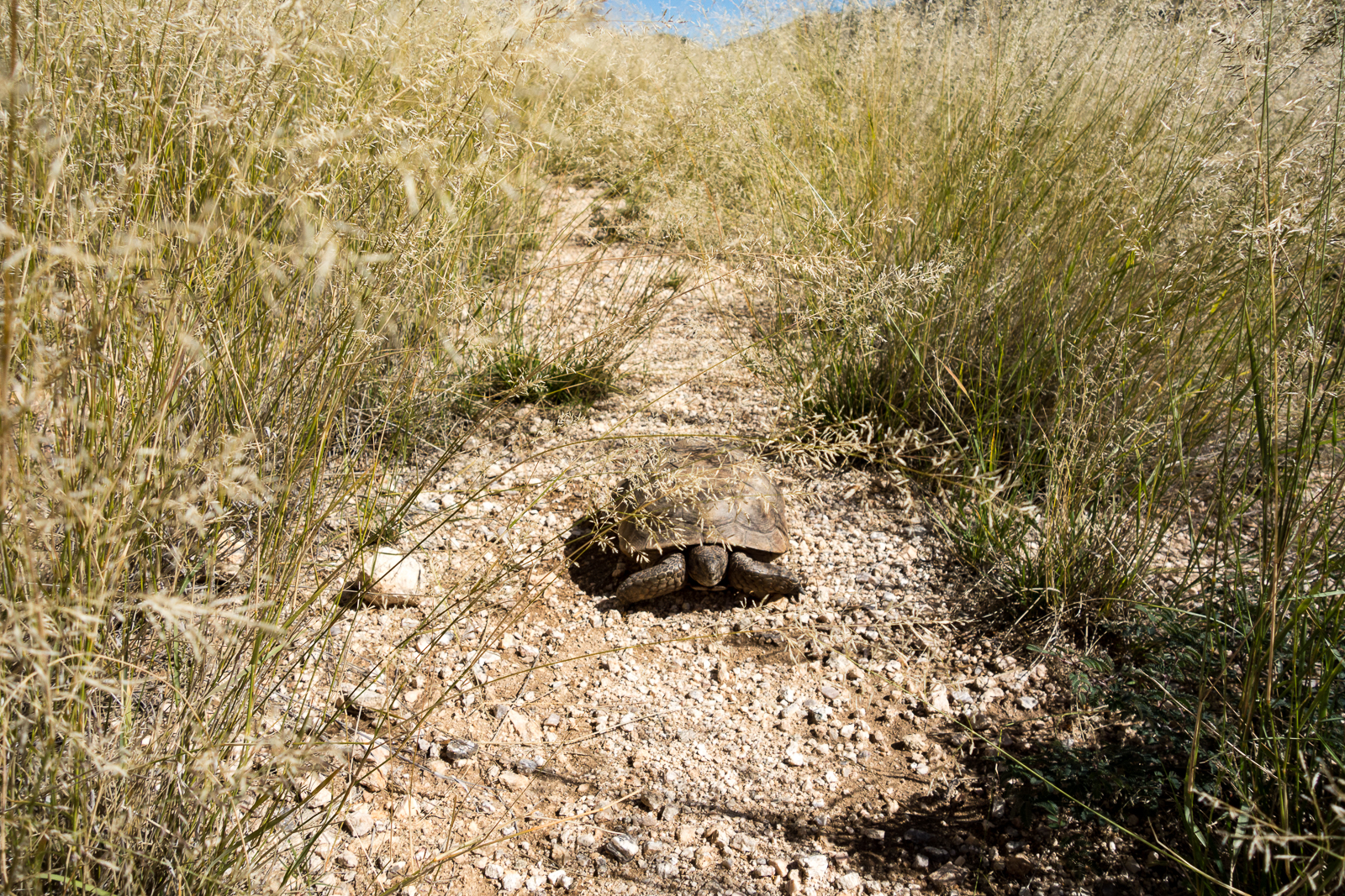
Not long after turning onto FR4445 and beginning the descent into Agua Caliente Canyon we find a desert tortoise – perhaps enjoying a break from the tall grass?

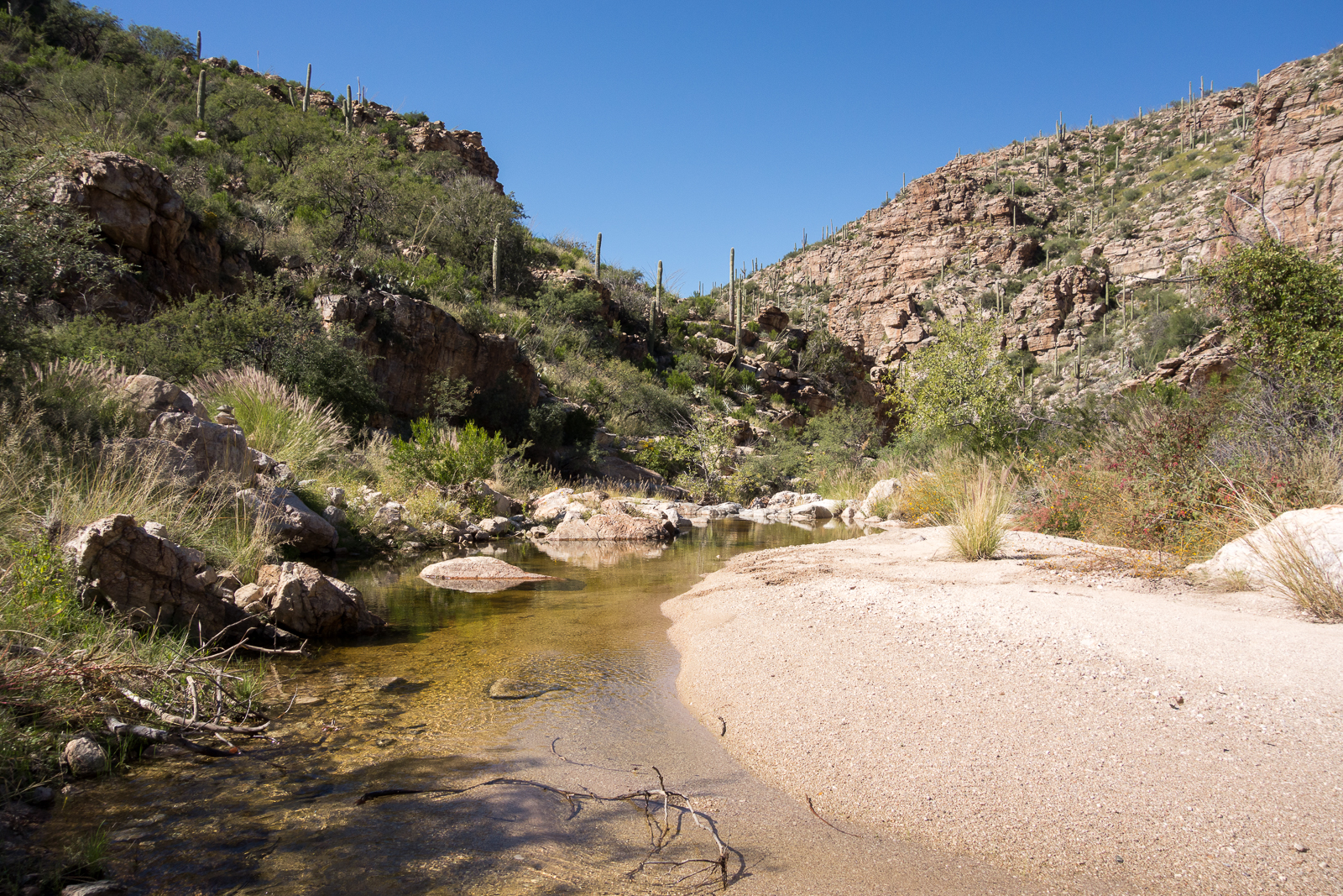
Plentiful flowing water in Agua Caliente Canyon! A nice reason to pause before the long climb up to the Agua Caliente Hill Trail, past False Hope Hill and to the summit!

Water flowing in Agua Caliente Canyon at the FR4445 crossing. October 2015.
Agua Caliente Trail below False Hope Hill - heading for the summit! October 2015.
Agua Caliente Trail below False Hope Hill – heading for the summit! October 2015.
Butterflies and flowers at the end of October on the Agua Caliente Hill Trail. October 2015.

Molino Basin Parking Area, Bellota Trail, La Milagrosa Trail, FR4445, Agua Caliente Hill Trail, Agua Caliente Hill South Trailhead – 13.8 miles, +3200’/-4500′ of elevation gain/loss.


Agua Caliente Hill Trail and Ridge Loop – 2/12/2015

1502 Cat Track Tank
Cat Track Tank with water from the recent winter storms. February 2015.

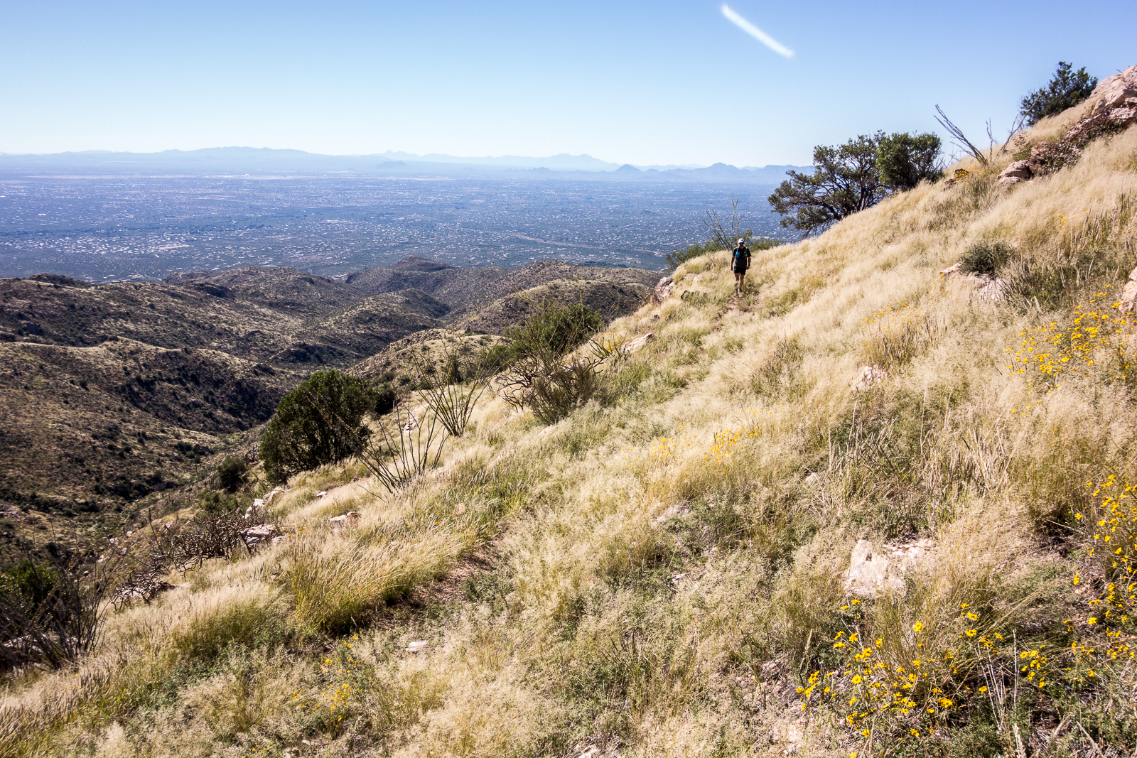
Its sunny and windy, no sign of the rain that filled Cat Track Tank and many of the smaller drainages – I follow the Agua Caliente Hill Trail past the junction with FR4445, under False Hope Hill, across the grassy hillsides and up to the top.

At the top – a quick note in the summit register, a few moments pondering the short/sad/beautiful note above mine and a brief but careful consultation of the map and GPS before leaving the trail and plunging down the ridge to the west towards towards Cat Track Tank.

1502 Weathertop to Tuffet Tank
Off-trail on the ridge west of Agua Caliente Hill (center) with a view stretching from Weathertop (left) to Tuffet Tank (right). February 2015.

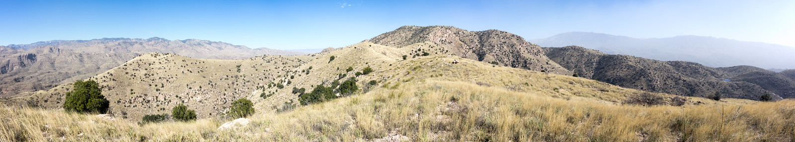
Capturing the view from Weathertop to Tuffet Tank takes multiple photos – stitched together they document the view, but fall far short of capturing the joy of being out on the ridge. The map shows a trail from the ridge to Cat Track Tank, I find it and try to follow the fading track.

1502 Grass and Tree
Grass and tree on the ridge – the windy day reduced visibility and looking towards the Tucson Mountains the sky was white with dust. February 2015.

As the trail descends off ridge it disappears and the Cat’s Claw closes in – eventually I abandon trying to find the trail and cut down to the Agua Caliente Hill Trail to finish the day.

9.2 miles, +/- 3000′ of elevation gain and loss.

Molino Basin to Agua Caliente Hill – 12/7/2014

1412 Into the Sunset
Sunset on the Agua Caliente Hill Trail. December 2014.

Climbing up the Bellota Trail out of Molino Basin a Gopher Snake and then a Tarantula stop my progress – not what I was expecting on a December afternoon – but always beautiful to see, I watch them move slowly away from the trail. There is water and mud at West Spring Tank – and in Milagrosa Canyon as I turn south.

I don’t see anyone on the Milagrosa Trail and the ridge between the canyons feels wonderfully far from the city. Trail 46A down into Agua Caliente Canyon – along the bottom – and then the climb to join the Agua Caliente Hill Trail.

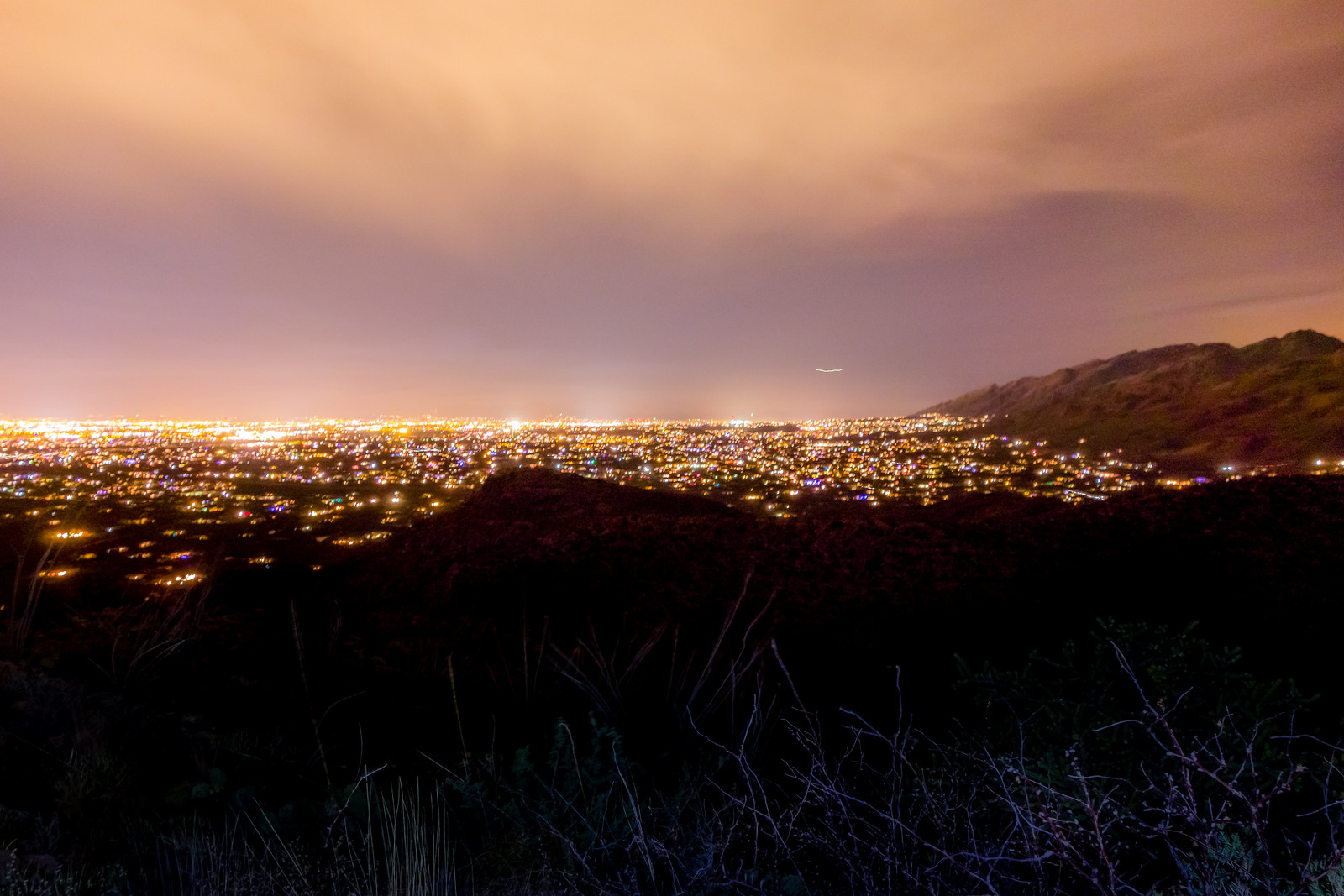
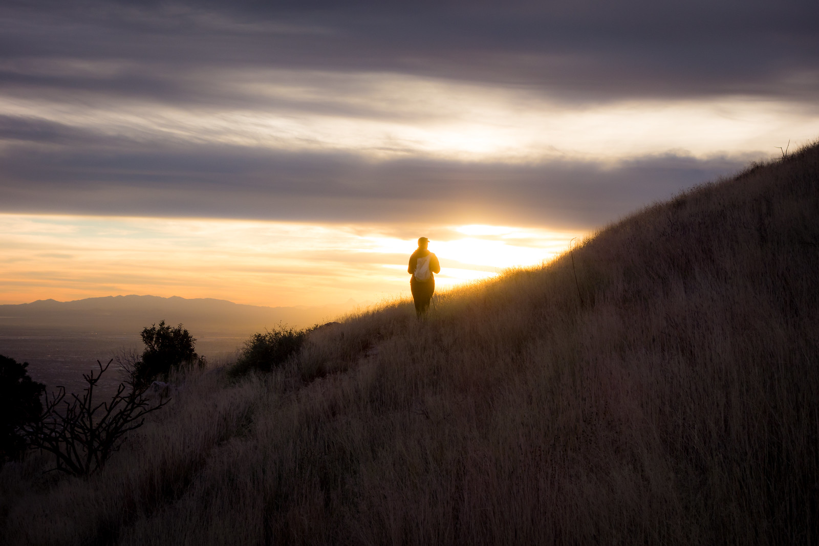
A pause at the summit and we start down – the sun, grass and views are stunning! The day fades – we watch the lights come on in the city and finish our in the Agua Caliente Hill South Trailhead just before the moon rises. 13.7 miles, +3200’/-4500′ elevation gain/loss.

1412 Tucson from the Agua Caliente Hill Trail
The Tucson City Lights from the Agua Caliente Hill Trail. December 2014.