
Overview
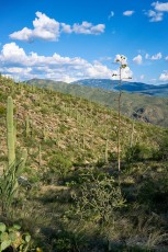
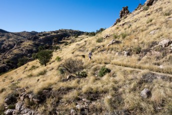
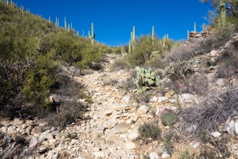
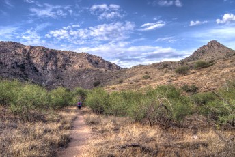
From the lowest official trailhead on the mountain Soldier Trail #53 starts with a steep ascent thru Saguaros and Prickly Pear as it climbs up to better and better views into and across Soldier Canyon. After the steep ascent the trail flattens out, crosses Soldier Canyon and winds thru the Mesquites before making the final climb up to the Gordon Hirabayashi Recreation Site on grassy hillsides.
Hike Stats
- Out and Back
- 5 miles
- 2,000' Elevation Gain
- 2,000' Elevation Loss
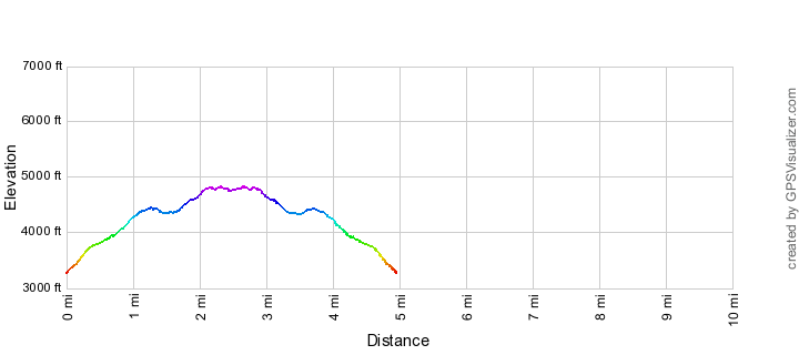
- Highest Elevation: 4,850'
- Lowest Elevation: 3,250'
Location
- This hike is located in the Pusch Ridge Wilderness in the Santa Catalina Mountains north of Tucson, Arizona.
- Start/End: Soldier Trail Trailhead (Lower Highway Hikes)
Details
- Fee: No
- Dogs: Yes
- Bikes: No (Pusch Ridge Wilderness)
Drive
- 15.2 miles from Speedway and Campbell
- 30 Minutes from Speedway and Campbell
- Vehicle Access: Paved Roads/Passenger Car (Mountain Road - be careful of weather conditions!)
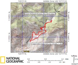
Soldier Trail Elevation Profile
Driving Directions
Suggested driving directions from the Speedway and Campbell intersection in Tucson to the Soldier Trail Trailhead:
- Drive East on Speedway (5.0 miles)
- Left on Wilmot and continue on Tanque Verde (4.3 miles)
- Left on Catalina Highway (5.9 miles)
- The parking for this trailhead is a pullout on the down-mountain side of the highway - there are signs that will help you find the pullout.
Google Maps Directions from the Speedway and Campbell intersection in Tucson to Soldier Trail Trailhead.

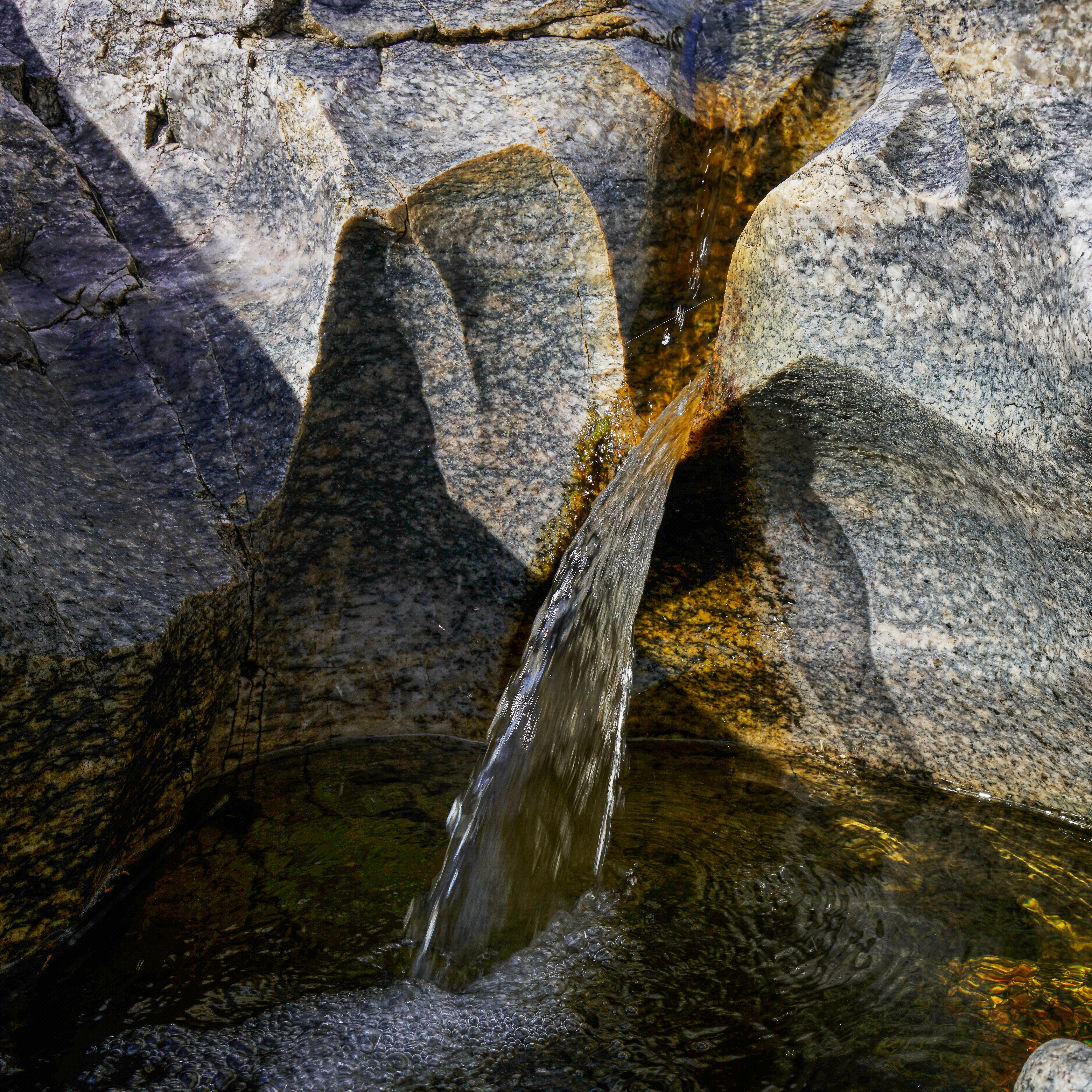
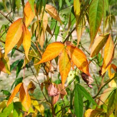
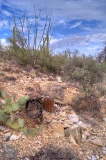
Right: Water and carved rock near the Soldier Trail in Soldier Canyon. August 2017.
Trail Notes
[CueListWarning]
- 0.0 miles, 3250′: A sign marks the start of the trail at the Soldier Trail Trailhead. [Waypoint thso]
- 0.6 miles, 3890′: Cross a wash on a rocky slab. [Waypoint SO01]
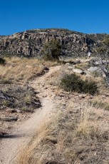
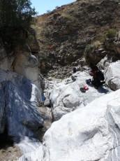
- 1.5 miles, 4360′: Enter Soldier Canyon – as the trail crosses and follows the canyon you may have to look carefully to find it. [Waypoint SO02]
- 1.6 miles, 4390′: Leave Soldier Canyon – head east onto the grassy hillsides. [Waypoint SO03]
- 2.3 miles, 4870′: A well-worn side trail splits off to the left to a great highpoint/vista. [Waypoint SO04]
- 2.4 miles, 4810′: Continue to the right at a sign for the Soldier Trail – the trail to the left is an unofficial trail into the bottom of Soldier Canyon frequently used by climbers. [Waypoint SO05]
- 2.5 miles, 4810′: The Soldier Trail ends at a junction with the Molino Basin Trail at a sign under a large tree – right on the Molino Basin Trail takes you towards the Gordon Hirabayashi Recreation Site, Shreve Saddle and the Sycamore Reservoir Trail are to the left. [Waypoint so-mb]
- To return to the Soldier Trail Trailhead hike back down Soldier Trail – longer hikes are possible by using the Molino Basin Trail.
This trail has a long history. In [LookToTheMountains/] Suzanne Hensel identifies the ‘Old Soldier Trail’ as a route believed to have been created by soldiers from Fort Lowell. In the early 1900s this trail became one of several paths that were used to travel from Tucson to areas high on the mountain. In [GuideYellowBook/] the authors give a few more historic details:
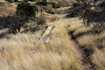
The lower portion was made into a dozer road by Trico Electric Cooperative … for the construction and maintenance of a powerline to the Federal Prison Camp near Milepost 8 … The camp was abandoned … The line and conductors were removed and the power poles were cut off above ground level and left where they lay.
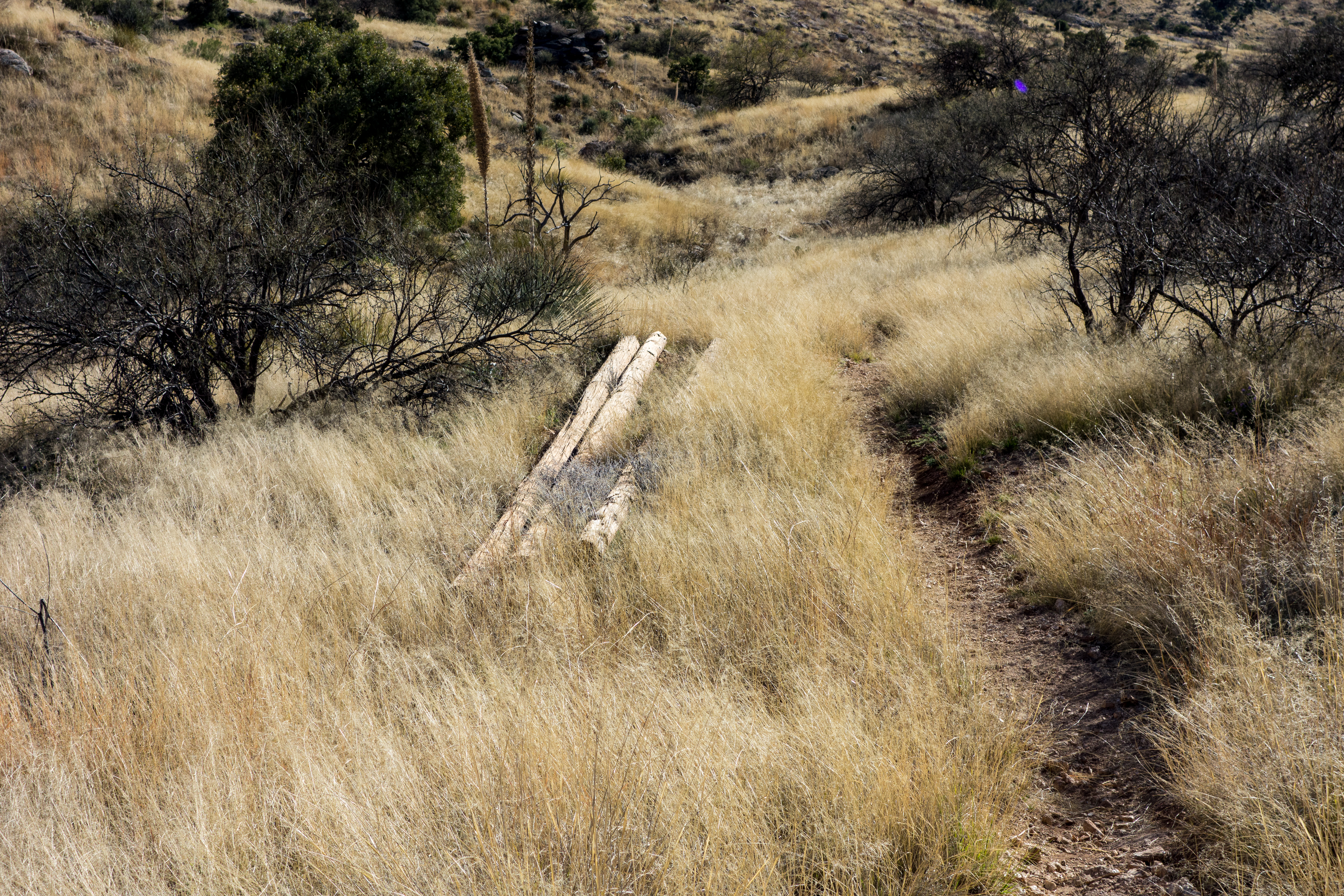
Right: Old power poles along the Soldier Trail - this line used to supply power to the Prison Camp. February 2016.
Resources
- HikeArizona
- Coronado National Forest
- Soldier Trail Hiking Guide – Back 0′ Beyond
- Tucson Hikes – AZDean
- Tucson Trail Runners – Soldier/La Milagrosa Loop – an interesting loop if you are interested in a longer hike/run and don’t mind some miles on the highway.
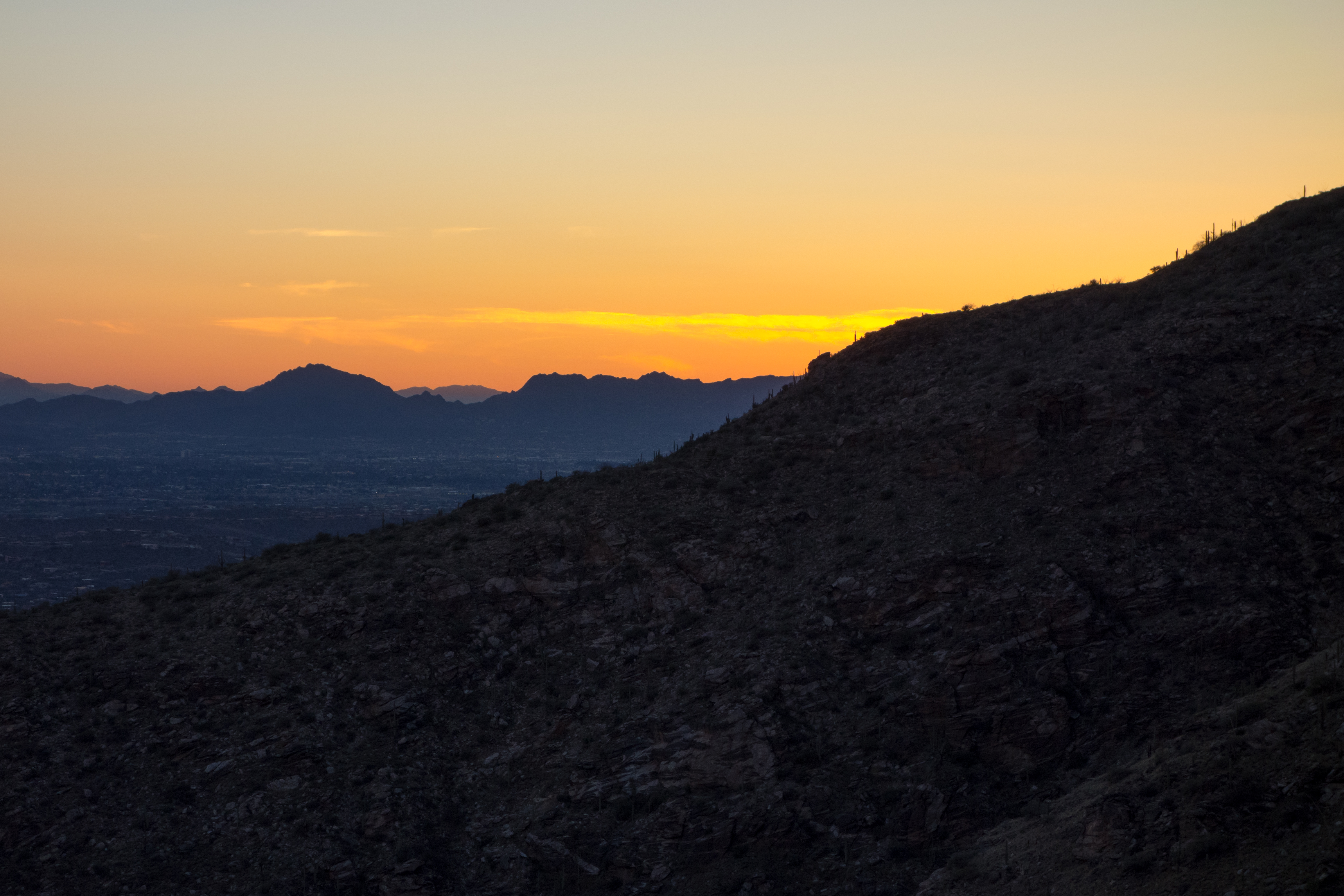
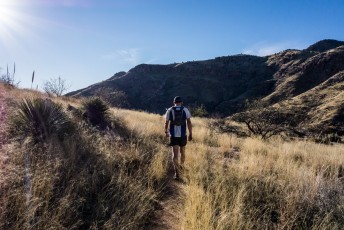
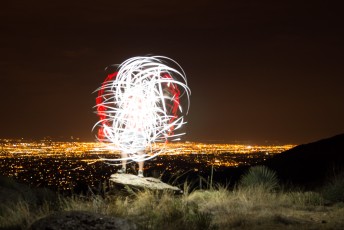
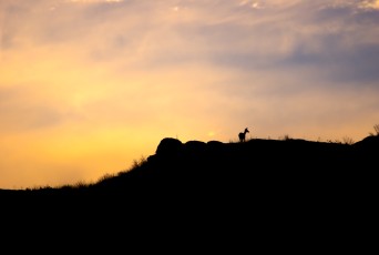
Right: Sunset from the Soldier Trail. March 2014.

Pictures
2017 August Soldier Trail


2016 February Bug Spring and Soldier Trail

2014 March Soldier Trail


2013 August Soldier Trail


2007 March Soldier Canyon
Update Notes
- 2017/8/31 – Img Srcset update, added two new pictures, added new flickr photosets
- 2017/8/15 – HikeLemmon posts added to Resources, Added a link for a Back o’ Beyond post on Soldier Trail
- 2016/2/16 – New pictures, update GPX (hand edit, elevation smoothing), update trail description, add links
- 2016/2/8 – Fix broken images
- 2014/11/2 – Small Waypoint rename, typo fix, added PDF Trail Map with Description, added several history notes
- 2014/9/23 – Tweaked GPX file and added downloadable PDF Trail Map
- 2014/7/29 – Format Update
- 2014/3/24 – Added picture set and fixed picture set typo
- 2014/3/20 – Updated map waypoint info and added waypoints to hiking notes
- 2014/3/17 – Added pictures
- 2014/3/16 – First barebones version of the page added