Overview
Over the years I have only occasionally heard anyone mention Gibbon Mountain – so I was surprised when I looked it up in [GuideYellowBook/] and found three different routes to the top!?! But after visiting Gibbon Mountain I am less surprised – while perhaps not currently a popular destination (and lacking any official trail) the ridges in the area are enjoyable hiking and views from this highpoint – especially from the southern end of the mountain – are gorgeous!
Hike Stats
- Out and Back
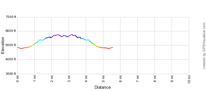
- 5.6 miles
- 1,800' Elevation Gain
- 1,800' Elevation Loss
- Highest Elevation: 5,800'
- Lowest Elevation: 4,700'
Location
- This hike is located in the Santa Catalina Mountains near Tucson, Arizona.
- Start/End: Gordon Hirabayashi Recreation Site (Lower Highway Hikes)
Details
- Fee: No
- Dogs: Yes
- Bikes: No (Pusch Ridge Wilderness)
- [OffTrailWarning/]
Drive
- 21.3 miles from Speedway and Campbell
- 45 Minutes from Speedway and Campbell
- Vehicle Access: Most of the drive is Paved Roads/Passenger Car (Mountain Road - be careful of weather conditions!) - the drive to the end of the road parking area is on a dirt road that is generally in good condition and passenger car friendly.
Gibbon Mountain Elevation Profile
Driving Directions
Suggested driving directions from the Speedway and Campbell intersection in Tucson to the Gordon Hirabayashi Recreation Site:
- Drive East on Speedway (5.0 miles)
- Left on Wilmot and continue on Tanque Verde (4.3 miles)
- Left on Catalina Highway (11.8 miles)
- Signs mark the turn into the Gordon Hirabayashi Recreation Site on the down-mountain side of the Highway.
- If the gate is closed: park in the paved upper parking or one of the dirt pullouts and walk to the parking area at the end of the dirt road (this will add to the total mileage of your hike). If the gate is open: drive the 0.3 miles to the parking area at the end of the dirt road. Restrooms are located just before the parking circle at the end of the road (the restrooms may be closed seasonally) – no water is available.
Google Maps Directions from the Speedway and Campbell intersection in Tucson to Gordon Hirabayashi Recreation Site.
Trail Notes
[CueListWarning]
- 0.0 miles, 4850′: Park/Start at the lower parking area (end of the road) in the Gordon Hirabayashi Recreation Site
- The following part of the hike is the same as going to Point 4981 Above Hairpin Turn
- Take the Molino Basin Trail west (towards Sycamore Reservoir)
- 0.5 miles, 4800′: Look for several old pipes on the left side of the trail, just after the pipes there is a small, but obvious, drainage coming in from the left – the trail to Point 4981 is just beyond the drainage (this picture shows the pipes and (just barely) the drainage coming in). The trail is well worn at this point.
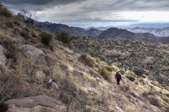
- You are no longer on an official trail – while sections of the trail are reasonable possible to follow many sections are vague/non-existent – this is best considered an off-trail hike, certainly don’t attempt this unless you are comfortable navigating off-trail! There are decent stretches of good trail – if you are not seeing any sign of a trail it may be worth your time to backtrack/look for the trail – it is sometimes faster than traveling cross country.
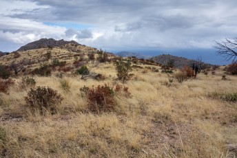
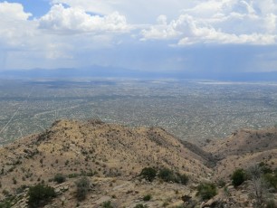
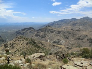
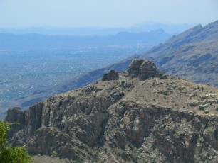
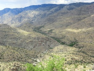
- 1.3 miles, 5400′: After climbing the trail tops out on a ridge with views of Tucson – a lovely spot.
- At the ridge you will leave the trail to Point 4981 Above Hairpin Turn and head north along the ridge and/or contouring along the hillside to a ridge between two drainages. You may be able to find a very faint route up to this point – but nothing as obvious as the trail coming up to the ridge.
- At this point the goal is to find the best way onto/along the ridges that lead up to Gibbon Mountain (you can take a more direct route to Gibbon Mountain – but my experience is that the small amount of extra effort/mileage to follow the ridges is well worth it). The map below should only be considered a suggestion/rough guide – you may find some cairns and faint trails in the area.
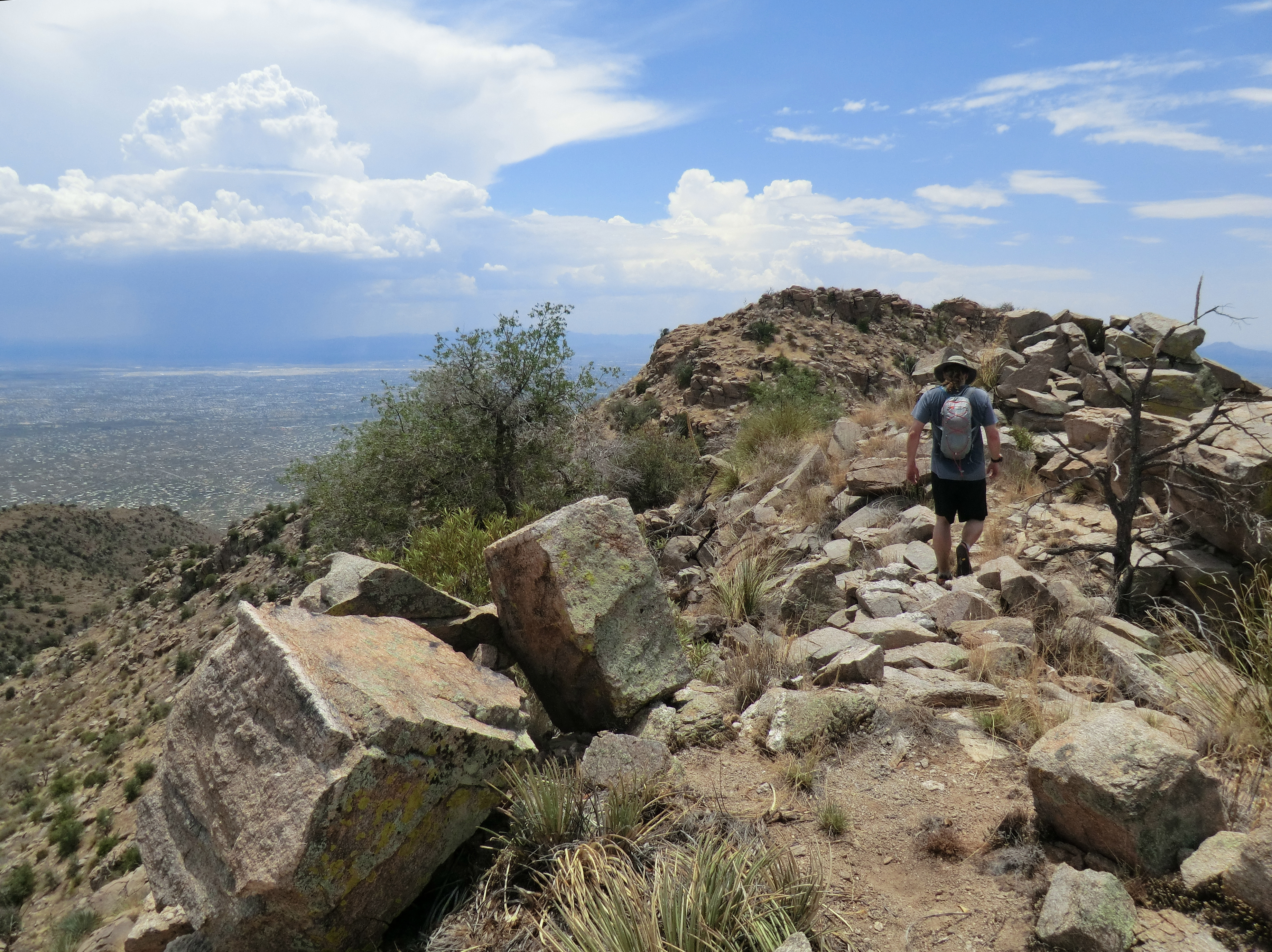
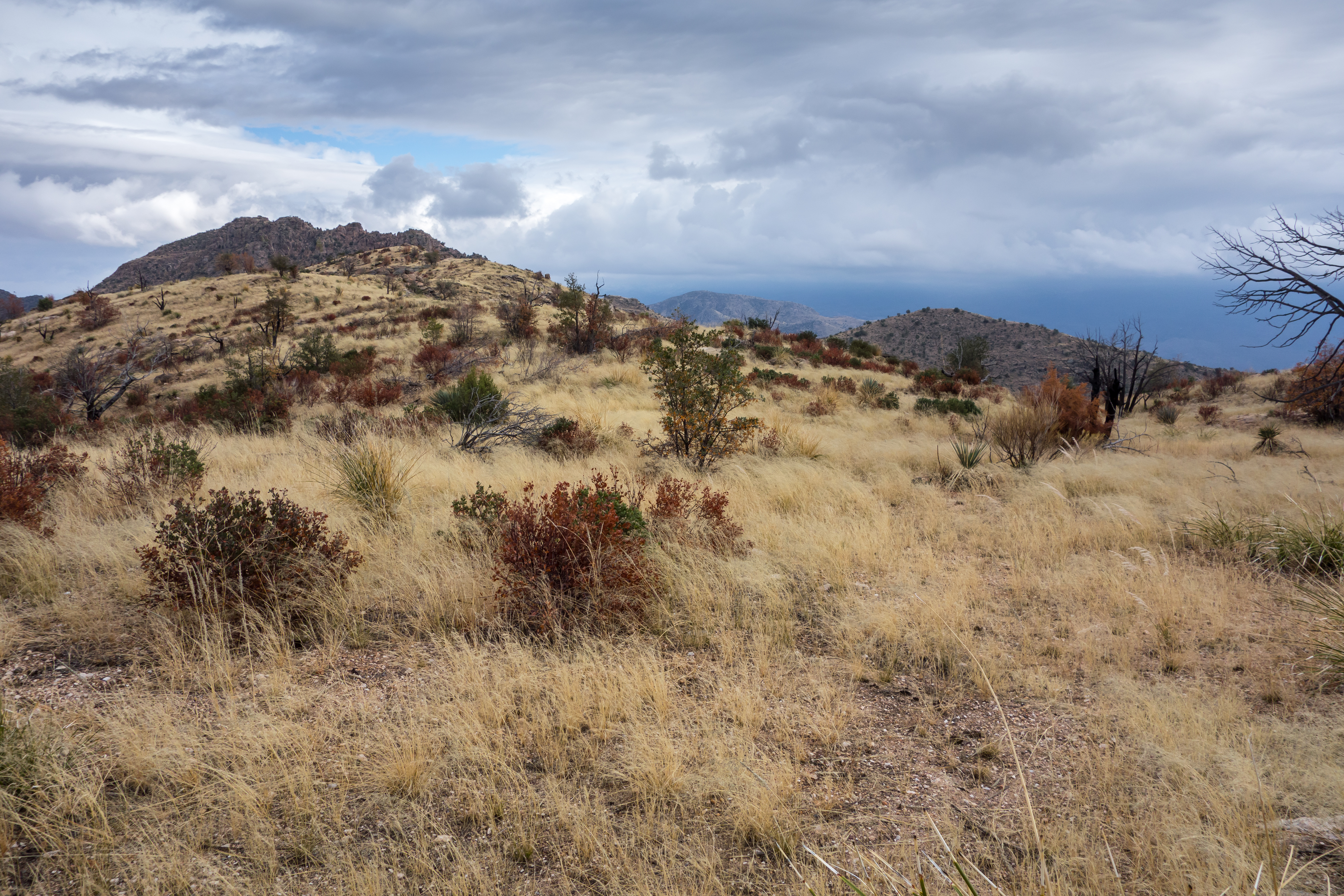
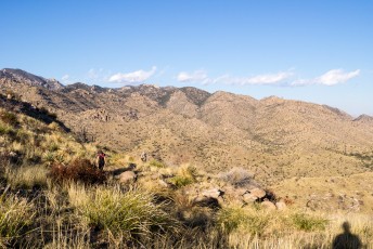
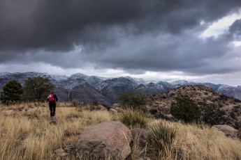
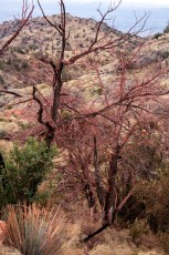
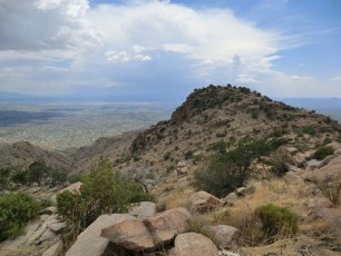
- The ridges to Gibbon Mountain are quite fun – good views, mostly easy off-trail travel and even a few spots where the ridge is pleasantly narrow. While I wouldn’t describe anything on this route as ‘scrambling’ but there are plenty of loose, dirty, rocky sections and cliffs to be cautious of – you should only attempt this hike if you are comfortable traveling off-trail in the Santa Catalina Mountains.
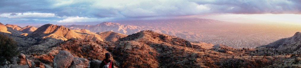
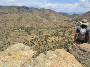
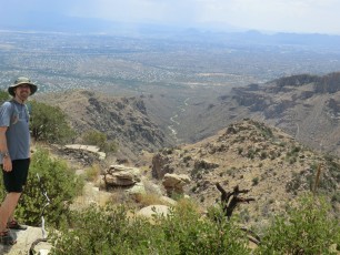
- While Point 5801 seems to be marked/referred to as ‘Gibbon Mountain’ don’t stop there! For great views of the lower portion of Bear Canyon (and a nicer spot to stop and take a break) continue to the next prominent high spot (to the south-west) (note that if you look at both the Agua Caliente Hill USGS Quad and the Sabino Canyon USGS Quad ‘Gibbon Mountain’ seems to be marked in two different locations (perhaps just because of the location of the map ‘seam’) – the GNIS Entry for Gibbon Mountain defines the NE Gibbon Mountain as the ‘official’ summit, but both locations are well worth a visit!!!!)
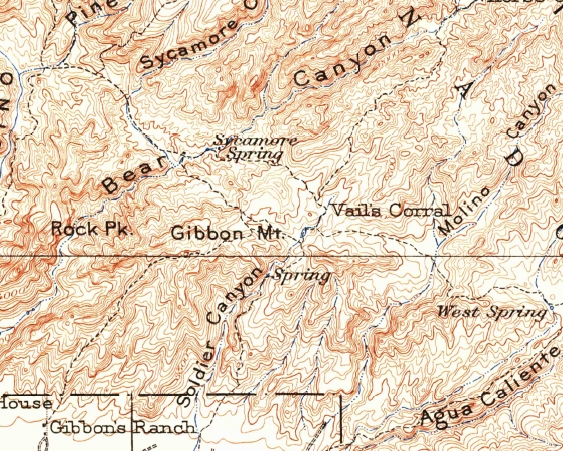
The name Gibbon Mountain puzzled me for sometime – but this image from the 1904 USGS Tucson Quadrangle showing Gibbon’s Ranch below Gibbon Mountain likely explains the name (note also on this map section that the Gordon Hirabayashi Recreation Site is called Vail’s Corral (Vail’s Ranch is to the east). While Gibbon’s Ranch is not on any recent USGS Maps Gibbon Springs is on recent maps and is in the same area (also of note is ARCHAEOLOGY IN TUCSON, Volume 8 Number 4, January 1994 which has information on a Hohokam Village in the Gibbon Spring area).
There are several different routes described in [GuideYellowBook/] – I don’t believe the route above exactly matches any of them – a few notes about those routes:
- Prison Camp Route – I tried to faithfully follow this route and I will say that it was shorter and may have been up on the ridges longer, but getting to the ridges was somewhat less than thrilling (functional but not so pleasant) – I think using the trail to Point 4981 Above Hairpin Turn is much more lovely…
- Soldier Trail Route – This route may have the most in common with the route above. Note that [GuideYellowBook/] makes reference to Point 5411 – this Point is not found on the current version of the Agua Caliente Hill USGS Quad or the Green Trails Santa Catalina Mountains Recreation Map, but it is found on the Southern Arizona Hiking Club Santa Catalina Map. The suggested turn off in the description above from the trail to Point 4981 Above Hairpin Turn is about 500′ north of Point 5411, but I am slightly unclear if the directions from the saddle are the same or different…
- Bear Canyon Ridge Route – wow, seems like quite an adventure! I have not tried it yet and I would love to hear about it!

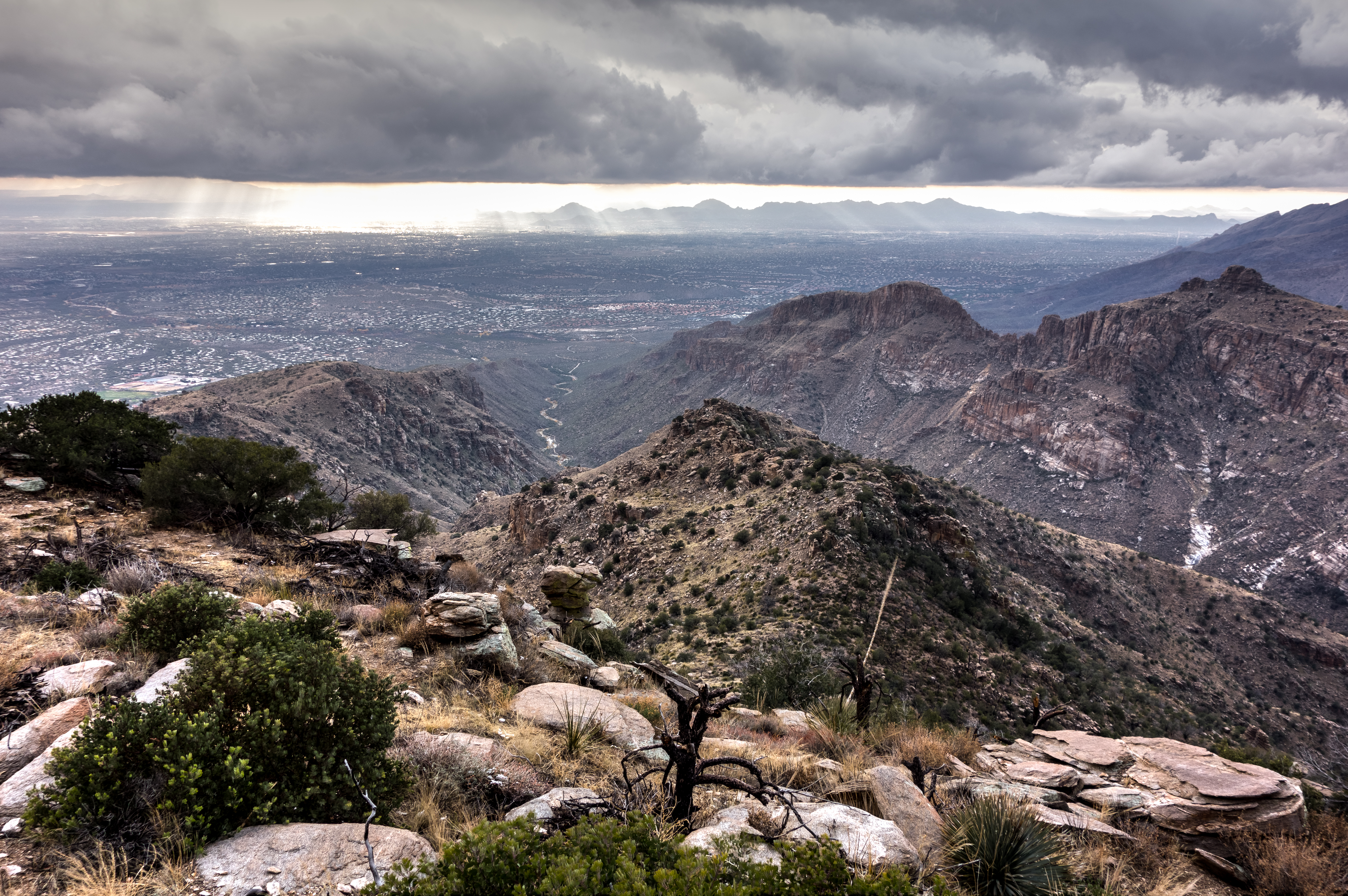
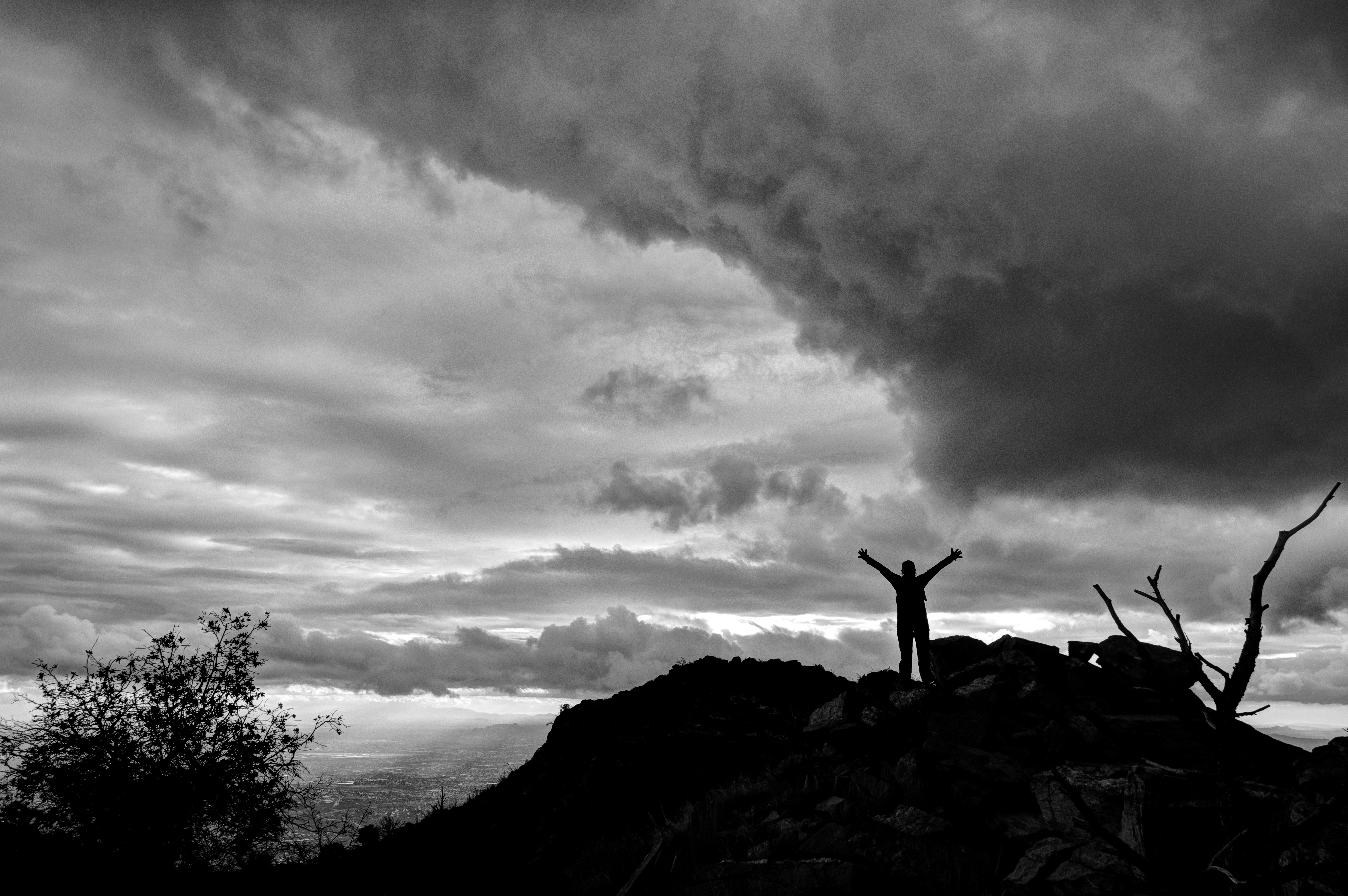
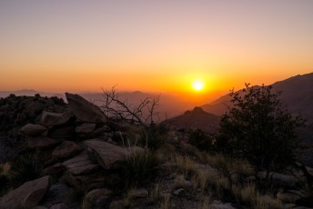
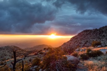
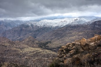
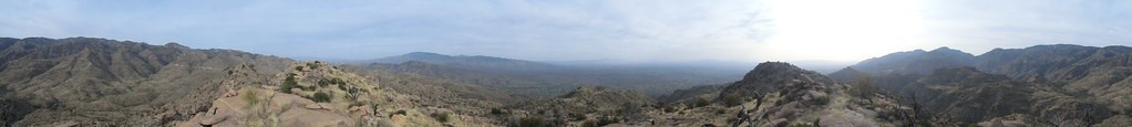
Right: From the South Summit of Gibbon Mountain looking into the snow covered Santa Catalina Mountains. December 2013.
Maps
- [MapGreenTrailsCatalina]
- [MapSahcCatalina]
- The Agua Caliente Hill USGS Quad covers all of the hike but Gibbon Mountain is on the extreme west side of the map so it is nice to also have the Sabino Canyon USGS Quad – because there is no official maintained trail to Gibbon Mountain having the detail of the USGS quads is nice.
Resources
- HikeArizona
- SummitPost
- Ineo Mons – March 2007
- [GuideYellowBook/]
Pictures
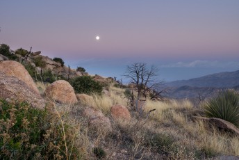
2014 March Gibbon Mountain


Update Notes
- 2017/8/14 – Add HikeLemmon Posts to Resources
- 2017/8/3 – Img Srcset update
- 2014/3/24 – Added Picture Set
- 2014/3/2 – First conversion to WordPress
- 2014/2/22 – Added elevation profile, corrected picture dates
- 2014/1/28 – Added information about Wilderness Restrictions, driving map and corrected a typo in the driving directions.
- 2014/1/26 – Correctly driving mileage from the turn onto Catalina Highway, added services notes and cautions, increased the size of the Gmap4 Topo Map.
- 2014/1/19 – Updated to new format including adding driving information and new pictures and other changes related to format.