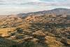
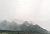
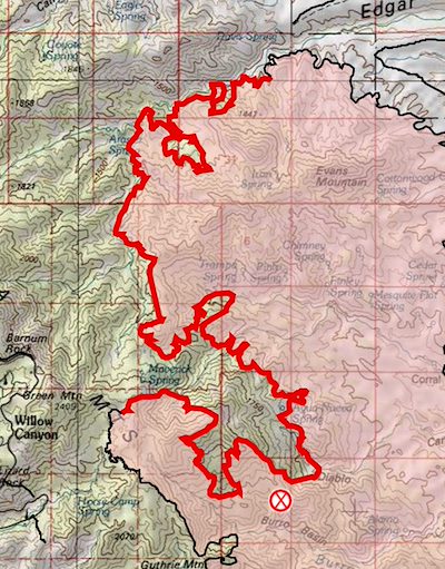
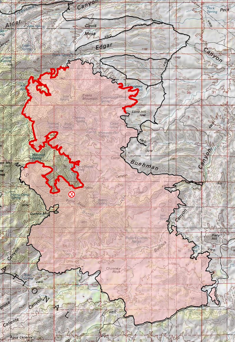
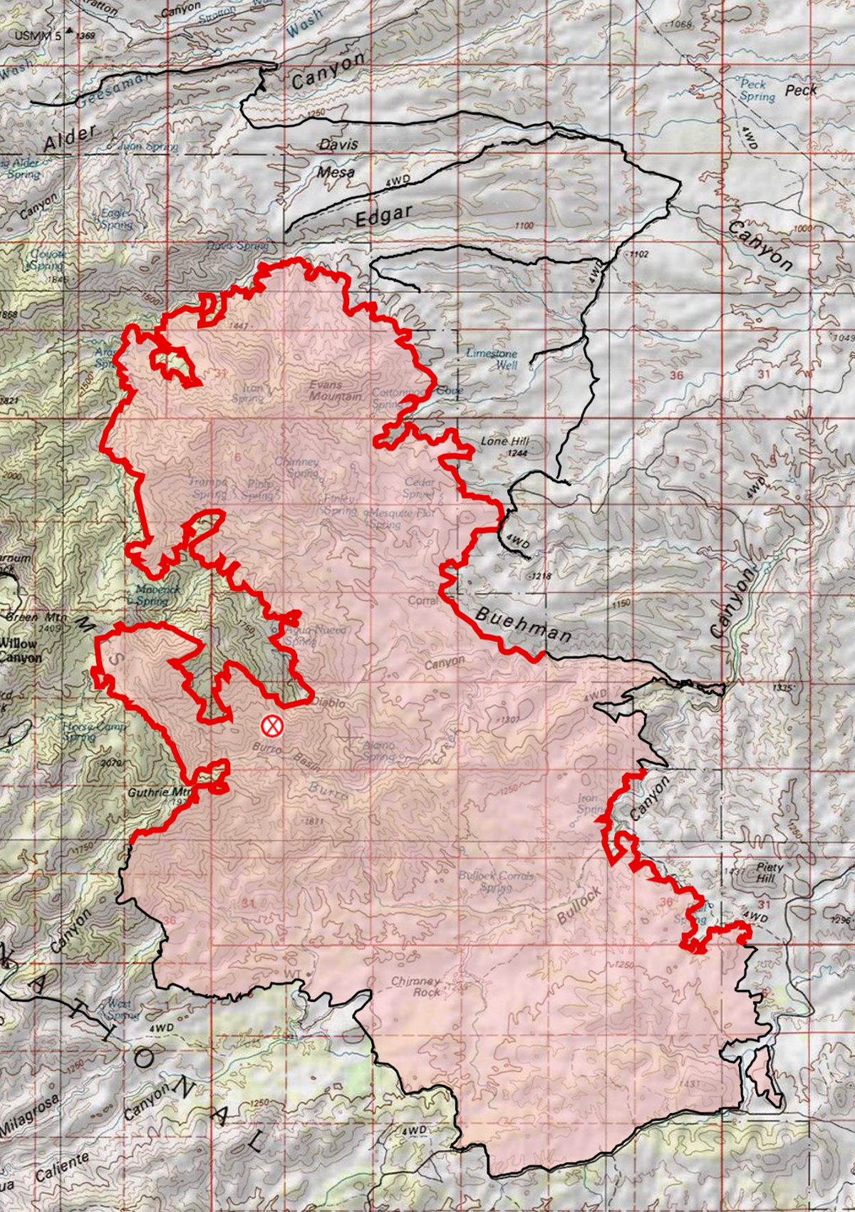
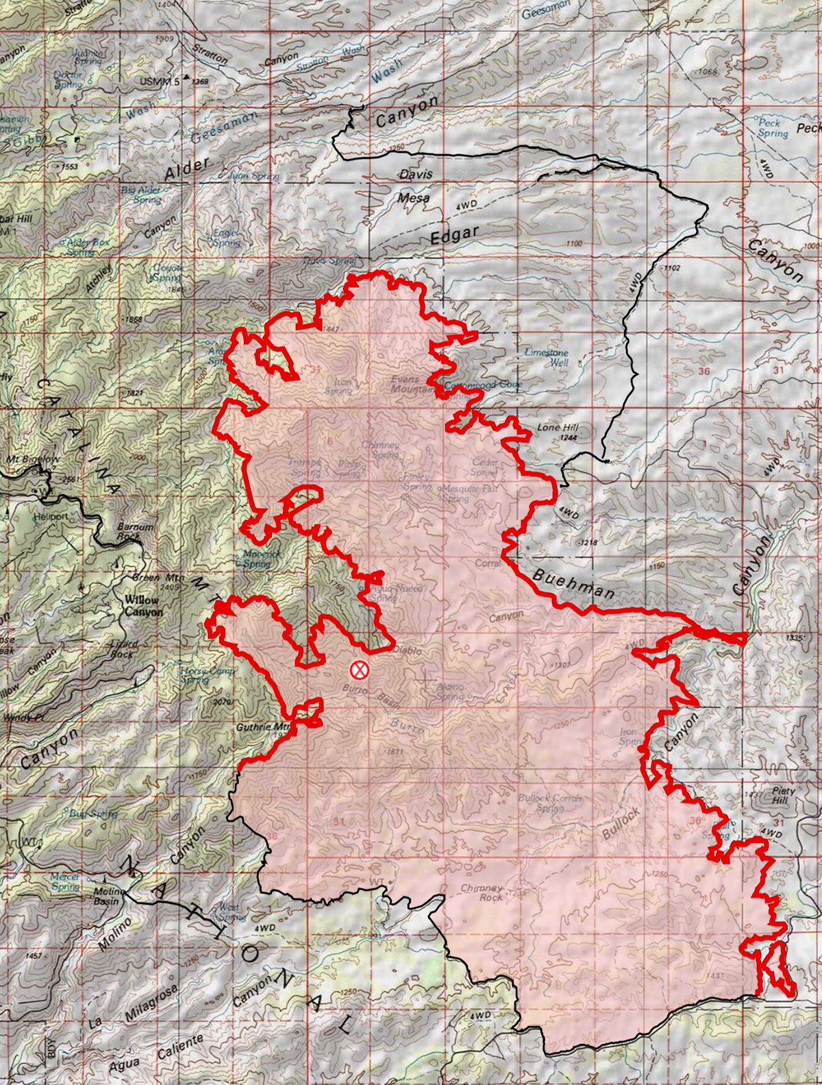
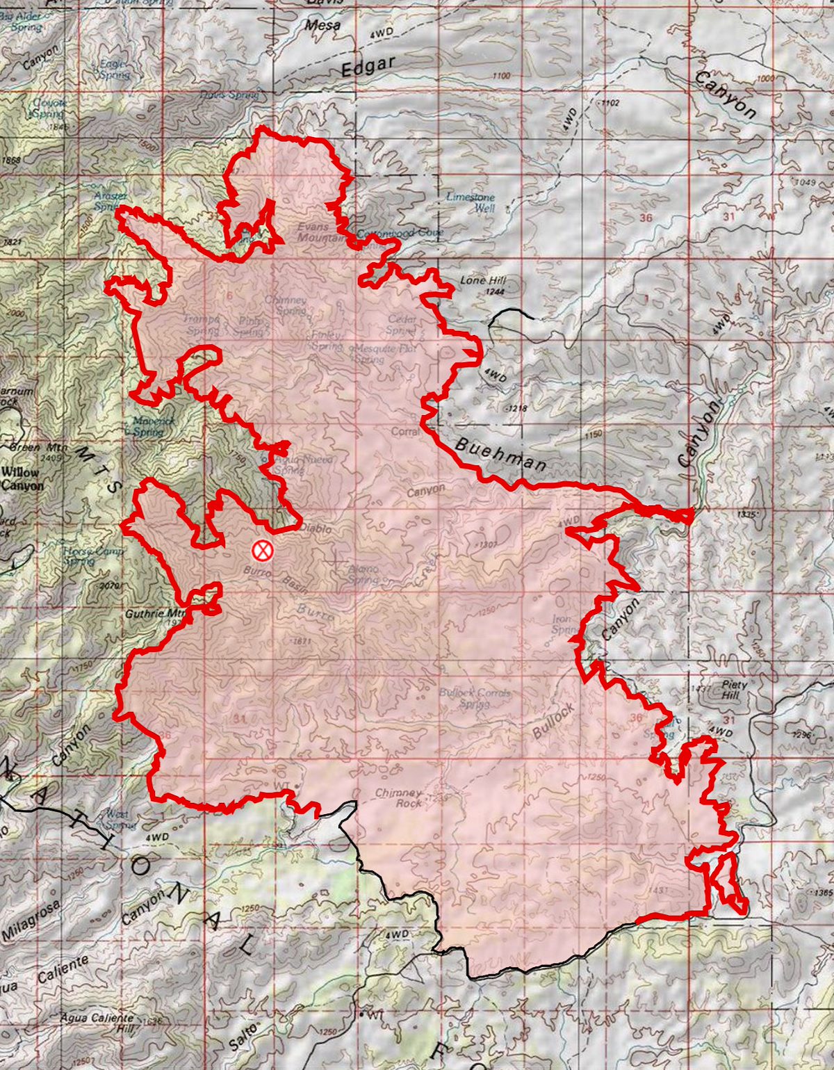
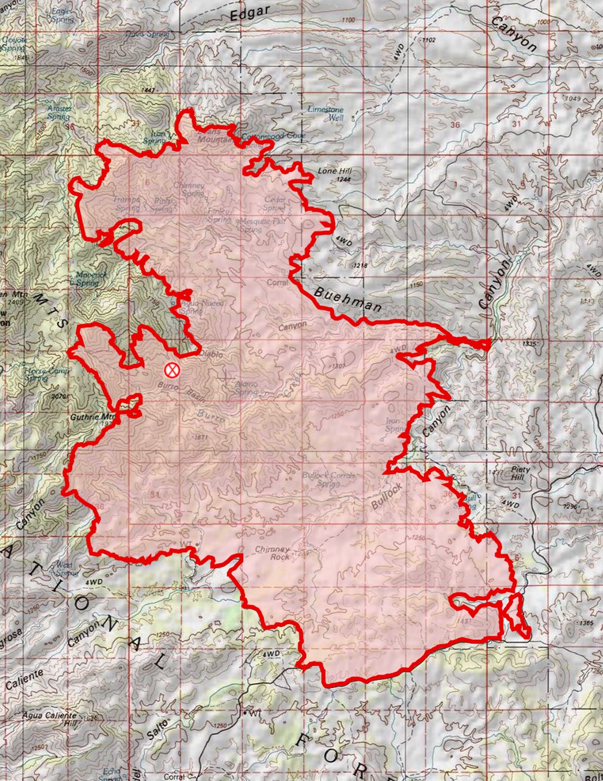
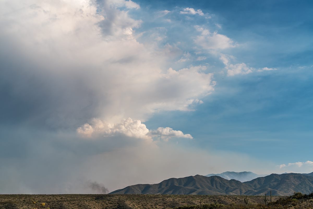
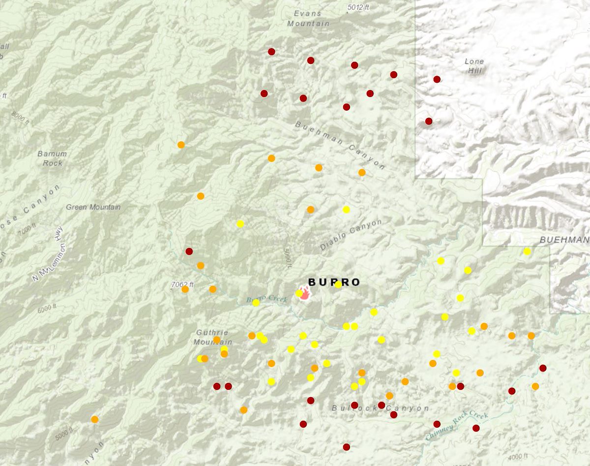
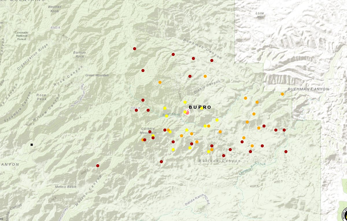
The Burro Fire started on June 30th near Burro Tank in the Redington Pass area - the fire burned 27,238 acres.
Final Update
On 7/13/2017 a final update was issued on Inciweb - the mountain will re-open on 7/14 8am and and all closures will be lifted so that all trails/trailheads on the mountain will be open!! The final size of the fire is estimated at 27,238 acres. The containment is listed at 95% (there is a small area on the NW side of the fire that on the last map still has active perimeter marked). The cause is still listed as 'Under Investigation'.
- Burro Fire one of many regular Southern Arizona blazes - The Daily Wildcat
- Mt. Lemmon is back in business with road open - KGUN9
- Visitors head to Mt. Lemmon - Tucson News Now
- Mount Lemmon Highway to open at 8 a.m. Friday - KGUN9
- Game and Fish warns of bears spotted on Mount Lemmon - KGUN9
- Bear sightings prompt warning ahead of public's return to Santa - Tucson News Now
- Bears possibly displaced by wildfire seen in Mount Lemmon's Summerhaven - Arizona Daily Star
7/12/2017
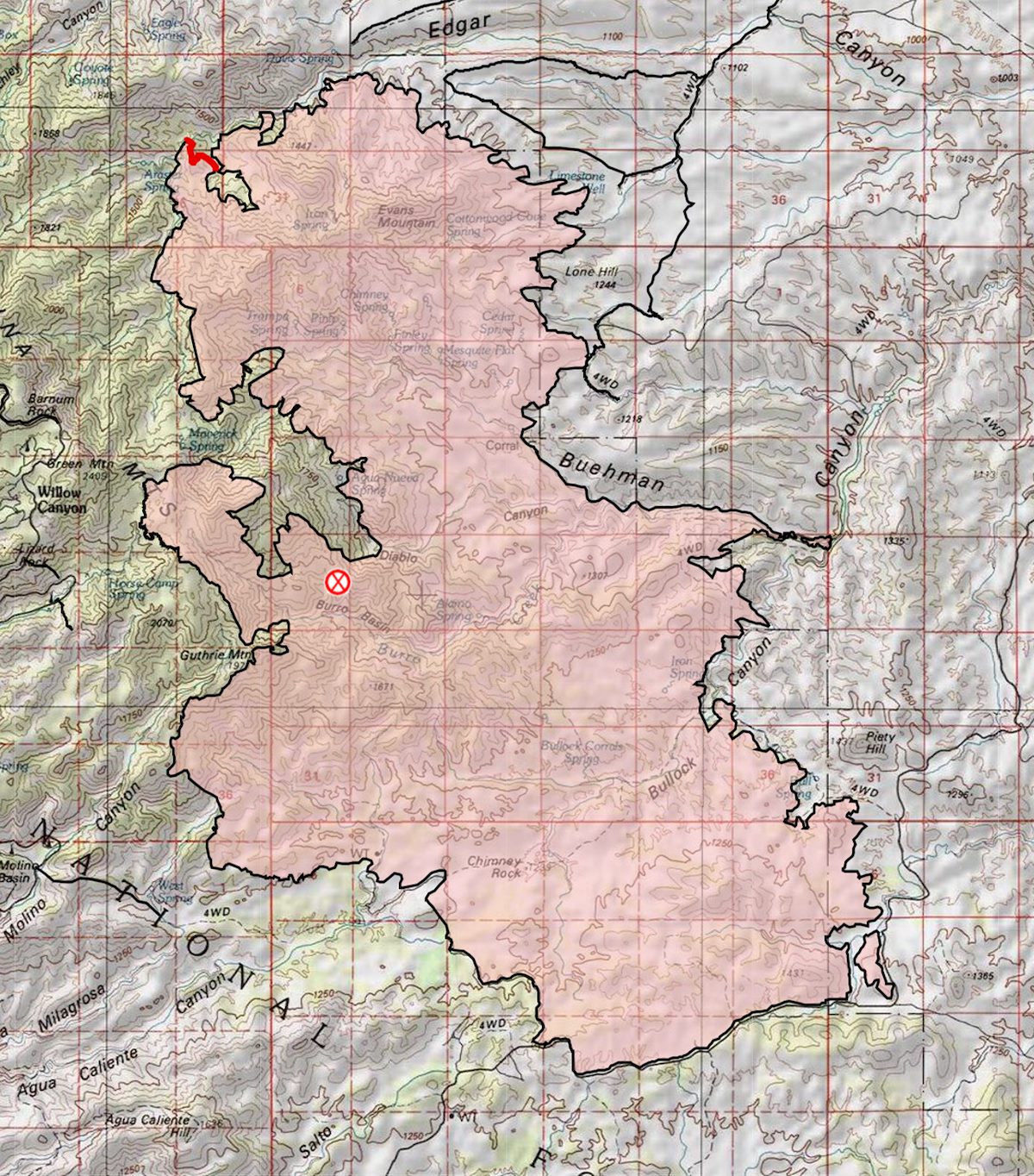
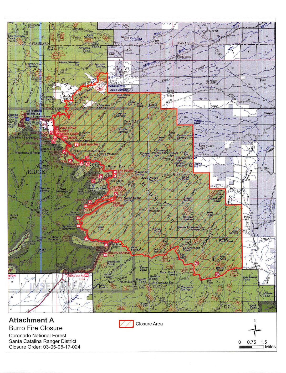
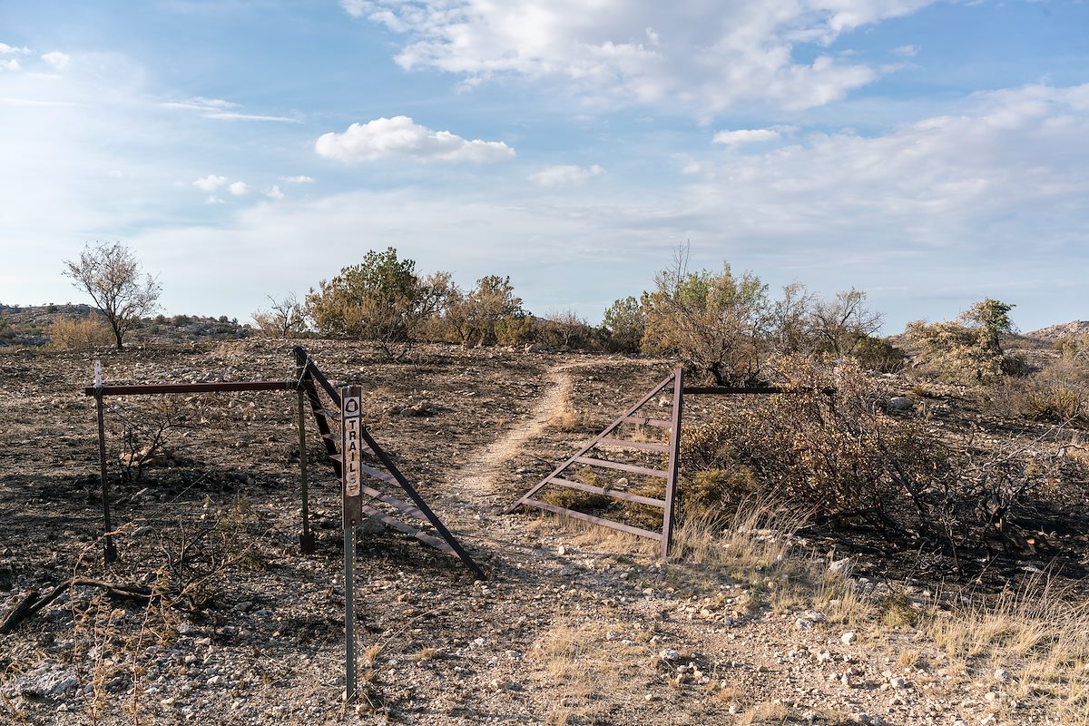
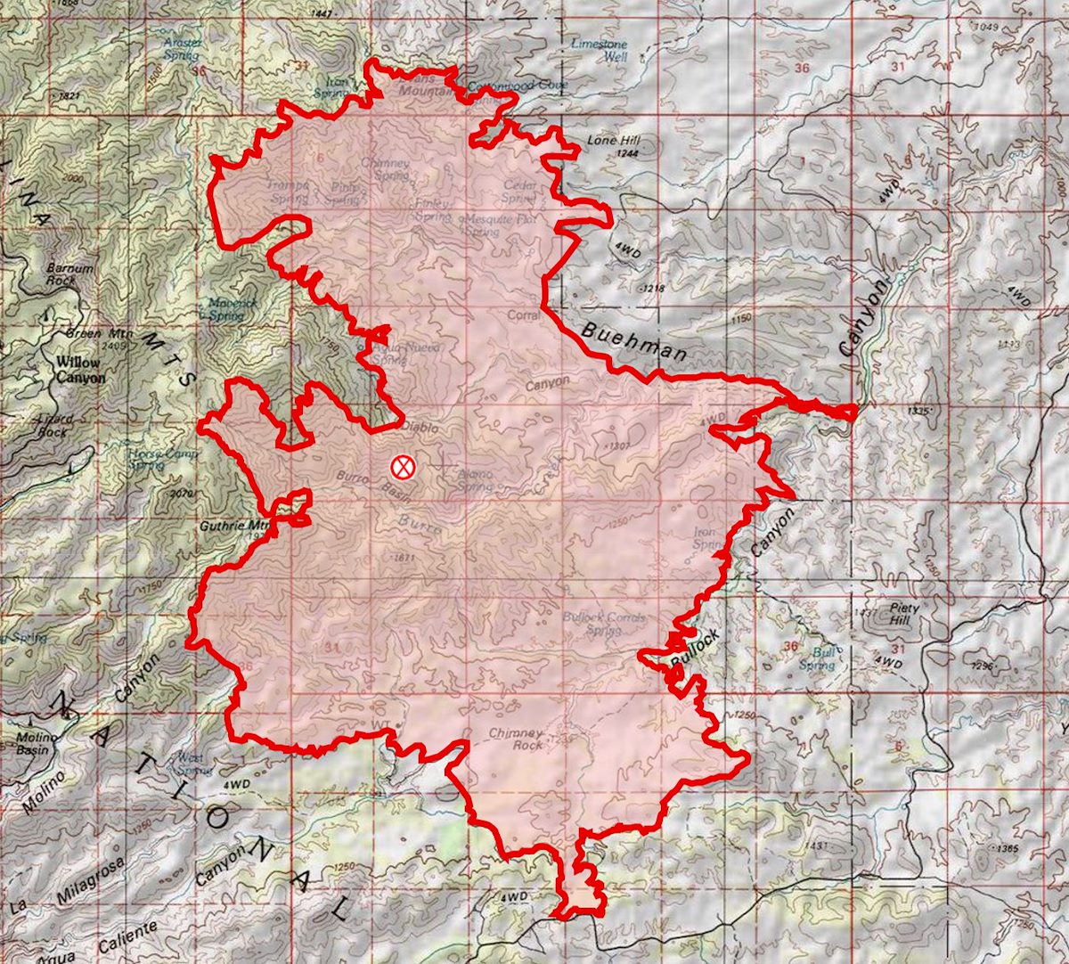
8:02 AM: The Burro Fire's estimated acreage remains the same at 27,238 and containment is now reported as 74% - only the northwest portion of the fire remains as active perimeter on the current map and there is a decreasing number personnel committed to the fire. With the highway up the mountain likely to open Friday for the general public there is now a revised closure order. Trails that are closed: [link slug="crystal-spring-trail"/], [link slug="butterfly-trail"/], [link slug="green-mountain-trail"/], [link slug="maverick-spring-trail"/], [link slug="bug-spring-trail"/], [link slug="brush-corral-shortcut-trail"/], [link slug="guthrie-mountain"/], [link slug="knagge-trail"/], [link slug="bigelow-trail"/], Davis Spring Trail, [link slug="incinerator-ridge-trail-and-kellogg-trail"/].
7/11/2017
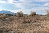
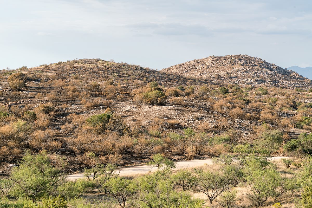
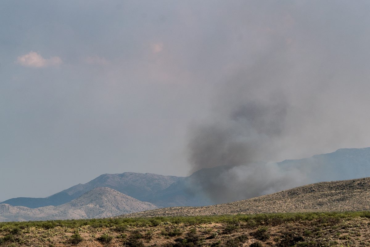
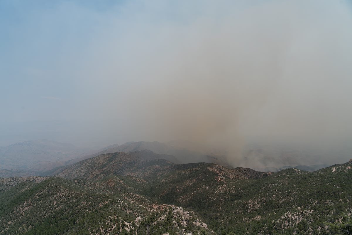
Evening: I drove Redington Road to Piety Hill to get a quick look at the impacts of the fire and fire fighting. Close to the road in the burned areas I could see the grass was gone, some or many trees were still standing and in some spots green vegetation was still visible. There were ridges in the distance that looked like they burned hotter - and near the road some of I saw was probably controlled burning by fire crews - but thankfully, at least near the road, the landscape was not a desolate moonscape!

6:40 AM: Yesterday evening 65% containment was announced - and perhaps more telling about the state of the fire residents, business owners and business employees were allowed back up the mountain starting at 3pm yesterday and at this time no additional community meetings are scheduled! (The incident commander, Bea Day, did not give any estimate on when the mountain would be open to the general public.) Redington Road is now open to all traffic. The fire is listed at 27,238 acres. The current map reflects the increased containment with more of perimeter marked as contained on every side of the fire! Rain again last night should help dampen the fire and increase containment (Green Mountain, Dan Saddle and Redington gauges all show rain in the last day on the Pima County ALERT map).
- Mt. Lemmon Highway to open to residents, employees with ID - Arizona Daily Star
- BURRO FIRE: Road to Mount Lemmon to reopen to residents, employe - Tucson News Now
- Rains help firefight against Burro Fire - KGUN9
- Mt. Lemmon to reopen to the public on Friday morning - Tucson News Now
- Catalina Highway is expected to reopen to the public Friday morning - Arizona Daily Star
- Catalina Highway is expected to reopen to the public Friday morning - Arizona Daily Star
- After Burro Fire and evacuations Summerhaven ready to get back to summer as usual - KGUN9
- Photos: The Burro Fire burns in mountains near Tucson, but is nearly contained - Arizona Daily Star
- Firefighters continue to battle Burro Fire - KGUN9
7/9/2017
7:38 AM: 27,266 Acres, 51% Contained. Fire crews finished prepping the Control Road yesterday and added more dirt road/dozer lines to the map - the extensive circle of preparations can be seen on the map! Fire growth in Edgar Canyon was minimal even though hot/rugged conditions meant that there were not crews in the Peck Basin area yesterday - the fire continues a slow spread to the east, with hot conditions limiting crews on the ground and established lines to the east the fire is being allowed to grow in that direction for now. Progress was made containing the fire in the Piety Hill, Buehman Canyon and Guthrie Mountain areas.
- Burro Fire gets some help from the monsoon - KVOA.com
- Afternoon storms help fight Burro Fire in Catalina Mountains - Arizona Daily Star
- Burro Fire containment threatened by chance of thunderstorms - KVOA.com
- Firefighters battle Burro Fire - KGUN9
7/8/2017
7:40 AM: Inciweb was updated this AM to report 26,731 acres burned and 36% containment. Fire growth shown on the map this AM is modest. Fire crews with air support have been able to stop the fire at Edgar Canyon and prevent the fire from moving west into the Peck Basin area - east of this area the map now shows a much more extensive set of fire lines surrounding the fire. The southeast portion of the fire has quite a bit less active fire perimeter with area near Buehman Canyon and Piety Hill now shown in black.
- Firefighters waiting for rain while slowly gaining on Burro Fire - Arizona Daily Star
- Safety officer assesses risk at Burro Fire - Tucson News Now
- Burro Fire nearing $5 million to fight - KVOA.com
- Burro Fire now over one-third contained, 5 miles from Mount Lemmon's Summerhaven - Arizona Daily Star
- Storms are expected to hit over Burro Fire starting this weekend - KGUN9
- Gov. Ducey thanks crews batting fires across the state - KVOA.com
- Smoke from Burro Fire prompts air quality advisory - KVOA.com
- Crews continue to battle growing Burro Fire - KVOA.com
7/7/2017
5:30 PM: At the community meeting they just announced 36% containment. There is a news article below about two injured firefighters - at the meeting there was a question about the injuries and it was mentioned that they were minor and the firefighters were back at work.
- Two firefighters injured in Burro Fire - KGUN9
- Flyover video of Burro Fire - Arizona Daily Star
- Burro Fire in Catalina Mountains now at 26,000 acres, 19 percent contained - Arizona Daily Star
- Boy Scouts are camping indoors after they were evacuated from their campground - KGUN9
- How to help crews battling the Burro Fire - KVOA.com
- UPDATE: Burro Fire grows but firefighters make progress; 19 perc - KVOA.com
- Woman opens up bed and breakfast to Burro Fire evacuees - Tucson News Now
7:20 AM: Inciweb lists the Burro Fire at 25,355 acres and 19% contained. Compared to yesterday note the growth in the Edgar Canyon/Peck Basin area - this area was mentioned multiple times in the Community Meeting last night in part because of the concern that the fire could burn up from this area towards the highway. The map this AM also adds a substantial number of firelines compared to yesterday AM. The southwest side of the fire is now contained. On the west side preparations to hold the fire at the highway have been made including plans for burnouts if needed. On the east side a line has been established from Black Hills Mine Road, across Alder Canyon at Ventana Windmill, out Davis Mesa, across Edgar Canyon down to Lone Hill and then towards the Brush Corral Area (Black Hills Mine Road connects to the Control Road which has been mentioned as a feature that could be used to control the fire - if this line + the Control Road + the highway was held it would encircle a large section of the fire).
7/6/2017
- UPDATE: Burro Fire grows but firefighters make progress; 19 perc - KVOA.com
- Burro Fire brings back bad memories for firefighters - Tucson News Now
- Mt. Lemmon Water District helping with Burro Fire - KVOA.com
- Burro fire burns 25,355 acres, 19 percent contained - KGUN9
- Monsoon rains predicted Saturday to help battle 25,000-acre Burro Fire - Arizona Daily Star
7:30 AM: The Burro Fire is currently listed as 24,547 acres with 11% containment. The map as of this AM shows the south side of the fire - along Redington Road - as contained. Since yesterday AM the northern section of the fire has grown and is burning down towards Edgar Canyon.
- Burro Fire has burned 25,090 acres - KGUN9
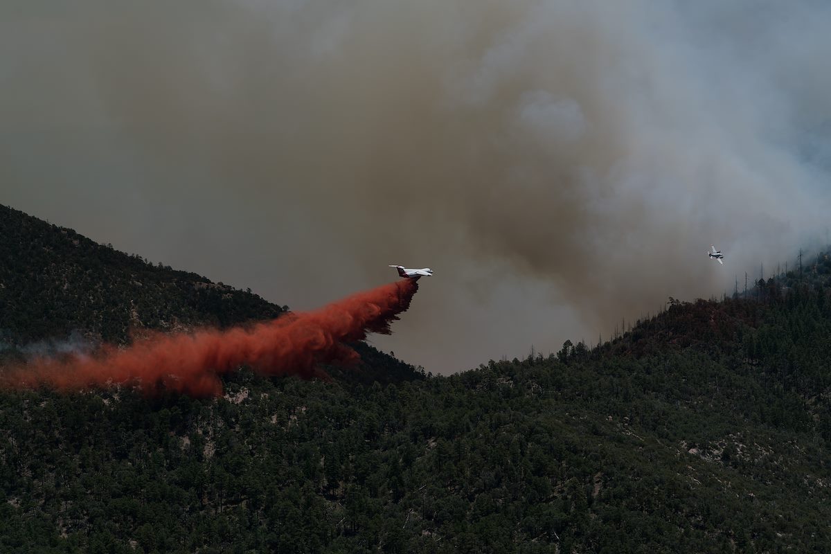
- MUST WATCH: Firefighting aircraft captures dramatic view of the - KVOA.com
- Burro Fire grows to over 23,000 acres in Santa Catalina Mountains, now 11 percent contained - Arizona Daily Star
7/5/2017
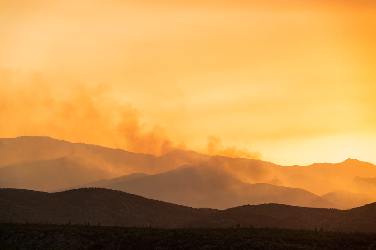
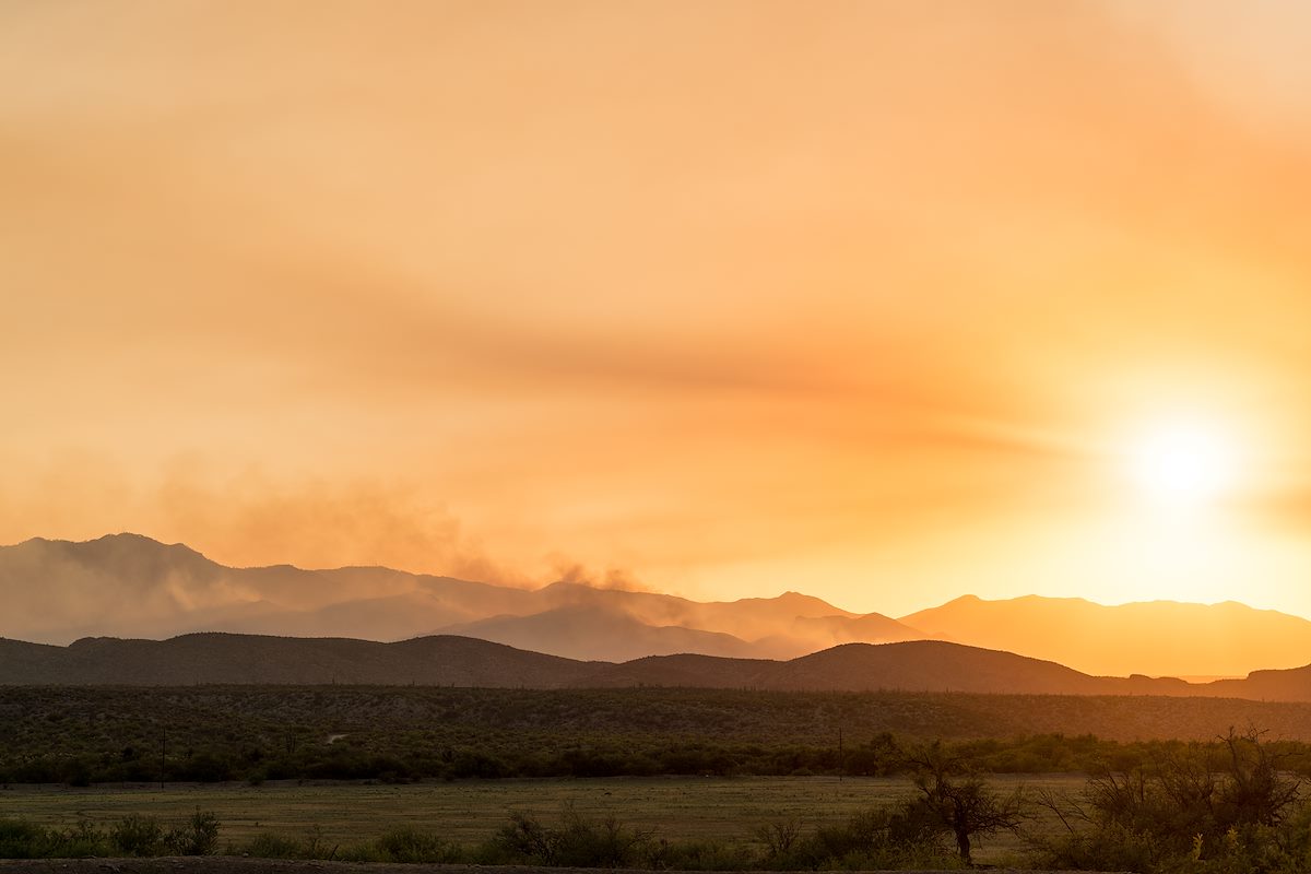
Evening/Night: Driving north from Benson the fire came into view well before the junction with Redington Road - sun, smoke and fire created several amazing views from the road. Black Hills Mine road is now closed - but with Evans mountain and the slopes down into Edgar Canyon burning the fire was easy to see from Redington Road after it climbs away from the San Pedro. The evening update puts the fire at 24,547 acres 11% contained.
From Inciweb:
- Today, firefighters strengthened control lines along the Redington Pass Road and after cold trailing and mop up of the line, declared that this section of fire perimeter is now contained. Tonight, engines will patrol the area and extinguish hot spots as needed. No additional fire growth is expected in this area.
- Prep work along the Catalina Highway is nearing completion. Fire crews have reinforced Firewise mitigations put in place by residents and have set up contingency fire lines as a defensive measure. Crews are prepared to initiate burning operations in front of the fire, should it move westward, threatening structures and other values at risk.
- Tonight crews will be patrolling the south eastern perimeter of the fire. Winds are predominately coming from the southeast, pushing the fire back onto itself.
- The northeastern side of the fire will be monitored through the night. Incident Fire Behavior Analysts do not anticipate any substantial fire spread in this area over night.
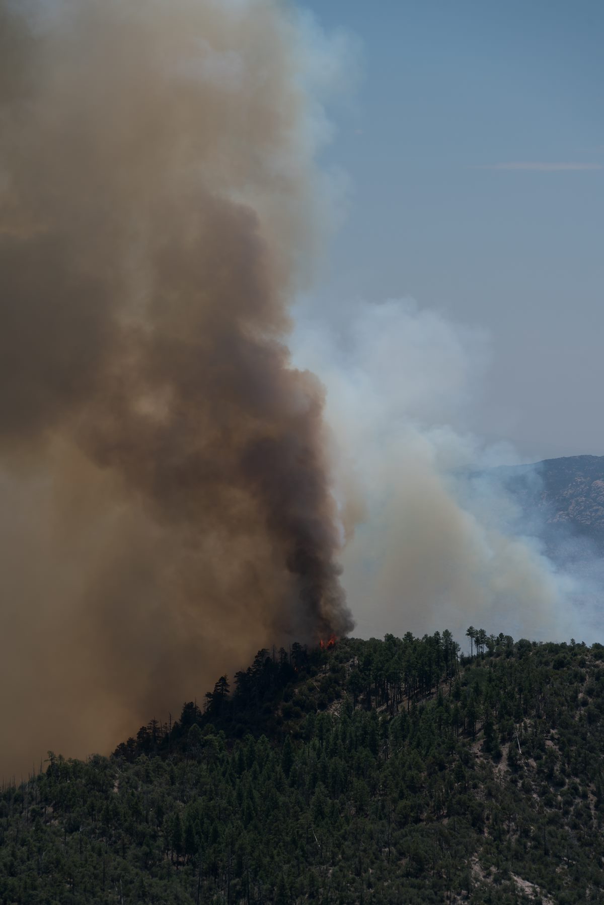
- The most active fire behavior on the Burro Fire was observed on the northwestern perimeter. In this section the fire has dropped into canyons where the vegetation is predominantly grass and scrub. Helicopters and fixed wing aircraft were used to impede the fires progress. Under current weather conditions, these canyons are in alignment with the wind, so that fire has the ability to move quickly through the light flashy fuels.
Media Coverage:
- Helicopter teams supporting Burro Fire from sky from dawn to dusk - KGUN9
- Burro Fire grows to over 23,000 acres in Santa Catalina Mountains, now 11 percent contained - Arizona Daily Star
7:10 AM: Inciweb was updated this AM to list the fire at 21k acres - several notes from the update:
- There will be a Community Meeting 5:30 p.m., Wednesday July 5, 2017, at the Sahuaro High School, 545 N. Camino Seco, Tucson, AZ 85710. American Sign Language (ASL) and Communication Access Real-Time Translation (CART) captioning will be provided. The meeting will be live streamed on Facebook https://www.facebook.com/BurroFireInfo/
- Fire crews continued patrolling and preparing homes and other structures along the Catalina Highway. They also surveyed the terrain between the fire’s western edge and the highway to determine locations where defensive measures might be taken should the fire encroach upon the roadway.
- With the support of heavy helicopters and fixed wing aircraft, fire crews built fire line along the southern and eastern flanks of the fire to protect infrastructure as well as cultural and recreational values, and were able to hold the fire north of Redington Pass Road. Despite dry conditions, high heat and outflow winds, firefighters were able to successfully protect ranch buildings in those areas. To date, the suppression efforts have ensured that no structures have been burned.
- The terrain on the north eastern side of the fire is rugged and mountainous. No roads exist that would provide access for fire apparatus. Given the topography and lack of access, the decision has been made to rely mainly on air resources to slow the fire’s progress in this area. Contingency plans are in place, should fire activity become a threat to infrastructure as well as cultural and recreational values.
In the maps this AM I noticed two interesting details:
- The satellite information on the fire suggests that the fire has made notable progress over the Evans Mountain area and is much closer to Edgar Canyon and Peck Basin.
- The maps reflect the note above about holding the fire north of Redington Road - the fire perimeter on the south-east now runs along Redington Road.
7/4/2017
- Burro Fire grows to more than 21,000 acres - KVOA.com
- Burro Fire near Tucson expands to over 21,000 acres - Arizona Daily Star
- Burro Fire: Blaze spreads to over 21,000 acres, crews to use Mount Lemmon highway as fire break - Arizona Daily Star
- Burro Fire causes change of plans for 4th of July travelers - KVOA.com
Inciweb currently lists the fire at 14,112 acres although more notably the maps from the AM show quite a bit of movement to the south. From Inciweb:
- Beginning July 4, Burro Fire Public Information Officers will provide media briefings at 7am and 7pm daily at the Incident Command Post at Sabino High School, 5000 Bowes Road, Tucson Arizona.
- The Coronado National Forest has now implemented forest closures from Redington Pass Road and the National Scenic Trail north including Catalina Highway and the Control Rd. to the Pima/Pinal County line. These closures can be found athttps://www.fs.usda.gov/coronado/
7/3/2017
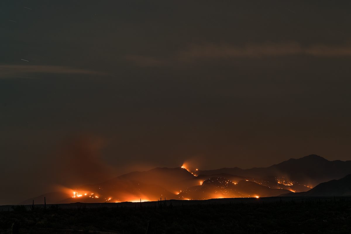
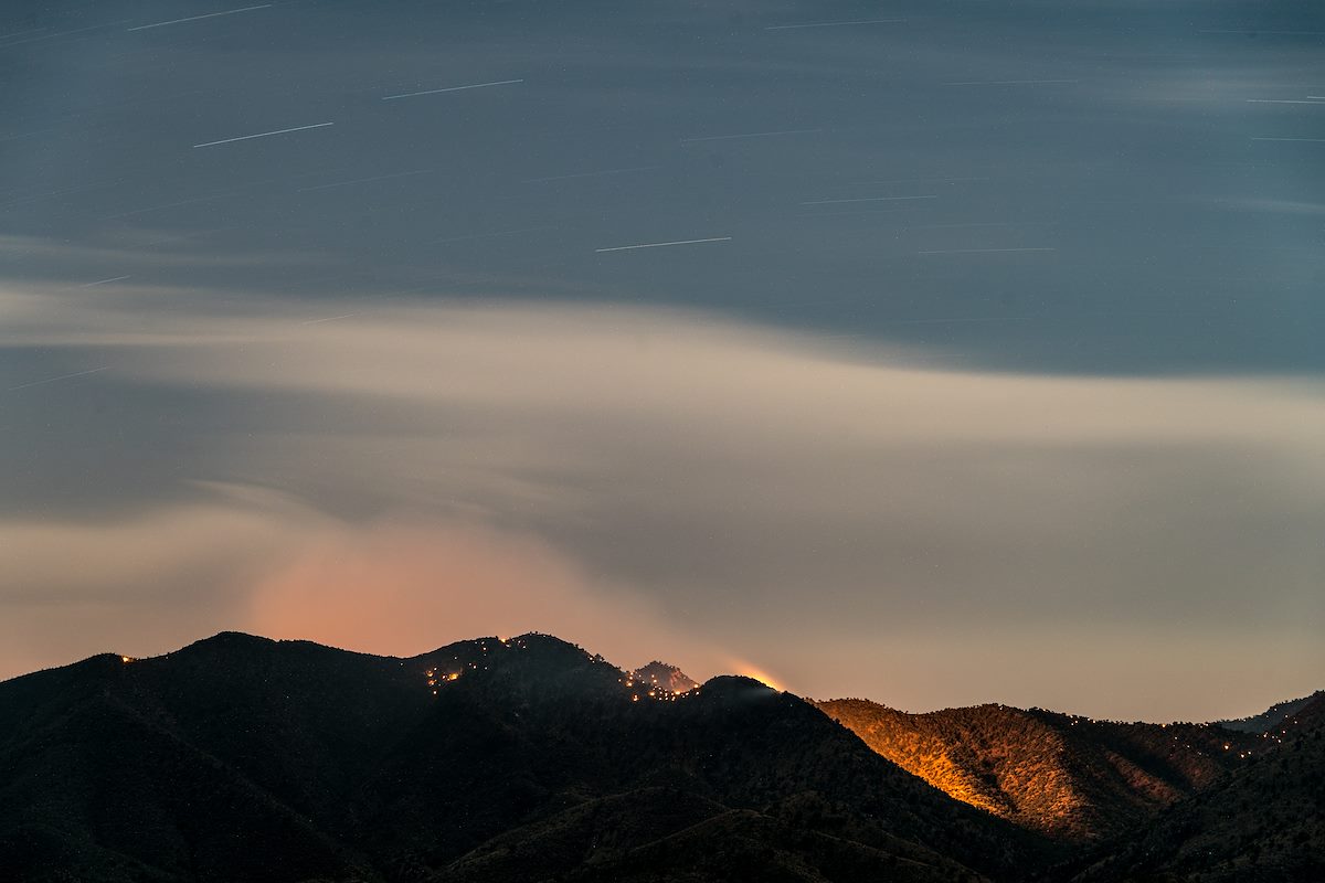
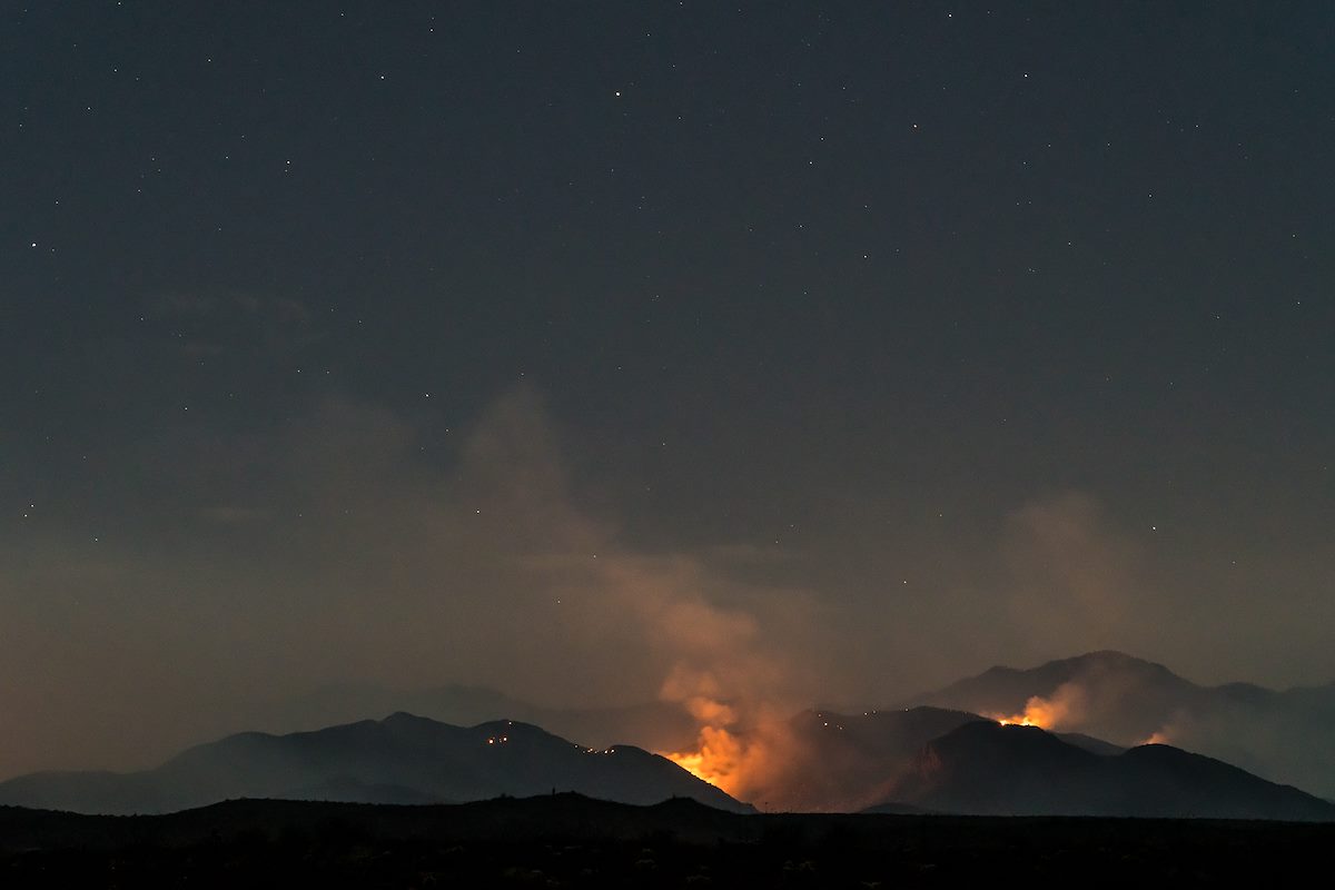
Evening/Night: With the Control Road and Highway up the mountain both closed I drove around the north end of the mountain and took Black Hills Mine Road out to the edge of Alder Canyon - this didn't give me a view of the more active south side of the fire, but it did let me watch as flames and smoke rose from the Evans Mountain area. For the most part the fire stayed behind the ridge - but as night fell all of the small hot spots, hidden in the days, became visible... From Inciweb:
- Firefighters made good progress on the Burro Fire. Indirect line construction and structural protection continued to be the focus along the Catalina (Mt. Lemmon) Highway. On the south side of the fire, firefighters continued preparation along the Redington Pass Road. Natural barriers are also being used to aid in suppression efforts. Airtankers and helicopters were used to help delay the fire’s spread where they could be used safely and effectively. With extreme temperatures, we expect to continue to have periods in the afternoons when it’s too hot to fly.
- Today’s fire spread was primarily in the southern area of the fire. Firefighters provided structural protection at the Bellota Ranch.
- Forest Service Closure Order
11:00 AM: Several new details from a recent news releasea recent news release:
There will be a Burro Fire Community meeting tonight, July 3, 5:30 p.m. at the Sahuaro High School (545 North Camino Seco, Tucson AZ). Please park in the main parking lot the meeting will be in the auditorium. The meeting will be live streamed on Facebook https://www.facebook.com/BurroFireInfo/. You must have an account to view the stream live. Following the meeting the recording will be posted, this will not require an account to view.
Firefighters are actively working to fully suppress the Burro Fire. Due the steep, rugged, inaccessible terrain and fire activity, firefighters are currently using indirect tactics. On the west side of the road, firefighters are planning and implementing structure protection along Catalina Highway. On the south side of the fire, firefighters are scouting and planning for preparation on holding the Redington Road. Airtankers and helicopters are being used to help delay the fire’s spread where they can be used safely and effectively. With extreme temperatures, we expect to continue to have periods in the afternoons when it’s too hot to fly.
There are currently 185 personnel working on the fire. Current resources include three hand crews, 14 engines, one water tender, and three helicopters.
6:30 AM: Evacuations have been extended - evacuations in Summerhaven were scheduled to start at 6am this morning. Inciweb now lists the fire at 14,000 acres - up from 5,000 listed yesterday. In the map below from the The National Wildfire Coordinating Group (NWCG) it appears that the movement on the north side of the fire has been considerable - the fire has burned across Buehman Canyon and certainly looks like it will burn thru the Evans Mountain area. From Inciweb planned actions: "Assess options for indirect line construction and containment using natural barriers. Assess needs for point protection at threatened infrastructure/communities."
7/2/2017
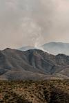
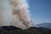
In the AM driving up the mountain the usual traffic was out on the road, you could barely smell the smoke and lower down on the mountain you had to look in the right direction to even know there was a fire. Higher on the mountain the smoke became more and more obvious... I hiked out to several points below Green Mountain to watch the fire - the smoke was impressive, scary, and larger than I expected. I watched cautiously for an hour or so as flames came up onto a ridge near Guthrie Mountain and aircraft dropped fire retardant to try to keep it in the canyon... Driving down the mountain I noticed fire personnel coming down and at the base Police had started to turn away anyone who was not a resident.

- 5,000 acres (7/2/2017, 11:37:15 AM)
- Redington Road closed from milepost 2 to 14 due to Burro Fire.
- Burro Fire updates! Evacuations have started. They begin at mile marker 0 up to Palisades Road. North of Palisades Rd is under a pre evacuation status. We understand this decision is sudden however based on the activity of the fire this is the safest and best decision for our residents. Please follow social media and MyAlerts.pima.gov for more updates to follow. Pima County Office of Emergency Management can be found on Facebook at: https://www.facebook.com/pcoem/
- Maps suggest that the fire is currently burning between Bullock and Buehman Canyons and is still east of the Green Moutain Trail and just inside the National Forest boundary to the East.
- Burro Fire Indicator of Extreme Dry Conditions, Official Says - Arizona Public Media
- Campers forced off of Mt. Lemmon because of Burro Fire - Tucson News Now
- Burro Fire grows to 14,000 acres, forces Mount Lemmon evacuations - Arizona Daily Star
- Burro Fire: Crews to use Mount Lemmon highway as fire break - Arizona Daily Star
- Community meeting Monday on Burro Fire - KVOA.com
- Burro Fire: Crews to use Mount Lemmon highway as fire break - Arizona Daily Star
- BURRO FIRE: Grows to 14,000 acres, evacuations in effect for are - Tucson News Now
- Tucson wildfire grows to 14,000 acres - Arizona Daily Star
- UPDATE: Burro fire prompts Summerhaven evacuations - KVOA.com
- Photos: The Burro Fire - Arizona Daily Star
- Wildfire cancels camp for large Boy Scouts group - KVOA.com
- Burro Fire near Redington Pass grows to 5,000 acres - KGUN9