Evans Mountain is an interesting destination - some maps show a trail that takes you to the summit - but I suspect that trail is now (at best) obscure (a summit register entry from 1994 reads "Trail? What Trail?"), Evans Mountain is between the well known Davis Spring Trail and the Brush Corral Trail - both of which have long stretches that are faint or have disappeared back into the landscape and Evans Mountain is only a few miles from the Davis Spring Trailhead - which is marked on some maps but about which there is not exactly an overwhelming amount of information...
*** 8/12/2017 - The 2017 Burro Fire burned over Evans Mountain and down to Edgar Canyon - because many of the hillsides we hiked up to Evans Mountain were covered with brush and grass (no large trees) I don't think the the the fire will have created any additional obstacles to getting to the top of Evans Mountain, but be aware conditions may have changed in this area! ***
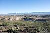
We didn't bother with an early start - navigating new-to-us dirt roads in the dark didn't have much appeal - thru Oracle, past San Manuel and just a couple of minutes on Redington Road before turning off onto the road that we hoped would take us up to Davis Mesa and the Davis Spring Trailhead. The first miles ticked by with much better road conditions than expected, but at the junction into the 6 Bar Ranch the road immediately changed - more rocks, more ruts, more sand and much slower progress, a couple of sections demanded the switch to 4wd and our progress slowed - not unexpected, but the smooth first few miles had given us hope for a much shorter than expected drive....
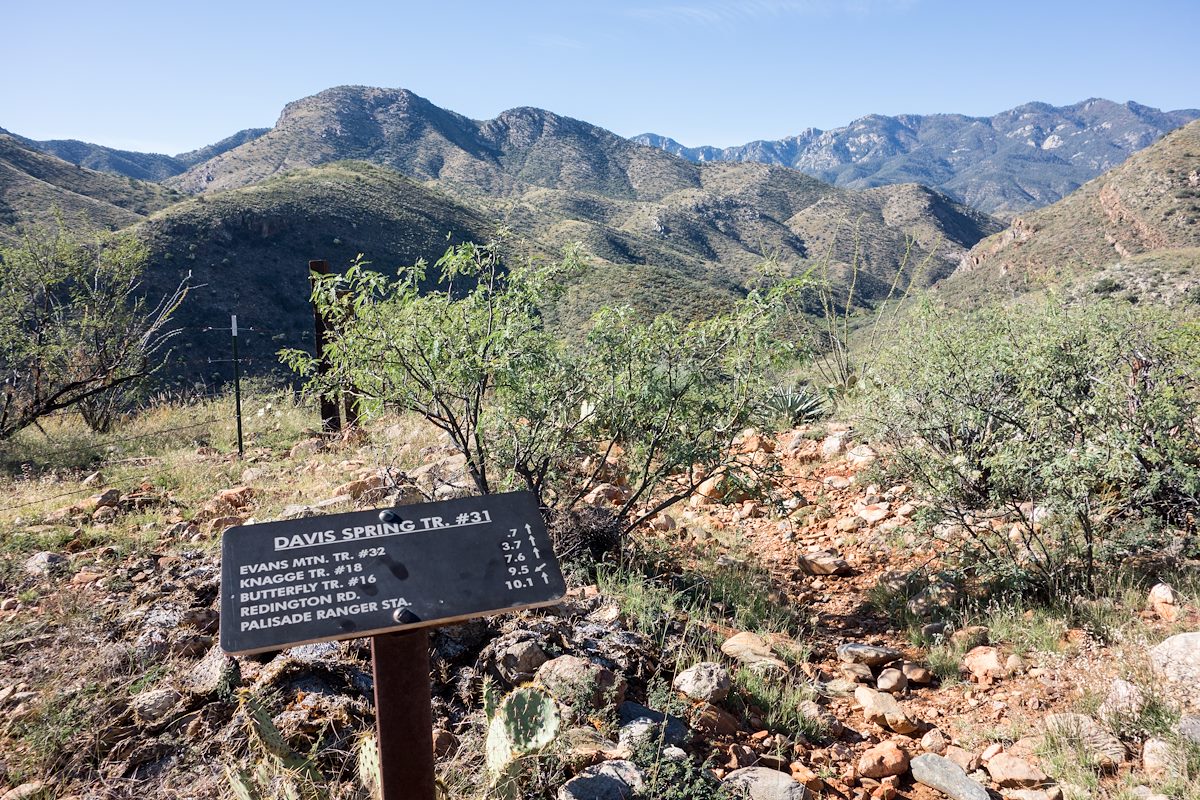
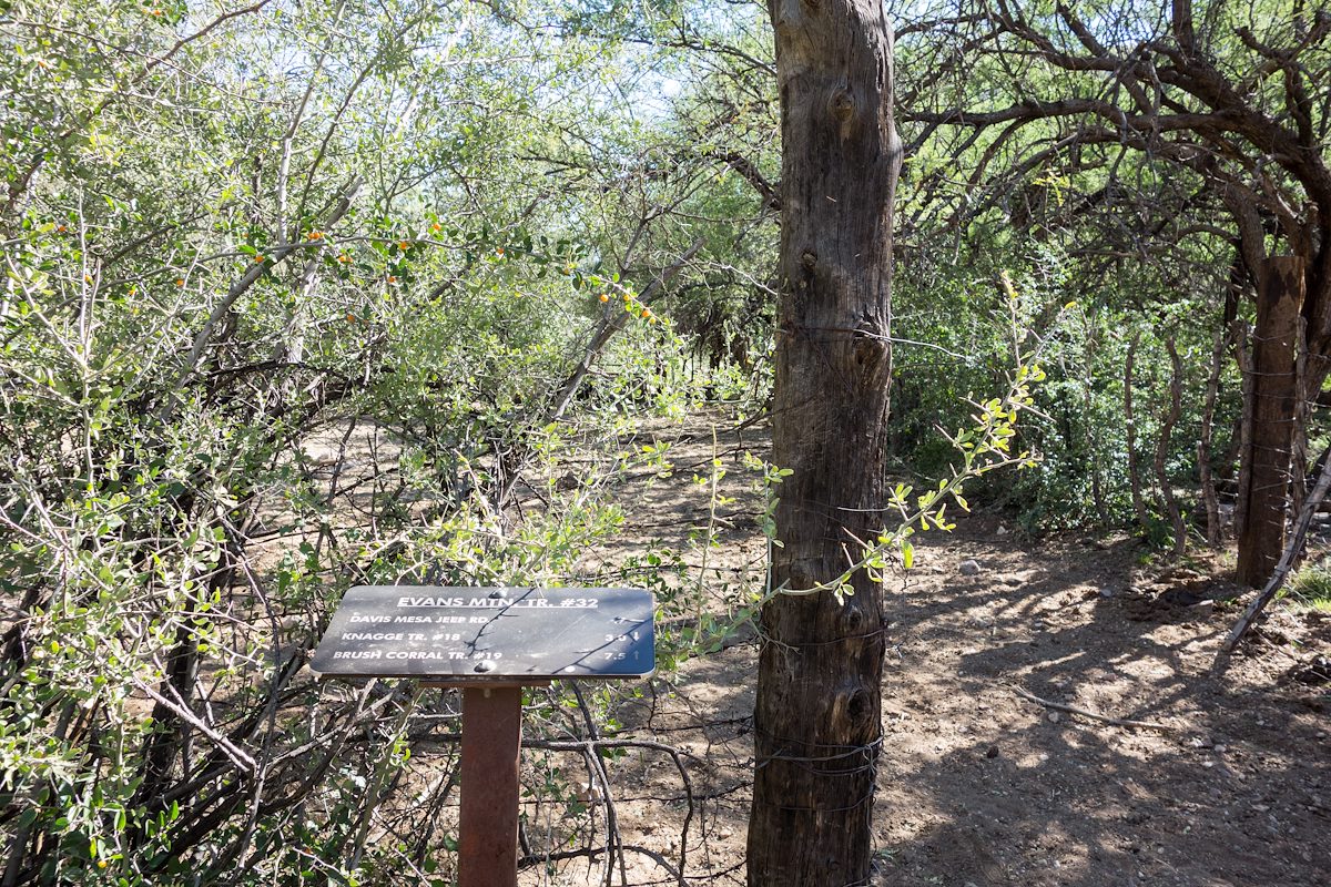
Eventually we arrived at the Davis Spring Trailhead - the drive made made this destination feel remote and the sturdy/clean trail sign seemed almost out of place. Luckily - as promised by the sign - an obvious trail leaves from the trailhead - we hiked past a tank fed by Davis Spring and down to a corral near Edgar Canyon where we found the Evans Mountain Trail #32 trail sign.
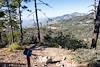
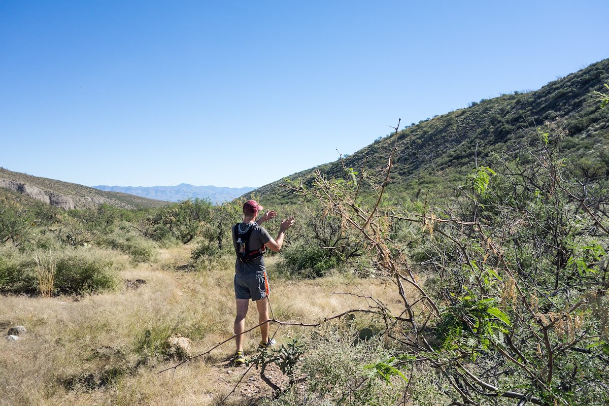
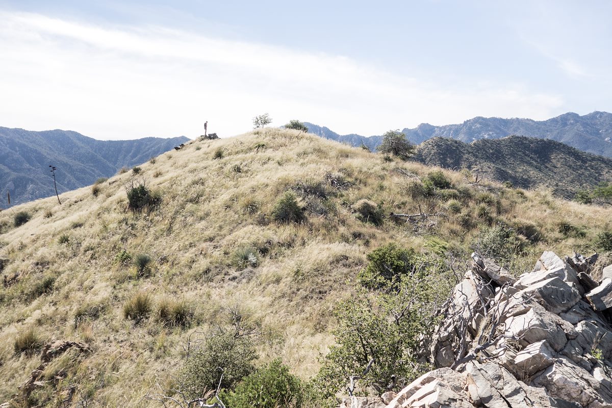
We followed the trail, and for a short time felt confident that we had found easy walking on the better-than-expected Evans Mountain Trail - but in retrospect we were probably lured too far east by well worn cow paths to correctly follow the trail's turn south out of Edgar Canyon - eventually we began to simply pick the most likely route cross-country as worked steadily uphill towards Evans Mountain.
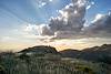
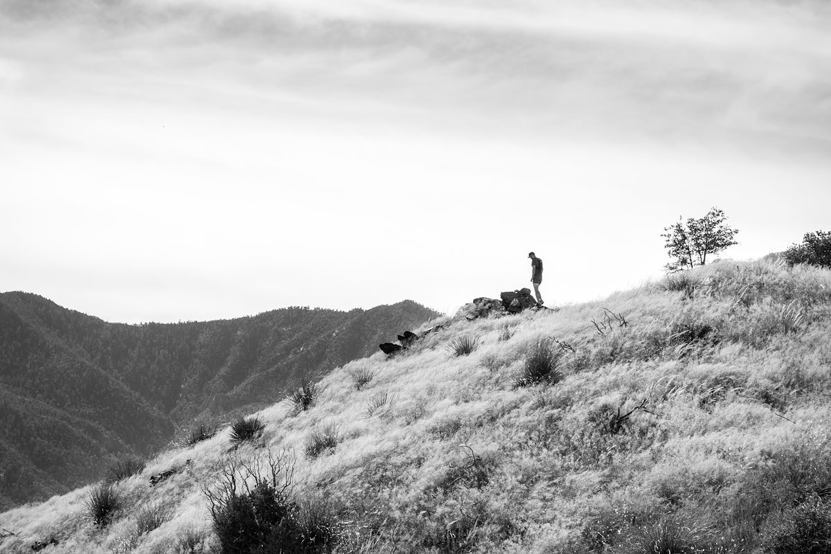
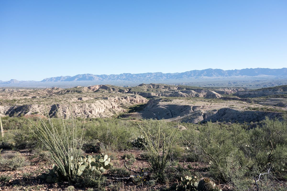
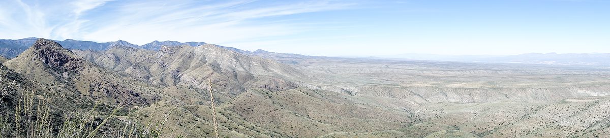
The ridgeline near Evans Mountain was a nice payoff for our climbing - great views! Soon enough we were at the top - from the register it looks like we are the only visit so far this year...
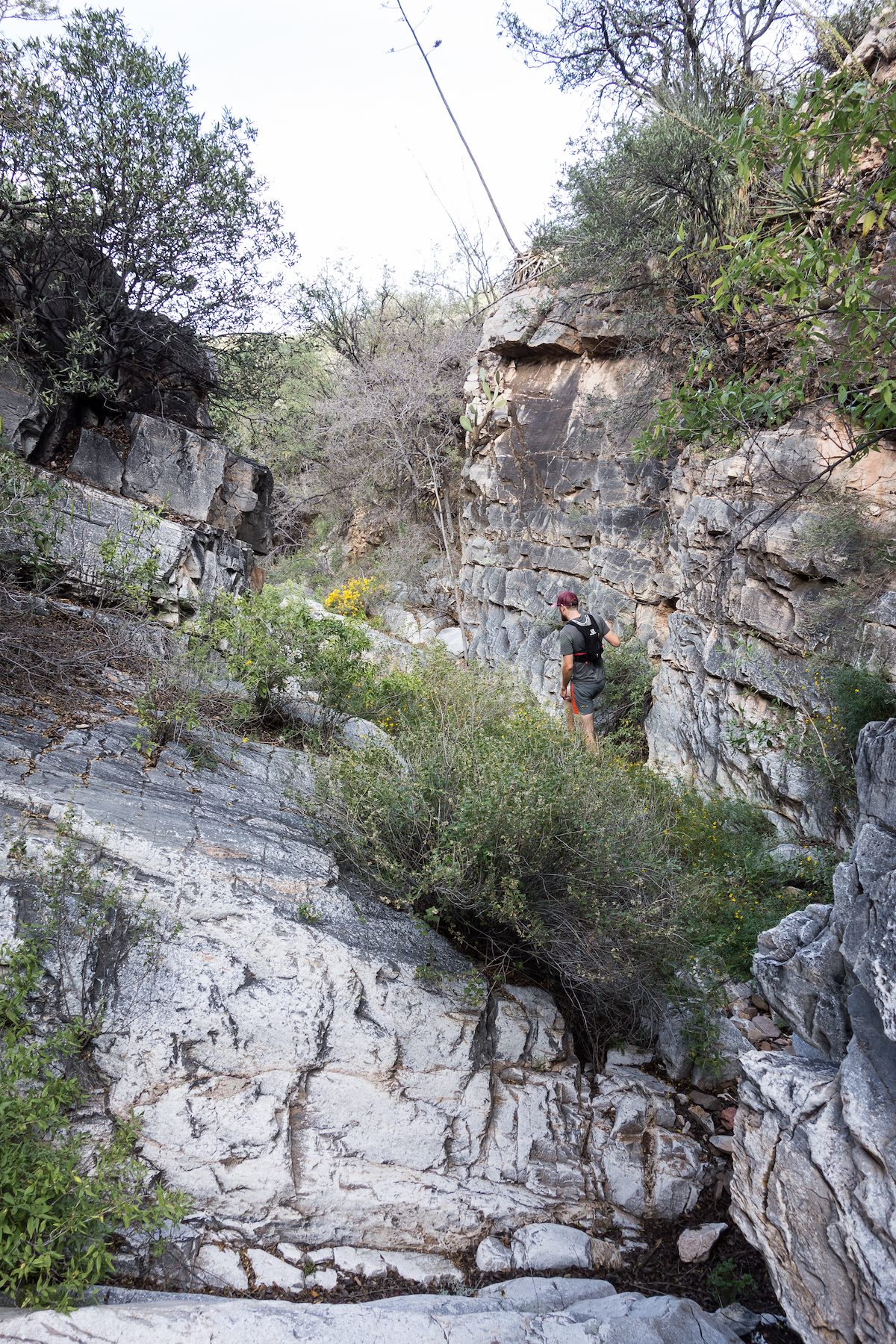
The trip back down was faster/shorter than the trip up - with no plan to even try to find the trail we simply picked a likely direct route and headed down - eventually following a lovely small canyon that had a small arch and a rather large drop near it's junction with Edgar Canyon. Back along Edgar Canyon we took the cow paths back to the corral and climbed out of the canyon - what a great day! 8.3 miles round-trip with +/- 2700' of elevation gain/loss.
Notes:
Based on the summit register Evans Mountains has at least one, and sometimes several, ascents each year. The summit, trailhead and access roads are easily found on (many) topographic maps of the area. The notes/resources below might provide interesting additional information if you want to visit this area (this list was last update 1/30/2019):
- See the Davis Spring Trailhead page on this site for directions, maps and a gpx file to help with getting to the trailhead - a 4wd vehicle is strongly recommended and if you are not familiar with the area I also strongly recommend looking at maps/directions ahead of time, the network of unmarked dirt roads in the area can be confusing especially on your first visit to the area!
- I have hiked Across Davis Mesa into Edgar Canyon - Black Hills Mine road to the parking above the road down to the Ventana Windmill is a 2wd friendly drive which is attractive vs the 4wd road out to the Davis Spring Trailhead, but ultimately I wrote "our path across Davis Mesa doesn’t seem worth repeating or recommending – a fun adventure and a great day out, but not the alternate Davis Spring Trailhead access I had hoped for!"
- During our visit there was a strong flow of water from Davis Spring into several different tanks - but from Davis Spring east sections of Edgar Canyon we saw (maybe .5 miles down canyon from the corral) were dry.
- Desert Mountaineer - Evans Mountain - This is a great post about a trip to Evans Mountain and several nearby high points - many thanks to the Desert Mountaineer for responding to our question about the drive to the trailhead!!! Great information and inspiration - a fun site to visit especially if you love off-the-beaten path Arizona adventures!
- Madrone Runner - Evans Mountain "Trail" Boondoggle - This has some great info on a hike to Evans Mountain via the Brush Corral Trail
- Arizona Game and Fish Department - Game Management Unit 33 - a few notes on the drive in (search in this page for 'Davis Mesa' to quickly find the relevant details).
- Pima County, Six Bar Ranch - Basic access map and information from Pima County on the 6 Bar Ranch.
- Pima Canyon Conservation Report - San Pedro Valley Reserve - 6 Bar Ranch - Not much 'practical' information for planning your adventure (other than perhaps confirming land management/ownership details) but an interesting short document about the area.
- [GuideYellowBook/] - As with nearly every destination in the Santa Catalina Mountains this guide is worth consulting - there are some details here that are probably useful but in this area (especially post Bullock Fire) it is hard to know how many details are 'current' enough to be useful.
- Sirena's Wanderings - Brush Corral Trail and Diary of Scott Morris - Brush Corral Epic - Both of these posts are about the Brush Corral Trail which is on the 'other side' of Evans mountain from the Davis Spring Trailhead. The Evans Mountain Trail used to connect the Davis Spring Trail to the Brush Corral Trail. These posts are only vaguely related to the Davis Spring Trailhead and Evans Mountain - they are included since it is worth knowing about this possible alternate approach to Evans Mountain.