Suggested driving directions from the Speedway and Campbell intersection in Tucson to the The Lake Trailhead:
North on Campbell Avenue (1.0 mile)
Right on Grant Road (5.6 miles)
Left on Tanque Verde Road - Tanque Verde becomes Redington Road, after several miles the the pavement ends. Approximately 7 miles after the pavement ends FR36 leaves Redington Road on the left - this road is rougher and narrower than Redington Road (18.3 miles) (If you reach the Italian Spring Trailhead you have gone too far.)
Turn left onto FR36 (2.1 miles)
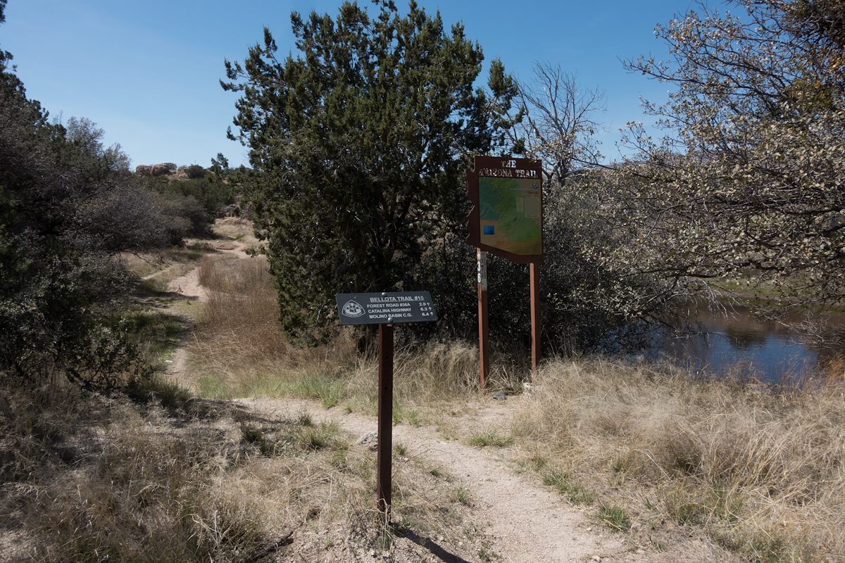
The trailhead is located at a wash crossing - the only markers visible from the road will be small Arizona Trail Signs on the left where the Bellota/AZ Trail come thru a fence and join FR36. Parking is not specifically marked but is easy to find. (if pass an Arizona Trail marker on your right you have gone too far - head back to the wash crossing).
2017 March Arizona Trail The Lake Signs on the Bellota Trail. Charles Miles. 3/26/2017.
Located north of Redington Road and the Italian Spring Trailhead this trailhead provides access to the Bellota Trail - the Arizona Trail thru this area. While it takes more time to drive to than the Italian Spring Trailhead (FR32 is often notable rougher than Redington Road) it can be nice to access this area but be away from the more heavily used Redington Road.
1 Hour and 30 Minutes from Speedway and Campbell
26.4 miles from Speedway and Campbell
Vehicle Access: A high clearance vehicle is needed for FR36 and recommended for Redington Road.
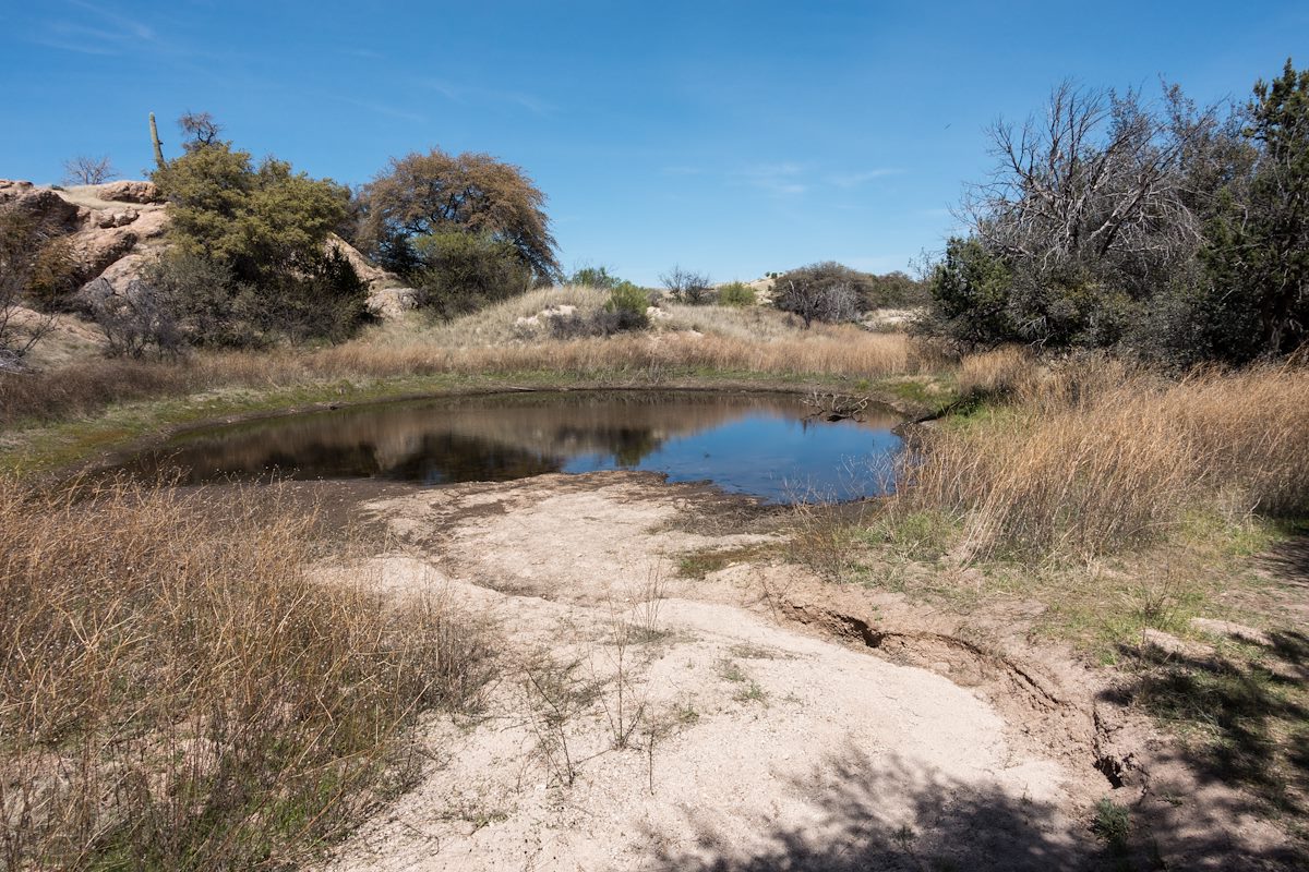
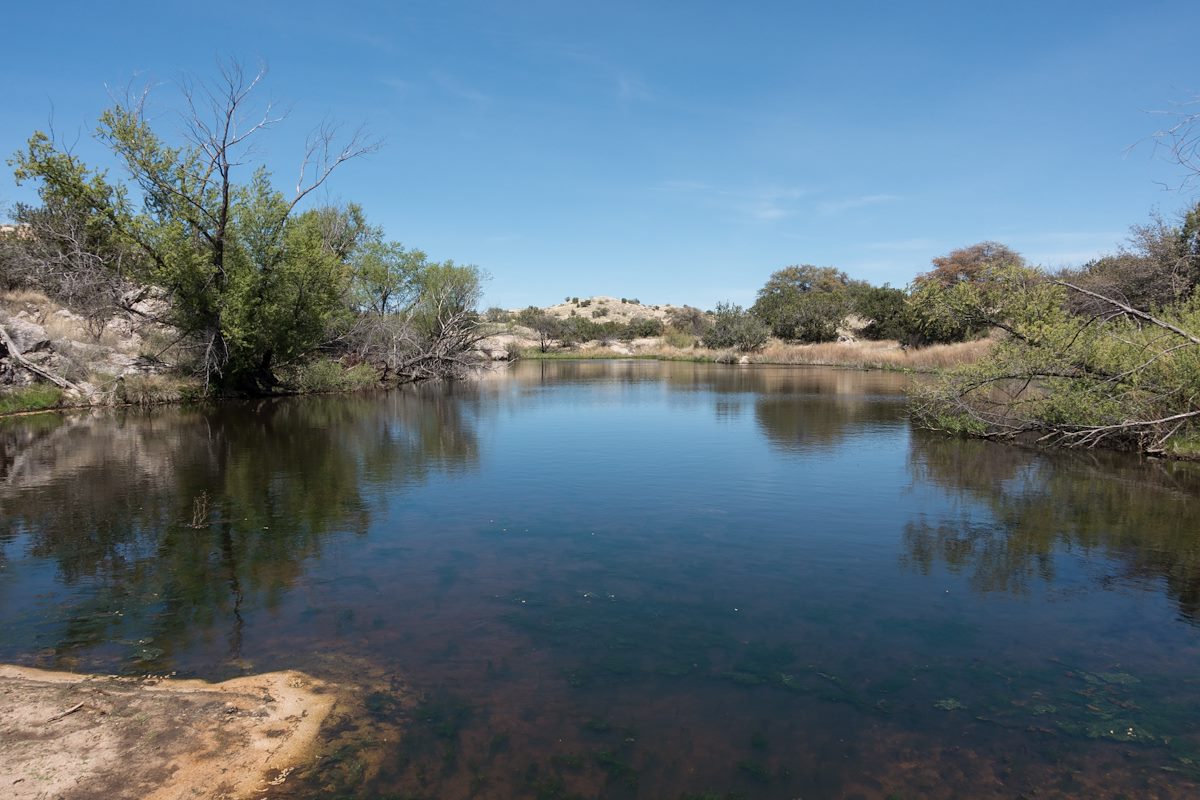
There are no facilities at the trailhead, there may be water nearby at 'The Lake' (seasonal) but you will need to filter/treat it.
At This Trailhead: Bellota Trail, Arizona Trail, 'The Lake'