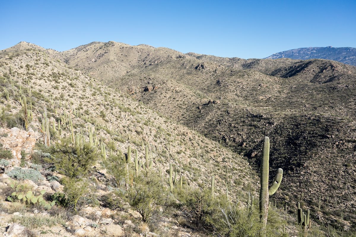
2015 February Looking towards Agua Caliente Hill: Cat Track Tank - on the Agua Caliente Hill Trail - is above the Saguaro in the foreground. Charles Miles. 2/8/2015.
ƒ/5.6
1/640
ISO 125
10.4 mm
28-100mm F1.8-4.9
SONY
DSC-RX100
©2015 Charles Miles
Tags:
agua caliente hill
arizona
coronado national forest
fr4446
pima county
santa catalina mountains
santa catalina ranger district
Related:
Photographs - February 8, Sunday, 2015
10/24/2022
Previous/Next:
2015 February Old Road from Gnat Tank towards Roger Road
10/24/2022
2015 February Old Boundary Line
10/24/2022
Created by Charles Miles on 8/10/2020. Updated by Feature Intersection Tagger on 10/24/2022.