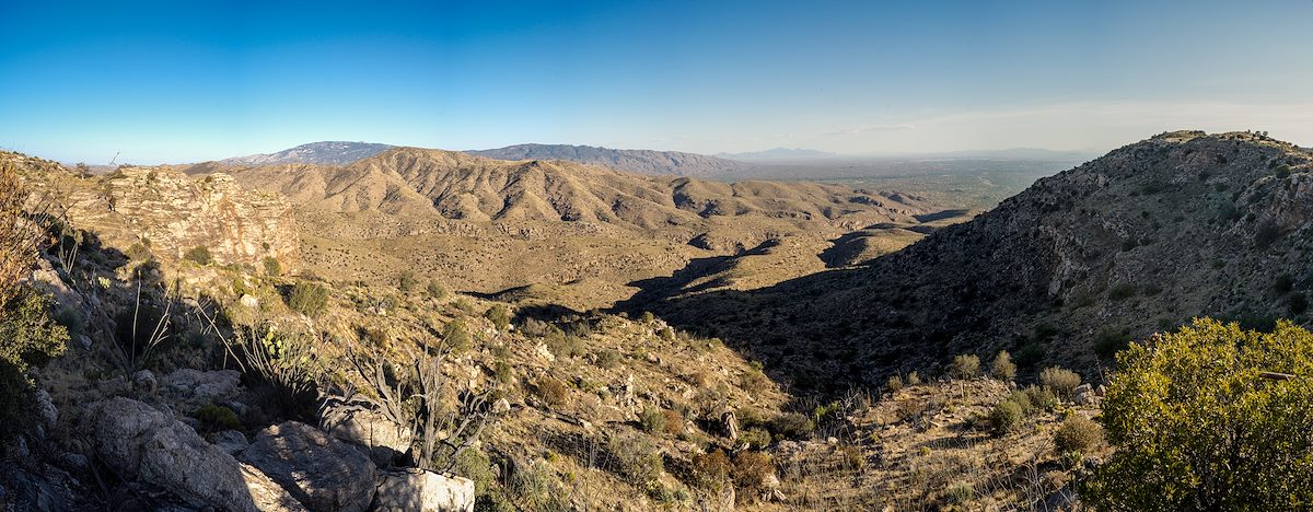
2014 June The Ruins to Point 4831. Charles Miles. 6/21/2014.
Tags:
agua caliente hill
arizona
butterfly roadless area roadless area
coronado national forest
mica mountain
pima county
point 4763
point 4831
santa catalina mountains
santa catalina ranger district
tanque verde peak
the ruins
tucson mountains
Related:
Photographs - June 21, Saturday, 2014
10/24/2022
Previous/Next:
2014 May Pusch Ridge from the 50 Year Trail
10/24/2022
2014 June The Ruins above the Shadows
10/24/2022
Created by Charles Miles on 8/11/2020. Updated by Feature Intersection Tagger on 10/24/2022.