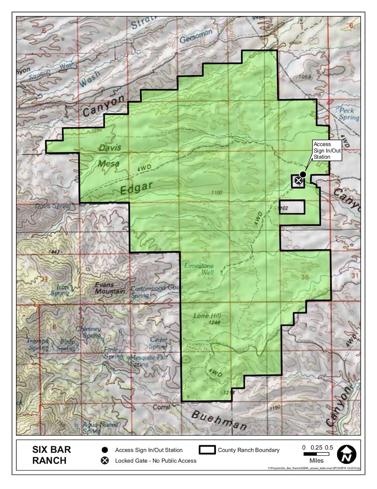
In 2006 Pima County purchased the Six Bar Ranch with Open Space Bond money. The ranch sits on the east side of the Santa Catalina Mountains and notably includes portions of Davis Mesa, Edgar Canyon and protects access to the Davis Spring Trailhead.
Source: PDF from Natural Resources - Pima County.