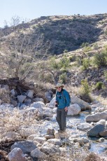
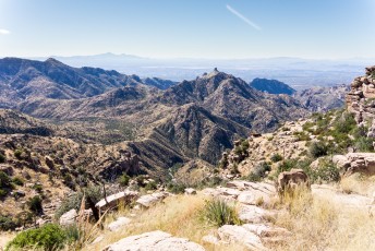
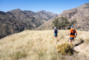
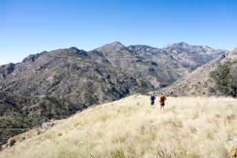
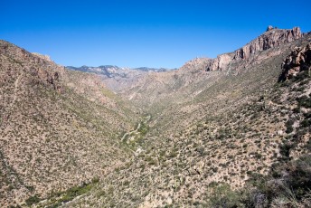
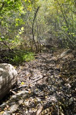
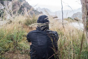
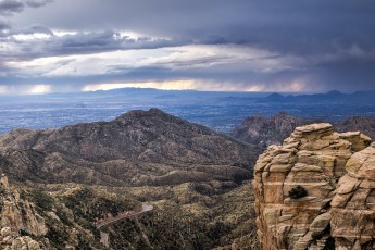
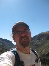
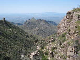
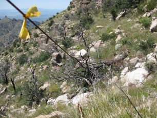
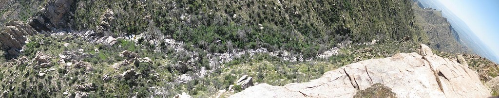
 The view from just over 4 miles down the Palisade Trail. January 2015.
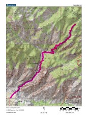
Overview
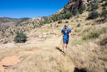
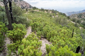
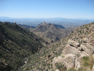
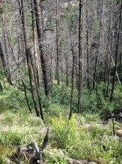
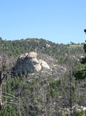
The Palisade Trail #99 is a classic – it starts high in the pines – sometimes with snow in the winter, takes a path thru areas that burned over a decade ago in the Aspen fire with bare burned trunks still visible above the new green growth, offers great views of Cathedral Peak and the Sabino Canyon area, makes you duck under a telephone line that ran thru the mountains over a century ago, shows you the beautiful waterfall in Pine Canyon and ends in the middle of the Santa Catalina Mountains with options to continue all the way to Tucson!!!
Hike Stats
- Out and Back
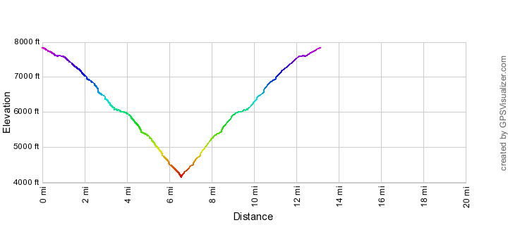
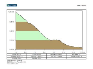
- 13.2 miles
- 3,700' Elevation Gain
- 3,700' Elevation Loss
- Highest Elevation: 7,850'
- Lowest Elevation: 4,150'
Location
- In the Santa Catalina Mountains starting from Organization Ridge Road near the Palisade Visitor Center.
- Start/End: Palisade Trailhead (Upper Highway Hikes)
Details
- Fee: No
- Dogs: Yes
- Bikes: No (Pusch Ridge Wilderness)
Drive
- 33.9 miles from Speedway and Campbell
- 1 Hour and 5 Minutes from Speedway and Campbell
- Vehicle Access: Most of the drive is Paved Roads/Passenger Car (Mountain Road - be careful of weather conditions!) - the last .5 miles to the Trailhead is on a dirt road that is sometimes rough/slow, but usually possible in most passenger cars (low clearance cars not recommended). Closed to motor vehicles in winter (December 15 to March 1 - dates subject to change depending on weather/conditions).
Palisade Trail Elevation Profile
Suggested driving directions from the Speedway and Campbell intersection in Tucson to the Palisade Trailhead:
- Drive East on Speedway (5.0 miles)
- Left on Wilmot and continue on Tanque Verde (4.3 miles)
- Left on Catalina Highway (24.0 miles)
- Organization Ridge Road where the Palisade Trail is located is closed to vehicles and gated in the winter - in the winter park in the Bigelow Trailhead on the up-mountain side of the highway - if the road is open to motor vehicles:
- Left on Organization Ridge Road - the turn is slightly up-mountain from the Bigelow Trailhead and down-mountain from the Palisade Visitor Center. (0.5 miles)
- Organization Ridge Road is a dirt road and conditions will vary - sometimes it is rough/slow but it is usually ok for passenger cars (low clearance vehicles not recommended).
Google Maps Directions from the Speedway and Campbell intersection in Tucson to Palisade Trailhead.
[/driving_directions_div]
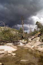
[ImageTwoPictureSideBySide imagepathone=”/santa-catalina-mountains/palisade-trail/1410-Above-the-First-Falls-Looking-up-Pine-Canyon” captionone=”Looking up Pine Canyon into the approaching storm. October 2014.” imagepathtwo=”/santa-catalina-mountains/palisade-trail/1410-Palisade-Trail-below-Mud-Spring” captiontwo=”The Palisade Trail – wet and muddy below Mud Spring. October 2014.”/]
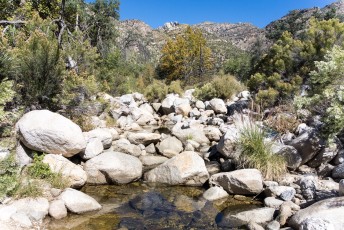
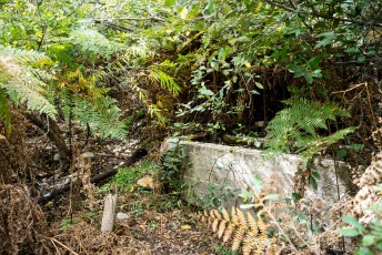
 Mud Spring Tank - full of water and surrounded by green. October 2014.
Trail Notes
[CueListWarning]
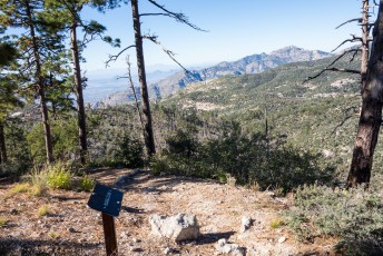
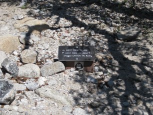
- 0.0 miles, 7840′: Start at the Palisade Trailhead – a large Map and smaller Trail Sign both mark the start of the trail. [Waypoint thp]
- 0.5 miles, 7550′: The Palisade trail continues straight past two side trails. The side trail to the right takes you down to and along/above Palisade Canyon, there is usually water in the canyon and visiting the canyon is a great side trip (or a nice stopping spot for a relaxed day!). The trail to the left leads towards private property on the ridge. [Waypoint p01]
- 1.0 miles, 7600′: A trail sign helps show the way as the trail begins to descend into the Pusch Ridge Wilderness. [Waypoint p02]
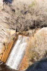
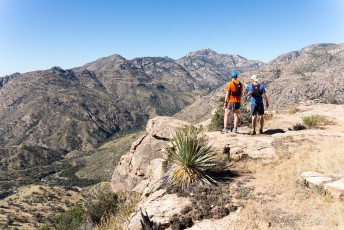
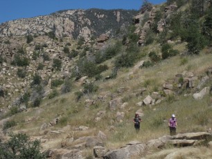
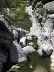
- 2.6 miles, 6570′: The trail comes alongside Pine Canyon and at approximately 2.6 miles there are several un-official side trails to the left that can be used to get to the bottom of the canyon. With beautiful polished rock and – at times – flowing water this section of canyon is worth visiting – be careful on the slippery rock and cautious of the cliffs and falls in this area. This is a great destination and – especially with time for a nice break in the rocky canyon bottom – turning around here makes a great day hike. [Waypoint p03]
- 2.7 miles, 6630′: Look for the Mud Spring tank on the right – the area is quite lush and it is possible to miss it, but there is usually mud on the trail below the spring which is harder to miss. [Waypoint p04]
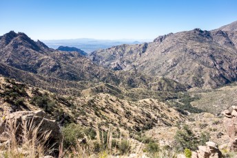
- The trail descends from Mud Spring to an incredibly scenic section of trail that cuts across the hillside high above Pine Canyon – the views become more dramatic as the floor of the canyon falls away and the large waterfall in Pine Canyon comes into view. Below this section the trail is less often used and can be harder to follow.
- 3.5 miles, 6080′: The old Telephone line crosses and re-crosses the trail – the line can be hard to see and is solid enough that it is better not to accidentally run into it. (See below for a little information about this line). [Waypoint p05]
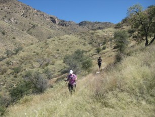
- 4.2 miles, 5800′: A rocky outcropping just off the trail is a great spot to take a break and enjoy the views – after this spot the trail becomes yet more rugged – and often overgrown. [Waypoint p06]
- 6.2 miles, 4390′: The trail turns and begins to contour along the hillsides down to the end of the trail. [Waypoint p07]
- 6.6 miles, 4140′: After crossing Pine Canyon – a lovely spot especially if there is flowing water – the Palisade Trail ends at a signed junction with the East Fork Trail [Waypoint ef-p]. Returning up the Palisade Trail is the most obvious way to return to the trailhead – but with a car shuttle or a bit of walking on the highway there are a number of interesting alternatives:
- East Fork Trail to the Box Camp Trail and up to the Box Camp Trailhead (to a car shuttle or walk along the General Hitchcock Highway).
- East Fork Trail to the Sabino Canyon Trail – above the last tram stop on the Sabino Canyon Road choose either continuing along the Phone Line Trail, riding the tram (you will have cash to pay the driver) or walking the road to get to the Sabino Canyon Visitor Center.
- East Fork Trail to the Sycamore Reservoir Trail and out to the Gordon Hirabayashi Recreation Site.
- East Fork Trail to the West Fork Trail and then to Catalina State Park or any number of other destinations…
Paradise Found, The Settlement of the Santa Catalina Mountains and Look to the Mountains, An in-depth look into the lives and times of the people who shaped the history of the Catalina Mountains give some interesting details about the history of this trail – it was surveyed by E.O. Stratton in 1911 and was originally called the Pine Ridge Trail. At the time of the trail’s original construction the Palisade Ranger Station did not yet exist (‘Burnt Cabin’ was found at that spot – the Palisade Ranger Station was constructed in 1934). The trail was completed in May of 1912 and was also the path of a telephone line (the lower portion of the line followed the Phoneline Trail (originally called the Plate Rail Trail) – you can still find the telephone line crossing the trail. An early account of traveling the Palisades trail by E.L. Vail published in the Arizona Daily Star in 1919 includes this about Mud Springs:
we reach Mud Springs at noon stopping for luncheon. The water does not bear out the nomenclature of the spring, being clear, cold and delicious…The rather unattractive designation of the locality came from a huge spot of mud on the hillside below, which, in the driest season, always appears to be moist. A few sprigs of mint planted some years ago in this natural damp bed, by E. O. Stratton have spread into a fragrant patch of verdure of an acre or more in extent…Scattering pines begin to show up at Mud Springs
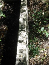
The telephone line that crosses the Palisade Trail was installed in 1911 by the Forest Service – it connected Sabino Canyon in Tucson up to Soldier Camp (where a phone booth was built!), Mount Lemmon, Summerhaven, Brush Corral and Manning Camp. The wire was strung between insulators on cactus and trees – you can still occasionally find insulators from the line on the mountain.
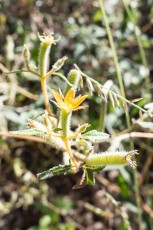
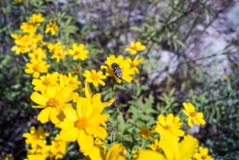
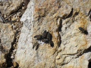
[ImageTwoPictureSideBySide imagepathone=”/santa-catalina-mountains/palisade-trail/1410-Looking-out-towards-Sabino-Canyon-from-the-Palisade-Trail” captionone=”Looking at the Palisade Trail descending towards Sabino Canyon and it’s junction with the East Fork Trail. October 2014″ imagepathtwo=”/santa-catalina-mountains/palisade-trail/1410-Acmaeodera” captiontwo=”An Acmaeodera on yellow flowers – in Pine Canyon near the Palisade Trail . October 2014.”/]
[ImageTwoPictureSideBySide imagepathone=”/santa-catalina-mountains/palisade-trail/0809-Wire-Crossing-the-Palisade-Trail” captionone=”The old telephone line crossing the Palisade Trail. September 2009.” imagepathtwo=”/santa-catalina-mountains/palisade-trail/1110-Old-Phoneline” captiontwo=”Insulator and hanger. October 2011.”/]
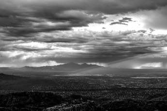
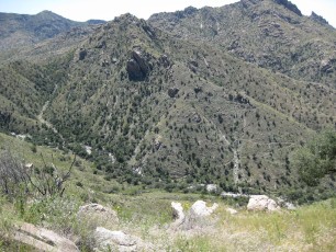
 Night in the Santa Catalina Mountains - you can just make out the Palisade Trail making it's way down the hillside to it's junction with the East Fork Trail (visible on the left descending in shadow). April 2014.
Resources
- HikeArizona
- Sirena’s Wanderings – Palisades to Prison Camp
- Trail Talk – Summit Hut Blog – Palisade Trailhead to the Sabino Canyon Tram
- [GuideYellowBook/]
- Posts on HikeLemmon.com:
- Palisade Trail, Late Summer Night – 9/16 and 9/17/2018
- Bigelow Trailhead to the Gordon Hirabayashi Recreation Site – 1/17/2015
- Palisade Trailhead to the Sabino Canyon Visitor Center, Pines to Cactus – 11/6/2014
- Palisade Trail to Pine Canyon, 10/19/2014
- Upper Palisade Canyon – 2014/7/13
- Sycamore Reservoir – 2014/4/12
 The falls in Pine Canyon during a summer storm. June 2006.
Pictures
2015 January Trail Palisade to Prison Camp


2014 October Palisade Trail to Sabino Canyon
2014 October Palisade Trail to the Cliffs above the Falls
2011 October Palisade Trail to the last Sabino Canyon Tram Stop
2008 Sept Palisade Trail
Sirena – Palisades to Prison Camp 8-10-11
Update Notes
- 2017/8/15 – HikeLemmon posts added to resources, fix broken link
- 2015/01/19 – Updated PDF, updated overview description
- 2015/01/18 – Added two new waypoints, updated and improved cue list, updated GPX, updated total distance, added new pictures and removed one older picture, added new photo sets, added more information about the telephone line, corrected typos.
- 2014/11/21 – Added a new waypoint, added additional cue list description notes, added new picture, revised PDF map and description.
- 2014/11/04 – Corrected small typos, fixed bad links to Bigelow Trailhead in driving description, added Cue List waypoint names missing in last update, added PDF Map and Description
- 2014/10/23 – Added new pictures and picture set, improved GPX file and cue list, corrected an elevation typo
- 2014/07/12 – Changed GPX files, added pictures, changed format, added current stats format
- 2014/04/07 – Clean up links for move to HikeLemmon